Clare Valley to the Victorian Border

9 – 11 December 2017 

The next 6 days (until we reach Balnarring) are what Steve refers to as ‘transfers’. That is, we’re not being travellers taking our time to see and enjoy where we are, we are just driving – big difference.

However we’ve still chosen a scenic route which I’m sure we’ll enjoy.

Saturday morning as we headed south the wheat stubble and brown fields gave way to grape vines as we entered the Clare valley. We stopped for an enjoyable afternoon tea with Bob and Cathy’s daughter Hannah, Raine and baby Dean. Then through the Barossa to stop the night at the tiny town of Palmer, where we camped beside the cricket oval. We even got to enjoy the last session with prime seats! Palmer won. The oval is virtually in the middle of a well-established olive grove – interesting!

We dined at the pub where the meals have been highly recommended, both ordering the pork belly and not being disappointed.

Sunday 10th.

The publican last night recommended a scenic drive that would eventually get us back onto our track. It took us along an unsealed road through grazing land along a valley and through a gap in the granite hills. Unsurprisingly it was called Gap Road. We came out near Mannum where our publican had recommended we see the waterfall.

The Gap on Gap Rd outside Palmer. Pretty drive.

From here we followed the highway to Murray Bridge and crossed the Murray on the first bridge ever built across this mighty river. It was good to be back to the Murray again after following it closer to its source for a few weeks back in March this year. Even more exciting was driving along the shore of Lake Alexandrina and Lake Albert which is where the Murray finally reached the sea.

Tonight we’re camped at Kingston SE in the RV park right on the shore ($10) – brilliant location, if maybe a little windy.

Not a bad “Big Lobster”. Kingston SE

Monday morning we went for a walk along the river to the mouth and back through a park where the locals have put in some sundials of different types – doesn’t sound great, but it was very good. Then to the cafe where we had coffee, bought lots of gifts for Christmas and downloaded some podcasts using their wifi. Excellent cafe. Good experience at Kingston SE – well done!

Onwards to Robe for brunch, parked overlooking a small marina, before moving on to the Lighthouse Lookout. Perfect day weather-wise and magnificent views of the shore, coastline and ocean.

Rugged coastline, but look at all those blues. Robe, SA

At Mt Gambier we had another break. The Information Centre has a museum which is excellent – note to self- allow at least an hour, or more, to view this next time. We emptied our water tanks of the last of the metallic-tasting Norseman water and refilled with the amazing water from the Blue Lake which provides Mt Gambier with its water supply.  This 72m deep lake is the crater of a volcano, the very clear water in it filtering through limestone rock to fill it. There is a sudden change in water colour from grey through winter to vivid blue, the change occurring over a few days at the end of November. This dramatic colour change occurs as the sun is higher in the sky, the pure waters refracting more blue in the colour spectrum and the cleansing of the water as tiny calcite crystals reacting to the warmer water fall to the bottom, taking organic material with them.

The Blue Lake at Mt Gambier

From here we drove around to the Umpherston Sinkhole which has been made into a cool, relaxing garden. Thousands of years ago the underlying limestone cave collapsed creating this deep, steep-sided sinkhole. James Umpherston owned the grazing property which contained it. In 1884 he decided to make it into a garden for the locals to enjoy.

Umpherston Sinkhole. An incredible sight.

It’s had a mixed history since then but today a ramp and stairs take you down into the sinkhole where the grassed, terraced base is planted with hydrangeas and tree ferns, the steep sides dripping with ivy. Under a cliff overhang are picnic tables and a BBQ.

From one side of the sinkhole to the other. Its diameter is not huge. Umpherston Sinkhole

This evening’s destination is free camp at Dry Creek which is on the Glenelg River, on the SA/Vic border. This unlikely camping spot is really just a parking area for fishers launching their boats at the boat ramp here. A tree-lined dirt road in off the main road ends in a turning circle and camping is wherever you can find a level enough spot. Built out off the shore and over the water are half a dozen shacks.  It’s a lovely spot and we sat on the jetty enjoying our sundowners and chatting to the fishers launching their boats. A quiet night.

Not quite in Victoria yet.


For more photos from this trip CLICK HERE


Eyre H’way and Nullarbor Plain

1st – 8th December, 2017

The Nullarbor (Latin meaning no trees) Plain is a flat, almost treeless plain of limestone bedrock that stretches 1100km from west of Balladonia WA to Ceduna SA between the coast of the Great Australian Bight to the south and the Great Victoria Desert to the north. This limestone platform is the largest in the world, and the reason that trees don’t get much of a go here.
Edward John Eyre in 1841 was the first European to cross this arid country describing it thus, “a hideous anomaly, a blot on the face of Nature, the sort of place one gets into in bad dreams”. I guess he didn’t like it. It took him and his aboriginal guide, Wylie, 4 months to cross. We’ll cross it in one week on the Eyre Highway, which is going very, very slowly by today’s standards.
The 1660km Eyre Highway starts at Norseman in Western Australia and ends in Port Augusta in South Australia. From its construction in the 1870s it was just a hazardous trail until, with the threat of war in the Pacific, the government finally put some money into an east-west crossing and it became trafficable by 1942 though still little more than a dirt track. By the late 1960s the WA side was sealed and finally in 1976 the last SA section was sealed. It is described today as one of the World’s great road journeys.

The Eyre Highway, in red, stretches 1660km from Norseman to Port Augusta. It crosses the Nullarbor Plain from Balladonia (just east of Norseman where the road dips south) to Ceduna.

The road is in very good condition, two lanes with wide flat shoulders which were appreciated as the many road trains overtook us. Traffic was light, rarely seeing more than half a dozen vehicles an hour on the WA side, though it did pick up between Eucla and Ceduna.
There are literally dozens and dozens of free camping spots along the road. With the landscape being so flat, and vegetation sparse every rest area has tracks leading away from the road for free camping anywhere. The frequent rest areas variously have bins, picnic tables, some with toilets, a few have a dump point, but none have water! The roadhouses all have paid camping areas with power.

1st Dec (Happy birthday Olivia)
Our plan is to drive the Nullarbor slowly, enjoying the sights and experiences as we go. While the weather is pleasant here, Sth Aus and Victoria are being deluged so no great incentive to move quickly. And – big point- driving east in the mornings can be unpleasant with the sun directly through the windscreen.
With all this in mind we spent a few extra hours in Norseman. Driving up to Beacon Hill Lookout we passed several gold mines, none of which look to be operational, padlocks on the gates being a dead giveaway. There’s the most enormous quartzite tailings dump on the way up. I couldn’t find out much about the current mining operations, but it appears it closed in 2014, but is for sale and there’s hope it’ll reopen as an open cut mine (it’s currently an underground mine).

Norseman in the middle of the photo, the mine to the left and the huge quartzite tailings to the right, with the salt lakes fading into the horizon. Taken from the Beacon Lookout.

At Beacon Hill Lookout there’s quite good information boards describing the history of the area and a 1km walk around the hill to take in views over the town, the mine and the surrounding flat plains where you can see 50km to the horizon.
We filled our water tanks at the Information centre (for an obligatory ‘donation’), bought an extra 15L of drinking water from the IGA (no water available on Nullarbor), had a BBQ brunch in Norseman’s pleasant, grassy park and headed off on the Eyre Highway.
We passed the entrances to a few mines but other than that no agriculture, grazing or industry was seen. As we approached the large granite hills of Fraser Range we turned off to have a quick look at this historic working sheep station set amidst the world’s largest eucalyptus forest. Old vehicles, vintage farm equipment and a beautiful stone shearer’s shed looked interesting, but no sheep to be seen – they’re in some far distant paddock I guess.
We settled for the night at the free campsite at Newman Rocks. It’s well off the road, flat and enough trees to offer shade but not enough to worry about falling branches. Just us, no other campers tonight.

Our very peaceful campsite at Newman Rocks.

Saturday 2nd
We hung out at Newman Rocks for a while this morning, waiting for the sun to move a bit more to the west before we started our easterly drive. A walk around revealed an area of about 10 acres available to the camper. A large granite surface sloped gently downwards at the back of the campsite. In our elevated position you could see for miles over the flat saltbush-covered plain with a few salt lakes in the distance.

The rock at Newman Rocks, back behind our campsite. It’s rained recently so a few puddles around – note the salt lake in the distance.

Our first stop was the Balladonia Roadhouse, though not to buy fuel at $1.83/L. There’s a pretty good museum here with posters describing the human and natural history of the area, reports of some of the early journeys along this challenging road, for example the December 1926 Harley Davidson Motorcycle club trip and its 1980 re-enactment on vintage motorcycles, and the Redex Reliability Trials of the 1950s which was an around-Australia Rally testing the ability of various car makes. The Eyre Highway back in those days was extremely challenging.
But the highlight was Skylab! Skylab was the USA’s first and only space station which orbited earth for 6 years before it came crashing down in 1979, pieces landing near Balladonia.

In the museum at Balladonia. Newspaper articles about Skylab, some wreckage and a replica of a piece of Skylab and that landed not far from here.

We were living in Perth at the time and there was a lot of melodrama as the scientists tried to predict where it would crash – South Africa being their final prediction before it crashed here. I recall some budding entrepreneurs selling helmets! Jimmy Carter, the then President of the USA, phoned the Balladonia Roadhouse and apologised for the mess the space wreckage made.
Not far from Balladonia is the beginning of the 90 mile Straight, the longest straight stretch of road in Australia and amongst he longest in the World. Yeah it did get a bit achy in the shoulders, not moving your arms for so long.

We begin the 90-Mile Straight.

We’re on the Nullarbor Plain proper now – it’s flat and while there are some trees they’re not very big. The vegetation is mostly saltbush and bluebush.

Beware of wide loads too!

Tonight we’re camped at Baxter Rest Stop, a large, flat area off the road where the council has provided bins, toilets (smelly) and a dump point. There’re another 4 campers here with us.

Sunday 3rd
This morning we went for a walk around the campsite – tracks lead off in every direction over this flat countryside making it a huge camping area.
We continued our journey along the 90 Mile Straight stopping to see the blowhole at Caiguna. Thousands of blowholes and their associated shallow cave systems dot the limestone plain in this area in a 35km band about 75km inland. Blowholes are a result of weathering of the ground surface through to a cavity. The cave beneath the Caiguna Blowhole is between 0.5m – 1.5m (1.6 feet – 5 feet) though it probably connects to an extensive cave system of many small passages.

That’s it, down there! The Caiguna Blowhole.

Caves breathe out when the air pressure falls, and breathe in when the air pressure rises. The speed of air flow is dependent on the size of the cave entrance and the volume of air contained in the cave. This blowhole has had a measured wind speed of 72kph. It was breathing out when we were there, the cool air rushing out of it was certainly surprising.
Some of the caves beneath the Nullarbor have been mapped for several kilometres, and many of them contain large reservoirs of water that collectively form the artesian aquifer. This aquifer supplies the region’s bores and wells with fairly fresh water.
Further on we stopped at the Cocklebiddy Roadhouse and checked out the Eagles Nest 9th hole of the Nullarbor Links golf course. This 18-hole par 72 golf course spans 1,365 kilometres with one hole in each participating town or roadhouse along the Eyre Highway, from Kalgoorlie in Western Australia to Ceduna in South Australia.

The tee at the Eagles Nest hole.

Each hole includes a green and tee and somewhat rugged outback-style natural terrain fairway. To play the full course would be a unique experience – better still if I could play golf!
Moving on we’re now camped at Madura Pass Lookout, a free campsite similar to the others – large area with tracks meandering around small trees and campsites wherever you want. The Madura Pass however is quite a surprise in that we’re actually elevated on an escarpment – we haven’t experienced anything elevated for days. We’re overlooking the Roe Plain, a very flat, treeless, saltbush-covered plain that stretches to the ocean, way out on the horizon.

Sunset over Roe Plain from our campsite on the escarpment at Madura pass.

As the sun set through the trees the full moon rose over the plain – spectacular.
Anticipating a quiet night – we’re the only ones here.

Monday 4th
This morning we drove down the escarpment to follow the road along the plain, with the escarpment cliffs to our left all the way. It’s not hard to imagine this as the seabed and the escarpment as the foreshore cliffs. We stopped briefly at Madura Roadhouse – fuel is still $1.82+/L and we’re still not buying it.
Madura Homestead has a very unusual history. Originally it was settled  in 1876 as a pastoral homestead. However the owner, an ex-Army Officer, decided to breed quality polo and cavalry horses for the British Imperial Indian Army. At the time these fine stock horses were employed in various British campaigns on India’s rebellious Northwest Frontier. The horses were overlanded to Eucla for shipment to foreign ports.
Mundrabilla Roadhouse has fuel for $1.64 which is where we filled up, though still had a fair range left in the tank. Long-range fuel tanks are useful when it comes to being able to wait for less expensive fuel.

In several places along the Eyre Highway, as in other remote areas we’ve seen, the Royal Flying Doctor Service can use a section of the road as an emergency airstrip.

It wasn’t long before we climbed up the escarpment once more at Eucla Pass and drove on into Eucla. Eucla is famous for its telegraph Station. It was opened in 1877 and was the link between Western Australia and the rest of Australia. There was quite a large team of male telegraphists with a team from SA and another from WA who would pass messages across the table to each other to be sent on to the other State, all in Morse code. The building is now in ruins, covered in graffiti with sand dunes rapidly encroaching.

The ruins of the Eucla Telegraph Station. Note how the sand dune is encroaching on it – the doors are a bit low now to walk through.

Up at the Roadhouse is a small museum with some of the equipment they used, some tales of daily life and old photographs. It badly needs curating as it’s all fading, some of the stories already illegible.

It was a fine looking building back in its heyday.

Further on we crossed the WA/SA border. Wow, after 6 months and one week we’ve left WA. We sure have had a really good look around and caught up with so many friends – and we’ve only done half the state! Another big trip will be coming in from the north to experience the Kimberley’s and all the north has to offer.

Wow! We’re about to leave Western Australia. Hello South Australia.

We camped for the night at Lookout Number 4 – another flat, free area off the road, with views to the ocean. It’s a real treat to see the ocean again.

This is the beginning, or end, of the Bunda Cliffs. Taken from our Campsite.

Tuesday 5th
With pleasantly cool weather still we decided we’d leave earlier today as there are quite a few Lookouts to pop in to. They were all fantastic though Lookout Number 1 had to be the pick of them showcasing the magnificent Bunda Cliffs that plunge 90 metres straight down into the Southern Ocean. The seas are calm today, the ocean looking innocuous, however the undercutting of the cliffs and the many signs imploring us to keep away from the unstable cliff edges tells a different story. The Bunda Cliffs, stretching for 200 unbroken kilometres, would be a desperate seafarer’s worst nightmare.

Looking toward the east, the Bunda Cliffs – they go a long way!

The treeless plain really kicked in around here. Prior to this there were scattered small trees/large shrubs, but now there’s only half-meter high saltbush and bluebush as far as the eye can see.

Is that a tree I spy on the Treeless Plain? Poor thing – it’s trying.

Head of Bight is a tourist attraction situated at the most northerly point of the Great Australian Bight, where the white sand dunes and beaches meet the beginning of the Bunda Cliffs. Boardwalks lead the visitor to perfect viewing spots for the vista, and, in season, a whale watching vantage point. Apparently! We wouldn’t know because it closes at 4pm, despite the fact that the sun was still very high in the sky. Daylight Saving strikes again. Annoyed!
We’re starting to see occasional signs of human habitation, agriculture as in post-harvest wheat, and sheep grazing.
Tonight we’re camped at yet another large, flat open area amongst the mulga scrub at Rushys Balcony, an unofficial campsite.
Dont get the wrong idea about all the Roadhouses I’ve mentioned  so far. There is no surrounding town or even tiny settlement – just the roadhouse and the few people who staff it.

Wednesday 6th

Not far down the road we came to the first settlement since Norseman: the little farming town of Penong – that’s ‘little town’ not ‘little farms’. Penong provides a hub for the local pastoralists and wheat farmers, who generally have huge properties. Water out here on the edge of the Nullarbor Plain is always a problem but they are luckily above the artesian basin, consequently the farmers sank bores and attached windmills to pump the water up. Penong became unofficially known as the ‘windmill town’.

Priscilla with the windmills.

As solar-powered pumps began replacing the windmills the locals decided they liked their title and so began a ‘windmill museum’. A great coup for them was finding and restoring the largest windmill in Australia which has a span of 35 feet.

The Comet windmill is functional. It’s attached to a bore and pumps water into the tank.

Next stop was a rest area to cook up all the vegetables I’ve got still – we’ll soon be crossing the quarantine border between WA and SA. A delicious butter chicken for us tonight, with more veggies than chicken!

At Ceduna the first stop was the Foodland supermarket to stock up on fruit and vegetables, amongst other things. The supermarket is very well stocked as you’d expect being either the last or first sizeable town at the edge of the Nullarbor. We also ‘happened upon’ the Oyster Shed where I just had to support the local industry. Yum! At the Information Centre we picked up a few brochures, then drove out to Pinky Point which is where the port is situated. Gypsum, salt, mineral sands and wheat are exported from this deep-sea port. A 4.3 metre mosaic-covered lighthouse here at the Point commemorates the lives of those lost at sea.

The beautiful mosaic lighthouse at Pinky Point near the port at Ceduna.

Ceduna is a corruption of the aboriginal word Chedoona, meaning place to sit down and rest, and it was now time for us to do just that, so we headed to Shelly Beach Caravan Park. Not that we rested for long – there’s a dune walk that led us along the dunes, onto the beach (which was covered in shells!) and back to the caravan park. Excellent CP by the way – great facilities and friendly staff. ($23.40/n unpowered)

Low tide at sunset on Shelley Beach, Ceduna

Thursday 7th

Today we cross the Eyre Peninsula, again, completing the loop of SA, NT and WA we began earlier this year. There’s not a lot to see between Ceduna and our free camp for tonight, back at the Kimba Lions Park. The wheat has been harvested leaving short, brown stubble through which we drove for several hours.

Very impressed with the silo art at Kimba. Just to give you perspective – on the left is a semi-trailer being filled with grain from the long pipes you see coming out of the silo.

At Kimba the big change since we were here last is the silo art – fantastic!

Friday 8th December

Kimba is a lovely friendly town. We had a coffee at Eileen’s Cafe and chatted for ages with a retired wheat farmer who has lived here for 80 years. Even he says the town is a good supportive town. Anyway we moved on, the wheat and grazing land giving way to many kilometres of saltbush before we completed the Eyre Highway at Port Augusta where we brunched at a grassy park beside the tip of Spencer Gulf. Traveling the Eyre Highway and crossing the Nullarbor Plain was a fascinating and varied adventure which we both enjoyed.

Tonight we’ve moved on to the tiny of town of Nelshaby where we’re camped in the free camp at Lawries Oval – a level, semi-grassed open area with views in one direction to the ranges and the opposite direction to Spencer Gulf.

Christmas decorations in the bush – well, maybe in the wheat fields.

Christmas tree in a country town – Kimba.

For more photos from our travels across the Eyre Highway and Nullarbor CLICK HERE.

Return to Previous Trips tab

The Southern Coast

27th – 30th November, 2017

Monday 27th (Happy birthday John)
We’re heading for the coast now to see a bit more of WAs famed southern coastline. We were camped amidst wheat farms last night at Louis Lookout and today’s drive was through wheat and sheep country all looking very brown, either just harvested stubble or awaiting harvesting. Many laden trucks passed us headed for storage bins – big open-air ones, the wheat covered with tarps as each section is filled.

The grain on the conveyor belt is pouring in from a trucks that have just delivered it. Note the huge tarps covering the grain.

We stopped at Ravensthorpe for a look-around then headed to Hopetoun. Along the road there’s a couple of ‘Art in the Paddock’ sculptures, which are very good, but they probably need a few more to make it a ‘trail’.

This tea setting is wonderful – made from junk – corrugated iron for the teapot.

What a gem of a place Hopetoun is! It’s a tiny town, but has a couple of well-tended parks, one with very good children’s activities, another with BBQ, tables, etc beside the beach, a couple of cafes, a pub and a good walking path along the foredunes. The beach looks lovely, but too cold (still!) for a swim. For the RV traveller there’s the free campsite where we are next to the beach (no facilities), free hot showers in town, a designated ‘potable water’ spot to fill tanks, dump point and a car wash big enough to do motorhomes. There’s no industry here and it’s not on the way to anywhere, so just a holiday destination.

Tuesday 28th
Leaving Hopetoun we went back to Ravensthorpe then turned east, travelling predominantly through wheat and grazing country – all brown.
Tonight’s camp is at Quagi Beach, 10km along a reasonable dirt road off the highway. This council-run camp ($15/n) has about 17 campsites separated from each other by thick scrub, which is predominantly flowering banksias – beautiful!

Flowers around the campsites at Quagi Beach. The yellow one is known locally as the Christmas bush. But also note all the banksias flowering.

We’ve arranged to meet Ally and Rob here, fellow Jabiru owners who we first met by chance on the road at Exmouth many months ago as they headed north and we headed south. They’ve circumnavigated Australia since then! An enjoyable afternoon was spent chatting about places we’ve been to and checking out each other’s vehicles.

With Rob and Ally (and Charlotte) and their Trakka Jabiru at Quagi Beach.

Wednesday 29th

The four of us went for a walk along Quagi Beach this morning before heading our separate ways – Ally and Rob towards Perth, us to Esperance.

Quagi Beach.

There’s a Scenic Ocean Drive just before Esperance which took us off the highway, around the Pink Lake (which isn’t pink anymore) and alongside the ocean and into Esperance. There are dozens of really pretty beaches along this coastline – mostly small ones, some very well-protected, some with picnic facilities. They’d be heaven on a hot summer day.

You going for a swim Steve? Nope – too cold! At one of Esperance’s beaches.

Esperance was named  in 1792 by French explorers after one of the two French ships that sheltered from a storm behind the island in the photo above . Grazing was the industry that was initially established some 60 years later,  but the town really came alive when gold was discovered nearby in 1893. The town’s fortunes fluctuated until around 1960 when it became a major agricultural region – wheat, barley and canola being the main crops. It also seems to do pretty well out of tourism.

We walked from the Port, where a ship was being loaded with grain, to the old jetty, recently badly damaged in a storm. The foreshore is beautiful – well-tended gardens of native shrubs, cycling and walking paths, heaps of picnic areas all the way along and the walk culminating at a coffee van that sells really good coffee.

The beautiful foreshore of Esperance. An art installation paying tribute to the Southern Right Whales that pass by every winter.

Leaving the ocean, all too prematurely, there being some great National parks down here we haven’t had the time to explore, we headed half an hour north to Gibson Soak – a free camp at a pub. Quite a large camping area had maybe 10 other campers and most seemed to head to the pub for a drink and meal – as we did.

Thursday 30th

An uneventful drive north finds us this evening at Norseman. This is the last major town in WA before crossing the Nullarbor, and tending travellers of the Nullarbor helps sustain this old gold mining town. Gold was first discovered here in 1892, reputably by a prospector’s horse named Norseman who kicked a large nugget. A statue to Norseman is in the town centre. It does look like a struggling town these days though.

A statue of the horse after which Norseman was named – hoof raised indicating gold just there!

We did our shopping here, ready for our crossing of the Nullarbor, then settled in to the free camp they’ve provided. Only two other campers here though – very quiet.

For more photos from these last few days CLICK HERE.

Return to Previous Trips tab


Porongurups and Stirling Ranges

23rd – 26th November, 2017

Thursday 23rd

Repacking and restocking Priscilla yesterday afternoon, while a big job, was a great pleasure – it meant our next adventure would begin soon.

We left Bob and Cathy’s this morning having spent a relaxing couple of days with them and headed south to Dardanup to have lunch with and farewell Fran and Ric. Leaving Fran and Ric’s our route took us via Gnomesville.

Must be an important parade about to start – the gnomes of Gnomesville near Dardanup.

From the gnomes we headed to our overnight stop at Mt Barker via Boyup Brook and Frankland River. The wildflowers seem to be inexhaustible with banksias, Geraldton wax and a shrub that’s covered in dark yellow flowers lining the roads we travelled.
From Dardanup we drove through vineyards and dairy country, then into sheep and wheat country before vineyards and olive orchards took over again at Frankland River.
Tonight we’re in the free RV campsite provided by Mt Barker – nice central spot, right beside the rail line!

Friday 24th
Only one train last night about 10pm – can’t complain.
After refuelling and dropping into the Information Centre for some brochures on Porongurup Ranges we headed off.
The range’s distinctive granite domes are the remains of the ancient Porongurup pluton, a massive bubble of molten rock that rose from deep in the Earth’s core and pushed upwards into the overlying base rock of the continent.
Over millions of years the softer rock lying above the pluton weathered away to expose the giant granite mass. Changes in temperature and in the weight of the overlying rock caused the granite to fracture. Interesting, hey! I’ve never seen a granite bubble before.
We headed first to Castle Rock and the Granite Skywalk, though just before it is Balancing Rock. I’ll leave what it looks like to your imagination (and maybe a photo).

Balancing Rock. Porongurups

It’s a 5km return walk, which doesn’t sound far, but from the moment you leave the car park you’re climbing, getting steeper the closer you get to the destination. At Castle Rock there’s a short walk out to the lower lookout, but the upper lookout and Granite Skywalk is pretty impressive.

Amazing views from the Granite Skywalk.

It starts with steel handholds in the rock up which you have to climb, then a steel ladder up to the top where a walkway goes around the rock, suspended off the side of it. The views were incredible and the rock climb well worth the big effort and slight fear it induced. The return walk down the track was tough on the knees.

The people below are first climbing through the crevice using steel handholds, then it’s up the ladder to reach the Granite Skywalk. Castle Rock, Porongurups.

From there we drove to the other end of Porongurup NP to Tree-in-the-Rock picnic area where there are more walks. First we had brunch then set out on the Devils Slide walk to Mt Marmabup – another 5km return walk, with yet another very, very steep climb at the end to the summit, Mt Marmabup being the highest point of the Range. The trail started with a gentle incline covered in beautiful jarrah and karri trees, before the final steep, rocky climb up a gully. Surprisingly it was well vegetated and still has lots of wildflowers. The summit is a large expanse of bare sloping granite.

A strange rock lizard on Mt Marmabup.

From the top we could see hundreds of dead trees towering above the canopy, destroyed in a severe bushfire in 2007.

Good views from Mt Marmabup

Leaving the Park via a scenic drive we enjoyed more views of these unusual domes of granite before heading north to the Stirling Ranges where we entered it via the 42km scenic drive which wound its way past the spectacular mountains. We finished the drive, and our day, at Moingup Springs camping area, a National Park’s campsite.

Enjoying our Scenic Drive through the Stirling Ranges NP

Saturday 25th
Today’s challenge is Bluff Knoll. At 1095 metres this is the highest peak in the southern half of WA and the only place in WA that occasionally sees snow.

Keep walking Denise – you’re nowhere near the top yet! Note the flora.

It’s very steep and consists of hundreds of irregularly spaced ‘stairs’. An exhausting climb!

Oh those steps!!! This flight was at least reasonably evenly spaced.

Bluff Knoll, known to the traditional Aboriginal people of this area as Bular Mial has great spiritual significance being the home of a powerful ancestral being that moves in the mists and clouds that sometimes cover the summit. Climbers are warned not to wander from the path and to turn back if clouds begin to come in!

Rewarding views and we’re not even half way up the Bluff Knoll track yet!

The views all the way up were spectacular, not only in the distance but also the many different wildflowers that lined the track. At the summit the reward is 360 degree views – and a well-earned sense of accomplishment.

Having a break on the summit of Bluff Knoll

It’s a busy walk, but the majority of walkers are young, 20 – 30 somethings .. very few grey nomads like us.

Slowly does it – one careful step after another. On the Bluff Knoll track.

Sunday 26th

We leave the Stirling Ranges today, but not before doing another climb – Mt Trio. I chose this one as it looked the easiest, only 3.5km return and, after a steep section to begin, the plateau joining the three peaks is easy. Hmmm not so! The track is in very poor condition. Quite a few of the steps are either missing or just about fallen over and the surface is loose shale. It was quite dangerous walking, particularly coming down.

That horrible, horrible path up Mt Trio

Lovely views from the top once again. And the wildflowers – just so many and so beautiful.

From the summit of Mt Trio.

Once safely (miraculously!) back down we headed out of the park to stay in a free camp called Louis Lookout, which has views of the ranges in the distance. A band of rain moved through overnight, giving us some nice rain and quite a lightning show – in the distance, thankfully.

The gum nuts are so pretty. Mt Trio

For more photos from our few days at the Porongurups and Stirling Ranges CLICK HERE.

Perth for repairs

6th – 22nd November, 2017

Monday 6th
Well the weather has suddenly changed from winter chill, winds and rain to summer heat. At last!
We farewelled Trish and Bryan this morning at the Emu Park Caravan Park at Albany, not for long though as we’ll be seeing them in Perth in a couple of days. After we’d packed up we went to the cafe for a celebratory breakfast (the celebrations could last a while!) before heading towards Perth where Priscilla is booked in on Wednesday for 2 to 3 weeks (!!) to do the repairs following the accident.
We’re following the highway straight up from Albany to Perth but have detoured slightly to camp tonight beside Lake Queerearrup, a little north-east of Kojonup. This is a beautiful lake, quite large, slightly salty with excellent facilities – a boat ramp, loos, several picnic tables, a large shelter shed with gas BBQ and more tables, and free camping. And we’re the only ones here – quite a change from the last two weeks in caravan parks.

Tuesday 7th – Wednesday 22nd

With two to three weeks to fill in while the vehicle is at City Truck Repairs and insurance covering our accommodation and a hire car, we booked back into the Scarborough Beach AirBnB we’d stayed in in July. We unpacked all our goodies into the apartment and took Priscilla in to the repairers on Wednesday morning before picking up our hire car.

Our favourite cafe at Scarborough. By the time we left they knew our usual coffee orders without asking.

For the next two weeks we relaxed at the beach, went for swims, went to the coffee shop, went for walks, went to the shopping centre, visited friends, read books and generally relaxed. Bryan and Trish spent a few days with us and we visited Fremantle, caught up with Steve’s sister Maree and had a drink or three at Little Creatures brewery.

Our last sundowners at our Scarborough Beach unit.

We can pick Priscilla up on Wednesday 22nd (only two weeks – good surprise), so we checked out of our apartment and spent the last two days with Bob and Cathy in Mt Pleasant – and very pleasant it was.

While we’ve been in Western Australia these last few months as well as the great camping we’ve experienced, we’ve  had a wonderful time catching up with friends. First there was Laura and Ric and Gill, from Queensland, then (in no particular order) Don and Jan from Burnie, Dave and Louise, Terry and Christine, Fran and Ric, Anne and Greg, Bob and Cathy, Geoff and Karin and girls, Maree, Doug and Leura from Qld, John and Nina, Annie and Mark, Ally and Rob. Being ‘on the road’ certainly isn’t lonely.

We’re now looking forward to our journey homewards, which will start tomorrow but could take a few more months yet.


Return to Previous Trips tab


Bibbulmun Track: Denmark to Albany

31st October – 5th November 2017

Tuesday 31st (Day 8) Wilson Inlet to South Tennessee Rd (Lowland Beach)
We’ve been psyching ourselves up for today’s long walk, but fortunately mostly flat, according to the Trail profile. While the Denmark trailhead is just beside our caravan park, the start of the walk is directly across Wilson Inlet, the large protected bay on which Denmark is situated. There are various ways to get across there – boat charter, walk to the mouth and cross over the shallow sandbar (no sandbar at the moment), walk a long way around it to begin about 8 km short of the proper starting point, or be driven around by your support team. No prizes for guessing our option.

At the starting point for the leg from Denmark to Albany. Wilson Inlet with Denmark on the far side.

Because of the long drive (40mins) to our starting point we got away from camp at 7.15am. The first 4 kilometres of the walk was alongside Wilson Inlet. The fluffy white clouds reflecting in the glassy still water, with pelicans and black swans nearly making ripples as they glided past us. There are several classy looking homes here with lawns down to the foreshore, with private jetty and boat launching ramp.

Wilson Inlet, alongside our walk.

It was along here that we saw the first of the 4 snakes we’d see today. The trail then turned seaward for us to cross Nullaki Peninsula. A brunch stop at Nullaki camping shelter was a nice reward after 8 kilometres of walking. We’d been walking at a cracking pace too knowing it was going to be a long day and not wanting to finish too late.

Brunch at Nullaki camping shelter, and a quick check of the map.

The path starts climbing now just as the wildflowers became more prolific. It was a long slow climb over about 6km. A mother kangaroo with joey in pouch jumped ahead of us along our path for a little way. The less commonly seen red-tailed black cockatoos were happily feeding in a flowering tree while large flocks of the white-tailed black cockatoos raucously flew around before disappearing over the hill. There were lots of smaller birds too, but I’ve no idea what they were.

Many beautiful banksias.

The banksias are flowering now – one gully was just full of banksias as far as you could see – so beautiful.
As we got higher we saw the ocean several times. It’s a very different Southern Ocean to the one we’ve been used to, with only light winds and no rain the ocean, while not a millpond, at least didn’t have any white-caps.

A very different Southern Ocean now – gone are the white caps and frenzied crashing of waves we’ve seen over the last week. Looks nearly good enough to go sailing.

The last section of the walk took us downwards again, still amongst the flowering bushes, banksias and wildflowers towards South Tennessee Road (Lowlands Beach) where we’d organised to meet the boys.

Wildflowers alongside the path kept us oohing and ahhhing at the beauty of the trail.

However we’d been making such good time that we were there about half an hour before they arrived. So, in true Bibbulmun-walker spirit we walked along the road to meet them. A 24km day today.
We shared the roast Steve cooked in the DreamPot and followed it up with dairy-free mango mousse – delicious. Big brownie points to Steve.

Wednesday 1st November 
REST DAY! Yippee! And what a lovely day it was too. A nice sleep-in, followed by a delicious lunch at Lakeside Winery and Restaurant, then an 80-minute massage. The Support Team excelled themselves! Could life get better than this!

Thursday 2nd (Day 9)
After such a wonderful day yesterday it was hard to get back into it today, but we did! Today’s walk took us steadily upwards from the double bay of Lowlands Beach into West Cape Howe National Park where we walked along the ridge just inland from the ocean admiring the rugged sea cliffs. A pause at West Cape Howe camping shelter was appreciated.

A picnic table at West Cape Howe camping shelter – what a wonderful place to watch the sunset. A bit too early for us though and no plans to be out at sunset.

Once more the views lovely, the wildflowers colourful and abundant and the track very good – no muddy patches, no confusing signage.

Our path over this rocky hill gives views to ocean and West Cape Howe NP.

Wildlife wasn’t so prolific today with only a couple of black cockatoos, a couple of hawks and a few smaller birds to keep us company. It was a one-snake day – Trish stood on it! Luckily for her it was only tiny and keener to get away from her then to seek retaliation. We did see a very large snake skin though – would be happy not to see it’s previous owner.

Walking down those awkward steps – but very pretty.

We covered 17.5km over about 5 hours, plus an hour or so for breaks.

Friday 3rd (Day 10)
There was plenty of variety in today’s walk. Headland tracks with wonderful ocean views, melaleuca trees in low-lying swampy areas with yet another muddy flooded path to be negotiated, heathlands to about 2 metres high covered in wildflowers, steps, lots of steps leading down to the beach to finish with our favourite (not!) about 6km of beach walking.

The walk goes through a tunnel – kind of.


Oh dear – back to muddy paths!

Just before the hut about 5km into the walk, we were overtaken by other Bibbulmun walkers – two 20-something lads carrying the most enormous backpacks. At the hut we chatted with them for a little while before a man in his 60s walked in, an ‘end-to-ender’. It was pretty exciting to meet so many other Bibbulmun walkers considering the scarcity of them to this point.

And so begins another beach walk. Heading towards the Torbay Inlet.

Our main concern was crossing the Torbay Inlet, which is periodically closed due to the volume and rate of flow of water out of the inlet, necessitating a 19km detour!!! Enquiries indicated it was open, maybe shin-deep, but watch the tide. As it turns out we’d be there spot on high tide. High tides also make beach walking difficult, walking high on the beach through soft sand. The winds have dropped to about 20-30km an hour, however they’re right on the nose now. With all this in front of us we intrepidly pushed forward, negotiating a rocky outcrop midway along the beach where the tide was too high for us to walk around it.

A rocky headland on the beach had to be negotiated.

With stress mounting we arrived at Torbay Inlet to find a sandbar, high and dry, right across the mouth. An anticlimax in the end. We left the beach a couple of kilometres after this, climbing up the cliff face to Muttonbird Lookout to be met by our wonderful, worried support team, concerned we’d been swept away at the inlet.
12.5km today, but note that half of that was on soft sand!

Yep, that’s the beach we’ve just walked along. Pleased it’s now behind us.

Saturday 4th (Day 11)
Starting where we left off yesterday at Muttonbird Lookout our walk took us predominantly along the coastal headland high above the now tamed Southern Ocean. The wind has dropped and the dark foreboding clouds have disappeared leaving us with blue skies and fluffy white clouds. A unique experience for us!

Muttonbird Island. Just loved all the different shades of blue.

There were several places where we were provided with seats to sit awhile to admire the view. At one such spot the blues of the ocean changed from pale yellowish-blue covering shallow water to go deeper and deeper blue until it was almost indigo on the horizon.

Approaching the windmills. Today’s walk will end after we’ve passed them all.

The last several kilometres of today’s walk was alongside the Albany Wind Farm. The closer you get to wind turbines the more elegant they appear – the ultimate in streamlined design. The soft whoosh, whoosh from each as we walked by pleasant on the ear. The eighteen 65-metre towers here are positioned along the coastal cliff some 80 metres above the ocean each with three 35-metre blades. Apparently their positioning is perfect along this perpetually windy coastline, providing 80% of Albany’s electricity needs.

Looking back on the windmills and coastline.

This completed our walk for the day at Sandpatch – 14 km.
On the way back to camp we passed Australia’s first (and supposedly best) whiskey distillery which we couldn’t, of course, just drive by. A wee dram eased a few aching muscles.

Sunday 5th (Day 12)
Our last day – only 15.75 km to complete the 205 km walk into Albany. We started on the headland; once more we got spectacular views of the coast and ocean, as well as wildflowers in the heathlands.

Another delightfully positioned spot to rest. It may not look comfortable, but it is better than the ground, and by not having a back on it you don’t have to take your backpack off.

The banksias here are a little different to the ones further up the coast, but equally as beautiful. Flowering peppermint trees have lined our walk for the last several days. These trees are covered in little white flowers and having narrow drooping leaves which, with a little imagination, smell like peppermint when crushed.

Still seeing wildflowers we’d not seen before.

The path took us across a peninsula from the Southern Ocean through Torndirrup National Park to Princess Royal Harbour; Albany being positioned between this harbour and King George Sound.

We’ve left the ocean behind and now heading through Torndirrup National Park.

As we got closer to Albany we started to meet day walkers. The path took us past some lovely homes overlooking Princess Royal Harbour along the shores of which we walked. This is a well protected and very large natural harbour that is relatively shallow – about 2 metres deep. On this very windy day the windsurfers were fairly flying along.

Walking along the track towards Albany, which you can see across Princess Royal Harbour.

In the early 1900s it was dredged and huge jetties built to accommodate big ships. Of note in 1914 the ships carrying the Aussies who were to become the ANZACs left from here. Today the departing ships carry woodchips, silica sand and grain.
The walk through the outer suburbs and up and over a rocky hillock lost its enjoyment as all I could envisage was finally arriving at the Information Centre, the end of the trail.

We made it!!! 205km later we’re at the Albany Trailhead. What a wonderful feeling!

At last the end was in sight and our wonderful support crew had set up a finishing line with tape for us to run through. It was a great feeling. I signed off in the Log Book in the Info Centre then we all sat in the Rose Garden outside and drank champagne.

That’s us, signed off in the last logbook!


Oooo that feels good! And not a single blister between us!!


We really enjoyed that champers in the rose garden.

For more photos from this section of our walk CLICK HERE.

Some reflections of the walk….

For me it was quite an achievement, the longest distance I’d ever walked day after day.
The variety of the walking is what made it so enjoyable – inland, coastal, beach, headlands, alongside rivers, forests and the wildflowers … they were most certainly a highlight.
Other than where the path was flooded, it was nearly always a good surface to walk on … oh yes, exclude the soft sand beach walking from that description too!
Walking with Trish was enjoyable. We both had strengths and weaknesses and complemented each other well.
Being picked up every afternoon to have a meal cooked and a comfortable bed was a treat. Occasionally I’d read in the logs how much other walkers enjoyed watching the sun set (or rise!) over the camping shelter and I thought how nice it would be .. but not as nice as my proper meal and bed.
On our travels through WA we’ve walked on several short sections of the Bibbulmun, but I think we did choose the most beautiful sections to walk.
Would I come back to do more sections … hmm, not on my radar at this time. Maybe I’ll change my mind later.

Well earned, and well loved t-shirts.

Bibbulmun Track: Walpole to Denmark

22nd – 30th October 2017

The Bibbulmun Track is one of the world’s great long distance walk trails, stretching 1003 km from Kalamunda in the Perth Hills, to Albany on the south coast, winding through the heart of the scenic South West of Western Australia. The formation of this track was first mooted in 1972 by several bushwalking groups, first opening in 1979 with the final section to Albany being completed in 1998. This is a ‘walker-only’ trail; the Munda Biddi Trail is a cycle-only trail that follows a similar route further to the west. The Bibbulmun is jointly managed by the Dept of Parks and Wildlife and a not-for-profit community organisation which maintains the track condition.
The track symbol and direction marker is the waugyl, a snake-like creature that, according to Aboriginal creation stories, created the rivers and lakes and landforms.

This is the Waugul. Depending on which direct the apex pointed was the direction we were to go.

Trish and I have decided we’ll walk the final two sections of the trail, from Walpole to Albany, a total of 205 km over 12 walking days – at an average of nearly 17km per day it’s going to be quite a challenge for us.
Steve and Bryan are our support crew – promising to pick us up every afternoon with a hot meal cooked, a hot shower not far off, maybe a leg massage and a nice comfy bed. Sounds all right!

“I’ve got one of these.” “Well I’ve got two of these!”
Pack preparation.

Sunday 22nd (Day 1)
Today’s walk from Walpole to the Giant Tingle Tree is one of our shortest – a ‘warmer upper’. Yesterday we studied the map, and the walk profile (very important), unpacked our packs, compared what we were each taking, then repacked them adding even more essentials, prepared our snacks and laid out our clothes. We’re ready!

Yay! At the Walpole Trailhead. And we’re off!

8am we drove from our campsite at Coalmine Beach into Walpole to begin the big challenge. And it was – the map and the ‘wagyl symbols’ didn’t match up. We started following where the map indicated only to find the path flooded with muddy puddles. We turned back and walked back into town. Note to self: check the website for  ‘Track alterations and diversions’.

Anyway, an additional 3km later (it all counts!) we finally got back onto the right path, following the bay around and back through our campsite. (We’re purists, we couldn’t have started from there.) Brunch was had a few kilometres further on as we watched the pelicans in the bay and a lone small yacht. From there we headed inland through coastal scrub alive with wildflowers before the track started climbing, finally giving us a comfortable seat to rest and admire the view over the bay from Hilltop Lookout.

A selfie. At the Lookout. You really didn’t want to see the view did you?

Once rested we continued on, initially through a young Karri forest before moving into the old-growth Tingle forest where the Tingle trees can grow to 56 metres with incredibly wide girths, up to 25 metres. Some of these trees appear to be completely burnt out in the middle, however they keep growing from just under their bark.

A fallen Tingle Tree. They have massive girths.

This was our pickup point today. Weary feet, but very pleased we’d begun. Our support team is also off to a great start with silverside and veggies for dinner.

One of the BS Support Team (that stands for Bryan Steve!) helping take Trish’s pack at the end of Day 1.

Monday 23rd (Day 2)
Once more bags packed and ready we got away from camp at 8am to be dropped off back at the Giant Tingle Tree. My brain wasn’t in the right place this morning – I left without the map and without my phone which was to record our distance and track, show us precisely where we were and is, of course, a safety feature. Oh well – I’ll only do it once.
The walk started as it had ended, in the old-growth Tingle Tree forest. You can only say, wow look at that one, just so many times – magnificent trees.
Not long before we stopped for brunch Trish got the fright of her life as she came to within one step of standing on a snake. Brunch was at the Frankland River campsite.

One of the track huts. We stopped at them for lunch or just a snack and a rest, and signed the logbook at each. Note the sleeping platforms!

These camps are set up for the walkers who don’t have the advantage of our fabulous support team and have to camp out overnight. The hut has walls on 2 and a half sides and wide benches along 2 walls to lay a sleeping bag. Also a couple of sturdy timber tables and chairs, a tank of fresh water and a loo.


Misty rain heading across the valley, towards us. A nuisance, but quite ethereal.

Not long after we set out from the shelter it started a drizzly, light rain. All good – we’re prepared for everything! We followed the Frankland River, either high above it on the ridge or down in the valley beside it for the next few kilometres before crossing Sappers Bridge.

Hmm a bit confusing. OK it’s not closed for walkers, because that’s our trail! Sappers Bridge

In a few areas there were muddy sections of the trail or fallen trees to be negotiated – all part of the journey.

There were some obstacles along the path.

A slow but steady climb through the forest, crossing Boxhall Creek a couple of times on well-constructed small and larger bridges finally brought us through the Valley of the Giants to the Treetop walk.

Resting for a bit on one of the several little bridges over Boxall Creek.

Here we rendezvoused with our support team. 22km and 7 hours later (resting for brunch and lunch).
The drive back to Coalmine Beach camping area stunned me with how much distance we’d covered! Showers, dinner and an early night.

Tuesday 24th (Day 3)

A slower start to today as we all wanted to do the Treetop Walk at our starting point and it doesn’t open until 9am. A boardwalk takes you firstly through the ‘Ancient Empire’ which showcases some wonderful trees, no better than we’ve been walking through already, but I guess non-Bibbulmun walkers deserve to see these trees easily too.

Inside the base of a living Tingle Tree on the Ancient Empires section at the Treetop Walk.

The Treetop walk takes you high up into the canopy – an extraordinary experience and not to be missed.

Steve and Denise on the Treetop Walk, in the canopy of the Tingle and Karri trees. A unique experience. I wished I had a lot more time just to watch the birds up here.

We farewelled the boys and headed back into the forest to stop only about 2 km later at Giants campsite for brunch. The walk continued through forest with a few ups and downs until we reached Nut Lookout. A transition began here, from the tall trees to the rugged coastline.

Wow! Across the lush green fields to the ocean. Our walk is changing.

With National Park forest behind us we looked across lush green pastures with black Angus and white sheep grazing to the ocean and beaches in the distance – quite a change of outlook!
As we progressed, leaving forest behind us, the path became sandy and the foliage changed to sheoaks and banksias. More and more wildflowers began to appear too.

The wildflowers are now prolific. Such a pretty walk with these beautiful bouquets all the way. Trish

One part of the track traversed some swampland, the path being completely submerged in smelly, stagnant water. With no way around it (we did try!) we balanced as best we could on branches previous walkers had tossed in and hoped for the best. Tricky!

Careful consideration is put into every footstep. Denise

Finally sensing we were nearly there with only a few sandy dunes to climb, and the boys were there to meet us. Another very interesting walk. 16km and 6 hours.

The lunch is to be eaten, but first confirm all is well with the map. The white box you see beside me contains the official Log Book. We signed into these at each of the camping shelters.

Wednesday 25th (Day 4) Conspicuous Beach to Peaceful Bay
In my opinion today’s walk would have to rate up there with the best I’ve ever done. We didn’t start out so well. From the starting point at the car park at Conspicuous Beach we had to walk along the beach for a little way – all good except we couldn’t find the Waugyl symbol indicating where the path left the beach. Fortunately the boys were up at the Lookout watching us and gesticulated wildly when we were to exit.

On Conspicuous Beach. Trish and Denise

From there it was a steep climb up Conspicuous Cliffs where we got amazing views over the bay and rough Southern Ocean. Brunch stop at Rame Head campsite.

Looking back to Conspicuous Beach. We started today’s walk at the far end of the beach.

There were lots more ups and downs into and out of gullies. What made it so enjoyable were the wildflowers – masses of pink flowers, banksias, yellow buttons, grass trees, acacias and other yellow flowers, fuchsia pink daisies, blue daisies, native wisteria. You couldn’t have designed a more beautiful garden than the one we had the good fortune to be walking through for many hours.

How could you possibly not love a walk like this?

The trail led us inland for a while. Once more we encountered swampy, stagnant water over the trail and managed to cross it by walking on branches, until we came to one section that was long and deep. We could see where others had skirted around it by the broken undergrowth, so decided to follow one of these off to the left.

Time to find a detour. Though maybe, bearing in mind the outcome of doing just that, walking straight through could have been the better choice.

However when we bush-bashed our way back to intersect the path we couldn’t find it.

To bypass the water on the track we did a bit of bush-bashing. Trish

Between us and the ocean was a high sand dune and Trish had the good sense to climb it and look for the path. We could see our destination, Peaceful Bay, off to the right straight through the heath – the direction the path had been heading when we left it, except now when we spotted the path it was heading the opposite direction. It had made a turn to the right to follow the coast again after we’d left it!
We stopped for lunch at The Gap, a pretty cove where we hunkered down behind some rocks to escape the freshening wind.

Snack time. Sheltering from the wind.

Leaving here we came to more swampland, though over the worst of it were some boardwalks, but some weren’t quite long enough and in other places it was back to trying to cross it without sinking into the mud – I’m never going to leave the path again!

Hmmm. I think the board walk ended a little too soon.

Back to the coast, along the beach for a few hundred metres, up onto headlands where we could watch the ocean battering the coastline, and finally into Peaceful Bay.

A cove with the Southern Ocean making its presence felt.

Here the boys treated us to an ice block and fish and chips before heading to our new campsite at Ayr Sailean, directly north of Denmark.

Thursday, Friday 26th, 27th
The weather forecast today and tomorrow is not a good one for walkers – strong winds, rain and hail. A couple of rest days were in order!
Ayr Sailean, our campsite, is on a sheep farm. There are a lot of level, thickly-grassed, powered sites bordered with trees. The facilities are tops – free washing machines, free, fast wifi (there’s a Telstra on the property), hot showers with good pressure, rainwater for drinking and a very well-appointed, fully enclosed camp kitchen. And all this for only $23 per night! That’s pretty amazing.
The weather forecast became fact. As the wind howled and the rain pelted down we thought compassionately of those Bibbulmun walkers who were out there doing it today!

Saturday 28th (Day 5) Peaceful Bay to Boat Harbour 
The forecast still wasn’t brilliant but we decided we’d walk anyway. With more likelihood of rain later in the day we left early, 7am from the campsite. Today’s walk has been described by previous Bibbulmun walkers as the toughest day of the whole 1000 km.

That’s us!

About 5km into today’s walk we crossed Irwin Inlet by kayak.

Irwin Inlet. We’re to cross it in canoes. With the sky looking very ominous today could be interesting walking.

It’s a gap of about 50 metres, with kayaks and life jackets provided on both sides of the inlet – one person plus one backpack per kayak, and leave at least one kayak on the side you’re leaving.

There goes Trish!


Denise coming in to the landing having successfully negotiated Irwin Inlet.

Steve and Bryan decided they’d accompany us to this point to see us safely across and very generously towed our kayaks back across the inlet after our journeys.

Trish, amongst the flowers.

Farewelling the boys we headed off to climb and descend countless vegetated sand dunes. This was pretty tough going, but still a lovely walk with such great views that it was hard to complain. In one of the valleys was a mob of kangaroos numbering about 16, with some very big Roos amongst them.
There was a gale force wind warning for the coast along which we were walking – the Southern Ocean was stunning in its ferociousness, though many times when we were on an exposed section the wind blew us sideways.

Ocean views – the waves were crashing way out.

The track moved down onto the beach for several kilometres a couple of times. With an incoming tide, strong winds from behind us and sand blasting us from behind it made for exciting walking.

Getting sand-blasted from behind! Very grateful we weren’t walking the other direction.

Further excitement came from seeing a couple of brown snakes, dugites I’m told – The boys said they also saw 3 on their way back to the vehicle after dropping us off.

They grow them big out here – and deadly. This one, right beside the path, we left well alone and snuck past, quickly!

All in all though, despite the gale force wind and a light patter of rain, it was another truly beautiful walk. 18km

The track wound up and down numerous sand dunes.

The boys met us at the Bibbulmun Boat Harbour campsite but only after they’d driven 10km in on very soft, sandy roads with several long fairly deep water crossings. An epic trip! Thanks guys, particularly Bryan who was the driver and had to do it all again on the way out.

Sunday 29th (Day 6) Parry Beach Rd to Lights Beach Rd
Because of the shocking road into our pickup point yesterday we opted for a different starting point today – Parry’s Beach Campground. This is the beginning of Mazzoletti Beach, which is sometimes closed due to erosion and high tides, however it’s open today. Before we’d even walked 50 metres a wave came the full width of the beach making us scurry up the foredunes.

Not a beach either of us will forget in a hurry!

Anyway off we went, the first challenge being Parry Inlet where off came the shoes, socks and gaiters and rolled our pants up, and still got them wet when a wave came in halfway across!

Trish, with gaiters and boots slung around her neck, about to cross the inlet. Look at those threatening clouds!

We walked the length of the beach, 8km, bare foot and keeping a close eye out for rogue waves of which there were a few! The sand for the majority of the way was quite soft. My calves are going to be aching tomorrow! I know I’ve been all grumbles but it wasn’t all bad – it’s a beautiful beach and the ocean is still quite magnificent in its ferocity and the wind wasn’t nearly as strong as yesterday. And we enjoyed seeing the seabirds – seagulls, the larger Pacific gulls, black oystercatchers and a petrel, and even some black cockatoos.

Walking on the hard sand as often as we could, while watching out for rogue waves to catch us.

At the end of the beach, being misled by the waugal pointing strait ahead, we ended up at Greens Pool. Beautiful, but not impressed we’d walked further than we needed, we returned, climbed a wooden ladder to get off the beach and ate our brunch looking over the ocean and huge granite rocks.

These rocks are just around the corner from where we were supposed to exit Mazzoletti Beach.

From here the walk took us ever upward to a lookout over Elephant Rocks and Greens Pool, a popular, protected swimming area during summer, but no one there today! Tower Hill was then conquered giving us a wonderful view back over William Bay, the full length of Mazzoletti Beach to Parrys Campground where we’d started. Once again we’re walking through beautiful wildflowers, and again I’m seeing flowers I haven’t seen before.

Soft sand paths are easy walking – only when they’re not on a beach!

The track brought us back to the coast again at Lights Beach, with a very short beach walk, thank goodness, then up to the headland for a kilometre or two where once again the ocean and rugged coastline views were spectacular.

Exiting Lights Beach. Lucky it was low tide – getting to that bottom step could be fun when the tide is in.

With only 5 km to go to our pickup point we were powering along until ‘Twinkletoes Trish’ did her little dance backwards which she is beginning to perfect – another snake on the track. This one though was warm and happy and didn’t want to leave the path. We had no option to skirt it so spent some 15 minutes encouraging it to move on before it finally, languidly, slithered off into the undergrowth.

Not a fellow we wished to argue with. He wasn’t really too happy to let us pass.

Only one more snake seen before we reached our pickup point. A total of 18km today.

Monday 30th (Day 7): Lights Beach Road to Denmark Trailhead
Today’s walk started with an ascent – a really decent ascent!

We started today with a ‘difficult walk’ up Mt Hallowell.

Mt Hallowell rises to about 1000ft along a rocky path winding between tall Karri trees and huge granite boulders, Monkey Rock being one of them on the southern face. A lookout here gives 270 degree views over Denmark and William Bay.

Trish at the summit of Mt Hallowell.

Further up, at the summit which is a broad, nearly flat granite rock, the views were all around and well worth the difficult walk and several detours we made looking for the trail markers.

These signs weren’t nearly frequent enough up here. We took a wrong turn a couple of times.

The trail down, surrounded by Karri trees, soon changed to leaf-covered dirt, so much easier under foot.
It wasn’t too long before we were back walking towards the coast, housing beginning to appear around us. Back in these lowland areas the wildflowers were appearing again.

Yet another wildflower we hadn’t seen before.

The track used some sealed roads in suburbia for a little way, the gardens of these homes just beautiful. Along the coast we walked in either wooded areas or right on the foreshore of Wilson Inlet with the mowed lawns and manicured gardens of beautiful homes stretching down to include our trail.
We crossed Little River on a delightful wooden footbridge, taking our time to admire the pretty river and do some bird watching.

Boardwalks make for easy walking. Approaching Denmark.

The final stretch into Denmark was along a sandy, muddy, big puddles in places road – not so great. But it was great to see the boys at the end of it welcoming us to the trailhead in Denmark. Just a couple of hundred metres to the caravan park where we’re camped. Not a long walk today – only 12.5km.

Yay – we’ve arrived at the Denmark Trailhead. Part One of our walk done!

For all our photos from this section of our walk CLICK HERE.


Southern Forests WA

8th – 21st October 2017

Sunday 8th

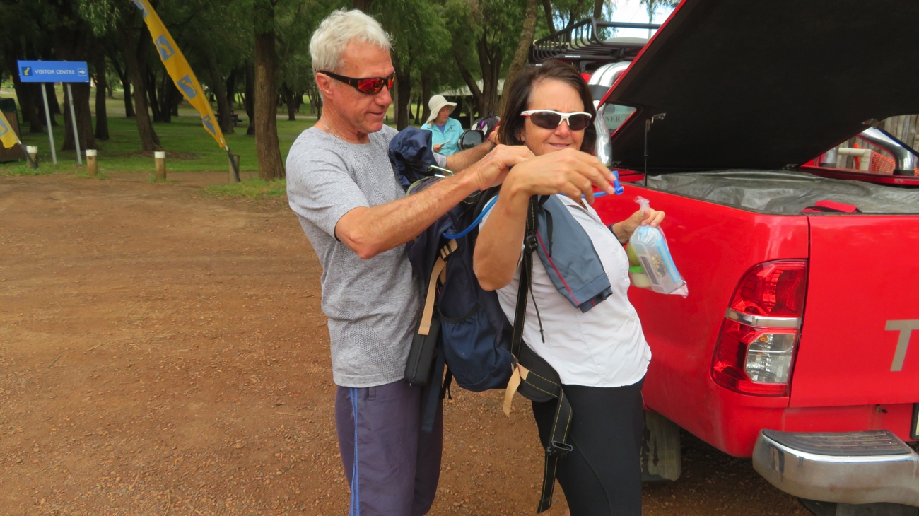
With still no date for when we can get the vehicle repairs done we decided we may as well keep travelling and exploring until called back to Perth. We’ve planned a trip through the forests of the south-west. Western Australia is famous for its beautiful timbers, karri and jarrah being the principle though tingle and tuart trees are also significant.

We left Yallingup about lunchtime heading south down the Caves Rd past all the wineries, breweries, deer farm, maze, caves and other tourist enticements. Well, we didn’t quite make it past ALL the wineries/breweries – we brunched at Cheeky Monkey Brewery and Vineyard.

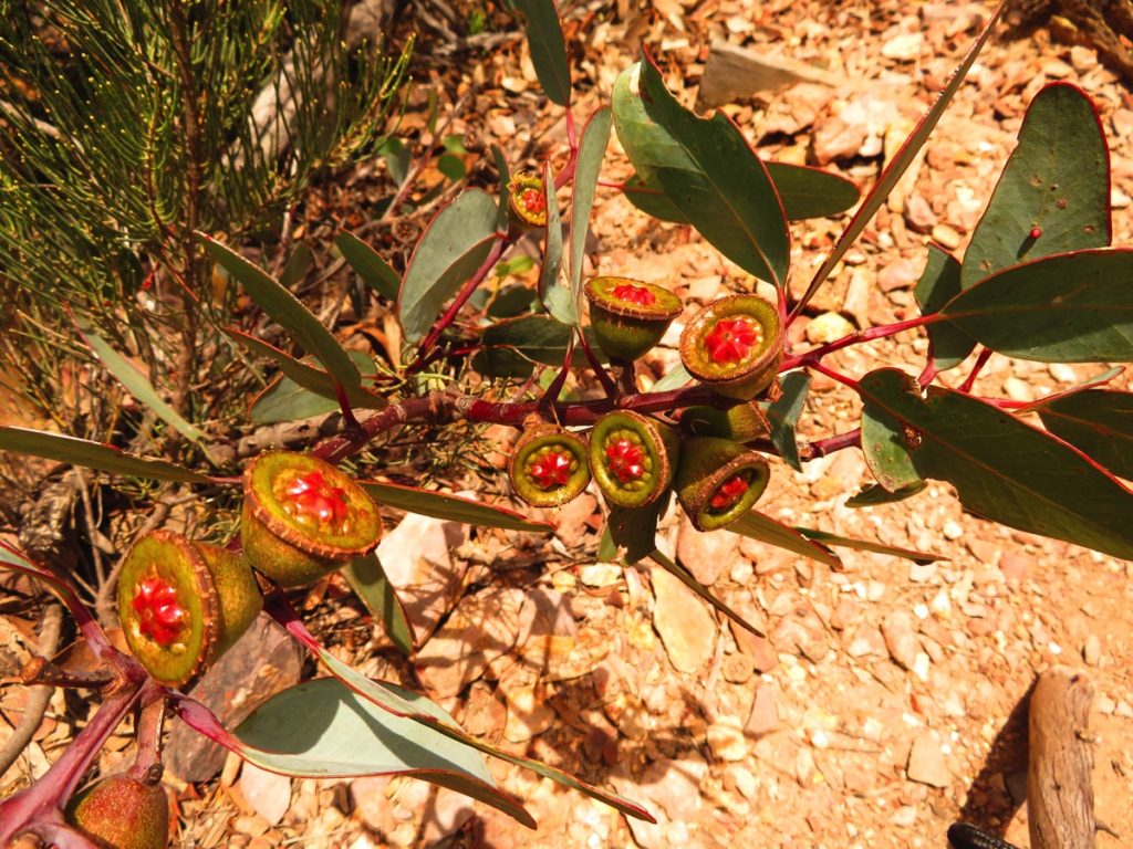
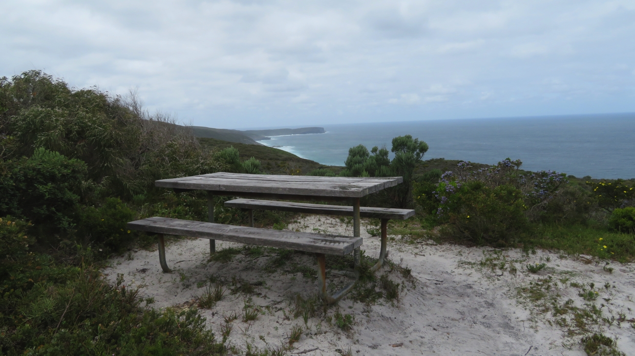
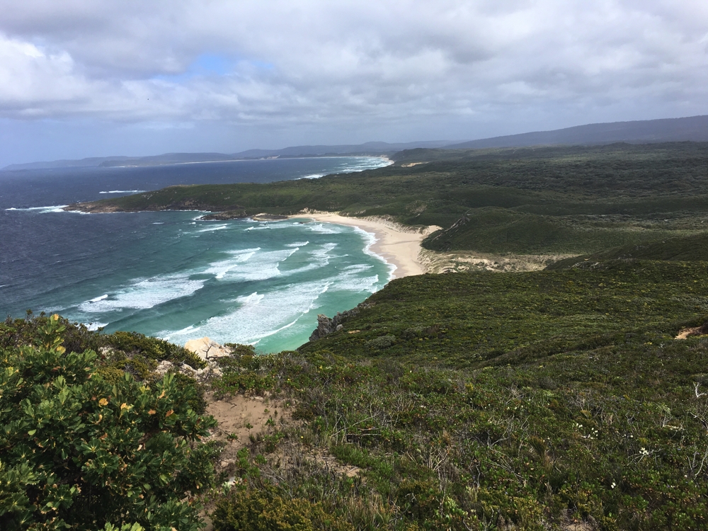
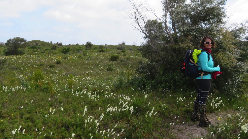
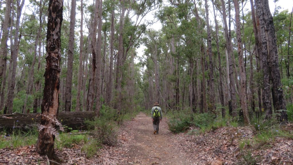
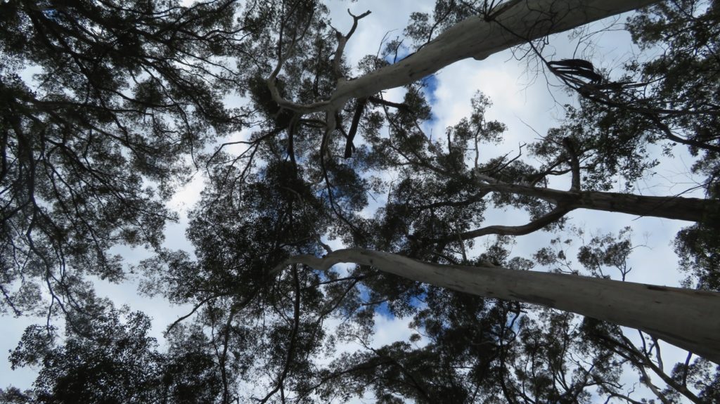
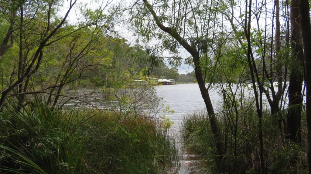
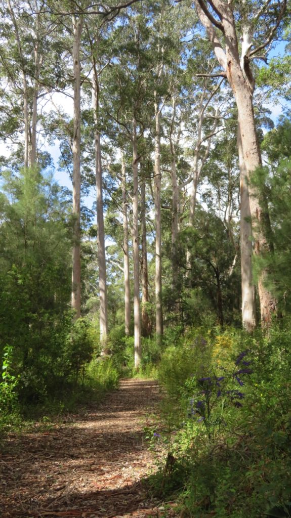
Boranup Road, an unsealed road off Caves Rd, provides a scenic drive of about 20km through the new-growth karri forest. These magnificent trees with their straight trunks towering up to 60metres into the sky are about a hundred years old now – logging in the early 20th century having cleared their forebears. A very pretty drive with a short detour to Boranup Lookout which overlooks the forest as it merges in the distance with the ocean. A couple of picnic tables and a toilet are provided here.

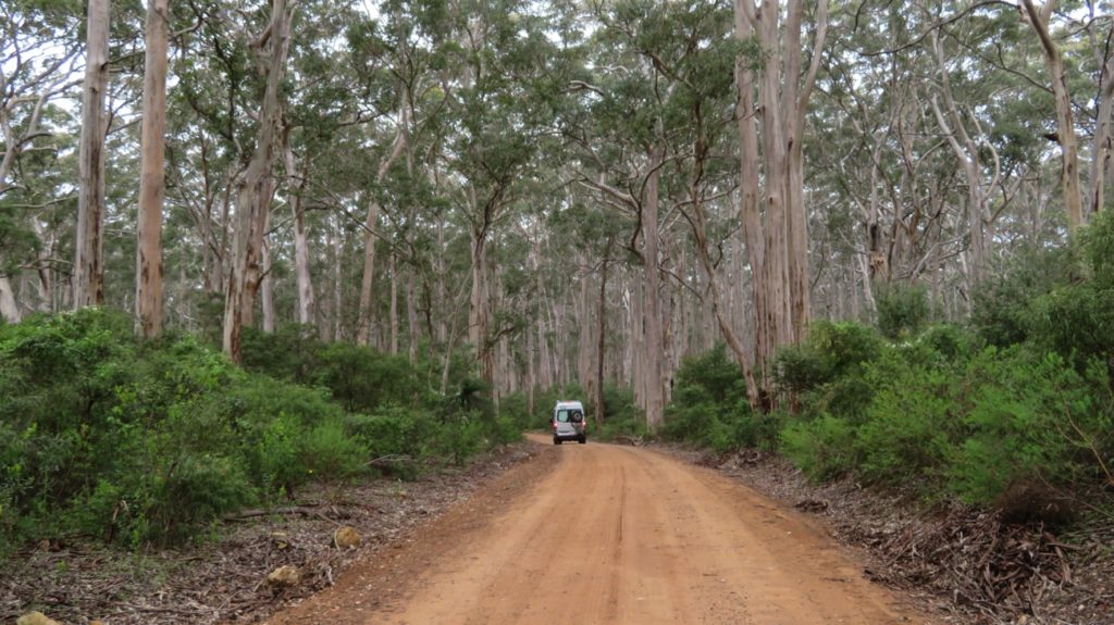
Driving through the Karri Forest, Boranup.

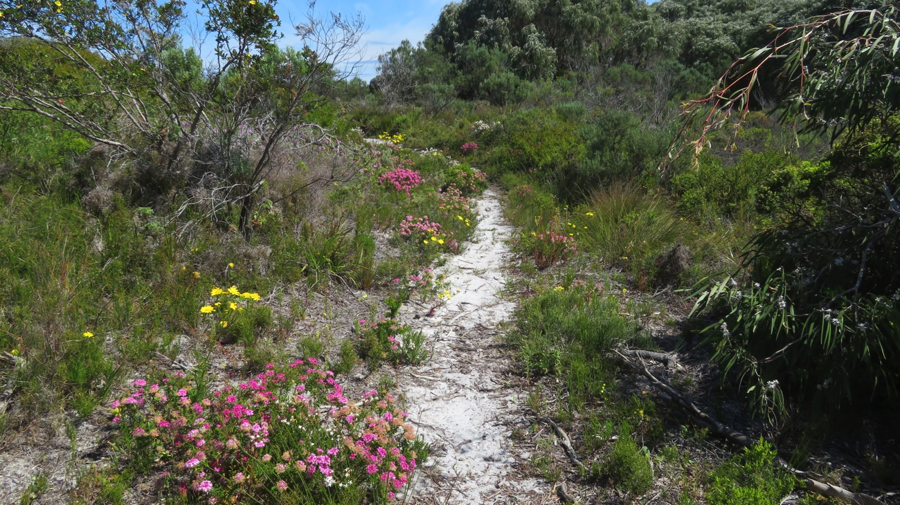
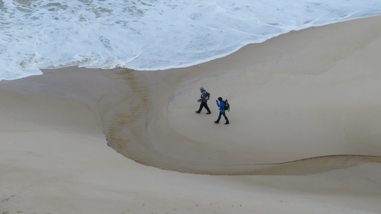
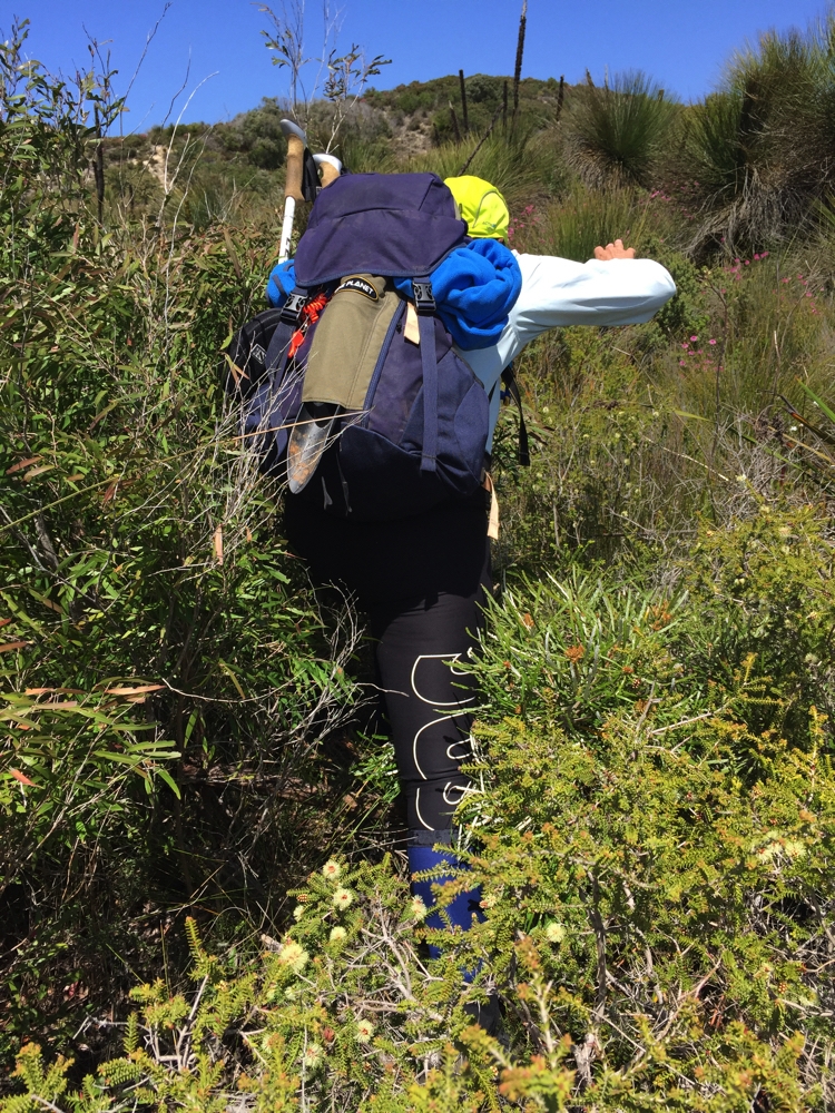
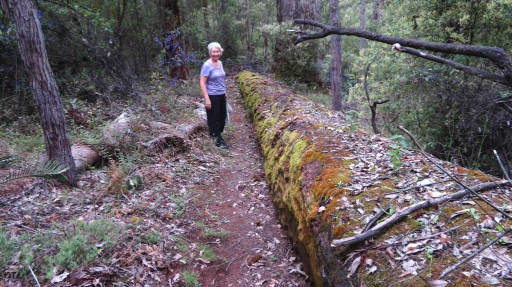
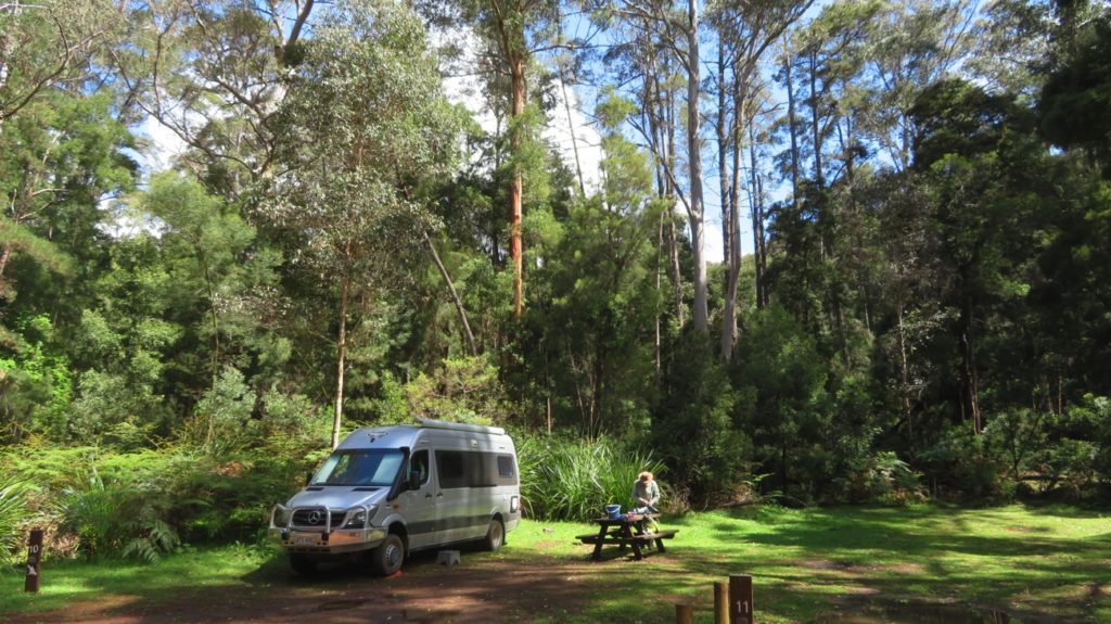
Tonight we’re camping amongst the trees at the National Parks Boranup campsite ($12/n), a small campsite alongside the scenic drive – very peaceful, only one other motorhome arrived late afternoon. We went for a 5km walk nearly to the beach.

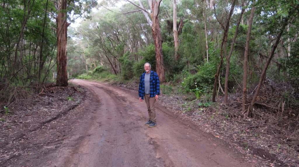
Exploring Boranup Drive on foot.

Monday 9th

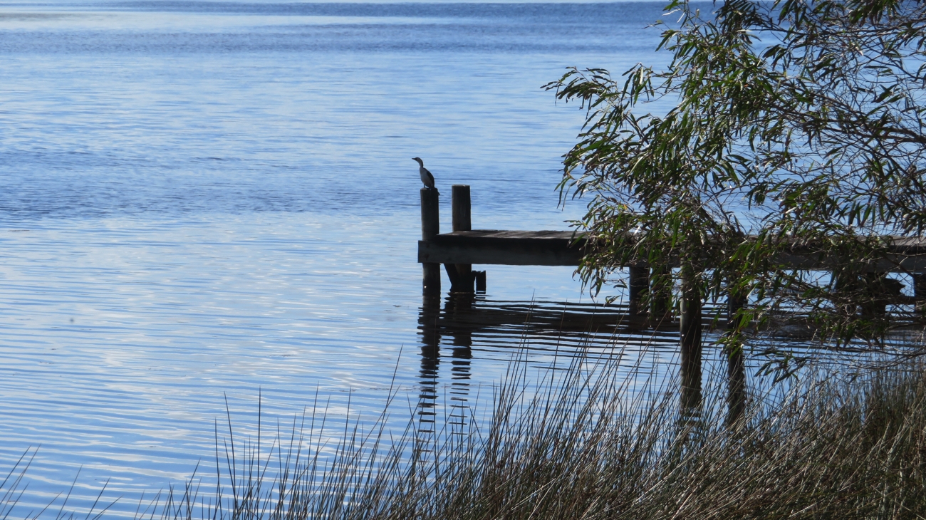
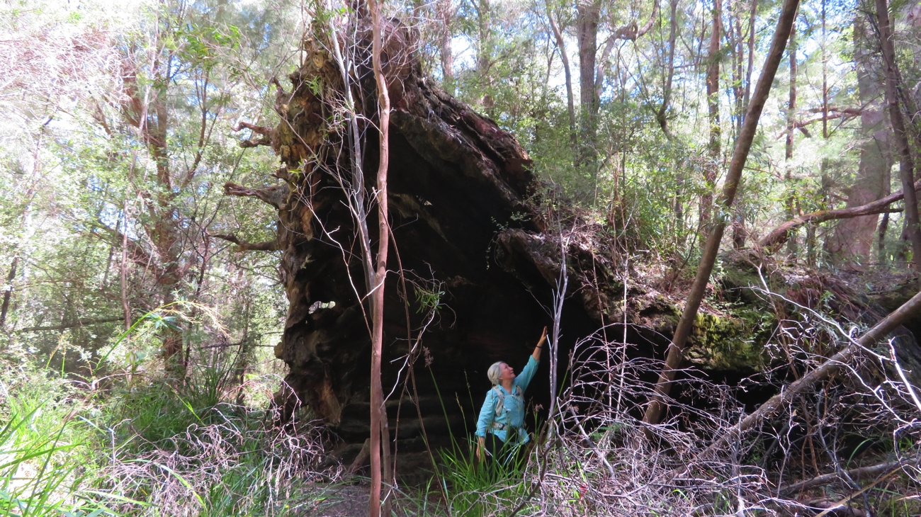
It was hard to leave this restful camp amongst the big trees with their understory of a carpet of beautiful arum lilies. Hamelin Bay is a little way to the south – a pretty Bay with lots of parking for cars with boat trailers; must be a fishing haven, though none out today. The old jetty is just a few timber piles sticking up now, however back in the early 1900s it was a busy port for the ships taking local karri to overseas destinations. None of the western Australian coastline is boating-friendly – this small bay has 11 shipwrecks in it. The changing preference to jarrah spelt the decline of the karri industry here.

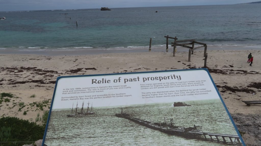
All that remains of the jetty at Hamelin Bay, and a snapshot of its history.

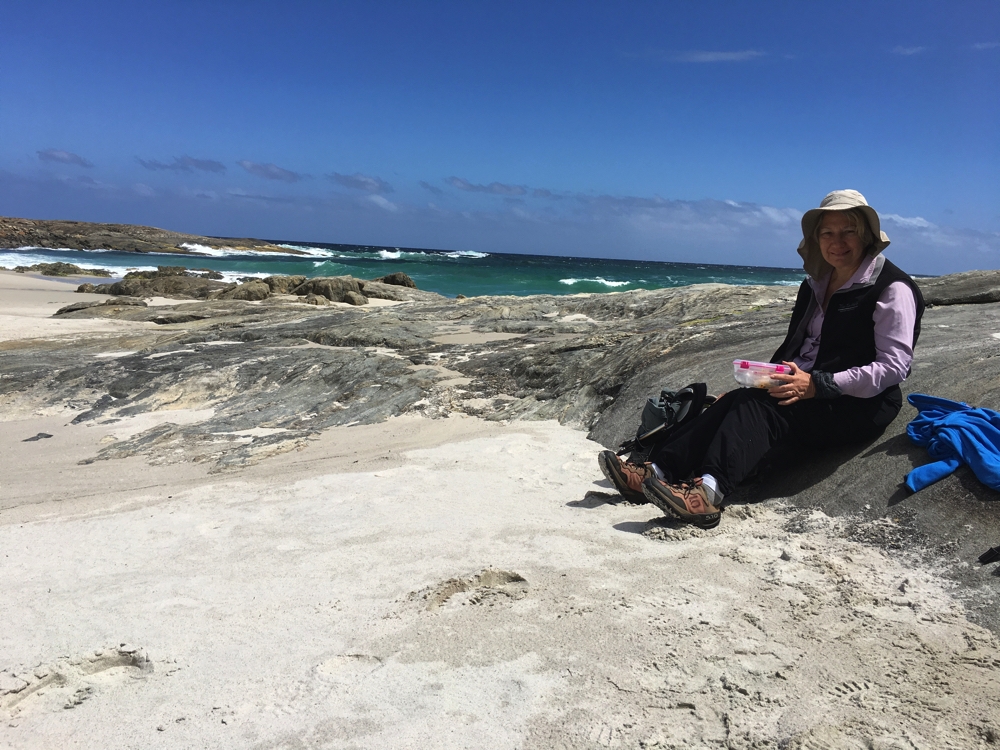
Brunch this morning at Cosy Corner, a secluded bay with a small car park on the headland.

Cosy Corner – definitely a lovely cosy little bay.

On to the lovely seaside town of Augusta built at the mouth of the Blackwood River. We parked here then walked 4km along the river – excellent walking trails. Thanks Augusta.

Augusta, at the mouth of the Blackwood River.

Not far outside Augusta is their new marina – a much-appreciated safe harbour for the recreational and commercial mariners who boat around this coastline. Augusta’s $36 million Royalties for Regions money was well spent here producing a top class facility with lots of trailer parking, floating pontoons beside the boat ramps, aesthetically pleasing picnic areas and a sea wall that looks impregnable. There were boats unloading abalone when we were there.

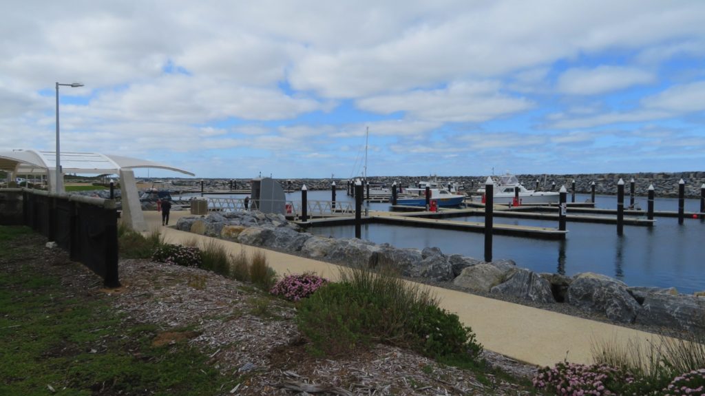
The beautiful marina at Augusta.

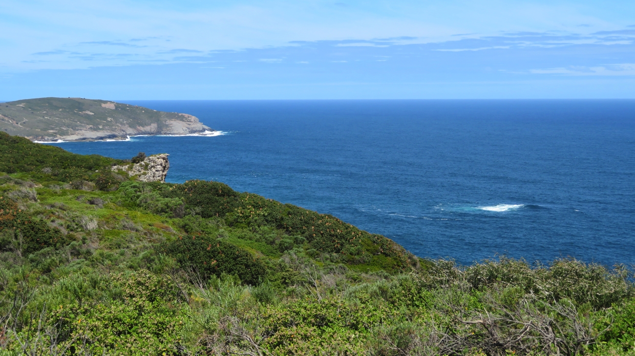
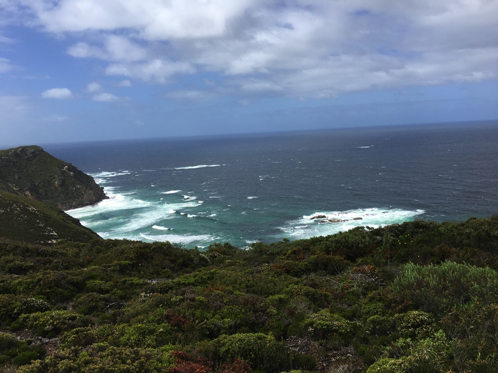
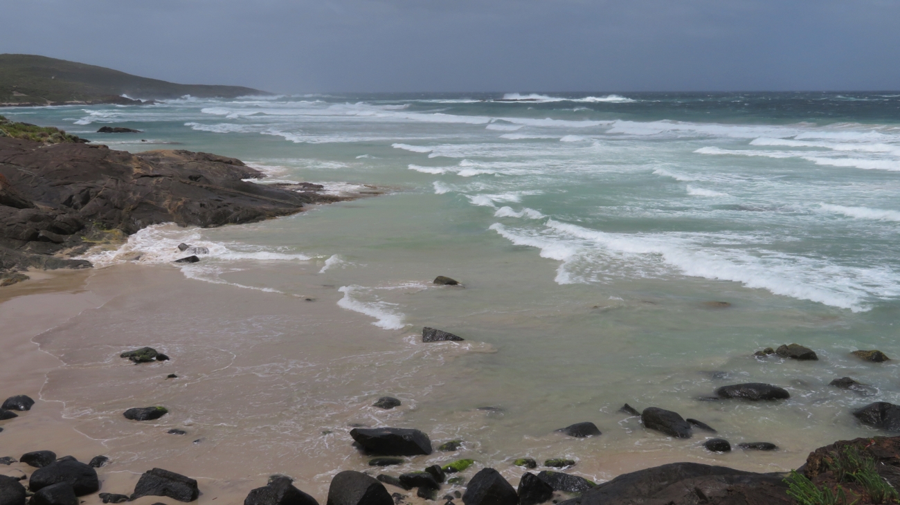
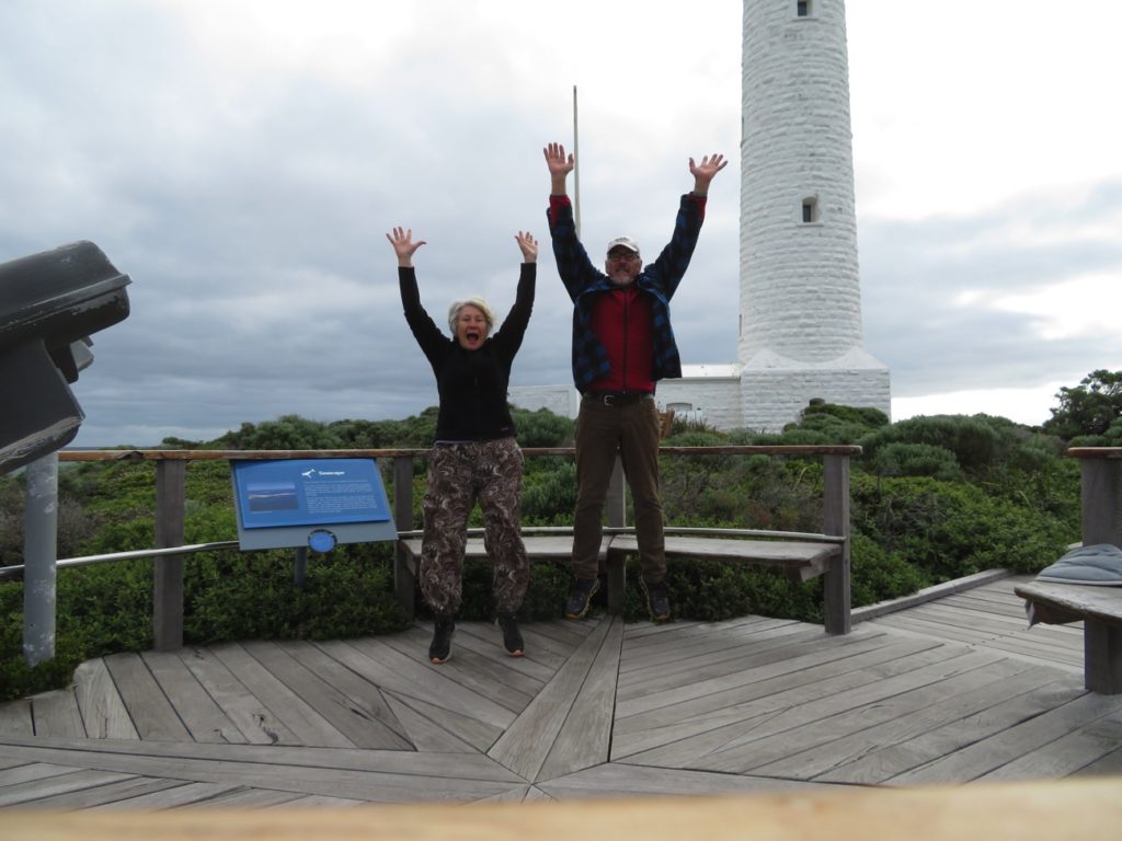
On to Cape Leeuwin Lighthouse, on the most southwesterly point of Australia and the place at which the Southern Ocean and the Indian Ocean meet. Matthew Flinders, who began the mapping of the south coast of Australia from this point in 1801, named the cape after the Dutch galleon, the Leeuwin, which accidentally discovered this area of land in 1622.

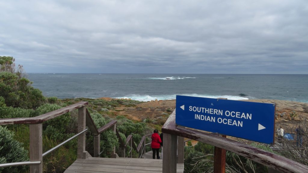
Where two oceans meet.

We wandered around the buildings and working lighthouse, now  automated, the last of the three lighthouse keepers leaving in 1998. Well tended lawns and information boards making it all the more interesting. Usually $8 pp entry, but as the lighthouse was undergoing some maintenance it was just a gold coin donation today.

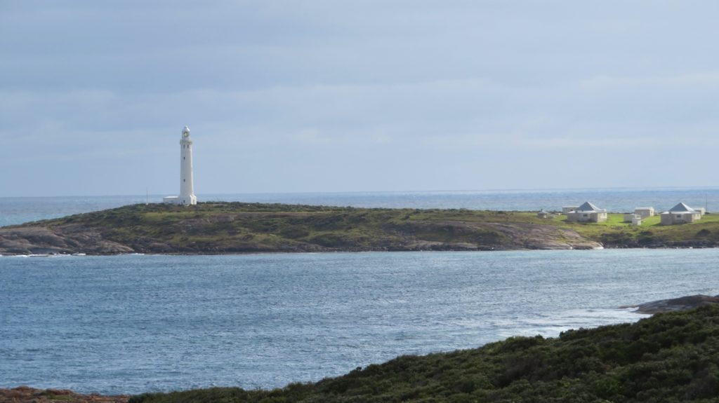
Cape Leeuwin lighthouse. Two of the lighthouse keepers houses are in the photo as well as some of the maintenance huts.


Cape Leeuwin – the most south-westerly point of Australia

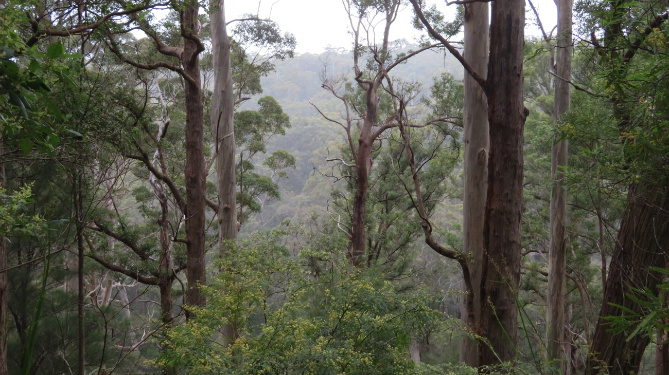
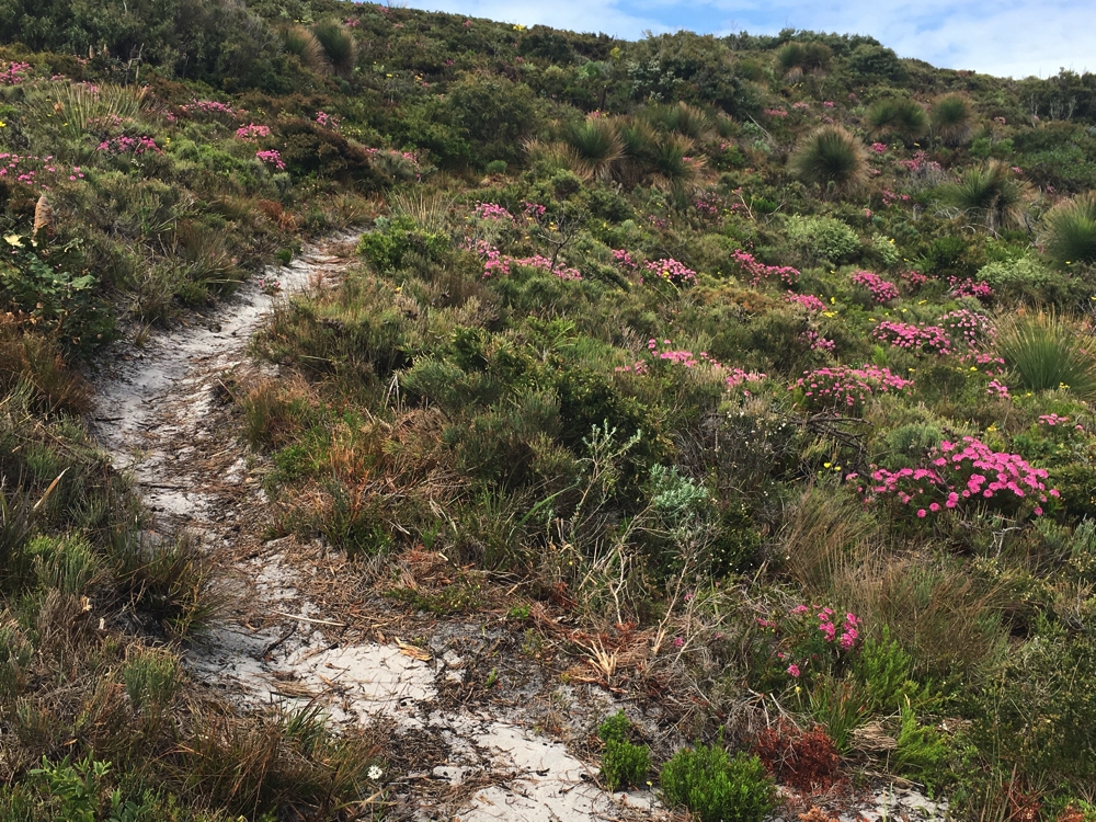
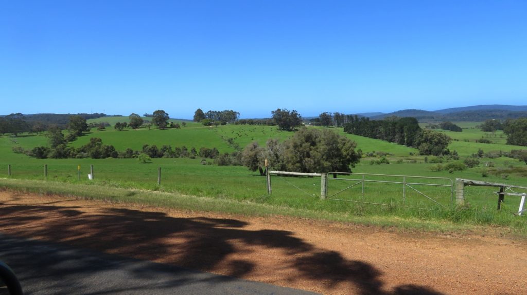
Leaving the Cape and Augusta we headed back inland towards the big trees. Today’s drives have been very pleasant, from the karri forest through coastal heathlands and wildflowers then inland through lush green sheep country to our free campsite in the bush via a dirt road and through an enormous puddle.

Our campsite off the highway and through that puddle. Quiet night! I think the puddle scared everyone else off.

Tuesday 10th

After a quiet night all alone we awoke to rain – 4WD has its uses (remember the puddle!).

Nannup provided a relaxing locale for our brunch beside their Arboretum – tall trees from other States planted nearly 100 years ago. We took a walk along the Blackwood River Trail and wandered the streets of this lovely timber town, past art galleries, music venues, locally crafted timber furniture stores to stop for a coffee at one of the several cafes.

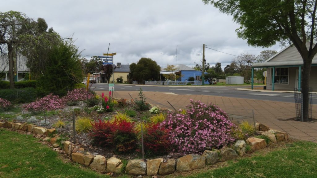
One of the lovely public gardens in Nannup

Nannup is noted for its gardens – well-deserved praise seeing the many public and private gardens ablaze with flowers and beautiful plants.

The totems at Nannup

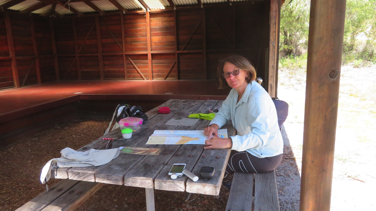
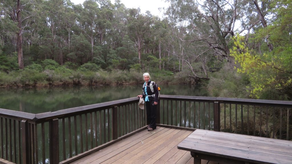
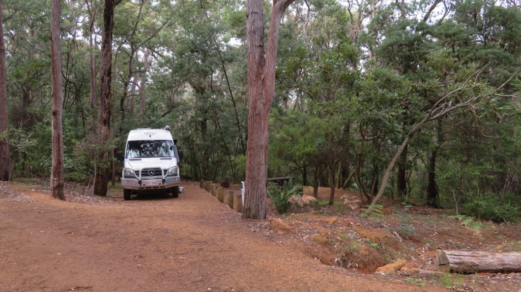
This evening we’re camped beside Workers Pool, a National Park’s campsite. We’re planning to walk some of the Old Timberline Trail tomorrow which passes through this campsite. There’re only about 6 or 8 sites here and it’s nearly full.

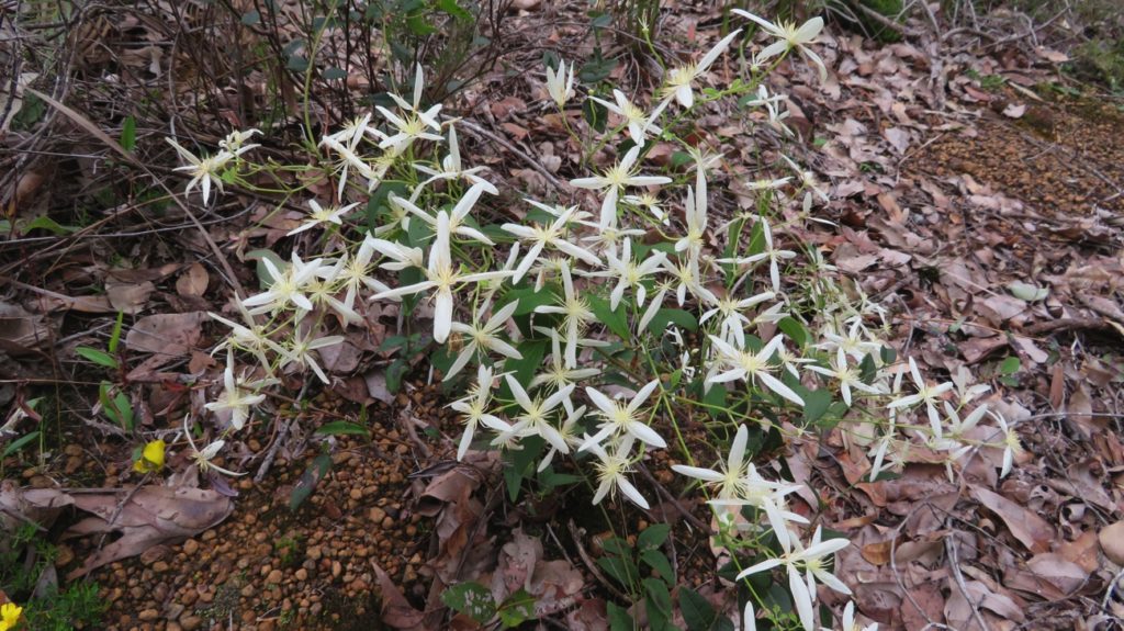
Clematis, Grandads Beard

Wednesday 11th

The Old Timberline Trail follows, in part, the route of the old rail line that was constructed to transport the timber out of the forest, diverging several times to St Johns Brook for the walker to enjoy this lovely fast flowing stream with its many large pools.

At Barrabup Pool, on the Old Timberline Trail

Logging ceased here in 1922 and other than a few ancient timber sleepers,the broken timber bridge over St Johns Brook and some very large old stumps there’s little to see of the railway line or the milling activities, or small township that grew up around the mill.

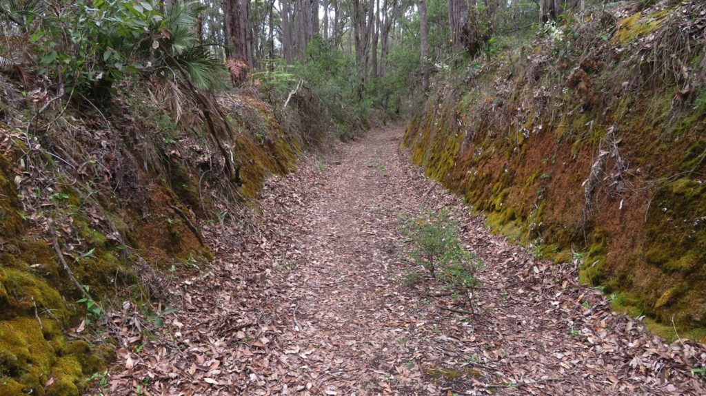
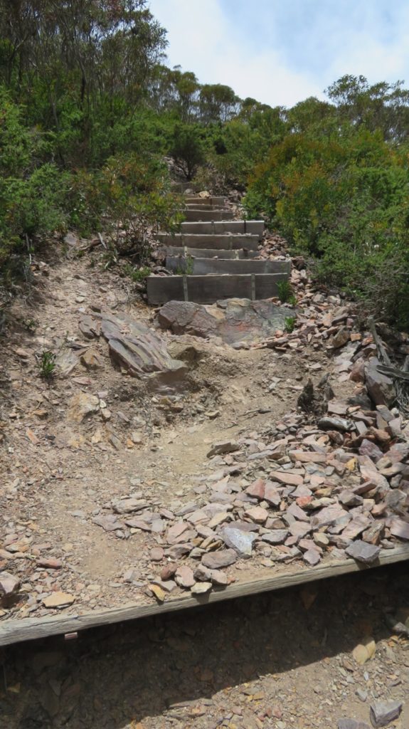
These cuttings were dug by hand back in the day – what a job! Old Timberline Trail

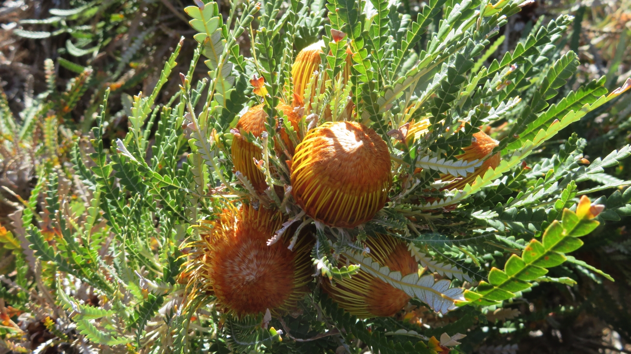
Today the forest, being in National Parks control, is a tangle of banksias, grass trees, other understory bushes and beautiful tall timbers, the walk lined with wildflowers, including the delicate native orchids.
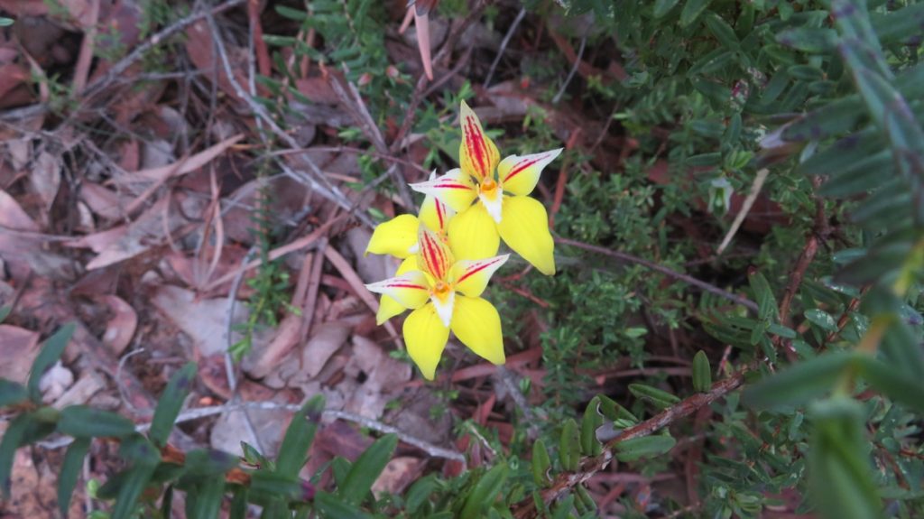
Orchids

We walked from Workers Pool to Barabup Pool past Hewers Camp and up to  Cambray Siding and return for a total of 22km. Altogether a very pleasant walk in pleasantly cool weather, if rather exhausting. It took about 5 hours of walking time with another hour rest for lunch.

Walking the Old Timberline Trail

I must say I love these National Parks campsites. Invariably they’re in beautiful locations surrounded by native bush, most sites so far separated from your neighbour by bush that you can’t see them, a sturdy picnic table and fire pit, this one having a swing hot plate and timber provided. And they’re inexpensive – $12/n for us.

Our campsite at Workers Pool.

Thursday 12th

We continued our journey along the Blackwood River valley from Nannup to Balingup to Greenbushes. The Blackwood River by WA standards is very impressive – wide, deep and plenty of water. The river valley is lush, green with beautiful rolling hills. It was a varied drive from big tree forests, to very pretty sheep and cattle properties and very large areas of plantation eucalypts and pine. We saw lots of big logging trucks either full of harvested pine or heading back empty for another load.

Brunch was at a cafe in Balingup, mine not so good, Steve’s great! We then detoured a little to look at the heritage-listed Golden Valley Tree Park. This 60 hectare arboretum was started, privately, more than 100 years ago. It has two sections, the International trees and the Australian trees. We wandered through the Australian section trying to work out how to recognise which tree is what …unsuccessfully! Lovely parks, now in public hands and managed by volunteers.

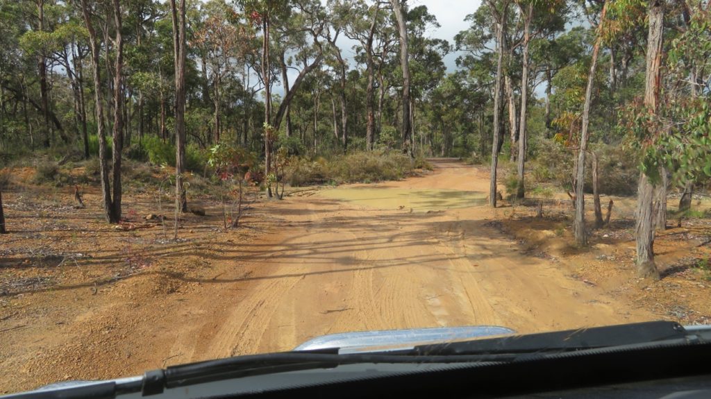
Due to this detour we headed down to Greenbushes via the back roads, ie dirt roads. All good though, as are most WA dirt roads.

Greenbushes came about when tin was discovered here, the first miner laying his claim in 1888. The town quickly sprang up as more miners moved here. Tin, however, went through a decline, but fortuitously they also discovered tantalite and lithium minerals here which has taken over as the major industry. We drove to the lookout to view the open-cut lithium mine – yep, big hole in ground.

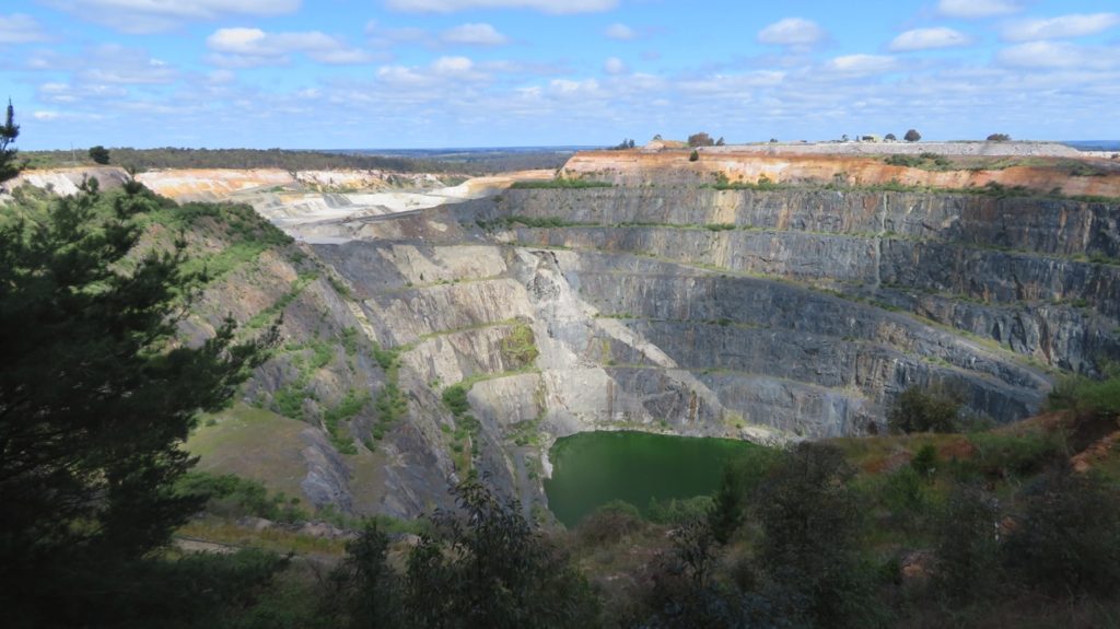
The lithium mine at Greenbushes

A couple of kilometres out of town we arrived at our camp beside Greenbushes Pool. There are several large pools (lakes/dams) here, formed by the early tin miners who needed water to sluice their diggings. This one is now purely for recreation, the local council having established swimming areas, play grounds, picnic areas, BBQ and (thank you Council) a free camp. We went for a walk around the pool, half of it on boardwalks. A top spot.

Friday 13th

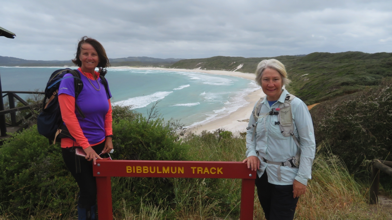
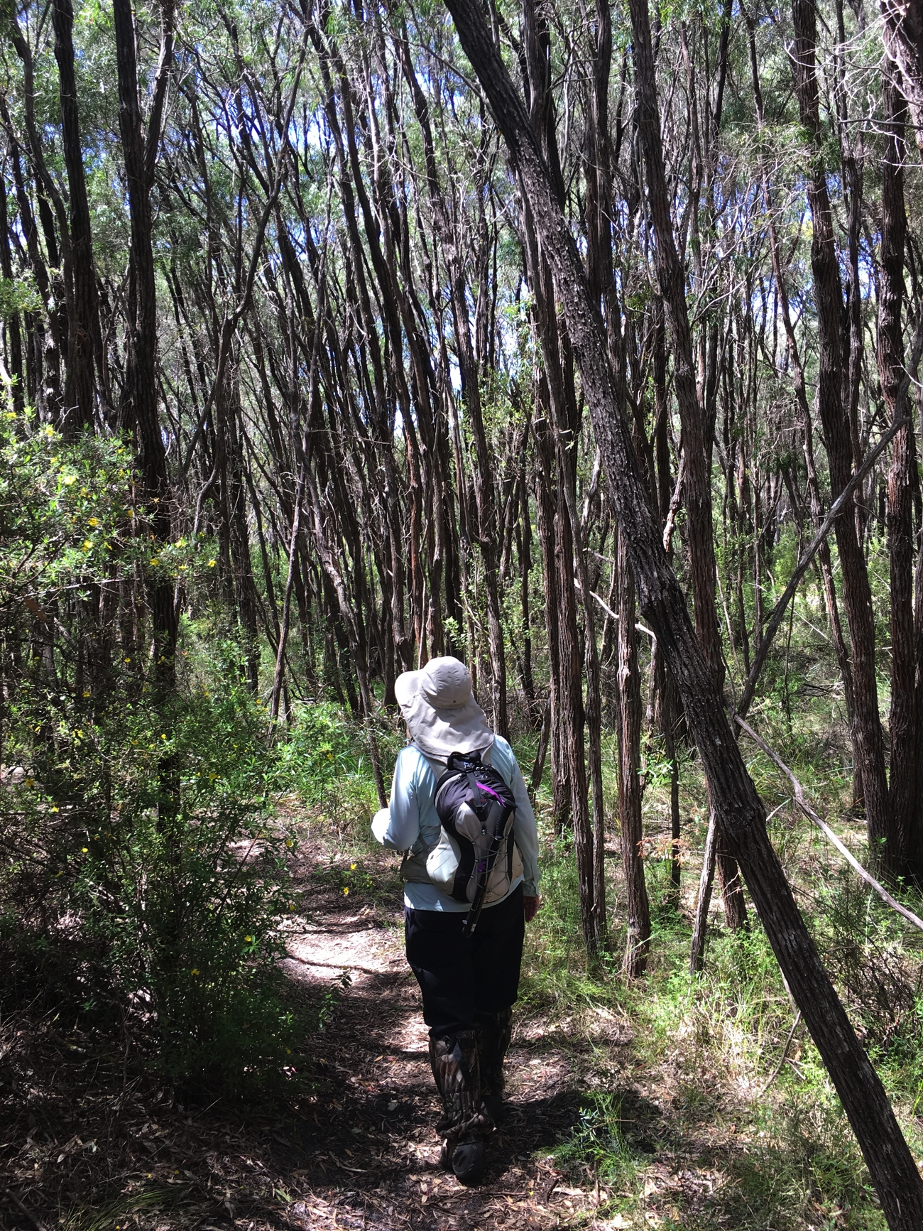
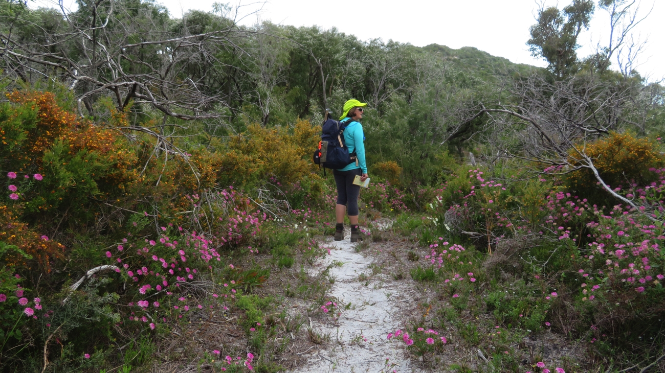
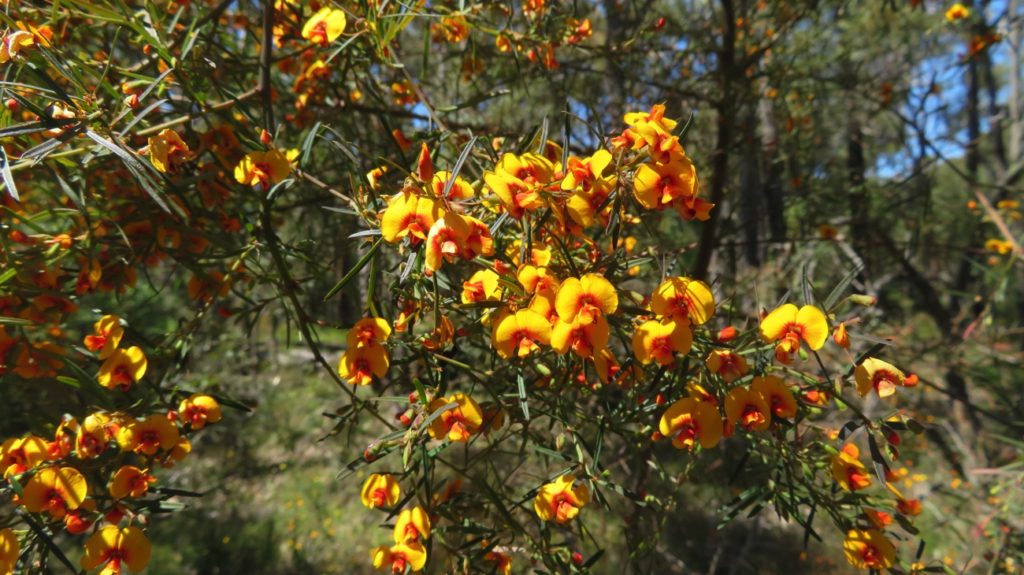
Bushwalking today! We walked the 16km Greenbushes Loop which took us from our campsite, past two large dams, over a dam wall or two, along 5km of the Bibbulmun Track, past remnants of the tin-mining era including ore loading ramps constructed of huge logs, before emerging from the Jarrah forest to a much-appreciated seat overlooking paddocks of wildflowers and grass trees, then waded knee-deep through the chilly waters of a creek crossing, onwards to Dumpling Valley water supply dam (had to note that as I like the name so much), back through the town of Greenbushes and finally back to our home at Greenbushes Pool. A pleasant walk, well-maintained, lots of variety and, once more, lined with wildflowers. Today I was in my ‘yellow mood’ – took lots of photos of yellow flowers.

The whole walk was very pretty – here’s just one example.


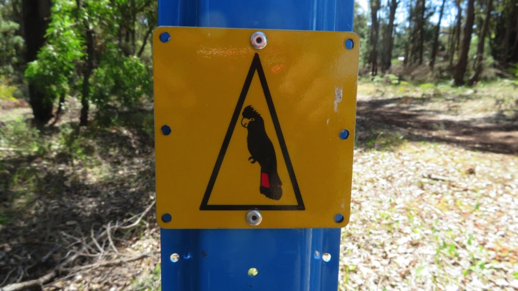
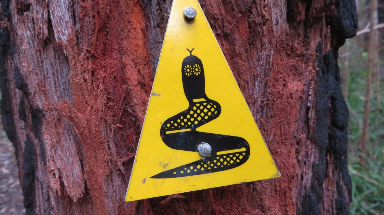
This is the symbol for our walk trail. This is the Forest red-tailed black cockatoo. We’ve been seeing them and their cousins the white-tailed black cockatoo frequently in the forests as we’ve been travelling.


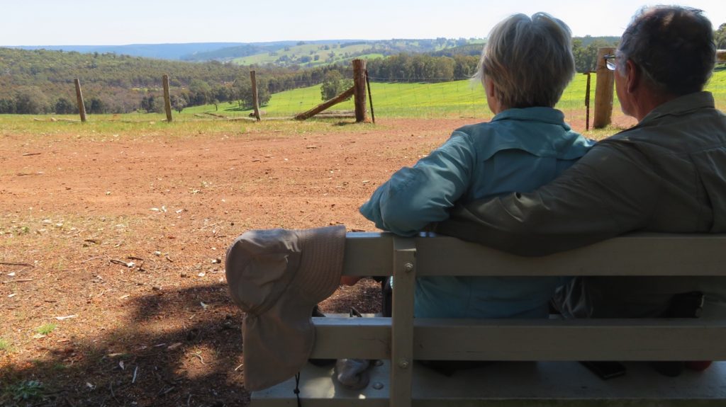
A well-deserved break on our Loop Walk at Greenbushes.


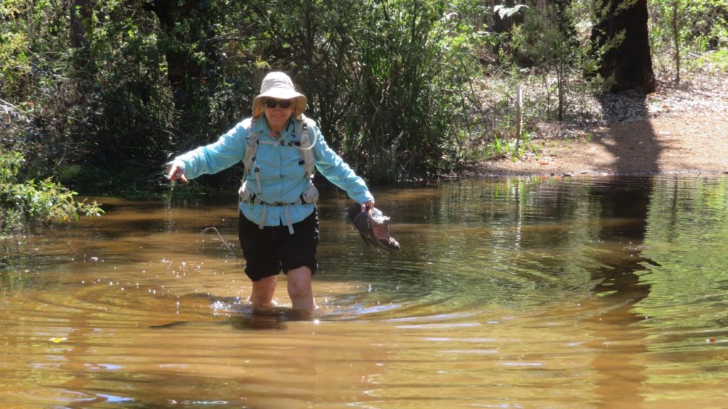
The track was got interesting in places! It got pretty deep!


Needless to say we did little else this afternoon other than cook and eat a meal.

Saturday 14th

Leaving Greenbushes the drive continued through some of the prettiest scenery – the sleek black cattle so fat in their greenest of green pastures and the sheep just about disappearing in the knee-high grass. Bridgetown was our first stop. Delightful town with interesting shops to browse and trendy cafes serving excellent coffee. About 20km out of town is Jarrah Park where we walked 6km of their trails admiring the Jarrah, Karri, Marri and Yarri (or WA blackbutt).

Mossy log. Just look how big these trees are when fallen.

Apparently this is as far north as Karri is found and this particular park is unique in having superb specimens of all four trees – and no we still can’t tell them apart!

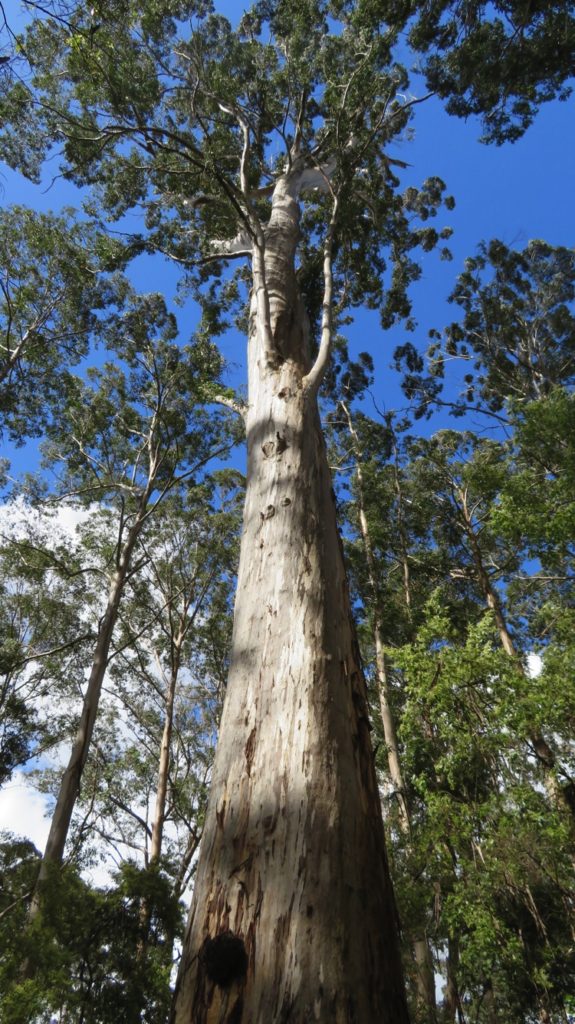
Looking up. Karri trees.

Leaving here we continued directly south through forests and farming land where we’re now seeing beautiful vineyards, stone fruit, apple and avocado orchards, wound our way through the valleys on dirt roads, retraced our tracks (lost, no! confused, maybe) until we found one of the very best National Parks camps we’ve ever stayed in – Greens Island. The Green family began planting Karri trees here mid last century. The huge camping area with 21 campsites is underneath these magnificent trees and bounded by a babbling, shallow Brook of crystal clear water.

Our campsite at Greens Island.

Timber is provided for the fire pits provided to each site, so BBQ steak was on the menu. There was just us and two other campers we couldn’t even see from our site, let alone hear! Such a tranquil spot!

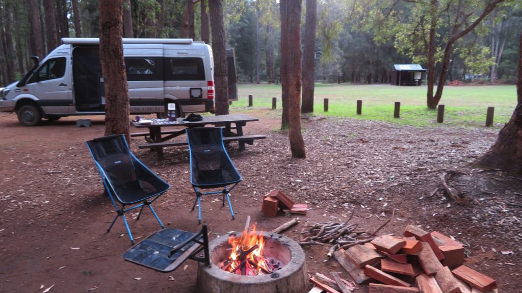
Getting ready to cook dinner. Greens Island

Sunday 15th

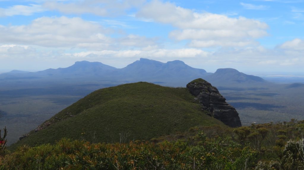
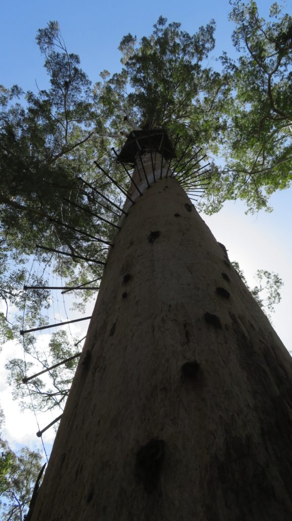
Leaving Greens Island, without getting lost, we headed to Manjimup for shopping at their Woolies. There’s not really much to commend Manjimup, sadly, other than that Pink Lady and the new ‘black’ Bravo apples were developed here. Outside Manjimup we stopped to view the Diamond Tree. This is one of 5 very tall Karri trees that were established in the early part of last century as fire lookouts. Three of these trees, Diamond, Gloucester and the Dave Evans Bicentennial Tree can be climbed by tourists. On to Pemberton, an average town nestled in a valley surrounded by Karri forests, vineyards and lush, green pastures. The Gloucester Tree is just outside Pemberton, but climbing it today, as tempting as it is, isn’t on our itinerary. Instead, surprise surprise, we’re going for an 8km bushwalk through the old-growth Karri forest – doing the Gloucester Route. These old-growth, magnificent trees are definitely the most outstanding we’ve seen so far, and that’s saying a lot. And thankfully, there were lots of them – not sure why last century’s loggers didn’t get to them. Once more wildflowers were everywhere – loved the clematis and every time we walk we see wildflowers we’ve not seen before. Lucky it was such a rewarding walk because it was very steep in places and one of the most exhausting we’ve done – my iPhone tells me I climbed the equivalent of 61 flights of stairs today – the Gloucester Tree would have been a doddle compared to that!

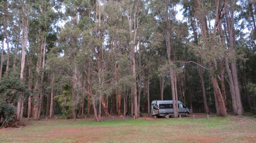
Back to the motorhome and we began the Karri Forest Explorer, an 86km drive through 4 National Parks, past vineyards, cideries and breweries! We’re not going far on it today – just to Big Brook Arboretum campsite where the very genial camp hosts already had the fire going and the sundowners on the go! Just us, another motorhoming couple and the camp hosts here tonight.

Our campsite at Big Brook Dam.

Monday 16th

We awoke to drizzling rain – sad, as the last three days have been lovely warm, sunny days. I cooked a butter chicken for dinner tonight while we waited to see if it would fine up. Just before lunch we headed off towards Big Brook Dam, walking the 6km return initially on the Bibbulmun Track, which passes through our campsite.

The forest around here is relatively young having been heavily logged in the 1920s, then a massive fire ravaged the area in the 1930s, this though caused the remaining Karri trees to drop their seeds which then germinated. Taking nothing away from today’s forest, while not having many of the huge old giants, it’s nevertheless a lovely place through which to walk.

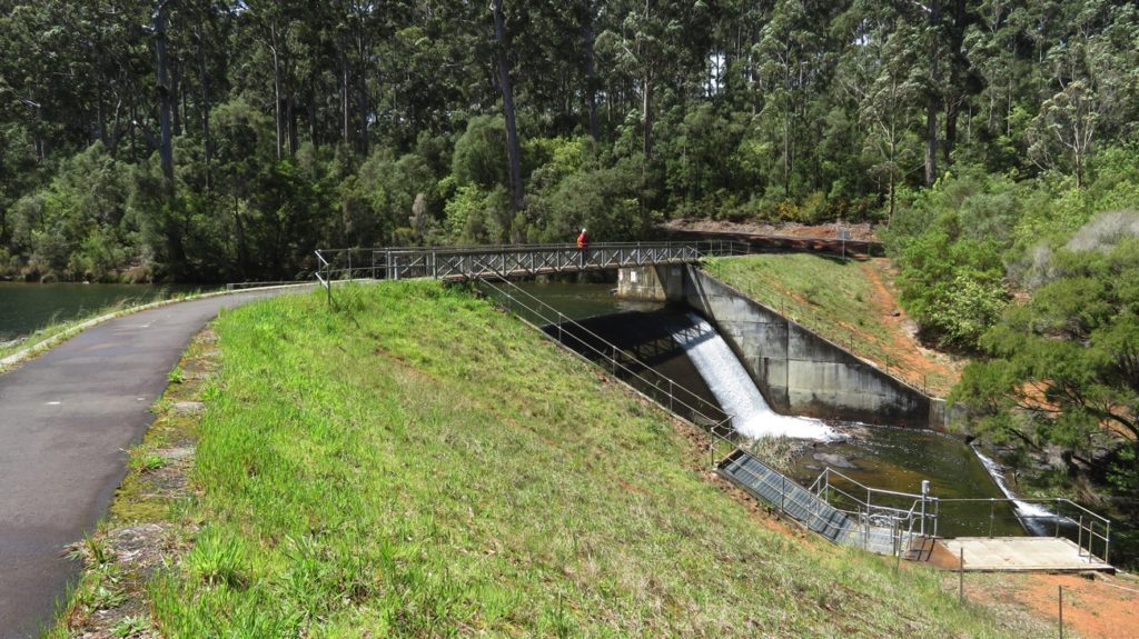
The bridge over the spillway at Big Brook Dam. This area is lacking in water at the moment.

At Big Brook Dam the Council has established a bitumen path that circumnavigates it, passing several little timber jetties, bird hides and shelter sheds on the way, with an excellent picnic area, gas BBQs, a lawn sweeping down to a sandy beach and ideal swimming area. The waterway was dammed to provide a larger water supply for Pemberton and also to support a fledgling trout hatchery. Trout fishing, marroning and canoeing are other popular activities at this Dam.

One of the many lookouts over the dam accessed from the sealed pathway around it.

The weather remained doubtful and, in typical WA weather style, periods of sunshine were interspersed with rain. Walking through the forest during light rain has to be one of the joys of life – there’s a stillness as the birds and animals seek shelter, then a gentle rumble heard in the distance, growing louder as the rain approaches. The sound of rain on leaves and wind blowing the tree tops is gentle. The subdued lighting, misty atmosphere and humus-y smells are a sensory delight. Fortunately during the only heavy shower we’d stopped at a covered shelter to admire the dam – ‘cold and wet’ wouldn’t have improved the ambience.

Back to Priscilla and we headed off along the Karri Forest Explorer once again. A brief stop at a short boardwalk led us to a stand of Warren River Cedars. Next stop at the Big Karri, yes it’s impressive!  

The Big Karri Tree.

Then onwards through some grazing countryside and alongside enormous plantings of avocados. We stopped at a ‘farm gate’ and bought a couple of avocados before further up the road being enticed to taste the wares at an organic vineyard and cidery. Two bottles of wine and cider later we continued on into Beedelup National Park. Here, at what is now a picnic area called Giblett, was the scene of a very protracted, though civilised, anti-logging protest in 1997. The protesters were determined to prevent more logging of old-growth forests and so set up a camp in the forest; platforms high in the trees where some protestors lived for the 6 months of the protest drew a lot of media attention. They were successful and today we have these magnificent forests and trees protected for eternity.

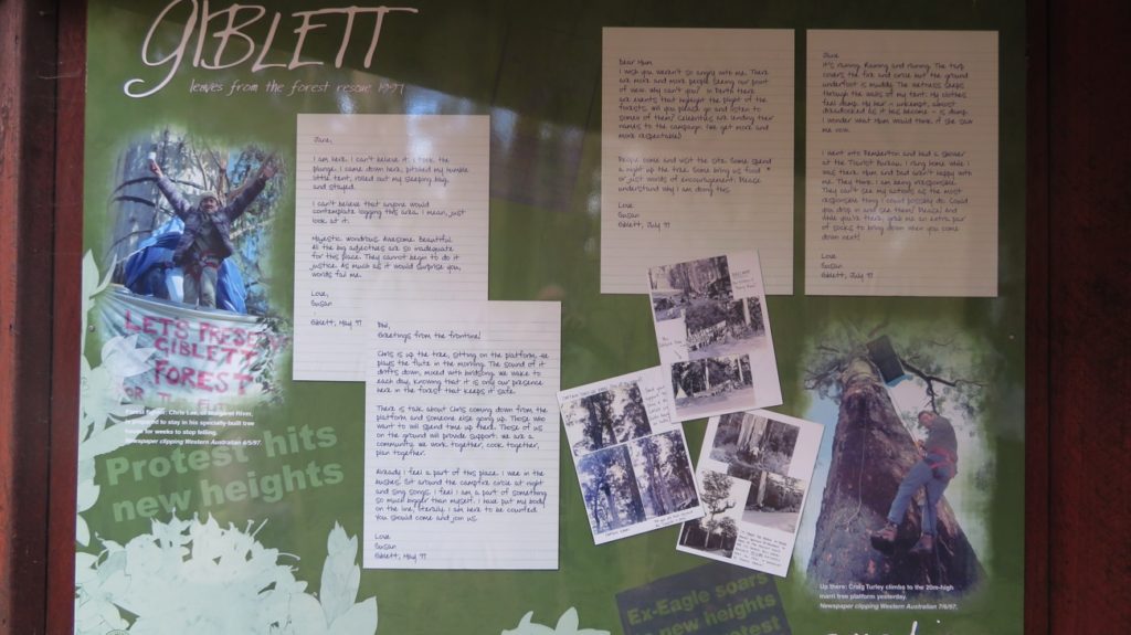
The site of people power! An interesting look at the protest, and where it occurred.

We’d intended to camp tonight at Snottygobble – how could you not stay at a camp named that! However, with very strong wind warnings for tonight and Snottygobble sites being closely surrounded by big trees with potentially loose limbs, we backtracked a little to Grass Tree Hollow where we found a site with trees that looked like they could be trusted. Both are National Parks camps, predominantly set up for tent-campers, but we managed to tuck Priscilla in just enough. No one here but us – bliss.

Tuesday 17th

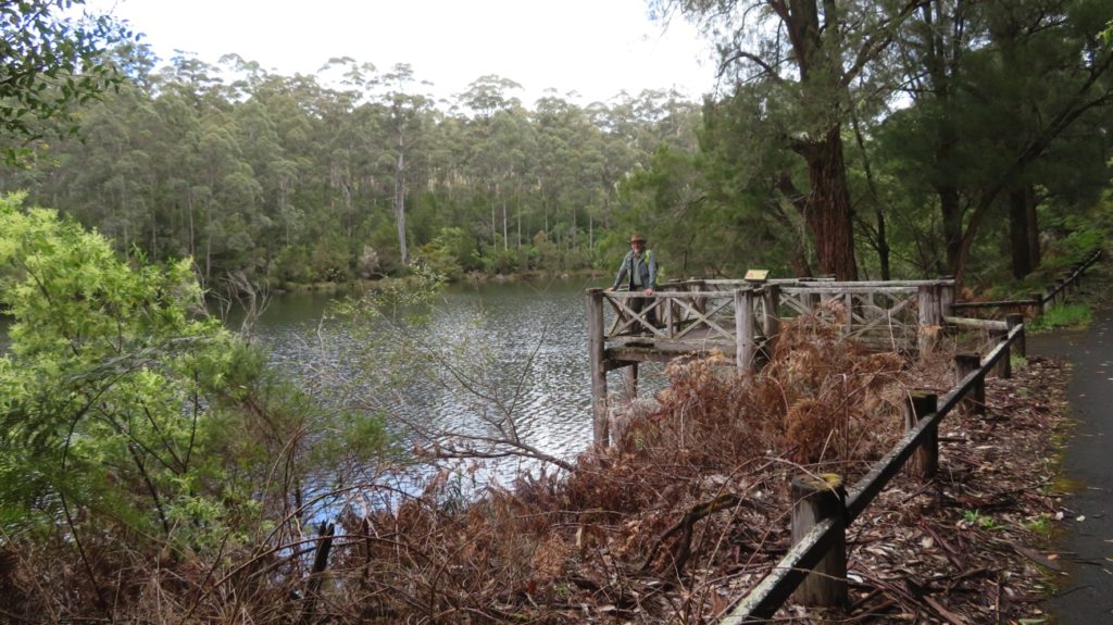
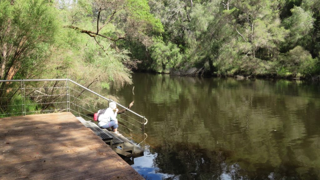
The wind overnight was mild – I guess where we are is well-protected, however it did rain on and off quite a bit. In a wander around the camp site I found a sign pointing to ‘River Access’, followed it and found the most beautiful creek, Carey Brook, hidden deep in the forest its banks lined with huge old Karri trees and flowering understory plants. Half a dozen steps led down to a solid timber deck built right at water level. We got the chairs and a thermos and our cuppas and returned to sit and meditate over this lovely, fast flowing stream where fallen tree trunks created mini whirlpools for the fallen flowers to twirl around in.

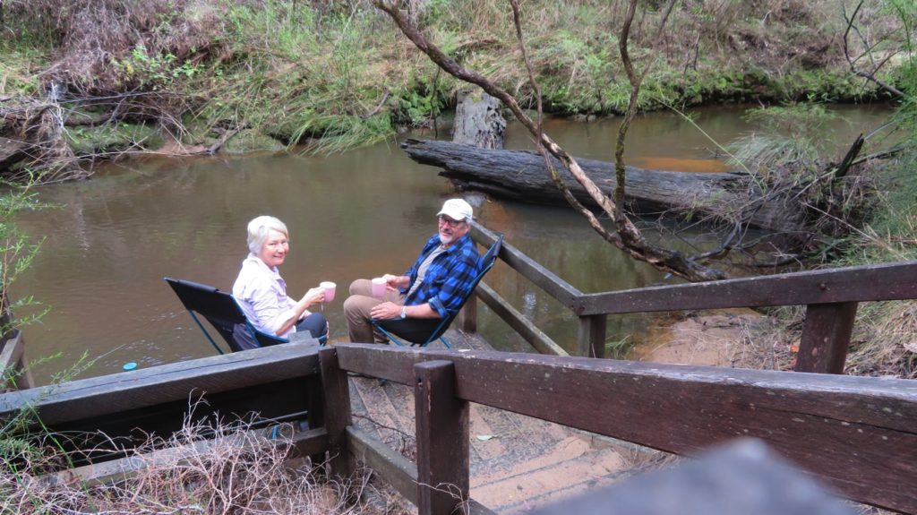
A highlight of our camp at Grass Tree Hollow

We could have stayed here for hours but for a light patter of rain beginning.

Back on the Karri Forest Explorer route to Beedelup Falls. There was plenty of water rushing over the falls and rocks and on into a lake. A newly constructed bridge above the falls is a good viewing platform, but not as good as the suspension bridge at the other end of the falls, and not as much fun either! Popular spot here with good picnicking facilities.

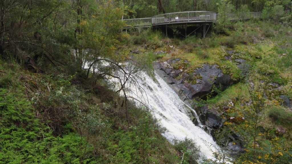
The Lookout over Beedleup Falls

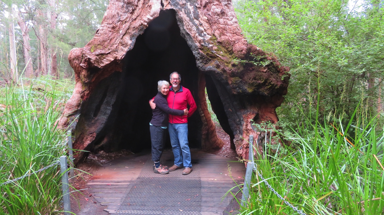
We walked on from the bridge to the ‘walk-through tree’ a round trip of about 4 kilometres – why do the walks I go on always start with steep climbs, the equivalent of 34 flights of stairs today! Anyway, once more, a lovely walk, plenty of wild flowers and the Tree was definitely worth it.

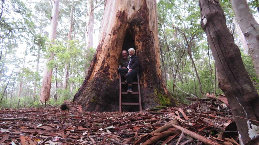
The ‘Walk Through’ tree even fits two people.

On the return loop we followed the beautiful lake and could see Karri Valley Resort across from us built right on the edge of the lake, its balconies overhanging the water – I could be tempted to stay there – very rarely, if ever, would I voluntarily leave our comfortable motorhome, so high praise indeed.

Karri Valley Resort – yep, I’d stay there without too much enticement.

Our destination today, still on the Karri Forest Explorer is Draftys campsite in Warren National Park. It’s along an unsealed road, then a turnoff onto the unsealed ‘Heartbreak Trail’ to a campsite National Parks website tells me is only suitable for tent camping or small campervans <6m – we’re 7metres. To cap it off when I asked about it at the Pemberton Visitor Info centre I was told our vehicle would be too wide for the one-way Trail. With that in mind and that it had rained all night we gamely headed on in – with no problems at all. 4WD helped on the steep, muddy, slippery ascents and descents, the road being pretty good and heaps wide enough, and most camp sites fine for us. Phew!

Once more we’re camped in the Karri forest surrounded by huge trees and thick understory bushes. Just us and one other (tent) camper on the far side.

Wednesday 18th

It rained on and off all night. Today we’re walking the Warren River Loop. We were keen to experience it as it’s been called one of the best in WA. The narrow, leaf-strewn track led from our campsite along the Warren River valley through old-growth Karri, sheoak and Warren River cedar to the next camping area before a steep climb out of the valley to the Dave Evans Bicentennial Tree.

The Bicentennial Tree

This lookout tree has been pegged (for climbing) to 65 metres. I made it up the first 20 metres or so until my thoughts began to wander to the 1.5 metre swing at the top on windy days, such as today, and how long it would take them to bring in a cherry-picker to get me down.

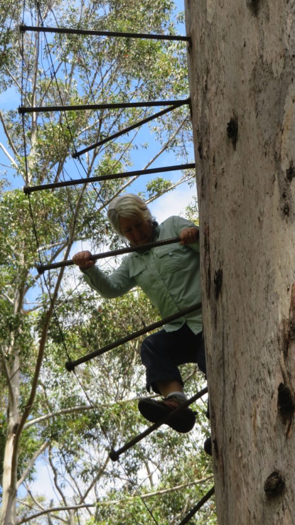
Climbing the Bicentennial Tree

The Trail continued through this pristine old-growth forest before winding its way back to the river where delicate maidenhair ferns lined the path as it took us past Maiden Bush, Heartbreak Crossing and finally, after 11.2 km, back to our camp. It rained once on our walk (while we were under cover in a picnic shelter having our lunch!) and was overcast and cool most of the day.

The maidenhair ferns and the mosses tell you how moist this area is, under the canopy of the big trees. Warren Loop Walk.

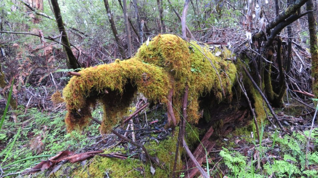
We took heaps of photos of huge old Karri trees in the forest – I’ve long known that pristine forest trees feed my soul. Well, my soul must be fit to burst! There were old fallen trees, huge trunks covered in mosses and fungi, slowly decaying, as well as recent falls of whole trees and big branches – the life cycle of the forest. Bird life, and song, is prolific, though wildflowers took a backseat to the beauty of the trees. Definitely a top walk.

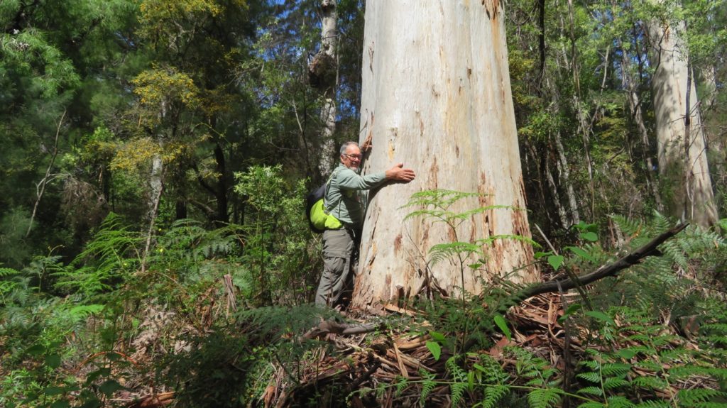
Steve, the tree hugger.

National Parks is to be commended for building shelters and picnic areas at 7 points of interest along the trail. Along the river they’ve created several sturdy timber and stainless steel decks at bank level with steps leading down to water level and another deck. Here at our campsite there’s also a large 3-side-open camp kitchen with 3 gas BBQs, sinks and picnic tables all under cover. Thank you DPaW.

After our BBQ tea we sat on the river deck for awhile enjoying the reflections in this wide, gently flowing river. So beautiful.

Tall trees on our Warren River Loop Walk.


A moment of contemplation. On the Warren River Loop walk.

Thursday 19th

This morning we completed the Karri Forest Explorer, a drive I’d highly recommend. It was sad to farewell the big Karri trees, but we were mollified a little stopping to see the Cascades, the last ‘point of interest’ on the drive.
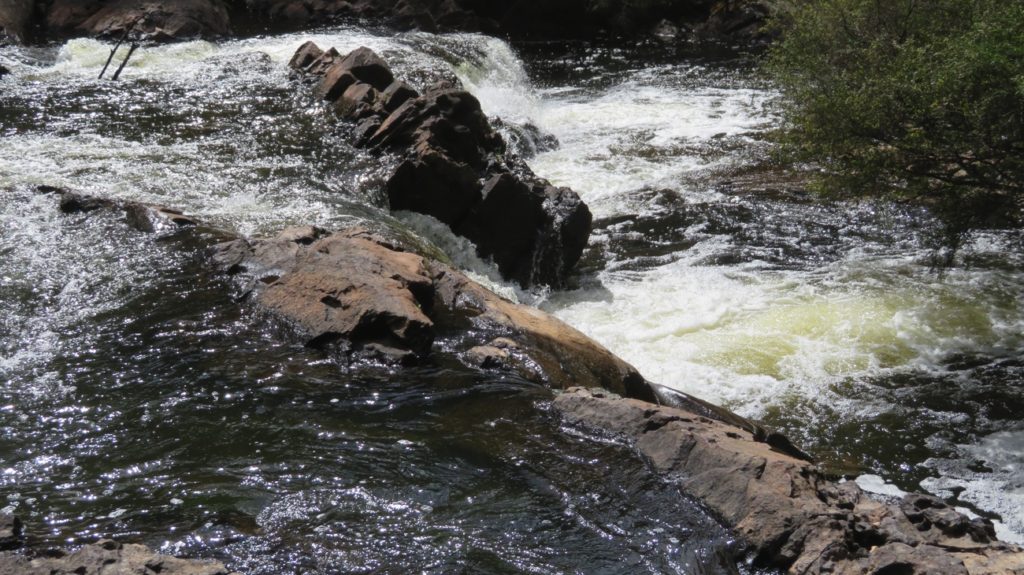
The Cascades

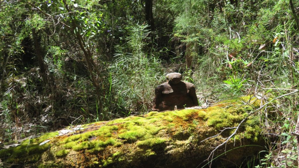
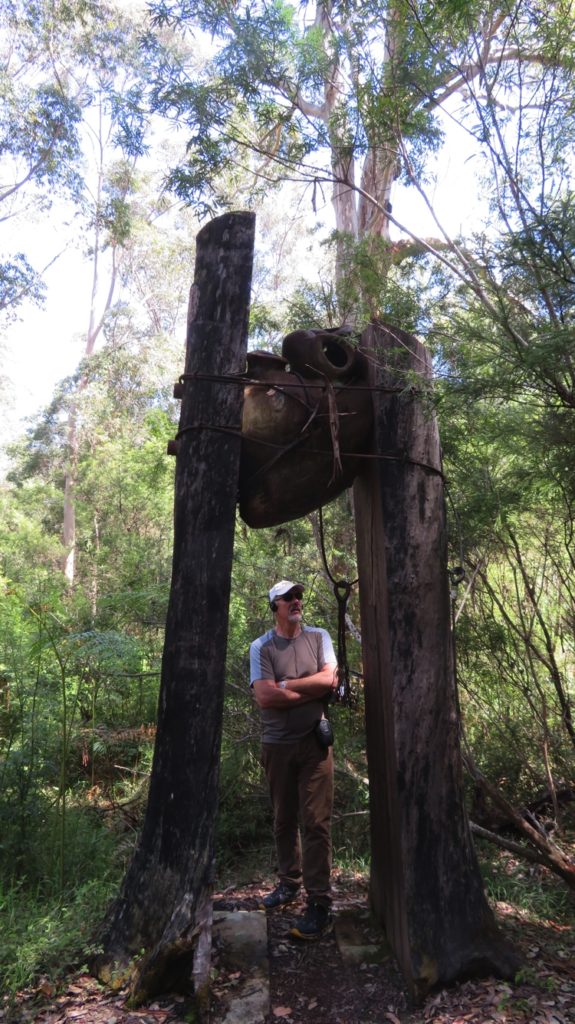
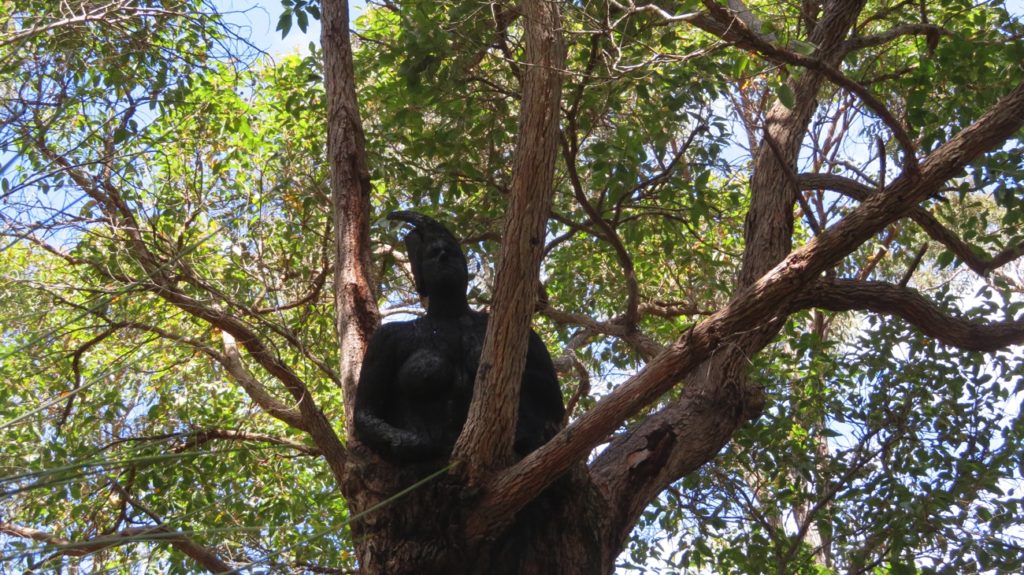
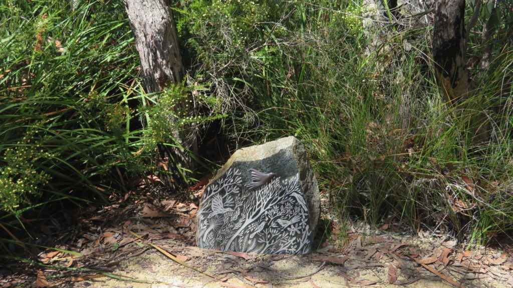
Heading south we stopped for brunch in the park at Northcliffe before doing the Understory Art Sculpture Walk, a walk of 1.2 km through a section of Karri Forest and heathland. The sculptures, by local, National and international artists, were installed throughout the walk in trees or hidden down on the ground. Such talented people!


Our destination for tonight is Shannon National Park campsite. Another tourist drive took us through the forest on unsealed roads, in some areas just two tyre tracks through the bush with lovely tall trees touching overhead – my kind of road! There was some old-growth forest, but mainly regenerating forests and even some melaleuca.

The campsite is being redeveloped and will be huge when completed. For now though the camp host met us and directed us up among the trees where you can’t see your neighbours. Hot showers at this camp – not that we used them, got our own.

Friday 20th (Happy birthday to my soul mate, Steve)

We leave these beautiful forests today. We’ve had many highlights on this trip, but this last week or so amongst the big trees is up there with the best of them. We’re heading towards the southern coast now. We took a few unsealed back roads on the way to Swarbrick, just north of Walpole. In so doing we managed to see more beautiful forests and more lush green pasture lands.

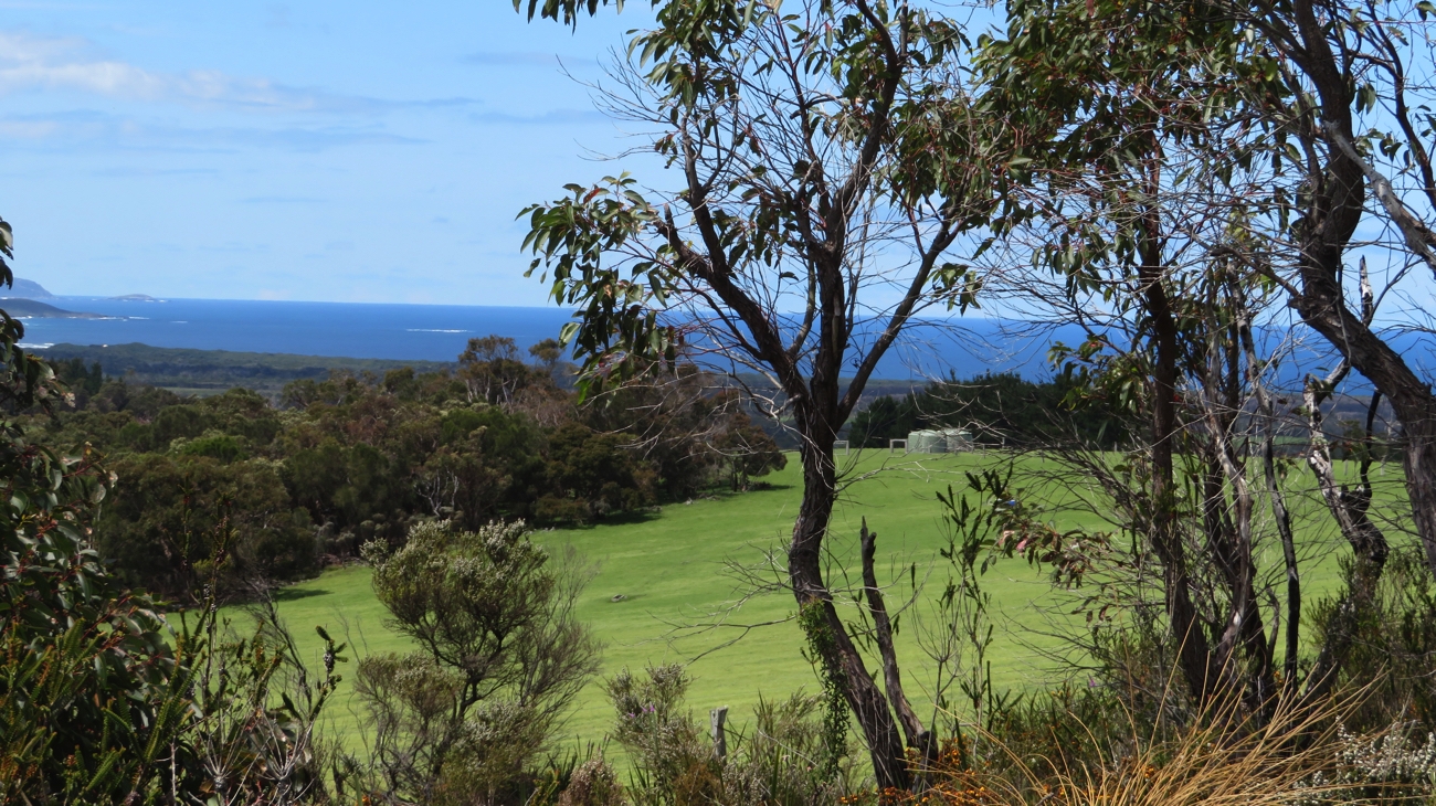
When it’s not National Parks big forests this is what the countryside looks like.

Swarbrick is an art walk a little different to Understory in that the same artists created it all and their theme is how the forests have been impacted by human habitation from the time humans first arrived until today and how humans were affected by the forests. It starts with a 50 metre x 4m high mirror wall, the Wall of Perceptions, reflecting the forest and you in it as you approach.

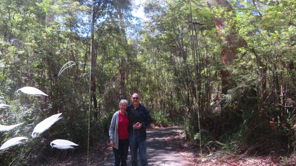
This is actually our reflection in the huge entrance wall.

The history of the forest is written in the panels, chronicling aboriginal, settler, logger and conservationist interactions with the forest. It’s a short 500m walk through the forest with half a dozen symbolic art installations. Interesting.

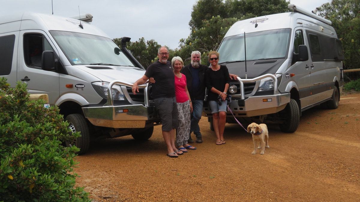
We continued on to Walpole for brunch and internet time, and to speak with all the family. Then on to Peaceful Bay Caravan Park where we met up with Annie and Mark in their Trakkadu, and Trish and Bryan who’ve arrived from Queensland with their camper trailer to share the next stage of our adventure with us.

A  fun afternoon, fish and chips (very good) at the caravan park and a platter of fresh fruits and cheeses provided by Annie and Mark to celebrate Steve’s birthday. A great evening. Thanks all.

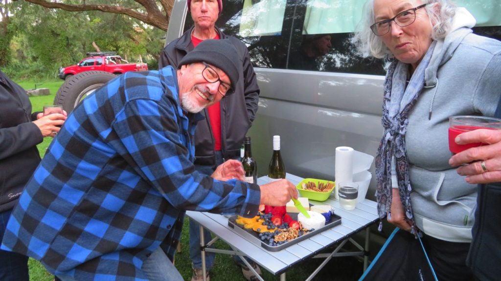
Steve, cutting his ‘birthday camembert’.
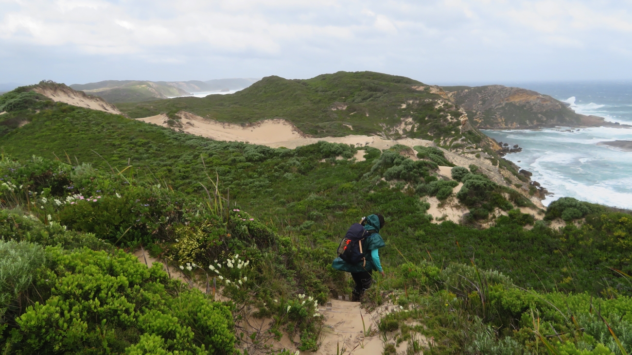
Saturday 21st

We farewelled Annie and Mark, then moved not far down the road to Coalmine Beach Caravan Park where we’ve booked in for the next 4 nights. A bit of shopping and preparations for our next big adventure begins.

For more photos from this time in our trip CLICK HERE

The Wheat Belt and Wave Rock

19th – 26th September, 2017

Tuesday 19th

After seeing the crash repairer this morning we figured that, as there’s nothing we can do here now, we would continue with our plans to explore east of Perth.

The route we took to explore the wheat belt out as far as Wave Rock.

Mid afternoon we found ourselves at Australia’s only monastic town, New Norcia, where in 1847 the Benedictine Monks established a monastery, school and farm. We spent a little time in the museum this afternoon before going to the beautiful old Hotel for a meal. Camping is on the cricket oval, $10 no facilities.

The hotel at New Norcia. It was built as a residence for parents whose children were at the school and needed somewhere to stay while they visited them.

Wednesday 20th

We did the 2 hour tour of New Norcia this morning. There are many heritage-listed buildings here, many of them quite beautiful. There are boys’ and girls’ orphanages and boys’ and girls’ boarding schools. It seems the orphanages were filled with aboriginal children. I felt quite sad viewing these buildings as they were “stolen generation” children. The Catholic Church has a very poor reputation for the way it treated children both in boarding schools and certainly the orphans in its care. In the museum is a ‘kind of’ apology to the children whose childhoods were less than ideal while in their care. According to the 2017 Royal Commission these colleges had the highest incidence of child sexual abuse of any Catholic institution in Australia. What a reputation!  The schools and orphanages are all closed now.

St Gertrude’s – the girls’ boarding school. New Norcia

Today there are 10 monks who live here.

This afternoon we arrived at Cunderdin. I was keen to see Cunderdin as my father was an instructor of pilots here during the war.

In memory of the many pilots trained at Cunderdin during World War II. Perhaps this was one that my dad flew in.

Tonight we’re at the Cunderdin CP – quite basic $25/n powered.

Thursday 21st

First stop today was at Kellerberrin where we eventually found the poorly signposted road to the lookout over this pleasant little rural town. Beyond the town limits it’s wheat as far as the eye can see. Nice lookout though – pity they haven’t put in a picnic table.

Overlooking Kellerberrin.

On through Merredin where the wheat silo has been painted. This has become a popular tourist attraction in South Australian wheat-growing towns with people doing silo tours. The one here at Merredin was only completed a few days ago. The Council needs to create a pull-over area so tourists can view and photograph it in safety. Hopefully on their agenda.

Silo art, Merredin.

Bruce Rock free camp is our destination tonight. We camped beside the sports complex. WA has had a program called “Royalties for Regions” where money gleaned from mining royalties is being invested into communities. Many (most) small towns are now the proud owners of beautiful football and cricket playing fields with night lights, 3 – 6 tennis courts, basketball/netball courts, swimming pool, etc. They really are impressive! Sadly though, even on weekends, we’ve yet to see anyone playing sport on them. Our campsite is on the edge of the cricket field tonight. I forgot to mention that they also have a new bar/function room/club house associated with them. We wandered up and had a pleasant drink at the bar this afternoon.

Friday 22nd

Bad weather has been forecast for today for the south-west corner reaching inland to where we are. It was windy and rained a bit last night. Regardless we set off today heading towards Wave Rock. At the Roadhouse at Narembeen is the Wheat Discovery Centre. Excellent display that explained the history of grain production in the district and how farming practices have changed with technology. It was very informative, one of the best displays I’ve seen.

The displays were very effective. It’s easy to imagine someone living in this, though awfully pleased it isn’t me!

However with my knowledge of how bad high carbohydrate intake is for us and the description of how much herbicide and other chemicals are poured onto the crops, then fungicides over the stored grain it’s not encouraged me to eat it. The herbicides are very effective – even in the fields that have been left fallow since the last crop was harvested there’s not a blade of green to be seen.
Fortunately while we were in the Grain Discovery Centre the first of the cold fronts hit, with very strong winds and heavy rain. We continued on to Hidden Hollow, a granite rock where in years gone by the farmers channelled the rain coming off the rock into a small hollow, and here they washed their empty fertiliser bags, reusing them for their harvested grain. There’s a walk around the rock, but the inclement weather dissuaded us from doing it.

Hidden Hollow – using initiative to solve a problem.

With this cold, windy, rainy weather we decided not to go to Wave Rock today, finishing the day at Tressies CP ($27/n powered). We were lucky to get a spot – there’s a music festival on this long weekend at Wave Rock and the vans kept pouring in until late.

Saturday 23rd

The cold fronts moved through overnight leaving us with an overcast, chilly day, but no rain. Wave Rock is very impressive. From the early 1920s the locals had created a dam to one side, channeling the water from a portion of the rock, expanding it in the 1950s. Other than that, little attention was paid to the rock.

This dam created on Wave Rock provided a water supply for the local area.

In 1964 a photographer entered a photo of it into an international competition and won, and so began the tourism industry here. It’s well done and a credit to the local tourism group.

Wave Rock. Note the wall around the top – channelling water into the dam.

We did the walks around and over the rock – about 5km.

Hippos Yawn rock formation – aptly named! The result of a unique type of weathering. Near Wave Rock

The walk took us past Hippos Yawn then through the ‘lake’ area near the rock.

This beautiful emu fence made the walk around the lake at Wave Rock all the more interesting.

Before all the trees were cleared for the growing of wheat the lakes were freshwater with an abundance of bird life. Now the rising water table has caused them to become saline, killing the vegetation and no wildlife.

Here we see in the background just a small portion of the damage caused by the growing salinity problem.

This problem with salinity is seen all though the wheat belt as a result of widescale clearing of trees. Currently about 12% of once arable land is now useless and it’s expected to rise to 30% in the future. Some farmers are trying to reduce the damage by planting rows of trees, dividing their wheat fields into smaller paddocks, but not nearly as many as should be. Very short-sighted.

Before leaving Wave Rock we joined the music festival for a while – good fun.

Hyden is the town closest to Wave Rock. We stopped briefly and enjoyed their unique heritage sculptures highlighting various people and their occupations. Well done Hyden.

I like the chap on the end, singing as he pedals. Hyden.

10 or so kilometres before Kulin is the Tin Horse H’way. The townsfolk have had a lot of fun sculpting these horses from tin cans.

Imaginative horses on the Tin Horse Highway, approaching Kulin.

Tonight we’re in the amazingly good free camp in the centre of Kulin; an area flanked by beautiful flowering bushes. Thank you Kulin.

Sunday 24th

Didn’t go far today. First stopover at Yeerkine Rock. There seems to be lots of these huge granite slabs of rock that randomly appear surrounded by acres of low, flat farmland, the most famous of course being Wave Rock. Yeerkine, while being much smaller, isn’t without appeal. The walk from the car park through the bush was delightful  – lots of wildflowers, many we hadn’t seen before. As happened at Wave Rock, the locals in the early 20th century built low walls around the top of the rock to channel the water toward a rock-lined channel they’d dug to a dam.

This rock-lined drain channelled water from the rock to a dam, about a kilometre away. Hark yakka went into this construction.

A steel sculpture has recently been installed on the top of the rock to commemorate the many men from the Kondinin area who joined the Light Horse brigade in WW1.

Dawn over the Light Horse Statue on Yeerkine Rock.

We brunched in Kondinin, just a tiny town, stopped at a Dam outside town where there are sculptures of farmers made from star pickets, before settling down for the rest of the day and night at Gorge Rock Pool near Corrigin.

These statues are made from star pickets.

A short walk leads up onto this rock where the locals dammed the rain flow exit off the rock to create a recreational swimming pool. It would have been a great swimming pool back then – even had a diving board at the deep end.

Another rock, another dam (though this one is a swimming pool), and lots more wheat fields.

Monday 25th 

It rained a fair bit over night and is quite chilly – 9.5° at 10am!

As we head coastward the flat plains are being replaced with rolling hills, verdant with lush-looking wheat, or bright yellow with flowering canola. There are more trees here too, many planted to treat the salinity problem, the naturally occurring ones being so much taller than they were further inland. The roadside also has lots of flowering shrubs and low-growing wildflowers. Altogether a pleasant drive.

A different type of grass tree (for me, anyway).

Our first stop was Corrigin for a cuppa. Corrigin, apart from being a prosperous wheat-growing town, is ‘famous’ for utes and dogs, particularly the number of utes with a dog they could line up altogether  – around 1300 or so, the current record holder in the Guiness Book of Records! Continuing the dog theme there’s also a dog cemetery just out of town – looking like every other cemetery in the country, though not dividing the Protestants from the Catholics!

The Dog Cemetery, Corrigin.

Brookton was next. We brunched here in their Railway Siding gardens which are beautifully landscaped with lots of flowering shrubs and trees. Passenger trains no longer travel this route, however the railway station building and platform has been preserved and are a credit to the community.

The beautiful wildflower gardens at the Brookton railway station rest area.

The roadside wildflowers continued to delight us.

Yellow wildflowers by the roadside, leaving Wandering.

Pingelly was next, but not particularly inspiring, then on to Pumphrey’s Bridge, our campsite for the night. It was lovely to set up here beside the Hotham river. We spent a very quiet night here on our own.

Pumphreys Bridge. Maybe just as well it’s no longer in use.

Tomorrow we head back to Perth. Another very enjoyable short trip completed.

To see more photos from our trip out to Wave Rock CLICK HERE.


Kings Park flowers

17th – 19th September 2017

Sunday 17th

It’s lovely to be back in Mt Lawley with Ann and Greg and their family. This morning we did a bike ride around the Swan River stopping for a coffee at Tranby House, one of the oldest buildings (built in 1830) still remaining from the original Swan River settlement.

Morning tea break on our bike ride. Greg, Ann, Denise

In the afternoon we took a drive to Kings Park which is now ablaze with colour as heaps of wildflowers are blooming.

Ann and Greg beside the floral clock at Kings Park.


Sculptures in Kings Park. Not that they’re needed – thousands of beautiful flowers blooming now.

Monday 18th

We farewelled Ann and Greg as they left for work this morning, then took the motorhome in for a service. We spent our time at Joondalup Shopping Centre where Annie, another Trakka owner, joined us for coffee and a chat before picking up our smoothly tuned machine and heading for Karrinyup CP for an early night.

Tuesday 19th

Today the motorhome went to the crash repairers for an evaluation. After many photos were taken of the damage we headed off; the quote and a plan for repair to follow, in the fullness of time.

Wildflowers in Kings Park

For lots of wildflower photos CLICK HERE