1st – 8th December, 2017
The Nullarbor (Latin meaning no trees) Plain is a flat, almost treeless plain of limestone bedrock that stretches 1100km from west of Balladonia WA to Ceduna SA between the coast of the Great Australian Bight to the south and the Great Victoria Desert to the north. This limestone platform is the largest in the world, and the reason that trees don’t get much of a go here.
Edward John Eyre in 1841 was the first European to cross this arid country describing it thus, “a hideous anomaly, a blot on the face of Nature, the sort of place one gets into in bad dreams”. I guess he didn’t like it. It took him and his aboriginal guide, Wylie, 4 months to cross. We’ll cross it in one week on the Eyre Highway, which is going very, very slowly by today’s standards.
The 1660km Eyre Highway starts at Norseman in Western Australia and ends in Port Augusta in South Australia. From its construction in the 1870s it was just a hazardous trail until, with the threat of war in the Pacific, the government finally put some money into an east-west crossing and it became trafficable by 1942 though still little more than a dirt track. By the late 1960s the WA side was sealed and finally in 1976 the last SA section was sealed. It is described today as one of the World’s great road journeys.
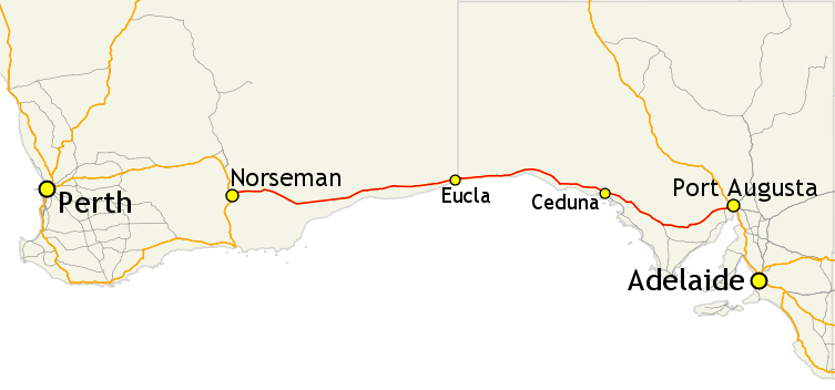
The Eyre Highway, in red, stretches 1660km from Norseman to Port Augusta. It crosses the Nullarbor Plain from Balladonia (just east of Norseman where the road dips south) to Ceduna.
The road is in very good condition, two lanes with wide flat shoulders which were appreciated as the many road trains overtook us. Traffic was light, rarely seeing more than half a dozen vehicles an hour on the WA side, though it did pick up between Eucla and Ceduna.
There are literally dozens and dozens of free camping spots along the road. With the landscape being so flat, and vegetation sparse every rest area has tracks leading away from the road for free camping anywhere. The frequent rest areas variously have bins, picnic tables, some with toilets, a few have a dump point, but none have water! The roadhouses all have paid camping areas with power.
1st Dec (Happy birthday Olivia)
Our plan is to drive the Nullarbor slowly, enjoying the sights and experiences as we go. While the weather is pleasant here, Sth Aus and Victoria are being deluged so no great incentive to move quickly. And – big point- driving east in the mornings can be unpleasant with the sun directly through the windscreen.
With all this in mind we spent a few extra hours in Norseman. Driving up to Beacon Hill Lookout we passed several gold mines, none of which look to be operational, padlocks on the gates being a dead giveaway. There’s the most enormous quartzite tailings dump on the way up. I couldn’t find out much about the current mining operations, but it appears it closed in 2014, but is for sale and there’s hope it’ll reopen as an open cut mine (it’s currently an underground mine).
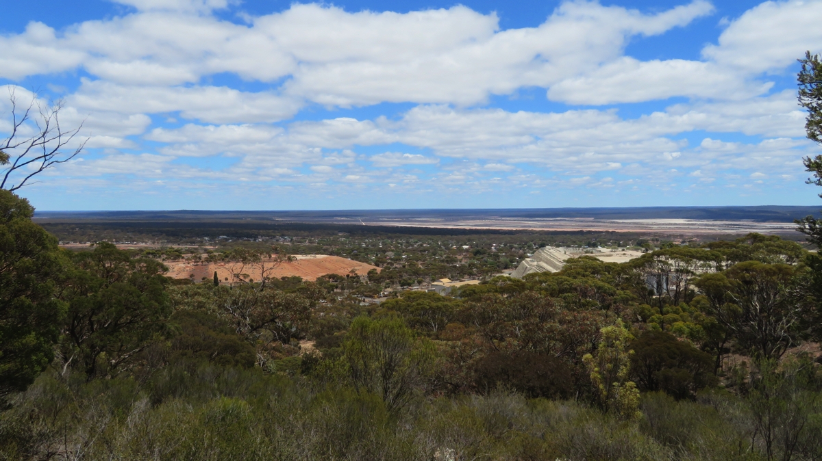
Norseman in the middle of the photo, the mine to the left and the huge quartzite tailings to the right, with the salt lakes fading into the horizon. Taken from the Beacon Lookout.
At Beacon Hill Lookout there’s quite good information boards describing the history of the area and a 1km walk around the hill to take in views over the town, the mine and the surrounding flat plains where you can see 50km to the horizon.
We filled our water tanks at the Information centre (for an obligatory ‘donation’), bought an extra 15L of drinking water from the IGA (no water available on Nullarbor), had a BBQ brunch in Norseman’s pleasant, grassy park and headed off on the Eyre Highway.
We passed the entrances to a few mines but other than that no agriculture, grazing or industry was seen. As we approached the large granite hills of Fraser Range we turned off to have a quick look at this historic working sheep station set amidst the world’s largest eucalyptus forest. Old vehicles, vintage farm equipment and a beautiful stone shearer’s shed looked interesting, but no sheep to be seen – they’re in some far distant paddock I guess.
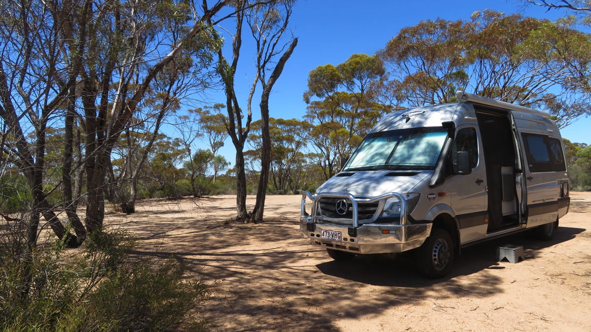
We settled for the night at the free campsite at Newman Rocks. It’s well off the road, flat and enough trees to offer shade but not enough to worry about falling branches. Just us, no other campers tonight.
Our very peaceful campsite at Newman Rocks.
Saturday 2nd
We hung out at Newman Rocks for a while this morning, waiting for the sun to move a bit more to the west before we started our easterly drive. A walk around revealed an area of about 10 acres available to the camper. A large granite surface sloped gently downwards at the back of the campsite. In our elevated position you could see for miles over the flat saltbush-covered plain with a few salt lakes in the distance.
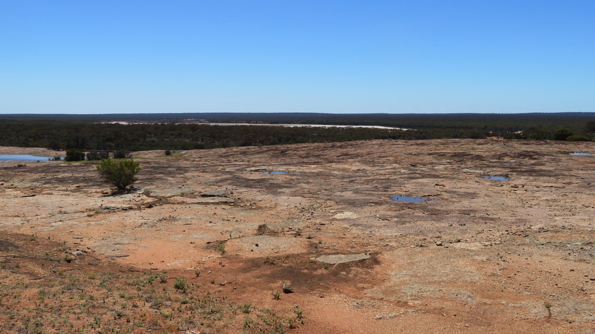
The rock at Newman Rocks, back behind our campsite. It’s rained recently so a few puddles around – note the salt lake in the distance.
Our first stop was the Balladonia Roadhouse, though not to buy fuel at $1.83/L. There’s a pretty good museum here with posters describing the human and natural history of the area, reports of some of the early journeys along this challenging road, for example the December 1926 Harley Davidson Motorcycle club trip and its 1980 re-enactment on vintage motorcycles, and the Redex Reliability Trials of the 1950s which was an around-Australia Rally testing the ability of various car makes. The Eyre Highway back in those days was extremely challenging.
But the highlight was Skylab! Skylab was the USA’s first and only space station which orbited earth for 6 years before it came crashing down in 1979, pieces landing near Balladonia.
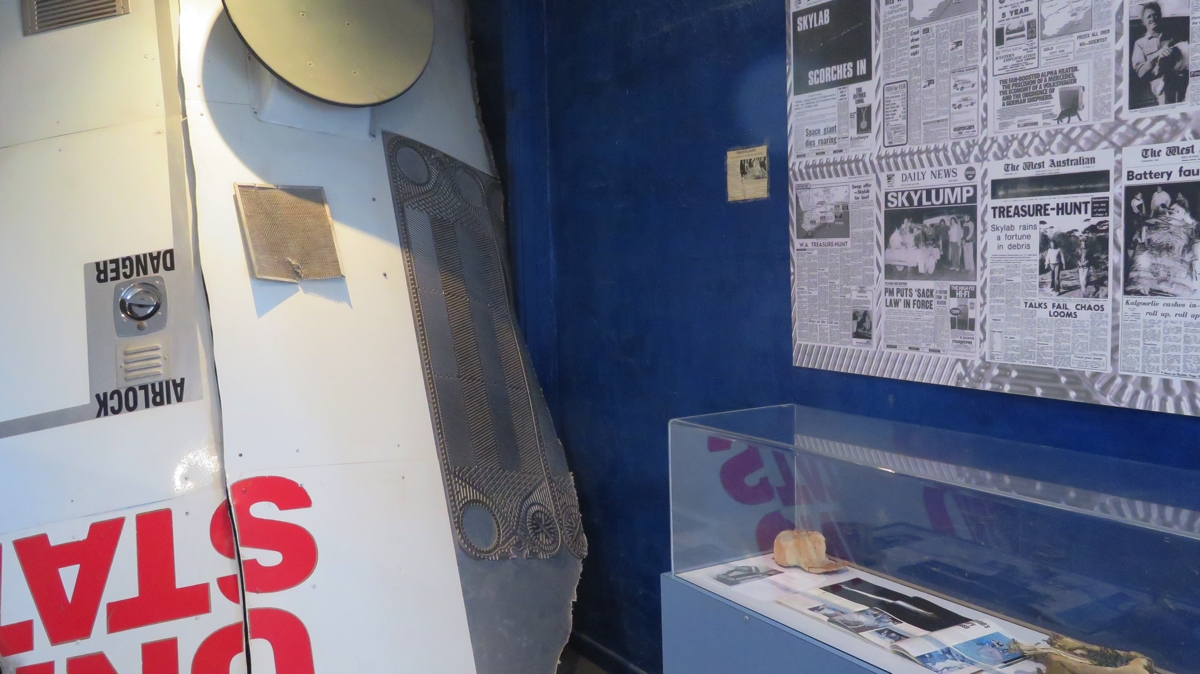
In the museum at Balladonia. Newspaper articles about Skylab, some wreckage and a replica of a piece of Skylab and that landed not far from here.
We were living in Perth at the time and there was a lot of melodrama as the scientists tried to predict where it would crash – South Africa being their final prediction before it crashed here. I recall some budding entrepreneurs selling helmets! Jimmy Carter, the then President of the USA, phoned the Balladonia Roadhouse and apologised for the mess the space wreckage made.
Not far from Balladonia is the beginning of the 90 mile Straight, the longest straight stretch of road in Australia and amongst he longest in the World. Yeah it did get a bit achy in the shoulders, not moving your arms for so long.
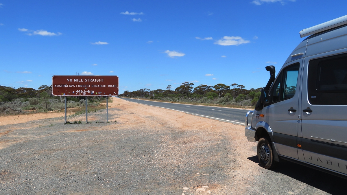
We begin the 90-Mile Straight.
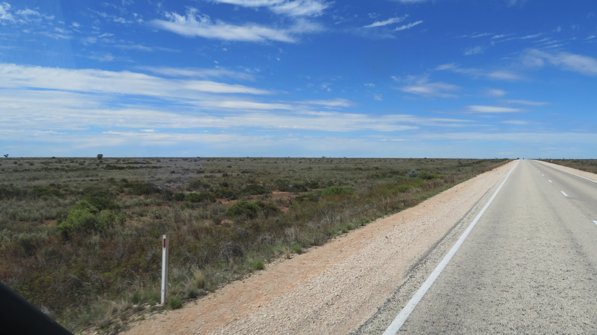
We’re on the Nullarbor Plain proper now – it’s flat and while there are some trees they’re not very big. The vegetation is mostly saltbush and bluebush.
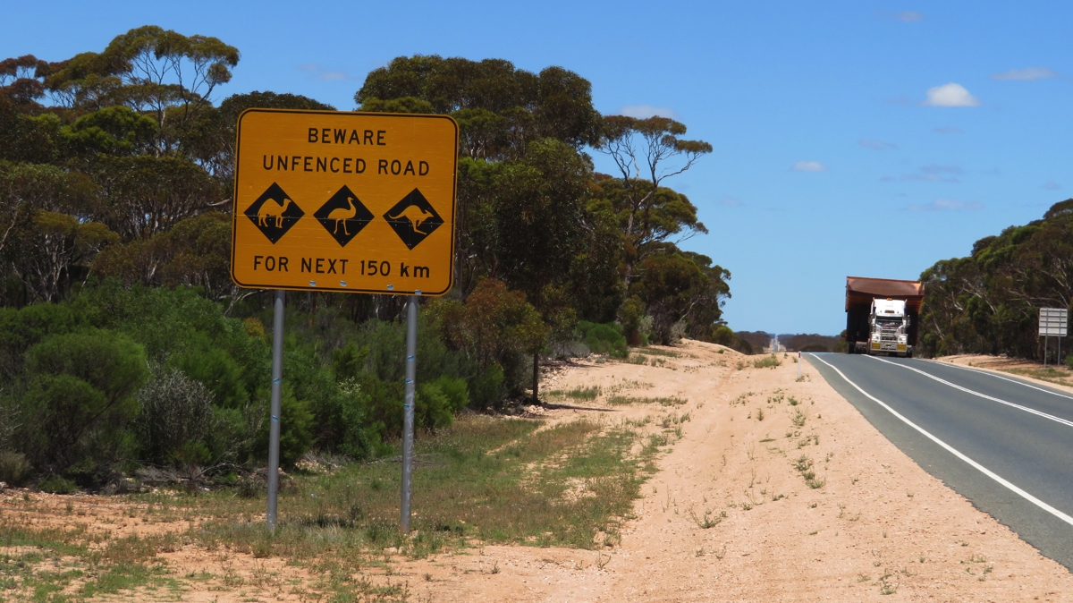
Beware of wide loads too!
Tonight we’re camped at Baxter Rest Stop, a large, flat area off the road where the council has provided bins, toilets (smelly) and a dump point. There’re another 4 campers here with us.
Sunday 3rd
This morning we went for a walk around the campsite – tracks lead off in every direction over this flat countryside making it a huge camping area.
We continued our journey along the 90 Mile Straight stopping to see the blowhole at Caiguna. Thousands of blowholes and their associated shallow cave systems dot the limestone plain in this area in a 35km band about 75km inland. Blowholes are a result of weathering of the ground surface through to a cavity. The cave beneath the Caiguna Blowhole is between 0.5m – 1.5m (1.6 feet – 5 feet) though it probably connects to an extensive cave system of many small passages.
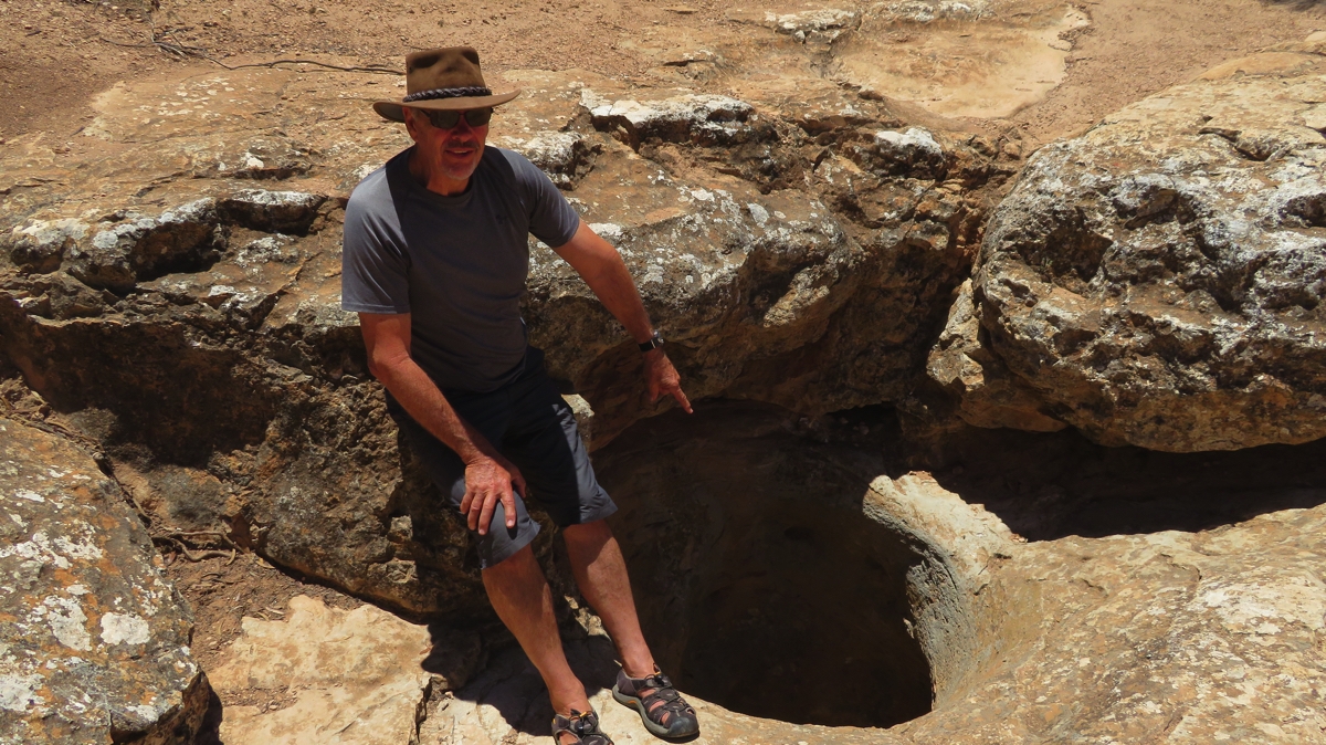
That’s it, down there! The Caiguna Blowhole.
Caves breathe out when the air pressure falls, and breathe in when the air pressure rises. The speed of air flow is dependent on the size of the cave entrance and the volume of air contained in the cave. This blowhole has had a measured wind speed of 72kph. It was breathing out when we were there, the cool air rushing out of it was certainly surprising.
Some of the caves beneath the Nullarbor have been mapped for several kilometres, and many of them contain large reservoirs of water that collectively form the artesian aquifer. This aquifer supplies the region’s bores and wells with fairly fresh water.
Further on we stopped at the Cocklebiddy Roadhouse and checked out the Eagles Nest 9th hole of the Nullarbor Links golf course. This 18-hole par 72 golf course spans 1,365 kilometres with one hole in each participating town or roadhouse along the Eyre Highway, from Kalgoorlie in Western Australia to Ceduna in South Australia.
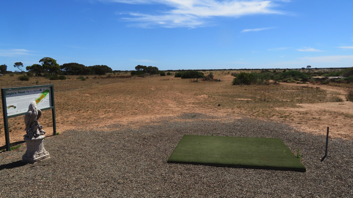
The tee at the Eagles Nest hole.
Each hole includes a green and tee and somewhat rugged outback-style natural terrain fairway. To play the full course would be a unique experience – better still if I could play golf!
Moving on we’re now camped at Madura Pass Lookout, a free campsite similar to the others – large area with tracks meandering around small trees and campsites wherever you want. The Madura Pass however is quite a surprise in that we’re actually elevated on an escarpment – we haven’t experienced anything elevated for days. We’re overlooking the Roe Plain, a very flat, treeless, saltbush-covered plain that stretches to the ocean, way out on the horizon.
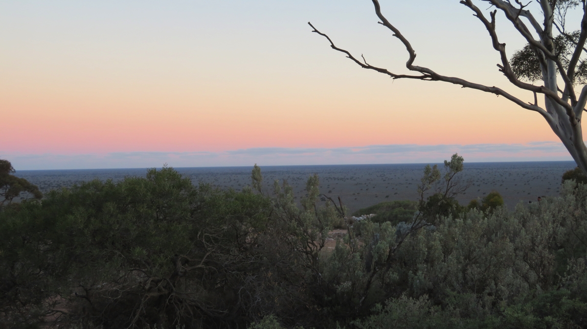
Sunset over Roe Plain from our campsite on the escarpment at Madura pass.
As the sun set through the trees the full moon rose over the plain – spectacular.
Anticipating a quiet night – we’re the only ones here.
Monday 4th
This morning we drove down the escarpment to follow the road along the plain, with the escarpment cliffs to our left all the way. It’s not hard to imagine this as the seabed and the escarpment as the foreshore cliffs. We stopped briefly at Madura Roadhouse – fuel is still $1.82+/L and we’re still not buying it.
Madura Homestead has a very unusual history. Originally it was settled in 1876 as a pastoral homestead. However the owner, an ex-Army Officer, decided to breed quality polo and cavalry horses for the British Imperial Indian Army. At the time these fine stock horses were employed in various British campaigns on India’s rebellious Northwest Frontier. The horses were overlanded to Eucla for shipment to foreign ports.
Mundrabilla Roadhouse has fuel for $1.64 which is where we filled up, though still had a fair range left in the tank. Long-range fuel tanks are useful when it comes to being able to wait for less expensive fuel.
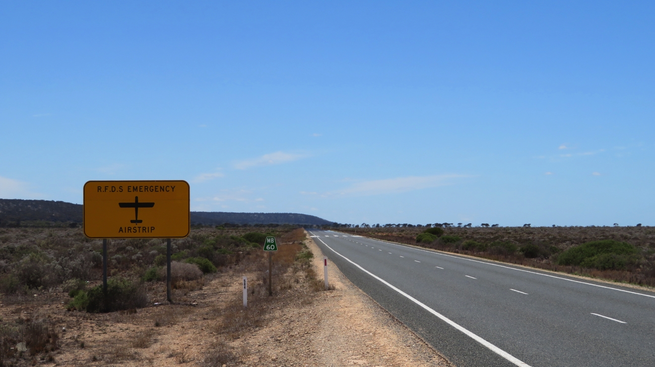
In several places along the Eyre Highway, as in other remote areas we’ve seen, the Royal Flying Doctor Service can use a section of the road as an emergency airstrip.
It wasn’t long before we climbed up the escarpment once more at Eucla Pass and drove on into Eucla. Eucla is famous for its telegraph Station. It was opened in 1877 and was the link between Western Australia and the rest of Australia. There was quite a large team of male telegraphists with a team from SA and another from WA who would pass messages across the table to each other to be sent on to the other State, all in Morse code. The building is now in ruins, covered in graffiti with sand dunes rapidly encroaching.
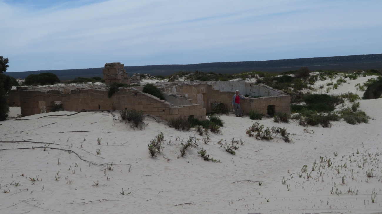
The ruins of the Eucla Telegraph Station. Note how the sand dune is encroaching on it – the doors are a bit low now to walk through.
Up at the Roadhouse is a small museum with some of the equipment they used, some tales of daily life and old photographs. It badly needs curating as it’s all fading, some of the stories already illegible.
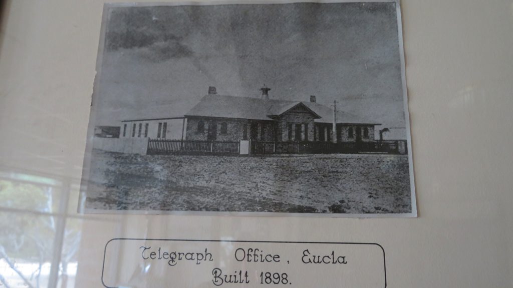
It was a fine looking building back in its heyday.
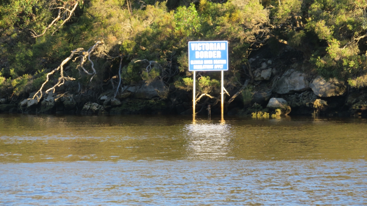
Further on we crossed the WA/SA border. Wow, after 6 months and one week we’ve left WA. We sure have had a really good look around and caught up with so many friends – and we’ve only done half the state! Another big trip will be coming in from the north to experience the Kimberley’s and all the north has to offer.
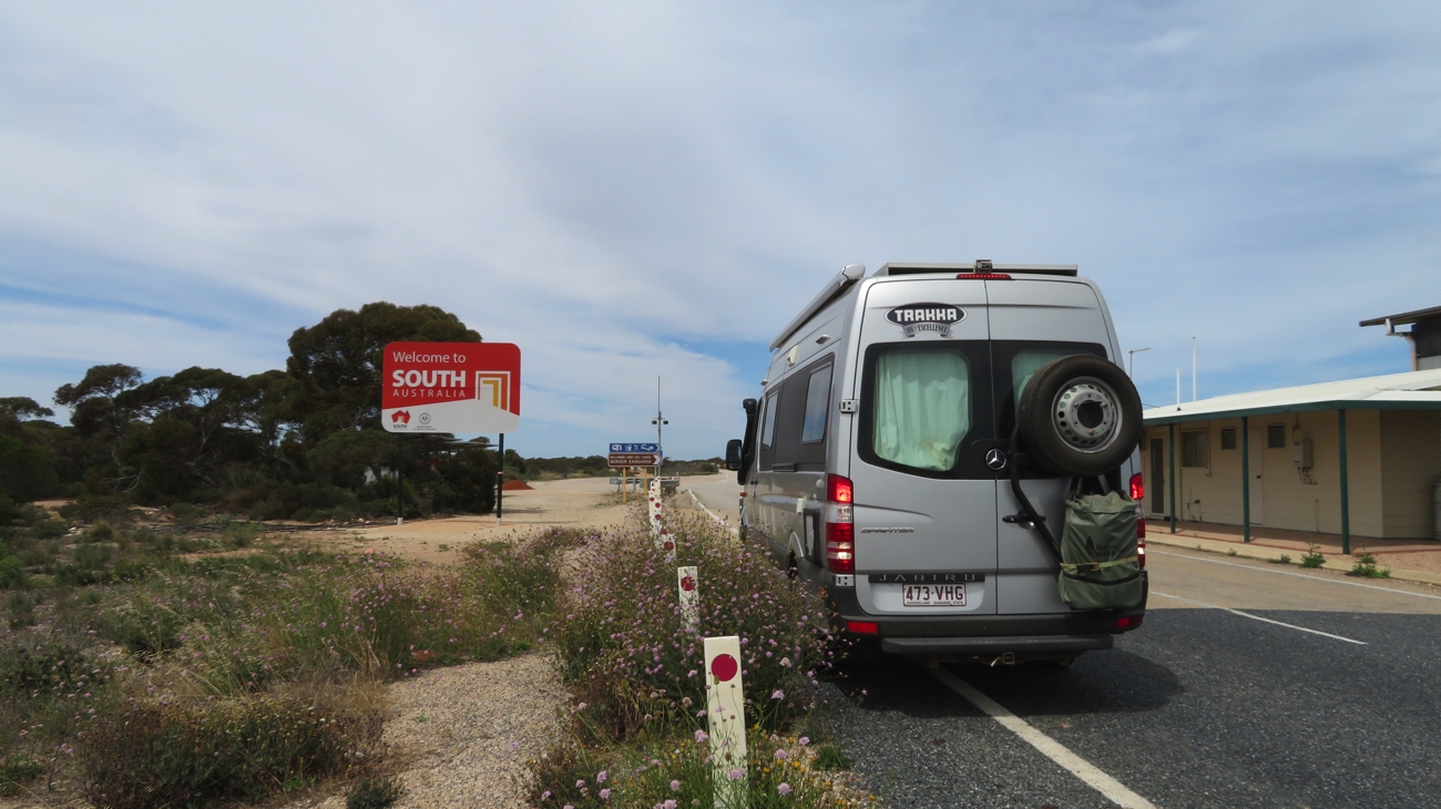
Wow! We’re about to leave Western Australia. Hello South Australia.
We camped for the night at Lookout Number 4 – another flat, free area off the road, with views to the ocean. It’s a real treat to see the ocean again.

This is the beginning, or end, of the Bunda Cliffs. Taken from our Campsite.
Tuesday 5th
With pleasantly cool weather still we decided we’d leave earlier today as there are quite a few Lookouts to pop in to. They were all fantastic though Lookout Number 1 had to be the pick of them showcasing the magnificent Bunda Cliffs that plunge 90 metres straight down into the Southern Ocean. The seas are calm today, the ocean looking innocuous, however the undercutting of the cliffs and the many signs imploring us to keep away from the unstable cliff edges tells a different story. The Bunda Cliffs, stretching for 200 unbroken kilometres, would be a desperate seafarer’s worst nightmare.
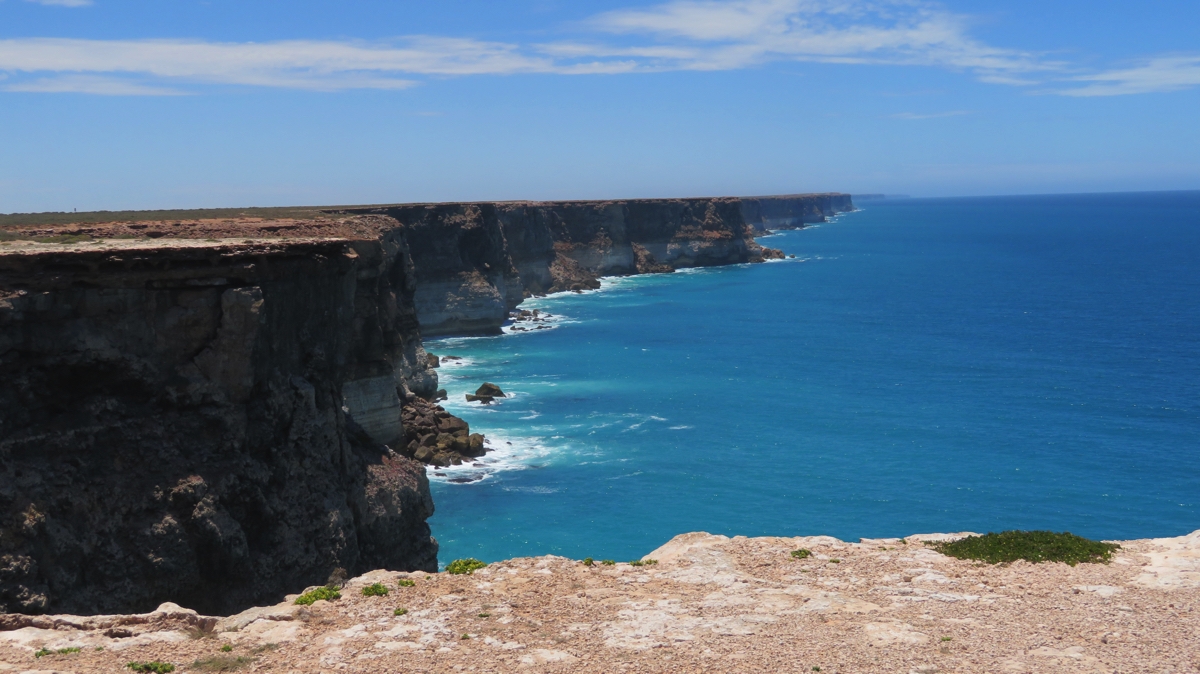
Looking toward the east, the Bunda Cliffs – they go a long way!
The treeless plain really kicked in around here. Prior to this there were scattered small trees/large shrubs, but now there’s only half-meter high saltbush and bluebush as far as the eye can see.
Is that a tree I spy on the Treeless Plain? Poor thing – it’s trying.
Head of Bight is a tourist attraction situated at the most northerly point of the Great Australian Bight, where the white sand dunes and beaches meet the beginning of the Bunda Cliffs. Boardwalks lead the visitor to perfect viewing spots for the vista, and, in season, a whale watching vantage point. Apparently! We wouldn’t know because it closes at 4pm, despite the fact that the sun was still very high in the sky. Daylight Saving strikes again. Annoyed!
We’re starting to see occasional signs of human habitation, agriculture as in post-harvest wheat, and sheep grazing.
Tonight we’re camped at yet another large, flat open area amongst the mulga scrub at Rushys Balcony, an unofficial campsite.
Dont get the wrong idea about all the Roadhouses I’ve mentioned so far. There is no surrounding town or even tiny settlement – just the roadhouse and the few people who staff it.
Wednesday 6th
Not far down the road we came to the first settlement since Norseman: the little farming town of Penong – that’s ‘little town’ not ‘little farms’. Penong provides a hub for the local pastoralists and wheat farmers, who generally have huge properties. Water out here on the edge of the Nullarbor Plain is always a problem but they are luckily above the artesian basin, consequently the farmers sank bores and attached windmills to pump the water up. Penong became unofficially known as the ‘windmill town’.
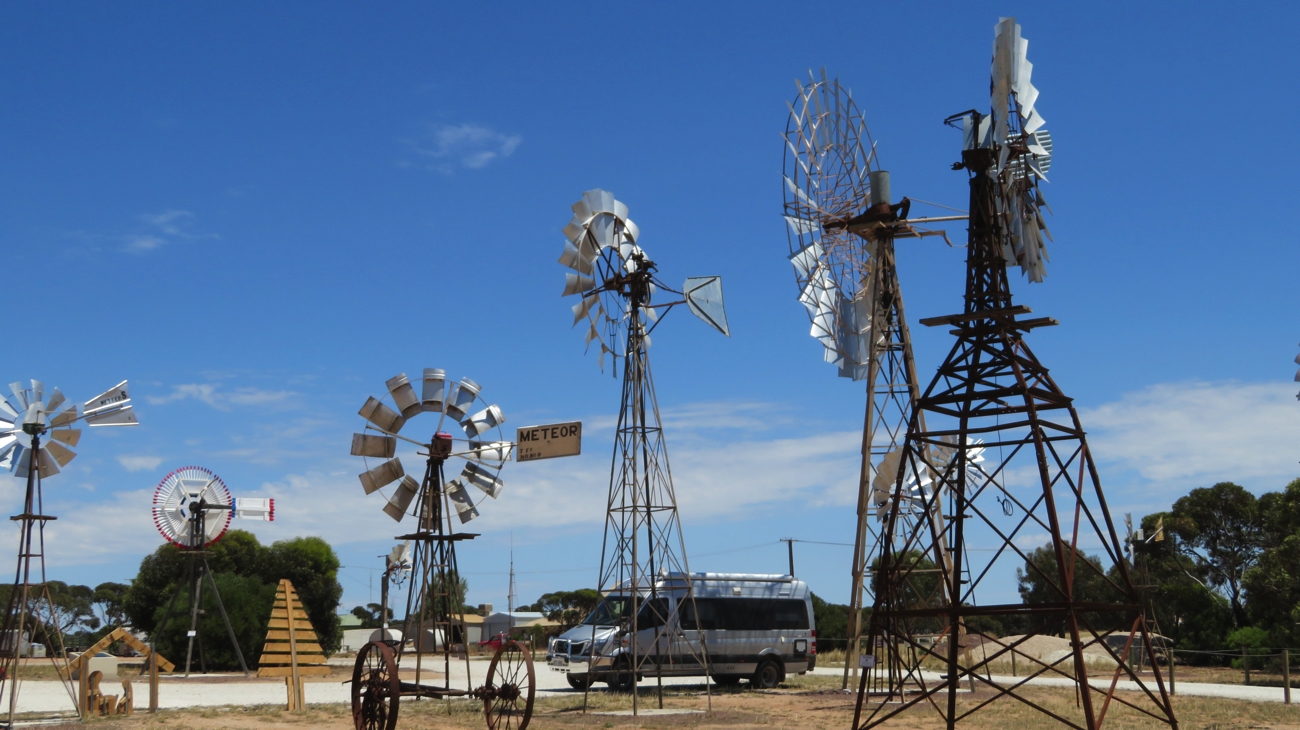
Priscilla with the windmills.
As solar-powered pumps began replacing the windmills the locals decided they liked their title and so began a ‘windmill museum’. A great coup for them was finding and restoring the largest windmill in Australia which has a span of 35 feet.
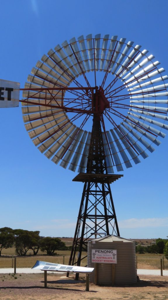
The Comet windmill is functional. It’s attached to a bore and pumps water into the tank.
Next stop was a rest area to cook up all the vegetables I’ve got still – we’ll soon be crossing the quarantine border between WA and SA. A delicious butter chicken for us tonight, with more veggies than chicken!
At Ceduna the first stop was the Foodland supermarket to stock up on fruit and vegetables, amongst other things. The supermarket is very well stocked as you’d expect being either the last or first sizeable town at the edge of the Nullarbor. We also ‘happened upon’ the Oyster Shed where I just had to support the local industry. Yum! At the Information Centre we picked up a few brochures, then drove out to Pinky Point which is where the port is situated. Gypsum, salt, mineral sands and wheat are exported from this deep-sea port. A 4.3 metre mosaic-covered lighthouse here at the Point commemorates the lives of those lost at sea.
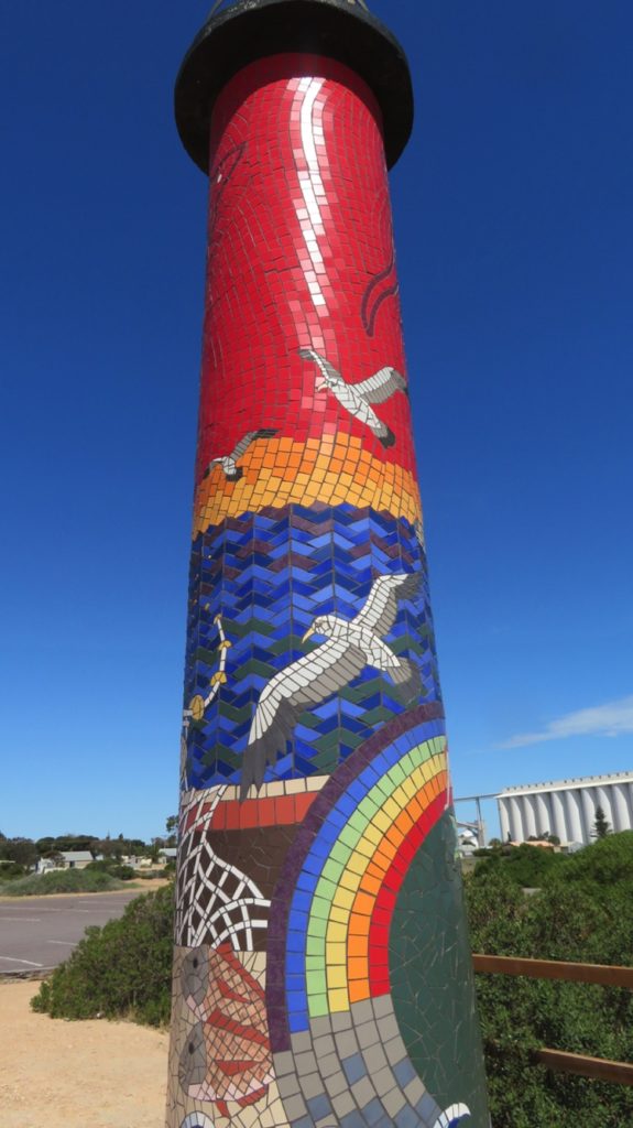
The beautiful mosaic lighthouse at Pinky Point near the port at Ceduna.
Ceduna is a corruption of the aboriginal word Chedoona, meaning place to sit down and rest, and it was now time for us to do just that, so we headed to Shelly Beach Caravan Park. Not that we rested for long – there’s a dune walk that led us along the dunes, onto the beach (which was covered in shells!) and back to the caravan park. Excellent CP by the way – great facilities and friendly staff. ($23.40/n unpowered)
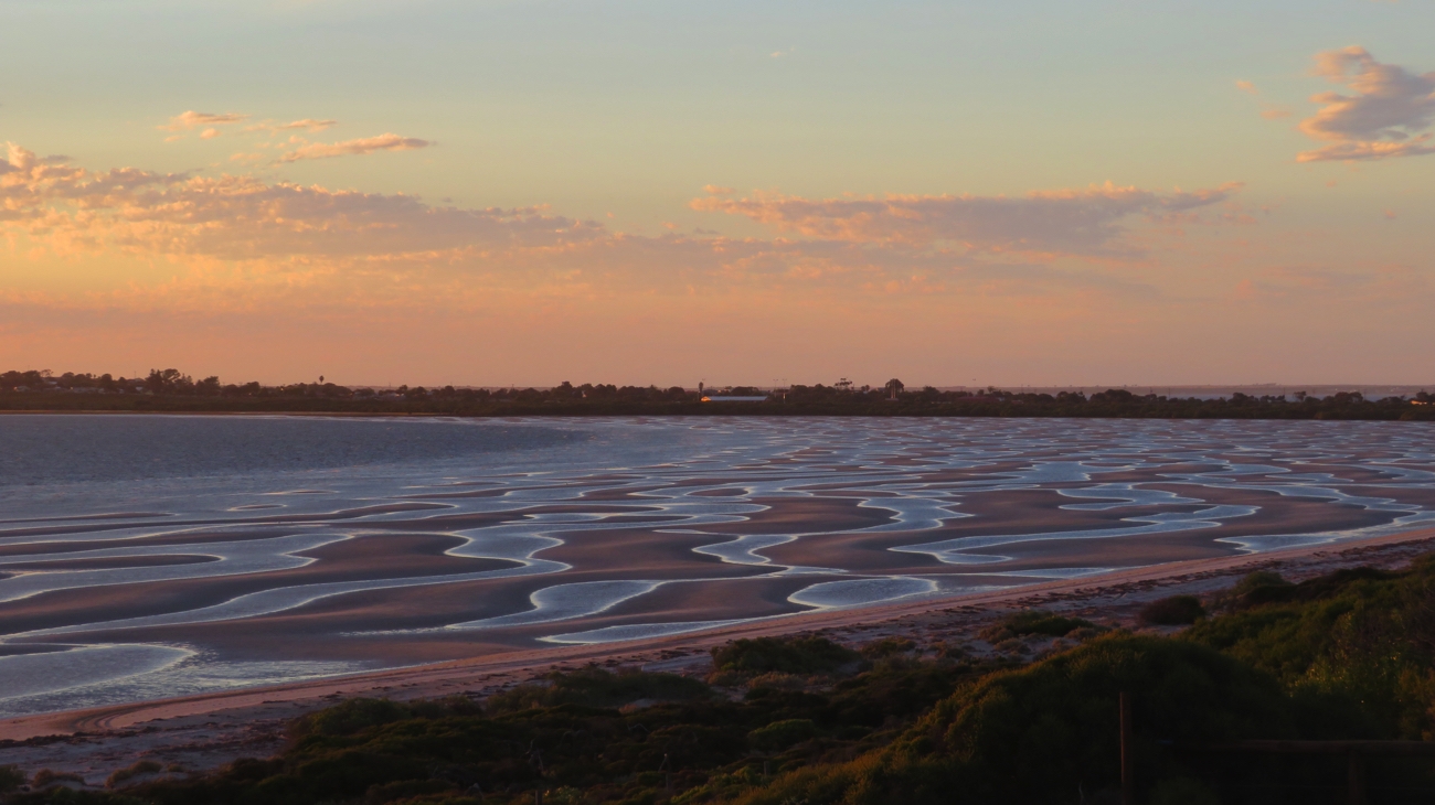
Low tide at sunset on Shelley Beach, Ceduna
Thursday 7th
Today we cross the Eyre Peninsula, again, completing the loop of SA, NT and WA we began earlier this year. There’s not a lot to see between Ceduna and our free camp for tonight, back at the Kimba Lions Park. The wheat has been harvested leaving short, brown stubble through which we drove for several hours.
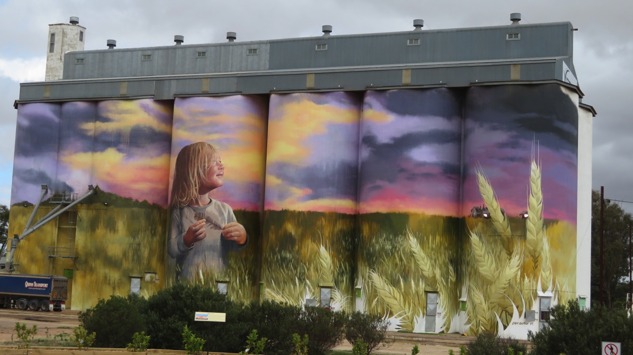
Very impressed with the silo art at Kimba. Just to give you perspective – on the left is a semi-trailer being filled with grain from the long pipes you see coming out of the silo.
At Kimba the big change since we were here last is the silo art – fantastic!
Friday 8th December
Kimba is a lovely friendly town. We had a coffee at Eileen’s Cafe and chatted for ages with a retired wheat farmer who has lived here for 80 years. Even he says the town is a good supportive town. Anyway we moved on, the wheat and grazing land giving way to many kilometres of saltbush before we completed the Eyre Highway at Port Augusta where we brunched at a grassy park beside the tip of Spencer Gulf. Traveling the Eyre Highway and crossing the Nullarbor Plain was a fascinating and varied adventure which we both enjoyed.
Tonight we’ve moved on to the tiny of town of Nelshaby where we’re camped in the free camp at Lawries Oval – a level, semi-grassed open area with views in one direction to the ranges and the opposite direction to Spencer Gulf.
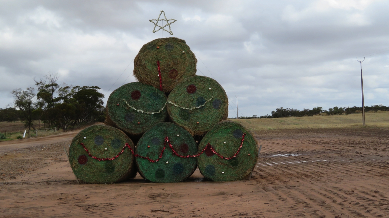
Christmas decorations in the bush – well, maybe in the wheat fields.
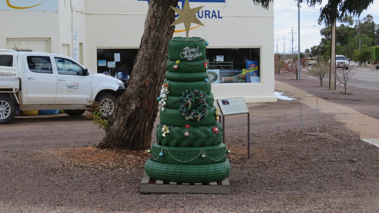
Christmas tree in a country town – Kimba.
For more photos from our travels across the Eyre Highway and Nullarbor CLICK HERE.
Return to Previous Trips tab