It’s lovely to be back in Mt Lawley with Ann and Greg and their family. This morning we did a bike ride around the Swan River stopping for a coffee at Tranby House, one of the oldest buildings (built in 1830) still remaining from the original Swan River settlement.
Morning tea break on our bike ride. Greg, Ann, Denise
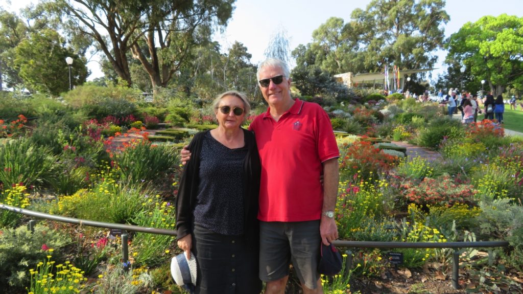
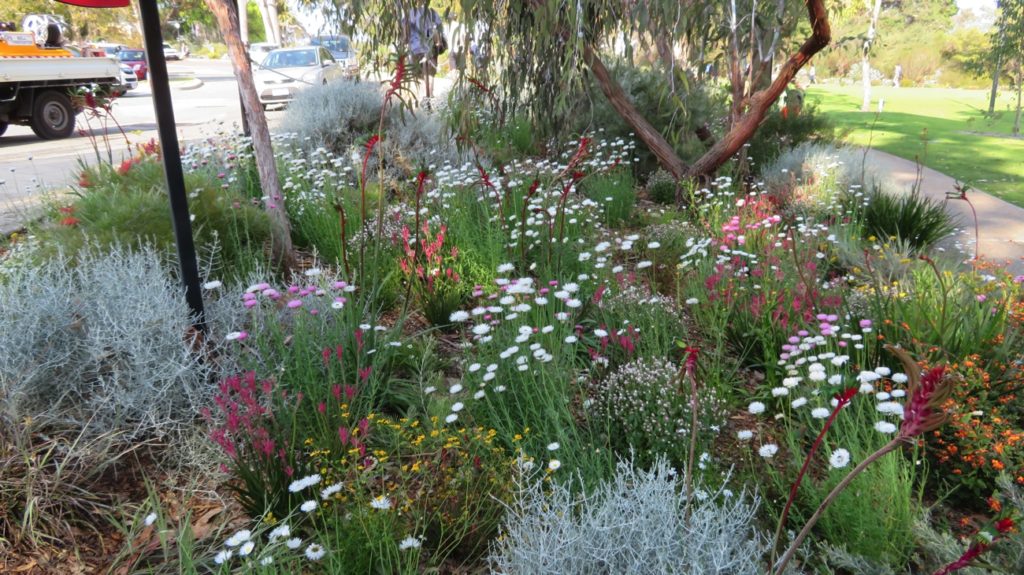
In the afternoon we took a drive to Kings Park which is now ablaze with colour as heaps of wildflowers are blooming.
Ann and Greg beside the floral clock at Kings Park.
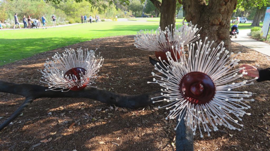
Sculptures in Kings Park. Not that they’re needed – thousands of beautiful flowers blooming now.
Monday 18th
We farewelled Ann and Greg as they left for work this morning, then took the motorhome in for a service. We spent our time at Joondalup Shopping Centre where Annie, another Trakka owner, joined us for coffee and a chat before picking up our smoothly tuned machine and heading for Karrinyup CP for an early night.
Tuesday 19th
Today the motorhome went to the crash repairers for an evaluation. After many photos were taken of the damage we headed off; the quote and a plan for repair to follow, in the fullness of time.
Western Australia has more than 12,000 species of wildflowers with more than 60% of them being unique to WA. The wildflower season is a big draw card for tourists and scientists annually. The timing of the rain and sunshine influences the timing of the season with it beginning in the north as early as June (we were seeing wildflowers in the Pilbara in June), extending through to November in the south. They cover an area of around 2.5 million square kilometres.
Our plan for the next few weeks is to wander around the central western section working our way gradually back towards Perth.
Tuesday 5th
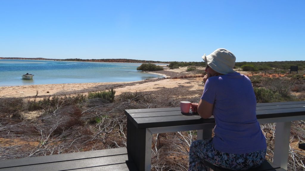
A lazy day today, not leaving our lovely quiet beachside campsite until lunchtime. Farewelling the very windy Shark Bay we begin the inland part of our wildflower journey.
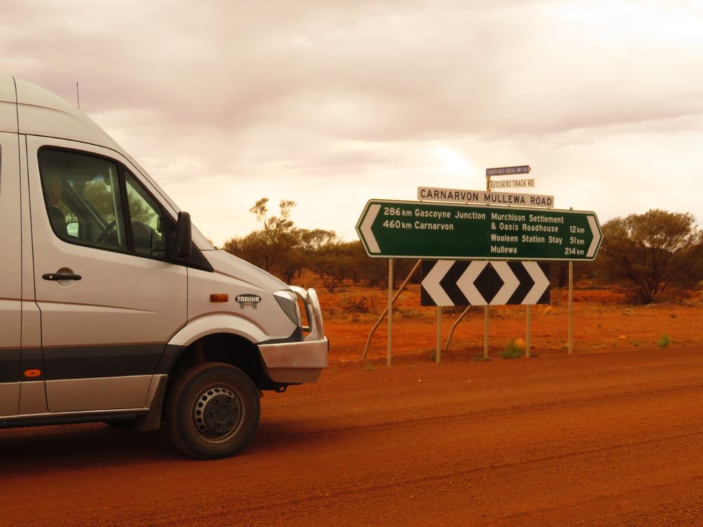
Butchers Track is an ‘alternative’ route from the coastal highway to the inland, ie it’s a dirt road – not too bad though, just a few corrugations and it’s lovely to once again see the deep red strip of earth unfolding before us between the olive green of the surrounding acacias.
Tonight we’ve pulled off Butchers Track down a service road to camp. Despite the lovely warm temperature, lack of wind, clear skies and full moon we had an unpleasant sundowners outside beset by clouds of midgies (sandflies).
Having just exited Butchers Track we’re heading to Wooleen Station.
Wednesday 6th
Our little home was midgie-proof allowing us to sleep well – and very peacefully. No traffic overnight, not surprising as we only saw two vehicles during our drive. Brunch at the Murchison Roadhouse (in our motorhome) then on to Wooleen Station to camp ($20/n unpwred).
This Station stay had been recommended to us by several people as not only a pleasant place to stay, but also an example of a young couple who were trying to farm sustainably. A rural TV report has been done on the work they are doing.
Wooleen Station covers about 300,000 acres of mostly mulga, saltbush and blue bush grazing land. It had been heavily stocked with sheep. In the mid 1930s a combination of a long and severe drought and 27,000 sheep eating everything they could see (17000 of them died of starvation), caused the destruction of the land and nearly totally wiped out the perennial vegetation needed to protect the soil and provide food during the dry summer months when annuals died.
Surveys done in the 1990’s revealed 80% of the vegetation to be in less than ‘good’ condition, with the remaining good vegetation being in rocky areas where grazing animals (sheep, cattle, kangaroos and feral goats) can’t reach.
Enter Dave Pollock and Frances Jones. Dave’s parents bought the property in 1989. Dave and Frances destocked the property for 4 years to help the vegetation recover. Since then they have only lightly stocked during good seasons and planned stock rotation and landcare carefully.
An interesting aside is that several years ago they had thousands of kangaroos and so many feral goats they were rounding them up and selling them, all a problem for their regeneration and negating the effect of their destocking. Enter the dingoes! The dingoes have wiped out the feral goats, while the kangaroo population and the feral cat population is under control. Bringing balance back into the ecology.
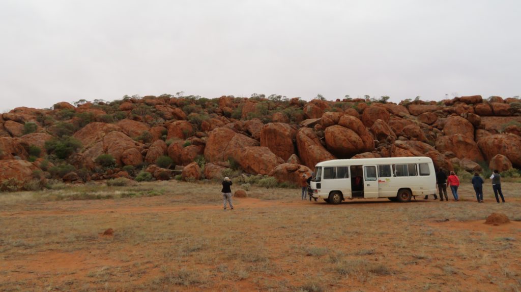
Dave took us and about 10 other people on a 3 hour tour of the property ($45ea) pointing out the degraded areas to compare with the regenerating areas. A long way to go still, but great to see what they have achieved so far.
Boodra, on Wooleen Station and our little tour bus.
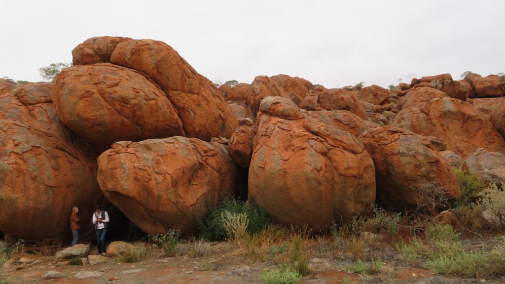
We finished the tour at the Boodra Rocks where there’s a cave with a fresh water spring. Truly beautiful rocks and a lovely spot where we had wine and nibbles as the sun sank behind the cloud cover (I think it did – it was overcast).
Boodra, on Wooleen Station. A fresh water spring is underneath that collection of rocks, the entrance via a cave where those people are standing.
Thursday 7th
Despite Dave being convinced the few drops of rain we’d had on our tour yesterday would be the last rains for September, it started raining about 3am and didn’t stop until late afternoon today. Not heavily but enough to close all the roads around here, 50mm.
We spent a very quiet day camped beside our Gidgee Tree, the only campers at this site which is about 6km from the homestead. There are two other camping areas, one 16km the other 17km from the homestead.
Friday 8th
We couldn’t leave Wooleen today until the Council opened one road allowing us to leave – “But drive slowly!”
Tonight we camped at Mullewa Caravan Park, which was booked out – we got the last site! We needed to be here tonight to get internet for Steve to watch the Broncos match.
Saturday 9th
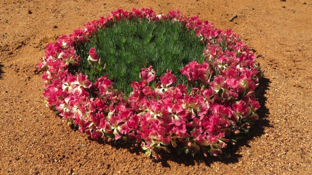
Leaving Mullewa we headed east to go through Pindar and up to see the famous wreath flowers. They were beautiful.
From here south we really enjoyed the wildflowers growing by the roadside.
Camping tonight is at Canna. This tiny town provides a free camp (donation box) with lovely clean hot showers and loos. There’s even 4 power points to plug into for those who need it. Well done and thank you Canna.
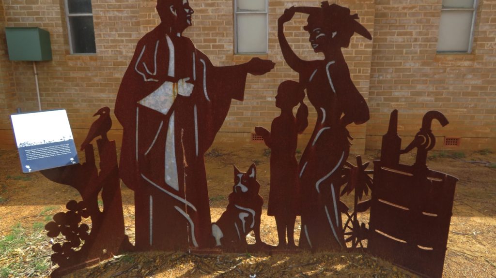
There’s a lot of these ‘scenes’ made in various historical sites around these small outback towns. It’s lovely to see them.
Sunday, Monday 10-11 th
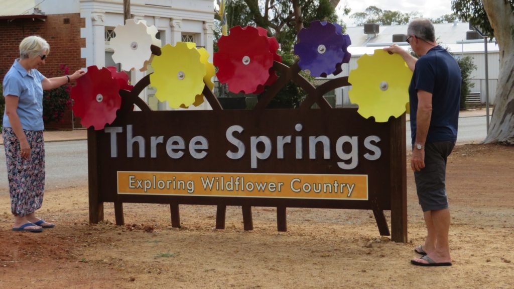
A short drive today to Three Springs camp – another great little campsite with good facilities for the cost of a donation.
These lovely town signs are at the entrance to each town on the Wildflower Trails.
We took a walk around the town, did a little shopping, particularly from the highly recommended butcher, followed the Heritage Trail to learn may about the town and enjoyed a restful couple of nights.
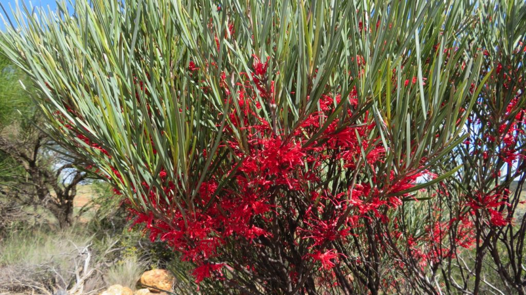
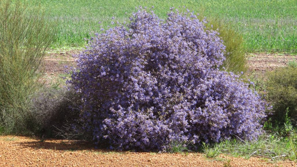
This bush is just all flowers.
Tuesday 12th
On to Latham tonight. A great little sporting complex with a community building with hot, clean showers and pretty flowers in all the gardens. Once again, well done Latham.
Wednesday 13th
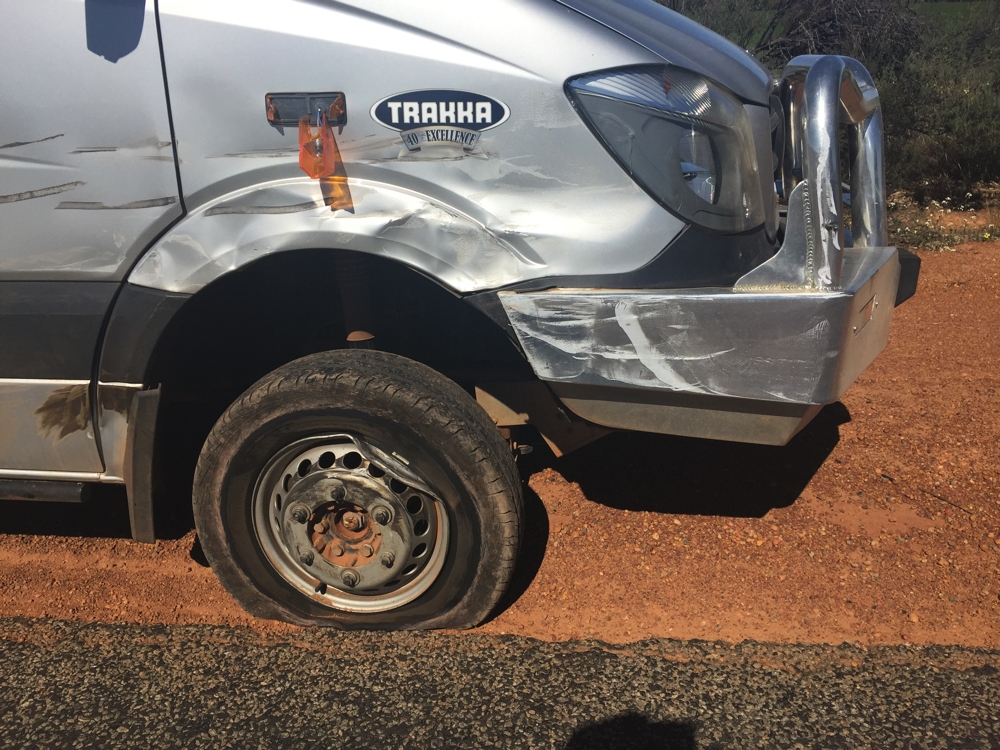
Should have known by the date that today wouldn’t be that good! Driving happily along though narrow country roads on our way to stay with our friends Terry and Christine in Dowerin, when SMACK – hit by a ute that was passing the car and caravan that had started to pass us. Luckily no one was hurt, though the ute was a write-off and Priscilla is going to need some extensive panel-beating, but fortunately is still drivable.
This kinda upset our day.
Here is the dash cam video from the car/caravan that was overtaking us as the accident occurred.
Thursday, Friday 14th – 15th
Restful couple of days, mostly spent doing admin – claim forms for insurance! We also had fun with Terry and Christine catching up on our various travels and family doings. Dowerin is a small town in the wheat belt that has a lovely community feel, all being involved in the State-wide-famous Dowerin Field Day.
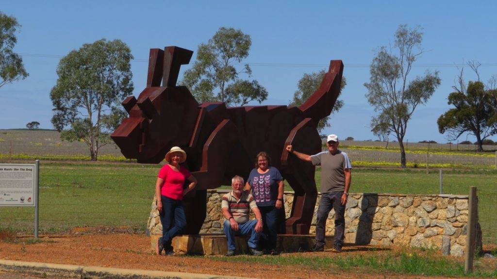
Rusty the Tin Dog, the HInchcliffs and us at Dowerin.
Saturday 16th
Leaving Dowerin we headed toward Perth via Meckering and Northam.
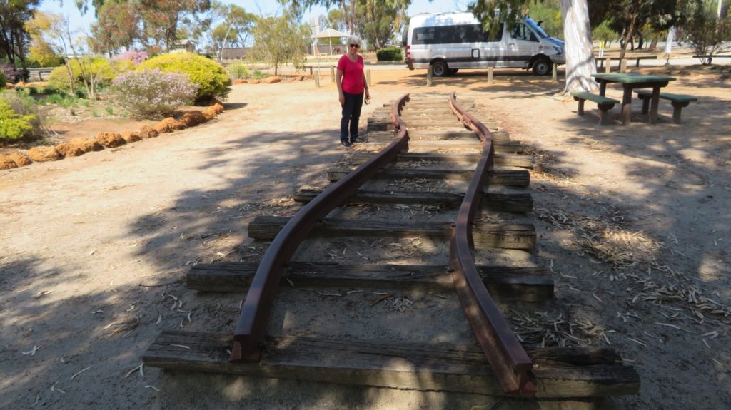
At 10.59a.m. on the 14th October 1968, the small town of Meckering was destroyed by an earthquake. Twenty people were injured. The magnitude of the Meckering earthquake was 6.9 on the Richter Scale, but relatively shallow at 7km deep, making it one of the largest recorded in the seismic history of Australia. The largest land displacement measured a westward heave of 2.44m, a southerly slip of 1.5m and vertical lift of 1.96m. In the park is a section of the rail lines with a big S- bend in them and a section of the water pipe that concertinaed together. Amazing forces.
In the Earthquake Memorial park are a few items to demonstrate the power of the earthquake. These railway lines are one, another a portion of a water pipeline that had intussusception.
We enjoyed brunch at Northam in a lovely cafe overlooking the river before heading on to Mt Lawley to spend the weekend with Ann and Greg (yet to retire, hence the weekend).
For more photos of this time in our travels CLICK HERE.
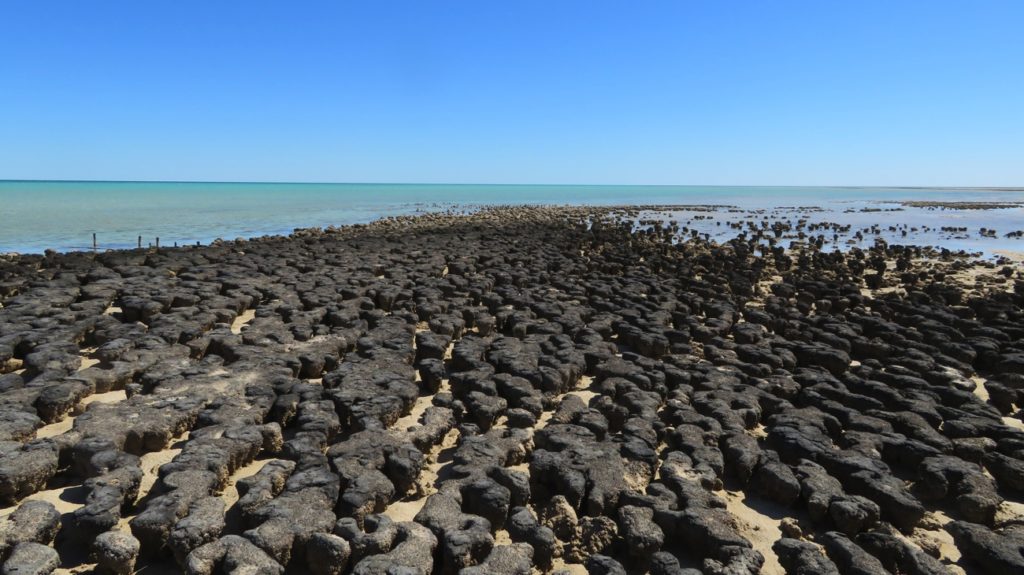
Here at Hamelin Pool are the oldest living organisms on earth – stromatolites! I must say I did find the explanation of their growth confusing, something to do with Cyanobacteria, light, accretion and the presence of a hypersaline environment. Anyway all these factors come together here at Hamelin Bay where it is full of these cauliflower-mushroom shapes about 50cm high living in the littoral zone.
Stromatolites at low tide. Shark Bay
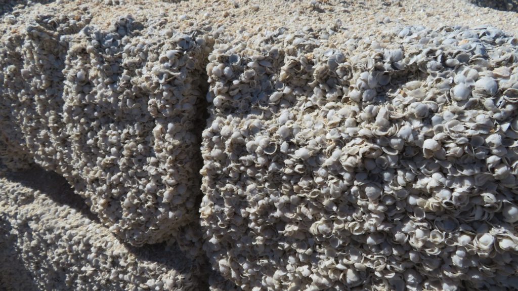
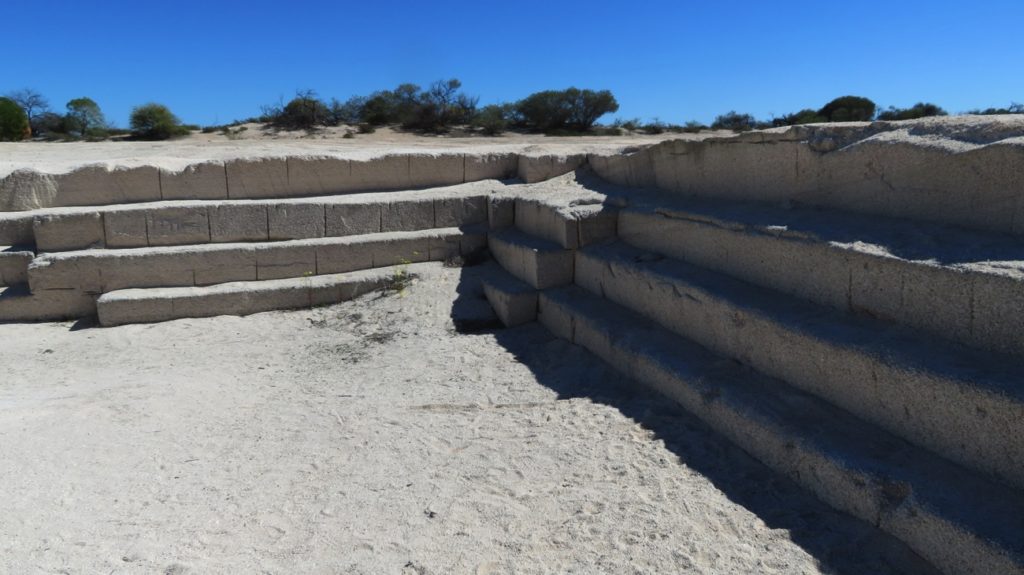
We also found the shell quarry fascinating – I’d never heard of a shell quarry before.
A building block of shell. Shark Bay
Tiny cockle shells, Fragum shells, have been swept up onto the beach over the centuries and become compacted so hard that the early white settlers were able to quarry out blocks of this coquina with cross cut saws to use as building materials. The coquina (compacted shells) are up to 9 metres deep in places.
The shell (coquina) quarry.
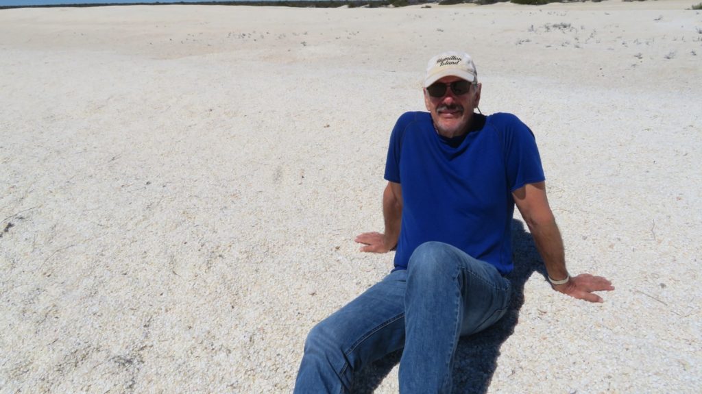
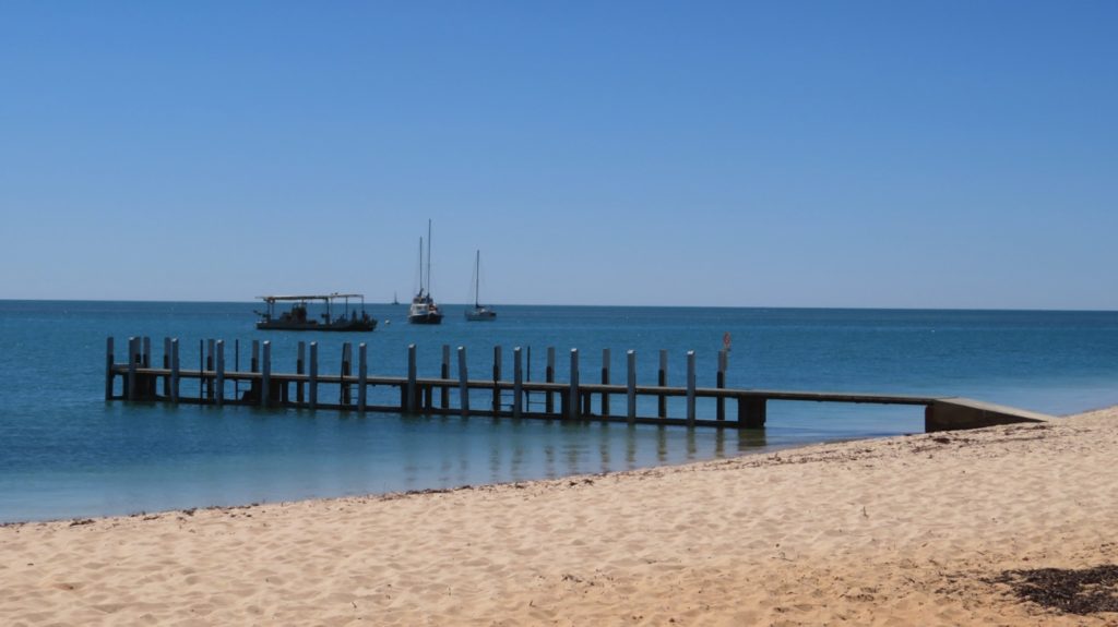
Heading further into Shark Bay World Heritage area we stopped at Nanga Bay, a pretty Bay with crystal-clear water, Shell Beach where we sat on dunes formed of the tiny cockle shells,
Steve, reclining on an ocean of shells.
then checked out the camp sites at Goulet Bluff, Whalebone Bay, Fowlers campsite and finally Eagle Bluff where we’re camped tonight. There’s a boardwalk along the headland here which gives lovely coastal views and where you can look down into the shallows to see sharks and stingrays. We saw a couple of sharks.
Our campsite is quite idyllic, just a little in from the cliff edge overlooking the bay. Wonderful sunset!
Sunset at our campsite, Eagle Bluff, Shark Bay
Monday 4th
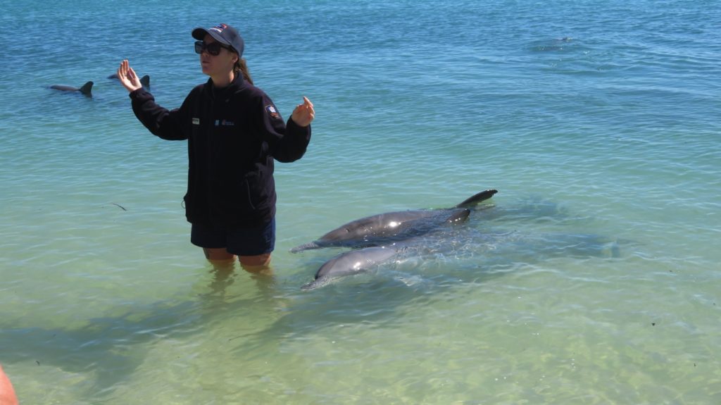
Monkey Mia Resort, on the eastern bay, is renown for the wild dolphins that come in daily to be hand-fed. However, a lot of people also complain about the cost of entry to the area and you may not see any dolphins; they are, after all, wild. The dolphin-feeding takes place at 7.30am and may be repeated once or twice more before 11am, if the dolphins come in.
A powered site at the Monkey Mia caravan park costs $72 – YIKES! We’ve seen plenty of dolphins before, so we camped about 45km away last night at Eagle Bluff and moseyed on in about 10am. We had brunch in the motorhome before wandering in and, would you believe it, 6 dolphins just arrived to be fed. How tinny was that!
Those two dolphins are hoping the fish they’re about be fed will be ‘that’ big. Monkey Mia, Shark Bay
Despite there being large pods of dolphins here, there are only 6 dolphins they feed and then only give them about 10% of their daily needs. It’s well-supervised and studied by marine biologists who give a talk about dolphin behaviour before the feeding. Despite our nonchalance we both enjoyed it.
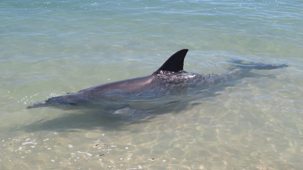
Bottle-nose dolphin at Monkey Mia, Shark Bay
We had a lovely walk along the beach and enjoyed a coffee on the deck of the waterfront cafe. I didn’t begrudge the $9 ea entrance fee.
The jetty, Monkey Mia, Shark Bay
Leaving Monkey Mia we drove into Francois Peron National Park. Big signs greeted us informing us it was 4WD-only roads and to lower our tyre pressures to 20. Truck tyres like we drive on can’t be lowered, only minimally if at all. So in we headed to Big Lagoon along 12 km of sandy track with some of it very soft. The good old Trakka, in 4WD mode, tyres still inflated, didn’t falter. Big Lagoon is a pretty inlet with a narrow deep channel but wide shallow areas – perfect for kayaking. The picnic facilities here are superb – large covered gazebos with gas BBQs and picnic tables, as well as great open-air areas all on a boardwalk. We enjoyed a cuppa here before heading back out to Denham.
Lovely facilities for picnickers at Big Lagoon, Francois Peron NP
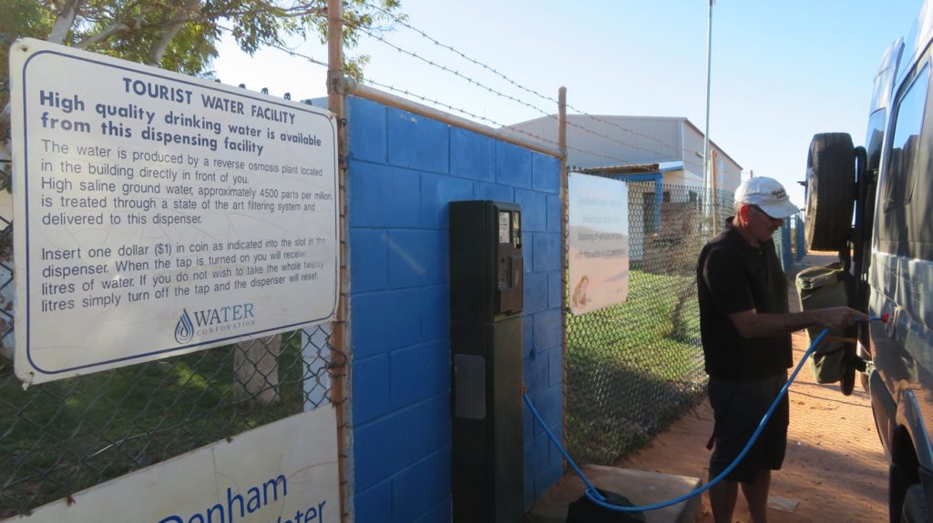
Our plans for the next week don’t include many places where we’ll be able to shop, so a stop at Denham IGA was essential, and we also filled our water tanks – the first time we’ve ever had to pay for water. Denham is a lovely little coastal tourist town.
Our first time buying water to refill the motorhome. A good facility – not begrudged at all. 15 litres for $1
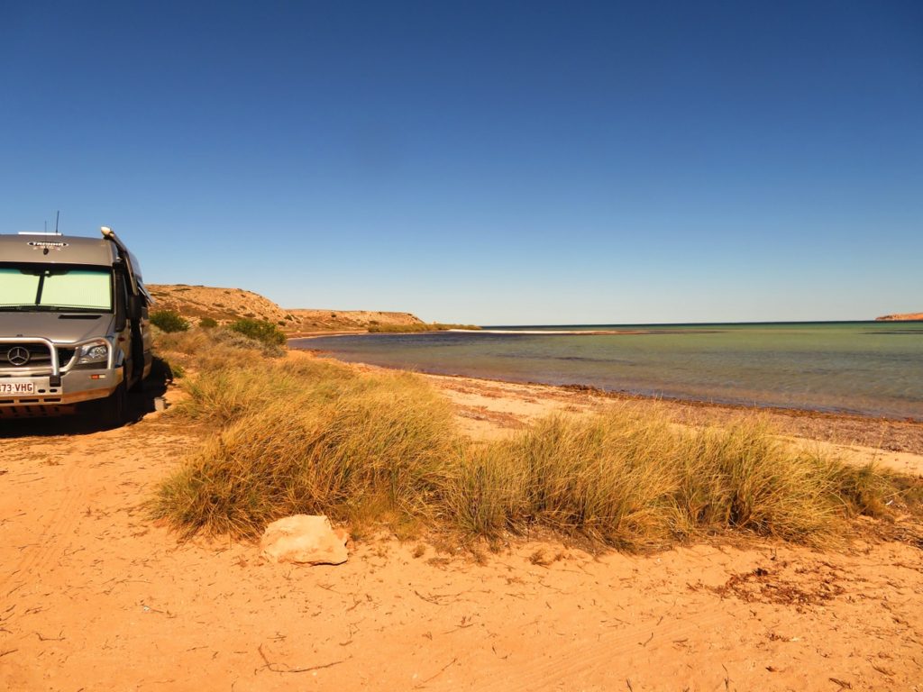
Our campsite tonight is just down the road a bit from last nights, at Fowlers campsite, right on the beach. Another $15/night site with no facilities. Again we’re the only campers here. Another beautiful sunset followed by a peaceful night, apart from the wind! What is it with these constant coastal winds!
Our beachside campsite, Fowlers Bay, Shark Bay
For more photos taken during these last couple of days CLICK HERE.
Tuesday 29th
It rained or hailed (small, thankfully – no damage to Priscilla) all night. The sandy road out was OK – still some water across the road, but the base was firm. I think it might have filled in the corrugations a bit – they didn’t seem so bad on the way out.
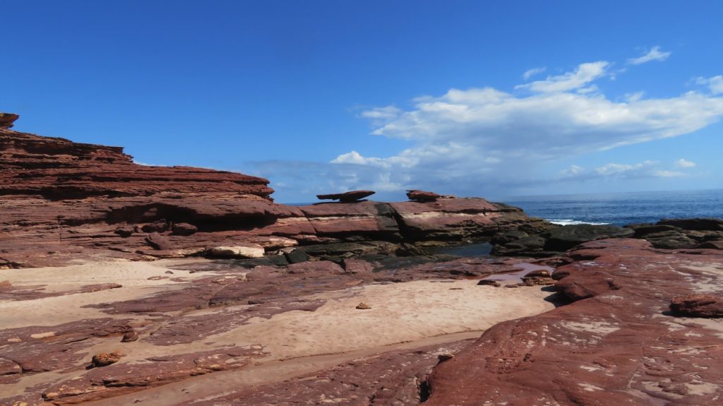
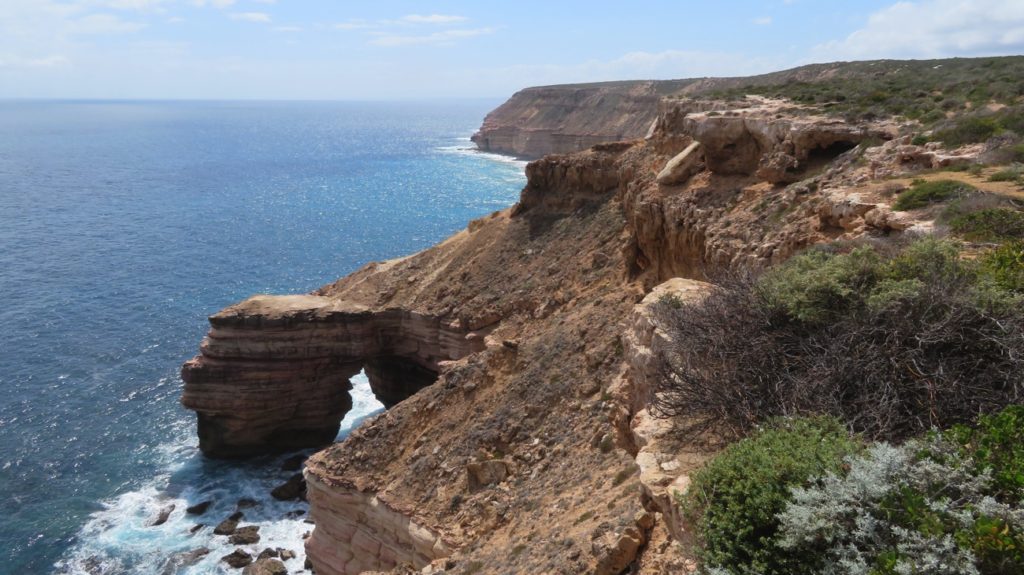
We headed to the coast to stay at Kalbarri. Kalbarri National Park has an inland section and a coastal section. The coastal section has many points of interest you can drive in to from the main road to see the striking coastline. We stopped at Rainbow Valley and did the 3km loop walk to Mushroom Rock. Lovely walk as it took us down to ocean level.
Mushroom Rock. Hmm maybe not ‘that’ outstanding, but a lovely walk to see it all the same.
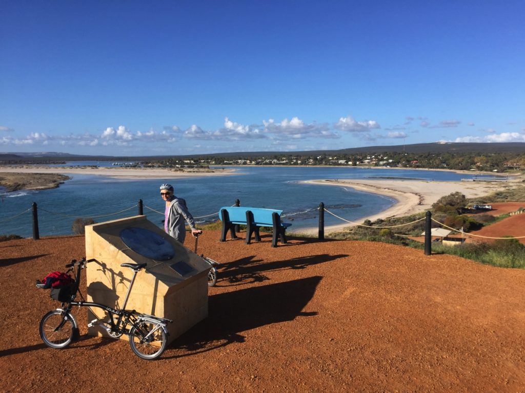
After checking in to the Murchison Caravan Park we got the bikes out and went for a ride along the foreshore. Great walking/cycling paths Kalbarri – thank you.
Sunset was glorious.
Cycle up to the Zuytdorp Lookout at Kalbarri. The monument tells the story of the Dutch East Indies ships that ventured down this far. Apparently to make the best use of the winds they would come as far south as the 26th parallel, which happens to be about here, before turning. However, some came a bit close to these treacherous shores and many ships were lost. The Batavia foundered in 1628. The Zuytdorp in 1712. It carried a rich cargo of 248,000 freshly minted silver coins along with 200 passengers. Hundreds of coins have been recovered from the famous ‘carpet of silver’ in and around the wreck. The precise circumstances of the wreck remain a mystery, because no survivors reached Batavia (Java) to tell the tale. Some did live for a time in Shark Bay, where they were helped by local Aboriginal people. This contact with Europeans was probably the first ever made by Australia’s Indigenous people to last longer than a brief encounter.
Wednesday 30th
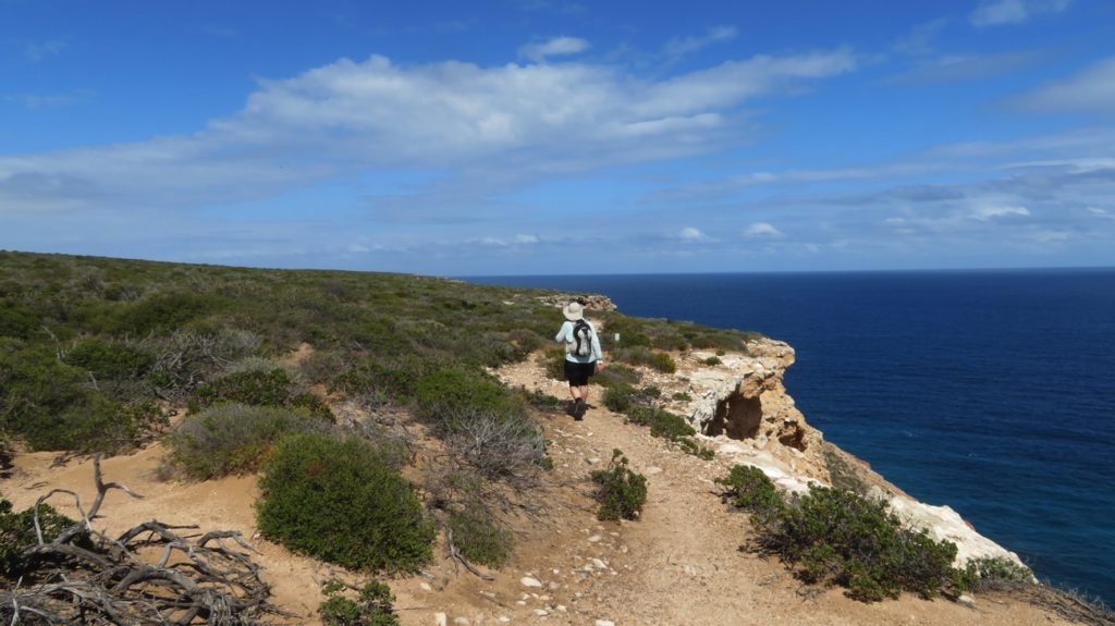
Today we’re doing the Bigurda Trail in Kalbarri NP which follows the coastline for 8km from Eagle Gorge to Natural Bridge – a 17km return walk. The walk started about 50 metres from the cliffs walking through flowering ground covers of so many different types. It was a sensory delight. Then the path curved in to follow the cliff edge.
Walking along the Bigurda Trail.
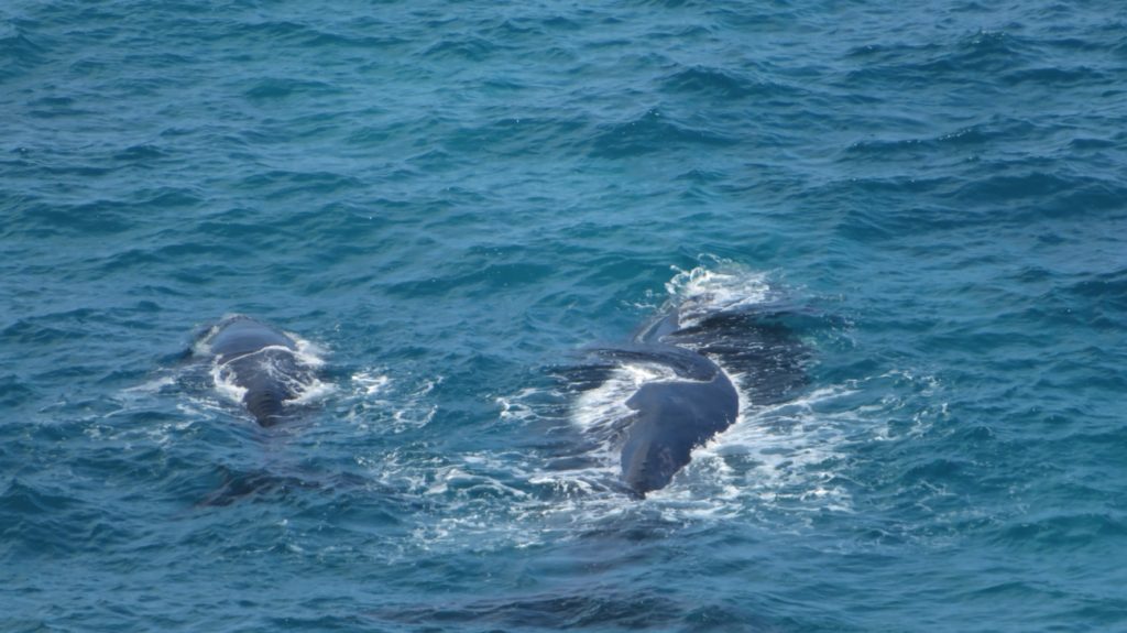
The humpback whales have just begun returning south. They travel from the Antarctic in June/July to the warm waters of the Kimberley’s where they either breed or give birth. A whale pregnancy is 12 months long. From September to November they return to their feeding grounds in the Antarctic, the female whales either newly pregnant or with a calf. We saw so many whales about 100 metres offshore breaching, slapping their pectoral fins, diving to display their tail flukes and just generally having a whale of a time (hee hee). It was pretty cute when the calves breached. In the protected cove beneath where we sat for brunch was a mother and calf resting – maybe 10-20 metres offshore. The calf drinks about 240 litres of milk a day – no wonder the mother needs a rest!
Mother and baby whale, resting.
Stopping so frequently to be delighted by whale antics it was a slow walk out. The return walk was faster – there were fewer whales and they performed less frequently, and besides we were all ‘whaled out’ by then. “Oh it’s only another whale breaching.”
Natural Arch – the turning point of our walk.
Back to Priscilla and the caravan park and a hot shower and I discovered I’d picked up a tick in my cubital fossa (google it!).
Fish and salad at the tavern and an early night for us. Hope my arm doesn’t drop off overnight – I think the head is still in it!
Thursday 31st
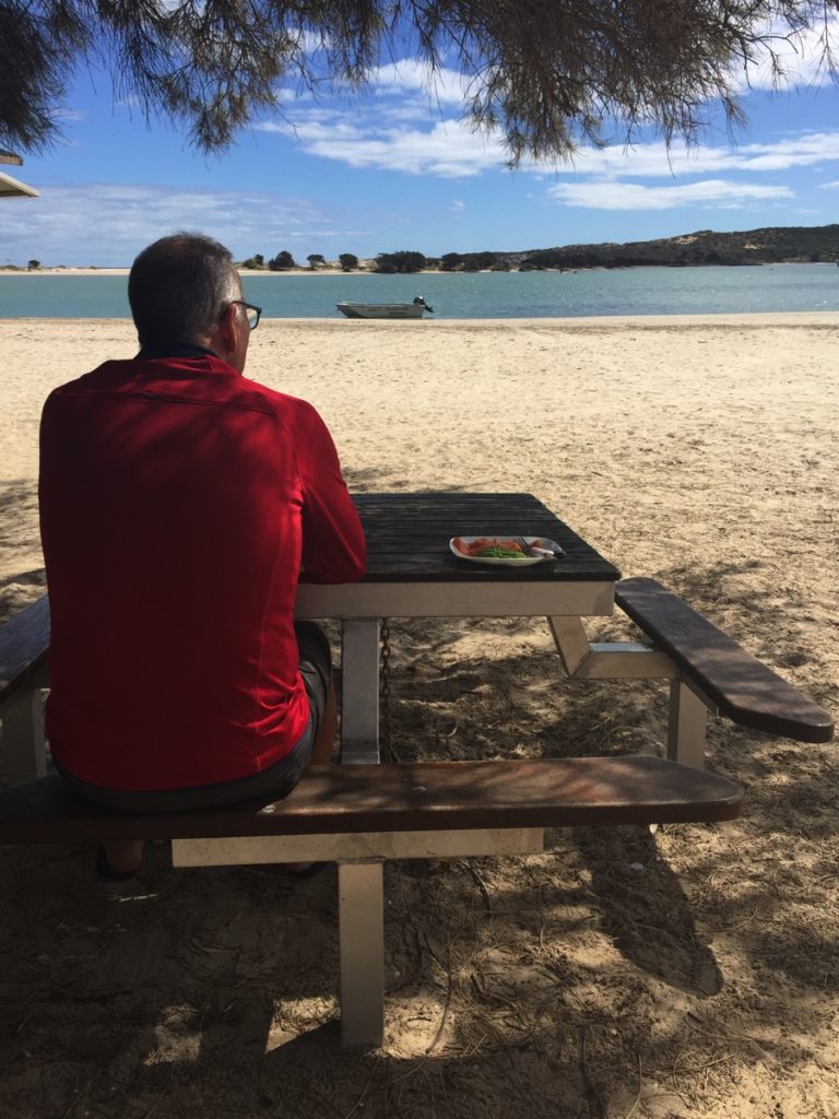
Arm still intact (I’m sure the head is still there! – arm-dropping-off is just a matter of time), we grocery shopped and had a last sit on the beach in Kalbarri before heading into the River Gorges section of Kalbarri NP.
Breakfast on the beach at Kalbarri.
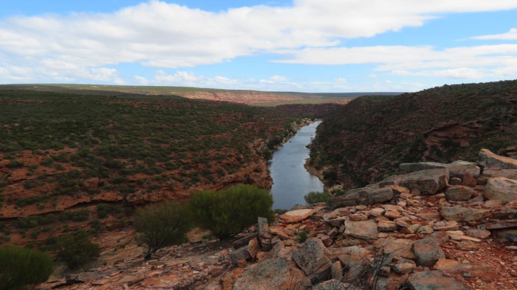
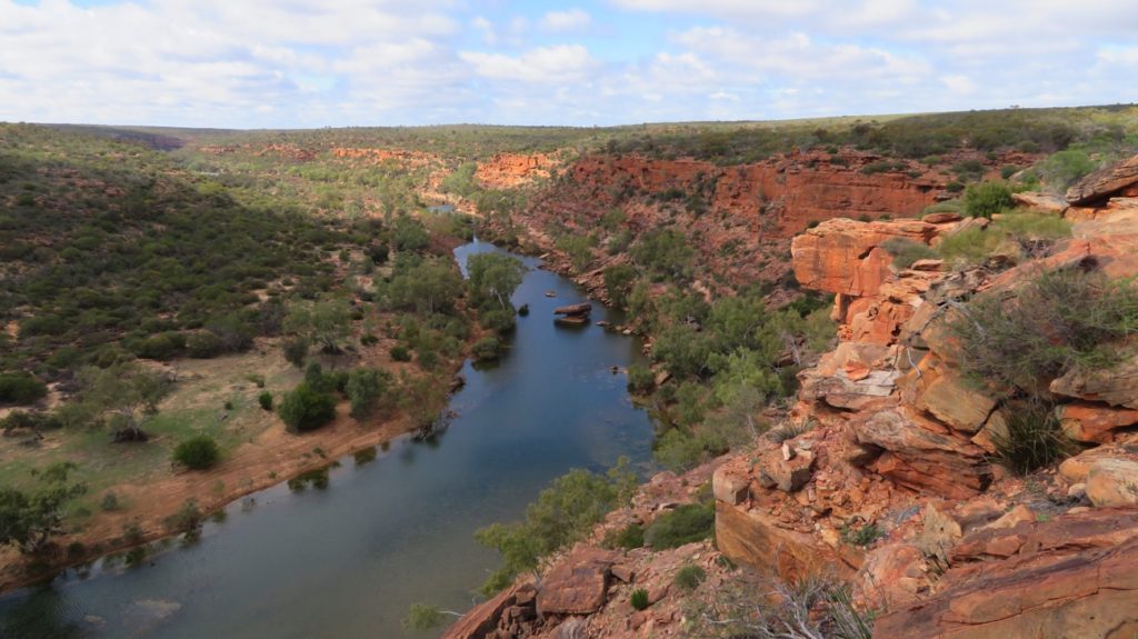
The Murchison River has cut an 80km swathe of gorges through beautiful reds and creamy white sandstone to form quite spectacular scenery.
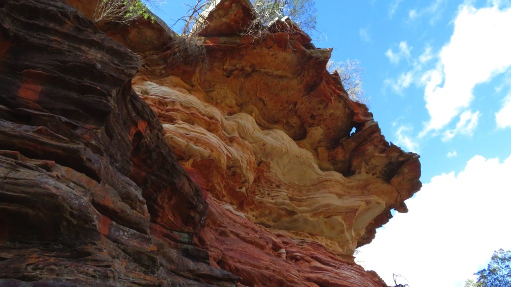
Just look at the beautiful rock layers. Z-Bend Gorge, Kalbarri NP
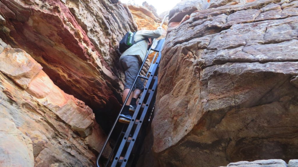
Today we went to Z-bend Lookout and walked the Z-Bend River Trail. It’s called Z-Bend because the faults in the sandstone caused the river, and subsequent Gorge, to form a big Z. I won’t rave on about how beautiful it is, just check out the photos. The River Trail was only 2.5km return, but it did take us down (and then back up again!) over huge rocks, sandy boulders, narrow crevices and several ladder climbs to the river. Definitely worth every slippery step!
Descending the ladder – that definitely helped the descent, and ascent a lot! Kalbarri NP, Z-Bend
Tonight we’re camped at a very pretty spot on the banks of the Murchison River at the historic Murchison Station ($25/n unpwred), along with about another 20 vans! Murchison Station is a working farm – they round up feral goats and sell them!
Friday 1st September
Back to the River Gorges this morning to walk to Nature’s Window and do the Loop Hike. The wildflowers along the drive in are beautiful – a whole field of smoke bush looked ethereal.
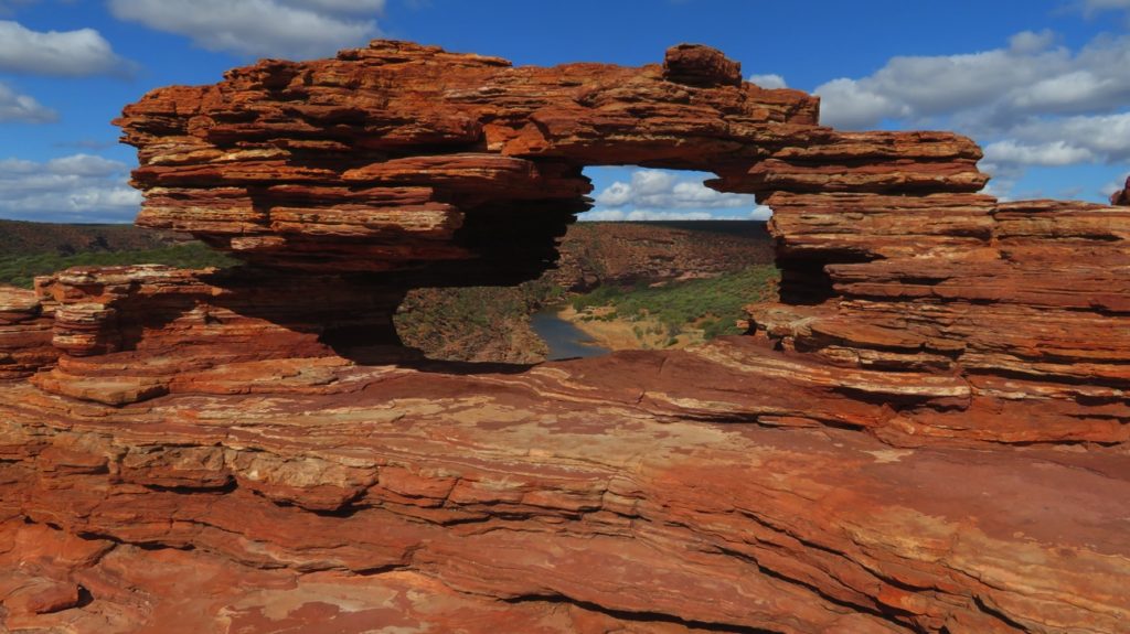
Nature’s Window is a pretty amazing geological formation and we did the tourist thing and posed in it.
Looking through Nature’s Window to the Murchison River, below. Kalbarri NP
Onwards from here the 8km Loop Trail took us along the ridge before a steep descent to the river. This is a Class 4 walk and, yes, the descent was challenging. However at the base, as we heaved a sigh of relief having descended safely, a sign met us stating that the next 5 km would be a lot more strenuous and to turn around now should we not be ‘experienced’ bushwalkers. Did that deter us? Not for a second!
View of the river and countryside from the cliff top we followed for awhile.
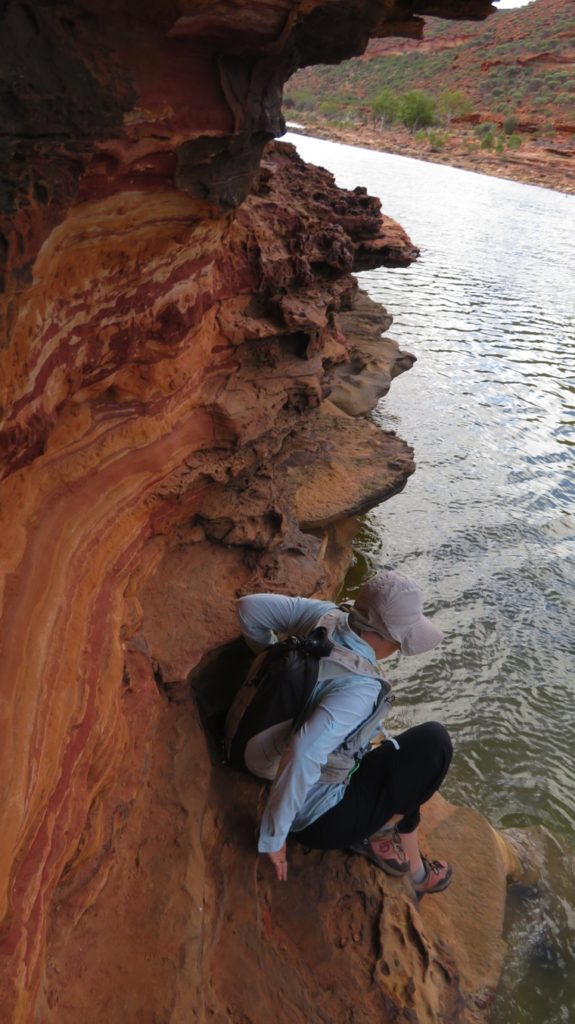
There were some very tricky parts I’ll grant you. Firstly walking along a narrow ledge at the base of the cliff just above where it plunged into the chilly Murchison River, then a little further on it was ‘crawl on hands and knees’ along the narrow ledge, under the overhanging rock, above the river. Great fun really – once we’d successfully negotiated it!
Ahh now I see why they say it’s difficult. Here I’m attempting to go to a lower level so that should I fall in I wouldn’t hurt myself too much. However … that came to a dead end. See the protruding ledges just above my left shoulder – that’s the trail!!
Anyway, all in all, a great walk with amazing views of the weathered cliff faces and the river winding through the Gorge.
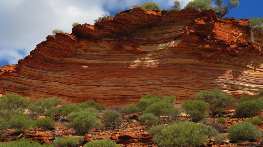
A close-up of the beautiful cliff face on the other side of the Murchison R to the Trail. These layers remind me of the Thousand Layer Cake (kek lapis) I ate in Malaysia.
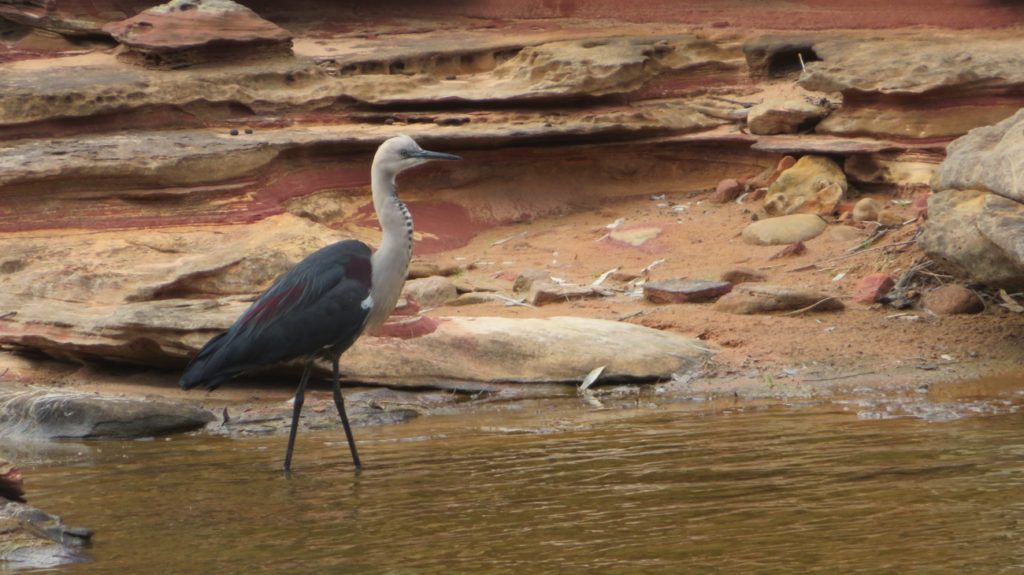
There was some wildlife along the way too – euros (a type of kangaroo), black swans, herons, numerous other birds and tiny fish in the river.
A white-necked heron looking for tiny fish in the Murchison River. Loop Trail, Kalbarri NP
A quiet night back at Murchison Station camp beside the now tamed Murchison River.
Saturday 2nd
As we left the Kalbarri region we stopped in at two more Gorge lookouts in Kalbarri National Park – Hawks Head and Ross Graham lookouts.
Murchison River from the Hawks Head lookout. That protruding rock on the upper right is meant to be the hawk’s head – a little imagination helps.
Continuing north and more wildflowers – this time a field of bright yellow-flowering acacia bushes, all about a metre high.
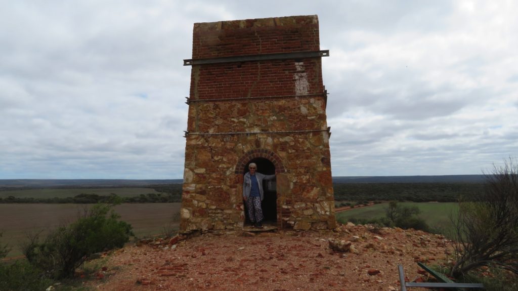
A detour took us to the Warrabanno Chimney – constructed in 1858 for a lead smelter.
Behind me is a void. Must have been built up like this to create a draft.
A long drive (for us) – nearly 300 km today to finally arrive at Hamelin Pool Caravan Park in the Shark Bay World Heritage Region.
To see more photos from our time in Kalbarri CLICK HERE.