
23rd – 26th November, 2017
Thursday 23rd
Repacking and restocking Priscilla yesterday afternoon, while a big job, was a great pleasure – it meant our next adventure would begin soon.
We left Bob and Cathy’s this morning having spent a relaxing couple of days with them and headed south to Dardanup to have lunch with and farewell Fran and Ric. Leaving Fran and Ric’s our route took us via Gnomesville.
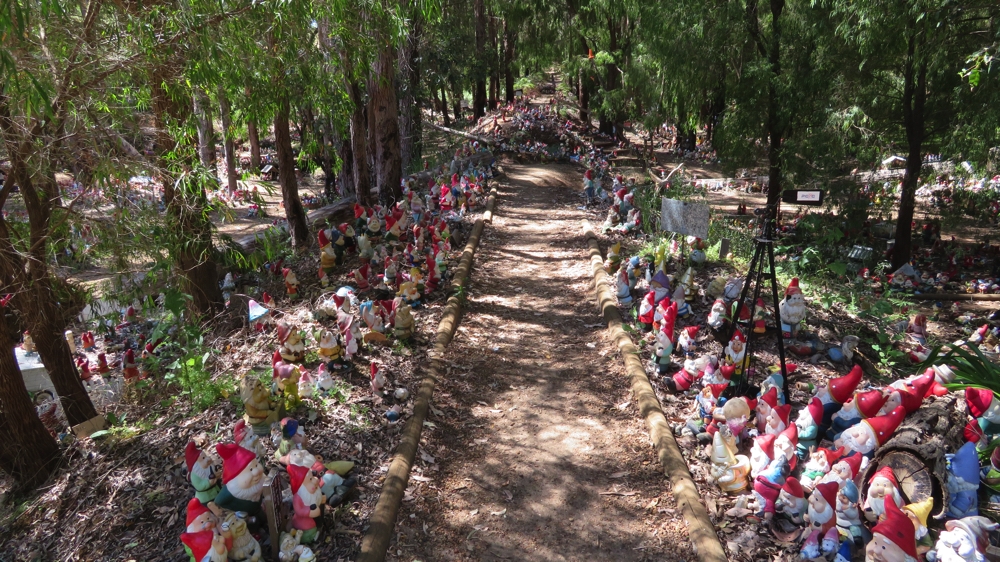
Must be an important parade about to start – the gnomes of Gnomesville near Dardanup.
From the gnomes we headed to our overnight stop at Mt Barker via Boyup Brook and Frankland River. The wildflowers seem to be inexhaustible with banksias, Geraldton wax and a shrub that’s covered in dark yellow flowers lining the roads we travelled.
From Dardanup we drove through vineyards and dairy country, then into sheep and wheat country before vineyards and olive orchards took over again at Frankland River.
Tonight we’re in the free RV campsite provided by Mt Barker – nice central spot, right beside the rail line!
Friday 24th
Only one train last night about 10pm – can’t complain.
After refuelling and dropping into the Information Centre for some brochures on Porongurup Ranges we headed off.
The range’s distinctive granite domes are the remains of the ancient Porongurup pluton, a massive bubble of molten rock that rose from deep in the Earth’s core and pushed upwards into the overlying base rock of the continent.
Over millions of years the softer rock lying above the pluton weathered away to expose the giant granite mass. Changes in temperature and in the weight of the overlying rock caused the granite to fracture. Interesting, hey! I’ve never seen a granite bubble before.
We headed first to Castle Rock and the Granite Skywalk, though just before it is Balancing Rock. I’ll leave what it looks like to your imagination (and maybe a photo).
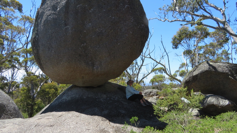
Balancing Rock. Porongurups
It’s a 5km return walk, which doesn’t sound far, but from the moment you leave the car park you’re climbing, getting steeper the closer you get to the destination. At Castle Rock there’s a short walk out to the lower lookout, but the upper lookout and Granite Skywalk is pretty impressive.
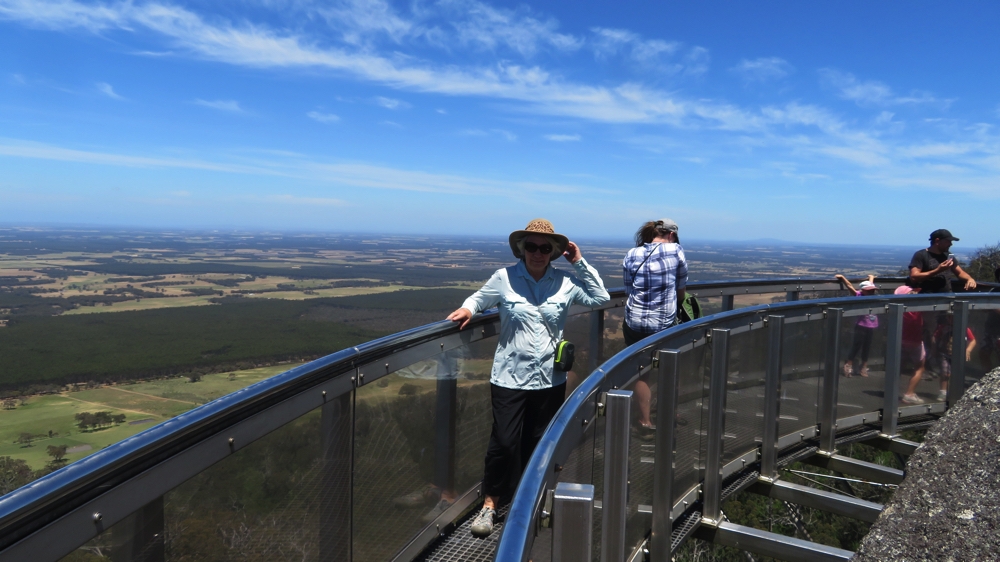
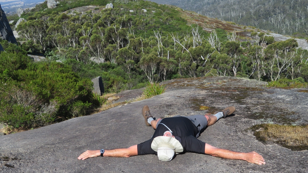
Amazing views from the Granite Skywalk.
It starts with steel handholds in the rock up which you have to climb, then a steel ladder up to the top where a walkway goes around the rock, suspended off the side of it. The views were incredible and the rock climb well worth the big effort and slight fear it induced. The return walk down the track was tough on the knees.
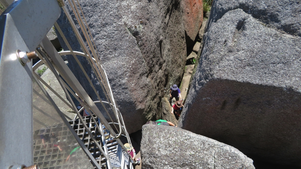
The people below are first climbing through the crevice using steel handholds, then it’s up the ladder to reach the Granite Skywalk. Castle Rock, Porongurups.
From there we drove to the other end of Porongurup NP to Tree-in-the-Rock picnic area where there are more walks. First we had brunch then set out on the Devils Slide walk to Mt Marmabup – another 5km return walk, with yet another very, very steep climb at the end to the summit, Mt Marmabup being the highest point of the Range. The trail started with a gentle incline covered in beautiful jarrah and karri trees, before the final steep, rocky climb up a gully. Surprisingly it was well vegetated and still has lots of wildflowers. The summit is a large expanse of bare sloping granite.
A strange rock lizard on Mt Marmabup.
From the top we could see hundreds of dead trees towering above the canopy, destroyed in a severe bushfire in 2007.
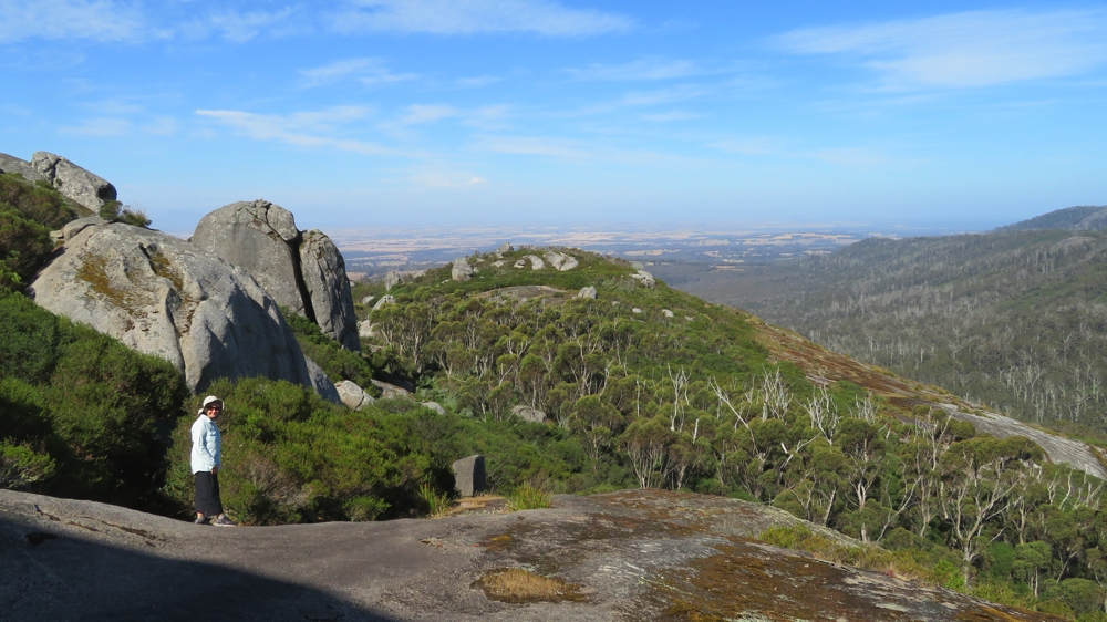
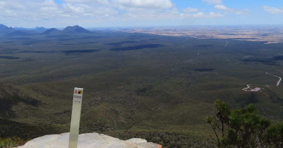
Good views from Mt Marmabup
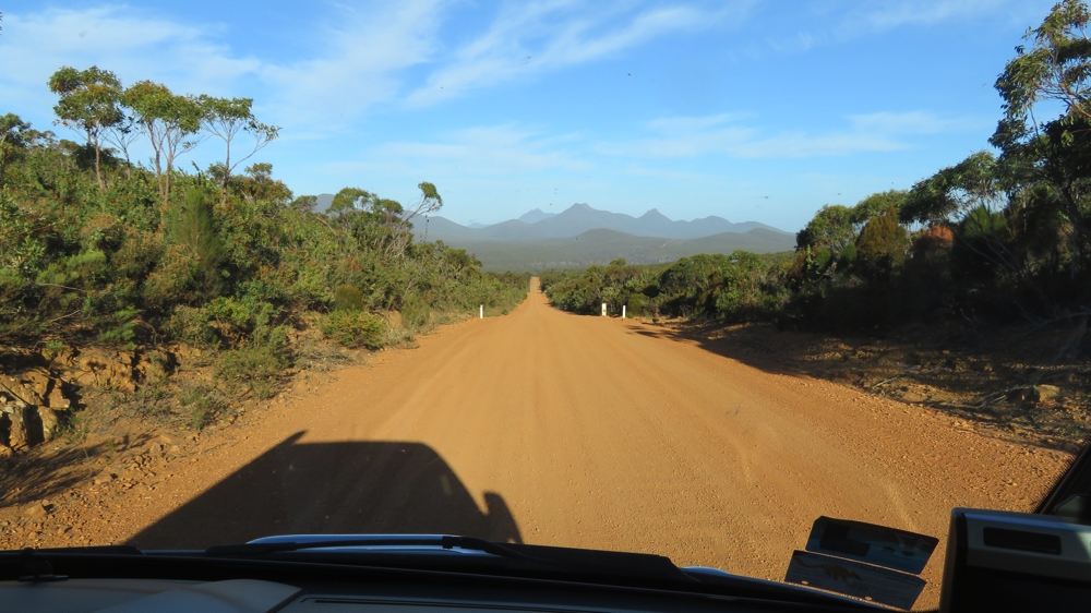
Leaving the Park via a scenic drive we enjoyed more views of these unusual domes of granite before heading north to the Stirling Ranges where we entered it via the 42km scenic drive which wound its way past the spectacular mountains. We finished the drive, and our day, at Moingup Springs camping area, a National Park’s campsite.
Enjoying our Scenic Drive through the Stirling Ranges NP
Saturday 25th
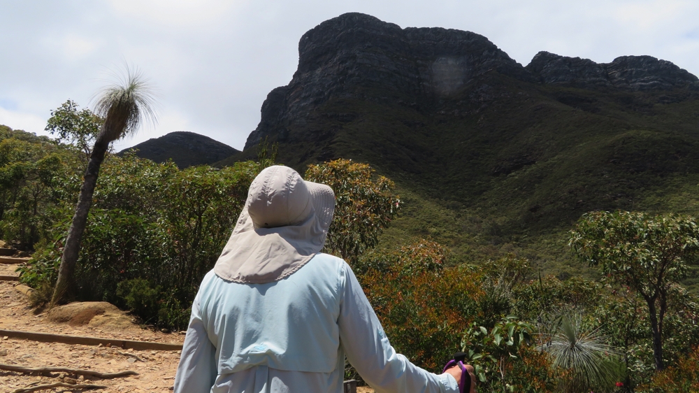
Today’s challenge is Bluff Knoll. At 1095 metres this is the highest peak in the southern half of WA and the only place in WA that occasionally sees snow.
Keep walking Denise – you’re nowhere near the top yet! Note the flora.
It’s very steep and consists of hundreds of irregularly spaced ‘stairs’. An exhausting climb!
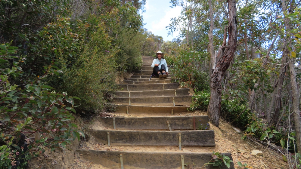
Oh those steps!!! This flight was at least reasonably evenly spaced.
Bluff Knoll, known to the traditional Aboriginal people of this area as Bular Mial has great spiritual significance being the home of a powerful ancestral being that moves in the mists and clouds that sometimes cover the summit. Climbers are warned not to wander from the path and to turn back if clouds begin to come in!
Rewarding views and we’re not even half way up the Bluff Knoll track yet!
The views all the way up were spectacular, not only in the distance but also the many different wildflowers that lined the track. At the summit the reward is 360 degree views – and a well-earned sense of accomplishment.
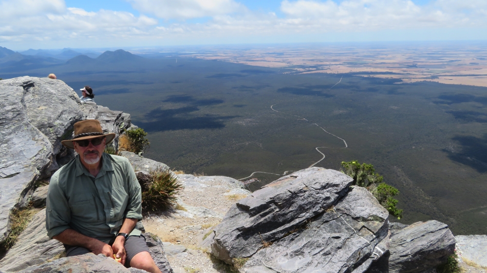
Having a break on the summit of Bluff Knoll
It’s a busy walk, but the majority of walkers are young, 20 – 30 somethings .. very few grey nomads like us.
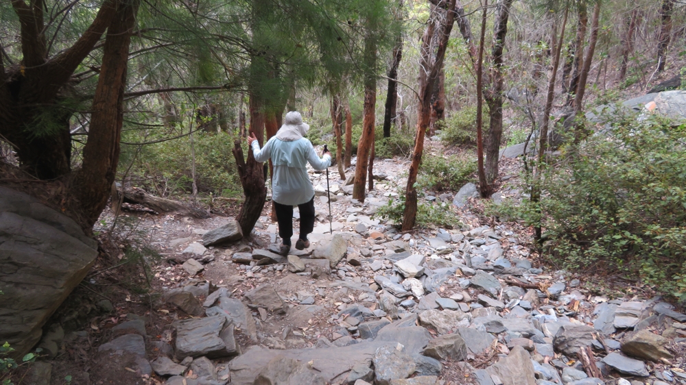
Slowly does it – one careful step after another. On the Bluff Knoll track.
Sunday 26th
We leave the Stirling Ranges today, but not before doing another climb – Mt Trio. I chose this one as it looked the easiest, only 3.5km return and, after a steep section to begin, the plateau joining the three peaks is easy. Hmmm not so! The track is in very poor condition. Quite a few of the steps are either missing or just about fallen over and the surface is loose shale. It was quite dangerous walking, particularly coming down.
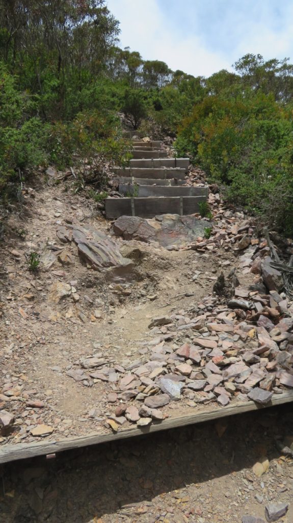
That horrible, horrible path up Mt Trio
Lovely views from the top once again. And the wildflowers – just so many and so beautiful.
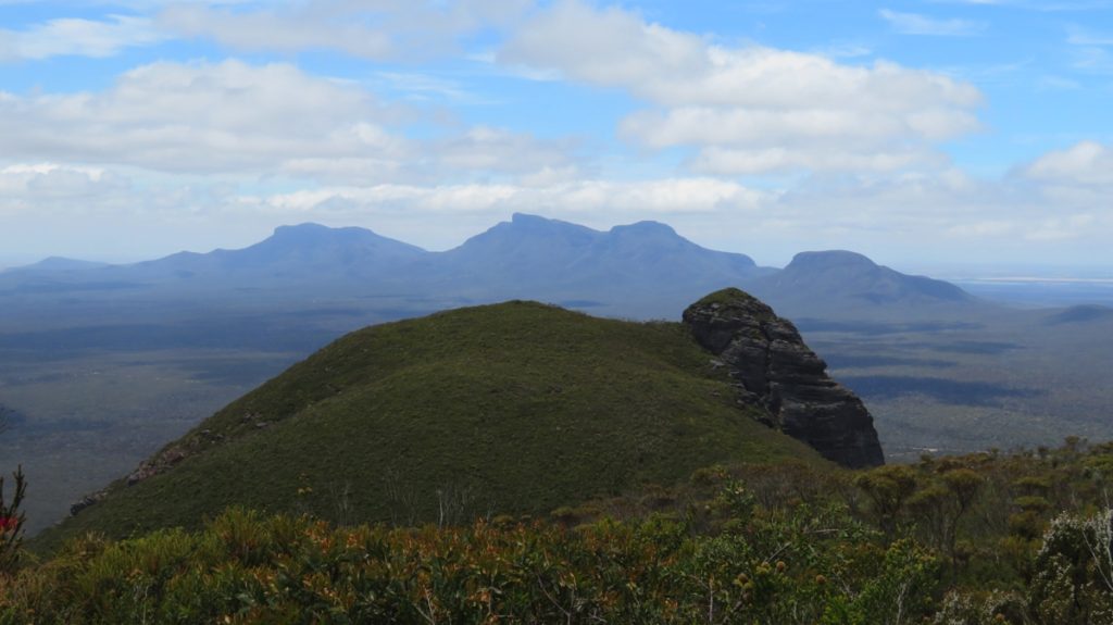
From the summit of Mt Trio.
Once safely (miraculously!) back down we headed out of the park to stay in a free camp called Louis Lookout, which has views of the ranges in the distance. A band of rain moved through overnight, giving us some nice rain and quite a lightning show – in the distance, thankfully.
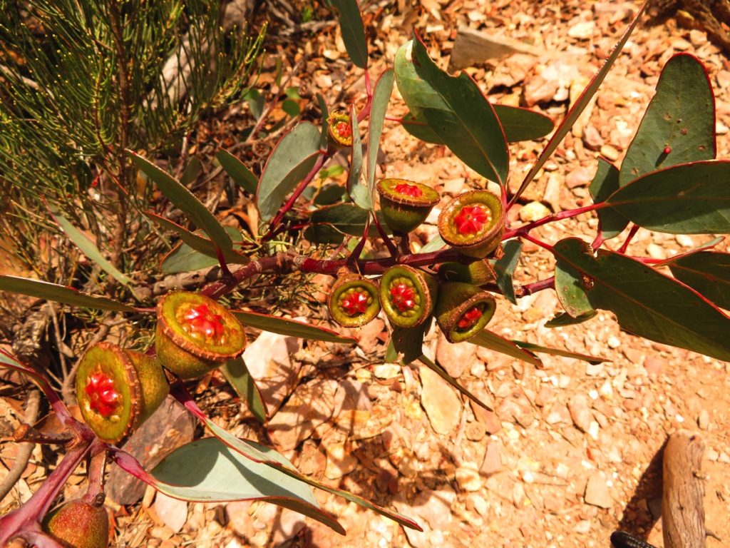
The gum nuts are so pretty. Mt Trio
For more photos from our few days at the Porongurups and Stirling Ranges CLICK HERE.