Gorges and Tubes and the Gulf

13th – 27th April

For many, many years people have raved to us about how wonderful Lawn Hill Gorge is (Boodjamulla National Park), and finally, finally we’re going to see it for ourselves. From Mt Isa we headed north on the Camooweal Rd, another really bad road, to Miyumba camp, the southern-most camp in the National Park. The road was rocky, and when not rocky, it was corrugations, plus a few water crossings thrown in for good measure. We drove ‘according to conditions’ and arrived intact.

Poor condition of road on the way north to Riversleigh

The final water crossing, just 100m short of our camp was over the Gregory River. It was flowing quite swiftly, about shin deep – no drama for Priscilla. Once camped (only ones there) we walked back to the river and had a lovely, cool, spa bath right there beside the road. 

Having a ‘spa’ on the side of the road in the swiftly flowing Gregory River

The night was magic – no lights, no moon and millions of stars from horizon to horizon. These are the nights we especially love. 

14th – 17th April Boodjamulla NP

Riversleigh World Heritage Area

Next morning, continuing north, we stopped at the Riversleigh World Heritage site renown as a dinosaur fossil site. It’s very well presented and interesting with large  fossils evident in the rocks along an 800m path. 

The signage and displays at Riversleigh were very good.

The gorge part of Boodjamulla is 55km north. A large commercial campsite at Adels Grove, just outside the NP, provides accommodation for the on-road vehicles and caravans and those who didn’t book early enough to get into the NP. The National Park campsite is 10 km down the road at the Gorge. The road was improved significantly.

Over the next 4 days we did a twilight walk up to Duwadarri Lookout completing the circuit via Indarri Falls, a walk to the Cascades, then back to walk to the Upper Gorge. These walks were lovely in places, stunning in others and difficult in parts, but well worthwhile. Another day we took the kayak up the river, marvelling at the stunning cliffs through which we paddled.

At Indarri Falls we ‘portered’ the kayak along the path to bypass it, then continued right up to the Upper Gorge where we found a fabulous landing spot at rapids where we stopped for lunch, a swim and a massage under the rapids. We were lucky to have the place to ourselves for more than an hour. On our last day we kayaked up to Indarri Falls then spent quite a few hours there, swimming, getting massaged by the falls, chatting to other kayakers, relaxing and staying cool.

Indarri Falls. Boodjamulla NP

We both enjoyed Boodjamulla, and while a longer stay wasn’t necessary, I wouldn’t mind coming back another time. The only thing that spoilt our visit was the weather – it’s very hot, 35/36° for the first 3 days, cool breeze on the last. 

19th – 22nd April

We saw the Gulf of Carpentaria from the west in our Arnhem Land trip in 2019 and now, heading to Karumba I’m planning to get my feet wet in the eastern Gulf. But first the drive from Boodjamulla was pleasant on good unsealed roads, just a few small washouts and corrugations as we traversed the grass lands stopping for a coffee and a highly-touted muffin at Murray’s Place in Gregory. From here we headed north (on sealed roads) to Burke for a look around town, sitting in a park having lunch at the same time the ABC News that night informed us it was the hottest town in Queensland! Back south again to stay the night at Leichhardt Falls. 

Leichhardt R falls – free camp

Leichhardt Falls, on the Leichhardt River is not much more than a puddle during the dry season, but at the moment the water is roaring over the falls. A croc was spotted just down from the base of the falls – no swimming! Watching the road trains navigate the long, single-lane bridge that crossed the river gave me an even greater respect for those drivers.

Not a long drive today. The road to Karumba is unsealed, but mostly pretty good. At Camp 119 we viewed the blazed trees and read the story of Burke and Wills most northerly campsite. They tried to walk further on to the coast, but as it was the wet season (crazy!!) it was too swampy to reach.

The most northerly campsite of Burke and Wills in 1861

Another rest stop at Normanton proved interesting for not only the story of Krys, the largest crocodile ever, but also the Information Centre told the story of the beef industry here and the important role of the native stockmen.

Krys, the largest crocodile ever seen in Australia. This magnificent creature was dozing on a riverbank when a crocodile hunter shot it dead. So sad.

A cruise on into Karumba was easy driving before we found our campsite at Ronnies and settled in. First point of call was to buy prawns for our lunch. 

Karumba prawns for lunch. Delicious

Karumba exists to service the commercial prawning trawlers, the commercial barramundi fishers, to a lesser extent the export of zinc from Century mine and, of course, tourism. The prawning industry started in the early 1960’s when a wealthy businessman managed to talk the CSIRO into jointly funding an exploration in the Gulf and the highly sought-after banana prawns were found in abundance. 

The purpose of the Barramundi Discovery Centre is to maintain the stocks of barramundi by breeding them to fingerling size then releasing back into the wild. It was begun some years ago by the local commercial fishermen who saw the need to protect the barramundi from over-fishing. Smart move! The Centre was recommended to us by other travellers and I must say it is really interesting and not to be missed, though the tour at $50 each, was overpriced.

Karumba has been recognised for their efforts to maintain a sustainable seafood industry. Well done Karumba. 

While here we did a sunset cruise (so so) and enjoyed meals at the End Of the Road restaurant one night and the Sunset Tavern another – seafood meals, of course, while sipping cocktails and watching magnificent sunsets.

Sunset over the Gulf of Carpentaria. Karumba

Road closure due to flooding changed our route of departure to the sealed section of the Savannah Way – traversing rich grasslands once more. 

Darn! That was our intended route.

22nd – 23rd April

The highlight of a night at Gilbert River West (free camp, no facilities) was seeing the foaming waters of the river in flood, not far beneath the long one-lane bridge.

Viewing the flooding Gilbert River – not over the road, fortunately!

Next morning we moseyed on into Georgetown to stay at the CP, the power giving our batteries a boost. A walk around town left us with the impression of a small town with plenty of pride. 

They’re pretty laid-back in Georgetown

24th – 25th April

On towards Cobbold Gorge over unsealed roads in pretty good condition with just a few shallow water crossings. On the way a cuppa stop at Forsayth and a wander around town found this town to be as impressive as Georgetown with its beautiful, restored buildings and well-tended parks. 

I was very excited to get to Cobbold Gorge – the photos I’d seen of the gorge were stunning and it didn’t disappoint. The beauty of the narrow gorge (only about 2 meters wide in some places) was only discovered a few years ago by the current owners of Robin Hood Station, the cattle station it is in.

This image has an empty alt attribute; its file name is 04_25_cobbold03-1024x768.jpg
Cobbold Gorge

A LOT of private/public funding has gone into developing the tourist facility here which includes a large reception area with souvenirs, a small grocery stocking basics, a large open-air restaurant beside the pool which has a swim-up bar, a function hall as well as very well laid-out RV and camping areas.

Apart from the Gorge itself there’s a large dam with free kayaks, several bush walks and mountain bike trails (BYO bike) and some four-wheel drive tracks to points of interest and the gem fields (agate mostly). 

On our first afternoon, after settling in, we did an 8km walk up to a lookout, then back for a swim and cocktail at the swim-up bar. 

This image has an empty alt attribute; its file name is 04_24_cobbold-1024x768.jpg
Chilling at the swim-up bar at Cobbold Gorge

The Gorge is several kilometres away from the resort and only accessible on tours in an effort to maintain its pristine condition. We did the boat tour next morning. The guide was particularly good sharing historical, geological and botanical knowledge with us. The boat, an open punt, has a silent electric motor.

This image has an empty alt attribute; its file name is 04_25_cobbold02-768x1024.jpg
The amazing narrow gorge of Cobbold Gorge

It was a stunning experience with the walls of the gorge towering up beside us, close enough in places to touch both sides at the same time, while we glided silently along. Back at the start we then walked up onto the huge sandstone rock that encloses the gorge, crossing over the gorge on a glass bridge. 

This image has an empty alt attribute; its file name is 04_25_cobbold04-768x1024.jpg
On the glass bridge over Cobbold Gorge

That afternoon we’d signed up for the SUP tour. If this morning’s tour was stunning, the SUP induced awe. This morning’s boat held 14 people, plus the guide and while everyone was quiet, just soaking it all in, the guide, naturally talked a fair bit. With the SUP there were only 7 of us and we all headed off separately, so Steve and I were able to enjoy the gorge more or less alone. It was every bit as wonderful as I’d hoped – and I didn’t fall in! 

This image has an empty alt attribute; its file name is 04_25_cobbold06-1024x768.jpg
Denise, just finishing the return trip of Cobbold Gorge on the SUP

26th – 27th April

Leaving Cobbold Gorge we did one of their 4-wheel drive trips up to the Quartz Blow – a hill of beautiful white quartz which gave us views across to the horizon all around. 

This image has an empty alt attribute; its file name is 04_25_cobbold09-1024x768.jpg
Steve, contemplating geological wonders from atop the Quartz Blow, Cobbold Gorge

We’d asked around about the road through to Einasleigh and been rewarded with a shrug and “it’s OK”, so off we went, and it was “OK” – some bitumen, some corrugations, some washouts – OK. What we failed to ask about was the road from Einasleigh to the Gregory Developmental Rd! The Einasleigh River was over the causeway and flowing pretty fast.

This image has an empty alt attribute; its file name is 04_26_einasleigh01-1024x768.jpg
The Einasleigh River in flood. And we need to cross it.

As all good 4x4ers who don’t want to walk a river crossing do, we parked to the side and made ourselves some lunch and a cuppa. Sure enough 3 vehicles came down and we watched them cross, noted where it was washed out, noted their track and safely followed on. 

Kalkani Crater, a very typical cone-shaped hill with a perfectly round rim that drops away into the middle was a great little walk on our way to the Undara Experience, the resort set up at the Lava Tubes. 

Undara Experience, the accommodation associated with the lava tubes, was moderately busy as a music festival had just finished yesterday. It’s quite a resort here with lots of units, and heaps of powered and unpowered camping, a large open air cafe / restaurant, pool … you get the idea. 

“The lava tubes and caves were formed when rivers of lava confined to a valley crusted over and formed a roof. Insulated in its casing of solidified lava, the lava flow carried on for tens of kilometres before draining out, leaving an empty tube of lava. Weaker sections of the roof of the tubes later collapsed to form caves and depressions. More than 70 caves have been found in the park.” (Text from NP literature) The lava flowed more than 90km to the north and 160km to the north-west at a rate of 1,000m3 per second! 

This image has an empty alt attribute; its file name is 04_26_undara01-1024x768.jpg
How the Undara Lava Tubes were formed.

Access to the caves is restricted to approved scientists, speleologists and guided tours. The area has received 3 times its usual annual rainfall in the last few months and the caves have been full of water, a rare event. We had the amazing experience of walking through the caves on the walkways with crystal clear, chilly water up to our shins. 

This image has an empty alt attribute; its file name is 04_27_undara06-1024x768.jpg
Undara lava tube.

There are several bush walks starting from the camping ground, the longest being the Rosella Trail at about 14km. This trail took us to several lookouts from which we could trace the track of collapsed tubes by the bright green vegetation that grows in the protected stream bed.

Bibbulmun Track: Walpole to Denmark

22nd – 30th October 2017

The Bibbulmun Track is one of the world’s great long distance walk trails, stretching 1003 km from Kalamunda in the Perth Hills, to Albany on the south coast, winding through the heart of the scenic South West of Western Australia. The formation of this track was first mooted in 1972 by several bushwalking groups, first opening in 1979 with the final section to Albany being completed in 1998. This is a ‘walker-only’ trail; the Munda Biddi Trail is a cycle-only trail that follows a similar route further to the west. The Bibbulmun is jointly managed by the Dept of Parks and Wildlife and a not-for-profit community organisation which maintains the track condition.
The track symbol and direction marker is the waugyl, a snake-like creature that, according to Aboriginal creation stories, created the rivers and lakes and landforms.

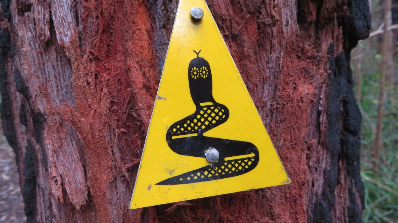
This is the Waugul. Depending on which direct the apex pointed was the direction we were to go.

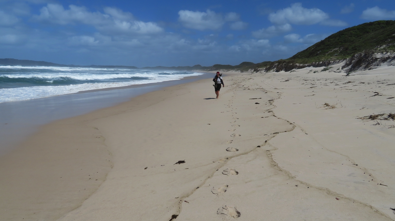
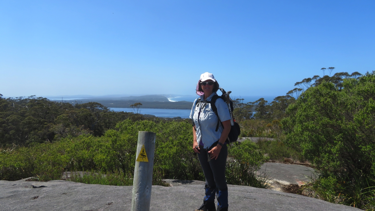
Trish and I have decided we’ll walk the final two sections of the trail, from Walpole to Albany, a total of 205 km over 12 walking days – at an average of nearly 17km per day it’s going to be quite a challenge for us.
Steve and Bryan are our support crew – promising to pick us up every afternoon with a hot meal cooked, a hot shower not far off, maybe a leg massage and a nice comfy bed. Sounds all right!

“I’ve got one of these.” “Well I’ve got two of these!”
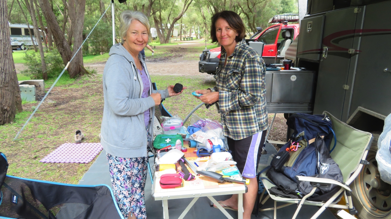
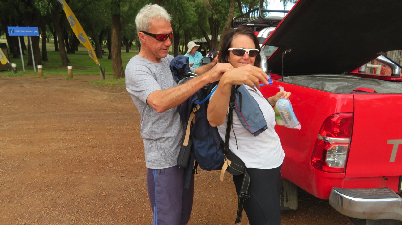
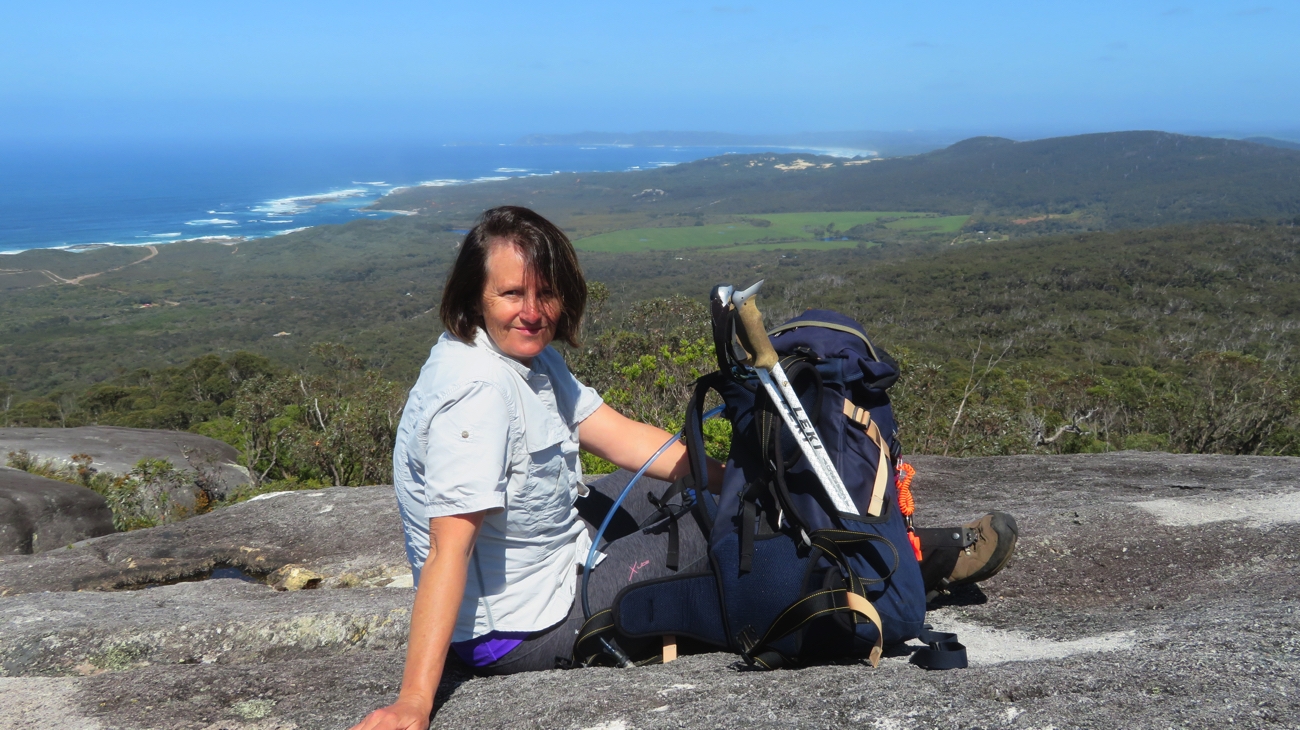
Pack preparation.

Sunday 22nd (Day 1)
Today’s walk from Walpole to the Giant Tingle Tree is one of our shortest – a ‘warmer upper’. Yesterday we studied the map, and the walk profile (very important), unpacked our packs, compared what we were each taking, then repacked them adding even more essentials, prepared our snacks and laid out our clothes. We’re ready!

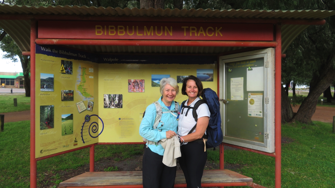
Yay! At the Walpole Trailhead. And we’re off!

8am we drove from our campsite at Coalmine Beach into Walpole to begin the big challenge. And it was – the map and the ‘wagyl symbols’ didn’t match up. We started following where the map indicated only to find the path flooded with muddy puddles. We turned back and walked back into town. Note to self: check the website for  ‘Track alterations and diversions’.

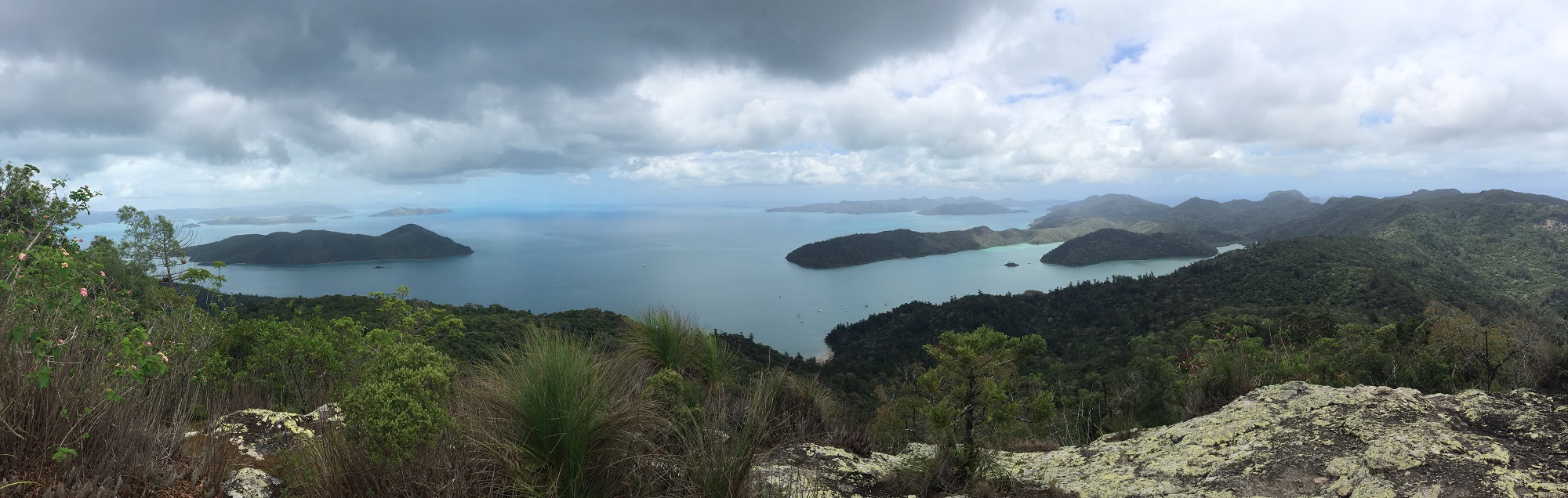
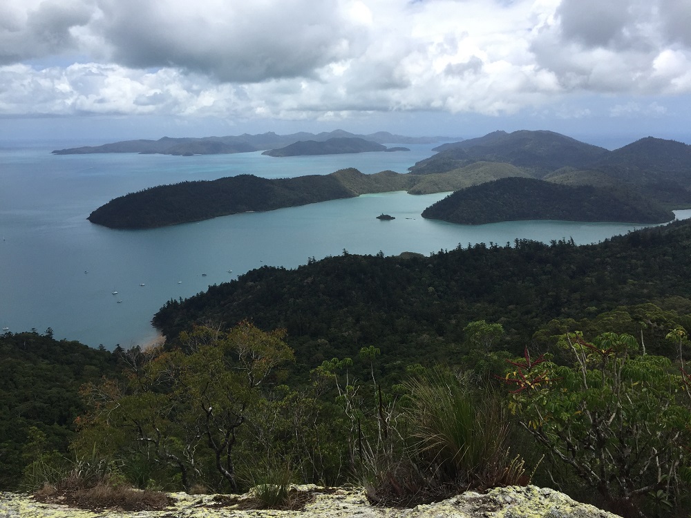
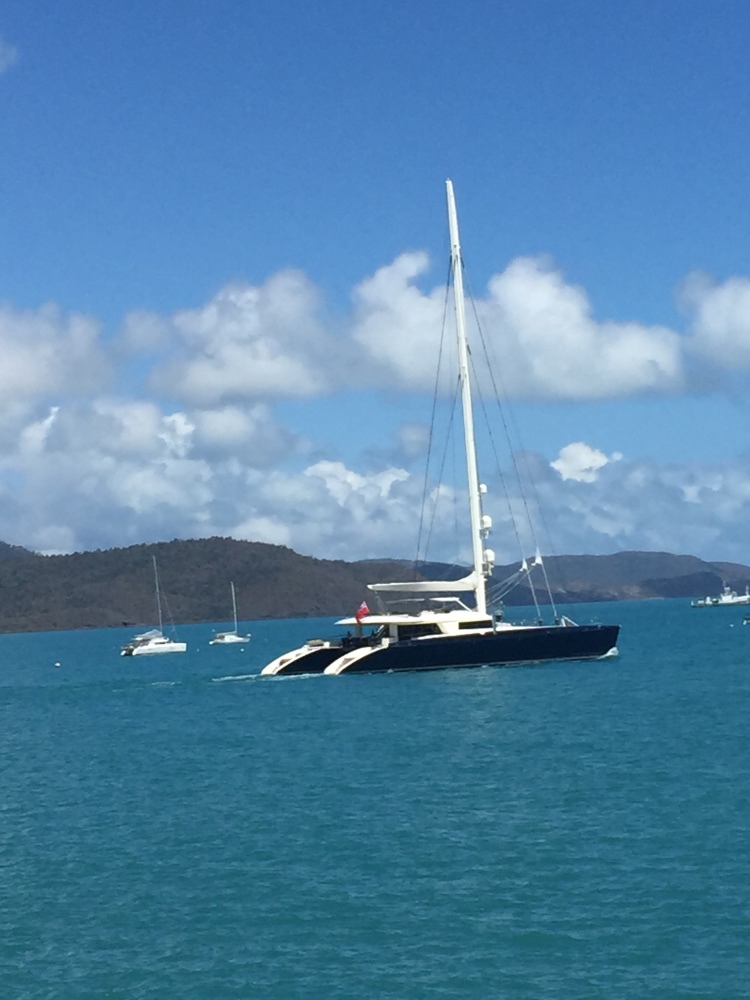
Anyway, an additional 3km later (it all counts!) we finally got back onto the right path, following the bay around and back through our campsite. (We’re purists, we couldn’t have started from there.) Brunch was had a few kilometres further on as we watched the pelicans in the bay and a lone small yacht. From there we headed inland through coastal scrub alive with wildflowers before the track started climbing, finally giving us a comfortable seat to rest and admire the view over the bay from Hilltop Lookout.

A selfie. At the Lookout. You really didn’t want to see the view did you?

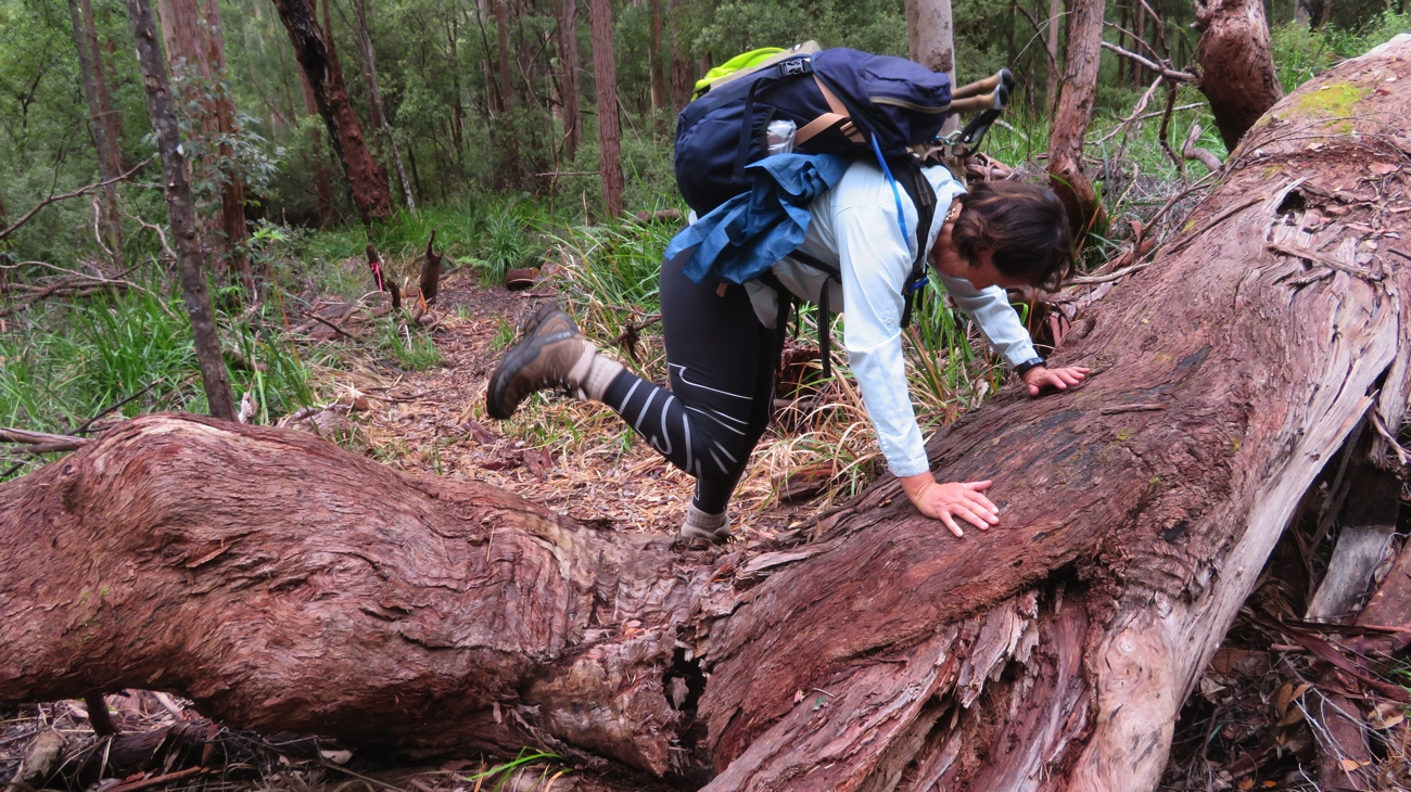
Once rested we continued on, initially through a young Karri forest before moving into the old-growth Tingle forest where the Tingle trees can grow to 56 metres with incredibly wide girths, up to 25 metres. Some of these trees appear to be completely burnt out in the middle, however they keep growing from just under their bark.

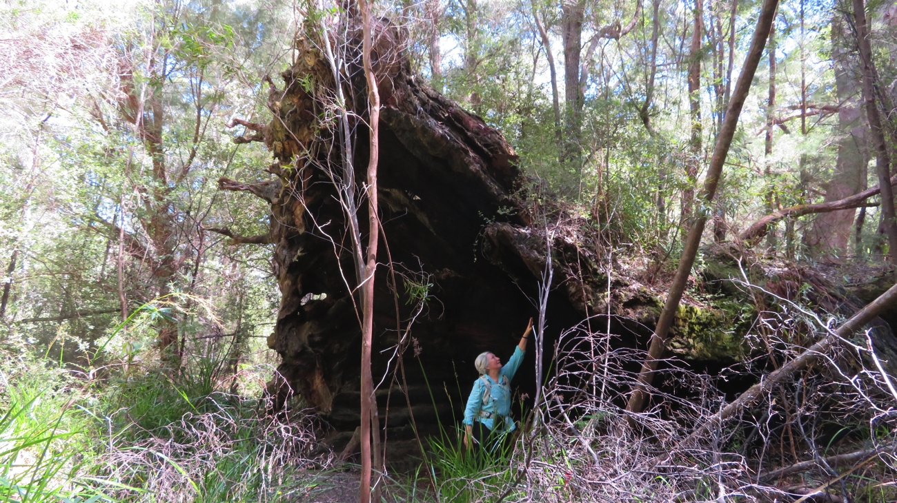
A fallen Tingle Tree. They have massive girths.

This was our pickup point today. Weary feet, but very pleased we’d begun. Our support team is also off to a great start with silverside and veggies for dinner.

One of the BS Support Team (that stands for Bryan Steve!) helping take Trish’s pack at the end of Day 1.

Monday 23rd (Day 2)
Once more bags packed and ready we got away from camp at 8am to be dropped off back at the Giant Tingle Tree. My brain wasn’t in the right place this morning – I left without the map and without my phone which was to record our distance and track, show us precisely where we were and is, of course, a safety feature. Oh well – I’ll only do it once.
The walk started as it had ended, in the old-growth Tingle Tree forest. You can only say, wow look at that one, just so many times – magnificent trees.
Not long before we stopped for brunch Trish got the fright of her life as she came to within one step of standing on a snake. Brunch was at the Frankland River campsite.

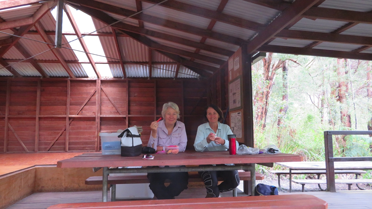
One of the track huts. We stopped at them for lunch or just a snack and a rest, and signed the logbook at each. Note the sleeping platforms!

These camps are set up for the walkers who don’t have the advantage of our fabulous support team and have to camp out overnight. The hut has walls on 2 and a half sides and wide benches along 2 walls to lay a sleeping bag. Also a couple of sturdy timber tables and chairs, a tank of fresh water and a loo.


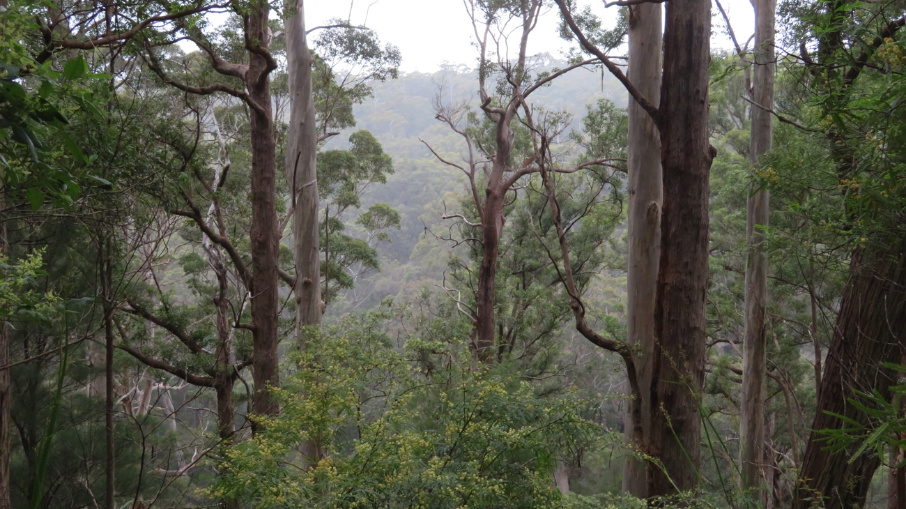
Misty rain heading across the valley, towards us. A nuisance, but quite ethereal.

Not long after we set out from the shelter it started a drizzly, light rain. All good – we’re prepared for everything! We followed the Frankland River, either high above it on the ridge or down in the valley beside it for the next few kilometres before crossing Sappers Bridge.

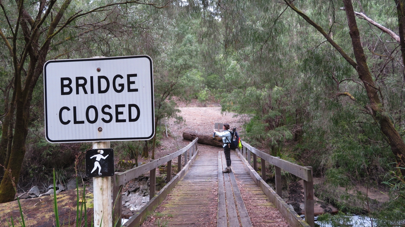
Hmm a bit confusing. OK it’s not closed for walkers, because that’s our trail! Sappers Bridge

In a few areas there were muddy sections of the trail or fallen trees to be negotiated – all part of the journey.

There were some obstacles along the path.

A slow but steady climb through the forest, crossing Boxhall Creek a couple of times on well-constructed small and larger bridges finally brought us through the Valley of the Giants to the Treetop walk.

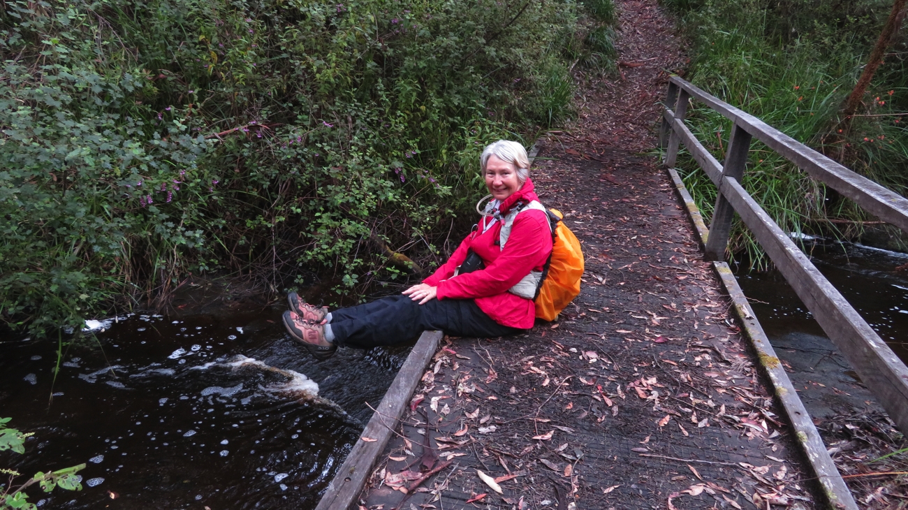
Resting for a bit on one of the several little bridges over Boxall Creek.

Here we rendezvoused with our support team. 22km and 7 hours later (resting for brunch and lunch).
The drive back to Coalmine Beach camping area stunned me with how much distance we’d covered! Showers, dinner and an early night.

Tuesday 24th (Day 3)

A slower start to today as we all wanted to do the Treetop Walk at our starting point and it doesn’t open until 9am. A boardwalk takes you firstly through the ‘Ancient Empire’ which showcases some wonderful trees, no better than we’ve been walking through already, but I guess non-Bibbulmun walkers deserve to see these trees easily too.

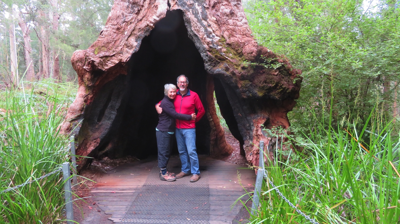
Inside the base of a living Tingle Tree on the Ancient Empires section at the Treetop Walk.

The Treetop walk takes you high up into the canopy – an extraordinary experience and not to be missed.

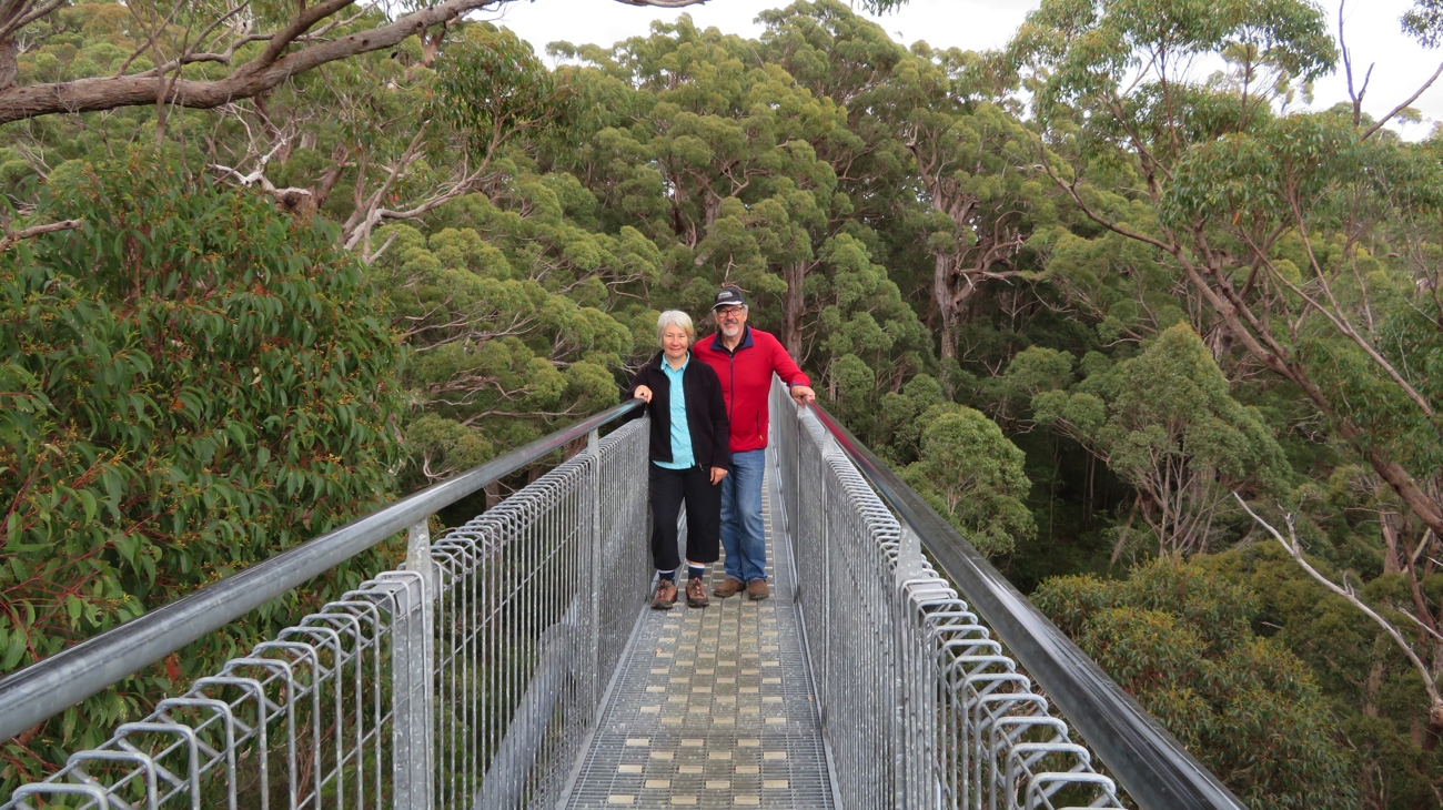
Steve and Denise on the Treetop Walk, in the canopy of the Tingle and Karri trees. A unique experience. I wished I had a lot more time just to watch the birds up here.

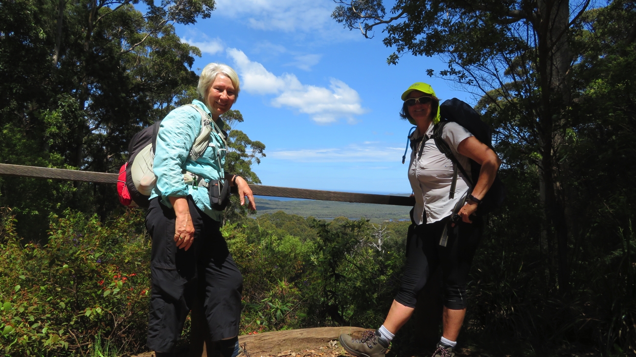
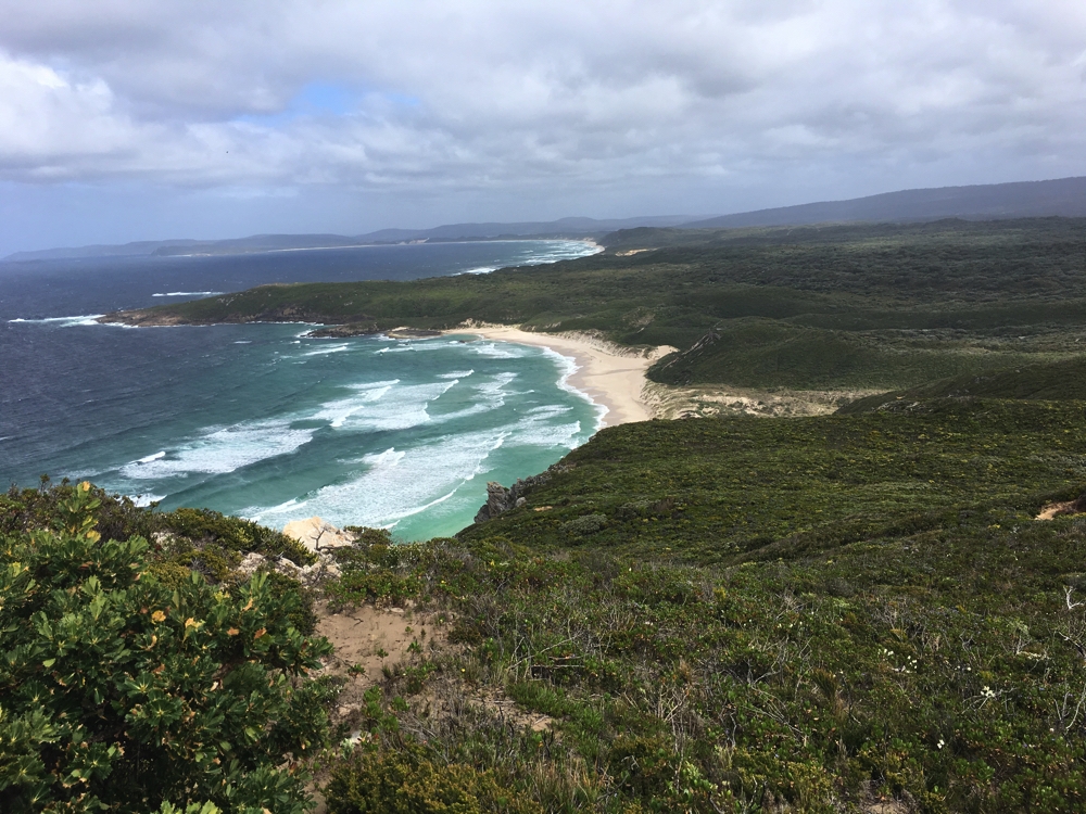
We farewelled the boys and headed back into the forest to stop only about 2 km later at Giants campsite for brunch. The walk continued through forest with a few ups and downs until we reached Nut Lookout. A transition began here, from the tall trees to the rugged coastline.

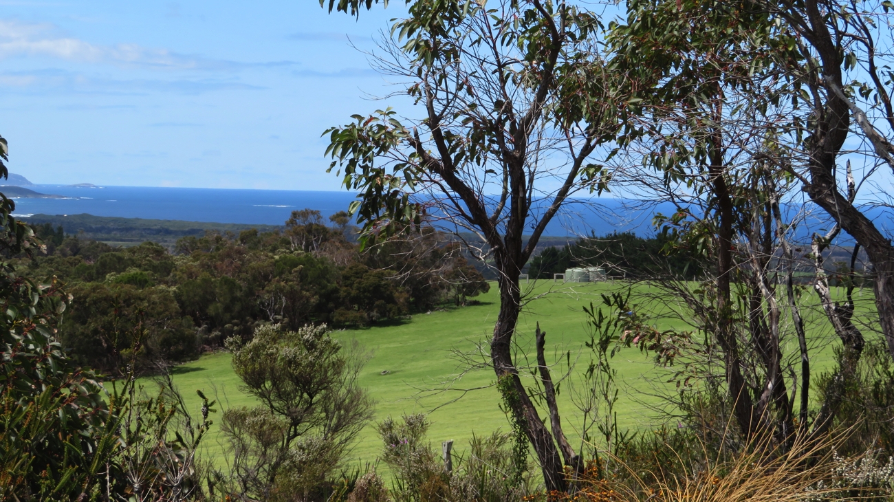
Wow! Across the lush green fields to the ocean. Our walk is changing.

With National Park forest behind us we looked across lush green pastures with black Angus and white sheep grazing to the ocean and beaches in the distance – quite a change of outlook!
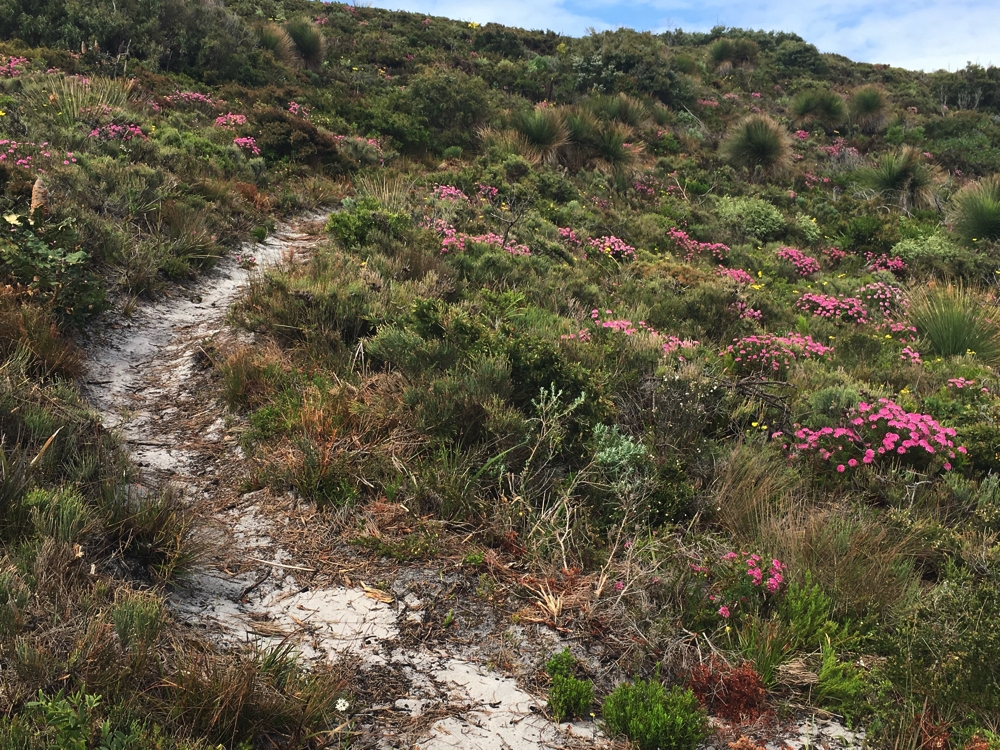
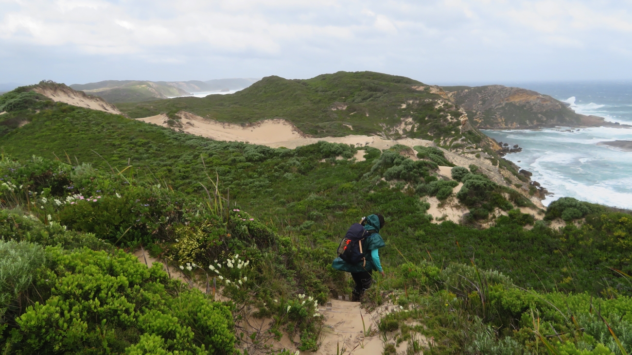
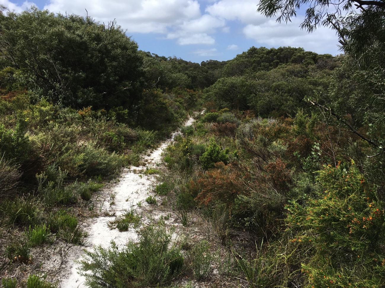
As we progressed, leaving forest behind us, the path became sandy and the foliage changed to sheoaks and banksias. More and more wildflowers began to appear too.

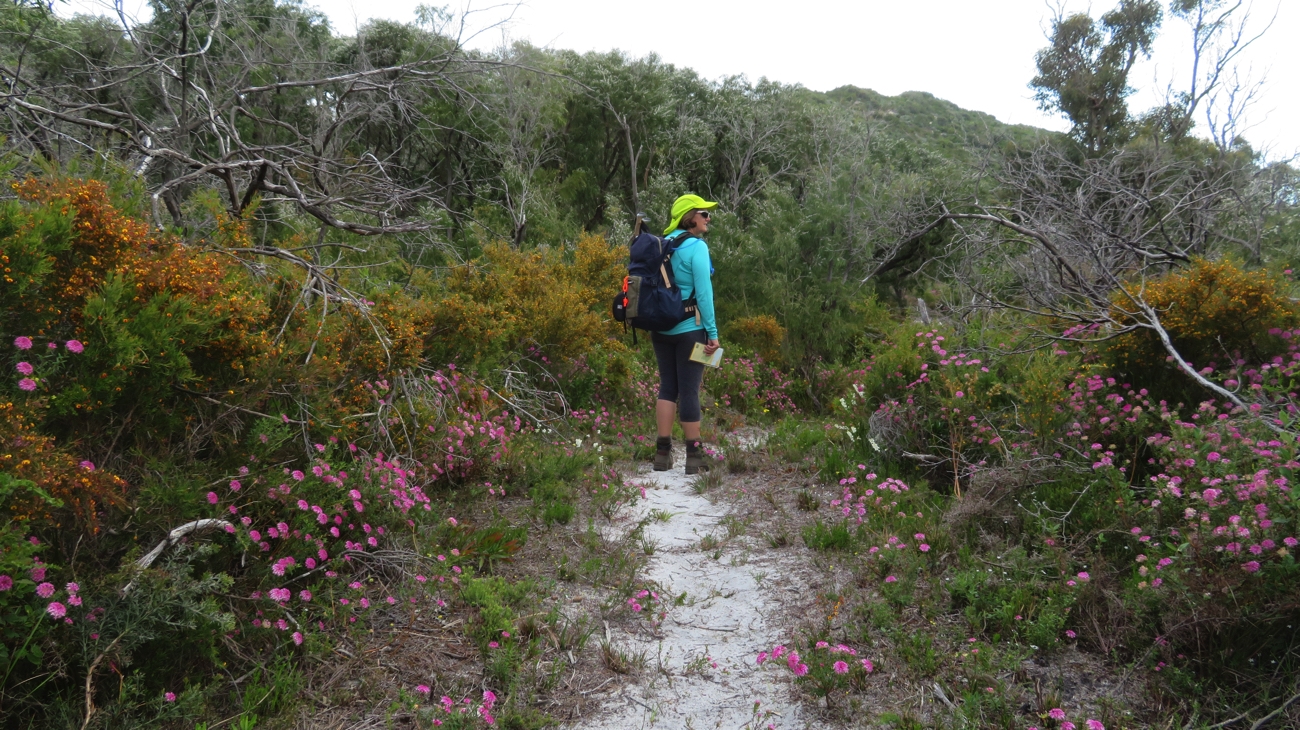
The wildflowers are now prolific. Such a pretty walk with these beautiful bouquets all the way. Trish

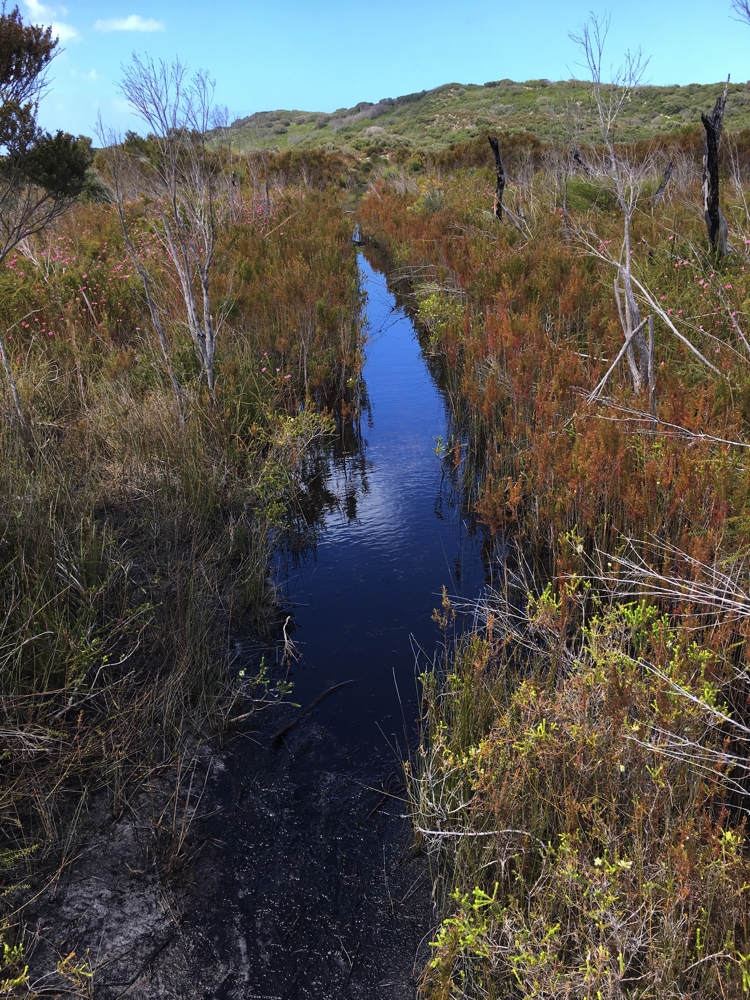
One part of the track traversed some swampland, the path being completely submerged in smelly, stagnant water. With no way around it (we did try!) we balanced as best we could on branches previous walkers had tossed in and hoped for the best. Tricky!

Careful consideration is put into every footstep. Denise

Finally sensing we were nearly there with only a few sandy dunes to climb, and the boys were there to meet us. Another very interesting walk. 16km and 6 hours.

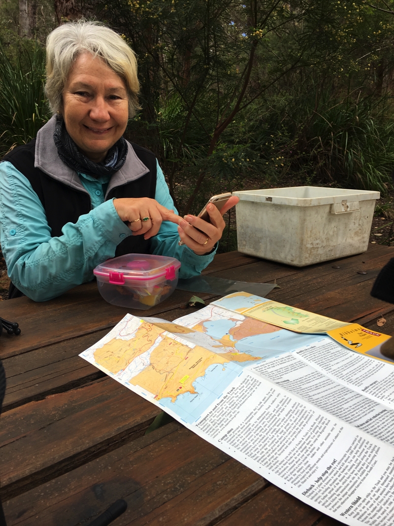
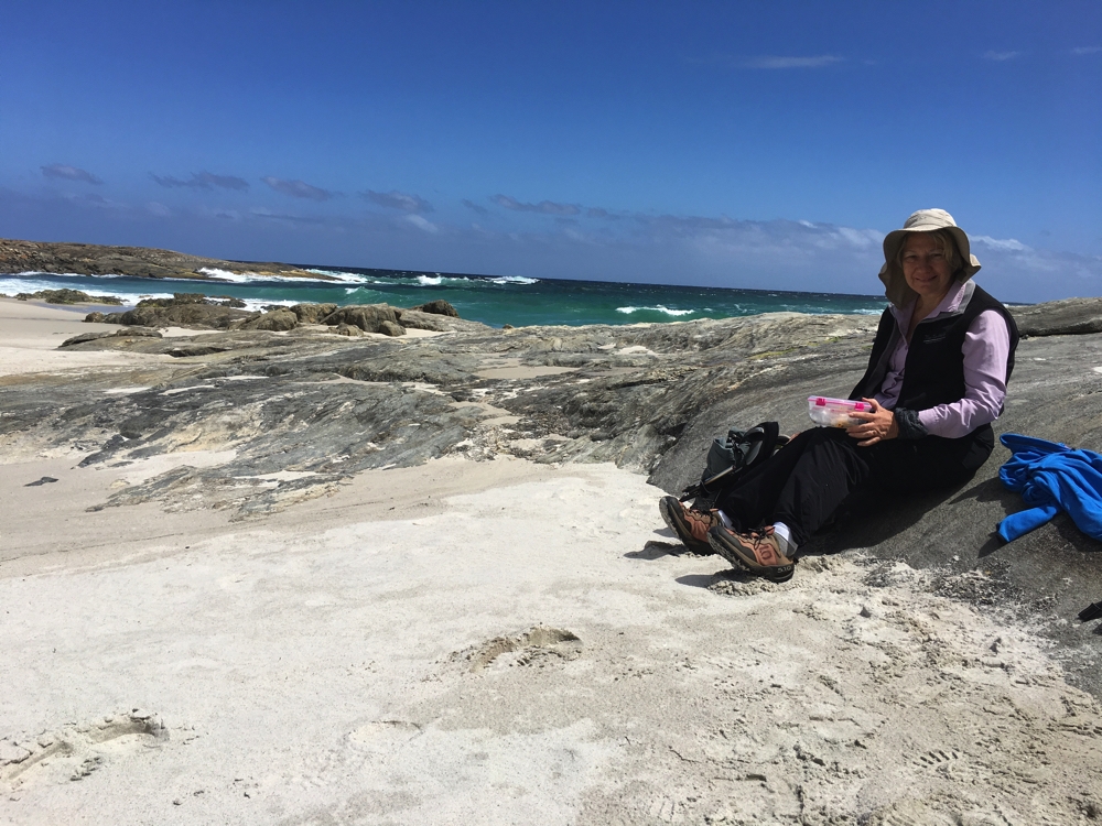
The lunch is to be eaten, but first confirm all is well with the map. The white box you see beside me contains the official Log Book. We signed into these at each of the camping shelters.

Wednesday 25th (Day 4) Conspicuous Beach to Peaceful Bay
In my opinion today’s walk would have to rate up there with the best I’ve ever done. We didn’t start out so well. From the starting point at the car park at Conspicuous Beach we had to walk along the beach for a little way – all good except we couldn’t find the Waugyl symbol indicating where the path left the beach. Fortunately the boys were up at the Lookout watching us and gesticulated wildly when we were to exit.

On Conspicuous Beach. Trish and Denise

From there it was a steep climb up Conspicuous Cliffs where we got amazing views over the bay and rough Southern Ocean. Brunch stop at Rame Head campsite.

Looking back to Conspicuous Beach. We started today’s walk at the far end of the beach.

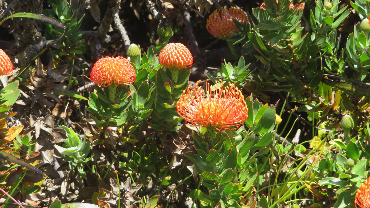
There were lots more ups and downs into and out of gullies. What made it so enjoyable were the wildflowers – masses of pink flowers, banksias, yellow buttons, grass trees, acacias and other yellow flowers, fuchsia pink daisies, blue daisies, native wisteria. You couldn’t have designed a more beautiful garden than the one we had the good fortune to be walking through for many hours.

How could you possibly not love a walk like this?

The trail led us inland for a while. Once more we encountered swampy, stagnant water over the trail and managed to cross it by walking on branches, until we came to one section that was long and deep. We could see where others had skirted around it by the broken undergrowth, so decided to follow one of these off to the left.

Time to find a detour. Though maybe, bearing in mind the outcome of doing just that, walking straight through could have been the better choice.

However when we bush-bashed our way back to intersect the path we couldn’t find it.

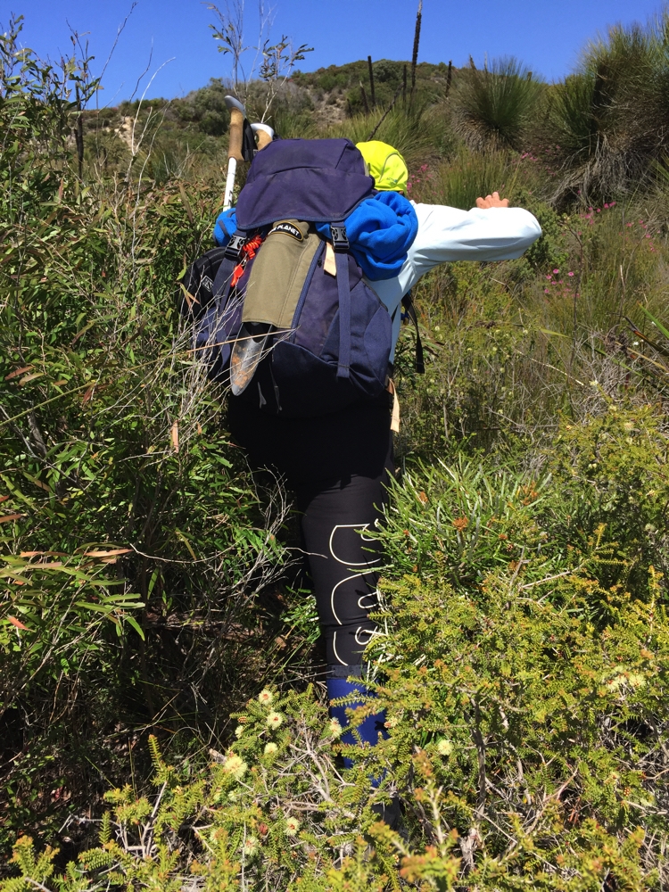
To bypass the water on the track we did a bit of bush-bashing. Trish

Between us and the ocean was a high sand dune and Trish had the good sense to climb it and look for the path. We could see our destination, Peaceful Bay, off to the right straight through the heath – the direction the path had been heading when we left it, except now when we spotted the path it was heading the opposite direction. It had made a turn to the right to follow the coast again after we’d left it!
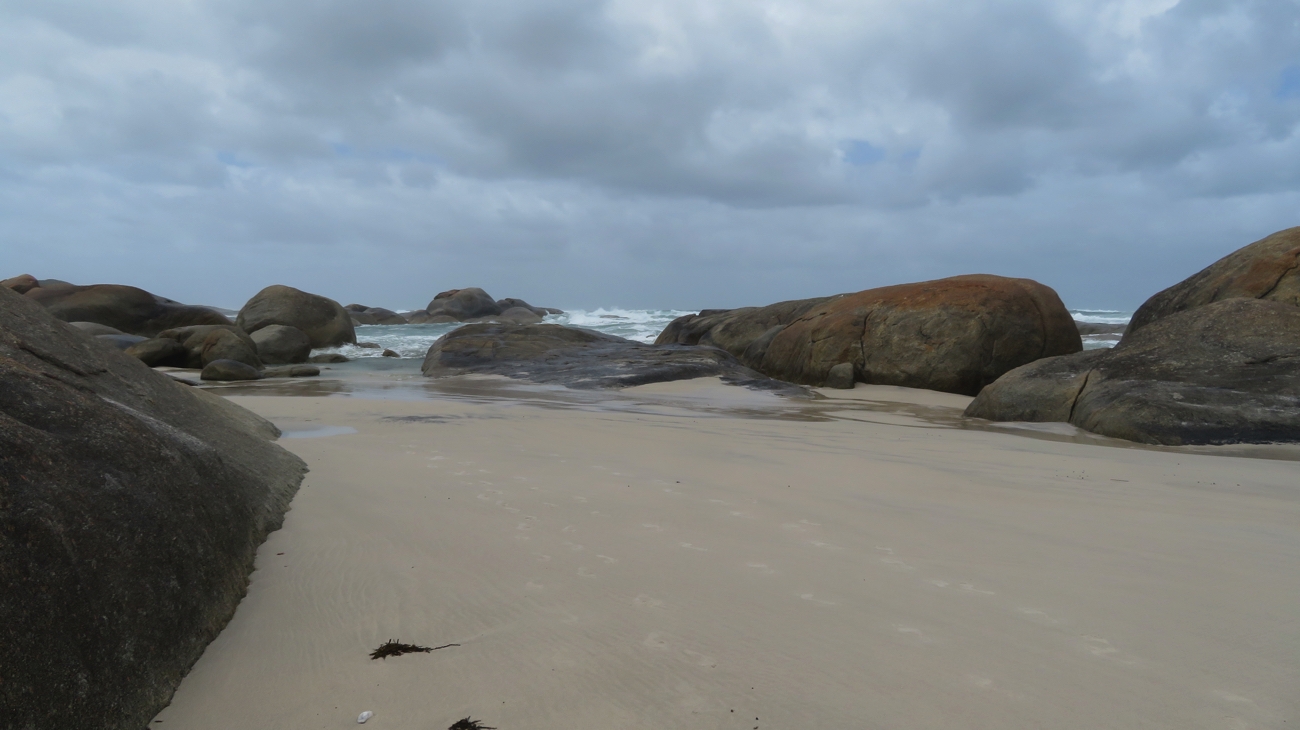
We stopped for lunch at The Gap, a pretty cove where we hunkered down behind some rocks to escape the freshening wind.

Snack time. Sheltering from the wind.

Leaving here we came to more swampland, though over the worst of it were some boardwalks, but some weren’t quite long enough and in other places it was back to trying to cross it without sinking into the mud – I’m never going to leave the path again!

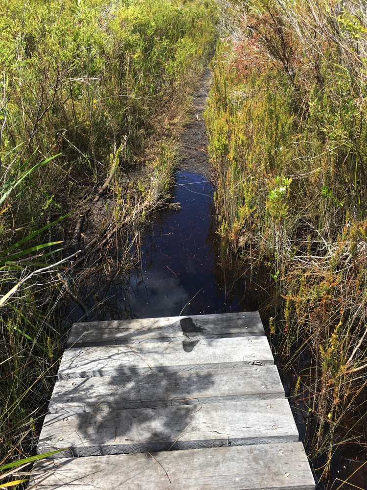
Hmmm. I think the board walk ended a little too soon.

Back to the coast, along the beach for a few hundred metres, up onto headlands where we could watch the ocean battering the coastline, and finally into Peaceful Bay.

A cove with the Southern Ocean making its presence felt.

Here the boys treated us to an ice block and fish and chips before heading to our new campsite at Ayr Sailean, directly north of Denmark.

Thursday, Friday 26th, 27th
The weather forecast today and tomorrow is not a good one for walkers – strong winds, rain and hail. A couple of rest days were in order!
Ayr Sailean, our campsite, is on a sheep farm. There are a lot of level, thickly-grassed, powered sites bordered with trees. The facilities are tops – free washing machines, free, fast wifi (there’s a Telstra on the property), hot showers with good pressure, rainwater for drinking and a very well-appointed, fully enclosed camp kitchen. And all this for only $23 per night! That’s pretty amazing.
The weather forecast became fact. As the wind howled and the rain pelted down we thought compassionately of those Bibbulmun walkers who were out there doing it today!

Saturday 28th (Day 5) Peaceful Bay to Boat Harbour 
The forecast still wasn’t brilliant but we decided we’d walk anyway. With more likelihood of rain later in the day we left early, 7am from the campsite. Today’s walk has been described by previous Bibbulmun walkers as the toughest day of the whole 1000 km.

That’s us!

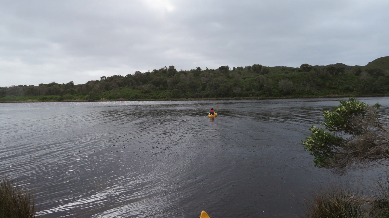
About 5km into today’s walk we crossed Irwin Inlet by kayak.

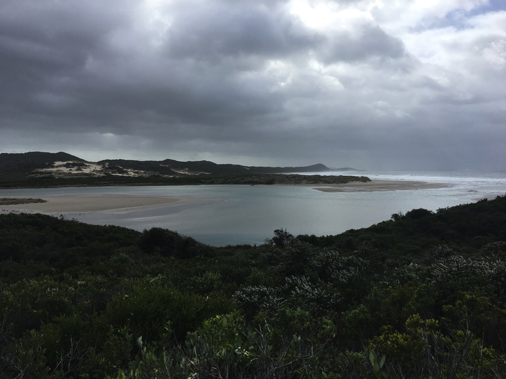
Irwin Inlet. We’re to cross it in canoes. With the sky looking very ominous today could be interesting walking.

It’s a gap of about 50 metres, with kayaks and life jackets provided on both sides of the inlet – one person plus one backpack per kayak, and leave at least one kayak on the side you’re leaving.

There goes Trish!


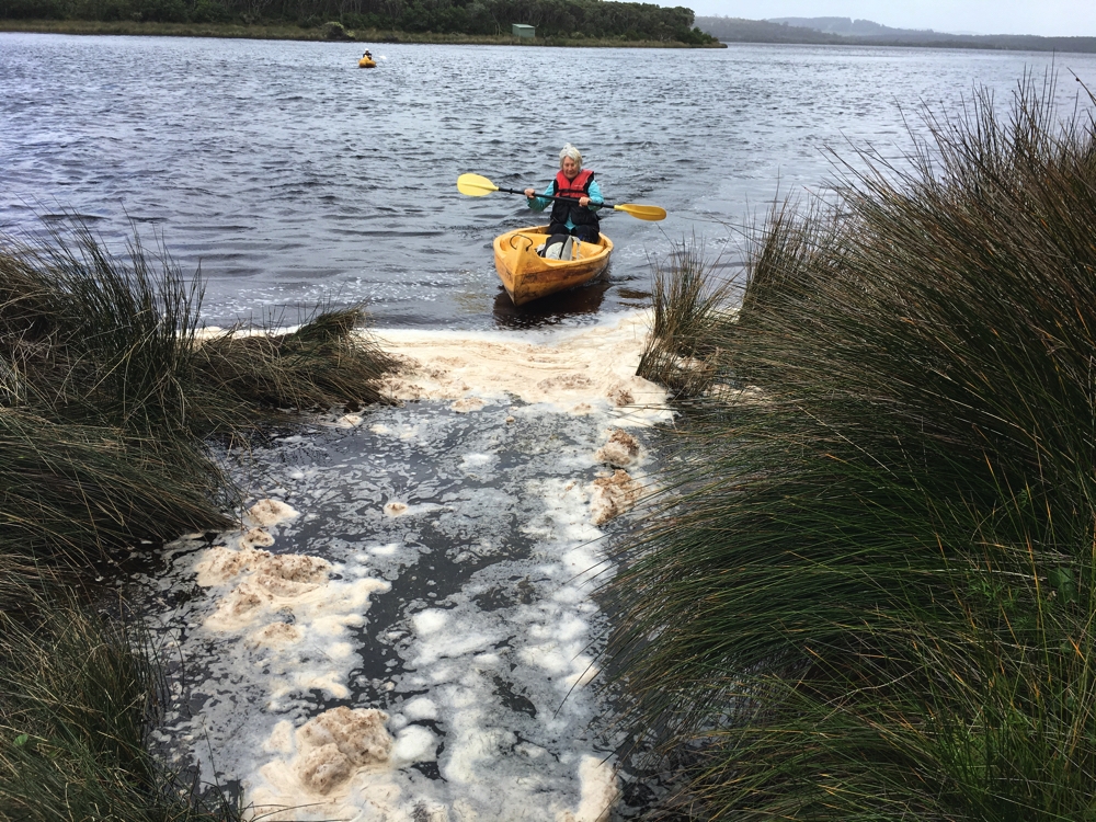
Denise coming in to the landing having successfully negotiated Irwin Inlet.

Steve and Bryan decided they’d accompany us to this point to see us safely across and very generously towed our kayaks back across the inlet after our journeys.

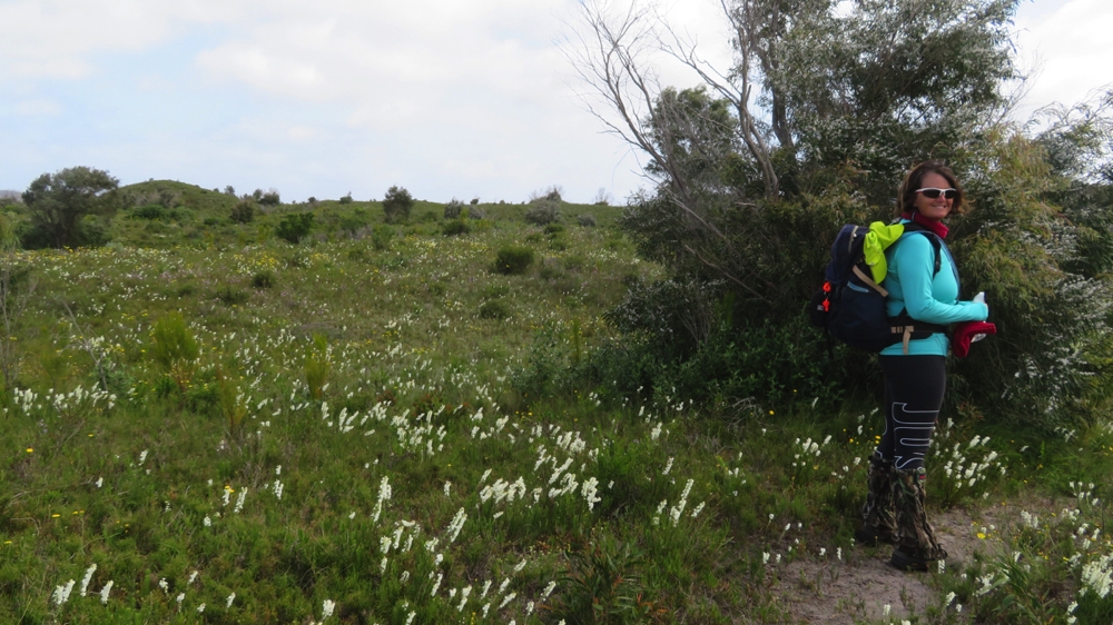
Trish, amongst the flowers.

Farewelling the boys we headed off to climb and descend countless vegetated sand dunes. This was pretty tough going, but still a lovely walk with such great views that it was hard to complain. In one of the valleys was a mob of kangaroos numbering about 16, with some very big Roos amongst them.
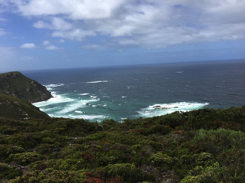
There was a gale force wind warning for the coast along which we were walking – the Southern Ocean was stunning in its ferociousness, though many times when we were on an exposed section the wind blew us sideways.

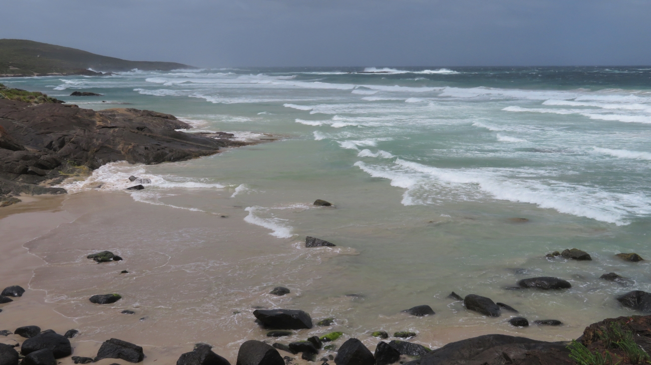
Ocean views – the waves were crashing way out.

The track moved down onto the beach for several kilometres a couple of times. With an incoming tide, strong winds from behind us and sand blasting us from behind it made for exciting walking.

Getting sand-blasted from behind! Very grateful we weren’t walking the other direction.

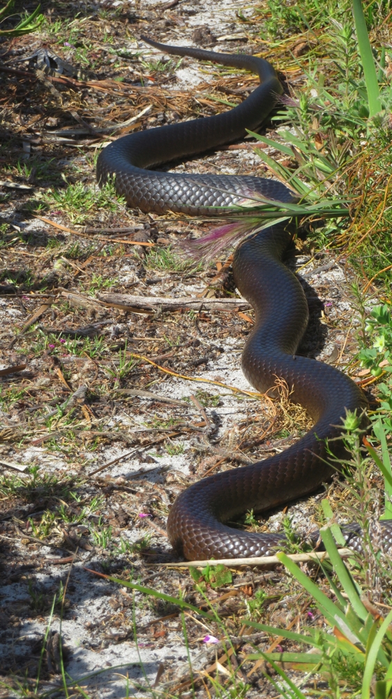
Further excitement came from seeing a couple of brown snakes, dugites I’m told – The boys said they also saw 3 on their way back to the vehicle after dropping us off.

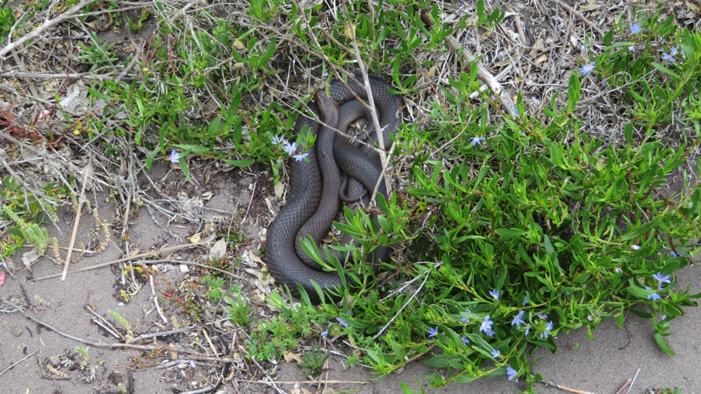
They grow them big out here – and deadly. This one, right beside the path, we left well alone and snuck past, quickly!

All in all though, despite the gale force wind and a light patter of rain, it was another truly beautiful walk. 18km

The track wound up and down numerous sand dunes.

The boys met us at the Bibbulmun Boat Harbour campsite but only after they’d driven 10km in on very soft, sandy roads with several long fairly deep water crossings. An epic trip! Thanks guys, particularly Bryan who was the driver and had to do it all again on the way out.

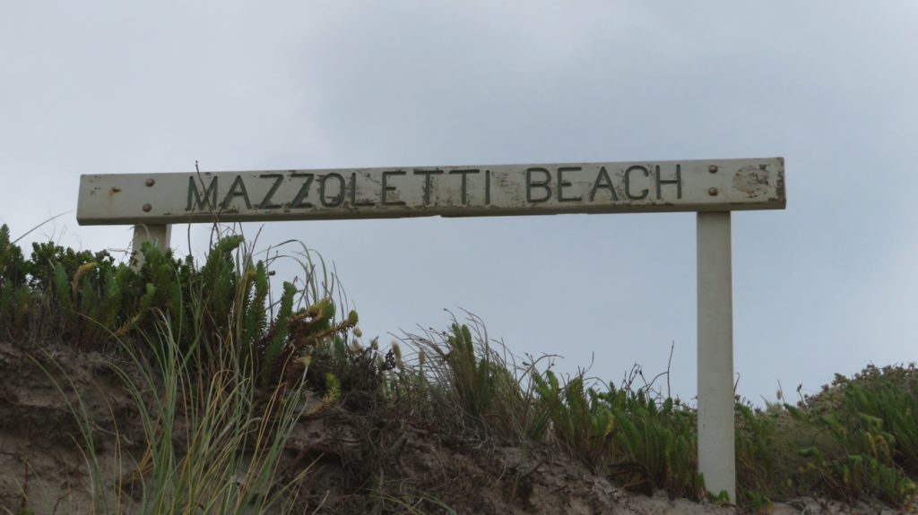
Sunday 29th (Day 6) Parry Beach Rd to Lights Beach Rd
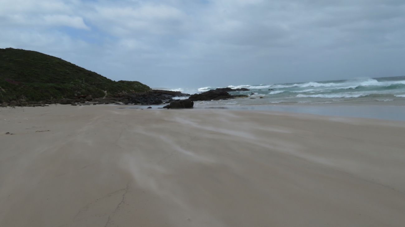
Because of the shocking road into our pickup point yesterday we opted for a different starting point today – Parry’s Beach Campground. This is the beginning of Mazzoletti Beach, which is sometimes closed due to erosion and high tides, however it’s open today. Before we’d even walked 50 metres a wave came the full width of the beach making us scurry up the foredunes.

Not a beach either of us will forget in a hurry!

Anyway off we went, the first challenge being Parry Inlet where off came the shoes, socks and gaiters and rolled our pants up, and still got them wet when a wave came in halfway across!

Trish, with gaiters and boots slung around her neck, about to cross the inlet. Look at those threatening clouds!

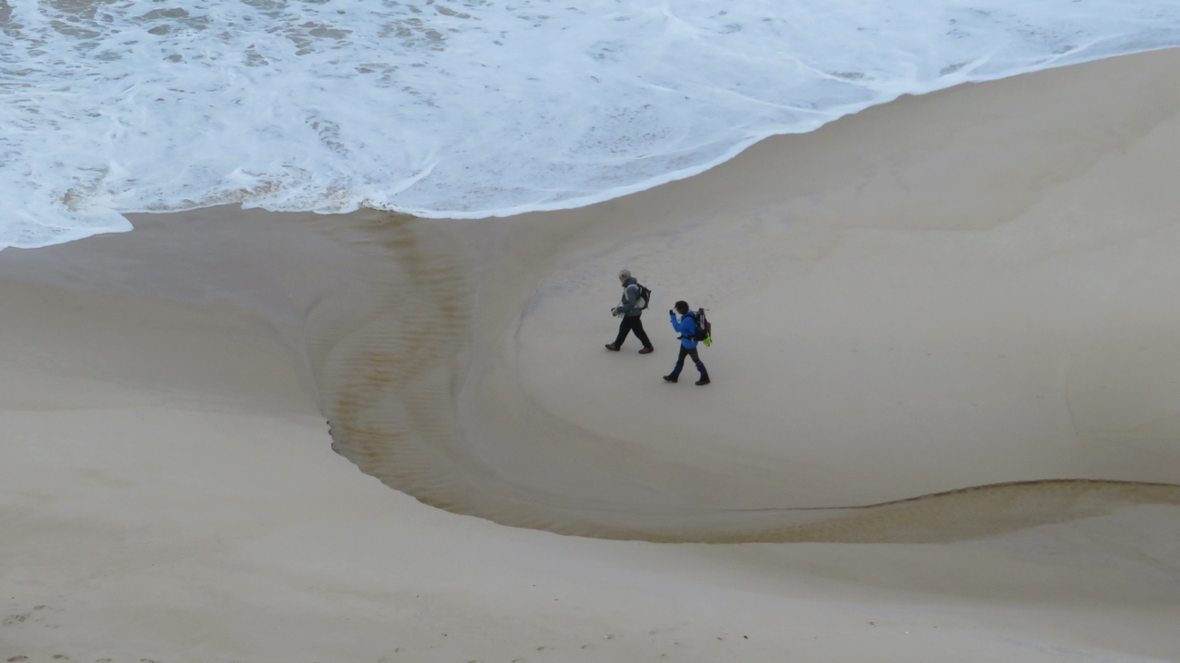
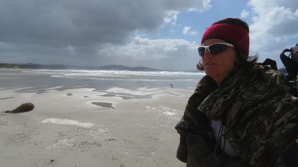
We walked the length of the beach, 8km, bare foot and keeping a close eye out for rogue waves of which there were a few! The sand for the majority of the way was quite soft. My calves are going to be aching tomorrow! I know I’ve been all grumbles but it wasn’t all bad – it’s a beautiful beach and the ocean is still quite magnificent in its ferocity and the wind wasn’t nearly as strong as yesterday. And we enjoyed seeing the seabirds – seagulls, the larger Pacific gulls, black oystercatchers and a petrel, and even some black cockatoos.

Walking on the hard sand as often as we could, while watching out for rogue waves to catch us.

At the end of the beach, being misled by the waugal pointing strait ahead, we ended up at Greens Pool. Beautiful, but not impressed we’d walked further than we needed, we returned, climbed a wooden ladder to get off the beach and ate our brunch looking over the ocean and huge granite rocks.

These rocks are just around the corner from where we were supposed to exit Mazzoletti Beach.

From here the walk took us ever upward to a lookout over Elephant Rocks and Greens Pool, a popular, protected swimming area during summer, but no one there today! Tower Hill was then conquered giving us a wonderful view back over William Bay, the full length of Mazzoletti Beach to Parrys Campground where we’d started. Once again we’re walking through beautiful wildflowers, and again I’m seeing flowers I haven’t seen before.

Soft sand paths are easy walking – only when they’re not on a beach!

The track brought us back to the coast again at Lights Beach, with a very short beach walk, thank goodness, then up to the headland for a kilometre or two where once again the ocean and rugged coastline views were spectacular.

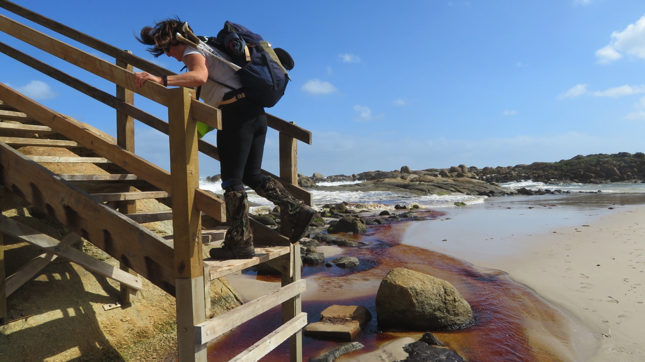
Exiting Lights Beach. Lucky it was low tide – getting to that bottom step could be fun when the tide is in.

With only 5 km to go to our pickup point we were powering along until ‘Twinkletoes Trish’ did her little dance backwards which she is beginning to perfect – another snake on the track. This one though was warm and happy and didn’t want to leave the path. We had no option to skirt it so spent some 15 minutes encouraging it to move on before it finally, languidly, slithered off into the undergrowth.

Not a fellow we wished to argue with. He wasn’t really too happy to let us pass.

Only one more snake seen before we reached our pickup point. A total of 18km today.

Monday 30th (Day 7): Lights Beach Road to Denmark Trailhead
Today’s walk started with an ascent – a really decent ascent!

We started today with a ‘difficult walk’ up Mt Hallowell.

Mt Hallowell rises to about 1000ft along a rocky path winding between tall Karri trees and huge granite boulders, Monkey Rock being one of them on the southern face. A lookout here gives 270 degree views over Denmark and William Bay.

Trish at the summit of Mt Hallowell.

Further up, at the summit which is a broad, nearly flat granite rock, the views were all around and well worth the difficult walk and several detours we made looking for the trail markers.

These signs weren’t nearly frequent enough up here. We took a wrong turn a couple of times.

The trail down, surrounded by Karri trees, soon changed to leaf-covered dirt, so much easier under foot.
It wasn’t too long before we were back walking towards the coast, housing beginning to appear around us. Back in these lowland areas the wildflowers were appearing again.

Yet another wildflower we hadn’t seen before.

The track used some sealed roads in suburbia for a little way, the gardens of these homes just beautiful. Along the coast we walked in either wooded areas or right on the foreshore of Wilson Inlet with the mowed lawns and manicured gardens of beautiful homes stretching down to include our trail.
We crossed Little River on a delightful wooden footbridge, taking our time to admire the pretty river and do some bird watching.

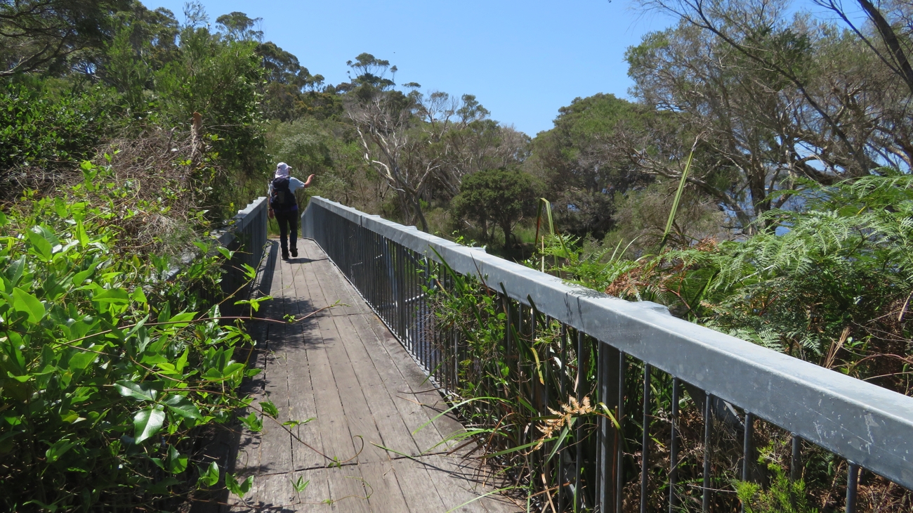
Boardwalks make for easy walking. Approaching Denmark.

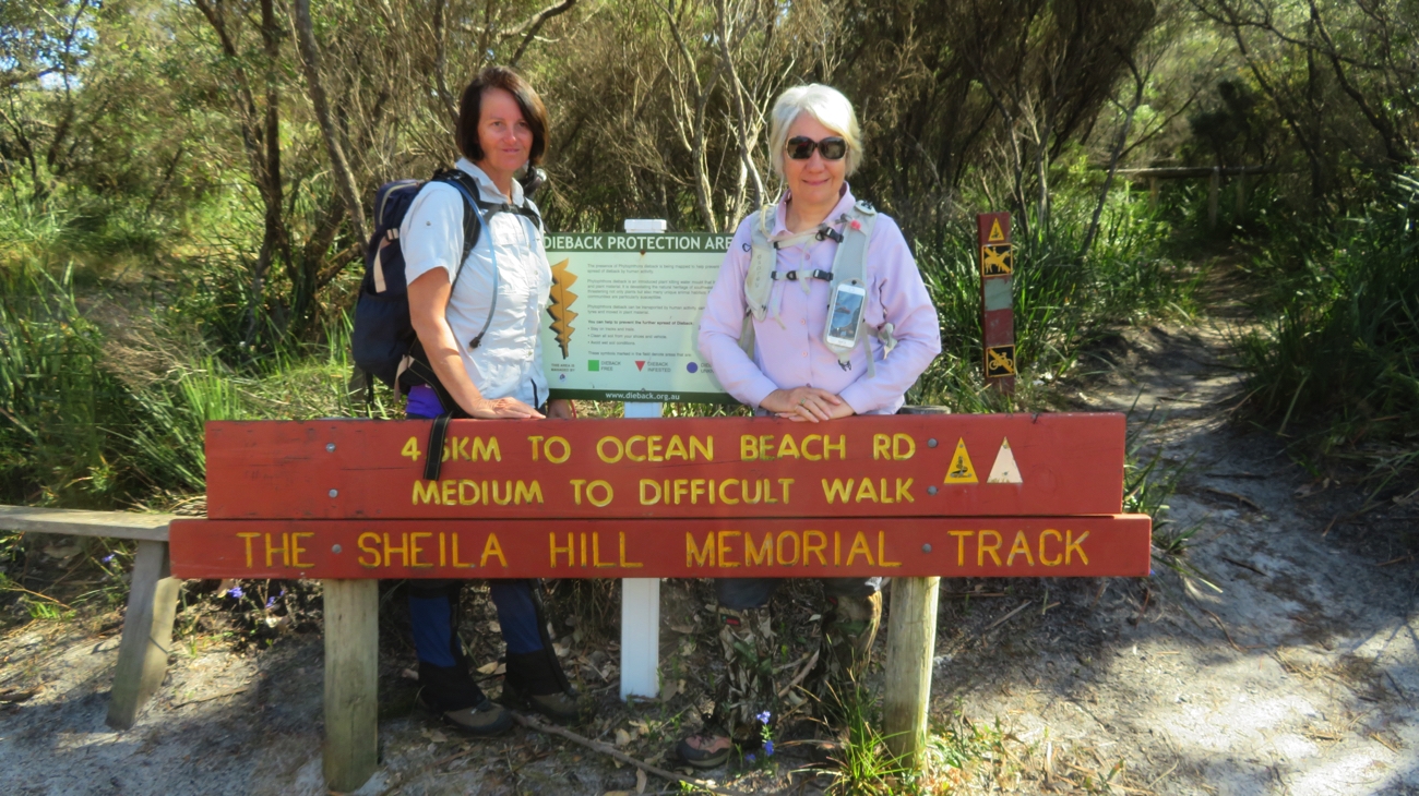
The final stretch into Denmark was along a sandy, muddy, big puddles in places road – not so great. But it was great to see the boys at the end of it welcoming us to the trailhead in Denmark. Just a couple of hundred metres to the caravan park where we’re camped. Not a long walk today – only 12.5km.

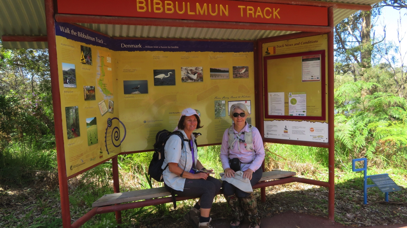
Yay – we’ve arrived at the Denmark Trailhead. Part One of our walk done!

For all our photos from this section of our walk CLICK HERE.


26 Oct-3 Nov: Cid, Waite, Chance, Cid

Monday 26th October: Airlie to Cid Harbour

Borrowed the marina courtesy car again to take the tender to repairers this morning. We’ll pick it up on our return in a week or so. In the meantime we can use the kayak to get to shore.

Left Abell Point marina at 1030 our destination Cid Harbour via North Molle Island. A very light easterly wind saw us motoring until we passed the Molle group, then motor sailing most of the way to Cid to counter the very strong north flooding tide. Bad planning – we shouldn’t have left until the tide was turning!

Enjoyed a lovely couple of hours this evening sitting in the cockpit listening to Dean Martin’s beautiful voice floating over the water from a neighbouring yacht.

Some of the islands are exactly the same today as when Captain Cook first saw them, and this could be him now.

Thanks to our wonderful National Parks some of the islands are exactly the same today as when Captain Cook first saw them, and this could be him now.

Tuesday

Cid Harbour to Waite Bay, Hazelwood Island

Phew! Today was a big day.

The several narrow passages between islands around the Whitsundays are notorious for striking fear into the mariner who would dare to traverse them with a contrary tide and wind. Fitzalan Pass on the northern side of Hamilton is one such passage.  We left our anchorage at 7am anticipating a two hour sail to reach the pass at slack tide.
If we’ve learnt nothing else sailing it’s that plans rarely work out as anticipated. No wind this morning but we caught the tidal stream of the flooding tide. With the outboard barely above idle we flew down Hunt Passage and around the corner towards the pass at up to 7kn at times, arriving an hour earlier than planned. Fortunately the pass was mellow as what little wind there was was going with the tide.

Fitzalan Pass. One of the many narrow passages that has a bad reputation. Luckily it was well-behaved today.

Fitzalan Pass. One of the many narrow passages that has a bad reputation. Low rocky outcrops extend for quite a distance from the little island. That’s Hamilton on the right.

We variously motored, sailed and motor-sailed on to Hazelwood Island where we initially anchored for lunch near Lupton Island. This anchorage is deep and surrounded by coral. The trip into the beach without a tender would be a long way and I didn’t want to swim from the boat in such deep water. We upanchored, very unhappily bringing up a piece of staghorn coral the anchor had broken off and moved across Waite Bay to anchor on Hazelwood Island  in a couple of metres of crystal clear water over lovely white sand. Happy now.

Hmmm – ideal opportunity to clean the hull! As the tide dropped we were able to walk around Top Shelf scrubbing off the baby barnacles, slimy growth and even feathery pretty growth. Steve swam under the boat scrubbing the very underneath. It was hard work here for a couple of hours.  We were shocked at how much growth was on her. We won’t leave her that long again. We should fair fly through the water now with all that growth gone.

It’s a full moon tonight. We’re the only ones in Waite Bay – I’m sure this is heaven.

Once more we get to see a full moon rising on this trip - our 3rd so far. This time it's over Lupton Island and we're anchored in Waite Bay on Hazelwood Island. No one else here; an idyllic tropical experience.

Once more we get to see a full moon rising on this trip – our 3rd so far. This time it’s over Lupton Island and we’re anchored in Waite Bay on Hazelwood Island. No one else here; an idyllic tropical experience.


Wednesday – Thursday

We had a lovely gentle sail over to Chance Bay on the southern side of Whitsunday Island. After the last few days of predominantly motoring it was good to be able to enjoy the peace of sailing.

Chance Bay is a pretty bay with two lovely white sandy beaches bordered with low growing trees, pandanus palms and crinum lilies which are flowering now. The fringing reef made anchoring challenging until another yacht in the perfect spot left – we quickly took their place.

Steve pumped up the kayak, we paddled ashore and walked another leg of the Ngaro Sea Trail. This 8.5km return walk took us up over the hill, through eucalypts, acacias, large bloodwood trees and grass trees to Whitehaven Beach.

From the lookout on our walk. At the bottom of the cliff is Whitehaven Beach. In the distance is Chalkies Beach on Hazelwood Island.

From the lookout on our walk. At the bottom of the cliff is Whitehaven Beach. In the distance is Chalkies Beach on Hazelwood Island.

We enjoyed a well-deserved swim and chill on the beach watching the comings and goings of the day-tripper yachts, giant catamarans, super-powered rubber ducks, sea planes and huge private motor launches before making our way back to our quiet beach.

These guys give a whole new perspective to Street Food. On Whitehaven Beach.

These guys give a whole new perspective to Street Food. On Whitehaven Beach.

Back at Chance Bay we snorkelled for a while, but other than rocks covered with giant oysters and a few schools of fish, we didn’t see much. It’s supposed to be good snorkelling on the other side of our bay – next time.

Friday

Another perfect day of sailing today. Easterlies at 5 -15kn took us firstly over to Torres Herald Beach in Turtle Bay. We snuck in over the rocks to shore, not quite drying out, lunched and relaxed for a couple of hours. I got a meal prepared for tonight and put it into the DreamPot to cook. This beach is only small but could be the poster beach for any idyllic tropical beach you care to dream about.

Torres Herald Beach in Turtle Bay. This was a delightful luncheon spot for us. We arrived on a rising tide and were able to take Top Shelf right in to shore.

Torres Herald Beach in Turtle Bay. This was a delightful luncheon spot for us. We arrived on a rising tide and were able to take Top Shelf right in to shore.

With strong winds forecast for the weekend we sailed on back to Cid Harbour – again a great sail just sitting back watching the deep turquoise waters of the islands as they disappeared behind us.
We anchored close in to shore just to the south of Sawmill Beach and enjoyed our perfectly cooked silverside and vegies.

Saturday: Cid Harbour

Rained on and off all day today, accompanied by strong gusty wind. We watched movies and read our books.

Sunday: Cid Harbour

Today we climbed Whitsunday Peak. This is one of the highest peaks in the Whitsundays at 450-ish meters and quite challenging. Commencing at Sawmill Beach we followed the dry creek bed initially. It would be spectacular to be here to see it flowing – particularly the waterfalls over some of the huge boulders. The island is heavily wooded with hoop pines and eucalypts which kept us shaded and cool. Leaving the creek the ascent is steep with many zigzags and countless stone steps. A few pauses were needed along the way.

The views from the top were spectacular! We spent about an hour at the top just absorbing the beauty of this magical part of the world. How lucky are we!! It was fun to see places we’d anchored and plan where we’d go next. From up there it looked reasonably close belying the hours of sailing it takes to reach each destination.

The view north from Whitsunday Peak. Cid Island on the left, Cid Harbour the protected area between the island and the headland jutting out from the right.

The view north from Whitsunday Peak. Cid Island on the left, Cid Harbour the protected area between the island and the headland jutting out from the right.

Once back at sea level we washed the sweat off with a swim – don’t know the logic behind that, but it felt good, and paddled the kayak back to Top Shelf.

Monday: Cid Harbour

Today was kayaking day. The inlet looked so enticing from our sky-high view yesterday that we decided to explore it in the kayak. It was a good paddle following the coastline around. In the photograph you’ll see a tiny island in the middle. It has a lovely sandy beach, rocky headland covered in oysters, all sorts of plants, including orchids, and as it doesn’t appear to be named we’ve claimed it for ourselves. Back to the boat another swim and relax after an enjoyable couple of hours paddling.

Dugong Inlet from Whitsunday Peak. Sawmill Beach to the bottom left.

Dugong Inlet from Whitsunday Peak. Sawmill Beach to the bottom left. Top Shelf is anchored just out of the picture on the left.

Tuesday: Cid Harbour to Airlie Beach

Back to Airlie today to reprovision and pick up our tender. This time we planned the trip to perfection and had a lovely sail, despite the winds being south-westerly when the forecast was for north-easterlies. We’re nothing if not adaptable.

Got a big fright coming into the marina. Our allocated berth was amongst the catamarans. As we were about to  turn the corner into the narrow finger to our spot a catamaran was coming out taking up the whole ‘road’. Steve handled it very well with a little forward and backwards, but needed a good stiff drink once we’d tied up.

Another rather impressive boat in the marina at the moment is Hemisphere, the largest sailing catamaran in the world. It’s doing charters up here for the rich and famous. At $360,000 a week we’re trying to get a group together for a trip – we’ll need around 3,600 friends I think – pity it only sleeps 10.

This is the largest catamaran in the world. To get a perspective of how big it is Denise is standing on the pontoon beside it.

This is the largest catamaran in the world. To get a perspective of how big it is Denise is standing on the pontoon beside it.


Hemisphere leaves Airlie. For an indication of size, see the catamaran behind her - that's an average-sized cruising catamaran.

Hemisphere leaves Airlie. For an indication of size, see the catamaran behind her – that’s an average-sized cruising catamaran.

For more photos from this week in our travels. CLICK HERE