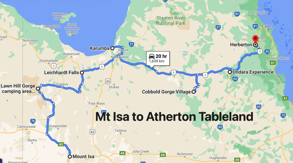
Gorges and Tubes and the Gulf

13th – 27th April

For many, many years people have raved to us about how wonderful Lawn Hill Gorge is (Boodjamulla National Park), and finally, finally we’re going to see it for ourselves. From Mt Isa we headed north on the Camooweal Rd, another really bad road, to Miyumba camp, the southern-most camp in the National Park. The road was rocky, and when not rocky, it was corrugations, plus a few water crossings thrown in for good measure. We drove ‘according to conditions’ and arrived intact.
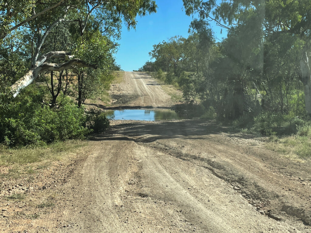
Poor condition of road on the way north to Riversleigh

The final water crossing, just 100m short of our camp was over the Gregory River. It was flowing quite swiftly, about shin deep – no drama for Priscilla. Once camped (only ones there) we walked back to the river and had a lovely, cool, spa bath right there beside the road. 
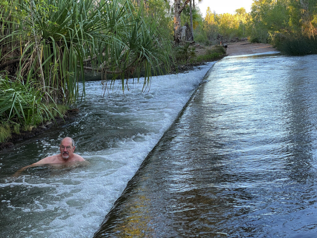
Having a ‘spa’ on the side of the road in the swiftly flowing Gregory River

The night was magic – no lights, no moon and millions of stars from horizon to horizon. These are the nights we especially love. 

14th – 17th April Boodjamulla NP
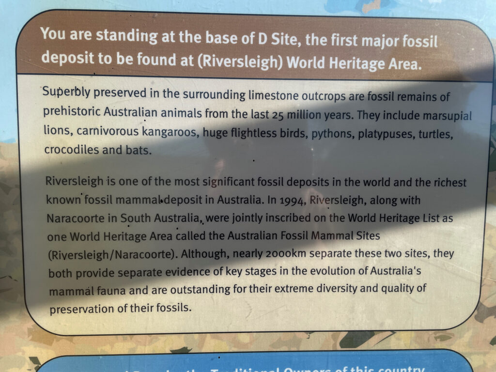
Riversleigh World Heritage Area

Next morning, continuing north, we stopped at the Riversleigh World Heritage site renown as a dinosaur fossil site. It’s very well presented and interesting with large  fossils evident in the rocks along an 800m path. 
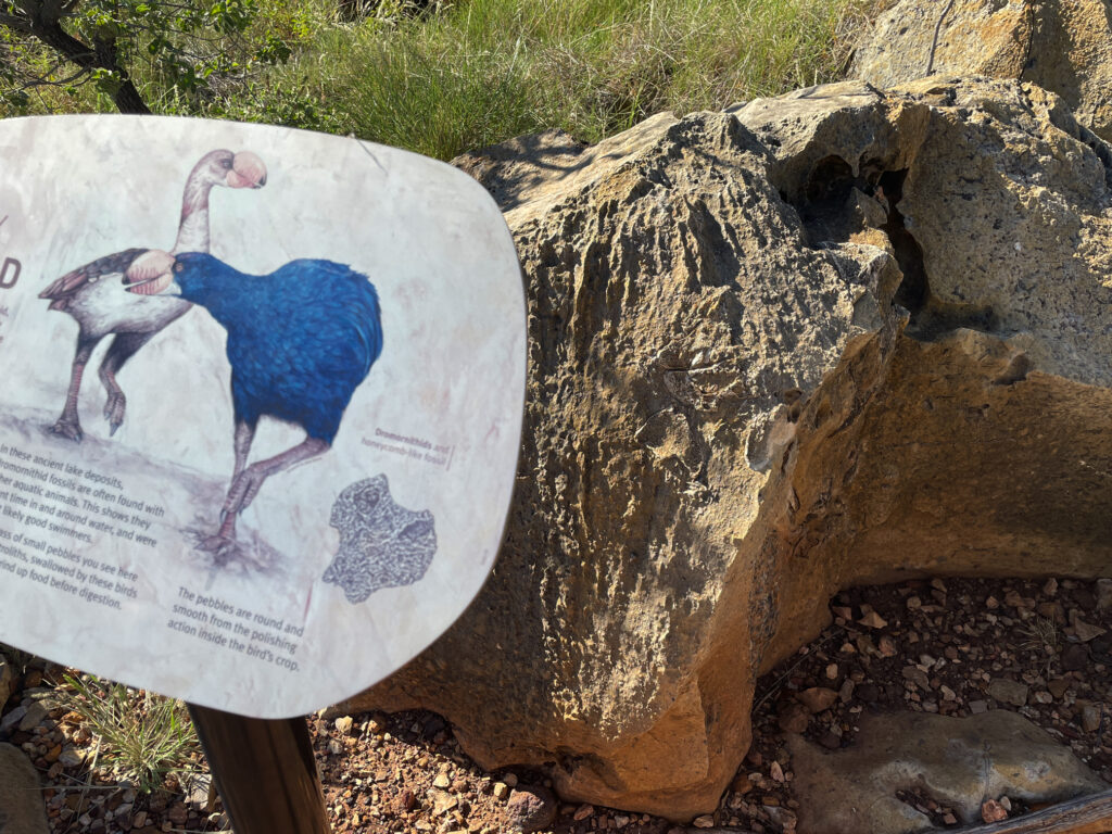
The signage and displays at Riversleigh were very good.

The gorge part of Boodjamulla is 55km north. A large commercial campsite at Adels Grove, just outside the NP, provides accommodation for the on-road vehicles and caravans and those who didn’t book early enough to get into the NP. The National Park campsite is 10 km down the road at the Gorge. The road was improved significantly.

Over the next 4 days we did a twilight walk up to Duwadarri Lookout completing the circuit via Indarri Falls, a walk to the Cascades, then back to walk to the Upper Gorge. These walks were lovely in places, stunning in others and difficult in parts, but well worthwhile. Another day we took the kayak up the river, marvelling at the stunning cliffs through which we paddled.

At Indarri Falls we ‘portered’ the kayak along the path to bypass it, then continued right up to the Upper Gorge where we found a fabulous landing spot at rapids where we stopped for lunch, a swim and a massage under the rapids. We were lucky to have the place to ourselves for more than an hour. On our last day we kayaked up to Indarri Falls then spent quite a few hours there, swimming, getting massaged by the falls, chatting to other kayakers, relaxing and staying cool.
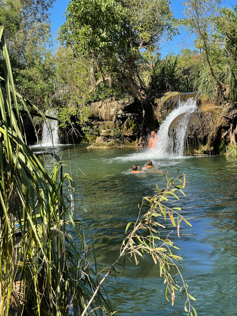
Indarri Falls. Boodjamulla NP

We both enjoyed Boodjamulla, and while a longer stay wasn’t necessary, I wouldn’t mind coming back another time. The only thing that spoilt our visit was the weather – it’s very hot, 35/36° for the first 3 days, cool breeze on the last. 

19th – 22nd April

We saw the Gulf of Carpentaria from the west in our Arnhem Land trip in 2019 and now, heading to Karumba I’m planning to get my feet wet in the eastern Gulf. But first the drive from Boodjamulla was pleasant on good unsealed roads, just a few small washouts and corrugations as we traversed the grass lands stopping for a coffee and a highly-touted muffin at Murray’s Place in Gregory. From here we headed north (on sealed roads) to Burke for a look around town, sitting in a park having lunch at the same time the ABC News that night informed us it was the hottest town in Queensland! Back south again to stay the night at Leichhardt Falls. 
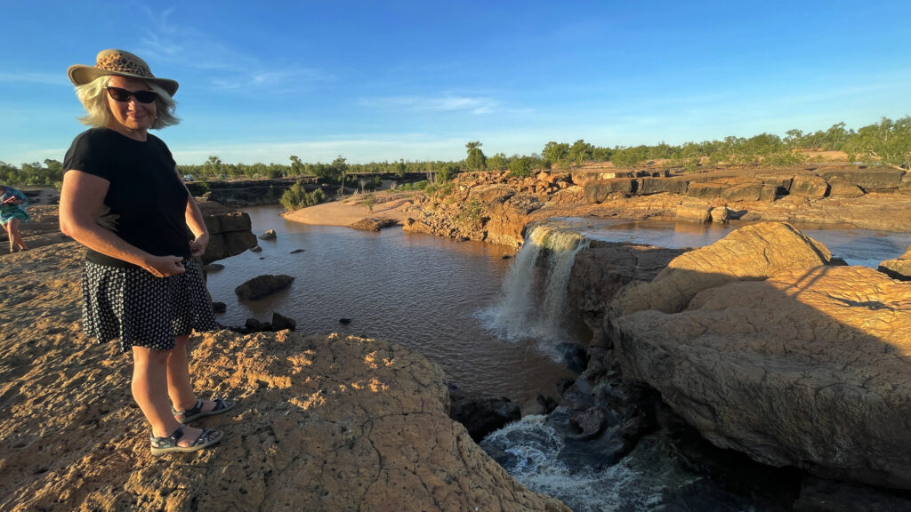
Leichhardt R falls – free camp

Leichhardt Falls, on the Leichhardt River is not much more than a puddle during the dry season, but at the moment the water is roaring over the falls. A croc was spotted just down from the base of the falls – no swimming! Watching the road trains navigate the long, single-lane bridge that crossed the river gave me an even greater respect for those drivers.

Not a long drive today. The road to Karumba is unsealed, but mostly pretty good. At Camp 119 we viewed the blazed trees and read the story of Burke and Wills most northerly campsite. They tried to walk further on to the coast, but as it was the wet season (crazy!!) it was too swampy to reach.
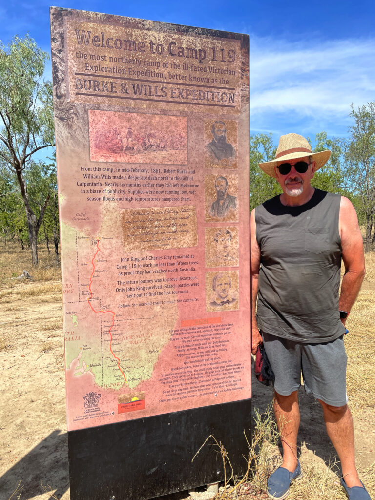
The most northerly campsite of Burke and Wills in 1861

Another rest stop at Normanton proved interesting for not only the story of Krys, the largest crocodile ever, but also the Information Centre told the story of the beef industry here and the important role of the native stockmen.
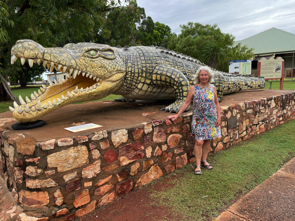
Krys, the largest crocodile ever seen in Australia. This magnificent creature was dozing on a riverbank when a crocodile hunter shot it dead. So sad.

A cruise on into Karumba was easy driving before we found our campsite at Ronnies and settled in. First point of call was to buy prawns for our lunch. 
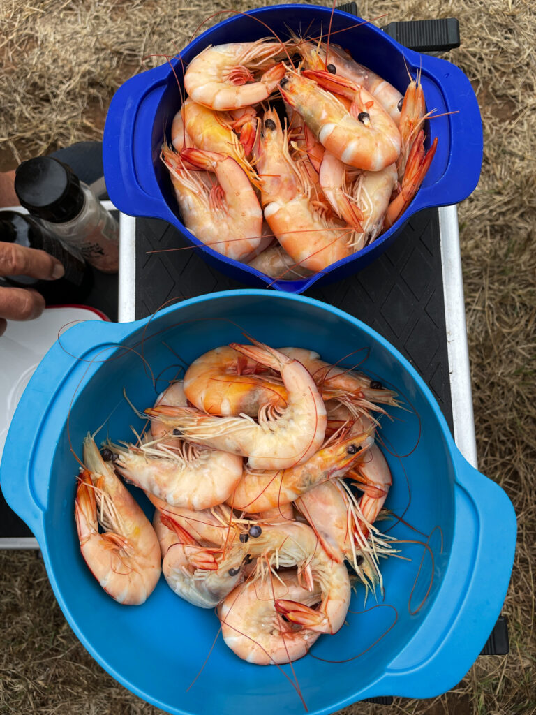
Karumba prawns for lunch. Delicious

Karumba exists to service the commercial prawning trawlers, the commercial barramundi fishers, to a lesser extent the export of zinc from Century mine and, of course, tourism. The prawning industry started in the early 1960’s when a wealthy businessman managed to talk the CSIRO into jointly funding an exploration in the Gulf and the highly sought-after banana prawns were found in abundance. 

The purpose of the Barramundi Discovery Centre is to maintain the stocks of barramundi by breeding them to fingerling size then releasing back into the wild. It was begun some years ago by the local commercial fishermen who saw the need to protect the barramundi from over-fishing. Smart move! The Centre was recommended to us by other travellers and I must say it is really interesting and not to be missed, though the tour at $50 each, was overpriced.

Karumba has been recognised for their efforts to maintain a sustainable seafood industry. Well done Karumba. 

While here we did a sunset cruise (so so) and enjoyed meals at the End Of the Road restaurant one night and the Sunset Tavern another – seafood meals, of course, while sipping cocktails and watching magnificent sunsets.
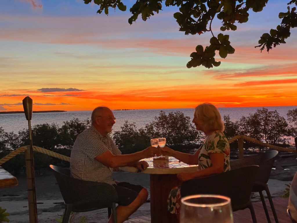
Sunset over the Gulf of Carpentaria. Karumba

Road closure due to flooding changed our route of departure to the sealed section of the Savannah Way – traversing rich grasslands once more. 
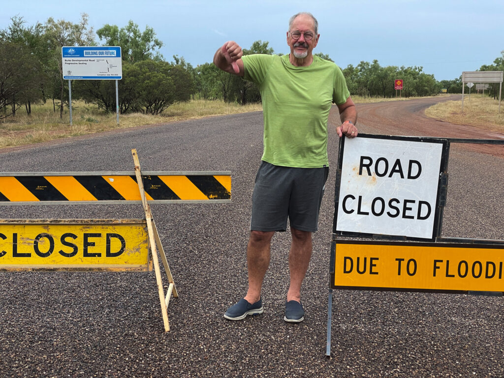
Darn! That was our intended route.

22nd – 23rd April

The highlight of a night at Gilbert River West (free camp, no facilities) was seeing the foaming waters of the river in flood, not far beneath the long one-lane bridge.
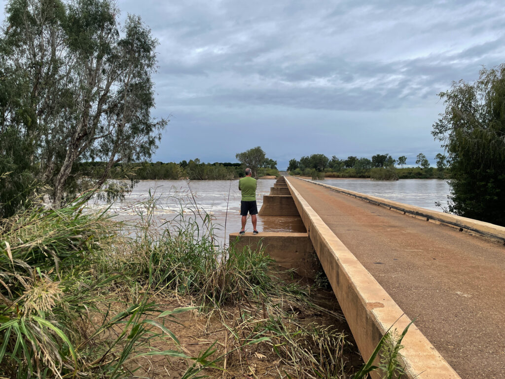
Viewing the flooding Gilbert River – not over the road, fortunately!

Next morning we moseyed on into Georgetown to stay at the CP, the power giving our batteries a boost. A walk around town left us with the impression of a small town with plenty of pride. 
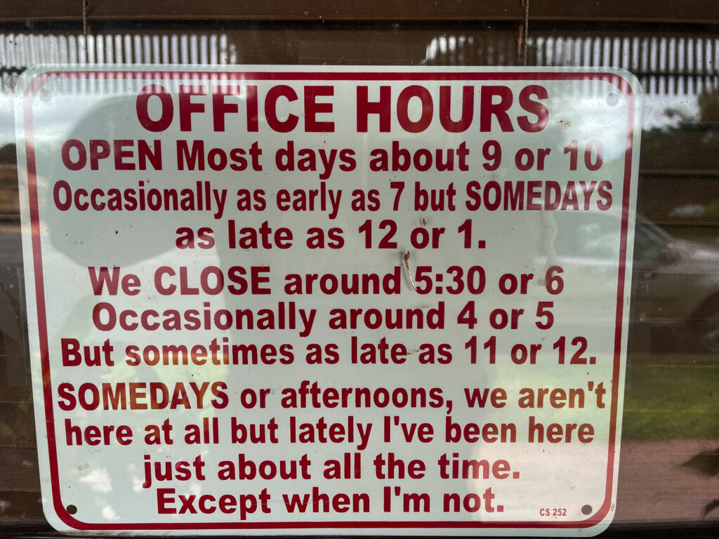
They’re pretty laid-back in Georgetown

24th – 25th April

On towards Cobbold Gorge over unsealed roads in pretty good condition with just a few shallow water crossings. On the way a cuppa stop at Forsayth and a wander around town found this town to be as impressive as Georgetown with its beautiful, restored buildings and well-tended parks. 

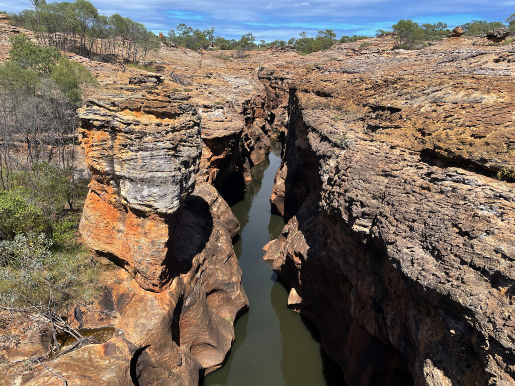
I was very excited to get to Cobbold Gorge – the photos I’d seen of the gorge were stunning and it didn’t disappoint. The beauty of the narrow gorge (only about 2 meters wide in some places) was only discovered a few years ago by the current owners of Robin Hood Station, the cattle station it is in.
This image has an empty alt attribute; its file name is 04_25_cobbold03-1024x768.jpg
Cobbold Gorge

A LOT of private/public funding has gone into developing the tourist facility here which includes a large reception area with souvenirs, a small grocery stocking basics, a large open-air restaurant beside the pool which has a swim-up bar, a function hall as well as very well laid-out RV and camping areas.

Apart from the Gorge itself there’s a large dam with free kayaks, several bush walks and mountain bike trails (BYO bike) and some four-wheel drive tracks to points of interest and the gem fields (agate mostly). 

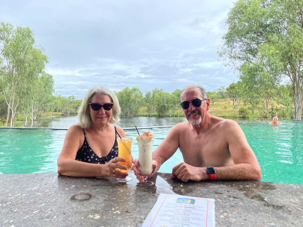
On our first afternoon, after settling in, we did an 8km walk up to a lookout, then back for a swim and cocktail at the swim-up bar. 
This image has an empty alt attribute; its file name is 04_24_cobbold-1024x768.jpg
Chilling at the swim-up bar at Cobbold Gorge

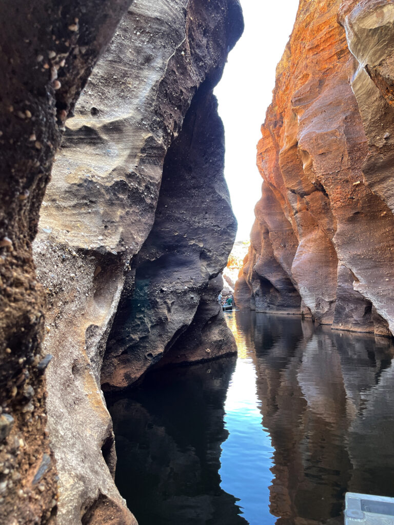
The Gorge is several kilometres away from the resort and only accessible on tours in an effort to maintain its pristine condition. We did the boat tour next morning. The guide was particularly good sharing historical, geological and botanical knowledge with us. The boat, an open punt, has a silent electric motor.
This image has an empty alt attribute; its file name is 04_25_cobbold02-768x1024.jpg
The amazing narrow gorge of Cobbold Gorge

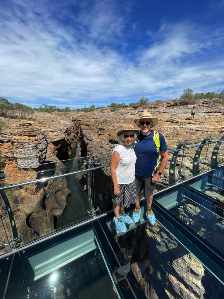
It was a stunning experience with the walls of the gorge towering up beside us, close enough in places to touch both sides at the same time, while we glided silently along. Back at the start we then walked up onto the huge sandstone rock that encloses the gorge, crossing over the gorge on a glass bridge. 
This image has an empty alt attribute; its file name is 04_25_cobbold04-768x1024.jpg
On the glass bridge over Cobbold Gorge

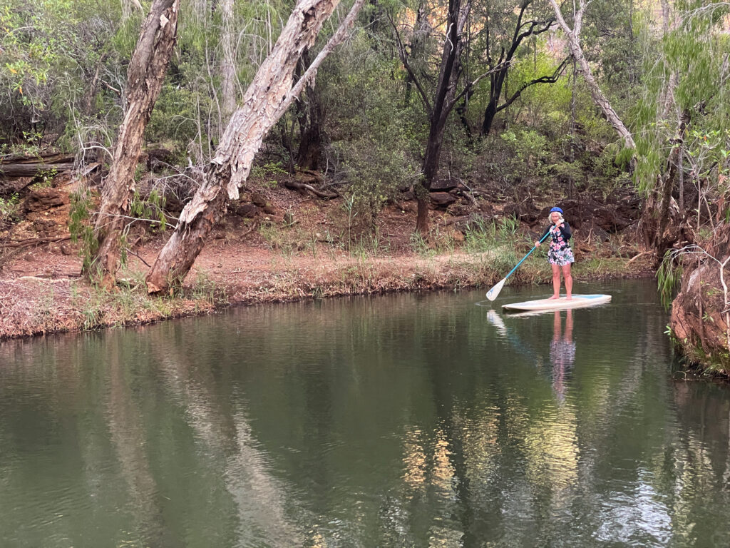
That afternoon we’d signed up for the SUP tour. If this morning’s tour was stunning, the SUP induced awe. This morning’s boat held 14 people, plus the guide and while everyone was quiet, just soaking it all in, the guide, naturally talked a fair bit. With the SUP there were only 7 of us and we all headed off separately, so Steve and I were able to enjoy the gorge more or less alone. It was every bit as wonderful as I’d hoped – and I didn’t fall in! 
This image has an empty alt attribute; its file name is 04_25_cobbold06-1024x768.jpg
Denise, just finishing the return trip of Cobbold Gorge on the SUP

26th – 27th April

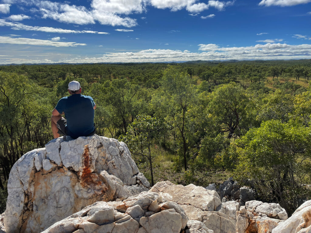
Leaving Cobbold Gorge we did one of their 4-wheel drive trips up to the Quartz Blow – a hill of beautiful white quartz which gave us views across to the horizon all around. 
This image has an empty alt attribute; its file name is 04_25_cobbold09-1024x768.jpg
Steve, contemplating geological wonders from atop the Quartz Blow, Cobbold Gorge

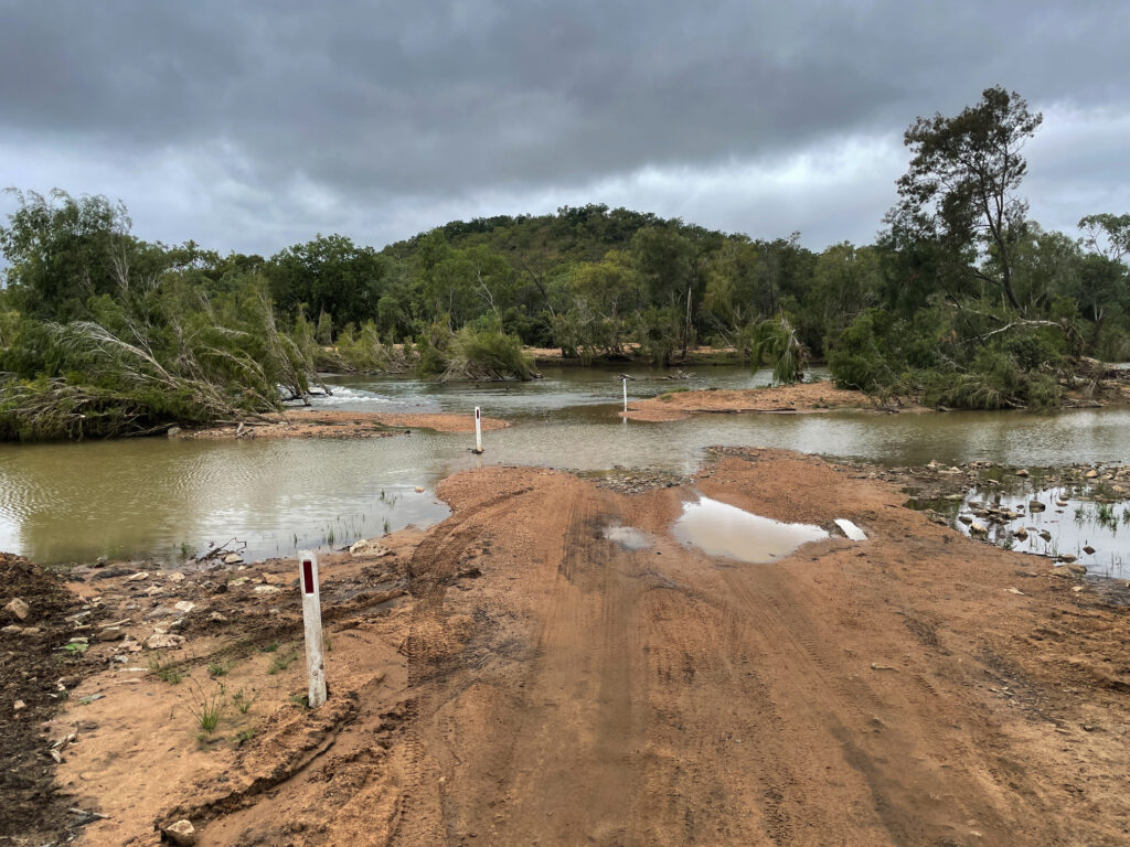
We’d asked around about the road through to Einasleigh and been rewarded with a shrug and “it’s OK”, so off we went, and it was “OK” – some bitumen, some corrugations, some washouts – OK. What we failed to ask about was the road from Einasleigh to the Gregory Developmental Rd! The Einasleigh River was over the causeway and flowing pretty fast.
This image has an empty alt attribute; its file name is 04_26_einasleigh01-1024x768.jpg
The Einasleigh River in flood. And we need to cross it.

As all good 4x4ers who don’t want to walk a river crossing do, we parked to the side and made ourselves some lunch and a cuppa. Sure enough 3 vehicles came down and we watched them cross, noted where it was washed out, noted their track and safely followed on. 

Kalkani Crater, a very typical cone-shaped hill with a perfectly round rim that drops away into the middle was a great little walk on our way to the Undara Experience, the resort set up at the Lava Tubes. 

Undara Experience, the accommodation associated with the lava tubes, was moderately busy as a music festival had just finished yesterday. It’s quite a resort here with lots of units, and heaps of powered and unpowered camping, a large open air cafe / restaurant, pool … you get the idea. 

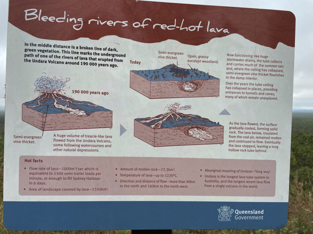
“The lava tubes and caves were formed when rivers of lava confined to a valley crusted over and formed a roof. Insulated in its casing of solidified lava, the lava flow carried on for tens of kilometres before draining out, leaving an empty tube of lava. Weaker sections of the roof of the tubes later collapsed to form caves and depressions. More than 70 caves have been found in the park.” (Text from NP literature) The lava flowed more than 90km to the north and 160km to the north-west at a rate of 1,000m3 per second! 
This image has an empty alt attribute; its file name is 04_26_undara01-1024x768.jpg
How the Undara Lava Tubes were formed.

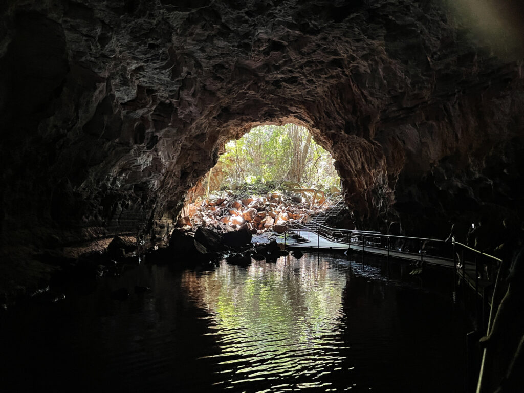
Access to the caves is restricted to approved scientists, speleologists and guided tours. The area has received 3 times its usual annual rainfall in the last few months and the caves have been full of water, a rare event. We had the amazing experience of walking through the caves on the walkways with crystal clear, chilly water up to our shins. 
This image has an empty alt attribute; its file name is 04_27_undara06-1024x768.jpg
Undara lava tube.

There are several bush walks starting from the camping ground, the longest being the Rosella Trail at about 14km. This trail took us to several lookouts from which we could trace the track of collapsed tubes by the bright green vegetation that grows in the protected stream bed.
Adelaide River and Nhulunbuy

Our Arnhem Land travels continue having left the Cobourg Peninsula and now heading to East Arnhem Land.

Saturday 10th August, 2019

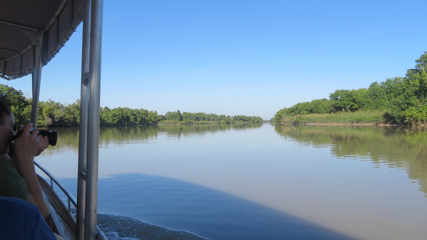
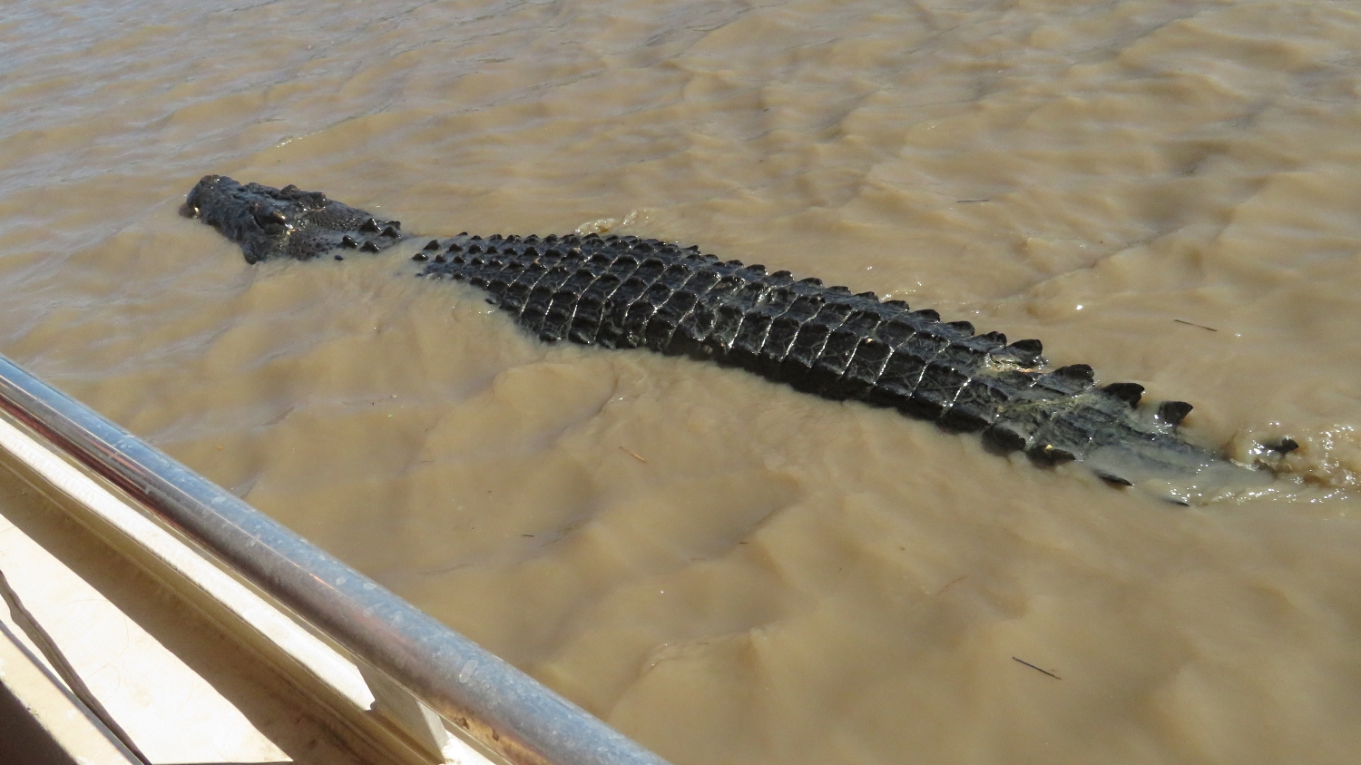
Another very full day today as we leave the caravan park just outside Kakadu and head a little further north along the Arnhem Highway to Adelaide River. The peaceful, picturesque Adelaide River’s claim to fame these days is the concentration of saltwater crocodiles (salties) that call it home. No trip to northern Australia would be considered complete if you didn’t see a saltwater croc, and this trip was not going to fall short on that score. Crocodiles were at risk of extinction before a hunting ban in the 1970’s saved them. It’s estimated there are around 150,000 salties and 100,000 ‘freshies’ (fresh water crocs) in northern Australia today – that means there’s nearly as many crocs as people – a sobering thought. Their habitat, ie fresh or salt water, has nothing to do with their name and they coexist happily in either. Salties can grow up to 10 metres in length and are aggressive in hunting their prey, of which humans are merely tasty morsels.

Idyllic day. Inviting river … but not for swimming! Adelaide River

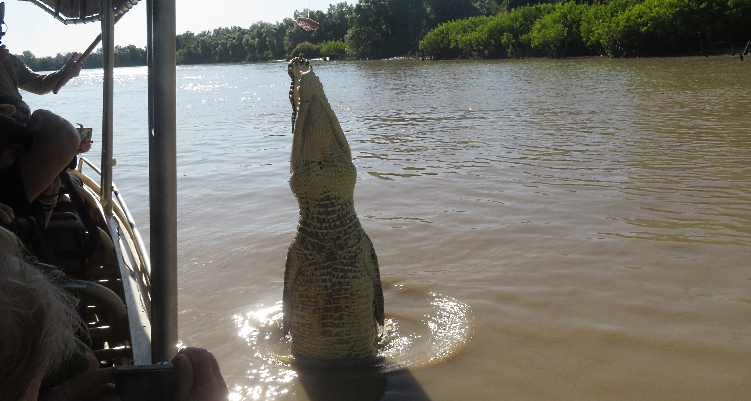
A tourism venture called “Original Jumping Crocodile Cruises” is our destination where we’re on the first cruise of the day. Well, it was pretty spectacular. We were in an open sided boat, told to keep all hands, cameras, etc inside the boat and headed out looking for crocs. The river itself is quite spectacular and just the cruise along the river was enjoyable, however it wasn’t long before we came across crocs lazing on the river banks keeping a watchful eye.

Cruising alongside the boat. Adelaide River

The tour guide was excellent – informative and fun. He’ll hold out a pole with a piece of meat tied onto a line and a croc will quietly slip into the water and sidle over, without so much as a ripple in the water. When the croc is alongside the boat, it’s teased a little with the meat. They’re expected to do 3 jumps before, on the third, they receive the meat. Just one piece per croc. We must have watched perhaps 10 big crocs jumping well out of the water to get the meat. The tour guides have named all the crocs and know their personalities well.

And up he goes. Note the meat on the line which you’ll see just at the top of the background tree line. Adelaide River

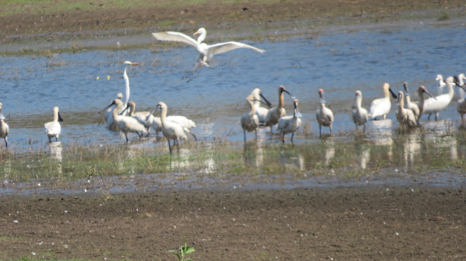
Moving on from here a nearby lagoon fulfilled our ration of birdlife for the day.

Coming in to land, ignored by the spoonbills.

From here we backtracked south a little way along the Arnhem Highway before turning right onto a 4-wheel drive road that was a shortcut across to the Stuart Highway. The road, while unsealed, was in good order, apparently infrequently used and a very pleasant drive.

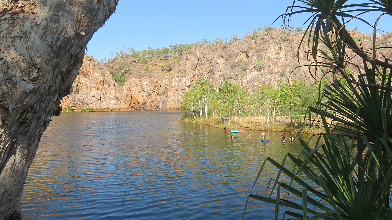
Next stop was the magnificent Leliyn (Edith Falls) which is on the edge of Nitmuluk NP (Katherine Gorge) and was the finishing point for my Jatbula walk of only 2 weeks ago. The Edith River cascades into this very beautiful, large freshwater pool that has been de-crocced (is that a word?) and therefore safe for swimming. We enjoyed a lovely swim and relaxed here for a couple of hours before wandering on, in our own time, to the Shady Lane caravan park in Katherine where we’ll spend the night.

The pool at Leliyn. That’s me with the grey hair, enyoying my swim with others in our group. In the distance you can just see where the Edith River cascades down into the pool.

Washing, shopping and refuelling in preparation for the next leg of our journey was a priority this afternoon. Once more we filled the jerry cans we carry on the roof racks (with diesel), just to be sure. Rather than cook we bought pizzas and shared them with Pat and Dick.

Sunday 11th August

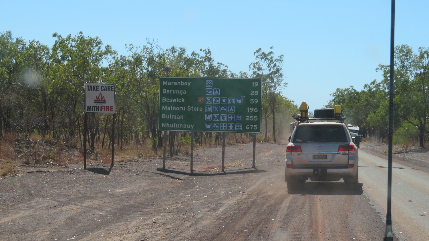
Heading south as we left Katherine it was only about 50km before the turnoff for the Central Arnhem Road that joins Nhulunbuy to the Stuart Highway. A few years ago 4WD Magazine ranked the Central Arnhem Road in its top 5 “must drive” four wheel drive tracks. We agree! This is another road that requires a permit from the Northern Lands Council as we travel predominantly through Aboriginal lands (as did all the West Arnhem Land roads). It’s unsuitable to tow vans and permits won’t be granted to do so, apparently

Beginning the Central Arnhem Highway. Mainoru Store is our destination today.

Once we hit the dirt the tyre pressures were once more reduced and our convoy spread out over many kilometres as we hung back from each others dust. We passed through a few small aboriginal communities on the way. A constant lookout had to be kept for feral animals straying onto the road –  cattle, donkeys and buffalo.

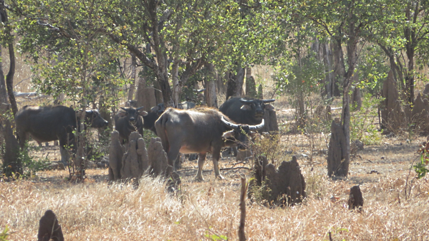
Feral buffalo are prolific in Arnhem Land. Hunting safaris are common and there’s also a meat trade in buffalo.

Lunch today was at a lookout over what is colloquially known as Jurassic Park. The area looks like its a sunken valley with cliff edges all around and a flat base. Quite unexpected out here where everything is so flat.

A break for lunch overlooking “Jurassic Park”.

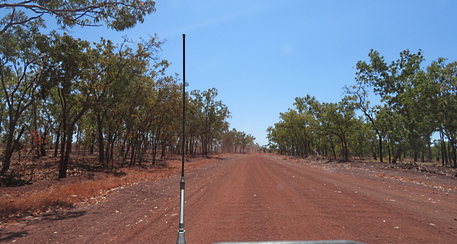
The road condition has been quite good. Some sections corrugated and dusty, but mostly reasonably smooth, fast, hard dirt. When oncoming vehicles approach we’d reduce speed to a crawl, and when the road trains approached, and we saw a few, we’d pull right off the road and stop. After they’d passed visibility would be close to zero for several minutes until their dust settled.

Central Arnhem Highway. A few corrugations here.

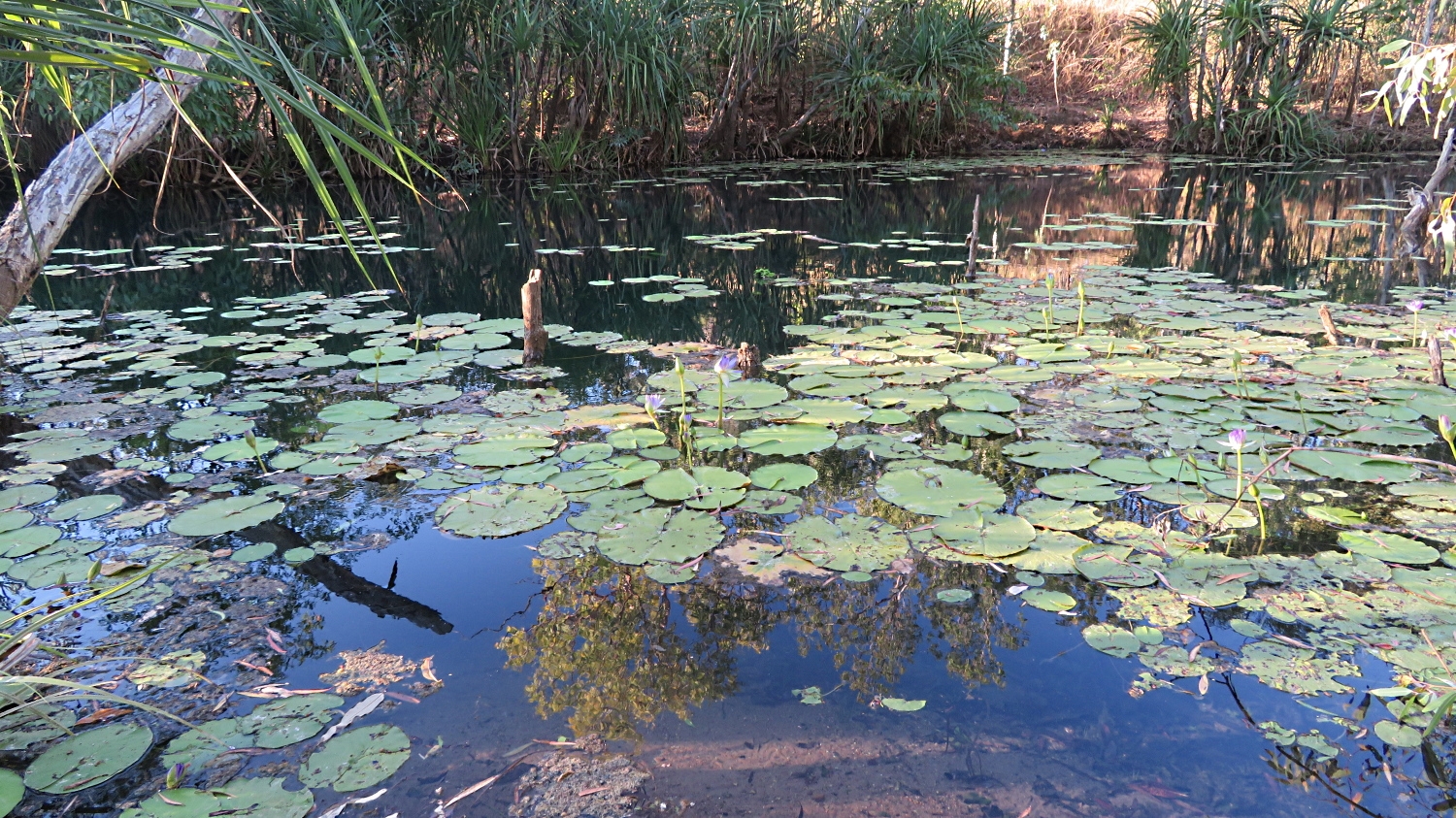
Late afternoon we arrived at Mainoru Store. This is a store that sells everything, food, clothing, shoes, etc. Camping tonight is on a beautifully grassed area beside a natural spring. The store owners have big sprinklers on the lawns 24/7 and that spring never falters. After setting up we went for a walk along it. It’s a beautiful lilly-covered oasis surrounded by glorious gum trees So unexpected out in this harsh environment.

The fresh water spring that never runs dry beside the camping ground at Mainoru.

All feeling weary after a long, dusty drive today Neill organised for the store to cook us a meal – chicken and salad. Very average. Then to cap it off Steve and I had set our tent up close to the toilets. Everytime the door opened, which was frequently, it closed with a loud bang, and the whole area was illuminated with what I swear was a search light on a motion sensor. Not the most restful of sleeps.

Monday 12th August

We left early today to cover the 470 remaining kilometers to Nhulunbuy. Much of it was corrugated, though some stretches not too bad.

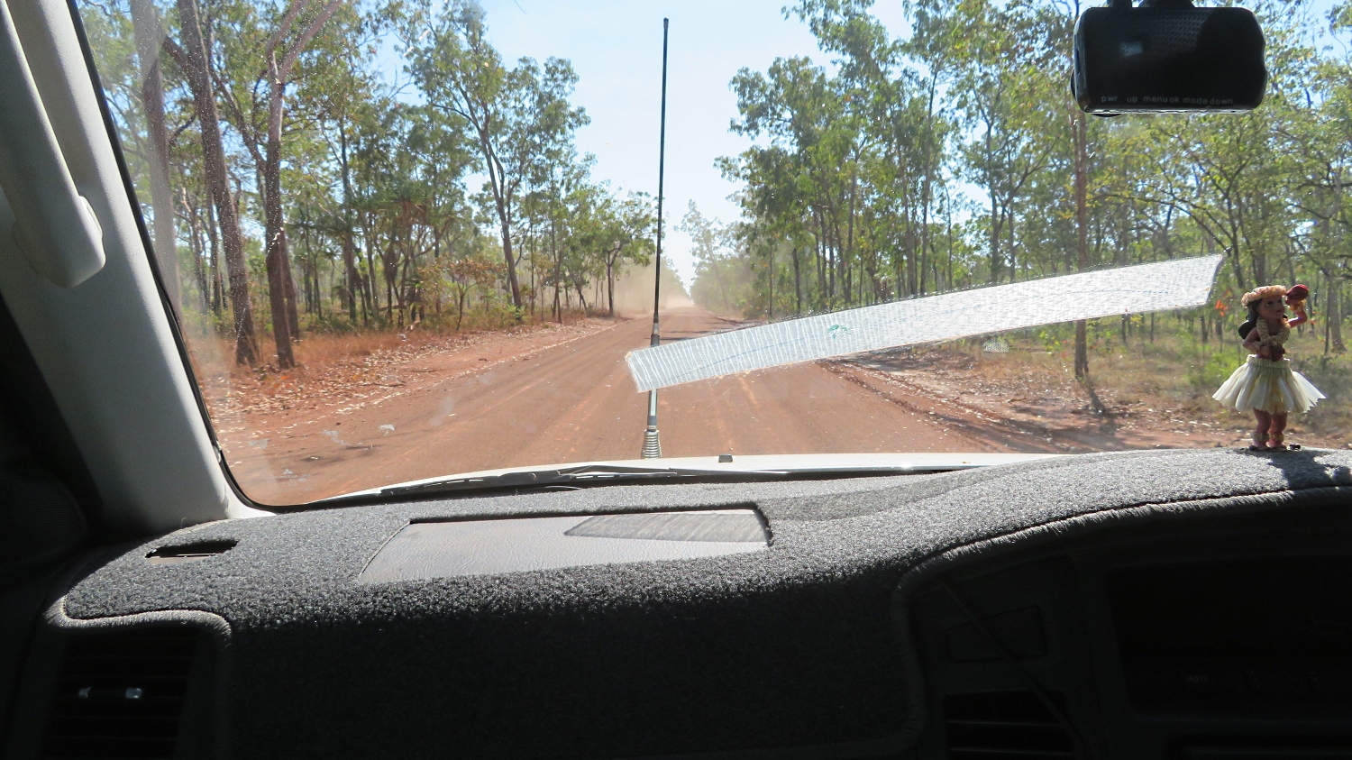
Driving the Central Arnhem Rd north of Mainoru Store. Note the tape on the windscreen – placed over a crack that occured on the way up to Darwin. Also note distance from vehicle we’re following, avoiding the dust.

The Central Arnhem Rd crosses several small creeks. It also crosses the Goyder River and its flood plain, a challenge for road users in wet weather prior to 2014 when the government built a very large, all-weather bridge to bypass this difficult crossing. The old crossing is our destination for morning tea today. It does appear that the road authorities don’t want you to go there as the exit off the main road is well hidden. With some prior knowledge though we were all soon travelling on a lovely single-lane road to a delightful, shallow, broad crystal-clear brook, babbling over a stoney base which was the Goyder River on this day. The entrance and exit could be steep and I can imagine the trouble the road trains had trying to cross this river before the bridge was constructed, particularly after a good wet season.

Will we or won’t we? Goyder River

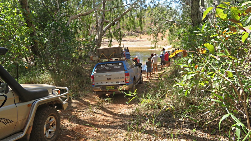
A discussion of whether we should cross or return the way we’d come in was had, with all voting to cross (not sure that Neill, the guide, had a say in that decision). What’s a 4-wheel drive trip without a decent water crossing or two? (Grin)

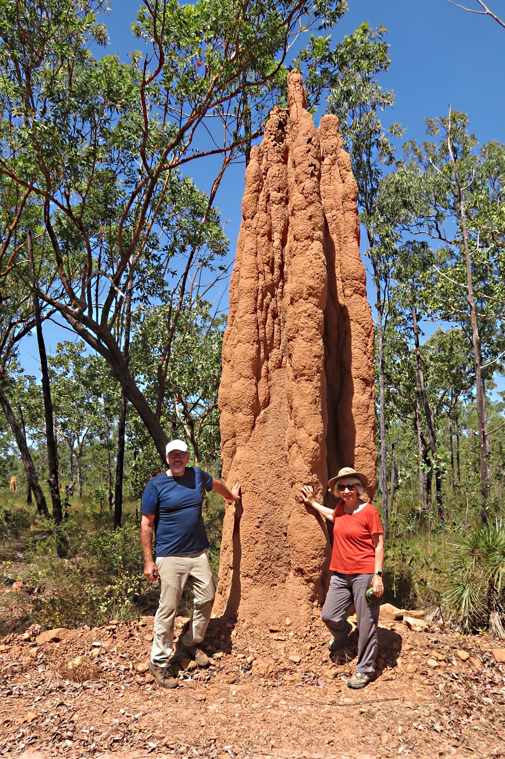
Apparently the biggest termite mound in Arnhem Land.

Further on we stopped by the largest termite mound in Arnhem Land.

Arriving tired at Nhulunbuy on the coast, we set up camp behind the Walkabout Lodge on lovely green grass, with modern, clean toilets and showers … and washing machines! After attending to the necessary I cooked a stir-fry and we went to bed to sleep well, listening to the surf in the background.

Tuesday 13th August

We did a full day trip down to Cape Arnhem today. Abel Tasman, a Dutch explorer, named Cape Arnhem in 1644 after the Dutch ship Arnhem which explored these waters in 1623 – the captain of this ship and some of his crew were killed here by the indigenous inhabitants – I wonder what they did to upset them! Terre d Arnhem appeared on early Dutch maps but wasn’t ‘official’ until the Aboriginal Reserve was named Arnhem Land in 1936.

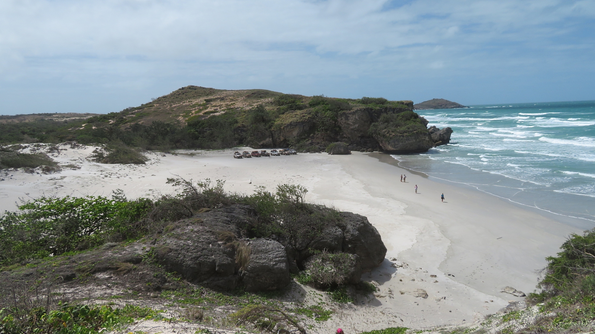
A narrow, winding track around trees, washouts, holes, rocks, etc, took us from the Central Arnhem Road to the coast, then a steep descent down the dune escarpment led to sea level and onto a beautiful little beach for a BBQ lunch provided by GDT. Tyre pressures were down to 16PSI by this time as we were driving on very soft sand.

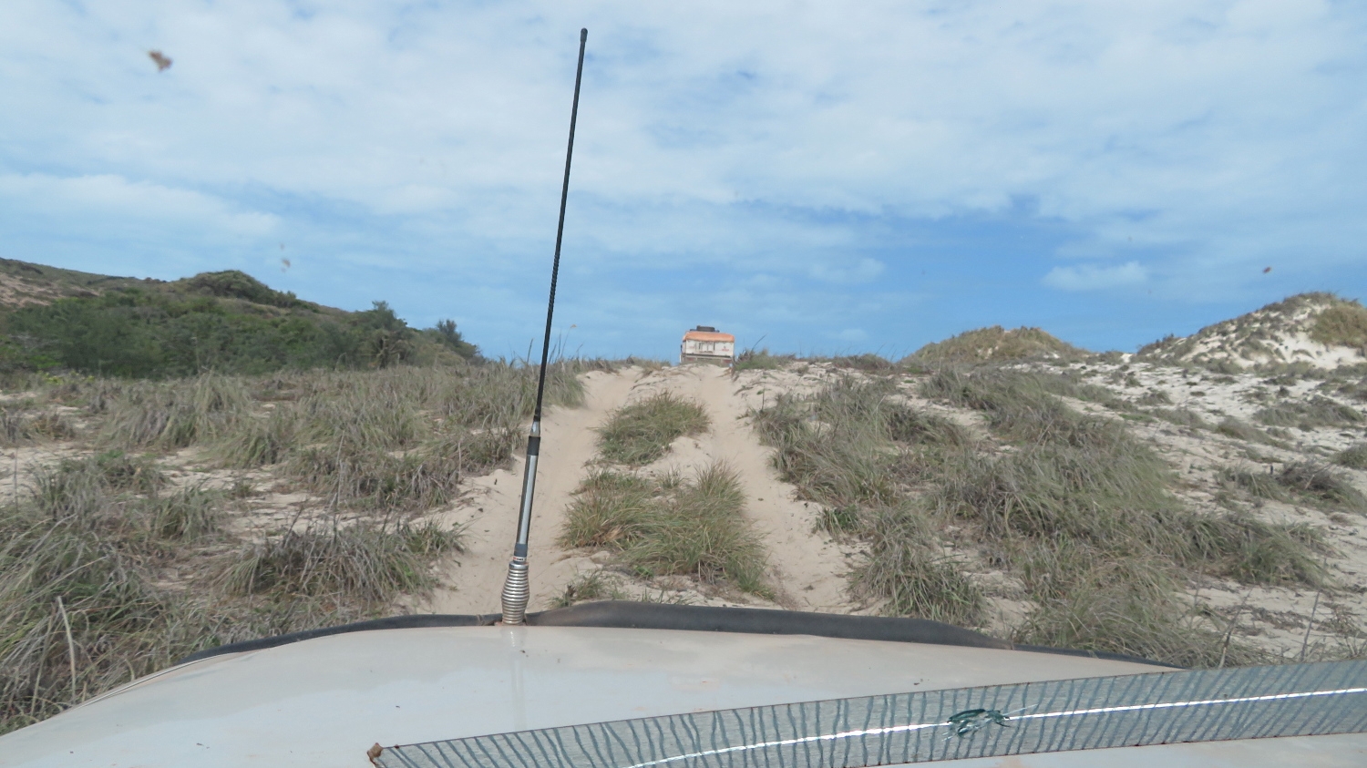
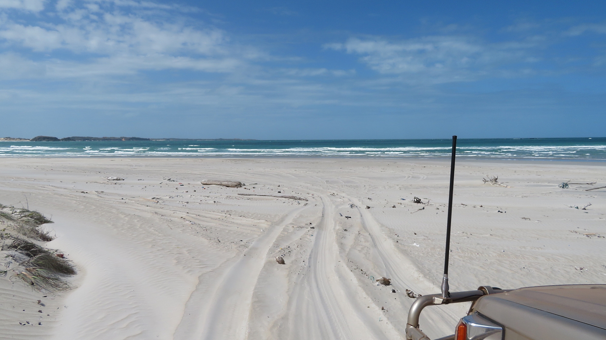
Up and over the sanddunes on our drive around Cape Arnhem and its beaches. (That’s the back of a vehicle with a built-on tent in front of us, not a house!)


A view of our ‘lunch time’ beach from the top of the dune.

After lunch Neill took us along tracks on the escarpment or down on the beach exploring towards the Cape.

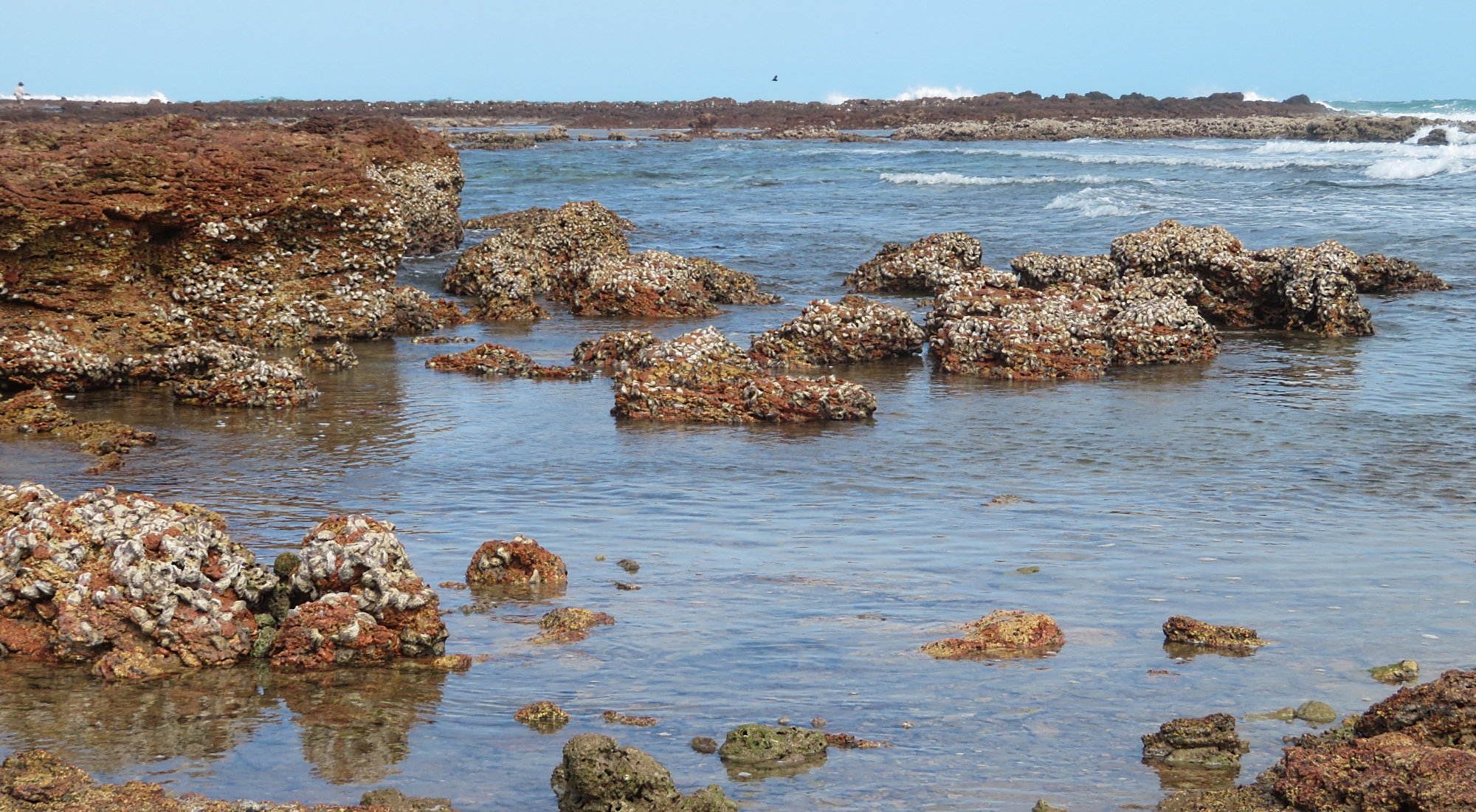
Oysters, oysters, big fat juicy oysters! Yes I did sample some of these, with one eye looking out for a croc. Cape Arnhem.

Neill gave us the good guff on sand driving, and we had plenty of opportunity to practice our skills.

Off to explore another beach of soft, white sand. Cape Arnhem

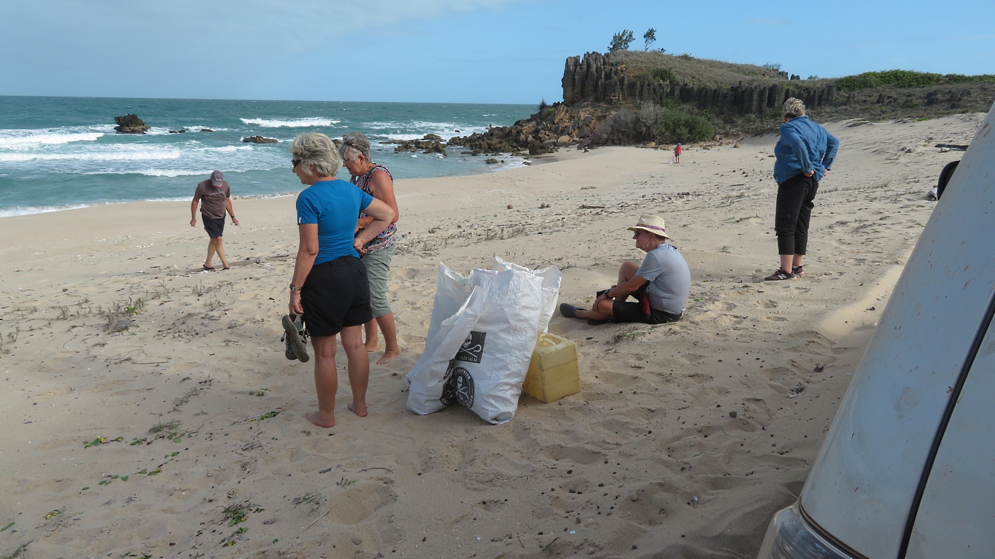
We stopped at one beach where we all did a ‘beach cleanup’ gathering 9 big bags of rubbish to take to the dump at Nhulunbuy. This beach looked stunning by the time we’d finished our clean up. Not all beaches gather rubbish – depends on  aspect and where the currents run.

This is the beach where our group did a clean-up We ‘over-filled’ 9 of those bags with rubbish that has drifted ashore here. Cape Arnhem


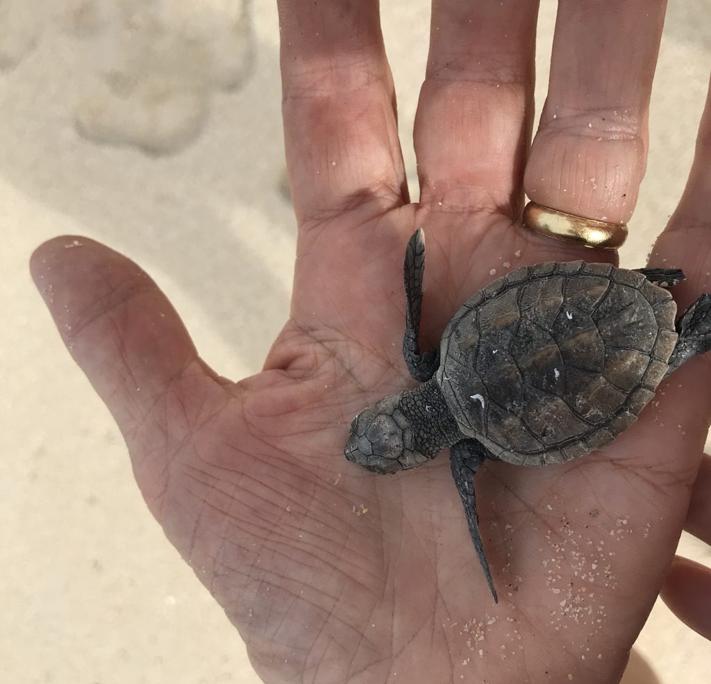
Awww. Look what I found on the beach clean-up. This little fellow was heading the wrong direction. I put her at the water’s edge and told her I’d be back in 20 years when she’s next back here laying her own eggs.

Back to camp after 104km of good fun. Dinner at Walkabout Lodge – expensive and OK. 

Wednesday 14th August

Restful morning.

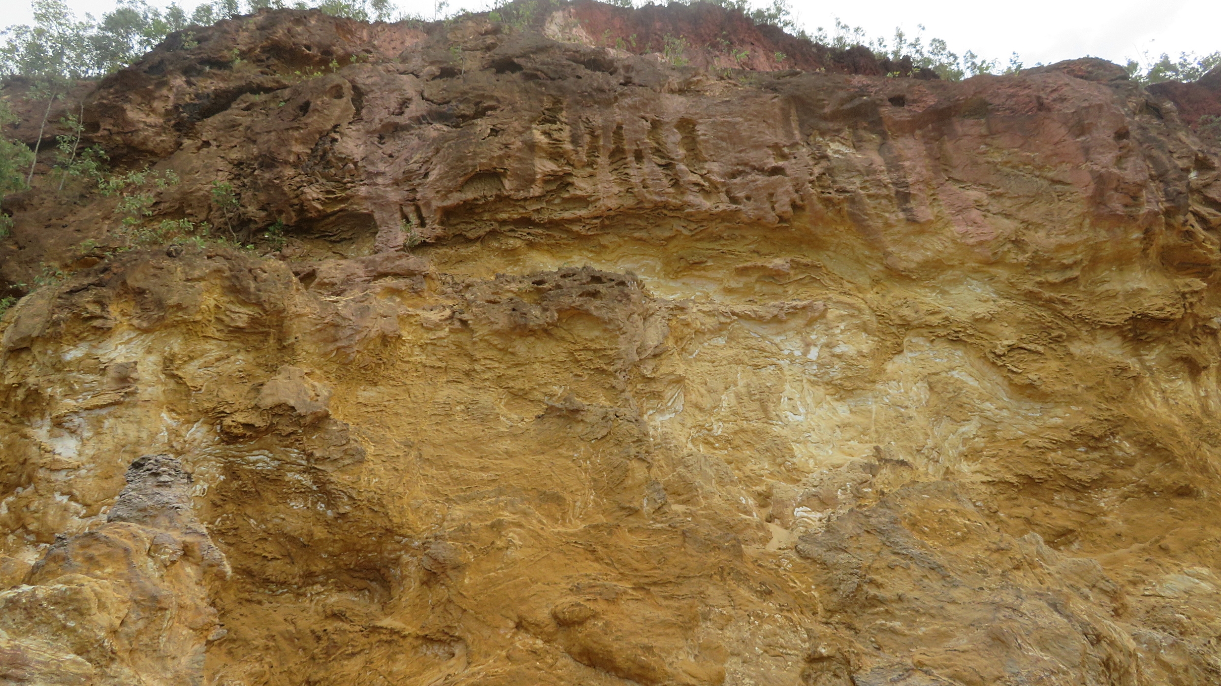
After lunch we went for a drive to Banambarrnga (Rainbow Cliffs). The exposed cliffs produce a striking effect from the weathering of the beautiful whites, yellows and red ochres. The top of the cliffs is a sacred site. We spent an enjoyable time exploring this beach, the little tidal creek which exits here and viewing the cliffs.

Rainbow Cliffs – beautifully shaded ochres.

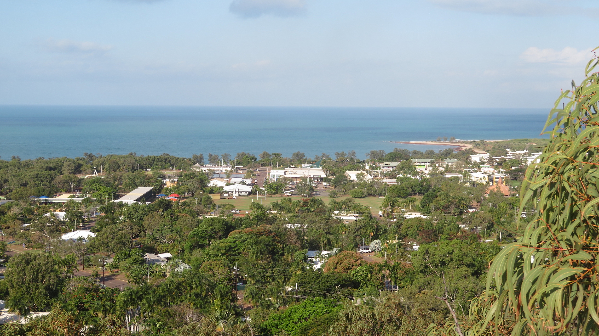
Back at Nhulunbuy, John, a long-time resident, the owner of Walkabout Lodge and a ‘mover and shaker’ in the town, took us for a drive around town, telling us about its development and the challenges it is currently facing. We started at the Lookout where we had wonderful views out over the town.

Nhulunbuy from the Lookout.

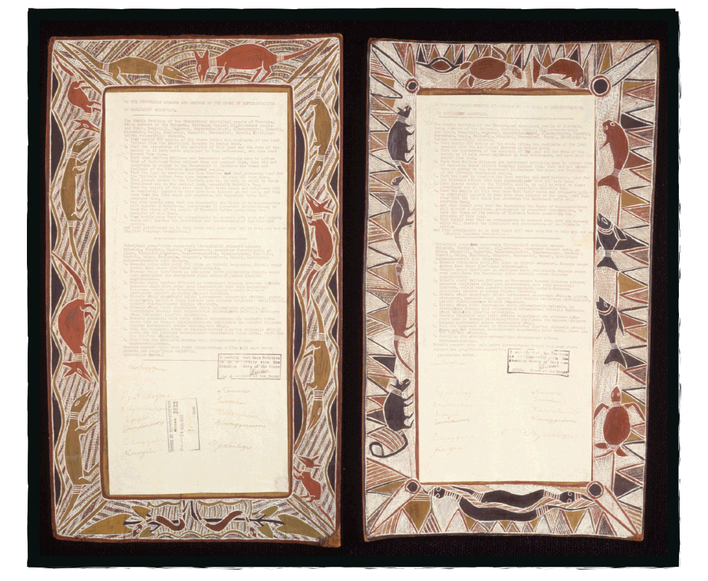
Nhulunbuy (also sometimes referred to as Gove) is a Yolgnu word meaning ‘honey man’ and is a very remote town by any standards, (over 700km by 4×4 vehicle, a tiny airport or an occasional boat being the only access). It came into being in 1963 when the Federal government approved a bauxite mine and a town was formed to house the workers. The Yolgnu people strongly opposed the mine and presented a bark petition to the Federal Government, obviously unsuccessfully. This petition is on display in Canberra (not sure how I feel about that – a continuing slap in the face to the indigenous people I think).

This is the Yirrkala Bark Petition which is on display in Parliament House in Canberra. The bark petitions asserted that the Yolngu people owned the land and protested the Commonwealth’s granting of mining rights of land excised from the Arnhem Aboriginal Land reserve. They asked that no arrangements be entered into with any company which will destroy the livelihood and independence of the Yirrkala people. And so this became the first formal claim for native title. It failed. In 1971 it was taken to the Supreme Court where the judge used the notion of terra nullius to justify this ruling. Photo Wikicommons

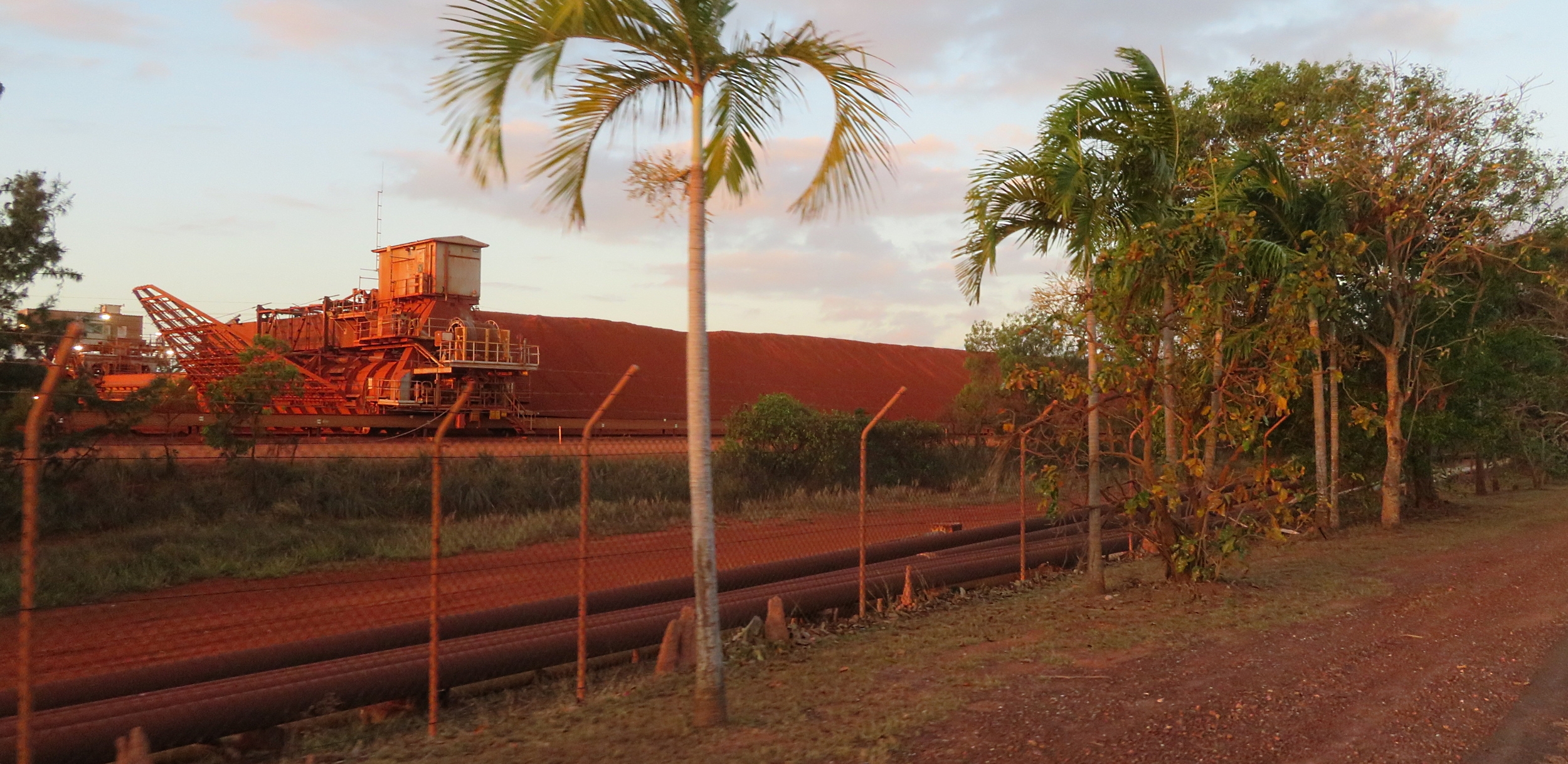
We drove through town, which has restaurants, schools, a hospital (that our business cooperated with when we ran the GOLD conferences back in our history) and a good shopping precinct – oh and a bakery! We headed north out of town to the port where the refinery is. The bauxite refinery closed in 2014 with a loss of over 1000 jobs – a huge loss to the town. Bauxite is still mined here and transported via ships for overseas processing. A new refinery had been built at great expense, however before it processed any bauxite it was closed. It’s still here, in pristine condition.

Bauxite stockpile awaiting shipment for processing overseas.

Just this year an area outside Nhulunbuy has been chosen as a rocket launch site by NASA. Being this close to the equator apparently the earth spins a bit faster, so you get an extra boost to your rocket, using less fuel. Who knew? Locals don’t feel it will add too many jobs for the locals though – time will tell.

Thursday 15th August

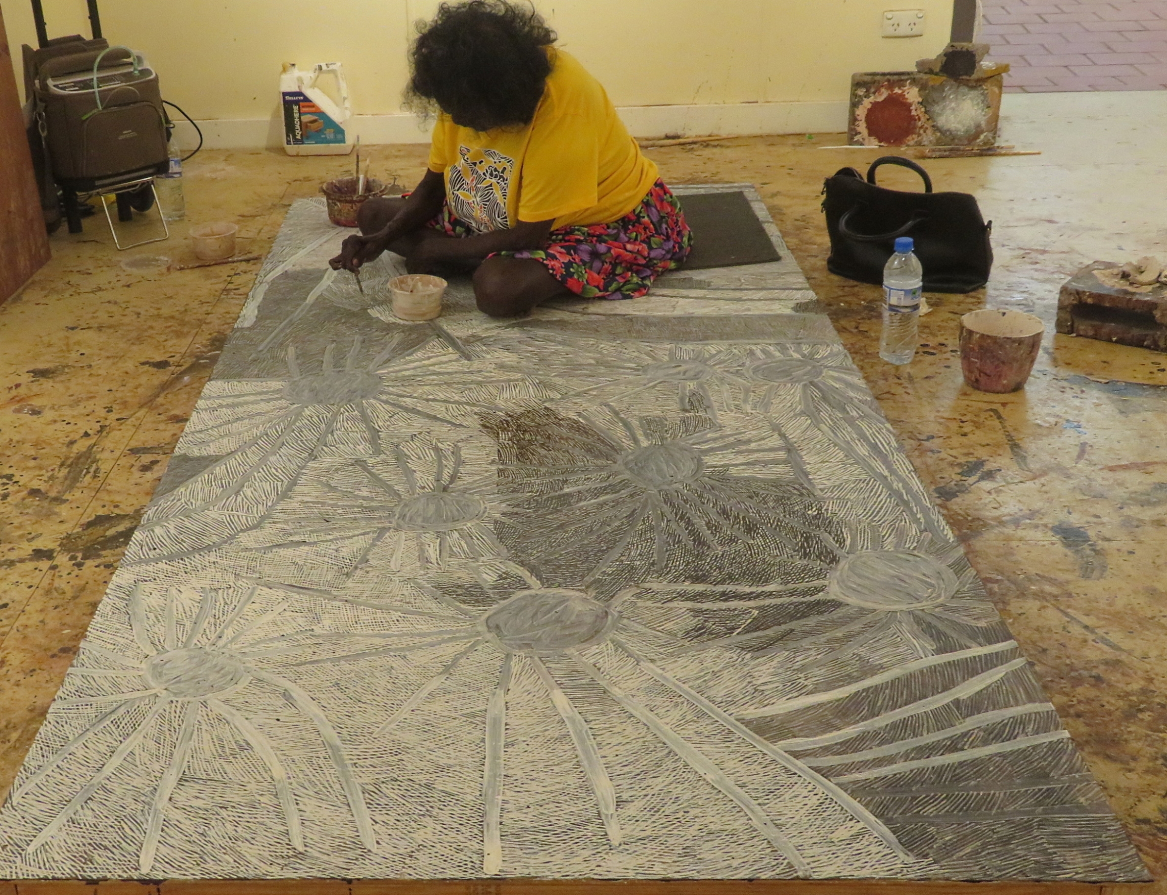
Today was a fabulous day starting in Yirrkala, the small indigenous community just south of Nhulunbuy. The amazing Buku-Larrŋgay Mulka Centre is located here. It started in the 1960s by an artist who exhibited his own art from a shelter on the beach, and from this it has grown to what it is today consisting of two divisions; the Buku Art Centre which represents Yolŋu artists exhibiting and selling contemporary art and The Mulka Project which acts as a digital production studio and archiving centre incorporating the museum.

Nyapanyapa Yunupiŋu, quite a famous artist, at work on her latest creation. Look closely at the fine lines that form the picture. Buku Art Centre, Yirrakala.

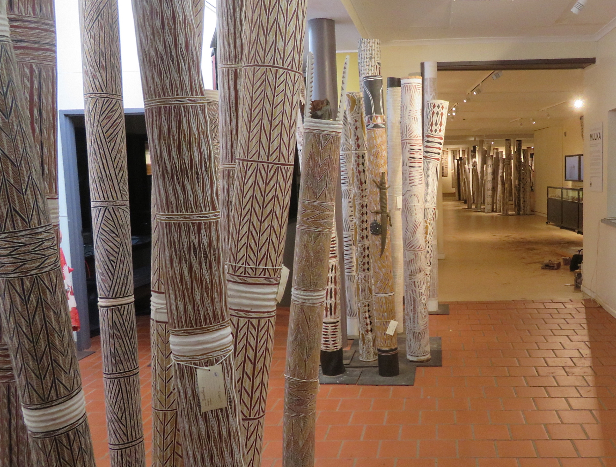
We couldn’t get over the amazing art – so talented and so intricate. There were many, many pieces of art we’d have loved to have bought. Most impressive in my mind were the many ḻarrakitj. Ḻarrakitj are memorial poles. In time past they held the bones of the dead and formed an important part of funeral rites. Today Yolŋu continue their cultural tradition painting hollow stringybark branches and selling their art (minus the human remains!), reviving and disseminating the beliefs of their ancestors. On one of our drives we saw a roadside memorial with a ḻarrakitj marking the place of a fatal road accident, much as our culture marks such roadside tragedies with a cross.

Some of the larrikitj, with others in the background in the Buku Art Centre, Yirrakala.

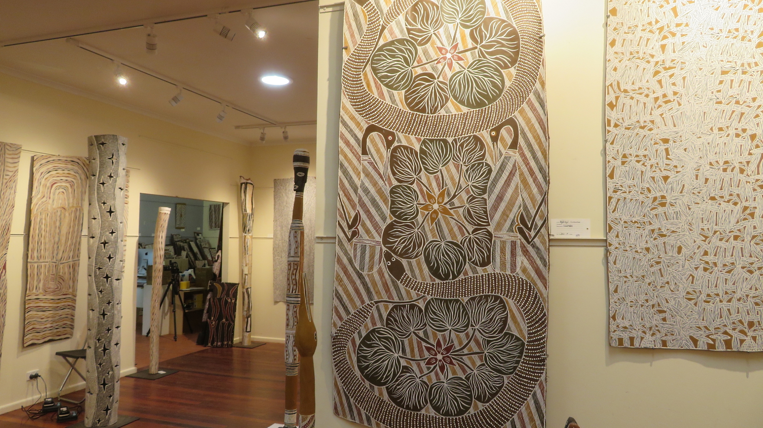
Every now and then while driving we’d come across a stringybark tree where a couple of metres of bark had been removed. Neill joked these were dingo trees (ie no bark – ha, ha, ha!) The bark that was removed is cured by fire, weighted and left to dry. Using locally sourced ochres traditional designs are painted onto the bark; each unique, very fine, cross-hatched pattern reflecting knowledge belonging to a particular estate, clan, state of water, moiety and place.

Highlighted in the middle of this photograph is one of the bark paintings (ie artwork done on a piece of bark). Exquisite! Buku Art Centre, Yirrakala

Yiḏaki is the correct term for what we call a didgeridoo. Prior to European colonisation yiḏaki were only found in northern Australia, in particular Arnhem Land. Today this term is only permitted to be used when the instuments have been made and decorated solely by Yolŋu people. Finding a naturally occuring termite-hollowed stringybark tree is the first step in making this unique wind instrument. According to sources at Yirrkala all other similar instruments should be called didgeridoos, unless they are made by an Aboriginal person and called by their local Aboriginal name for the instrument. And yes, there were many beautifully made and decorated yiḏaki on display.

In the museum Andrew, one of the curators, took us to see beautiful old pieces of art and photographs made by the anthopologist Donald Thompson in the 1920s – all fascinating and his descriptions wonderful.

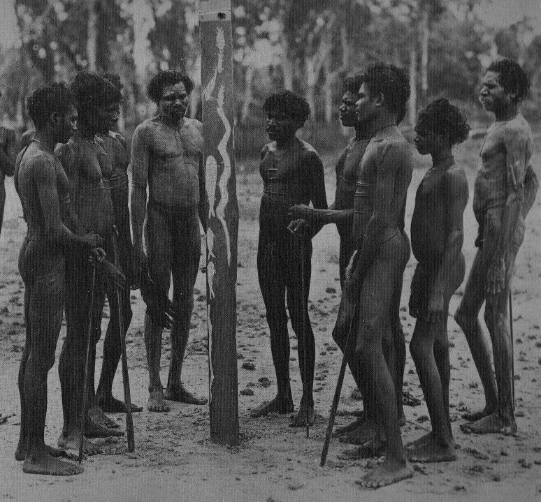
A Donald Thompson photograph taken in 1936. These tall, strong, healthy men are preparing a ḻarrakitj for the remaining bones of a clan member who had been interred (either in a shallow grave, or a burial platform) some time ago. The ḻarrakitj is painted with sacred designs of the deceased’s lineage.

But the most striking artwork in the museum are the two Church Panels. Each Church Panel is on masonite sheeting twelve feet tall and four feet wide. Yolŋu society is divided into two moieties—Dhuwa and Yirritja—and so too are the Church Panels. These panels, created by the elders of these moieties in 1962/63 were for display on either side of the alter in the new Methodist Church. There were two core reasons for their creation – firstly to introduce Yolŋu religious iconography into a Christian context to demonstrate that Yolŋu had their own sacred heritage; and a political assertion of Yolŋu sovereignty in the Yirrkala area to emphasise Yolŋu connection to land and land ownership. It was because the Federal Government annexed their land for the bauxite mine and after seeing these panels that Beazley Snr (a Federal political minister) suggested the Bark Petition – as such these Church Panels were the precursor to the first land rights claims in Australia.

Despite their intricacy, beauty, importance and sentiment, a Methodist minister had them removed from the church in 1974 (they didn’t tell the ‘right’ creation story!) and stored them, unprotected, under the eaves of the church. Four years later they were rescued by Buku-Larrŋgay Arts, but it wouldn’t be for another 10 years until the museum was built that they were once more on public display.

No trip to Arnhem Land could be considered complete without viewing the Church Panels. Their artistic beauty is notable, their message is important, but the spiritual feeling that envelops you as you sit quietly viewing these panels is extraordinary.

Reluctantly leaving, we could have spent many more hours here, we drove on to Daliwoi Bay. This camping area has a boat ramp and is at the mouth of an inlet. Great for fishing, so I’m told, but only from a boat as the crocs like this spot.
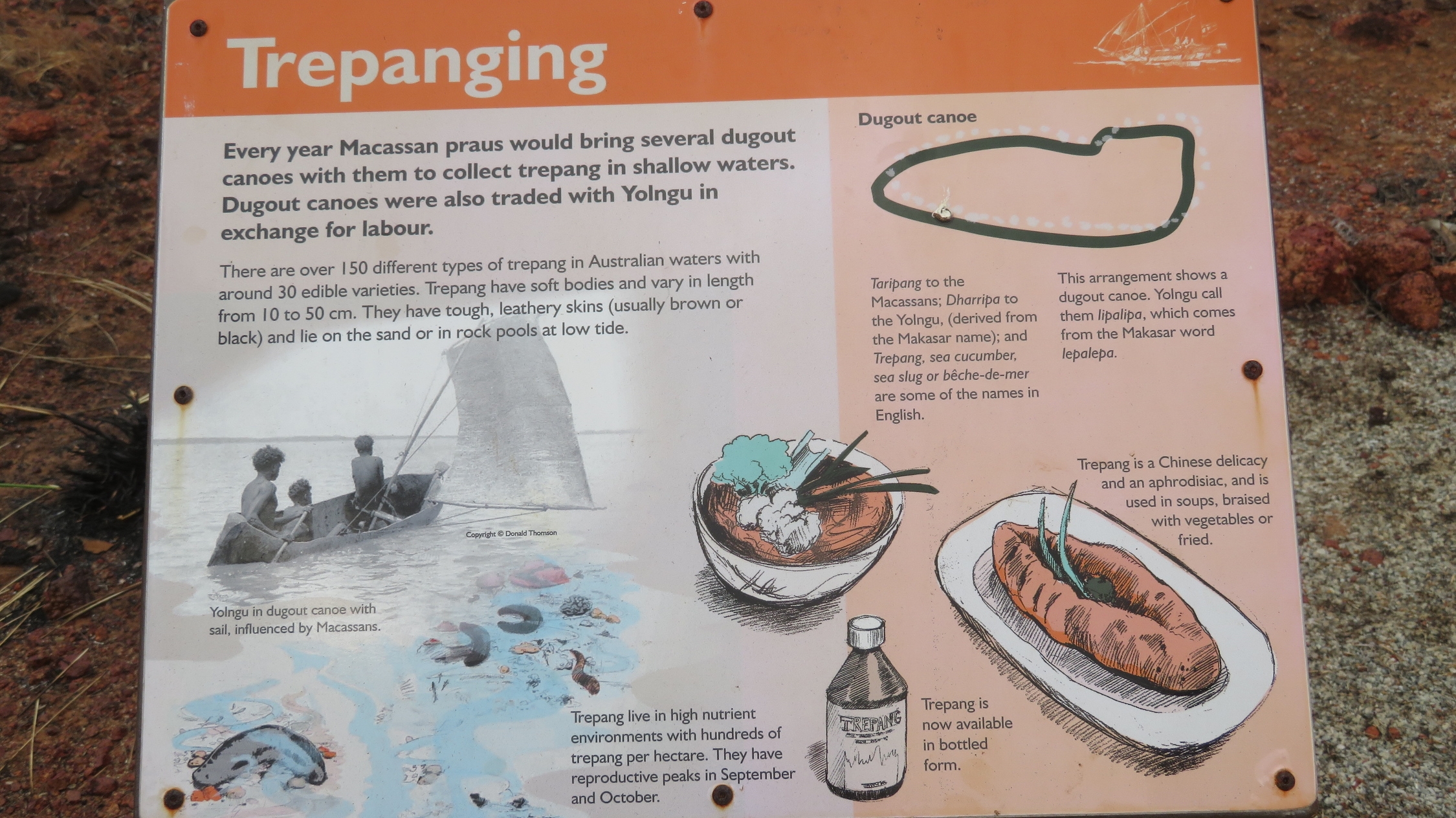
We drove on to Macassan Beach, a very pretty little tropical beach with a camping area. Here we found the story of the Macassan relationship with the Yolgnu told in stone arrangements. These were created in the 1800’s by Yolgnu to aid their oral tradition of passing on the stories of their people. A walk of a couple of hundred metres takes you past 6 stone installations each representing a facet of their history.

The information board describing the stone installation that represents the dugout canoes. Macassan Beach

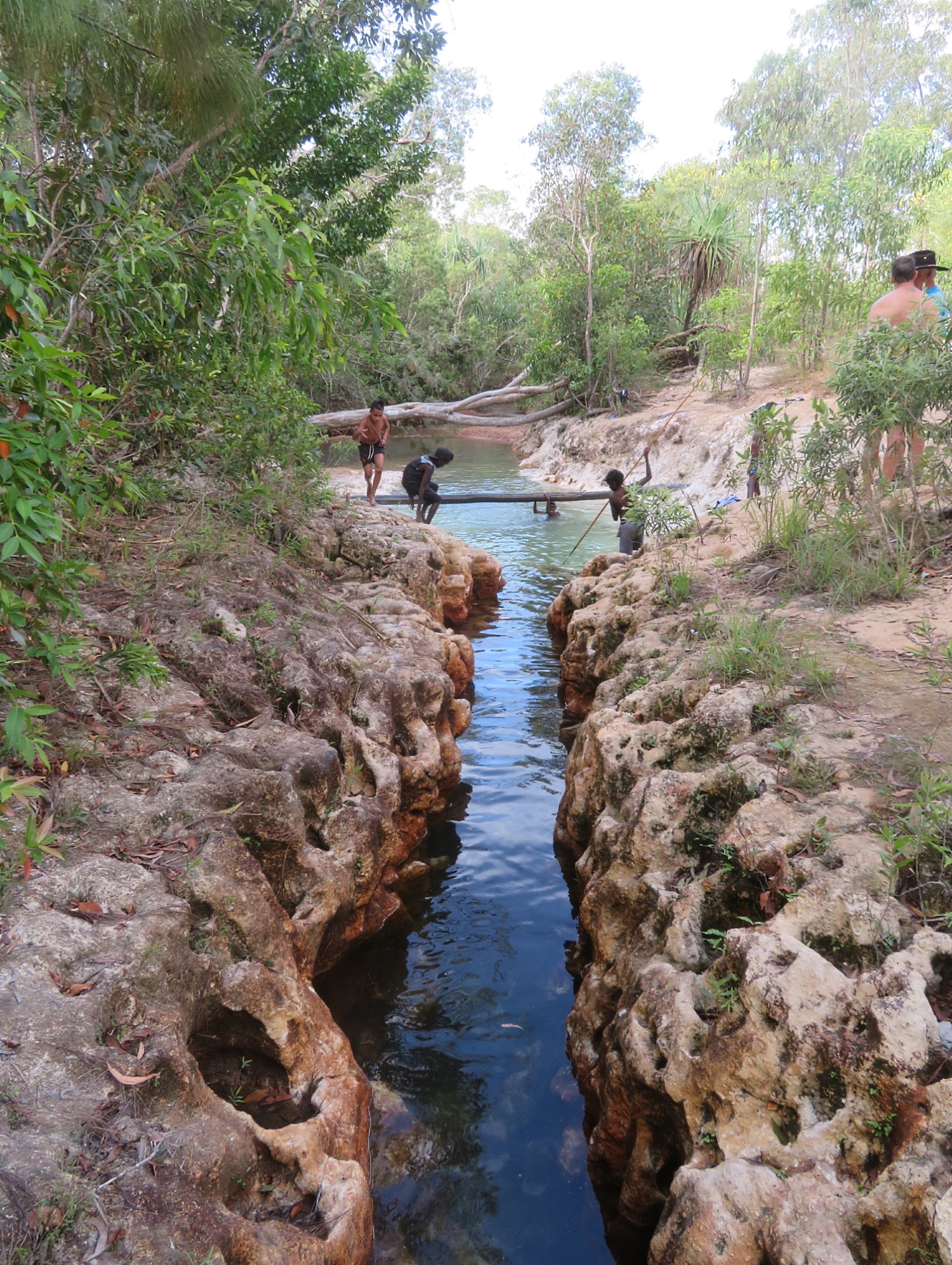
After a pleasant time spent looking at this installation and wandering the beach we headed back to the main road, then down a side road to Goanna Lagoon. What a top spot this was! There was a school group of a dozen or so young boys with their teachers who were camping here for a couple of nights. The boys were having a wonderful time, a few of them spear fishing for cherubin (yabbies). A narrow steep-sided creek has carved its way down to supply the lagoon with fresh, crystal-clear water. A delight to go for a dip on this warm afternoon.

A group of school boys having fun at Goanna Lagoon. Note the boy spear-fishing.

Back to camp in Nhulunbuy we spruced ourselves up ready for dinner at the Yacht Club to celebrate our last evening here.

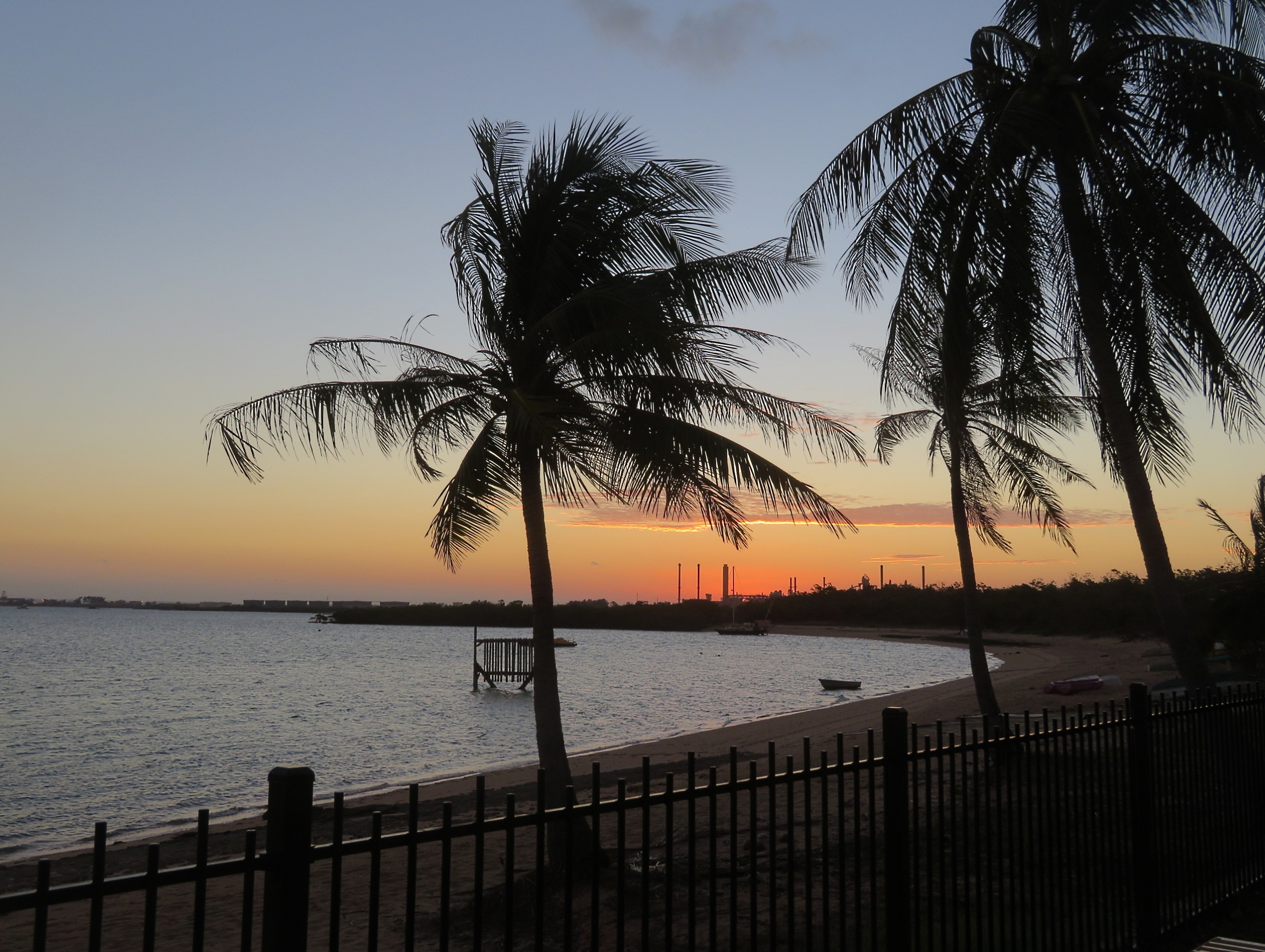
A beautiful sunset taken from the Yacht Club – bauxite processing and shipping structures in the background.

For more photos from this time spent in Arnhem Land CLICK HERE.