Bawaka, Baniyala, Mataranka and home

16th – 28th August, 2019

This part of our travel blog describes the remainder of our August Arnhem Land adventure, taking us from Nhulunbuy to home via the Yolŋu communities of Bawaka and Baniyala in East Arnhem Land and ending our tag-along at the very beautiful Mataranka.

Friday 16th August

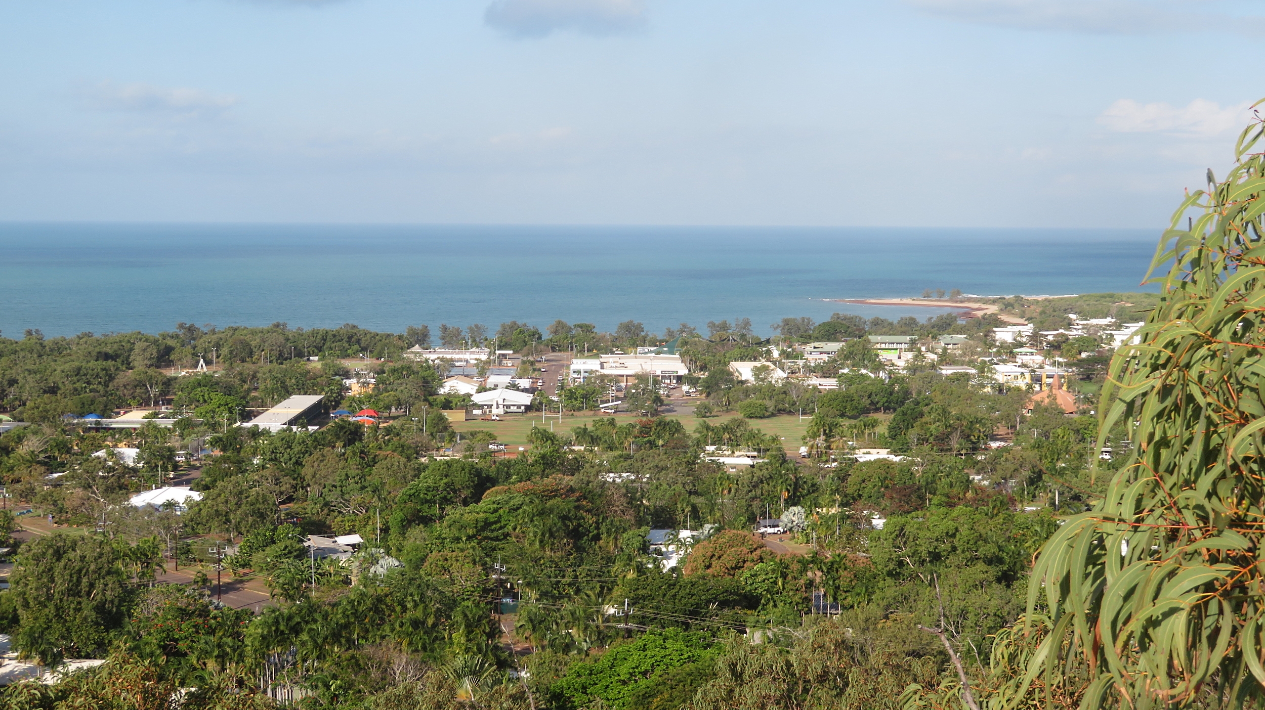
For the next three days we’ll be in Yolŋu homeland country of Bawaka, about 70km southeast of Nhulunbuy.
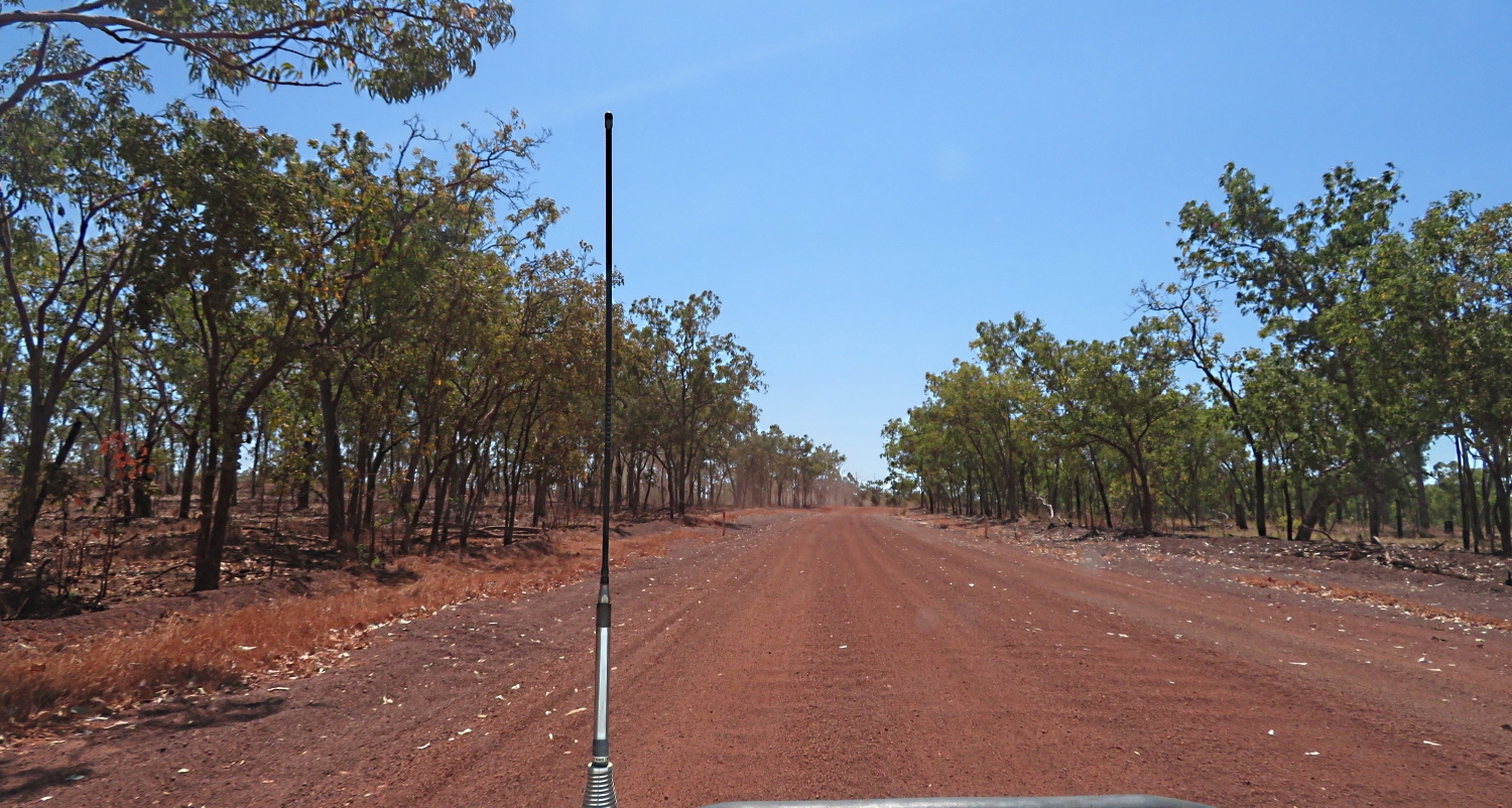
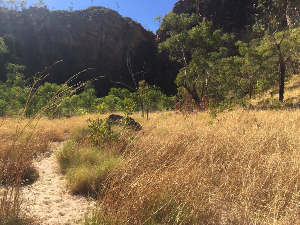
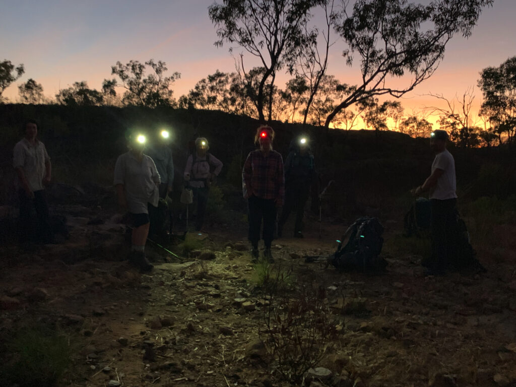
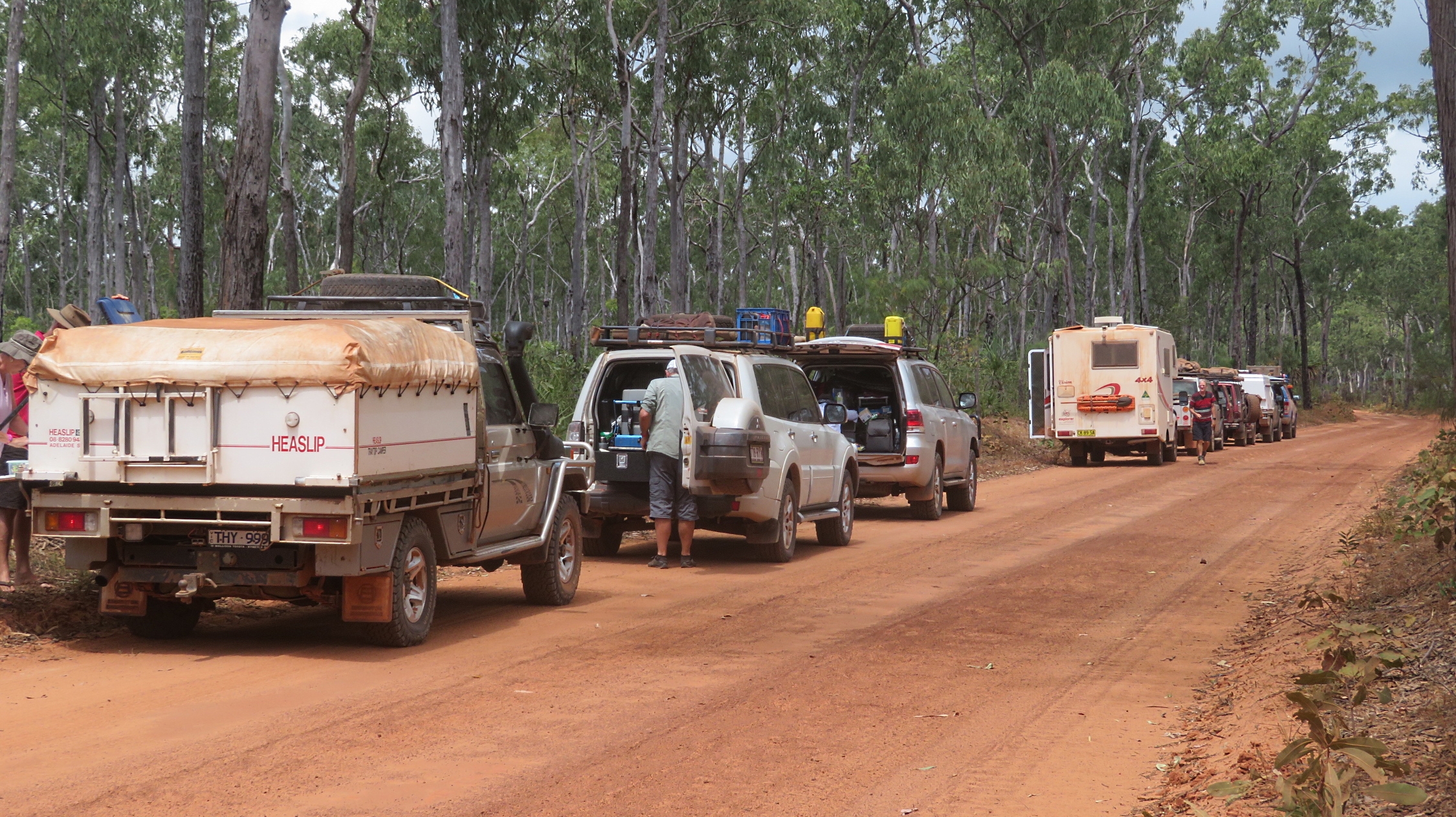
Leaving the Central Arnhem Highway after only 27km a sandy track wound its way through the bush.
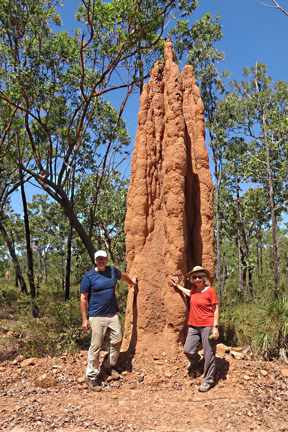
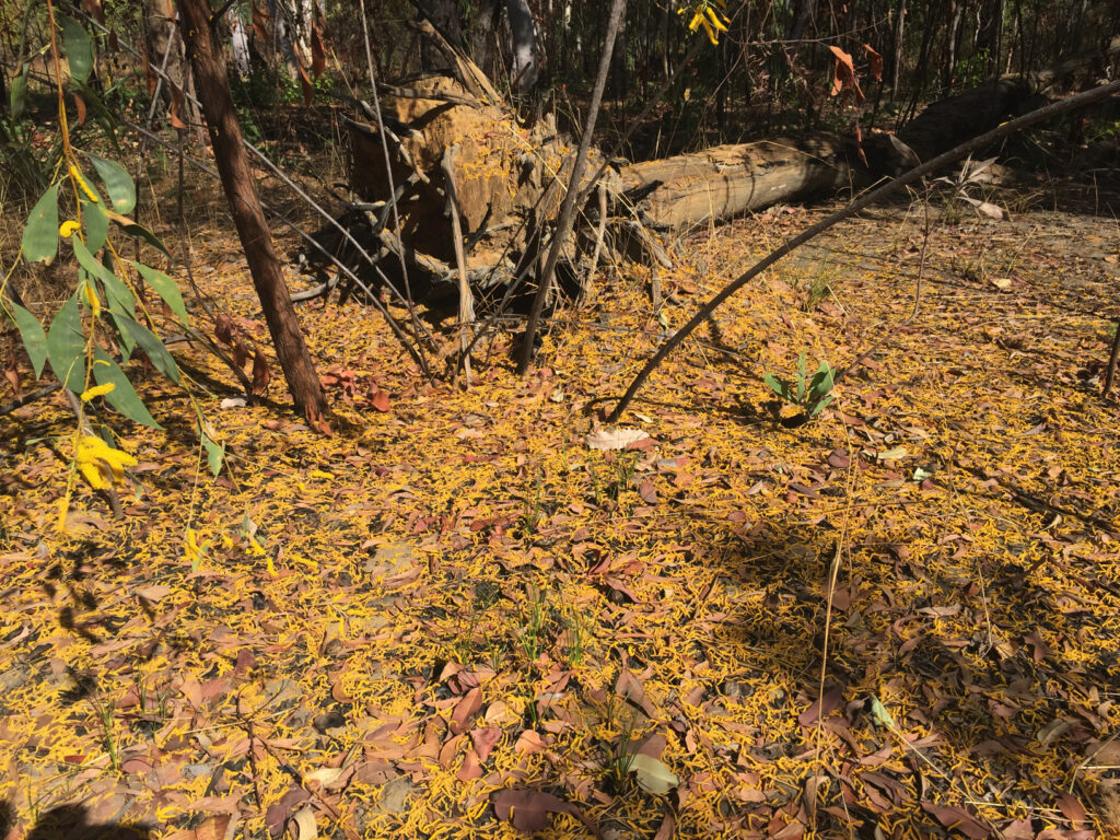
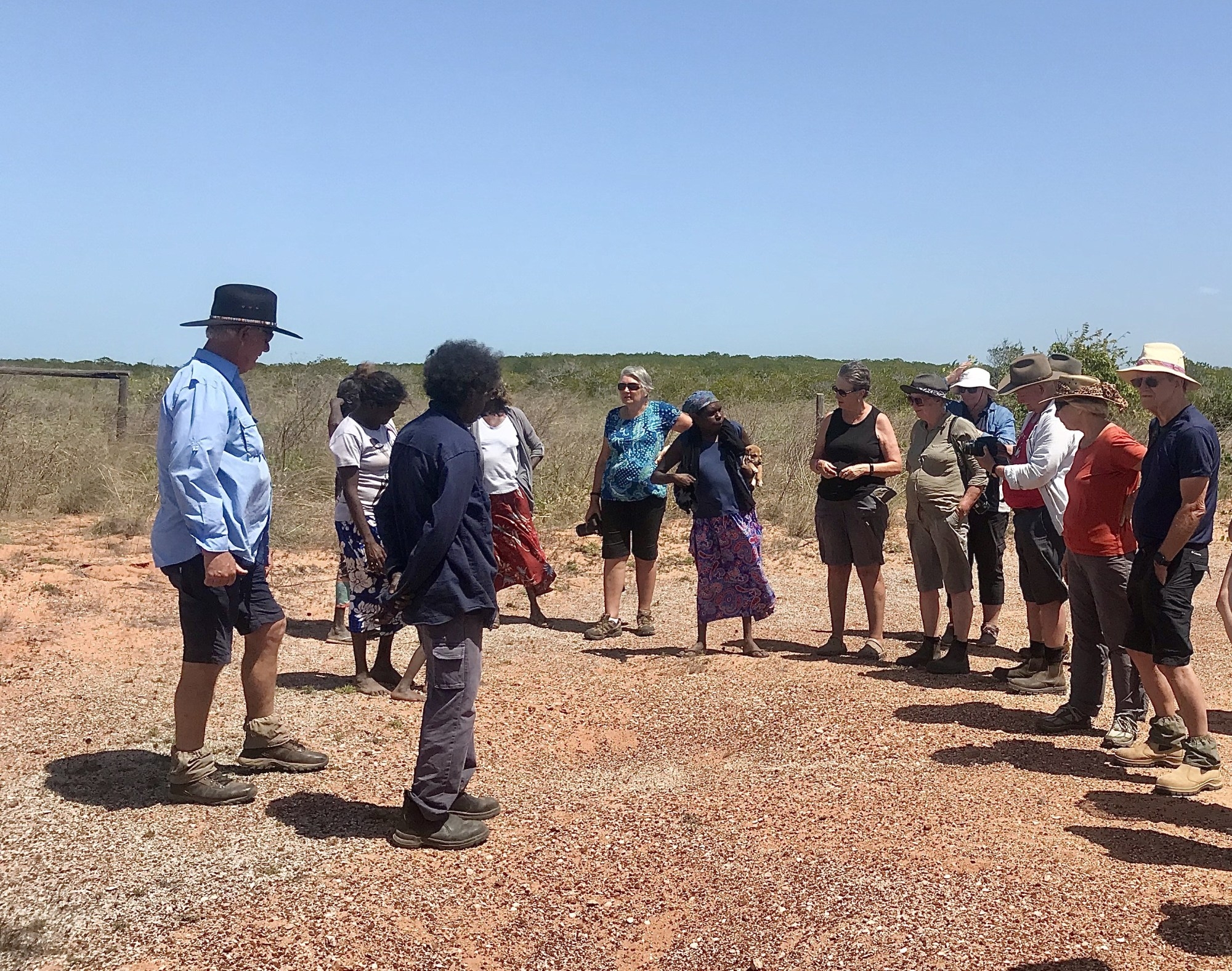
Stopping to have a closer look at a field of termite mounds we learnt this type of “magnetic” termite mound is only found in far northern Australia. The mounds are 2 – 3 metres high and very narrow with their long axis always built directly north-south.

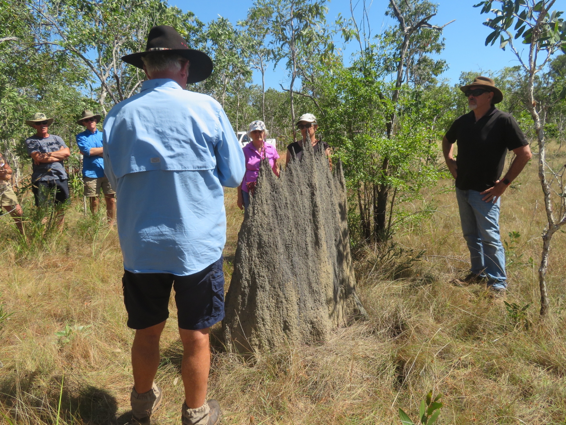
Neill teaching us about the magnetic anthills.

Neill explained the mounds have a central solid core, which insulates the east and west sides from each other. During the morning, when the sun shines on the long eastern surface the termites can be found on the western side, and vice versa in the afternoons, and in the middle of the day, when the sun is directly overhead and there’s no shade, only a very narrow surface faces the sun. The temperature difference between the two sides can be as much as 8 degrees. Other types of termites may retire to underground tunnels when it’s hot, however due to the summer monsoons and these grounds being flooded for months at a time, these termites don’t have that option. With a paucity of trees and wood these termites feed on grasses which are stored inside the mounds.

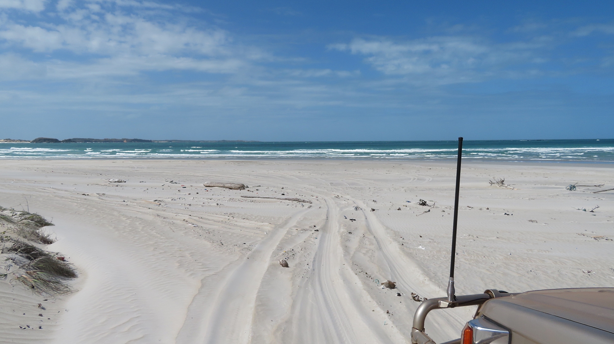
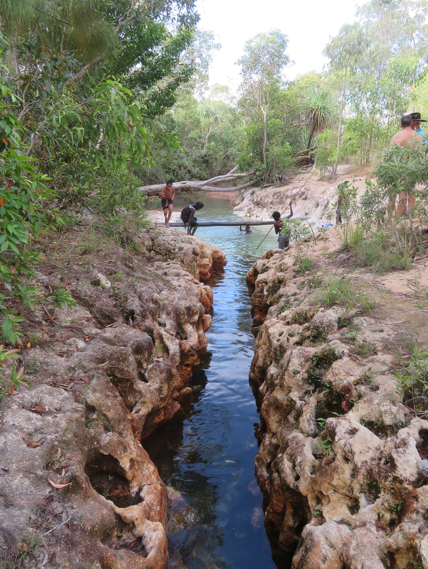
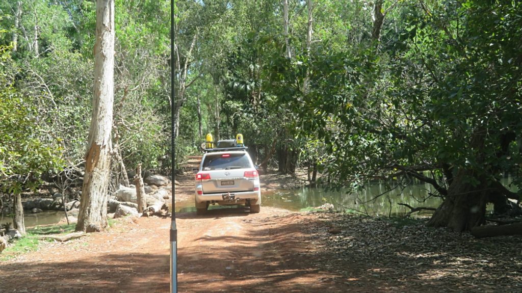
To enter Bawaka Neill opened a locked gate that restricts access and on we drove on an even narrower, even softer, sandy track until we reached the ocean before continuing along the beach.

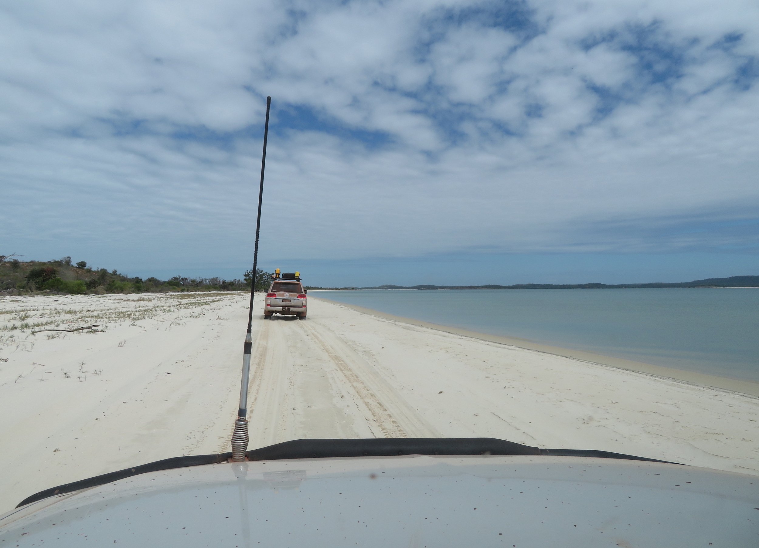
Leaving the very soft sand inland track and now following the beach around to Timmy’s place, Bawaka.

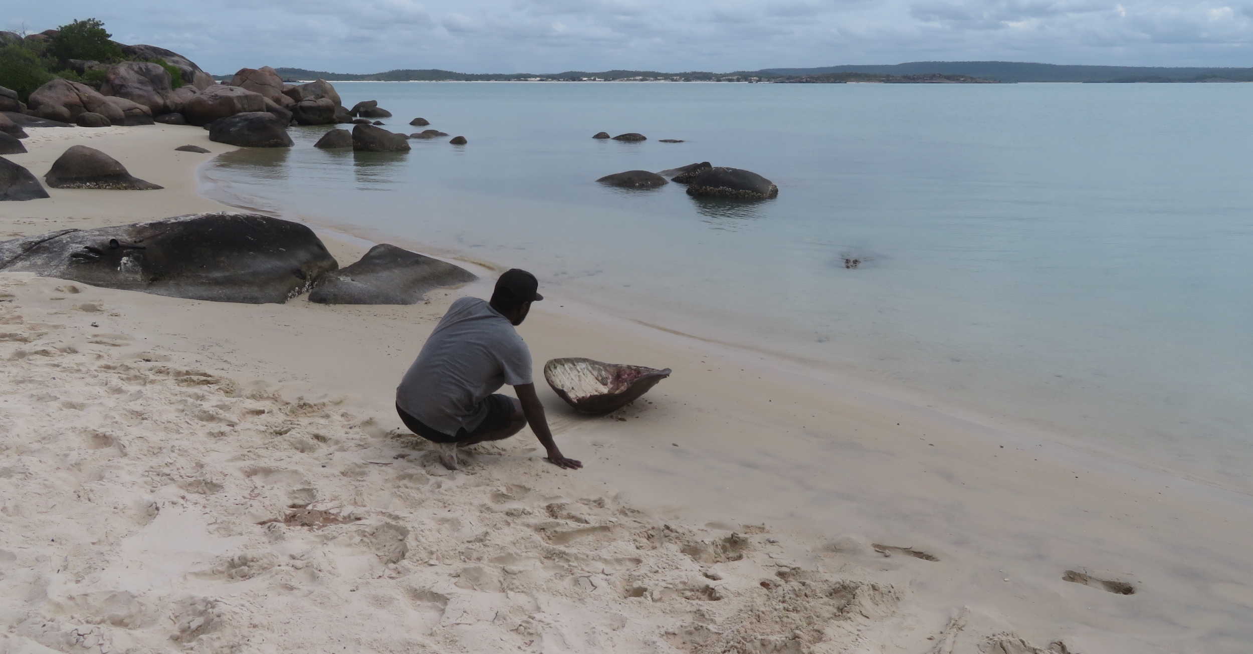
We’re here at the invitation of Timmy Burarrwanga, one of the traditional owners, and it’s Timmy and Jason who soon overtook our convoy and led us in. Suddenly their car stopped, out jumped Jason brandishing a fishing spear, ran into the ocean some 20 metres and speared a mudcrab. How they saw it from a moving car I’ll never know.

Spearing a mudcrab for our dinner.

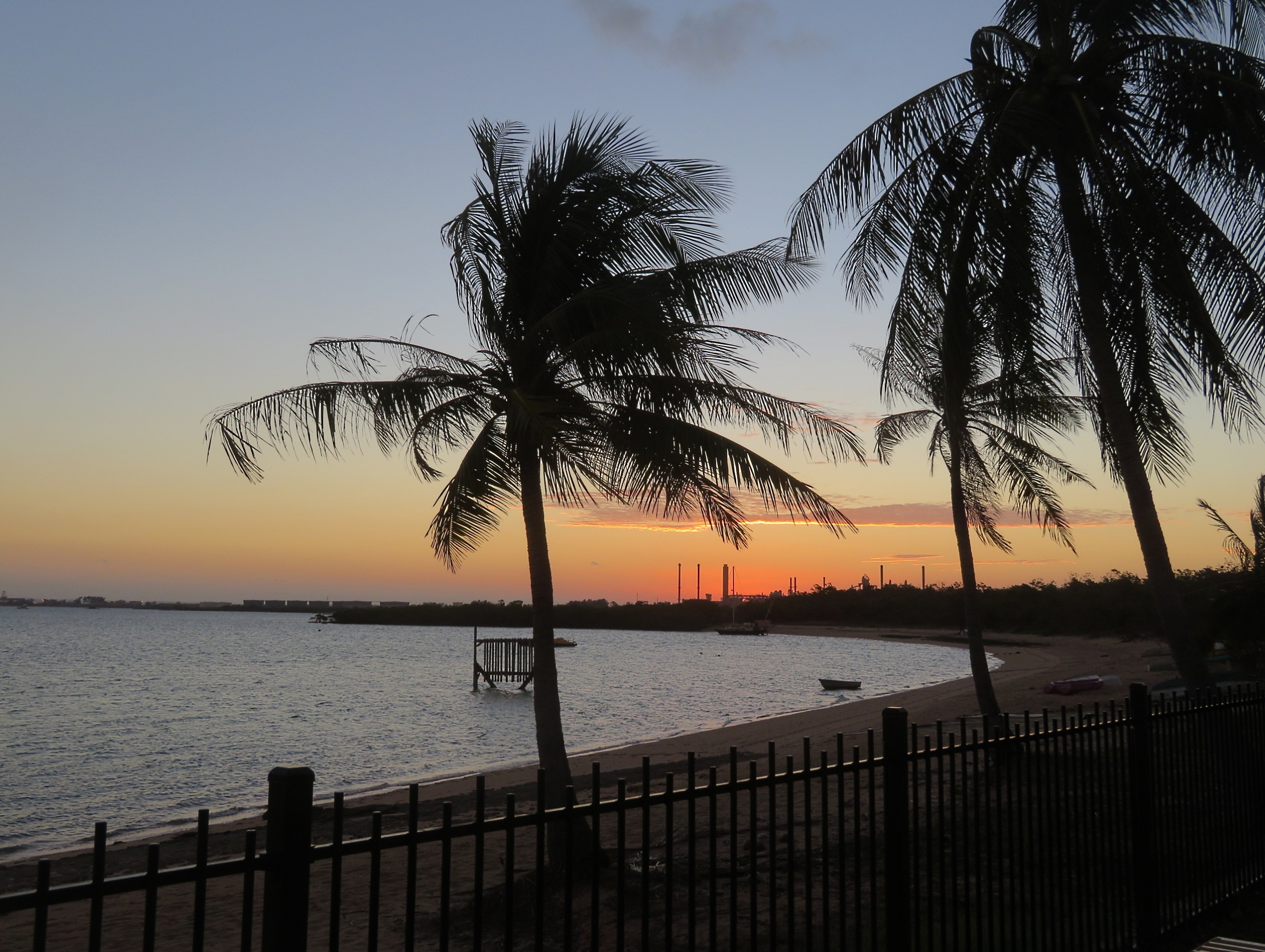
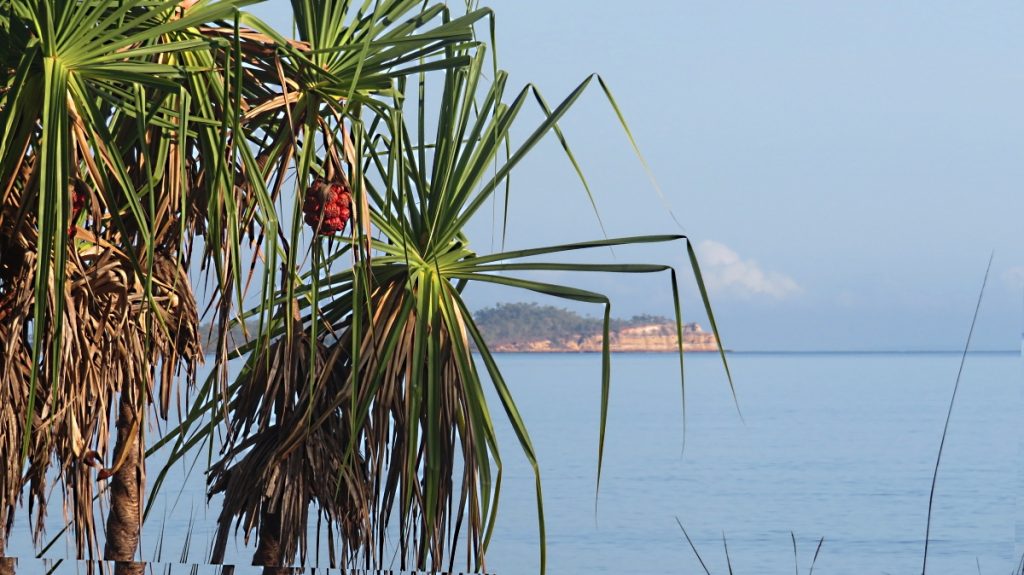
Bawaka means “a known heaven”, and this place is definitely that. Australia has many magnificent beaches, but the stunning blacks and reds in the dunes and rocks that meet the endless curve of the dazzling white sand beach with its shady tamarind trees and coconut palms bending over the clearest blue ocean before it meets the deep blue of the sky makes this one unforgettable.
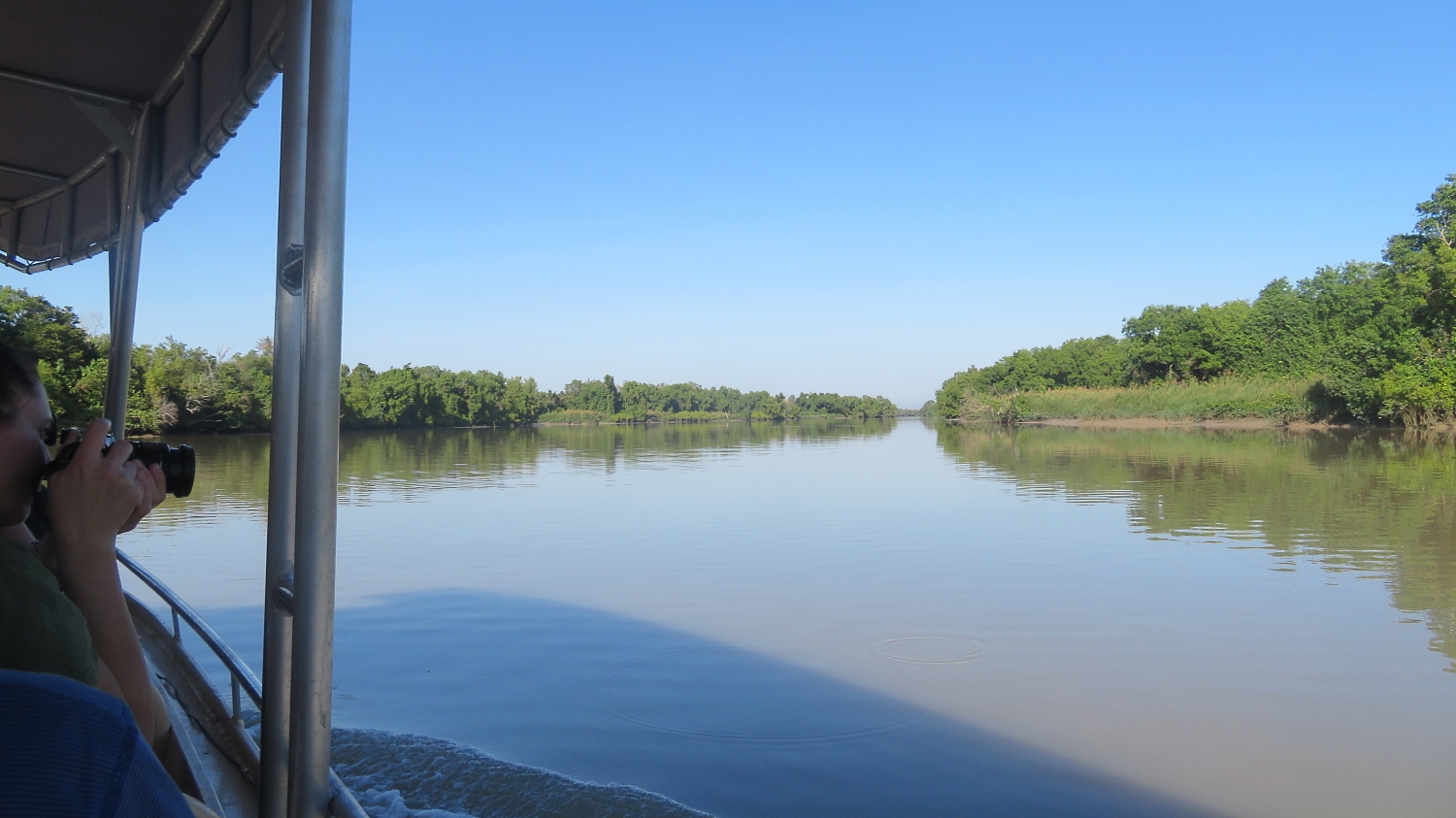
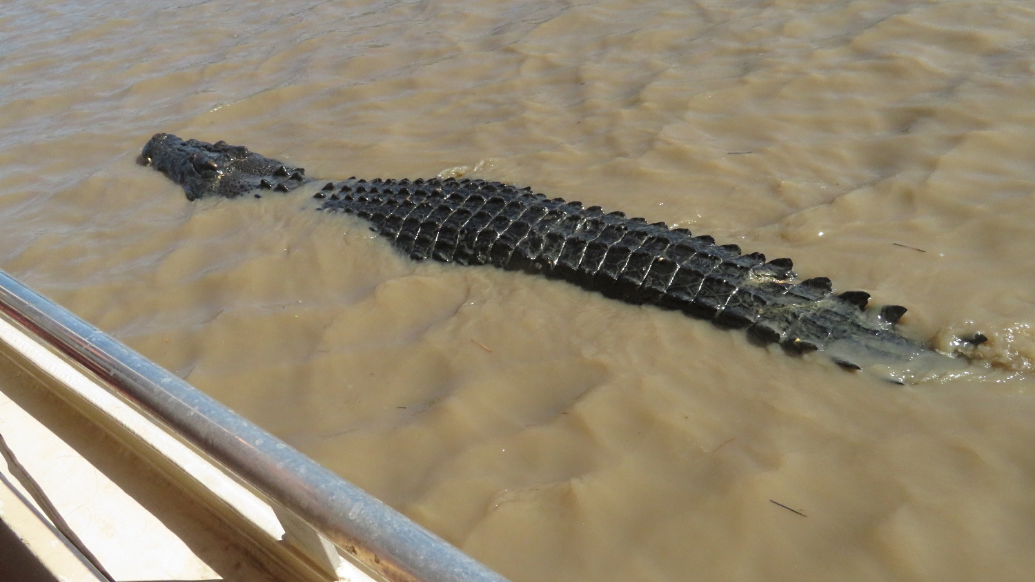
For the next couple of nights we’ll be sleeping on our air mattresses on a large open deck just above high tide mark – and above crocodile climbing height too, I hope! Offshore we could see Nike, the 4 metre crocodile who owns this beach cruising around.

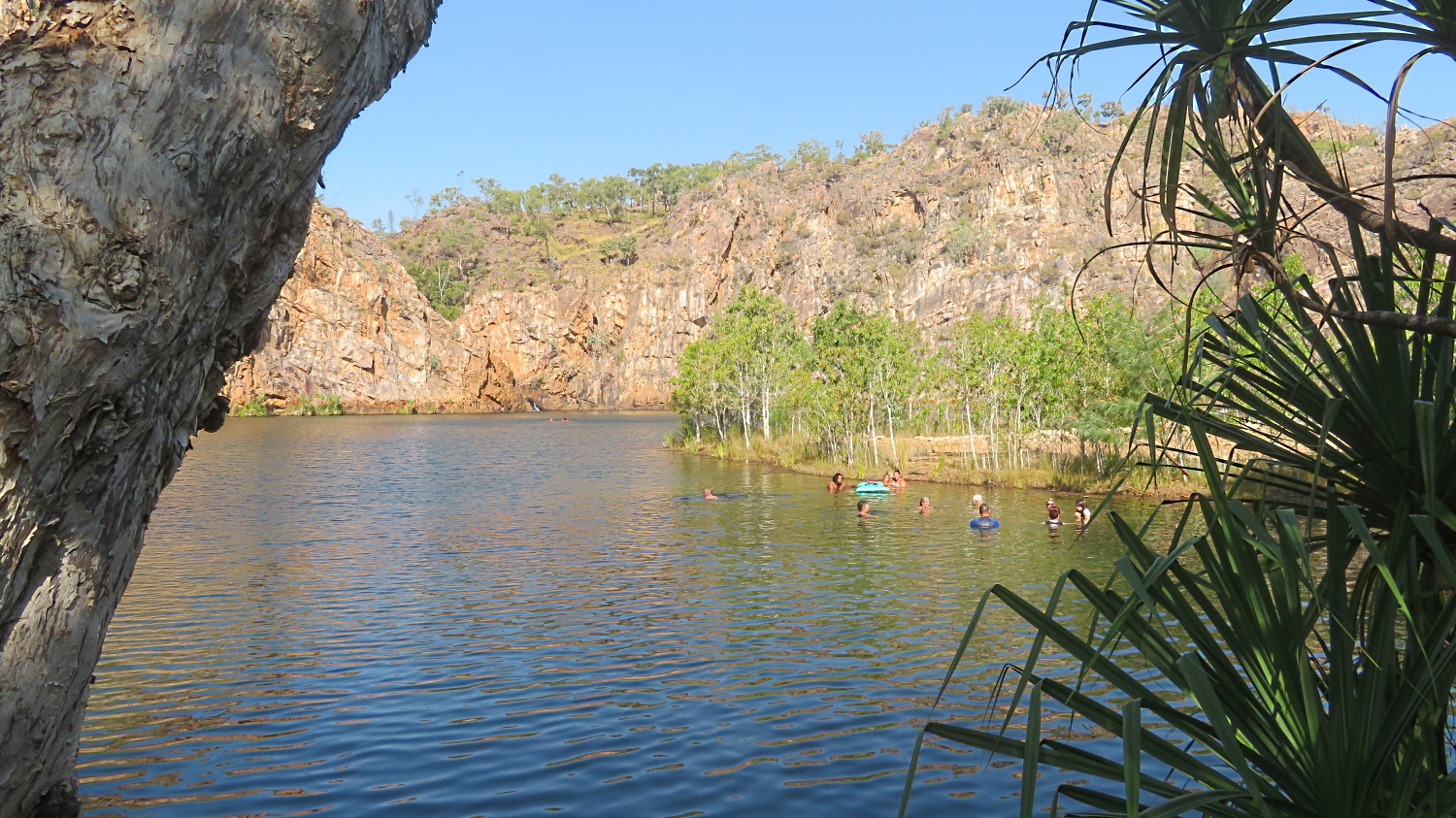
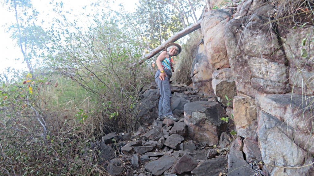
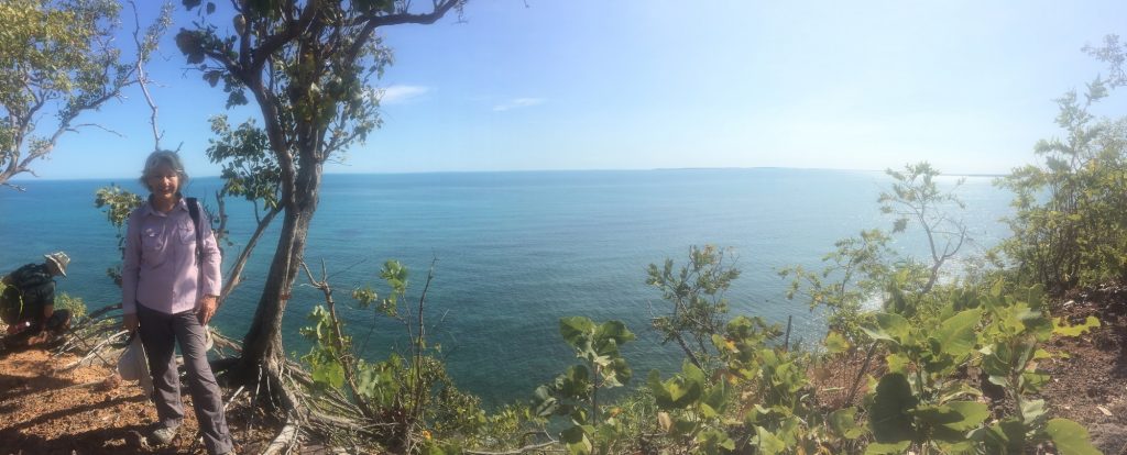
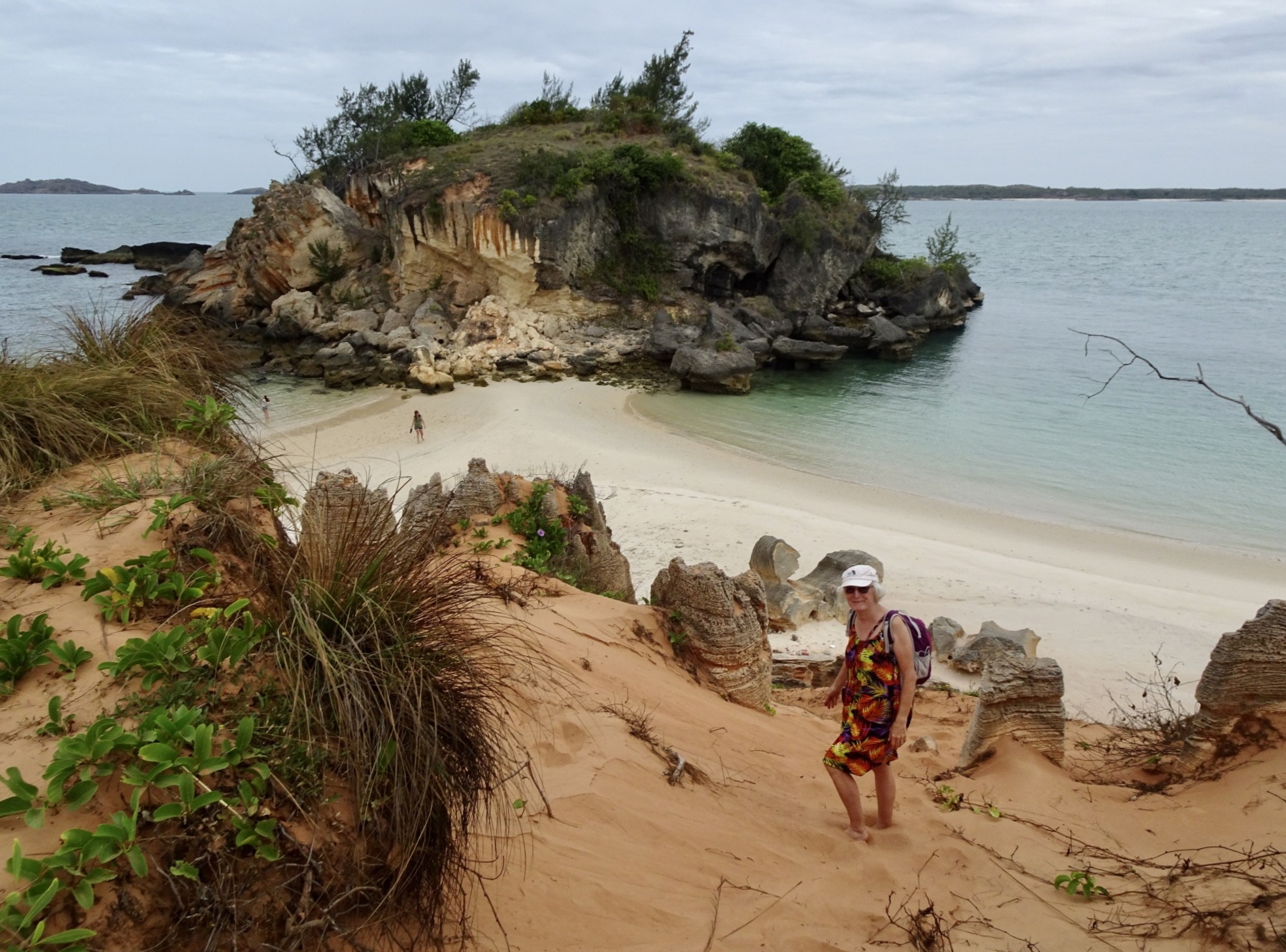
A short drive to the tip of the peninsula brought us out at Lonely Beach which we’d been told was ‘pretty safe’ for swimming (ie probably no crocs!). It’s a magnificent little cove between cliff faces, and the swimming was indeed magnificent.

Pat, heading down the cliff to the shore at Lonely Beach. We’ll swim in the cove to the left, but a lookout remained up here to keep an eye out for dark shadows moving through the water. (with thanks to Pat for the photo)

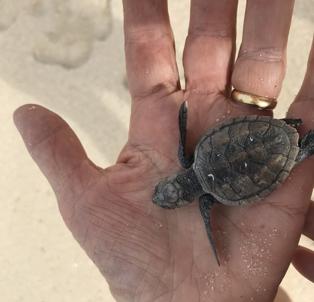
Our belief in what is wrong and right to eat will be challenged over the next couple of days. Yolŋu have protected and lived off this land for many thousands of years. They have title rights over not only the land but also their waters. Being sea people all manner of seafood has been a part of their diet, including dugong and turtles, both animals the western culture protects. This afternoon the Yolŋu men, having received permission of the elders, collected a bucket of turtle eggs and caught a turtle.
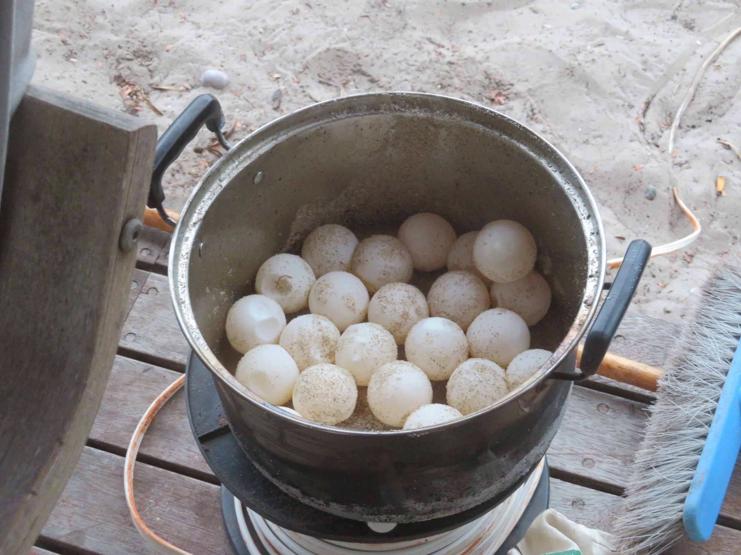
Turtle eggs.

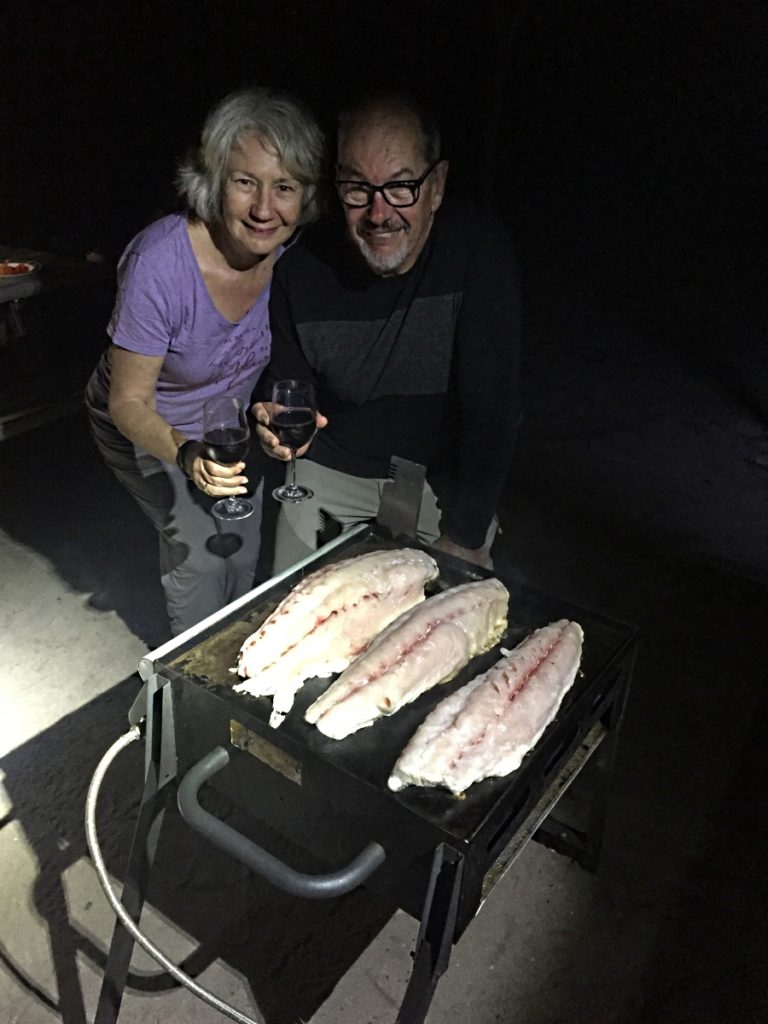
Randy, Timmy’s assistant for our stay, had also been busy spear fishing. We all shared tastes of one of the sea mullets he caught and the crab caught earlier (but not the turtle eggs; though I’m sure they would have shared had any of us asked).

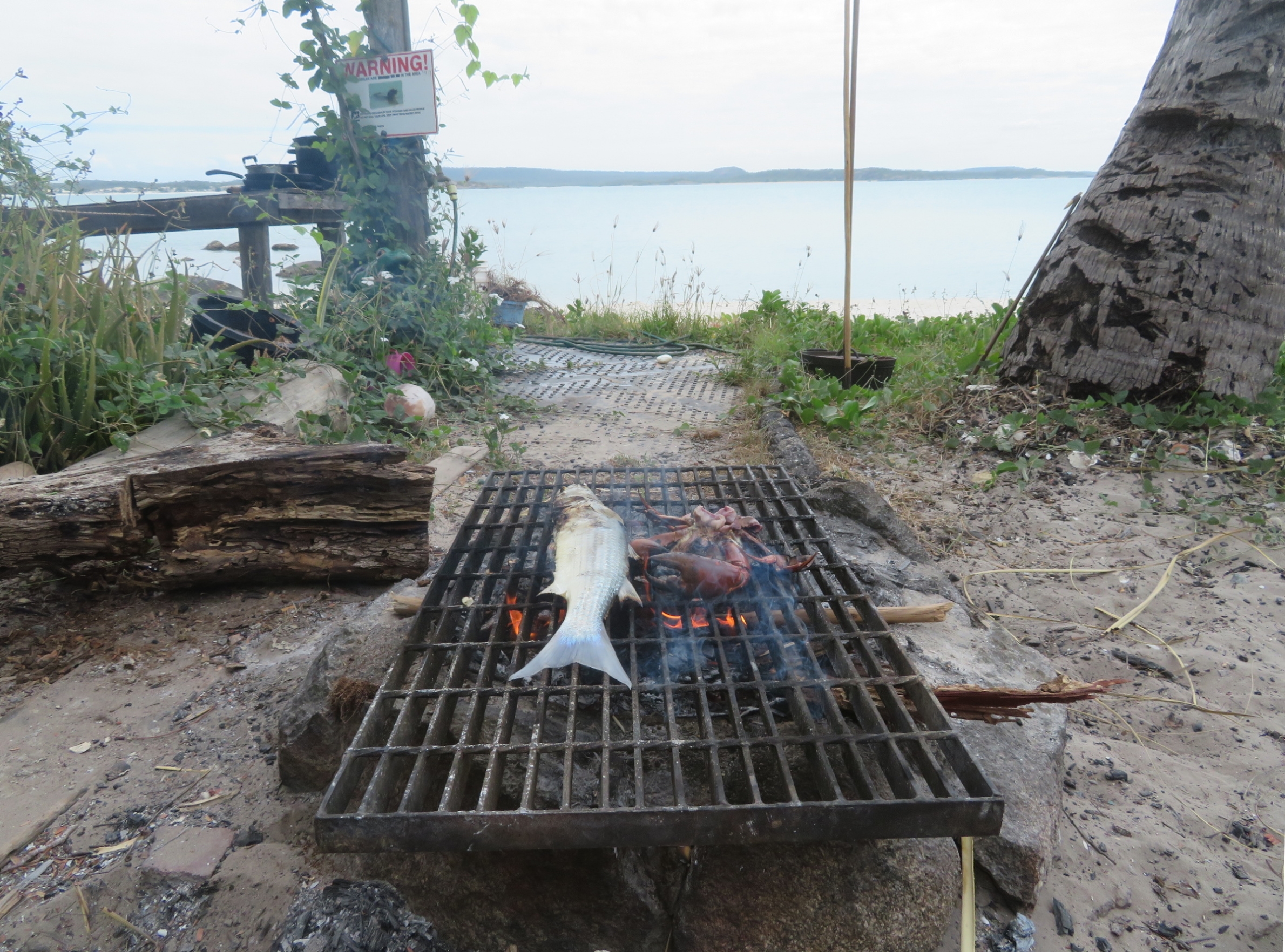
BBQing a fish and mudcrab just caught by the young guys with their spears.

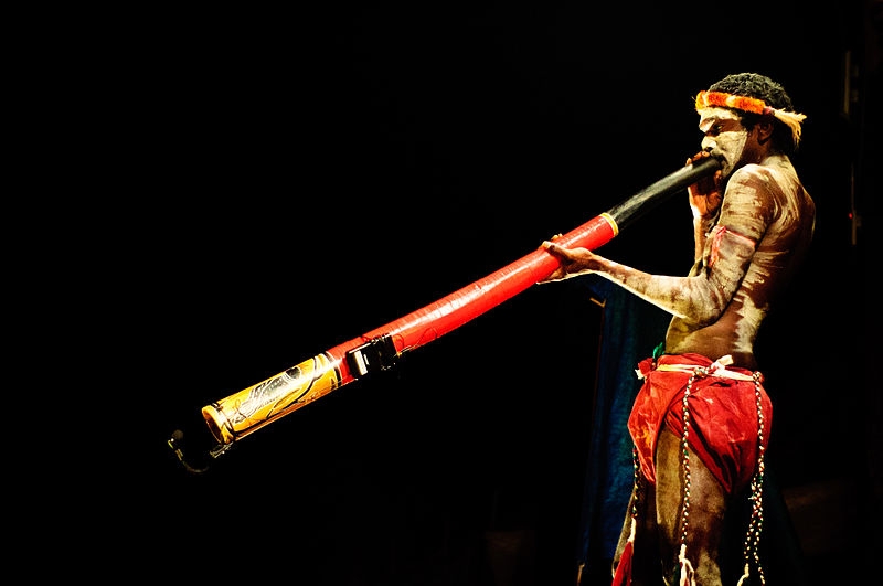
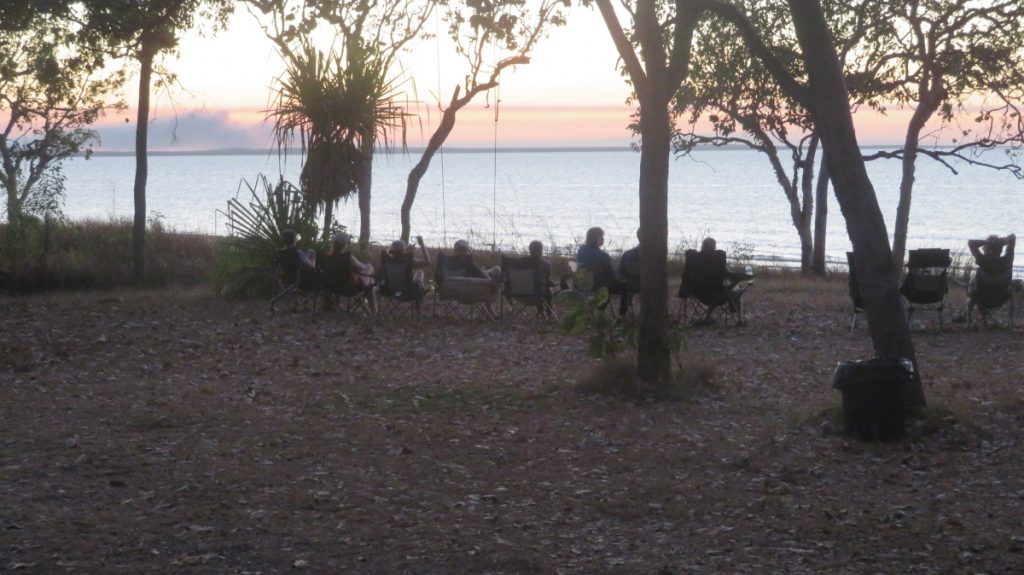
This evening the elders welcomed us to country with song and dance and a smoking ceremony where we all had ochre painted on our foreheads. Jason played the yidaki, Timmy the clap sticks and sang an ancient song and Randy danced. We were asked to remove our watches and become in tune with the rhythm of the land during our stay. A liberating experience. Timmy has been actively engaged in Yolŋu rights, protection of homeland and improving the economic opportunities for his community. While white contact occured here later than in most other parts of Australia and this community appears to be more intact than most, it was still not innocuous.

However the evening wasn’t all ‘deep and meanifuls’. Timmy told us the story of the first tractor in East Arnhem land and we danced and laughed to the ‘tractor song’.

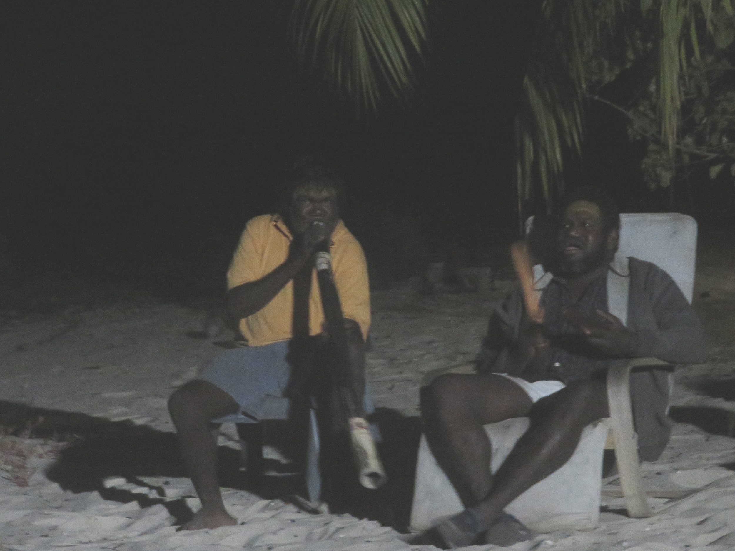
Timmy on the right. Jason playing the yidaki.

Timmy told us Nike’s story. Nike, the 4 metre crocodile, was named in honour of Kathy Freeman. At the time Kathy was in the area for a photo shoot Randy rescued a baby crocodile caught in flotsam. He brought it up as a pet until he became just a bit too big and demonstrated his natural instincts! Nike still comes when called, but is afforded a very healthy respect. At one time when I was standing near the water’s edge with my back to the ocean I was told by Randy in no uncertain terms to come away and never to do that again – I didn’t!

It was a delight to lie in bed tonight on my little mattress on the wide open deck listening to the gentle lapping of the waves and watching a million stars twinkling – a creation story in each. (No mozzies!) What a privilege to be invited to share a tiny portion of the lives of our first Australians.

Saturday 17th

Slow start this morning. It was very foggy, which Timmy tells me is quite unusual. Mind you the little bay looks so ethereal in the fog.

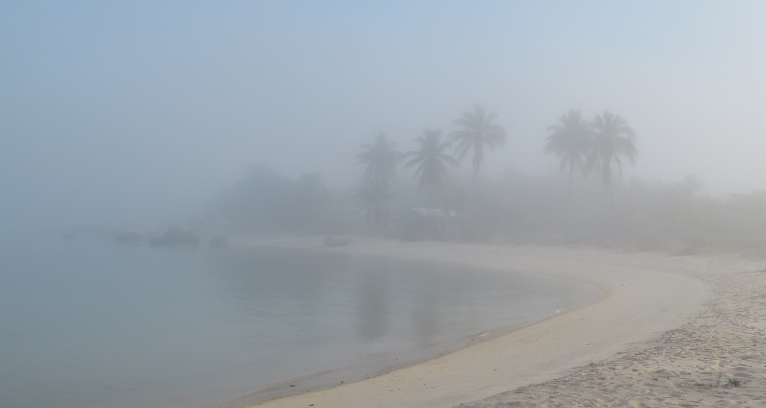
Foggy morning at Bawaka. Very unusual I’m told.

Nike the crocodile is just offshore, watching … I think he knows there’s going to be a feast for him today.

Timmy and Randy and Jason prepared the turtle for cooking today, with some help at times from Paul, Steve Orr and Neill. The rest of us just looked on, or walked away as it was quite confronting. Of course it’s easy to rationalise that we eat other meats and this is no different; however when it’s not part of our culture, quite the opposite, and it’s such a beautiful creature, it’s a little difficult.

If you don’t wish to read about it then skip reading from this photo until the next one.

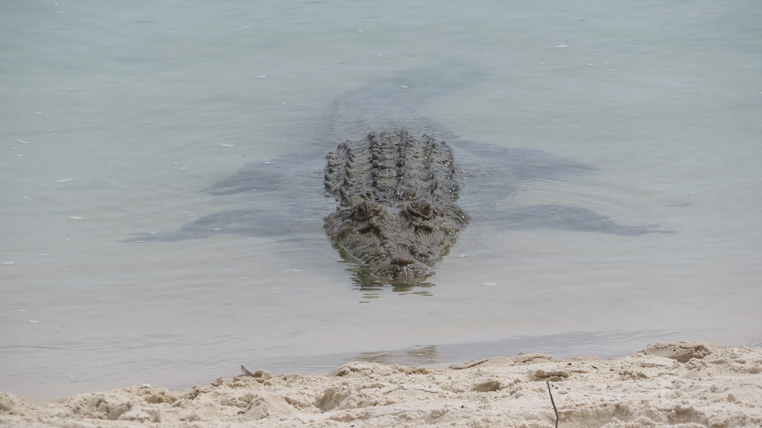
Nike. Thank goodness for long-range lenses. No desire to ever be this close to the gorgeous little critter.

Timmy, Randy and Jason started preparing the turtle for cooking. After the turtle was killed, the head and entrails were removed and wild herbs placed in the cavity. Hot rocks from the fire that had been started earlier were layered on top of them and then topped with grass clumps to keep the steam and heat in. The turtle shell was left standing upright to begin the cooking process.

After some time the turtle was placed on the fire, underneath plate down, then turned over and the outer shell charred. The meat was only partially cooked when it was taken off the fire. The remainder of the cooking will occur just before it is to be consumed. The underneath shell of the turtle was cut and levered off, then Timmy began the difficult, strenuous and precise job of butchering the turtle. The meat was washed and divided into large pieces to share with extended family. Nothing that could be edible was wasted – the intestines were rinsed out to be cooked and eaten too.

Timmy BBQ’d some intestine and liver for us to taste … I guess you could develop a taste for it, maybe.

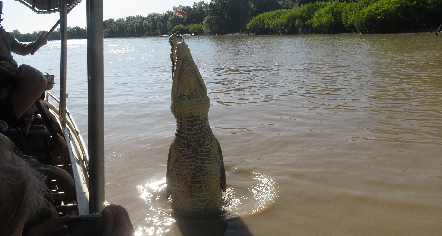
All the inedible parts, ie the head, fins, etc, including the shell, were fed to Nike.  Randy would call him and slap the water with the food for him and he’d come silently cruising in. Randy put the food high up the beach where Nike would lumber up to get it before returning to the water to eat it. A happy croc, but not one I’d like to get anywhere near.

To view the photos taken of this process CLICK HERE.

Randy calling Nike in to take the carapace of the turtle. You can see just his eyes out of the water and the shadow of his body. He’s swimming in. Notice there are no ripples at all. Also notice that Randy is watching him very closely.

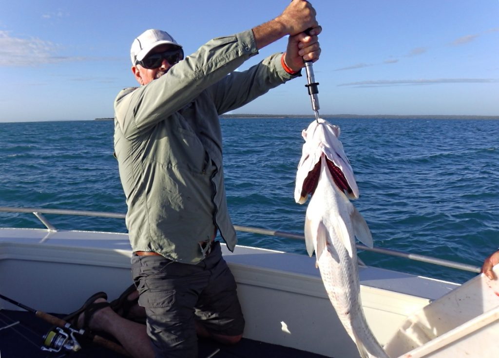
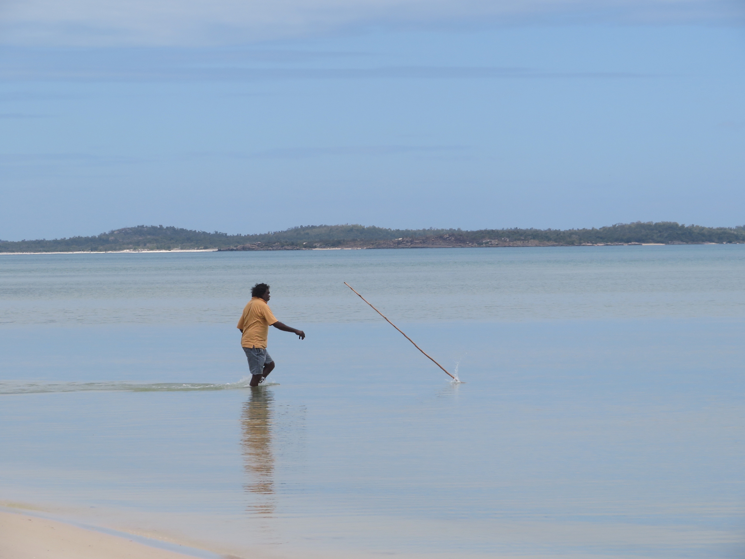
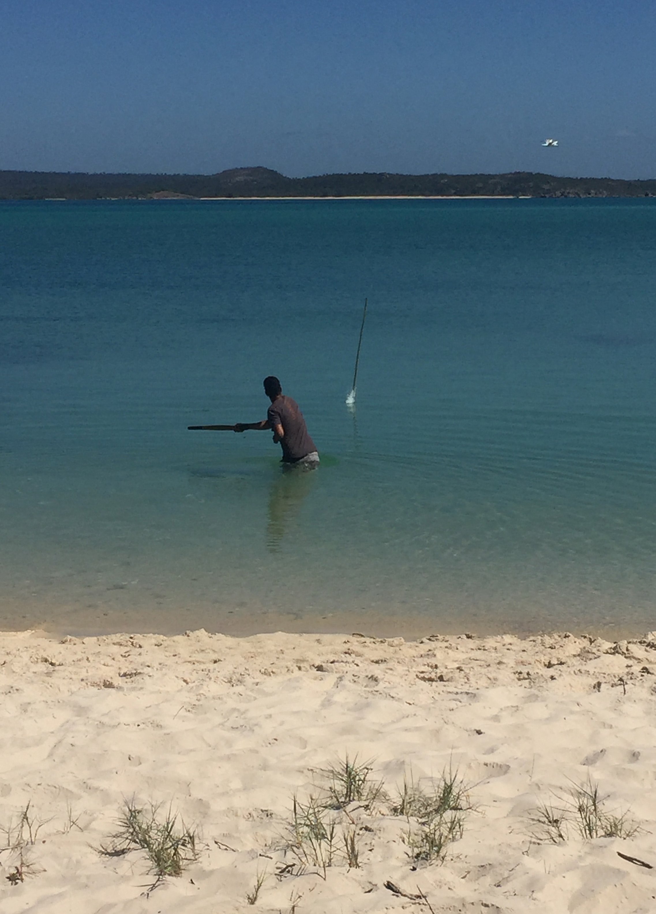
A few more fish were caught today. The keen fishermen in our group went around the other side of the bay with the local men and all came back with fish. Our guys used fancy, expensive fishing gear; the locals used spears.

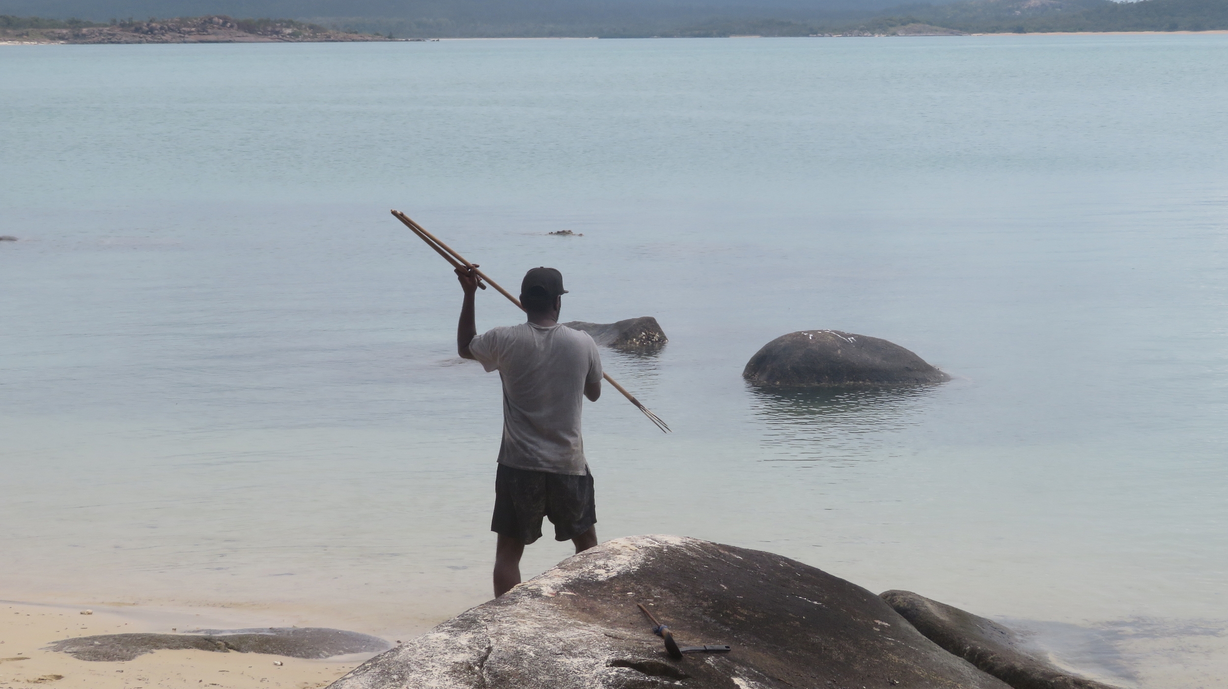
Never lose an opportunity to spear a fish. Note that Randy is holding a woomera attached to the top of the spear to assist with force when he throws it.

We had a big bonfire on the beach this evening and another very moving group talk with Timmy. Amongst other things he explained the way everything is divided into yirritja and dhuwa – like ying and yang. We were challenged when asked to reflect on our knowledge and beliefs of our country’s first people.

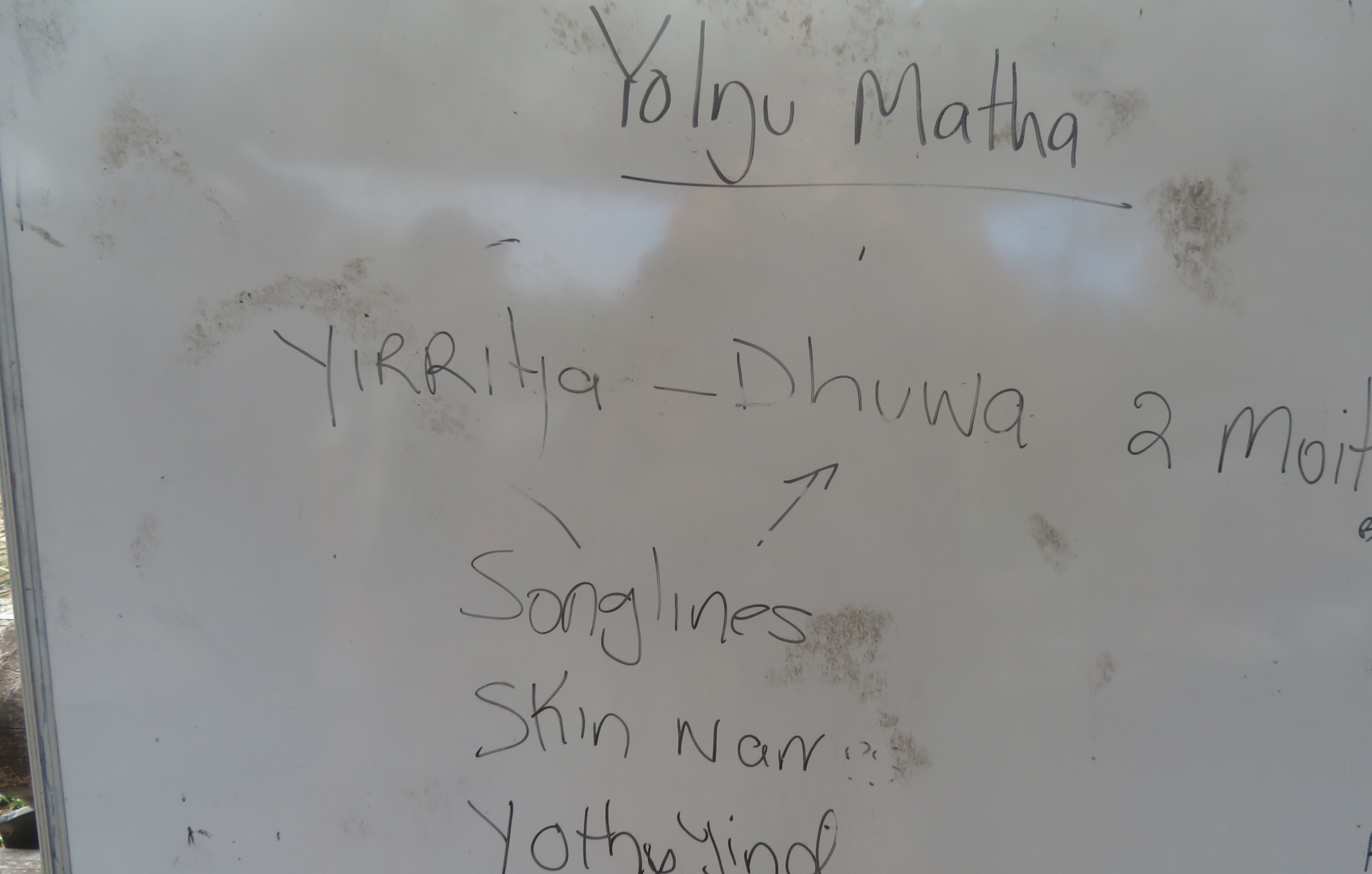
Yirritja and Dhuwa are the two moieties. Yothu yindi translates as ‘mother child’. Everything in Yolŋu life belongs to one of these moieties and they determine how people interact with one another and the country in which they live. It is a very complex and extensive system.


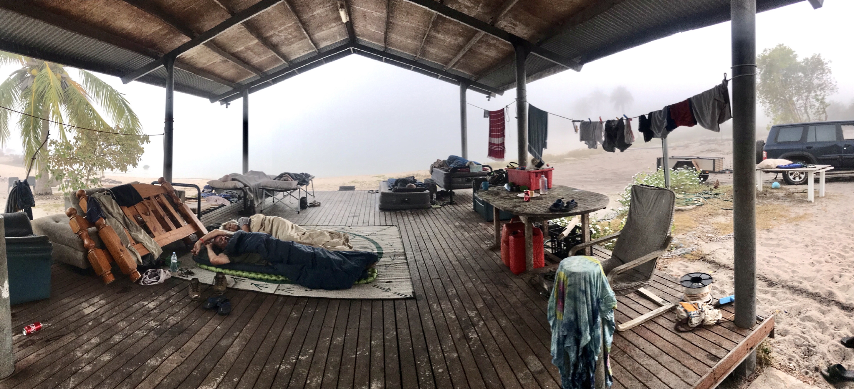
The open deck on which we slept for a couple of nights. Such a pity it’s a foggy morning when this photo was taken. You can see through the fog where the water is. That’s us on the mat at this end. Julie and Paul are sleeping on the stretchers to the far left of the photo and Steve and Jo on the big blowup mattresses on the far right of the deck. And no, none of the clothes and stuff lying around is ours. Others were sleeping either in the bunk house, or several had vehicles in which they could sleep. (thanks to Pat for the photo)

Sunday 18th

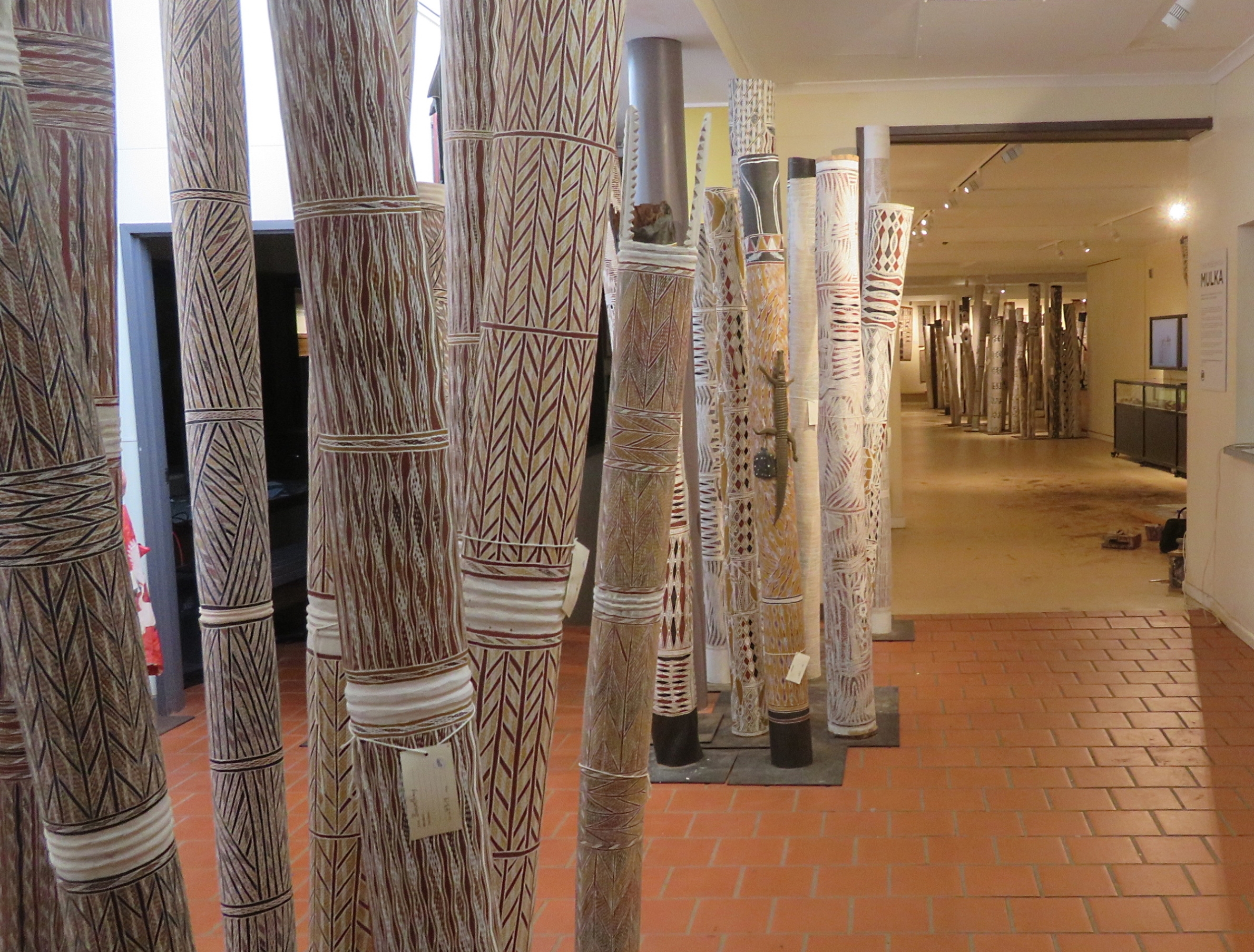
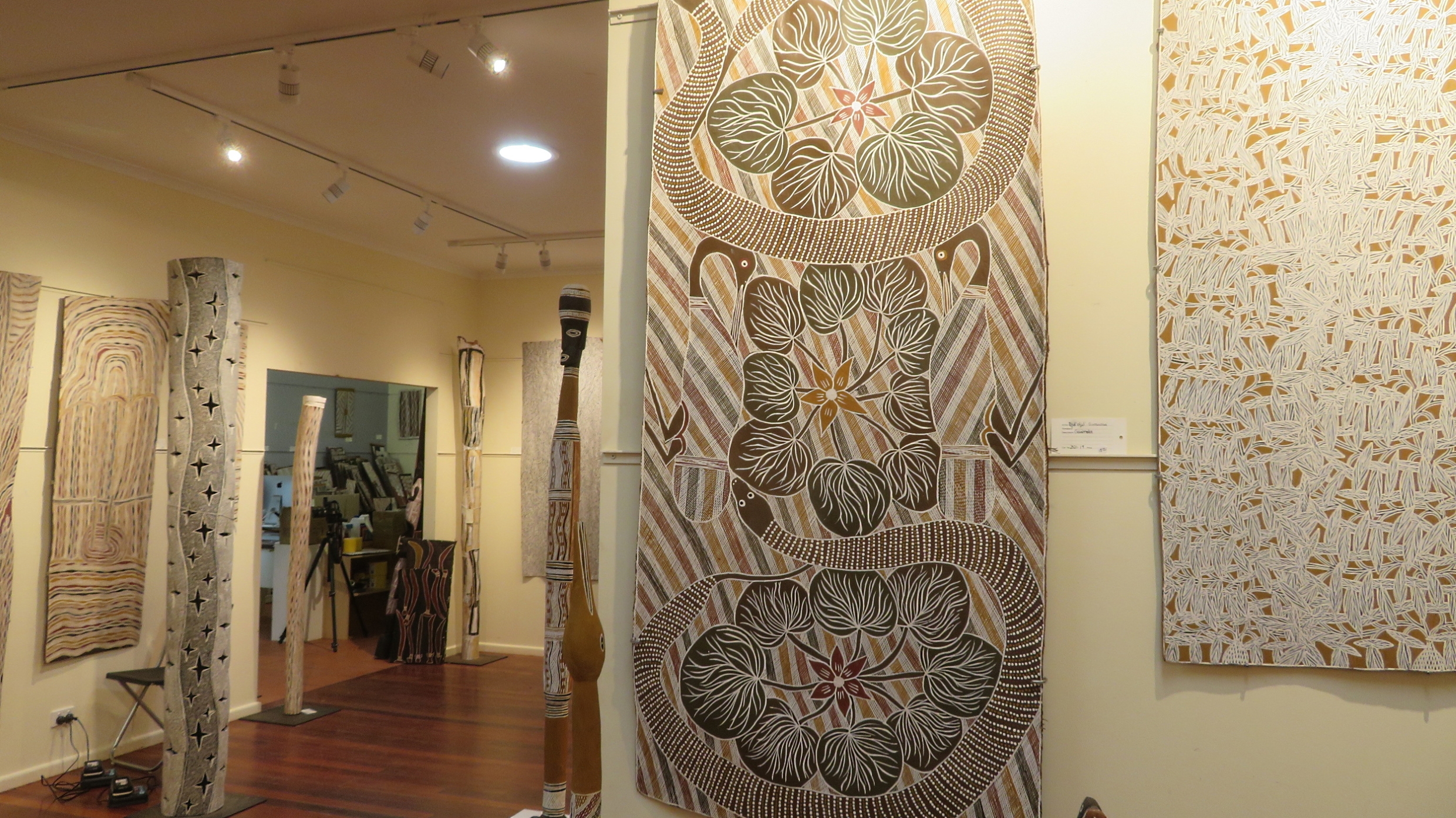
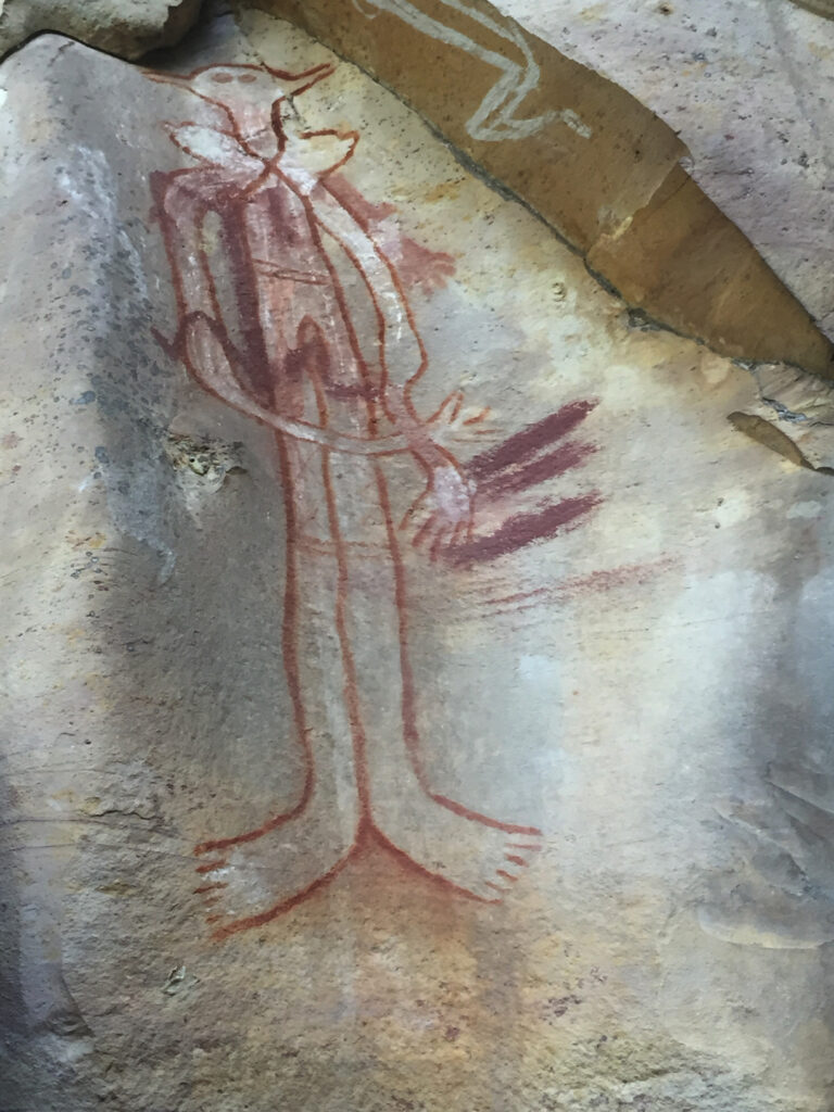
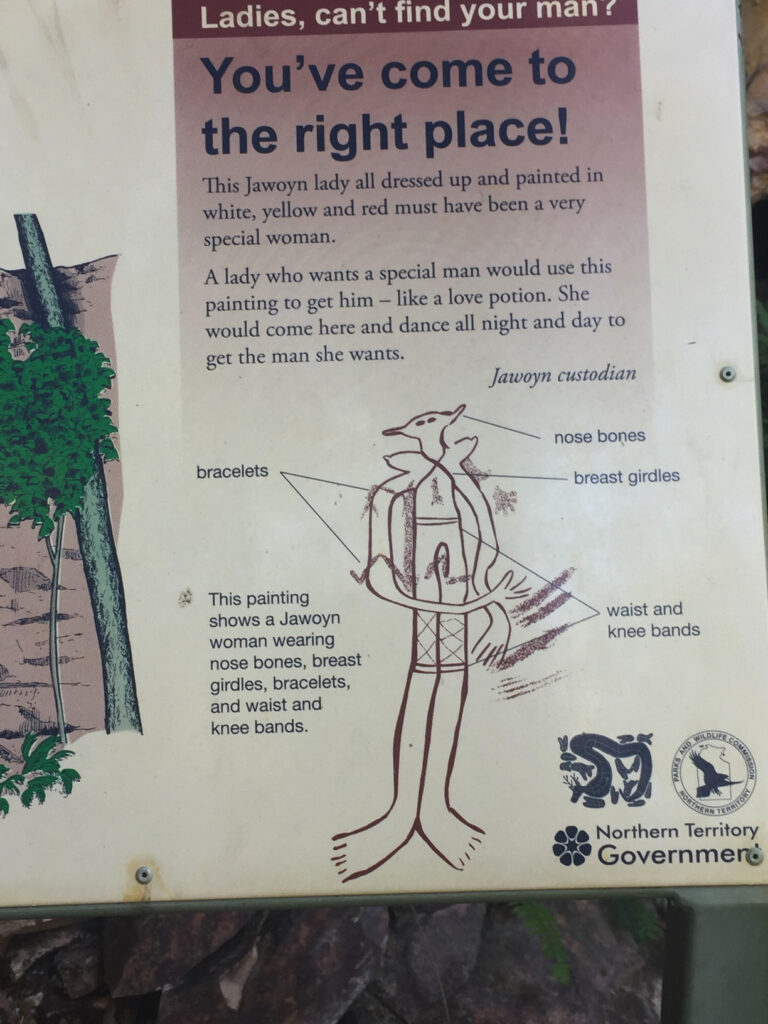
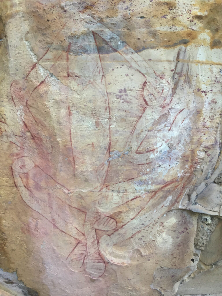
Quite a few of Timmy’s relatives began arriving yesterday from Yirrkala where the family lives. As well as the extremely talented artists whose artwork I showed in my last post, Yirrkala is also the home to several members of the successful music band Yothu Yindi and the award winning singer and musician Geoffrey Gurrumul Yunupingu. No, sadly, I’m not leading up to saying that we had a private concert from Yothu Yindu, just letting you know where they came from and yet another illustration of the talent in this area.

I love this photo of Randy fishing.

One such talented person that I hope we may hear more of sometime in the future is Sienna who is completing year 12 this year and came over to chat with us about her life and dreams and aboriginal culture. A very impressive young woman.

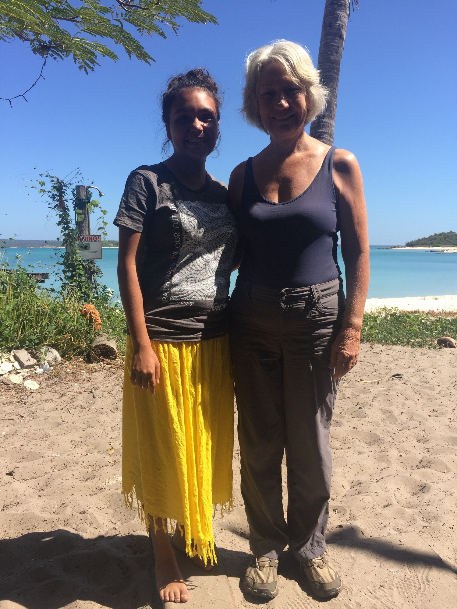
The lovely, vivacious Sienna who spent some time talking with us about her life and plans.

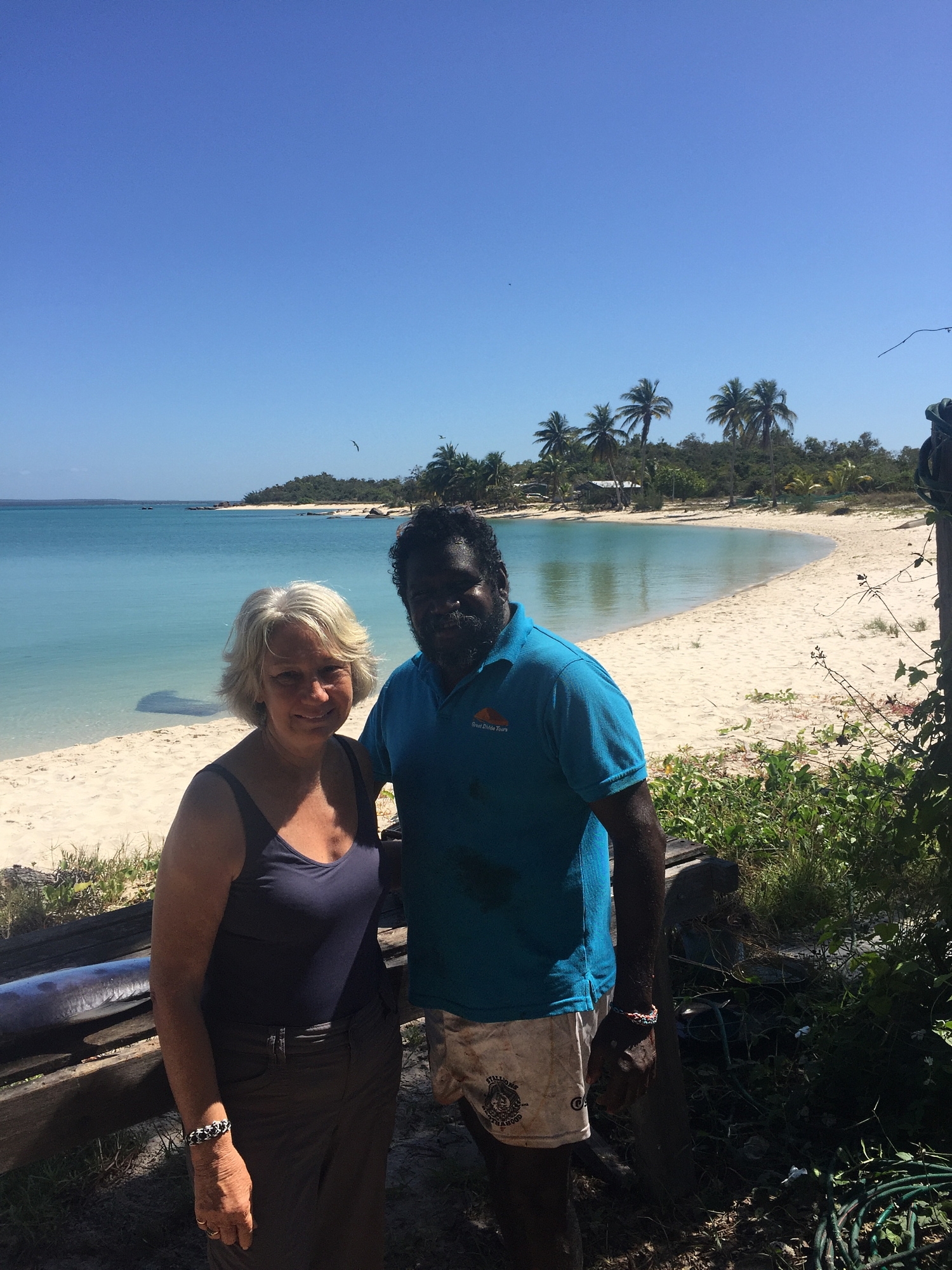
Timmy and I. He shared his homeland and his life with us in a very generous way. What an amazing experience!

One of the family is to be married next week and another turtle was caught and prepared today, all the meat going into the fridges ready for the celebrations.

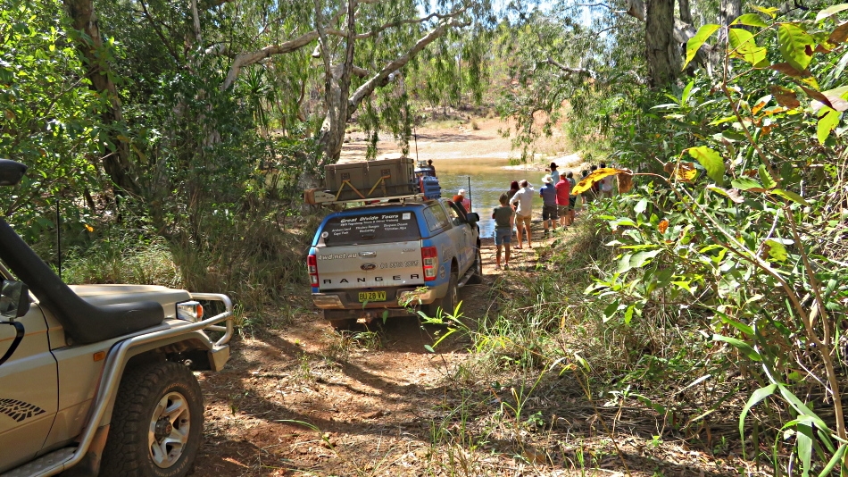
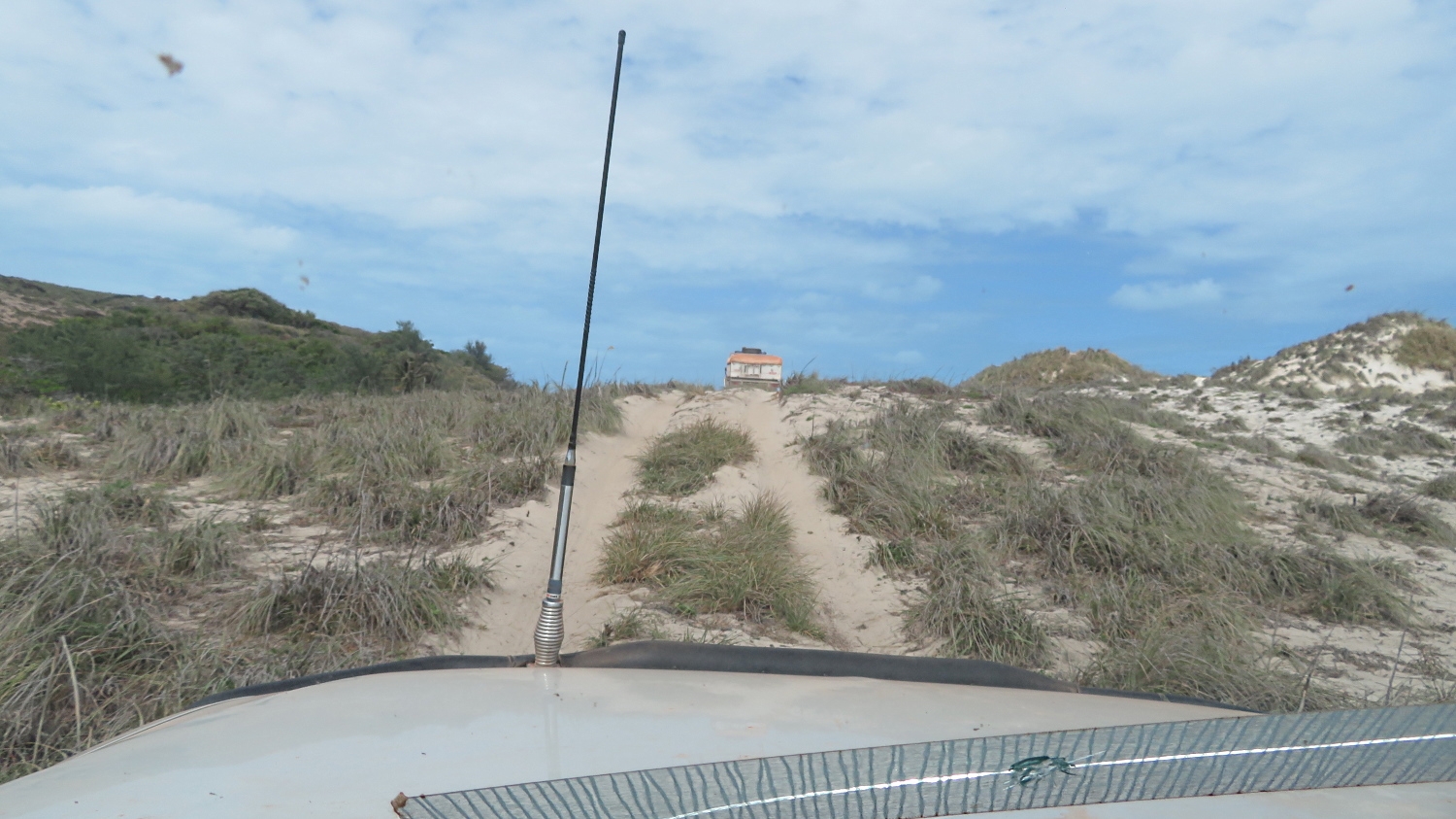
We packed up and left late morning, once more honing our 4×4 driving skills on sand that is so soft you knew if you stopped you’d be bogged. Someone had left the gate open and a random tourist, without permission, had started down the road and was very quickly bogged, blocking the track completely. While Neill was assisting them, and our convoy was all parked sporadically on any firm piece of ground we could find, another of the locals started to come in. I was amazed to see them leave the track completely, the passenger got out and, walking in front of the car, guided the driver through and around obstacles as they made their way through the bush and past us.

Back in Nhulunbuy for our final night here we shopped, refuelled, washed and generally sat around marvelling at the most incredible experience we’d all just had … and snuck our watches back on.

Back in Nhulunbuy, chatting about the very unique time we had at Bawaka.

Monday 19th

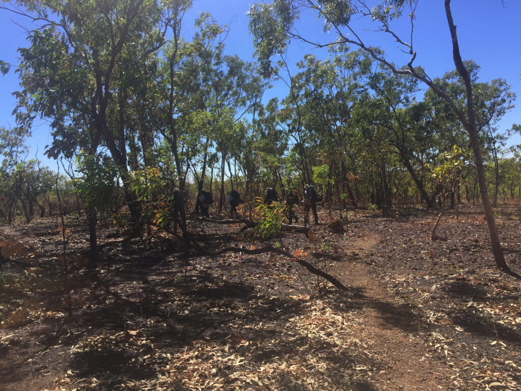
After a last visit to the bakery we headed back onto the Central Arnhem Highway, then along the track toward Baniyala.

Lunch break on the way to Baniyala. Only occasionally did we see oncoming or passing traffic on all of these roads.

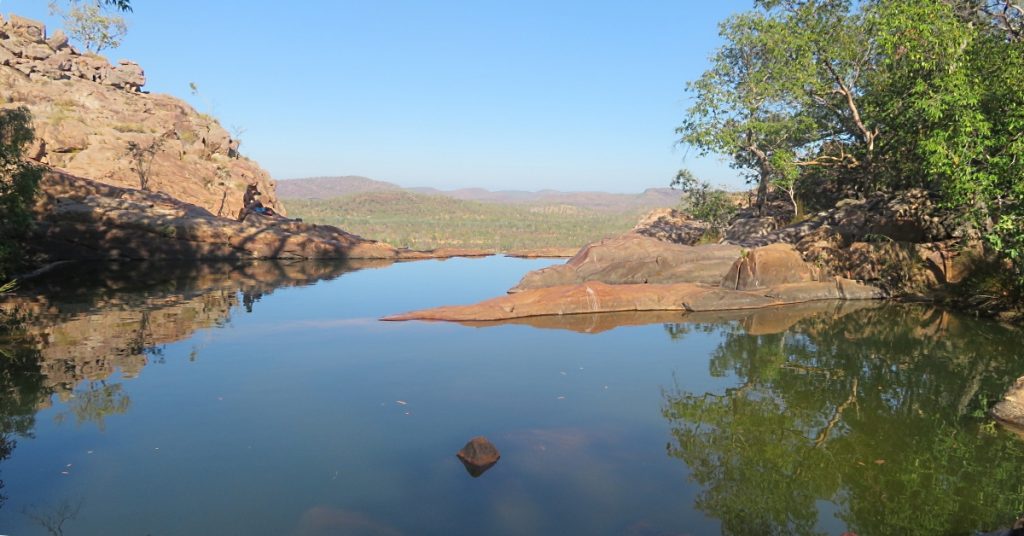
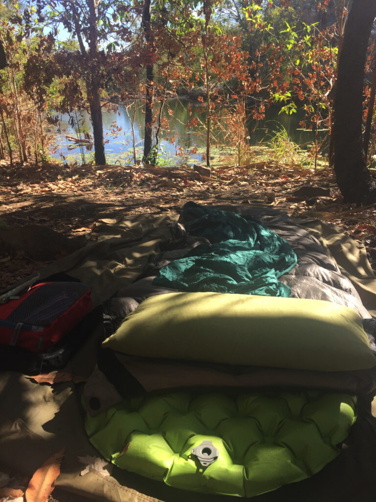
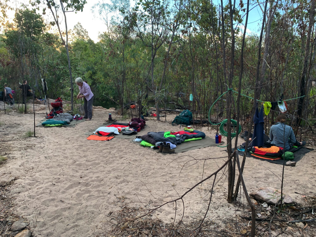
We drove on past the Baniyala turnoff to the National Parks camping area at Dhuluwuy Bay where we set up camp just metres from the ocean.

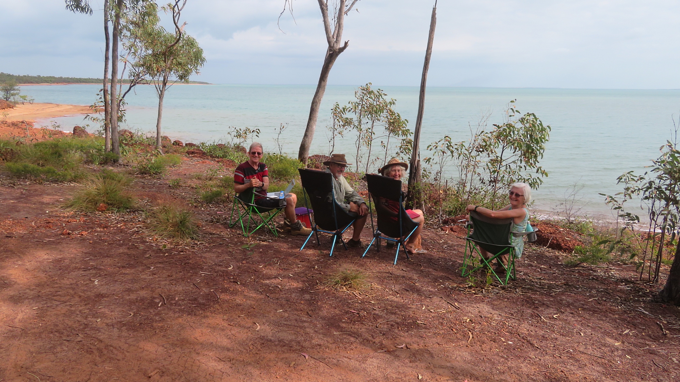
Oh it’s us! Dick, Steve, Denise and Pat. World problems solved!

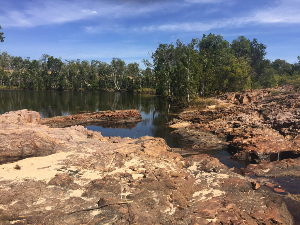
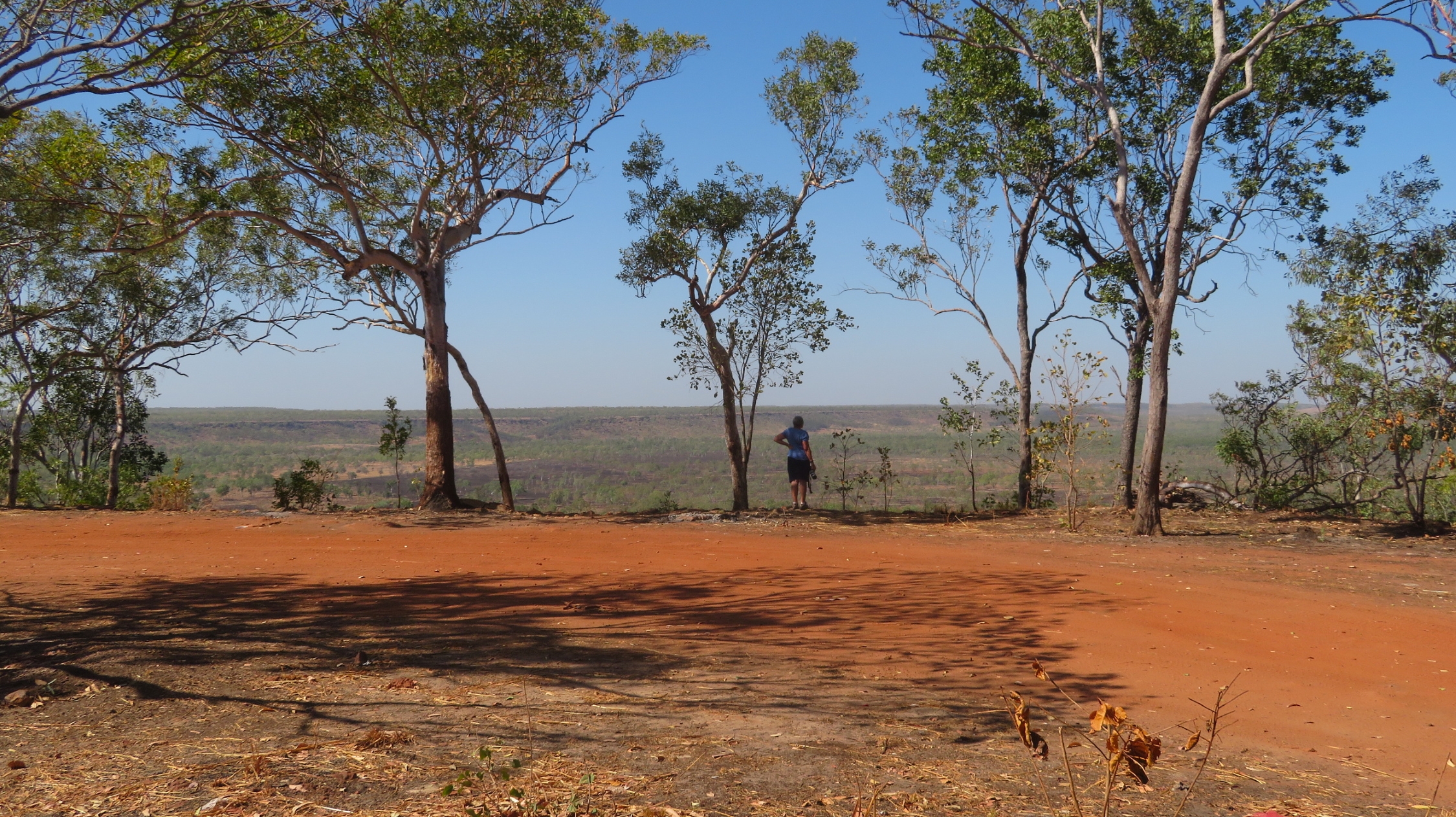
Admiring the view over Blue Mud Bay towards Groote Eylandt and into the Gulf of Carpentaria didn’t seem to tire us until well after a beautiful full moon rose.

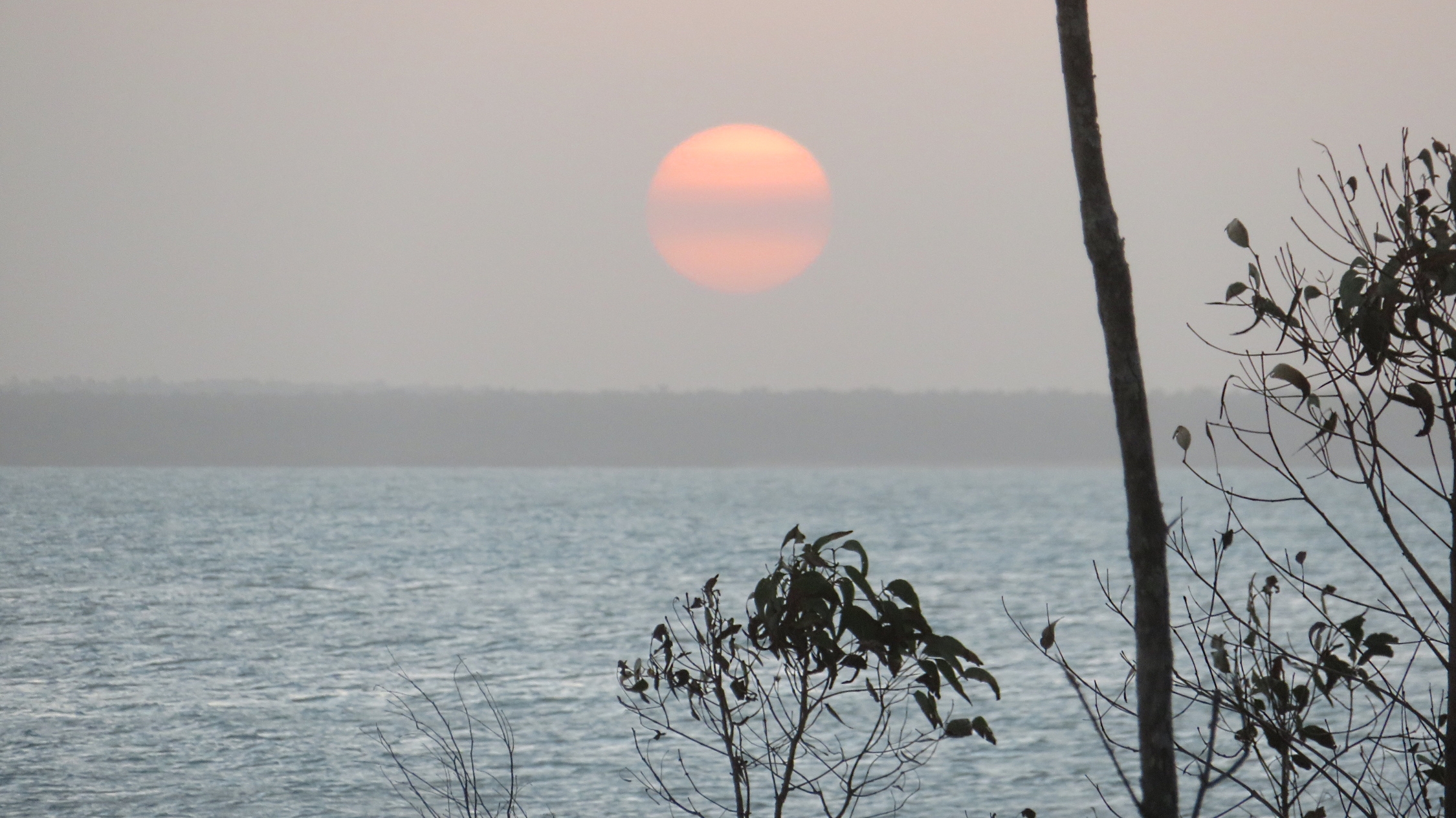
Moonrise over Blue Mud Bay. Wow, could life be more perfect.

The disadvantage of being right on the cliff edge overlooking the ocean, is the wind – blew lots tonight making sleep sporadic.

Tuesday 20th August

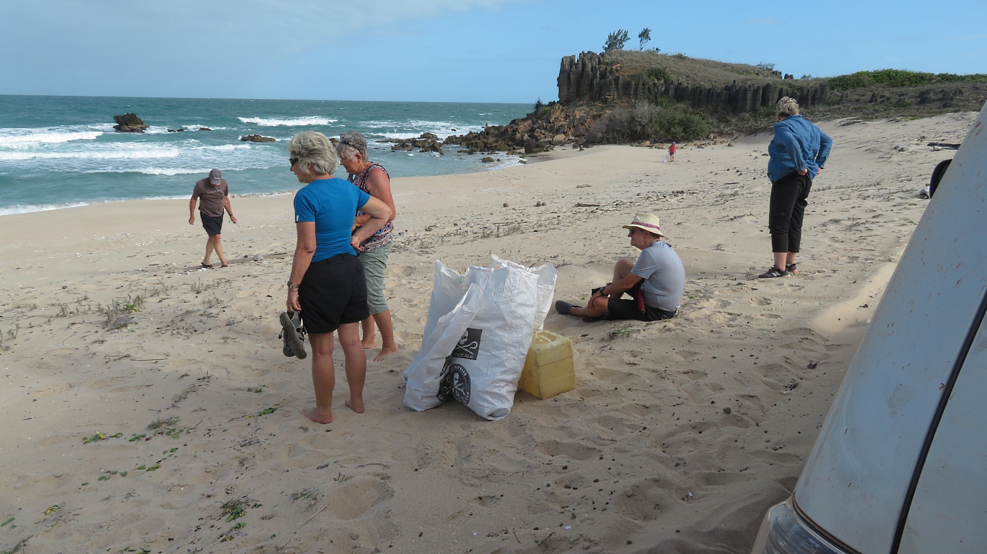
As a form of thanks for the unprecented access we’re granted by the local communities to share their lives, Neill takes every opportunity to contribute where he can; an example was the beach clean-up we did earlier. Today several of our group went with Neill into Baniyala to fix some tents that may one day become a tourism venture.

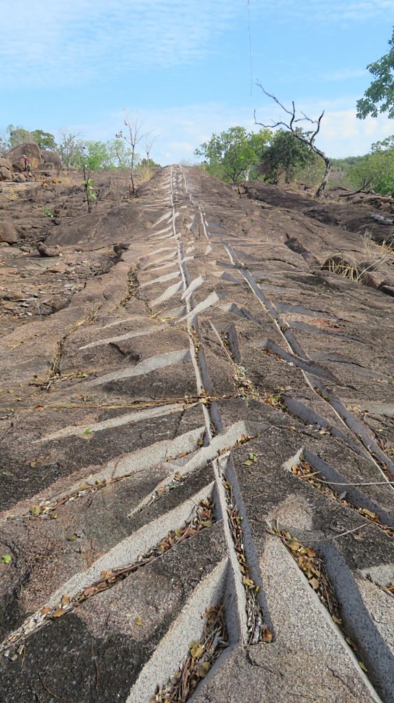
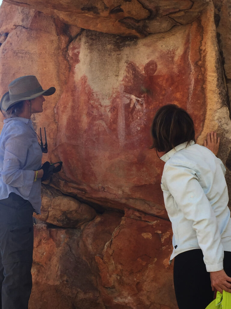
We joined them late morning and went up to the community where we were met and shown around by one of the elders. For many centuries they’ve had a sand representation of their lands, which is where they hold all their ceremonies. This is cared for and repaired as needed.

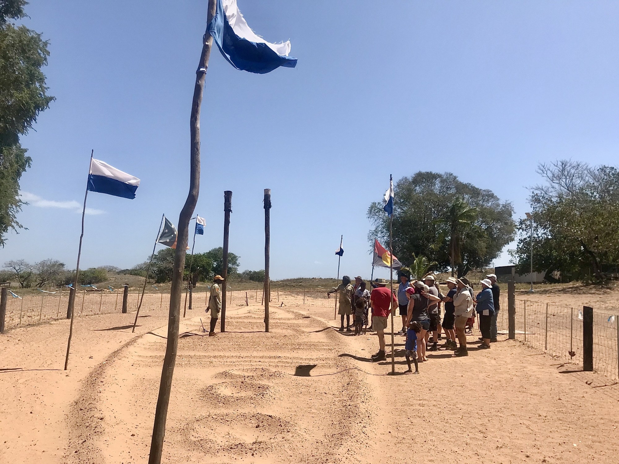
This large sand sculpture, which has been here for many, many years tended to as necessary, represents their land in relation to other places plus the sea and the clouds. (Photo courtesy Pat Evans)

The stingray is of great importance to this clan. They are able to show, by a huge indent in the ground, where the stingray came ashore back in the Dreamtime.

Here we are looking at the stingray sand sculpture. They take sand from the eye holes and name the places they plan to hunt stingrays, which helps them on the hunt. (Photo courtesy Pat Evans)

Graham is the man who took us to see these important aspects of their lives. He is also a very accomplished artist, working in sand painting. using coloured sand he makes beautiful designs on bark and logs.

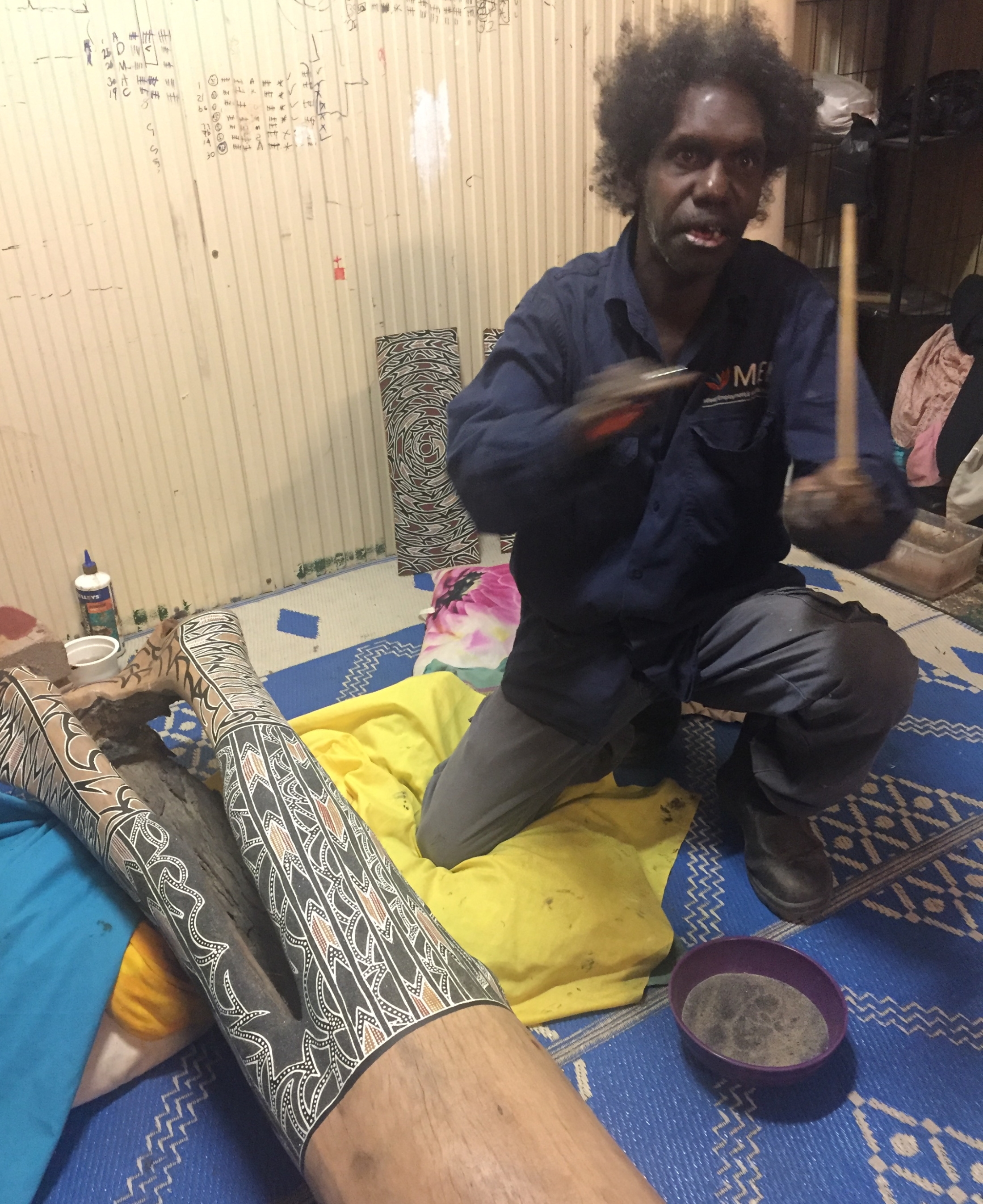
Graham, the artist explains to us how he paints first with glue then sprinkles the coloured sand he needs over it.

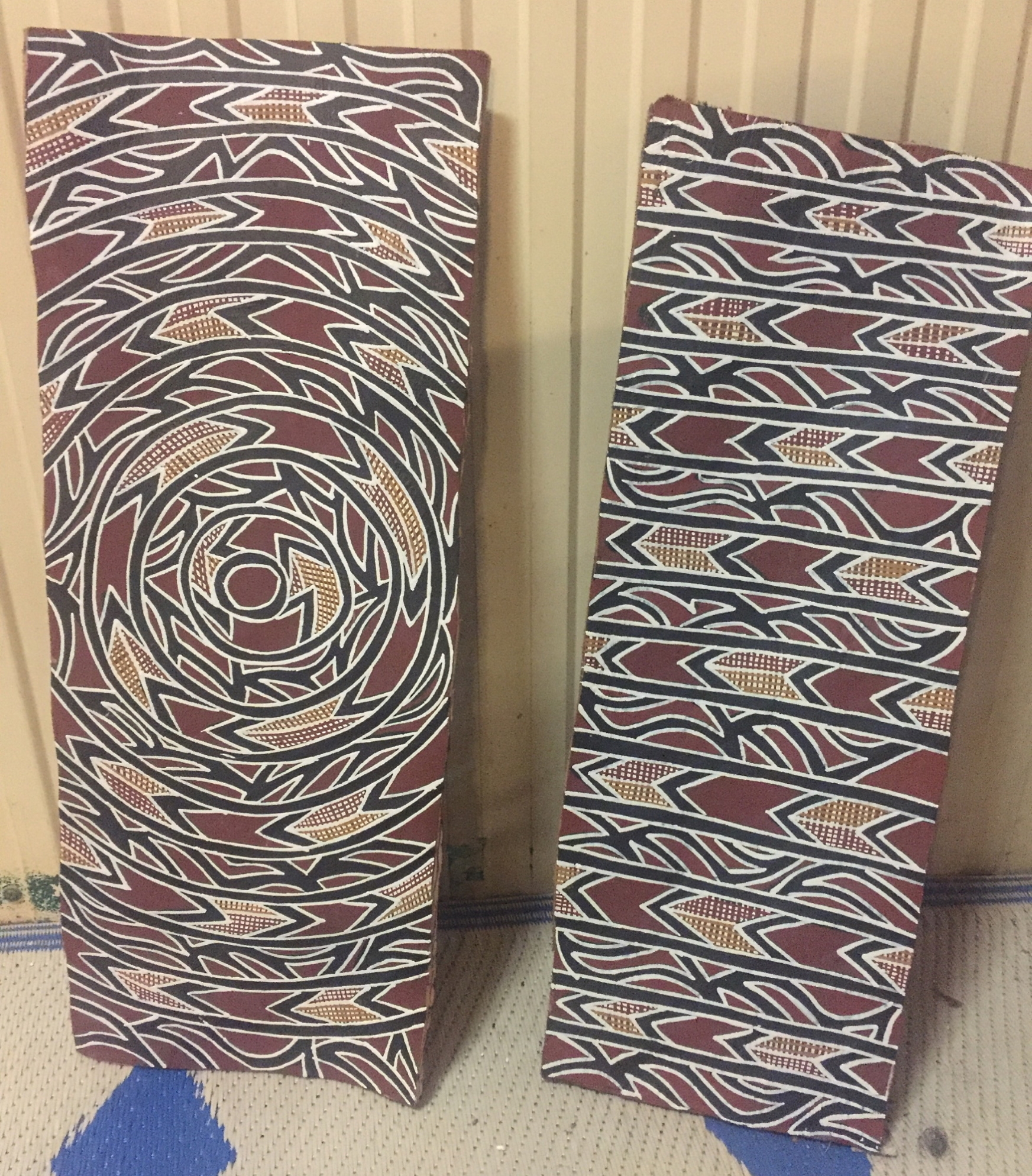
Two beautiful completed sand art works by Graham – made on commission unfortunately. I would have loved to have bought one.

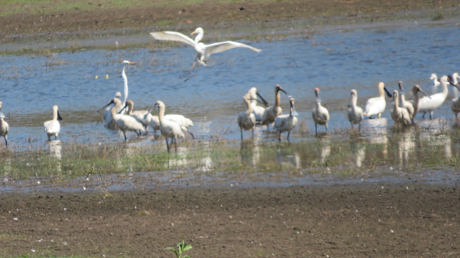
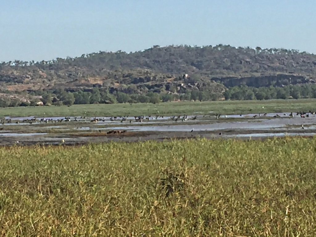
After lunch the locals took us out of town where we women were dropped off while the men drove on further to a large lagoon where they saw brolgas, emus, heaps of birds and even more mosquitoes, so I’m told.
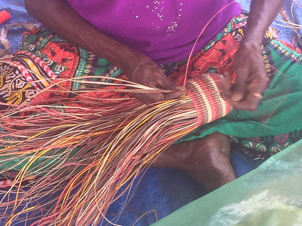
The indigenous women started by looking for a pandanus palm that had fronds that would be perfect for weaving. When they found it they chopped it down and sorted out the fronds they wanted into a big bundle.

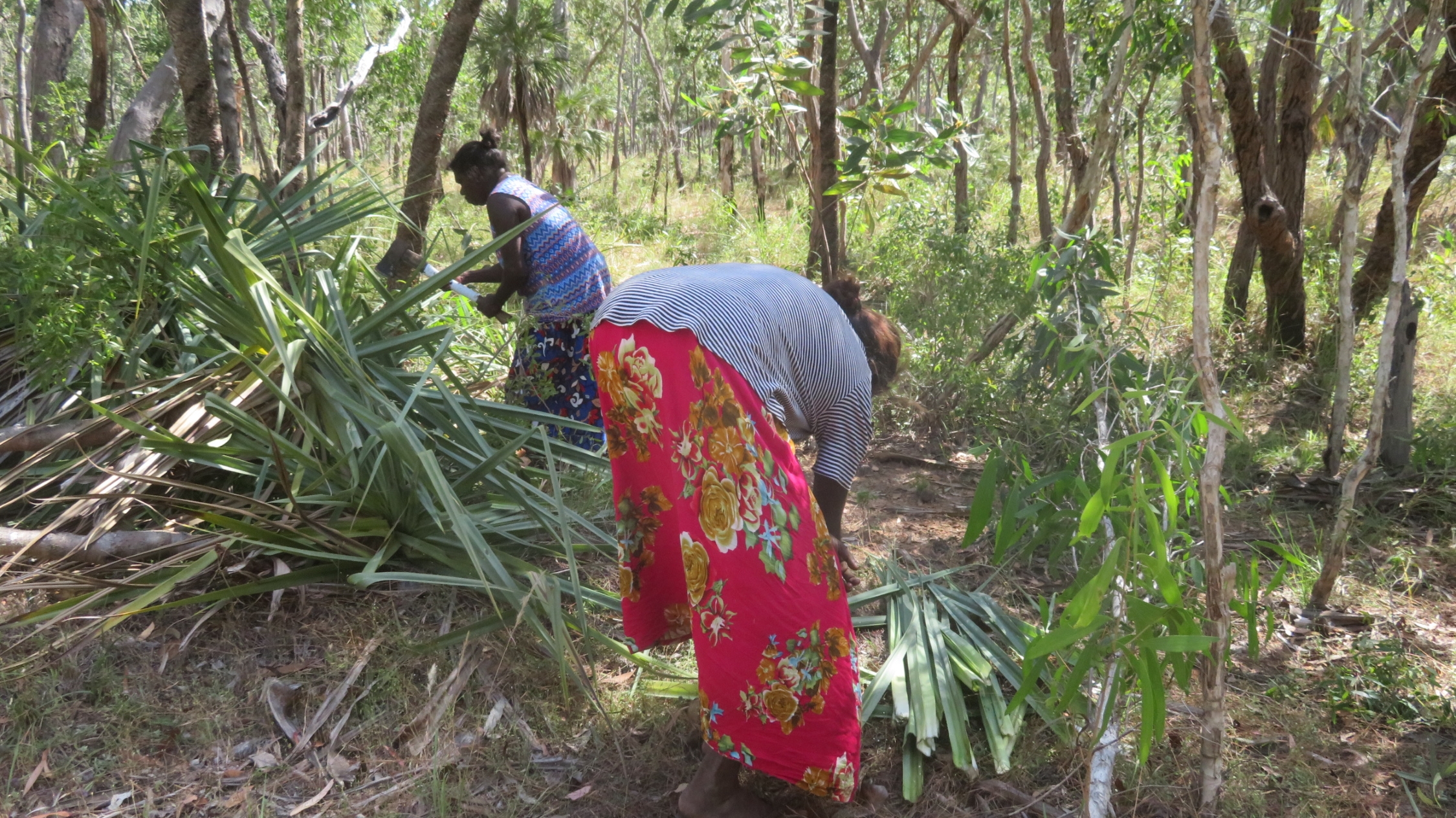
The pandanus palm has been cut down and suitable fronds are being stacked, ready for drying and eventually making one of the wonderful woven baskets they are so famous for.

Then they began to look for a tree that would contain a native bees hive, and hence honey. We all walked around for ages, spreading right out. I was completely lost, so just followed one of the local women. The tree we were looking for would probably be a stringy bark, that was hollowed out by termites and where they could see the bees flying in and out of a small hole. The call came – one had been spotted. Despite staring very closely I couldn’t see any bees.

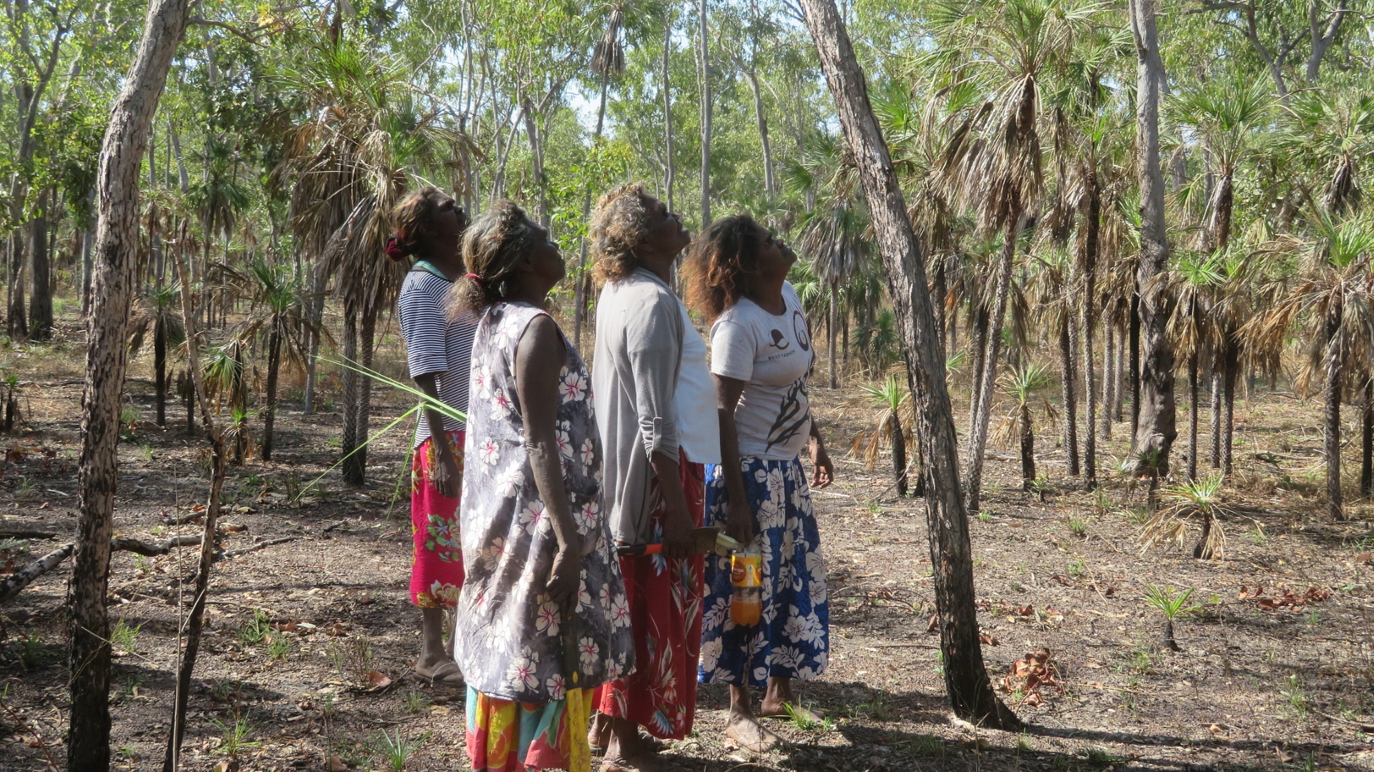
Ah ha, found one! Look – tiny little native bees flitting in and out way up at the top of that tree! Better eyesight then I have!

The oldest of the group of women took the axe and chopped the tree down, then cut a hole where they guessed the hive was. Sure enough, lots of beautiful, dark honey flowed. A pot was placed under it and the honey flowed in. It was really delicious honey – such a rich, sweet taste.

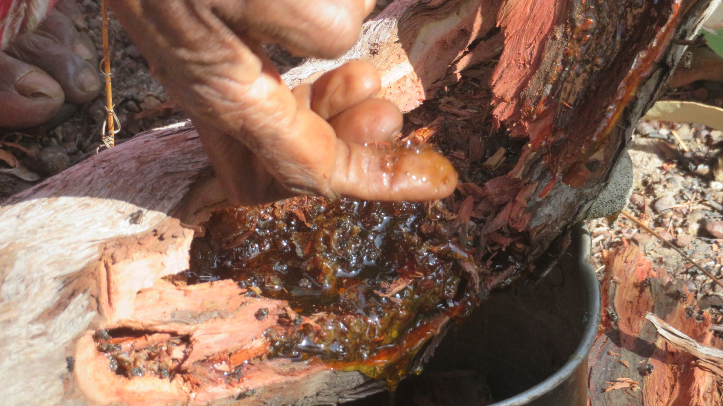
Look at that beautiful, dark, rich honey. The honey is dripping into the saucepan under the log.


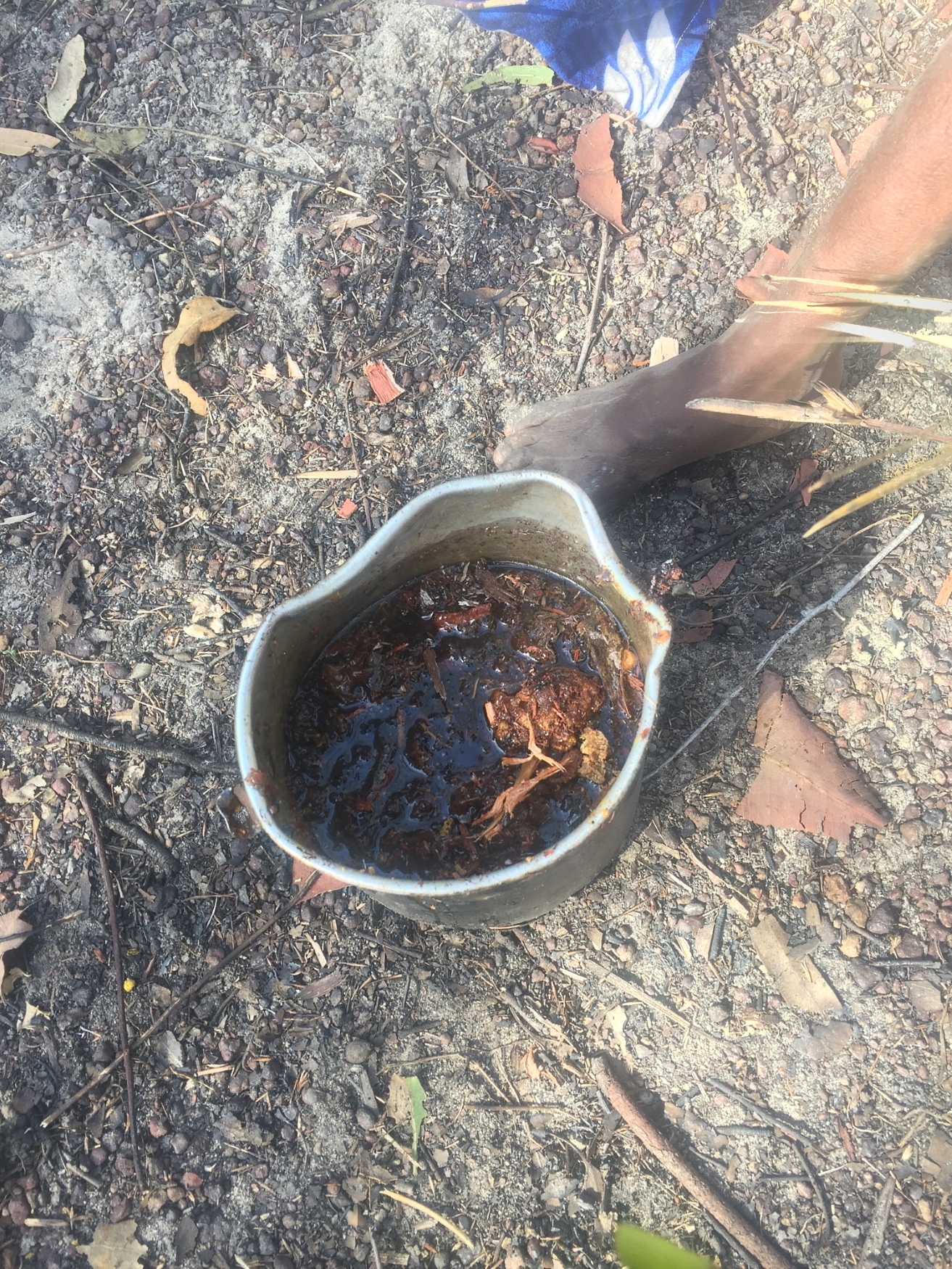
The saucepan nearly full of honey – and a bit of bark.

The women gathered all the honey and the pollen which would be eaten, and also the wax, which would be kept for molding mouth pieces for yidaki. Yet another very unique opportunity to share a little of their way of life.

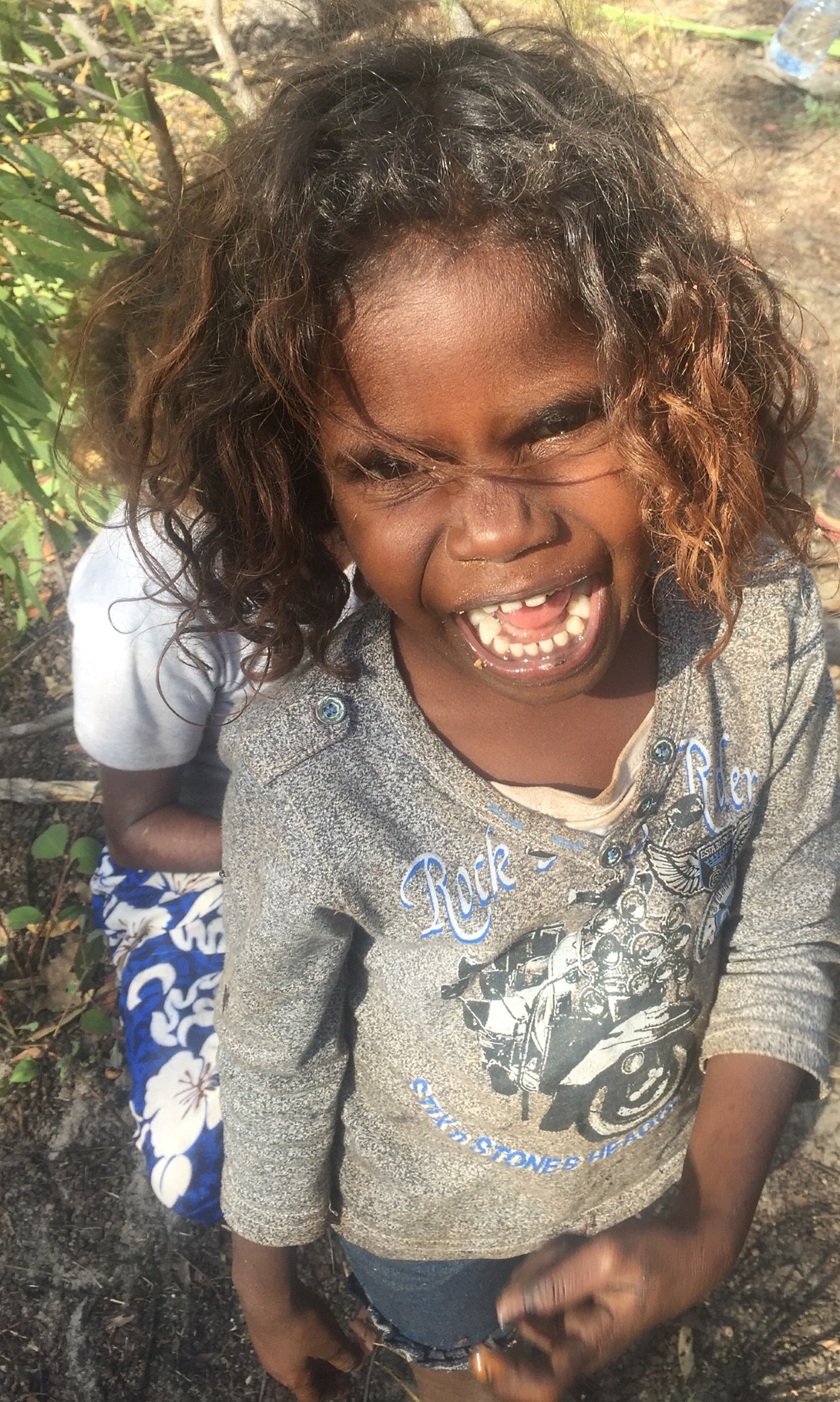
Cheeky boy – how come all boys this age are so adorably cheeky!

Back at camp we lit the campfire, though it was still blowing a gale. We BBQ’d our meat for dinner and spent the evening solving the World’s problems with Pat and Dick. We then slept surprisingly well, despite the wind. Maybe because the toilets and showers were easily a 500m walk away from our camp – all that exercise!

Wednesday 21st

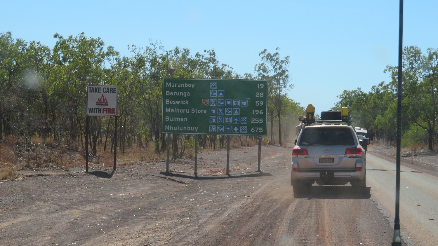
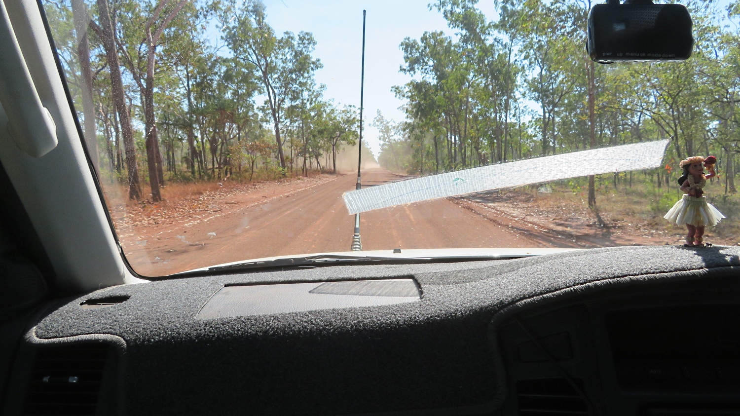
Leaving this morning at 9am we rejoined the Central Arnhem Hway and headed south. Parts of the road were wonderful, recently graded gravel that we could travel at 80-90km/hr.   Other parts were bad: corrugations, stony, bull dust holes, washouts – a mixed bag.

As we’ve travelled these roads we’ve frequently seen slow burning fires. Some of these have been lit by the rangers doing a controlled burn to reduce the fuel load preventing serious bushfires later in the dry season. But many of them are caused by lightning strike, or discarded cigarettes or mischief-makers. Another cause could be the ‘fire birds’. You’ll often see kites (the raptor)  flying just in front of a fire catching the small ground animals fleeing from the fire. These birds have learnt to pick up a burning stick and drop it in another spot if this fire is going out or not producing enough fleeing animals.

Slow moving fires are very common in the Top End at this time of the year. No fires should be lit after August 1st, however this is not adhered to, obviously, and is often quite random rather than planned.

There is some contention about the amount of burning that is happening. A return to the fire management regimes of the traditional owners is being strongly encouraged.

It was a long driving day, broken up with stops at the bridge we bypassed on our outward journey and Bulman where an ice block from the local store was greatly appreciated.

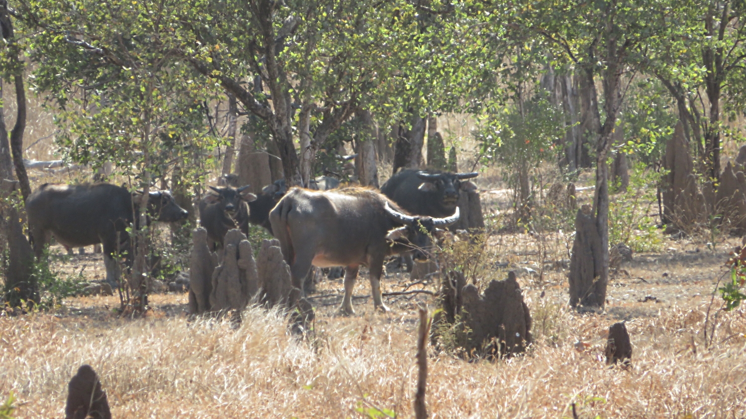
We saw lots more feral animals too – buffalo and donkeys.

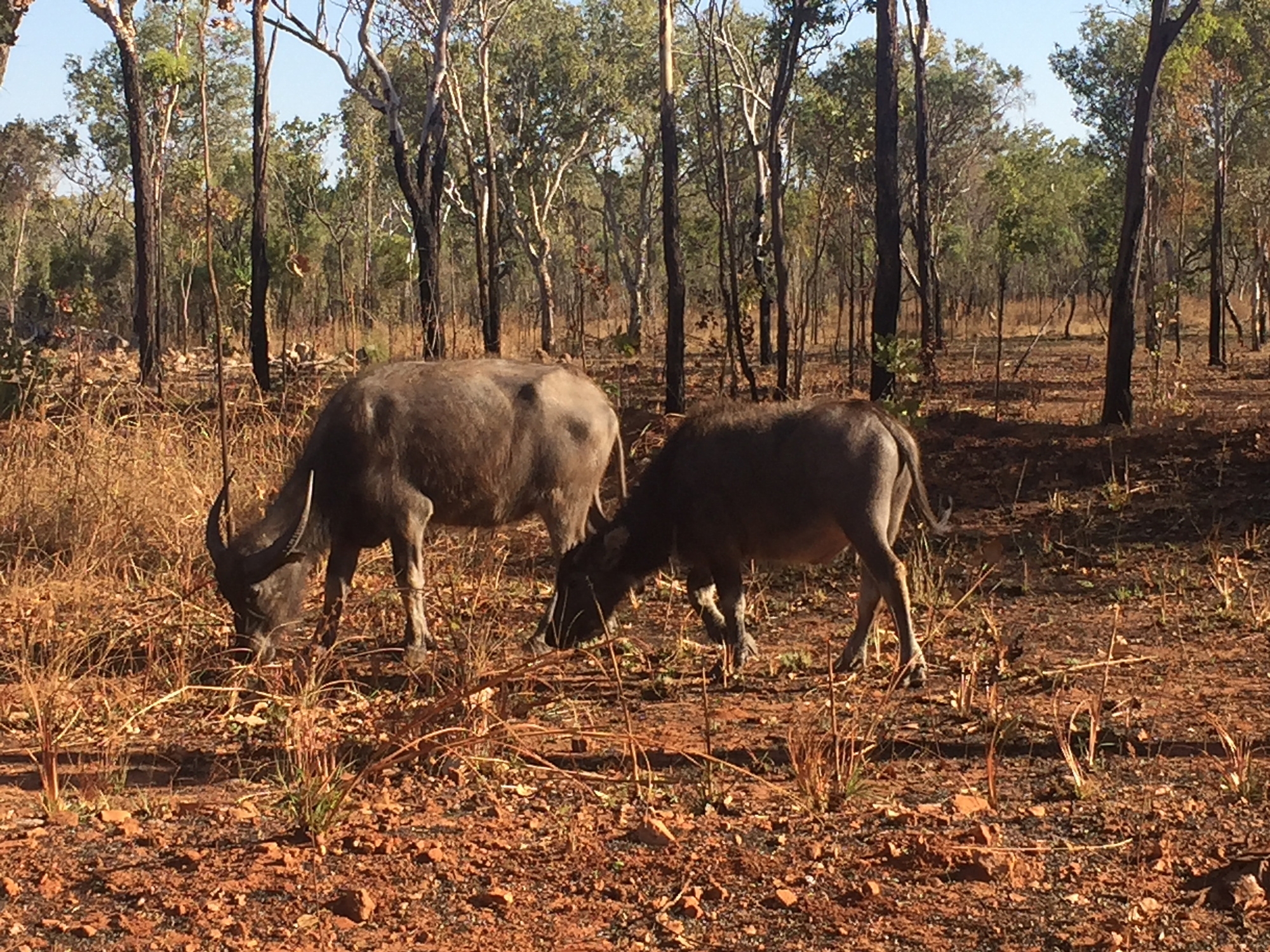
Buffalos grazing by the side of the road. These can be very dangerous if they take it into their heads to cross the road as you get there.

Eventually arriving back at Mainoru Store we once again appreciated the grassy campsite beside the springfed brook, the flushing toilets and the warm-ish showers.  Dinner tonight was once again provided by the Store: beef and salad (tough as).

Early night – exhausted after a long day.

Thursday 22nd

Our last day of the tag-along!

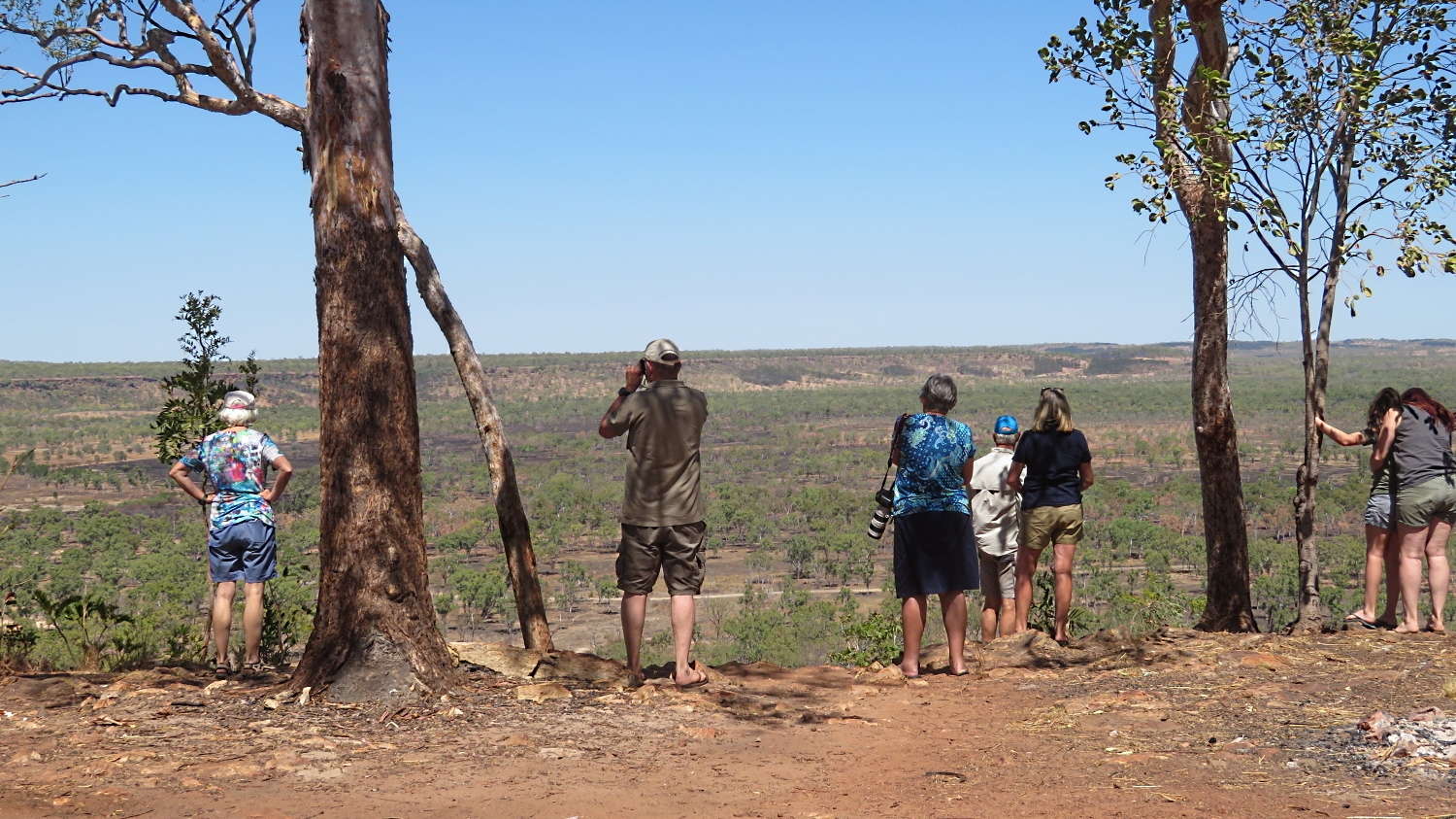
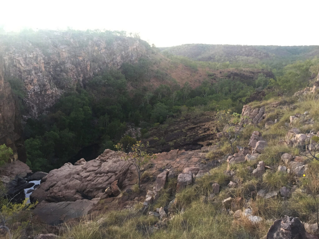
A long drive continuing along the Central Arnhem Highway. Lots of buffalos, donkeys, cattle to be seen. The landscape and flora changed subtly as we travelled from driving along the ridge to down in the valley. Once more we stopped at Jurassic Park – only buffalo in the park thank goodness, no dinosaurs, though it wouldn’t surprise me.

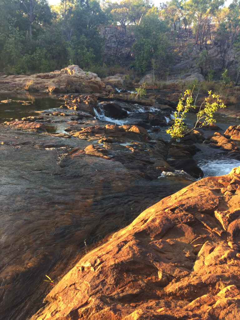
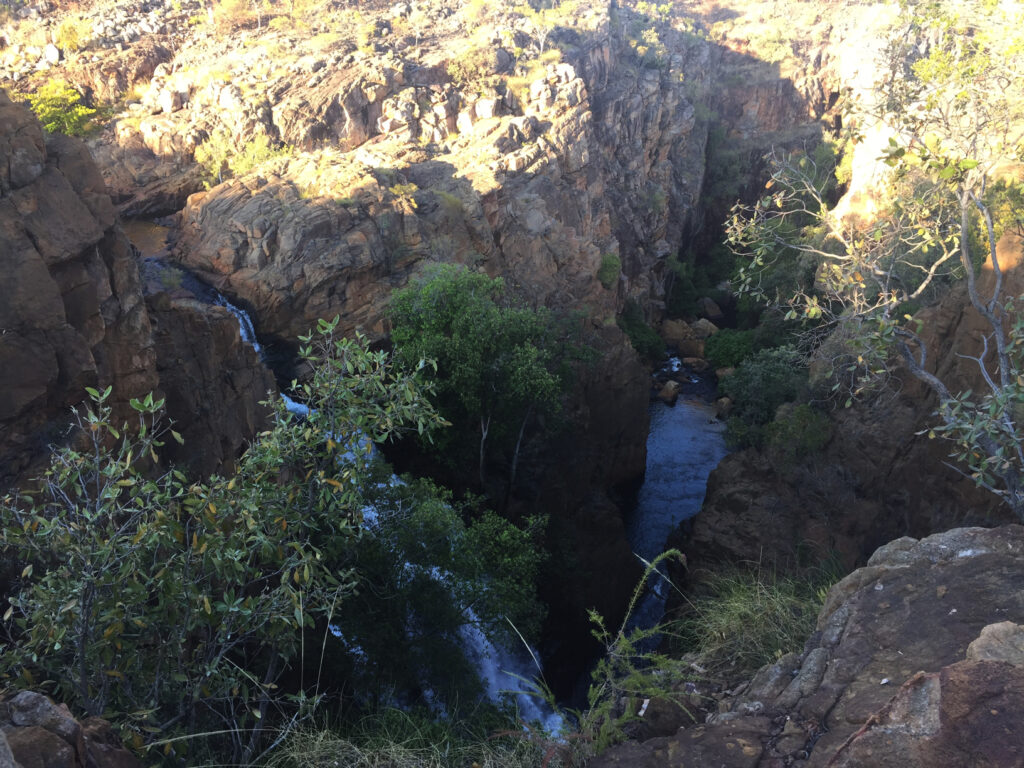
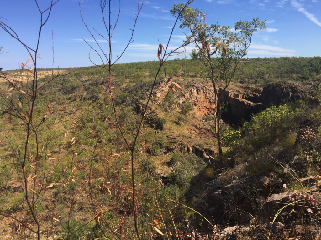
The sunken valley of Jurassic Park. You can see the cliff edge on the far side where it once more rises to the usual level.

A craft shop at Beswick was open, though the highlight was their museum of artwork. In 1996 local elders and renowned digeridu player and artist David Blanasi conceived of the idea of putting together a collection of art to showcase and celebrate the strength of Indigenous culture in the area. The most famous of the artworks have an interactive installation where an animated story plays on a tablet when pointed at it.
Blanasi himself had an interesting history bringing the digeridoo (bambu in his language) to international fame in 1967 after giving digeridu lessons on the very popular Rolf Harris television show in London. Following the death of a very close friend of his, in 2001 he went missing in the bush with no trace since.

Unfortunately there were few of the commmunity around as they were experiencing “sorry business”.

Here the blacktop began and we gleefully farewelled the corrugations and dust.

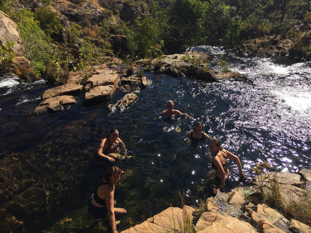
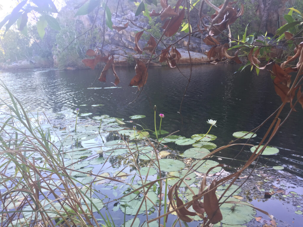
Once on the Stuart Highway we headed to Mataranka where we camped at the crowded caravan park, did the washing and headed down to Bitter Springs. Heaven on a stick! This 500m waterway is fed by an underground spring that gently flows down a watercourse lined with cabbage palms. With a noodle hired from the CP, we were able to float gently down the stream. The water is crystal clear, right to the bottom, which is well over my head – so crystal clear it looks icy blue, though icy it wasn’t, just delightfully warm. Only downside is the number of people we share it with.

Back at camp we’re all going for dinner at the CP up the road – lots of fun, nostalgic saying farewell to everyone with promises to drop in when passing, and delicious food.

Everyone really appreciated the great job Neill Bell, our knowledgeable, energetic but ever so patient leader did, ably assisted by his wife Gail.

And so ended our tag-along.

Friday 23rd – Tuesday 27th August

Homeward bound.

We packed up early, then ducked down to the Springs. Glorious! Only us and one or two other couples this morning, so we were able to thoroughly enjoy a relaxing and quiet float. These Springs are absolutely amazing – if ever you’re up this way, take time to enjoy them.

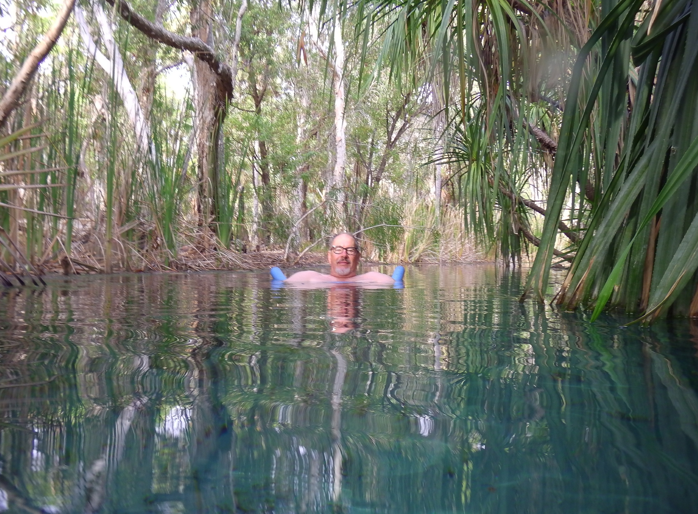
The very beautiful, artesian-fed watercourse lined with cabbage palms. Unforgettable.


Got away about 9am taking turns with the driving. We headed south on the Stuart Highway before heading east on the Carpentaria Highway as far as Heartbreak Hotel at Cape Crawford. Grassy site for the tent.

Two big Brahman bulls wander the campsite grazing on the green grass, coming into the outdoor eating area and drinking water directly from the sprinklers. They entertained us for awhile, though there was a little fear they may wish to investigate our tent while we sleep.

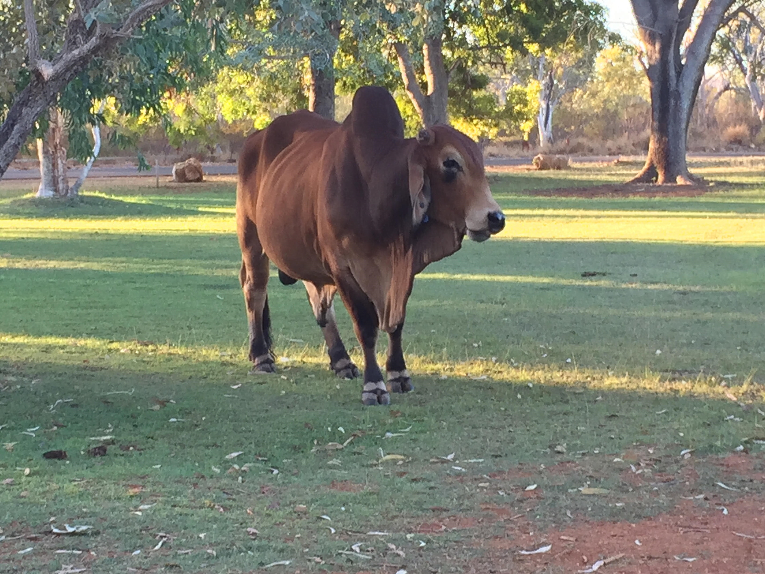
One of the two Brahmans that wander the hotel and camping grounds. What was most entertaining is when they drank from directly from the large sprinklers that keep this grass so lovely and green.

Saturday: Early start heading south on the Tableland Highway. Mixed feelings about this drive as it is a good road and a bit different to the main highway south, however the fields were absolutely bare other than for the carcasses of cattle that had starved to death.  We soon headed east across the border back into Queensland where we met up with Pat and Dick in Camooweal in time to take in a little local culture – the Queensland camp drafting championships. We arrived in time for the evening festivities – several entertainers including a very talented young man who cracked a burning whip in time to music – you really needed to be there to appreciate it.

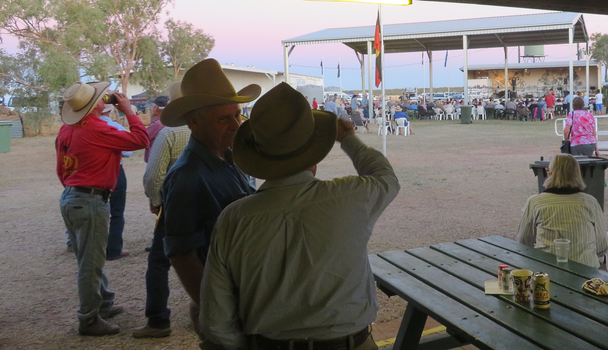
A big horse event happened here today. Now there’s just the music, the bar and the BIG hats to go. Camooweal

Sunday: Both vehicles headed off to Winton today via the Barkly and Landsborough Highways.  At the Winton caravan park we had the pleasure of being entertained by a bush poet.

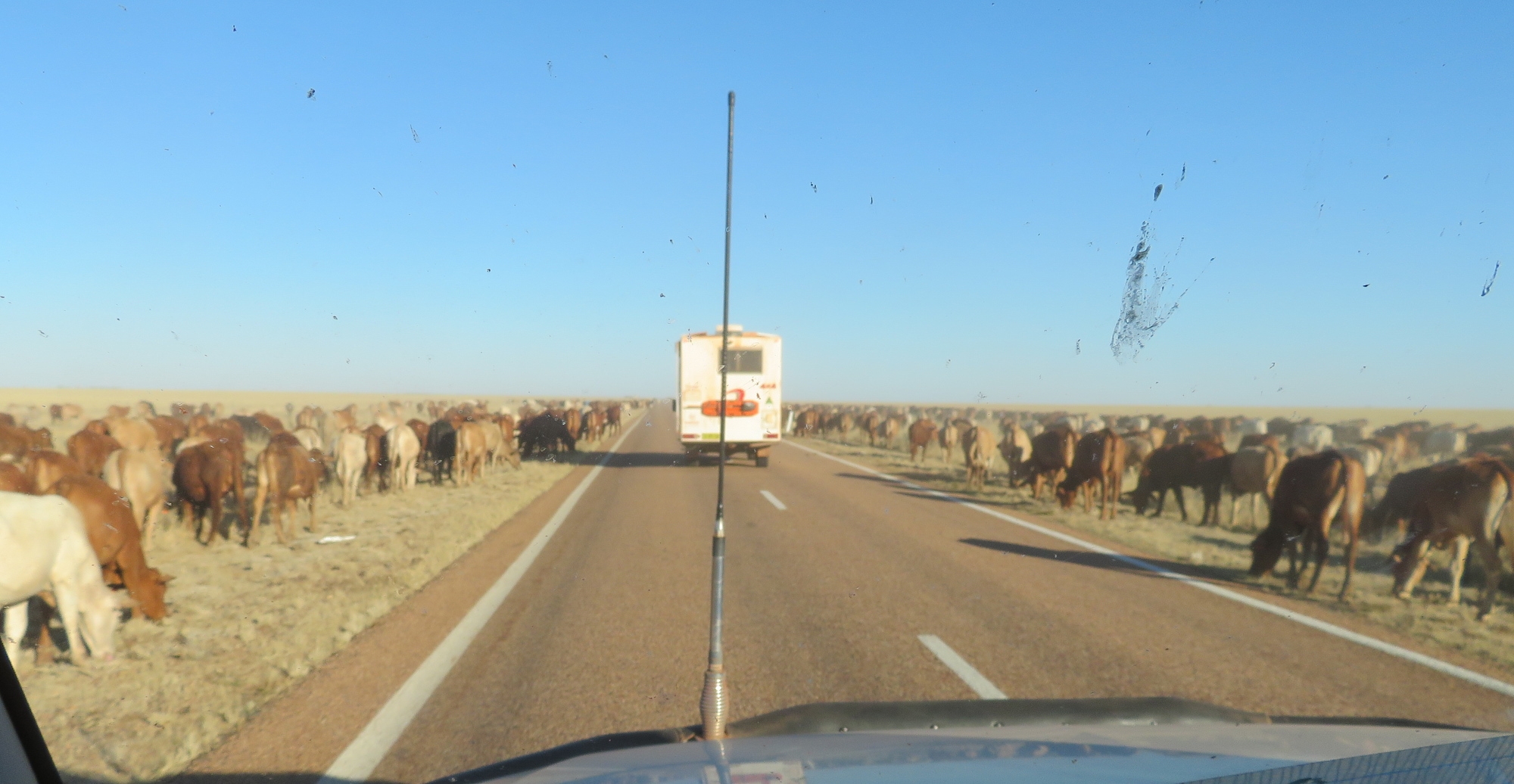
Grazing the long paddock. As you can see there’s not too much here for the poor damn animals to eat either. So dry. Following Pat and Dick on the Landsborough Highway

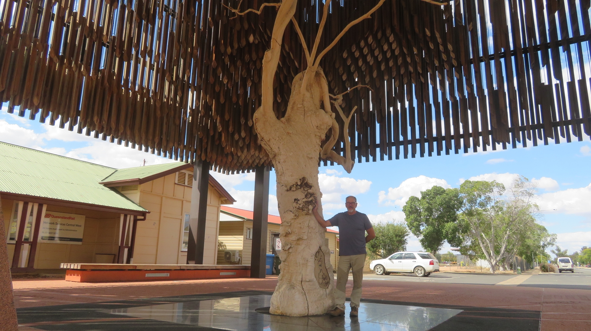
Barcaldine and the Tree of Knowledge.

Monday: We lunched together at Barcaldine before sadly farewelling our newest friends as they hurried back to their home in Sydney and we scuttled home as fast as we could to avoid sleeping in the tent any longer than we had to.

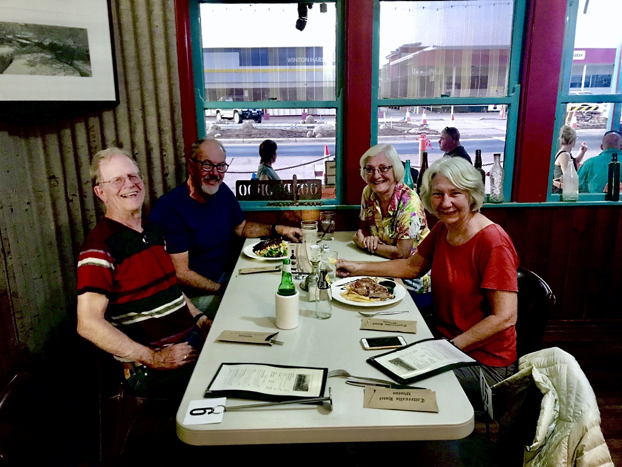
Farewell lunch in Barcaldine with Pat and Dick. You’ve been great travelling companions and I hope we’ll have more travels together in the future.

On reflection this Arnhem Land trip has been up there with the very best travel we’ve ever done, anywhere. We shared the land, the culture and the spiritualism of the oldest continuous living culture on Earth with great generosity on their behalf. This was no ‘tourist highlight’ – this was life as raw and as beautiful as it gets. We are incredibly fortunate.

And a super big thankyou to Great Divide 4X4 Tours whose ethical behaviour has seen the local indigenous communities welcome them back every year, and a really wonderful group of fellow travellers with which to share it.

To see all our photos from East Arnhem Land CLICK HERE.

Adelaide River and Nhulunbuy

Our Arnhem Land travels continue having left the Cobourg Peninsula and now heading to East Arnhem Land.

Saturday 10th August, 2019

Another very full day today as we leave the caravan park just outside Kakadu and head a little further north along the Arnhem Highway to Adelaide River. The peaceful, picturesque Adelaide River’s claim to fame these days is the concentration of saltwater crocodiles (salties) that call it home. No trip to northern Australia would be considered complete if you didn’t see a saltwater croc, and this trip was not going to fall short on that score. Crocodiles were at risk of extinction before a hunting ban in the 1970’s saved them. It’s estimated there are around 150,000 salties and 100,000 ‘freshies’ (fresh water crocs) in northern Australia today – that means there’s nearly as many crocs as people – a sobering thought. Their habitat, ie fresh or salt water, has nothing to do with their name and they coexist happily in either. Salties can grow up to 10 metres in length and are aggressive in hunting their prey, of which humans are merely tasty morsels.

Idyllic day. Inviting river … but not for swimming! Adelaide River

A tourism venture called “Original Jumping Crocodile Cruises” is our destination where we’re on the first cruise of the day. Well, it was pretty spectacular. We were in an open sided boat, told to keep all hands, cameras, etc inside the boat and headed out looking for crocs. The river itself is quite spectacular and just the cruise along the river was enjoyable, however it wasn’t long before we came across crocs lazing on the river banks keeping a watchful eye.

Cruising alongside the boat. Adelaide River

The tour guide was excellent – informative and fun. He’ll hold out a pole with a piece of meat tied onto a line and a croc will quietly slip into the water and sidle over, without so much as a ripple in the water. When the croc is alongside the boat, it’s teased a little with the meat. They’re expected to do 3 jumps before, on the third, they receive the meat. Just one piece per croc. We must have watched perhaps 10 big crocs jumping well out of the water to get the meat. The tour guides have named all the crocs and know their personalities well.

And up he goes. Note the meat on the line which you’ll see just at the top of the background tree line. Adelaide River

Moving on from here a nearby lagoon fulfilled our ration of birdlife for the day.

Coming in to land, ignored by the spoonbills.

From here we backtracked south a little way along the Arnhem Highway before turning right onto a 4-wheel drive road that was a shortcut across to the Stuart Highway. The road, while unsealed, was in good order, apparently infrequently used and a very pleasant drive.

Next stop was the magnificent Leliyn (Edith Falls) which is on the edge of Nitmuluk NP (Katherine Gorge) and was the finishing point for my Jatbula walk of only 2 weeks ago. The Edith River cascades into this very beautiful, large freshwater pool that has been de-crocced (is that a word?) and therefore safe for swimming. We enjoyed a lovely swim and relaxed here for a couple of hours before wandering on, in our own time, to the Shady Lane caravan park in Katherine where we’ll spend the night.

The pool at Leliyn. That’s me with the grey hair, enyoying my swim with others in our group. In the distance you can just see where the Edith River cascades down into the pool.

Washing, shopping and refuelling in preparation for the next leg of our journey was a priority this afternoon. Once more we filled the jerry cans we carry on the roof racks (with diesel), just to be sure. Rather than cook we bought pizzas and shared them with Pat and Dick.

Sunday 11th August

Heading south as we left Katherine it was only about 50km before the turnoff for the Central Arnhem Road that joins Nhulunbuy to the Stuart Highway. A few years ago 4WD Magazine ranked the Central Arnhem Road in its top 5 “must drive” four wheel drive tracks. We agree! This is another road that requires a permit from the Northern Lands Council as we travel predominantly through Aboriginal lands (as did all the West Arnhem Land roads). It’s unsuitable to tow vans and permits won’t be granted to do so, apparently

Beginning the Central Arnhem Highway. Mainoru Store is our destination today.

Once we hit the dirt the tyre pressures were once more reduced and our convoy spread out over many kilometres as we hung back from each others dust. We passed through a few small aboriginal communities on the way. A constant lookout had to be kept for feral animals straying onto the road –  cattle, donkeys and buffalo.

Feral buffalo are prolific in Arnhem Land. Hunting safaris are common and there’s also a meat trade in buffalo.

Lunch today was at a lookout over what is colloquially known as Jurassic Park. The area looks like its a sunken valley with cliff edges all around and a flat base. Quite unexpected out here where everything is so flat.

A break for lunch overlooking “Jurassic Park”.

The road condition has been quite good. Some sections corrugated and dusty, but mostly reasonably smooth, fast, hard dirt. When oncoming vehicles approach we’d reduce speed to a crawl, and when the road trains approached, and we saw a few, we’d pull right off the road and stop. After they’d passed visibility would be close to zero for several minutes until their dust settled.

Central Arnhem Highway. A few corrugations here.

Late afternoon we arrived at Mainoru Store. This is a store that sells everything, food, clothing, shoes, etc. Camping tonight is on a beautifully grassed area beside a natural spring. The store owners have big sprinklers on the lawns 24/7 and that spring never falters. After setting up we went for a walk along it. It’s a beautiful lilly-covered oasis surrounded by glorious gum trees So unexpected out in this harsh environment.

The fresh water spring that never runs dry beside the camping ground at Mainoru.

All feeling weary after a long, dusty drive today Neill organised for the store to cook us a meal – chicken and salad. Very average. Then to cap it off Steve and I had set our tent up close to the toilets. Everytime the door opened, which was frequently, it closed with a loud bang, and the whole area was illuminated with what I swear was a search light on a motion sensor. Not the most restful of sleeps.

Monday 12th August

We left early today to cover the 470 remaining kilometers to Nhulunbuy. Much of it was corrugated, though some stretches not too bad.

Driving the Central Arnhem Rd north of Mainoru Store. Note the tape on the windscreen – placed over a crack that occured on the way up to Darwin. Also note distance from vehicle we’re following, avoiding the dust.

The Central Arnhem Rd crosses several small creeks. It also crosses the Goyder River and its flood plain, a challenge for road users in wet weather prior to 2014 when the government built a very large, all-weather bridge to bypass this difficult crossing. The old crossing is our destination for morning tea today. It does appear that the road authorities don’t want you to go there as the exit off the main road is well hidden. With some prior knowledge though we were all soon travelling on a lovely single-lane road to a delightful, shallow, broad crystal-clear brook, babbling over a stoney base which was the Goyder River on this day. The entrance and exit could be steep and I can imagine the trouble the road trains had trying to cross this river before the bridge was constructed, particularly after a good wet season.

Will we or won’t we? Goyder River

A discussion of whether we should cross or return the way we’d come in was had, with all voting to cross (not sure that Neill, the guide, had a say in that decision). What’s a 4-wheel drive trip without a decent water crossing or two? (Grin)

Apparently the biggest termite mound in Arnhem Land.

Further on we stopped by the largest termite mound in Arnhem Land.

Arriving tired at Nhulunbuy on the coast, we set up camp behind the Walkabout Lodge on lovely green grass, with modern, clean toilets and showers … and washing machines! After attending to the necessary I cooked a stir-fry and we went to bed to sleep well, listening to the surf in the background.

Tuesday 13th August

We did a full day trip down to Cape Arnhem today. Abel Tasman, a Dutch explorer, named Cape Arnhem in 1644 after the Dutch ship Arnhem which explored these waters in 1623 – the captain of this ship and some of his crew were killed here by the indigenous inhabitants – I wonder what they did to upset them! Terre d Arnhem appeared on early Dutch maps but wasn’t ‘official’ until the Aboriginal Reserve was named Arnhem Land in 1936.

A narrow, winding track around trees, washouts, holes, rocks, etc, took us from the Central Arnhem Road to the coast, then a steep descent down the dune escarpment led to sea level and onto a beautiful little beach for a BBQ lunch provided by GDT. Tyre pressures were down to 16PSI by this time as we were driving on very soft sand.

Up and over the sanddunes on our drive around Cape Arnhem and its beaches. (That’s the back of a vehicle with a built-on tent in front of us, not a house!)


A view of our ‘lunch time’ beach from the top of the dune.

After lunch Neill took us along tracks on the escarpment or down on the beach exploring towards the Cape.

Oysters, oysters, big fat juicy oysters! Yes I did sample some of these, with one eye looking out for a croc. Cape Arnhem.

Neill gave us the good guff on sand driving, and we had plenty of opportunity to practice our skills.

Off to explore another beach of soft, white sand. Cape Arnhem

We stopped at one beach where we all did a ‘beach cleanup’ gathering 9 big bags of rubbish to take to the dump at Nhulunbuy. This beach looked stunning by the time we’d finished our clean up. Not all beaches gather rubbish – depends on  aspect and where the currents run.

This is the beach where our group did a clean-up We ‘over-filled’ 9 of those bags with rubbish that has drifted ashore here. Cape Arnhem


Awww. Look what I found on the beach clean-up. This little fellow was heading the wrong direction. I put her at the water’s edge and told her I’d be back in 20 years when she’s next back here laying her own eggs.

Back to camp after 104km of good fun. Dinner at Walkabout Lodge – expensive and OK. 

Wednesday 14th August

Restful morning.

After lunch we went for a drive to Banambarrnga (Rainbow Cliffs). The exposed cliffs produce a striking effect from the weathering of the beautiful whites, yellows and red ochres. The top of the cliffs is a sacred site. We spent an enjoyable time exploring this beach, the little tidal creek which exits here and viewing the cliffs.

Rainbow Cliffs – beautifully shaded ochres.

Back at Nhulunbuy, John, a long-time resident, the owner of Walkabout Lodge and a ‘mover and shaker’ in the town, took us for a drive around town, telling us about its development and the challenges it is currently facing. We started at the Lookout where we had wonderful views out over the town.

Nhulunbuy from the Lookout.

Nhulunbuy (also sometimes referred to as Gove) is a Yolgnu word meaning ‘honey man’ and is a very remote town by any standards, (over 700km by 4×4 vehicle, a tiny airport or an occasional boat being the only access). It came into being in 1963 when the Federal government approved a bauxite mine and a town was formed to house the workers. The Yolgnu people strongly opposed the mine and presented a bark petition to the Federal Government, obviously unsuccessfully. This petition is on display in Canberra (not sure how I feel about that – a continuing slap in the face to the indigenous people I think).

This is the Yirrkala Bark Petition which is on display in Parliament House in Canberra. The bark petitions asserted that the Yolngu people owned the land and protested the Commonwealth’s granting of mining rights of land excised from the Arnhem Aboriginal Land reserve. They asked that no arrangements be entered into with any company which will destroy the livelihood and independence of the Yirrkala people. And so this became the first formal claim for native title. It failed. In 1971 it was taken to the Supreme Court where the judge used the notion of terra nullius to justify this ruling. Photo Wikicommons

We drove through town, which has restaurants, schools, a hospital (that our business cooperated with when we ran the GOLD conferences back in our history) and a good shopping precinct – oh and a bakery! We headed north out of town to the port where the refinery is. The bauxite refinery closed in 2014 with a loss of over 1000 jobs – a huge loss to the town. Bauxite is still mined here and transported via ships for overseas processing. A new refinery had been built at great expense, however before it processed any bauxite it was closed. It’s still here, in pristine condition.

Bauxite stockpile awaiting shipment for processing overseas.

Just this year an area outside Nhulunbuy has been chosen as a rocket launch site by NASA. Being this close to the equator apparently the earth spins a bit faster, so you get an extra boost to your rocket, using less fuel. Who knew? Locals don’t feel it will add too many jobs for the locals though – time will tell.

Thursday 15th August

Today was a fabulous day starting in Yirrkala, the small indigenous community just south of Nhulunbuy. The amazing Buku-Larrŋgay Mulka Centre is located here. It started in the 1960s by an artist who exhibited his own art from a shelter on the beach, and from this it has grown to what it is today consisting of two divisions; the Buku Art Centre which represents Yolŋu artists exhibiting and selling contemporary art and The Mulka Project which acts as a digital production studio and archiving centre incorporating the museum.

Nyapanyapa Yunupiŋu, quite a famous artist, at work on her latest creation. Look closely at the fine lines that form the picture. Buku Art Centre, Yirrakala.

We couldn’t get over the amazing art – so talented and so intricate. There were many, many pieces of art we’d have loved to have bought. Most impressive in my mind were the many ḻarrakitj. Ḻarrakitj are memorial poles. In time past they held the bones of the dead and formed an important part of funeral rites. Today Yolŋu continue their cultural tradition painting hollow stringybark branches and selling their art (minus the human remains!), reviving and disseminating the beliefs of their ancestors. On one of our drives we saw a roadside memorial with a ḻarrakitj marking the place of a fatal road accident, much as our culture marks such roadside tragedies with a cross.

Some of the larrikitj, with others in the background in the Buku Art Centre, Yirrakala.

Every now and then while driving we’d come across a stringybark tree where a couple of metres of bark had been removed. Neill joked these were dingo trees (ie no bark – ha, ha, ha!) The bark that was removed is cured by fire, weighted and left to dry. Using locally sourced ochres traditional designs are painted onto the bark; each unique, very fine, cross-hatched pattern reflecting knowledge belonging to a particular estate, clan, state of water, moiety and place.

Highlighted in the middle of this photograph is one of the bark paintings (ie artwork done on a piece of bark). Exquisite! Buku Art Centre, Yirrakala

Yiḏaki is the correct term for what we call a didgeridoo. Prior to European colonisation yiḏaki were only found in northern Australia, in particular Arnhem Land. Today this term is only permitted to be used when the instuments have been made and decorated solely by Yolŋu people. Finding a naturally occuring termite-hollowed stringybark tree is the first step in making this unique wind instrument. According to sources at Yirrkala all other similar instruments should be called didgeridoos, unless they are made by an Aboriginal person and called by their local Aboriginal name for the instrument. And yes, there were many beautifully made and decorated yiḏaki on display.

In the museum Andrew, one of the curators, took us to see beautiful old pieces of art and photographs made by the anthopologist Donald Thompson in the 1920s – all fascinating and his descriptions wonderful.

A Donald Thompson photograph taken in 1936. These tall, strong, healthy men are preparing a ḻarrakitj for the remaining bones of a clan member who had been interred (either in a shallow grave, or a burial platform) some time ago. The ḻarrakitj is painted with sacred designs of the deceased’s lineage.

But the most striking artwork in the museum are the two Church Panels. Each Church Panel is on masonite sheeting twelve feet tall and four feet wide. Yolŋu society is divided into two moieties—Dhuwa and Yirritja—and so too are the Church Panels. These panels, created by the elders of these moieties in 1962/63 were for display on either side of the alter in the new Methodist Church. There were two core reasons for their creation – firstly to introduce Yolŋu religious iconography into a Christian context to demonstrate that Yolŋu had their own sacred heritage; and a political assertion of Yolŋu sovereignty in the Yirrkala area to emphasise Yolŋu connection to land and land ownership. It was because the Federal Government annexed their land for the bauxite mine and after seeing these panels that Beazley Snr (a Federal political minister) suggested the Bark Petition – as such these Church Panels were the precursor to the first land rights claims in Australia.

Despite their intricacy, beauty, importance and sentiment, a Methodist minister had them removed from the church in 1974 (they didn’t tell the ‘right’ creation story!) and stored them, unprotected, under the eaves of the church. Four years later they were rescued by Buku-Larrŋgay Arts, but it wouldn’t be for another 10 years until the museum was built that they were once more on public display.

No trip to Arnhem Land could be considered complete without viewing the Church Panels. Their artistic beauty is notable, their message is important, but the spiritual feeling that envelops you as you sit quietly viewing these panels is extraordinary.

Reluctantly leaving, we could have spent many more hours here, we drove on to Daliwoi Bay. This camping area has a boat ramp and is at the mouth of an inlet. Great for fishing, so I’m told, but only from a boat as the crocs like this spot.
We drove on to Macassan Beach, a very pretty little tropical beach with a camping area. Here we found the story of the Macassan relationship with the Yolgnu told in stone arrangements. These were created in the 1800’s by Yolgnu to aid their oral tradition of passing on the stories of their people. A walk of a couple of hundred metres takes you past 6 stone installations each representing a facet of their history.

The information board describing the stone installation that represents the dugout canoes. Macassan Beach

After a pleasant time spent looking at this installation and wandering the beach we headed back to the main road, then down a side road to Goanna Lagoon. What a top spot this was! There was a school group of a dozen or so young boys with their teachers who were camping here for a couple of nights. The boys were having a wonderful time, a few of them spear fishing for cherubin (yabbies). A narrow steep-sided creek has carved its way down to supply the lagoon with fresh, crystal-clear water. A delight to go for a dip on this warm afternoon.

A group of school boys having fun at Goanna Lagoon. Note the boy spear-fishing.

Back to camp in Nhulunbuy we spruced ourselves up ready for dinner at the Yacht Club to celebrate our last evening here.

A beautiful sunset taken from the Yacht Club – bauxite processing and shipping structures in the background.

For more photos from this time spent in Arnhem Land CLICK HERE.

West Arnhem Land (Cobourg Peninsula)

The following posts are the report of our tour from Darwin to Arnhem Land and home again in August 2019. Due to the remoteness of Arnhem Land and the potential difficulty getting permits we’ve joined a tag-along tour run by Great Divide Tours. While Priscilla (our Trakka Sprinter 4WD) would have made the trip very comfortable for us, we were rightly concerned that due to her length and height she wouldn’t have managed the smaller side tours we did. We’re in the Pajero with a free-standing, small tent.

Note the National Park and Smith’s Point shown at the northern part of the map and follow the Central Arnhem Highway to Nhulunbuy in the east, both areas we visited.

Arnhem Land is in the north east of the Northern Territory, with its northernmost point only marginally more south than Cape York, Australian mainland’s most northern point. With an area of 100,000 sq km it’s larger than Hungary, Portugal or Austria. However total population for this very remote area is only around 16,000 people, 12,000 of whom are the traditional land owners, the Yolngu people. Arnhem Land was named after the Dutch ship Arnhem which navigated across this coastline in 1623. We know we are privileged to be able to access this very remote area of the World, the indigenous communities and people who live here.

Did you know Arnhem Land is the home of Australia’s most famous instrument, the didgeridoo?

Gratuitous photo of a didgeridoo. Image from wikicommons

Sunday 28th, Monday 29th July 2019

Darwin

Yesterday I finished walking the 65km Jatbula Trail in Nitmuluk NP with some friends, and am now in Darwin. Meanwhile Steve and his mate Nigel left home a week ago to drive to Darwin from Brisbane via Birdsville.

I farewelled my walking buddies as they headed to the airport and I walked over to the Ramada Zen Hotel (ONLY 2.5km, easy!) to await Steve and Nigel. By all reports they had a brilliant trip. Relaxing, catching up on our experiences, drinks and dinner at the Penthouse (barramundi) before an early night finished that day. 

Monday we drove out to the War Museum at East Point. It is very well curated and had lots and lots to see both inside the museum and outside in the grounds, including the big 9 inch guns and lots of personal stories from civilians and military personnel in Darwin 1942. An excellent documentary style film portrayed the events of February 19 1942, the day war came to Australian shores with the bombing of Darwin by the Japanese.  I was here particularly looking for a photograph of my mother who was an army nurse during WWII and stationed in Darwin. I think I’ve found the one I’d been told about. 

Maybe mum is the one third from the right in the middle row. Though she was a registered nurse so I’d expect her to be wearing a veil. Perhaps she’s the nurse sitting in the front row, second from the right.

From there we headed into Darwin and wandered the streets and malls finally settling for lunch on the lawn overlooking the ocean at the Speakers Corner cafe in Government House. Wonderful location! 

We’re sitting under those umbrellas enjoying the view of the ocean, which is over the shoulder of the photographer. A lovely building, designed beautifully for the climate.

Later in the afternoon we went to the joint RFDS / War Memorial building on Stokes Wharf. Here there was a virtual reality portrayal at the time of the bombing and also a good hologram depiction of the actions of a US naval captain whose ship was in harbour at the time of the bombing. 

We finished the day at Crustaceans restaurant on the wharf where we all relished the joy given by a whole chili crab each. Fantastic! 

Kakadu

Tuesday 30th – Friday 2nd August

This morning Nigel flew back to Brisbane, and Steve and I provisioned the car before heading to Kakadu NP via the Kakadu Highway. We’re camped in the tent at Gunlom for two nights. I tried to talk Steve into going tent-free (as I had been during our Jatbula walk) but haven’t achieved it yet.

Our campsite at Gunlom. The infinity pool is at the top of the hill in the background. A lovely clear, sandy pool is at the base, off to the left of our campsite.

Gunlom brings back very happy memories from the last time we were here with Ric and Gill. However this time the road in, supposedly a 2WD road, is very badly corrugated and due to a poor “wet” this year the creek feeding the infinity pool  is low, hence not a great flow through the pool nor over the escarpment. And the upper ¾ of the steep path to the infinity pool is a temporary one scrambling over rocks, hanging onto saplings, and even steeper than the original which is being replaced with steps.

The track up to Gunlom infinity pool – challenging!

The pool itself and view are as spectacular as ever, however the pool is green and the many submerged rocks very slippery. Not the picture postcard perfect experience the tourist is led to expect. Mind you over the two days we’ve been here we haven’t seen any tourist busses pull in. The plunge pool at the bottom of the falls, however, is as spectacular as ever, crystal clear and chilly and an enjoyable swim. 

Gunlom infinity pool, still a magnificent pool despite the dry weather. You can see the small waterfall that leaves this pool at the far end.

After a dip in the plunge pool on Thursday morning we moved closer to Jabiru, which is where we will join our Arnhem Land tour. On the way we stopped to look at the Warradjan Aboriginal Cultural Centre. This well curated very interesting centre is well worth a visit. Cooinda, our camp for the night, is a very large, very busy, privately owned caravan park that I wouldn’t recommend. Friday we moved on to the township of Jabiru. This little town used to be the centre for the Ranger Uranium Mine until it closed down several years ago. There are many closed shops and it’s beginning to look neglected, except for the tourists that keep it going. As it is on Aboriginal Land the mine was granted a limited time lease for the town. That has been extended once for another 5 or 6 years, and there is a feeling it may not be extended when it comes up again – time will tell. 

We restocked our food at the local supermarket, which was pretty good, considering. We booked into the cabins in the caravan park (not salubrious), did some washing and rested in the air conditioning – not that it’s hot, unless you’re in direct sun with no breeze. 

This evening we met the group we’ll be travelling with for the next three weeks then we all went over for a meal at the bistro – lovely tender pork for me, steak for Steve. Tomorrow our trip begins. 

Garig Gunak Barlu NP (Cobourg Peninsula)

Saturday 3rd – Tuesday 6th

8 4WD of all different types lined up this morning, with Neill Bell from Great Divide Tours, our tour leader, in the front. About 40km out of Jabiru we all “aired down” to 28 and crossed Cahill’s Crossing which had about half a meter of water flowing over; and we saw our first crocodile. 

Cahill’s Crossing. The crocodiles are further upstream. Apparently as the high tide flows out the crocs sit at the edge of the crossing and pick off the fish as they are swept over the causeway.

That ended the black top. Our road varied over the next 250-odd kilometres between smooth and badly corrugated dirt or sand with washouts and bulldust holes.

The whole Cobourg Peninsula comprises the Garig Gunak Barlu NP. This extensive park includes the surrounding waters of the Arafura Sea and Van Diemen Gulf, and some of the neighbouring islands.

Another water crossing on the way. (Paul and Julie’s car)

We stopped to view points of interest, have a coffee break, collect wood for a fire and “Sturt” stops (think of the pretty red flower that grows in the desert).  

Lots of birds at these wetlands. Garig Gunak Barlu NP

Our campsite (cold showers, long-drop toilets) is right at the beach at Smith’s Point at the head of Port Essington and is exclusive to our group. Our site looks directly onto the Arafura Sea. After watching a spectacular sun set into the ocean, meals were cooked on the big gas BBQ that Neill fires up each night, then we all settled down around the fire for a yarn. A good first day.

Sunday Steve and I and 4 others (Mark, Katie, Steve and Jo) went down to the jetty to join our fishing trip. Wow! That was exciting! Travis, the skipper, flicked a line out at the end of the jetty and straight away pulled in a decent sized trevally which was our bait. First spot we stopped the lines weren’t in the water for more than 3 minutes before Steve got a BIG strike. It took him about 10 minutes to bring it in as it pulled him all around the boat – a very good sized Jew fish.

Steve’s ‘catch of the day’ – a jew fish

It wasn’t long before Mark also caught one, maybe even bigger. Then it was my turn with a “queenie” that gave me a workout and measured about 1.5 metres long. We moved to a few different spots and mostly caught and released what we caught after that, except for a beautiful big coral trout. It was rough on the water with 30 knot winds gusting stronger, but the excitement of the trip over-rode the rocking and rolling. 

Travis, our very competent fishing teacher, filleting one of the many fish we caught.

Everyone had BBQ’d fish for dinner tonight. 

Enjoying the fruits of Denise’s labour – Queenie on the barby.

In the afternoon we did a scenic drive, in convoy, around the Peninsula along narrow, two-tyre-track tracks that hugged the magnificent coastline for awhile before we went inland to see the wetlands. These wetlands received Ramsar accreditation in 1992, designating it as a “Wetland of International Importance” because of its diversity of coastal and inland wetland types, support for populations of threatened species including a number of endangered turtles, maintenance of regional biodiversity, support for life-cycle functions such as turtle and waterbird breeding and refugia values, and for providing important fish nursery and spawning habitats. There are now some 65 Australian wetlands recognised under this convention, however this was Australia’s first.

The previous wet season up here is one of the worst (ie poor rainfall) in recorded history and though the wetlands are significantly reduced the bird life was still prolific. I’d have loved to be here at dawn or dusk to see the birds. We drove back around the coastline then across the Peninsula and back to camp. A good drive and great to see more of Cobourg Peninsula. 

Lots of birds at these wetlands. Garig Gunak Barlu NP

Monday was a quiet morning at camp before once more we joined Travis on the boat this time to go to Victoria Settlement, an army garrison set up in 1838 to warn and protect the new colony of potential threats from the French and the Dutch and to encourage Asian trade. It was a very comprehensive settlement with beautifully built stone officer’s quarters, a kiln, hospital, quartermaster’s stores and munitions store. National Parks has created a 4 km walk around the site. Some of the buildings were so well constructed that much of them remains in very good order.

The chimney stacks and fireplaces for cooking are all that remain of the Officers’ homes. Victoria Settlement

It was an ill-fated settlement with many deaths and was finally abandoned after only 11 years. However in its day it was very busy with Macassans coming down from Sulawesi as they had done from as early as the mid-1700’s to trade with the many aboriginals who lived around there. In exchange for fishing rights, turtle shell and pearls the Macassans traded cloth, tobacco, metal axes and knives, rice and gin. They predominantly harvested and dried the trepangs (sea cucumbers) for culinary and medicinal use. A lasting legacy is the number of tamarind trees planted by the Macassins that remain today. Travis told us that there was a lot of mixing of the cultures and that aboriginals had already been travelling to Sulawesi, Asia and even Holland as the Dutch traded here too. Intercultural marriages occured both here and in the destinations to which they travelled. We’re learning a lot of Australian history that is not widely known. Another excellent excursion, made all the better for the incredible knowledge Travis shared with us. 

More BBQd fish and another big fire tonight. 

Tuesday was a restful morning for us while one group went fishing in the morning and another in the afternoon – yep, heaps more fish, Jew fish and coral trout. A trip to the Aboriginal Cultural Centre gave us more perspective with displays describing the life and a little history of the indigenous people, the Macassans and the Victoria Settlement. Caiman Creek, some 20 km down the corrugations was good for fishing for some, while we enjoyed a walk to the mouth of the creek to view the cliffs.

During our travels we occasionally spotted the elusive Banteng, a feral cattle native to Asia, that was released when Victoria Settlement was closed in 1848. These cattle are endangered in Asia with few numbers and no longer any pure bred, while these in Arnhem Land are very pure and thriving. It’s become an issue for the conservationists trying to protect the National Park and those conservationists trying to protect an endangered species. 

Alan, has been the Ranger here for 34 years – there’s not much he doesn’t know about the area. He chatted with us around the campfire tonight sharing a wealth of information. One of the many advantages of doing this trip with a company that has a long and well-respected association with the area. 

Wiligi Outstation

Wednesday 7th – Thursday 8th

Leaving the Peninsula and National Park we travelled 140 km to our destination for the next two nights, Wiligi Outstation, a small tourism venture with camping and a few cabins, owned by one of the Traditional Owners. This is another spectacular campsite with our tent barely 20 metres from the high tide line.

Our campsite from the boat. Our tent is on the far left, between the two pandanus palms.

We had a boat hired for the day for fishing or going out to explore Copeland Island. Steve chose to stay in camp reading, listening to music (and the gentle lapping waves); I took the opportunity to go to explore the island with Pat and Dick (Neill took us over in the boat), climbing to its peak to get 360° views. Beautiful. 

Taken from the highest point on Copeland Is, with Dick to the left of the photo.

Sunset alongside our campsite at Wiligi Outstation.

Pandanus Spiralis or ‘screw pine’ at Wiligi. The Indigenous Australians use the strappy leaves for weaving and the fruit (the big orange fruit you can see) has a tasty nut, though it’s hard to access. The base of each leaf is white and apparently tastes a bit like cabbage. The dead trunk can be made into a didgeridoo and as it burns slowly the Indigenous people would use it to carry fire from one place to another. A useful plant.

Friday 9th

Leaving Arnhem Land for the time being we return to civilisation today. We retraced our outward journey, via another wetland before stopping in at Gunbalanya (Oenpelli) where, unfortunately, the Art Centre was closed. The major Art Awards are on in Darwin and many of the artists and their works are currently there. However there were a few artists sitting around painting or weaving outside the centre so we wandered around observing them. 

Weaving a dilly bag from pandanus leaves.

Back over Cahills Crossing and into Jabiru where we had lunch by the lake, a minor restock and refuelled. 

We followed the blacktop through Kakadu NP on the Arnhem Hwy. Outside the NP and at a very inconspicuous spot on the highway at Mt Bundy is the turnoff to an amazing granite sculpure ‘park’ celebrating the importance of wild rice as a staple food for indigenous peoples for centuries as well as its importance as a sustainable food crop for the future. The wild rice of northern Australia is genetically pure. The sculptures were created by an elderly Japanese artist, Mitsuaki Tanabe and are epic in their proportions, the longest being a wild rice sheaf 82 metres long carved in the granite ridge.

Viewing the extent of the granite carving of a wild rice sheaf. Mt Bundy

Tonight we’re camped at the privately owned Corroboree caravan park for the night. It was very full and very noisy! Ahh, but the joy of freshly laundered clothes can’t be underestimated. Dinner tonight was at their restaurant with the group – salt and pepper calamari for me. 

We’re all looking forward to the next part of our adventure in a couple days when East Arnhem Land will be the highlight.

To see more photos from this part of our trip CLICK HERE.

Jatbula Trail

21st – 28th July, 2019

Situated amongst the stunning ancient landscape of Nitmiluk National Park, the 62 km Jatbula Trail follows the route travelled by generations of Jawoyn people, from Nitmiluk (Katherine Gorge) to Leliyn (Edith Falls) – a traditional song line. The local indigenous people, the Jawoyn, named the area of the gorge Nitmiluk (pronounced Nit-mi-look) meaning ‘place of cicadas’.
The trail was named after Jawoyn Traditional Owner Peter Jatbula who was instrumental in securing land rights for his people and who walked the route of the trail with his family.

The Jatbula is walked as a one-way trail with walkers limited to no more than 15 leaving per day, the trail to be completed over 5 or 6 days. Walkers must be fully self-sufficient as there is no access to the trail other than at the beginning and the end. It’s booked out almost as soon as the places are released online, hence Trish has organised our little group of 4 to be doing it through a trekking company, Gecko Trekking and Canoeing.

Jatbula Trailhead


21st July

Yesterday Steve and Nigel left on their epic drive to Darwin via Birdsville. I’ll see them in Darwin on the 28th. Today I flew to a very warm Darwin and met up with my walking buddies, Trish, Sarah and Wendy. We’re staying at the Hotel On Mitchell – self-contained apartments – well located and appointed. 

After packing and repacking our backpacks and discussing at length what we should leave behind, ie rain jacket, rain cover for backpack, puff jacket – “it will not rain” the tour company lady assured us – we went down to Cullen Beach to watch the sunset and partake of a seafood smorgasbord. 

Sunset at Cullen Beach in Darwin. Wendy, me, Sarah and Trish
Mmmmm seafood smorgasbord – heaven!

22nd July

Bob the driver for Gecko Trekking and Canoeing company picked us up at 7am and we joined David, Belinda and Emma who’ll be sharing our exciting adventure for the next 6 days. (ie 7 walkers plus our guide, Travis).

Firstly though a drive from Darwin to Katherine, stopping at Adelaide River for a coffee and to view Jock the Croc, a 5 metre stuffed crocodile, and the buffalo from the Crocodile Dundee movie. 

The buffalo from the Crocodile Dundee movie.

A cultural experience awaited us a local Jawoyn man played the didgeridoo for us …

then guided us on spear throwing using a woomera, lighting a fire using two sticks and traditional painting using a reed. It was a lot of fun, but I wasn’t a success at any of them.

Displaying my skills at spear throwing using a woomera. Lookout anyone within a 10 metre radius!
Trying to light a fire using two sticks. Needless to say after we’d all had a go at it, our guide had the fire going in no time at all.
My attempt to copy a piece of artwork using a traditional reed stick.

In Katherine a relaxing 2-hour cruise between the majestic towering cliffs and crystal clear waters of Katherine Gorge gave us a taste of the adventure to come. 

Trish and I standing, Wendy and Sarah sitting, on the cruise down Nitmiluk Gorge

Back to Mick’s property (owner of Gecko) to set up our first camp. Hmm took a bit to remember how to blow up the mattress, etc, but I got there. I’d mentioned I was eating predominantly Paleo and they’d bought in a whole box of Paleo dehydrated food for me. Wow! That was pretty decent of them. However dinner tonight was the tenderest steaks and salad. Delicious. 

The temperature dropped rapidly as the sun set and we turned in early to get warm. Several of us, including me, decided to sleep without a tent or insect screen. Lying in bed watching the stars is amazing. Earlier Travis, our tour guide, pointed out the Dark Emu, some constellations and planets and set up a telescope for us. As for being warm though – not so much. I put on my thermals and was still cold. A very restless night ensued. 

23rd – 27th July 

Map of the Jatbula Trail. Note it is walked from Nitmiluk Centre to Leliyn.

Walk Day 1: Nitmiluk to Biddlecombe Cascades – 10km

An early start and a lesson on how to pack my backpack quickly and efficiently from Mick himself was useful. All the food and cooking equipment for the 5 days was divvied up between us. My backpack weighed in at about 14kg, including 3 litres of water. I was very pleased with the fit of my new backpack, tolerating the weight well, and continued to for the duration of the walk.
Excitedly we began the trail with a boat ride over the Katherine River before we began walking in earnest.

The pathway we’ll be following, off into those hills. Adventure awaits.
A break here at Northern Rockhole for morning tea.
Biddlecombe Cascades.
We finished the first day walking the way we did at every campsite – with a wonderful swim in crystal clear fresh water. This is at Biddlecombe Cascades campsite.
Travis, our guide and chef for our trek.

Walk Day 2: Biddlecombe Cascades to Crystal Falls 12km

A tricky early morning departure from our campsite at Biddlecombe.
View from the hilltop.

While the trail is not noted for its hilliness nevertheless there are still some reasonable hills to climb. Here we got a good view of the surrounding countryside. Not many trees in this section.

Rock art.
Wendy and Trish examining the beautiful rock art.

Today we see the first of the rock art along this trail. These art works are protected under an overhanging rock.

The trail between Biddlecombe and Crystal Falls.

Another view of the trail and countryside we walked through. The disparity in walking speed was beginning to become a problem to me as I was frequently dropped and walked alone. Being at the back of the group I was concerned I’d be injured or bitten by a snake and no one would notice until it was too late. (Note that I was more than 10 years older than the next oldest on this walk!)

My air mattress, blow-up pillow, sleeping bag, etc all set up ready for a peaceful night at Crystal Falls campsite.
The lagoon at Crystal Falls. This view is just a few paces away from the bottom end of my air mattress!
Lots of spots here for a soak in a spa pool. Crystal Falls

Our drinking water (we began every day with 3 litres each) was sourced from the creeks and pools where we camped. We didn’t treat it and no one had tummy troubles from it. And it did taste really good!

The falls at Crystal Falls, beside which we’re camped for tonight.

Walk Day 3: Crystal Falls to 17 Mile Falls – 10km

Setting out from Crystal Falls. Note the blue triangle to indicate the trail. Most of the time the pathway was easy to see as it is here, but in some areas the triangles were useful.
Another photograph of the starkly beautiful country through which we’re walking. (after climbing another hill)

We leave our packs behind on the path and scramble down into the Amphitheatre where the flora becomes more tropical and lush and there’s a long wall of indigenous rock art.

Rock art
Rock art
An explanation.
Maybe this is the fellow the woman in the previous art was trying to attract!
Our campsites were all in very picturesque places, always beside a fresh water stream or pool. The sandy surface was comfy under the air mattress. It didn’t rain and insects weren’t a nuisance while we slept. I had no issues sleeping in the open with no tent cover.

Walk Day 4: 17 Mile Rocks to Sandy Billabong 16km

A longer walk today so we set off early with view to arriving at the campsite before the temperatures get too hot this afternoon. I don’t know what the temperature was, but I’d guess it was never less than 30°C once the sun got up. Evenings were cool to chilly.

Leaving 17 Mile Falls before dawn.
17 Mile Falls. We camped at the top of these falls last night.

My issues with being dropped by the others continued. However the group seemed to stop every 20 mins or so for a rest and a drink, which is when I’d catch them. Not needing to stop to rest so often I continued walking expecting to be passed, but they never did – too much stopping for me! This did mean that I walked the majority of the last 3 days on my own, which was disappointing as I’d wanted to share the walk with my friends, but it was safer for me than being behind on my own.
The upside was that the trail felt a lot more spiritual now with just the sounds of the birds and the wind in the trees as I walked. Beautiful!

The savanna country was now behind us. i found this countryside to be ‘intimidating’.

As I was walking alone by now interestingly I found this section of the walk a little creepy – like I was being watched. I’m sure a Jawoyn elder would tell me that I was, by one of their spirits.

There were many flowering grevillea to brighten the walk.
A very pretty place amongst the fallen acacia flowers to sit on the log waiting for the others to catch up.
Edith Creek crossing. Not much water here at the moment, so easy to cross.
Sandy Billabong – our last campsite on this walk – well, maybe on a nice sandy patch, not right here.

Walk Day 5: Sandy Billabong to Leliyn (Edith Falls) 15 km

Our last walking day took us through long grass, a few creeks including Edith River South and a swamp to negotiate before stopping at Sweetwater Pool for a break.

The trail condition changed throughout – mostly very good, as it is here.
This part of the trail is through long grass in a bog. Thank goodness for the boardwalk.

Sweetwater provides another campsite, but campers not doing the full walk can also access it from the Leliyn. Hence there were day trippers here and a few people camped.

Sweetwater. A delightful pool where we had a swim before moving on to Leliyn.

It’s only 4.5 km to Leliyn which, after a lovely cooling swim here, we walked on to – finishing the trail. Funnily enough, while most tourists consider Leliyn to be a fabulous pool, we walkers had experienced so much better that we didn’t even bother having a swim here.

We arrived at Leliyn (Edith Falls) around 1 pm completing our wonderful walk.
A celebratory lunch of fresh food and orange juice was the ideal way to finish a fabulous walk.

The 3-hr drive back to Darwin in the minibus seemed to take forever for our exhausted little troupe. We spent tonight at the same motel before Wendy, Sarah and Trish flew home and I continued my travels to Arnhem Land with Steve.