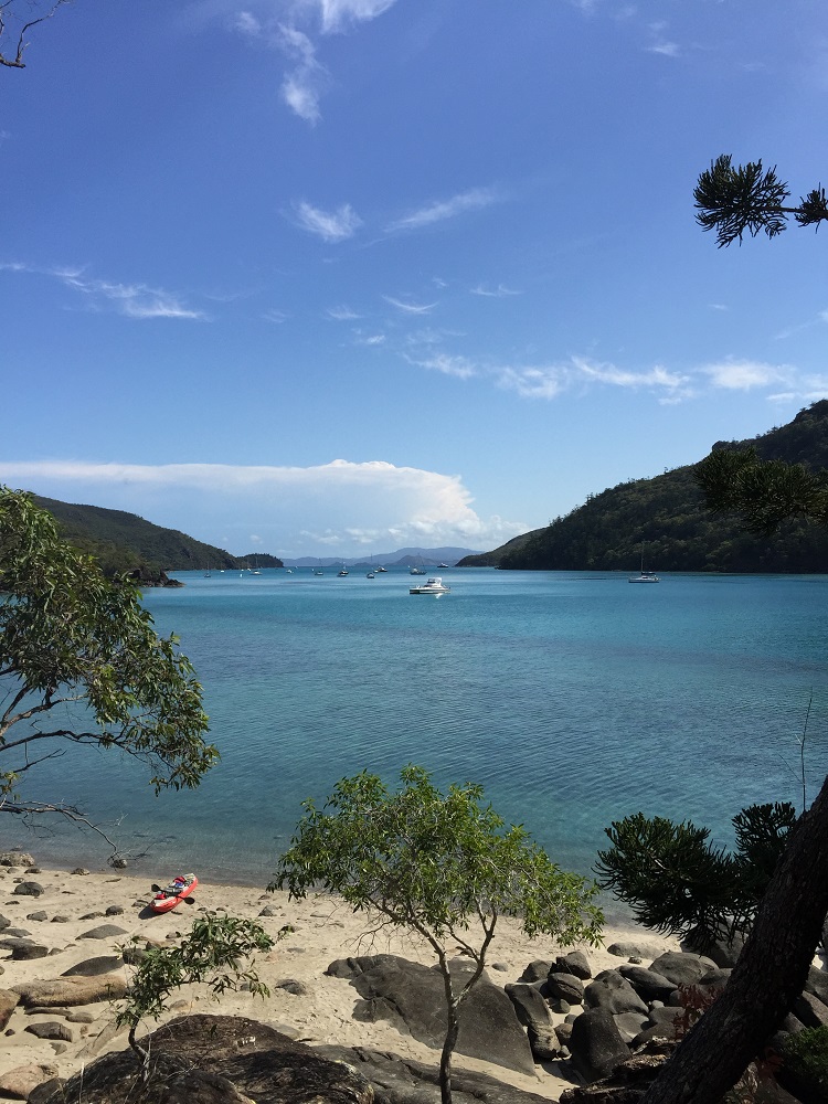
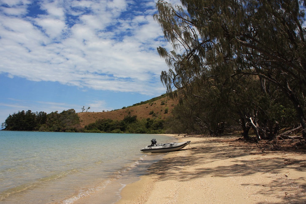
4 – 10 Nov: Long Is, Macona, Hill Inlet, Whitehaven

Wednesday 4th November

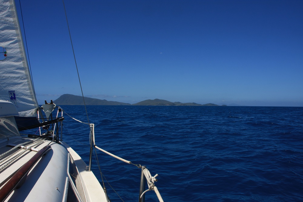
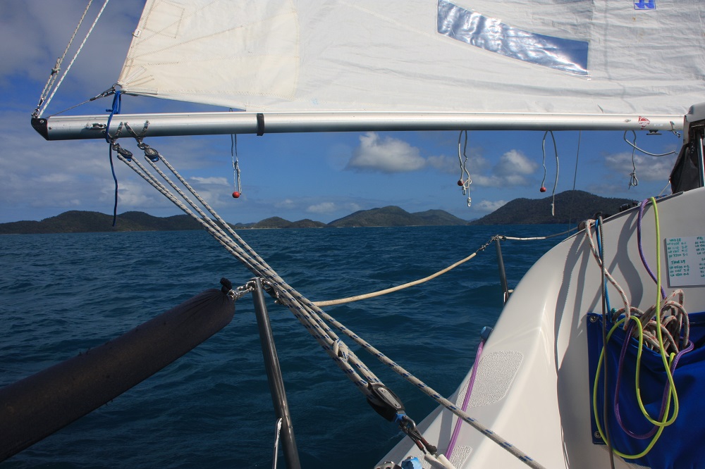
With our newly repaired tender in tow and all provisioned up we headed for Palm Bay on Long Island. It was one of the best sails we’ve had having a good 10kn wind behind us and the tide with us we flew along at upwards of 5kn at times. Ray was on the tiller; we sat back and enjoyed the islands as they floated by.

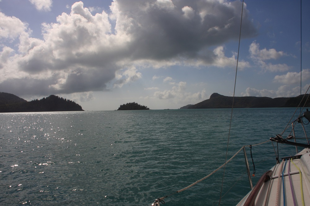
Running with the wind on our way to Long Island. Magic sailing.

Running with the wind on our way to Long Island. Magic sailing.

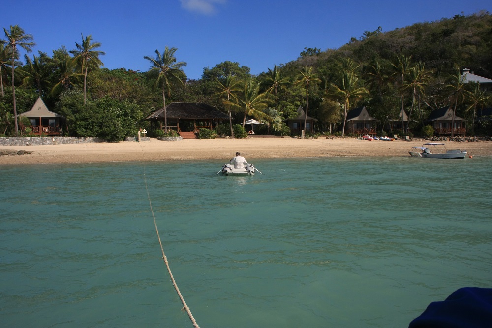
The entrance to Palm Bay is via a narrow, dredged channel to a small ‘lagoon’ within the rocks and coral. Here there are 4 mooring buoys. It took us a while and a phone call to reception to finally see the small red and green buoys that delineate the channel. We picked up a mooring buoy then went ashore and brought back one of the stern lines they provide. This will prevent us from swinging as the tide and wind change, hitting the reef, and also keeps us bow to the swell, ensuring a calm night.

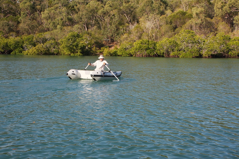
Steve rowing ashore. Note the stern line from Top Shelf to the shore.

Steve rowing ashore. Note the stern line from Top Shelf to the shore.

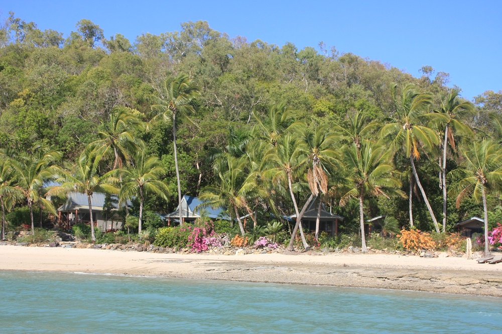
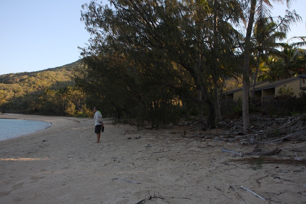
Times are changing on the islands. Our guide book said a mooring fee ($50/night) would cover the resort facilities including pool, showers, etc. Not so anymore – that’s an extra $25 each … bit much to pay for a swim and shower. Palm Bay resort is a pretty resort with small individual burés set in lush tropical gardens facing the beach. It’s all self-catering, with a nicely appointed kitchen and large open dining room for the guests to use.

Palm Bay bures.

Palm Bay bures.

Thursday

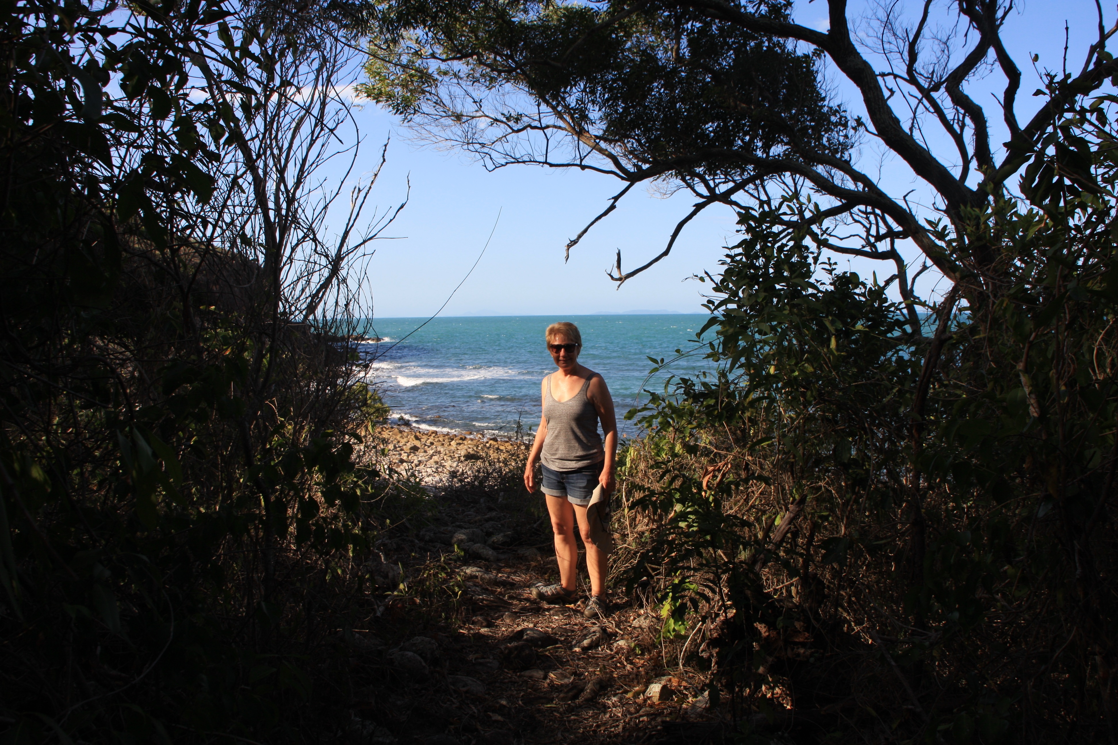
Today was a day of walking! We planned to walk the southern walks from Palm Bay first, then to Happy Bay, the resort just north of Palm Bay where we’d rest a while at the beachside cocktail bar we remembered from our last visit here, before continuing with the northern walks. It started so well as we walked along well-shaded tracks covered with a rich carpet of leaves to Sandy Bay, Fish Bay, Pandanus Bay and finally to the Happy Bay resort. This is where it all went wrong – it’s closed! Another ‘ghost resort’. We walked on, unsatiated, completing the island circuit, all up 15.5km. While there were no great peaks to assault with astounding views as we’ve experienced before, it was nevertheless an enjoyable walk around the island.
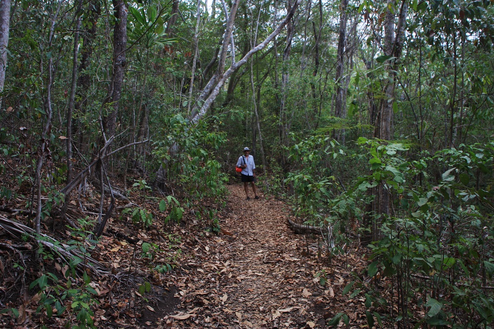
The islands are interlaced with these wonderful walks, and rarely do we ever meet anyone else out there doing it. They don't know what they're missing.

The islands are interlaced with these wonderful walks, and rarely do we ever meet anyone else out there doing it. They don’t know what they’re missing.

For more photos of our stay on Long Island CLICK HERE

Friday

Suitable anchorages for the persistent northerly winds are limited. We decided to cross the channel again and take our chances at some of the places we still want to see despite the winds. Today’s sail was quite long, but again very enjoyable for most of it. To quote the Skipper, ‘it got a little frisky there for a while’. We were close hauled all the way from Long Island up to Macona Inlet on Hook Island where we’ve anchored.

Saturday

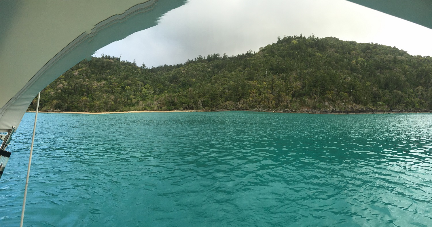
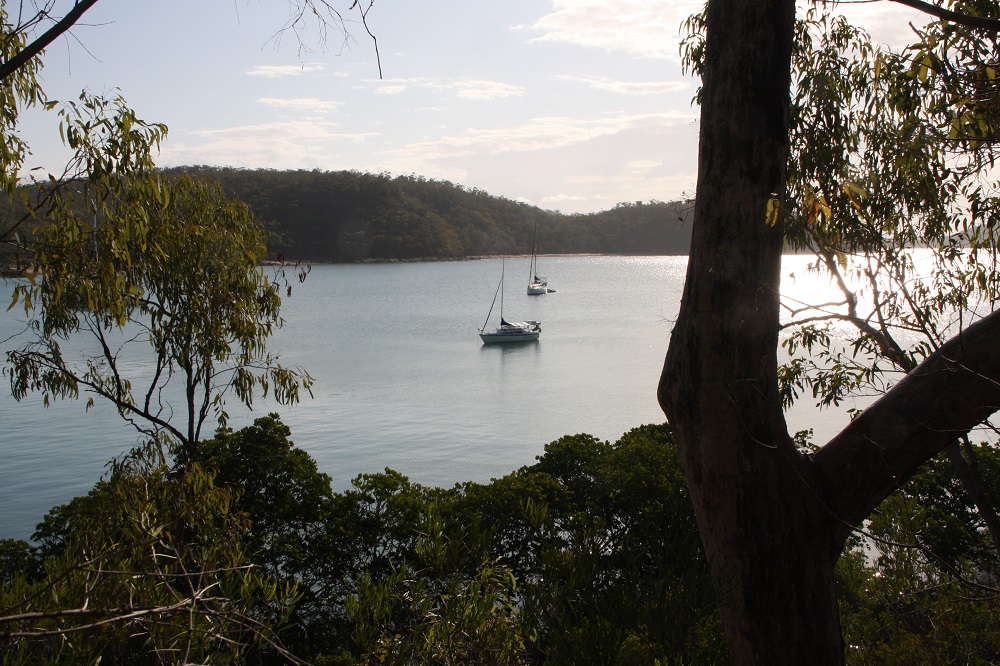
Decided to stay today and explore Macona Inlet in the tender. I must say I think this is one of the best anchorages in the Whitsundays. It has several lovely sandy beaches to explore and swim from, is well protected from all winds except a direct southerly, and the surrounding hillside is beautiful, covered in trees of so many different colours. And it’s not generally as popular as the other protected anchorages.

The guide book said you could catch fish here without requiring much skill. We duly baited our hooks and tossed the lines out, then sat reading – undisturbed. Obviously a greater skill required then we possess.

We were hit by storms tonight – lots of rain and lightning and wind. The anchor held without giving an inch and we had no problems. It soon passed and we slept well.

Sunday

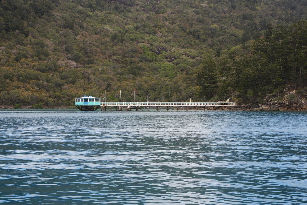
Off to Hill Inlet today on the eastern side of Whitsunday Island. But first we had to pass through Hook Passage. I remember many years ago visiting the Hook Island Underwater Observatory which was here in Hook Passage – but it’s now closed; apparently competition from the high speed catamarans which take tourists out to the reef for the real deal was too great. Pity, I really enjoyed it.

Another once thriving tourist attraction now closed: Hook Island Underway Observatory.

Another once thriving tourist attraction now closed: Hook Island Underway Observatory.

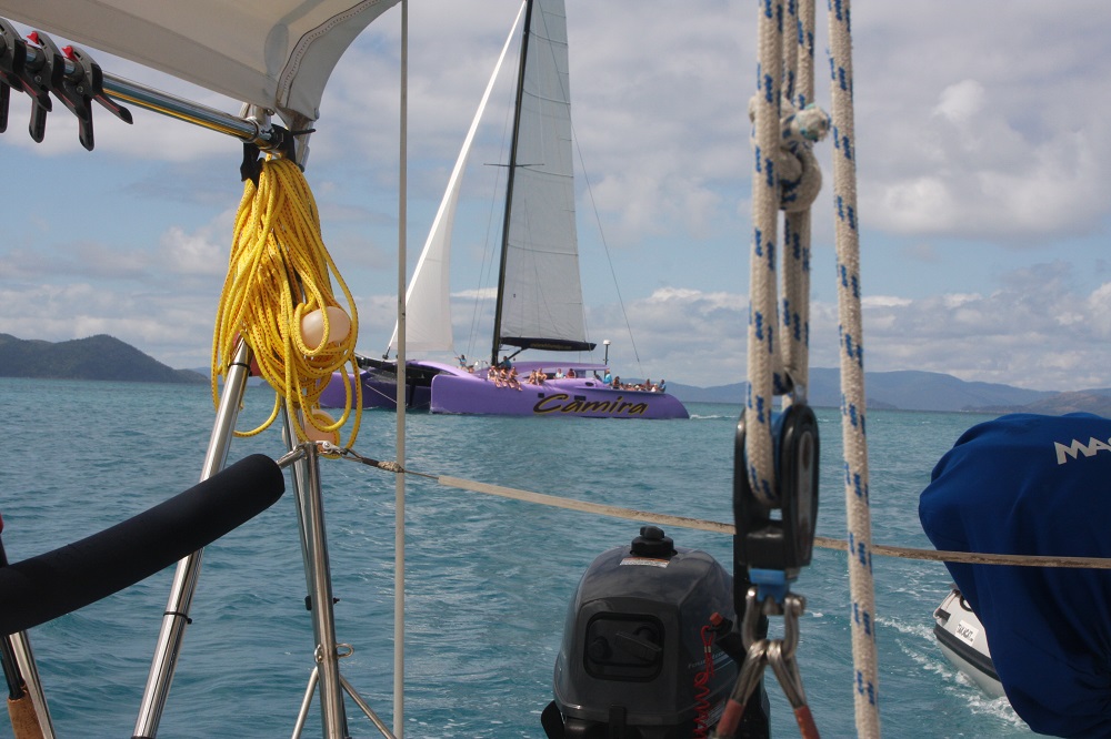
Hook Passage is another of the Whitsunday passages where you have to get wind and tide just so and our planning was good. The tidal flow tore us along at over 5 knots with not much wind to speak of. However the timing also coincided with the tourist boats passing through which added some drama, particularly coping with their wake.

Rapidly closing on us, in Hook Passage.

Rapidly closing on us, in Hook Passage.

To view a few photos of our trip to Hill Inlet CLICK HERE.

Due to lack of wind and a contrary tide as we headed south we motored all the way to Hill Inlet arriving about 2 and a half hours after full tide. This stunning inlet which is the northern boundary of Whitehaven Beach is very shallow – too shallow for keel yachts, but perfect for trailer sailers and catamarans. Sensibly you’d enter this narrow Inlet on the full tide, or at least a rising tide in case of running aground, but we didn’t have those options so in we went anyway. We wound up the keel and pulled the rudder up half way and I took up position standing at the bow trying to spot the deepest channel, waving the directions frantically to Steve. By good luck we didn’t run aground and anchored in a couple of meters of water on the southern side.
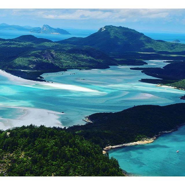
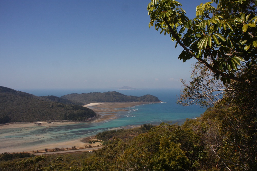
This is Hill Inlet. Not my photo - taken from a greater height than I could manage. Here you can see the size of the Inlet and the shifting sands we had to negotiate. Not complaining - top anchorage.

This is Hill Inlet. Not my photo – taken from a greater height than I could manage. Here you can see the size of the Inlet and the shifting sands we had to negotiate. Not complaining – top anchorage.

This was a fairly long trip today – about 15nm of motoring which isn’t relaxing.

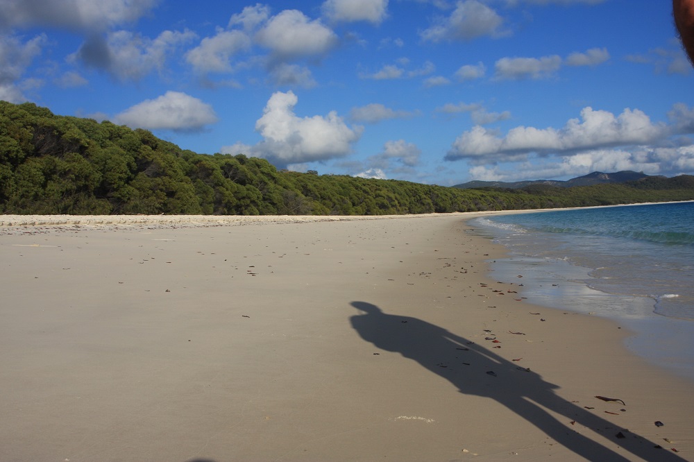
Late afternoon we went for a walk along Whitehaven beach. Whitehaven is 7km of pure white sand and is officially rated as one of the top 5 beaches in the World. The sand is 98% silica and very fine and soft. This amazing beach is a bit of an enigma as locally there are no quartz rocks from which it could have been formed. Naturally it’s a major tourist attraction of the area drawing several hundred visitors a day, mostly to the southern section. Being part of a National Park it is entirely unspoilt by development, looking the same today as it did to the Ngaro aboriginal communities over the centuries. And credit to all concerned it recently was awarded the ‘Cleanest Beach in Australia’, well-deserved too from our observations.

By late afternoon the day trippers are all gone and the yachties today are elsewhere, Whitehaven being a poor anchorage in northerly conditions. We could hardly believe our good fortune – arguably the best beach in the entire world and Steve and I had it entirely to ourselves to walk. Surreal.
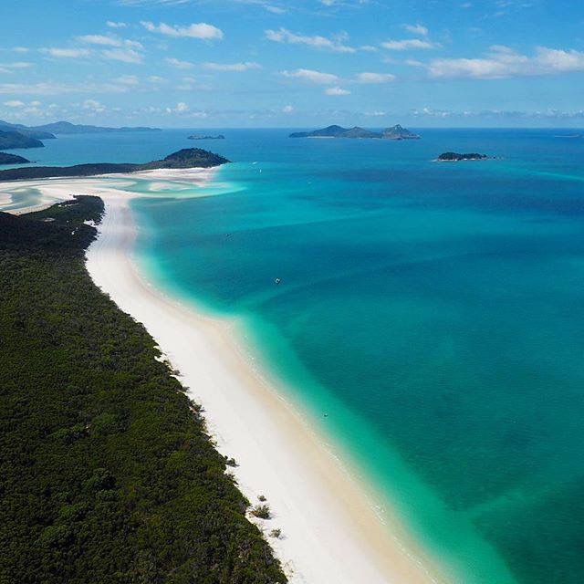
Aerial photo of Whitehaven looking north towards Hill Inlet. This is the stretch Steve and I walked. Again, not my photo.

Aerial photo of Whitehaven looking north towards Hill Inlet. This is the stretch Steve and I walked. Again, not my photo.

Monday

South easterlies are forecast to arrive today. Rather than stay in Hill Inlet where we only have one opportunity a day to leave and therefore risk having to leave at a time when winds don’t suit us, we decided to move on today. But first a little sightseeing and some housework.

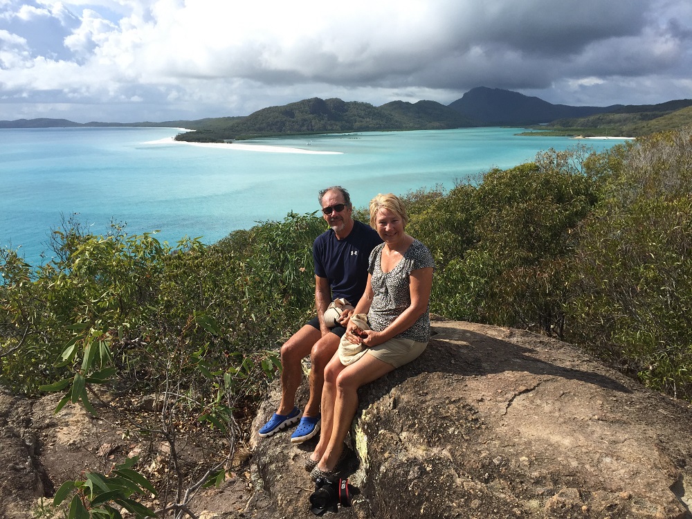
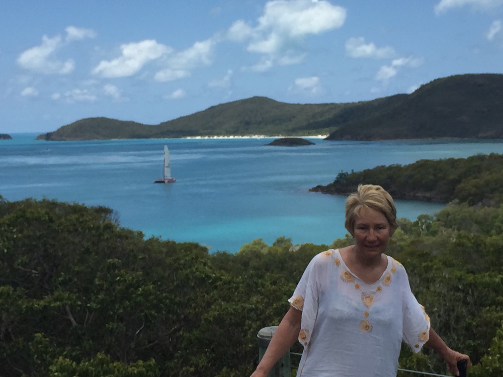
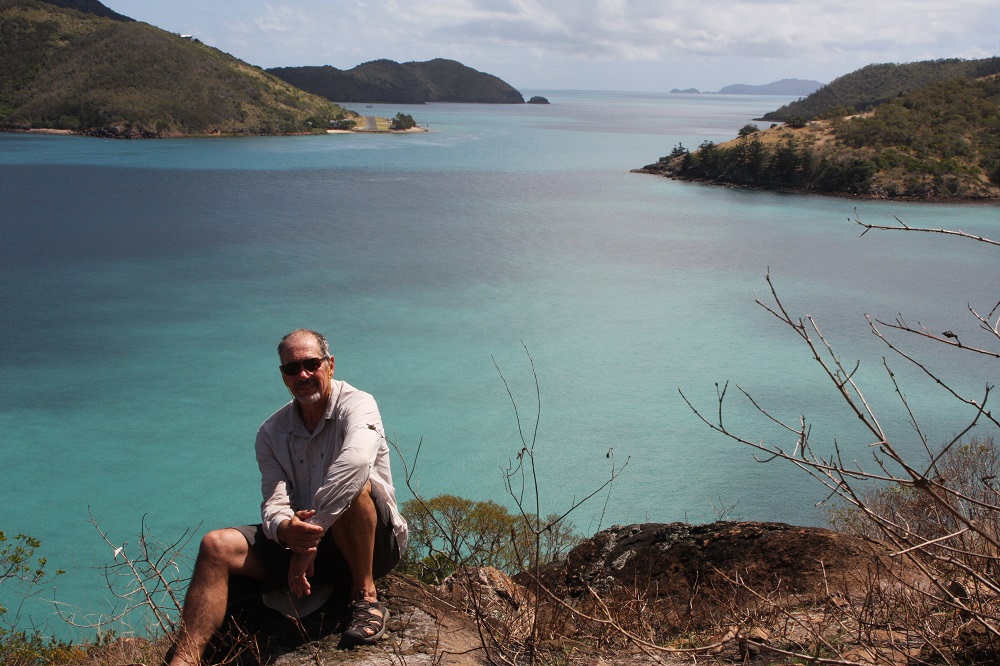
On the headland between Hill Inlet and Tongue Bay, the next bay north, National Parks has built a walking path to a lookout with magnificent views over the Inlet and Whitehaven. We took to the tender before breakfast to beat the crowds, enjoyed the views and photo opportunities then got caught in quite a long, heavy downpour. We were drenched!

Selfie from lookout overlooking Hill Inlet and Whitehaven Beach.

Selfie from lookout overlooking Hill Inlet and Whitehaven Beach.

Back at Top Shelf and now pushed for time we motored into shallower water and hopped overboard with snorkels and masks and our hull-cleaning equipment to give her another clean. Growth on the hull happens so quickly in these tropical waters. Hill Inlet has the same beautiful white silica sand as Whitehaven. The water is crystal clear over this lovely soft sand – it was quite visually striking and made hull-cleaning a pleasant pastime.

By the time we’d finished it was once more a couple of hours after high tide and we had to leave – still no breakfast. I repeated my demented arm-waving act standing on the bow and led us safely out to choppy waters. Fortunately not far to go – just to the southern end of Whitehaven – with southerly winds expected it’s now a good anchorage.

We managed to slip ourselves into the perfect location with the best protection on this magnificent beach and ate our breakfast at midday. Then we sat back and watched the comings and goings! Boats of every size everywhere, seaplanes flying in and out and even 5 identical helicopters arrived together and landed in formation on the beach.
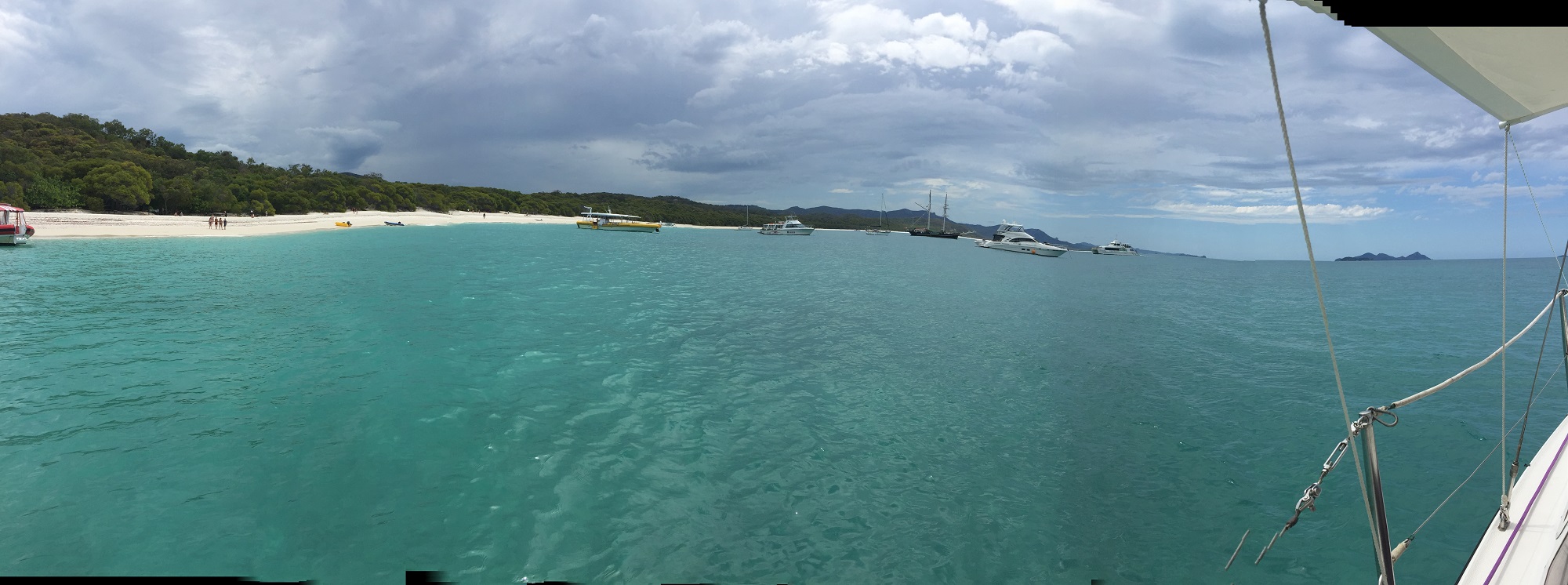
Panorama of a few of the tourists at Whitehaven. Bit wonky as Top Shelf wouldn't stay still for me. If you have very good eyesight you may be able to see 5 red helicopters on the beach.

Panorama of a few of the tourists at Whitehaven. Bit wonky as Top Shelf wouldn’t stay still for me. If you have very good eyesight you may be able to see 5 red helicopters on the beach.

By 4.30pm they’d all gone leaving us and 3 other yachts in peace for the night. We put out a stern anchor to the beach to prevent any rolling from the swell, cooked a delicious meal then sat in the cockpit for hours listening to beautiful music, staring at the sky, counting the shooting stars and sipping a chilled semillon. I hope this evening will remain in my memory for many years to come.

To see our photos from Hill Inlet and Whitehaven CLICK HERE.

Tuesday

I loved it so much here at Whitehaven that I momentarily considered suggesting to Steve that we stay here another night – then I remembered the tourists!! No, they didn’t fit into my idea of tranquility, and sure enough by 8.15am there were already 3 seaplanes landed, disgorging tourists onto my beach. Time to leave.

Our morning constitutional on Whitehaven Beach, before the tourists arrive.

Our morning constitutional on Whitehaven Beach, before the tourists arrive.

This time it’s Solway Pass, between Whitsunday and Hazelwood islands, to be traversed, but we’re getting pretty good at these narrow passes now. Even so with all conditions on our side, and motoring, the swirling waters swept us off course a few times. Once through up went the sails for a gentle, pleasant sail northwards through Fitzalan Pass to Henning Island where we picked up a buoy. Just short of Henning we had a near-catastrophe. We were running with the wind, which means the mainsail was nearly at right angles to the boat  Steve, on the tiller, looked down to start the motor in preparation for mooring when the wind suddenly flipped the sail right across the boat to the other side where I was in the process of sitting back up after leaning over the side to rinse a bucket. It hit the top of my head – if I’d been any higher up we both shudder to think of the consequences. Accidents happen in split seconds.

That set the tone for the next few hours. The wind got up and made the Henning Island mooring uncomfortable, not that my headache and I had any interest in exploring. We dropped the mooring buoy and headed to Beach 25 (yep, that’s its name)  just across the passage and a bit closer to Hamilton Island where we want to go tomorrow for reprovisioning. It was a hasty move as we were both still stressed from the ‘incident’ and it wasn’t until we were half way there that I took a good look at the chart – dangerous reef and very shallow water all around it. Sh*t! We carefully navigated in, anchored, then decided it was too swelly and potentially shallow here too, so moved again to Gulnare Inlet. Took the short-cut through a very narrow channel of ‘a bit deeper’ water between rocks and reefs before negotiating our way into this beautifully protected and calm, but very shallow at dead low tide (which it now was) inlet.

Once safely anchored the remaining alcoholhic beverages on board disappeared rapidly, but we did enjoy a beautiful evening.
26 Oct-3 Nov: Cid, Waite, Chance, Cid

Monday 26th October: Airlie to Cid Harbour

Borrowed the marina courtesy car again to take the tender to repairers this morning. We’ll pick it up on our return in a week or so. In the meantime we can use the kayak to get to shore.
Left Abell Point marina at 1030 our destination Cid Harbour via North Molle Island. A very light easterly wind saw us motoring until we passed the Molle group, then motor sailing most of the way to Cid to counter the very strong north flooding tide. Bad planning – we shouldn’t have left until the tide was turning!

Enjoyed a lovely couple of hours this evening sitting in the cockpit listening to Dean Martin’s beautiful voice floating over the water from a neighbouring yacht.

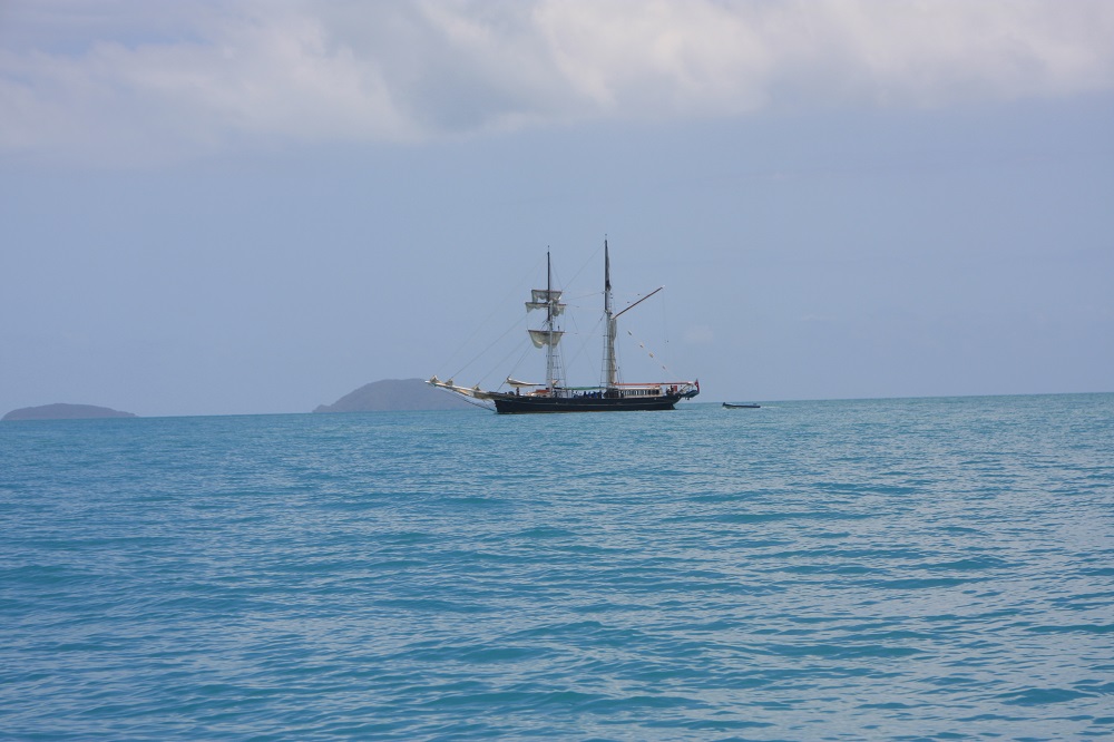
Some of the islands are exactly the same today as when Captain Cook first saw them, and this could be him now.

Thanks to our wonderful National Parks some of the islands are exactly the same today as when Captain Cook first saw them, and this could be him now.

Tuesday

Cid Harbour to Waite Bay, Hazelwood Island

Phew! Today was a big day.

The several narrow passages between islands around the Whitsundays are notorious for striking fear into the mariner who would dare to traverse them with a contrary tide and wind. Fitzalan Pass on the northern side of Hamilton is one such passage.  We left our anchorage at 7am anticipating a two hour sail to reach the pass at slack tide.
If we’ve learnt nothing else sailing it’s that plans rarely work out as anticipated. No wind this morning but we caught the tidal stream of the flooding tide. With the outboard barely above idle we flew down Hunt Passage and around the corner towards the pass at up to 7kn at times, arriving an hour earlier than planned. Fortunately the pass was mellow as what little wind there was was going with the tide.

Fitzalan Pass. One of the many narrow passages that has a bad reputation. Luckily it was well-behaved today.

Fitzalan Pass. One of the many narrow passages that has a bad reputation. Low rocky outcrops extend for quite a distance from the little island. That’s Hamilton on the right.

We variously motored, sailed and motor-sailed on to Hazelwood Island where we initially anchored for lunch near Lupton Island. This anchorage is deep and surrounded by coral. The trip into the beach without a tender would be a long way and I didn’t want to swim from the boat in such deep water. We upanchored, very unhappily bringing up a piece of staghorn coral the anchor had broken off and moved across Waite Bay to anchor on Hazelwood Island  in a couple of metres of crystal clear water over lovely white sand. Happy now.

Hmmm – ideal opportunity to clean the hull! As the tide dropped we were able to walk around Top Shelf scrubbing off the baby barnacles, slimy growth and even feathery pretty growth. Steve swam under the boat scrubbing the very underneath. It was hard work here for a couple of hours.  We were shocked at how much growth was on her. We won’t leave her that long again. We should fair fly through the water now with all that growth gone.

It’s a full moon tonight. We’re the only ones in Waite Bay – I’m sure this is heaven.

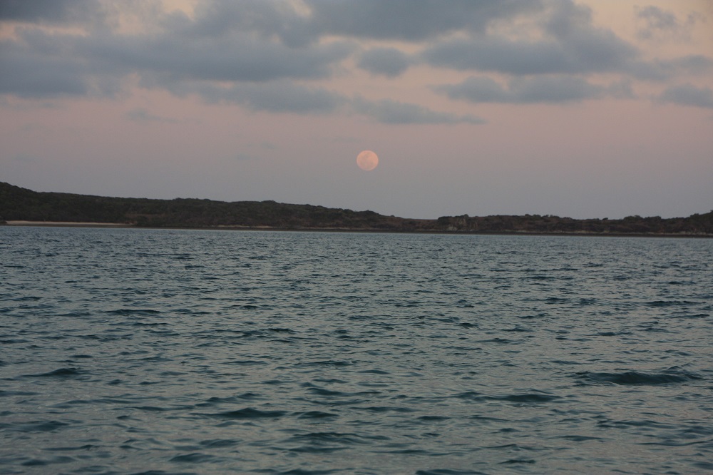
Once more we get to see a full moon rising on this trip - our 3rd so far. This time it's over Lupton Island and we're anchored in Waite Bay on Hazelwood Island. No one else here; an idyllic tropical experience.

Once more we get to see a full moon rising on this trip – our 3rd so far. This time it’s over Lupton Island and we’re anchored in Waite Bay on Hazelwood Island. No one else here; an idyllic tropical experience.


Wednesday – Thursday

We had a lovely gentle sail over to Chance Bay on the southern side of Whitsunday Island. After the last few days of predominantly motoring it was good to be able to enjoy the peace of sailing.
Chance Bay is a pretty bay with two lovely white sandy beaches bordered with low growing trees, pandanus palms and crinum lilies which are flowering now. The fringing reef made anchoring challenging until another yacht in the perfect spot left – we quickly took their place.

Steve pumped up the kayak, we paddled ashore and walked another leg of the Ngaro Sea Trail. This 8.5km return walk took us up over the hill, through eucalypts, acacias, large bloodwood trees and grass trees to Whitehaven Beach.

From the lookout on our walk. At the bottom of the cliff is Whitehaven Beach. In the distance is Chalkies Beach on Hazelwood Island.

From the lookout on our walk. At the bottom of the cliff is Whitehaven Beach. In the distance is Chalkies Beach on Hazelwood Island.

We enjoyed a well-deserved swim and chill on the beach watching the comings and goings of the day-tripper yachts, giant catamarans, super-powered rubber ducks, sea planes and huge private motor launches before making our way back to our quiet beach.

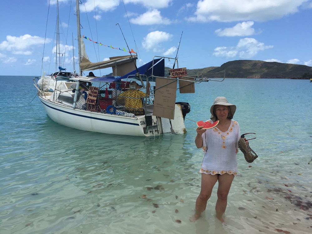
These guys give a whole new perspective to Street Food. On Whitehaven Beach.

These guys give a whole new perspective to Street Food. On Whitehaven Beach.

Back at Chance Bay we snorkelled for a while, but other than rocks covered with giant oysters and a few schools of fish, we didn’t see much. It’s supposed to be good snorkelling on the other side of our bay – next time.

Friday

Another perfect day of sailing today. Easterlies at 5 -15kn took us firstly over to Torres Herald Beach in Turtle Bay. We snuck in over the rocks to shore, not quite drying out, lunched and relaxed for a couple of hours. I got a meal prepared for tonight and put it into the DreamPot to cook. This beach is only small but could be the poster beach for any idyllic tropical beach you care to dream about.

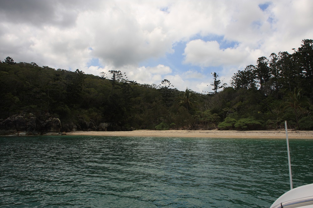
Torres Herald Beach in Turtle Bay. This was a delightful luncheon spot for us. We arrived on a rising tide and were able to take Top Shelf right in to shore.

Torres Herald Beach in Turtle Bay. This was a delightful luncheon spot for us. We arrived on a rising tide and were able to take Top Shelf right in to shore.

With strong winds forecast for the weekend we sailed on back to Cid Harbour – again a great sail just sitting back watching the deep turquoise waters of the islands as they disappeared behind us.
We anchored close in to shore just to the south of Sawmill Beach and enjoyed our perfectly cooked silverside and vegies.

Saturday: Cid Harbour

Rained on and off all day today, accompanied by strong gusty wind. We watched movies and read our books.

Sunday: Cid Harbour

Today we climbed Whitsunday Peak. This is one of the highest peaks in the Whitsundays at 450-ish meters and quite challenging. Commencing at Sawmill Beach we followed the dry creek bed initially. It would be spectacular to be here to see it flowing – particularly the waterfalls over some of the huge boulders. The island is heavily wooded with hoop pines and eucalypts which kept us shaded and cool. Leaving the creek the ascent is steep with many zigzags and countless stone steps. A few pauses were needed along the way.
The views from the top were spectacular! We spent about an hour at the top just absorbing the beauty of this magical part of the world. How lucky are we!! It was fun to see places we’d anchored and plan where we’d go next. From up there it looked reasonably close belying the hours of sailing it takes to reach each destination.

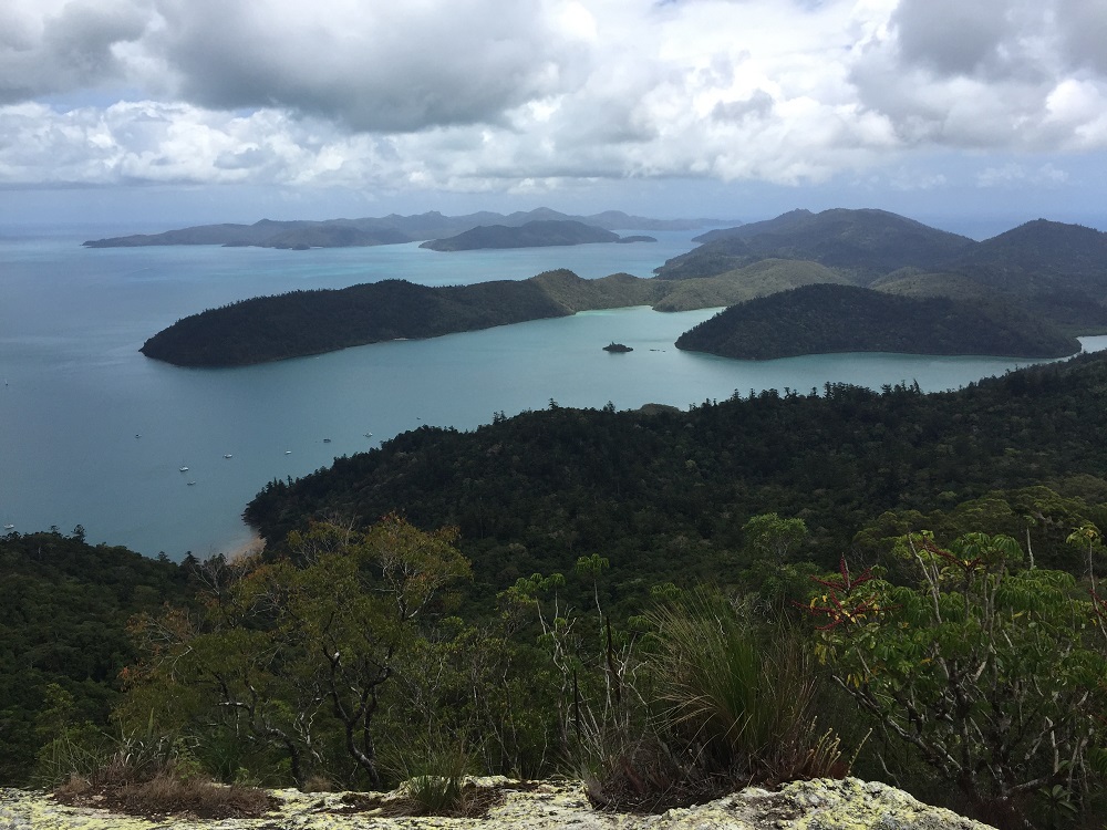
The view north from Whitsunday Peak. Cid Island on the left, Cid Harbour the protected area between the island and the headland jutting out from the right.

The view north from Whitsunday Peak. Cid Island on the left, Cid Harbour the protected area between the island and the headland jutting out from the right.

Once back at sea level we washed the sweat off with a swim – don’t know the logic behind that, but it felt good, and paddled the kayak back to Top Shelf.

Monday: Cid Harbour

Today was kayaking day. The inlet looked so enticing from our sky-high view yesterday that we decided to explore it in the kayak. It was a good paddle following the coastline around. In the photograph you’ll see a tiny island in the middle. It has a lovely sandy beach, rocky headland covered in oysters, all sorts of plants, including orchids, and as it doesn’t appear to be named we’ve claimed it for ourselves. Back to the boat another swim and relax after an enjoyable couple of hours paddling.
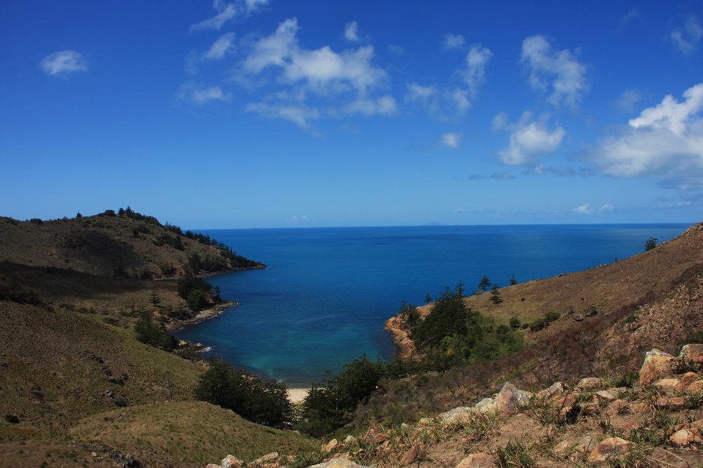
Dugong Inlet from Whitsunday Peak. Sawmill Beach to the bottom left.
Dugong Inlet from Whitsunday Peak. Sawmill Beach to the bottom left. Top Shelf is anchored just out of the picture on the left.

Tuesday: Cid Harbour to Airlie Beach

Back to Airlie today to reprovision and pick up our tender. This time we planned the trip to perfection and had a lovely sail, despite the winds being south-westerly when the forecast was for north-easterlies. We’re nothing if not adaptable.

Got a big fright coming into the marina. Our allocated berth was amongst the catamarans. As we were about to  turn the corner into the narrow finger to our spot a catamaran was coming out taking up the whole ‘road’. Steve handled it very well with a little forward and backwards, but needed a good stiff drink once we’d tied up.

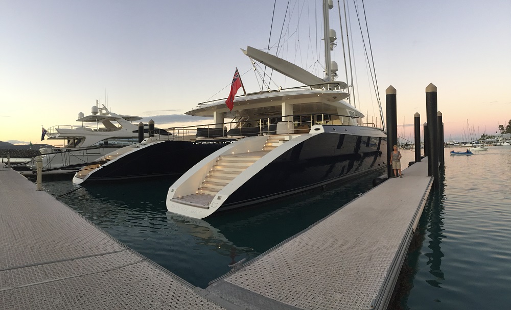
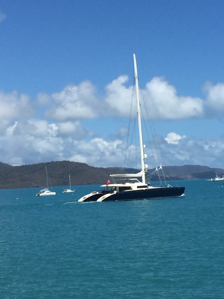
Another rather impressive boat in the marina at the moment is Hemisphere, the largest sailing catamaran in the world. It’s doing charters up here for the rich and famous. At $360,000 a week we’re trying to get a group together for a trip – we’ll need around 3,600 friends I think – pity it only sleeps 10.

This is the largest catamaran in the world. To get a perspective of how big it is Denise is standing on the pontoon beside it.

This is the largest catamaran in the world. To get a perspective of how big it is Denise is standing on the pontoon beside it.


Hemisphere leaves Airlie. For an indication of size, see the catamaran behind her - that's an average-sized cruising catamaran.

Hemisphere leaves Airlie. For an indication of size, see the catamaran behind her – that’s an average-sized cruising catamaran.

For more photos from this week in our travels. CLICK HERE

17-23rd Oct: Cid, Stonehaven, Nara

After farewelling Nick, Kim and the beautiful Baby John yesterday we re-provisioned at the store on Hamilton and prepared the boat to leave. Steve’s birthday in a few days called for a celebration at the seafood restaurant last night, and a toast to Hamilton Island.

The tender has a hole, possibly caused when dragging it on or off the boat. Fix-it kit comes into its own.

The strong winds are back but we’re off anyway! We waited for the change of tide to take us north and, along with the south easterlies and just a jib, we made good time to Cid Harbour on the western side of Whitsunday Island. This is a beautiful very large bay with several beaches and anchorages that comfortably accommodated at least 30 yachts on the three nights we spent here. Cid Harbour is very deep and protected from all directions except the west, a benefit during World War II when troop ships anchored here; today you’re more likely to find cruise ships.

Sawmill beach, Cid Harbour. A truly lovely, very protected, anchorage.

Sawmill beach, Cid Harbour. A truly lovely, very protected, anchorage.

On the short walk across to Dugong Beach we reminisced about camping here with the boys in the 80’s and more recently doing this walk with friends we bare boated with several years ago.

It rained on and off on our second day here- our books received lots of attention.

The tender continues to deflate slowly – not happy!

Tuesday

Happy birthday Steve!

The winds are finally dropping. We head for Stonehaven, a bay on the north of Hook Island. A swell made the trip roly until we cleared Hook Passage. We picked up a mooring buoy and prepared for snorkelling. The Great Barrier Reef Marine Park Authority has defined ‘no-anchor’ areas around many of the best fringing reefs to prevent them being damaged, installing mooring buoys for visiting boaties. These buoys have 2 hour  time limits on them, though if you’re on one at 3pm you can stay till the next day. The buoys are very good with long floating tags making it so much easier to pick up than the ones we learnt on – the boat hook was the way to go with these.

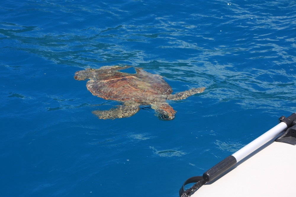
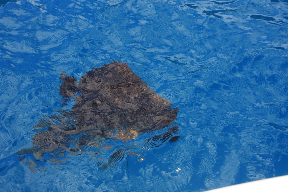
We’ve been welcomed, and farewelled, by turtles at EVERY anchorage we’ve been to so far. It’s uncanny. I’ve decided the turtles must have formed a Whitsunday Ambassadors group, taking it in turns to volunteer to welcome boats to the anchorages.

Turtles came to meet us, and farewell us, at every anchorage. I think they've formed a volunteer welcoming committee.

Turtles came to meet us, and farewell us, at every anchorage. I think they’ve formed a volunteer welcoming committee.

We arrived early to catch low tide, the best time for snorkelling, and snorkelled around the southern end. By lunchtime we were the only boat there so felt no guilt remaining on a mooring, though we did move to the eastern end in the hope the bullets coming down off the surrounding hills would be less. They weren’t – one bullet we measured at 35kn (70km/hr).

We stayed overnight, with all moorings taken by 5pm. Despite the bullets the anchorage was good as the boat turns bow into them – bullets are fine (when securely anchored/moored), it’s a swell that rocks the boat from side to side that makes life miserable.

Wednesday

After breakfast we motored the short distance over to Blue Pearl Bay on Hayman Island. This is reputably one of the best snorkelling and diving sites in the Whitsundays. Again we picked up a mooring to be surrounded immediately by beautiful bat fish. I’d guess that people feed them, hence their interest in us.

Dreadful photo, but you can see the size of the fish that were swimming around our boat at Blue Pearl Bay, Hayman Is.

Dreadful photo, but you can see the size of the fish that were swimming around our boat at Blue Pearl Bay, Hayman Is.

After pumping up the leaking rear side wall of the tender, again, we motored to the southern end of the bay for some snorkelling, but soon moved up into the central area where there’s a narrow marked channel for dinghy entry to the beach – this was the better spot for the amazing coral and fish. Steve videoed some of what we saw.
View a short video of our snorkelling – it’s only 2 mins.

We started to get cold, and the day-tripper boats were disgorging tourists by the score, so we lunched onboard then left, heading north around Hayman intending to spend the night in Butterfly Bay. But the wind was now moving around to the north and someone told us they’d had a very roly night there last night. We continued our circumnavigation of Hayman Island, putting up the sails as we turned west; exciting sailing as we watched for and prepared for the bullets to hit us. We finally anchored in Refuge Bay in Nara Inlet anticipating a quiet night.

Thursday

It was like a mill pond last night! We’d anchored in 9 meters of water, but noted as we drifted on the anchor the depth would drop (rise?) to 4 metres – still plenty of water for us. In the sunlight and with such beautifully crystal clear waters we could see we were drifting over corals. If the other name for this bay wasn’t ‘Shark Bay’, rumoured to be a breeding ground for hammer head sharks, I may have been tempted to snorkel over it.

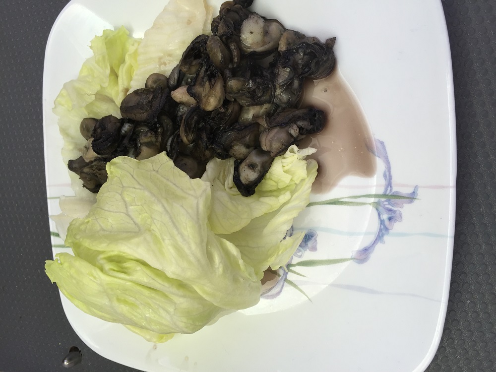
Today we went out to False Nara Inlet, a tiny bay just outside Nara destined to trick the unwary mariner. Here we picked up one of two mooring buoys then took the tender (after pumping up her broken wing again!) to the shore. The rocks were covered with the biggest oysters I’ve ever seen. This isn’t an often visited bay and few, if any, had been taken. Without moving more than 3 meters Steve had got a cup of oyster flesh for me – pity he doesn’t eat oysters!

My lunch today - 4 dozen oysters au beurre, fresh off the rocks at False Nara Inlet.

My lunch today – 4 dozen oysters au beurre, fresh off the rocks at False Nara Inlet.

A lovely swim followed then snorkelling over the coral bommies. I stayed mostly on the beach side so the coral was OK, but the fish kept me enthralled for ages – so beautiful. We investigated how we could get Top Shelf inside the fringing reef onto the gently sloping beach one day in the future to clean her hull – looks like a line from the middle of the two reef protection buoys on the southern side to the rock wall on shore looking out for two large bommies at the beginning. The water is so clear we’ll probably see them clearly.

We lunched here. By the time we’d finished there were three other yachts with us, one on the other buoy, and two anchored, one of which was a huge trimaran with about 20 bronzed, bikini-clad girls and half a dozen guys. They were ferried over to the reef to snorkel, which they seemed to enjoy, but they’d already missed the best time just before and during low tide.

I swear I’ve never seen anyone else at this little bay – seems like when one yacht anchors others just have to join them!

Back into Nara Inlet for another peaceful night.

Friday

The winds are back up again today – 20 knots from the north. No matter, we’re staying here today ready to sail to Airlie Beach tomorrow.

We spent a lazy morning attending to ‘business’ on our computers. I cooked one of my favourite meals, Pujabi lentils, while Steve inflated the kayak.

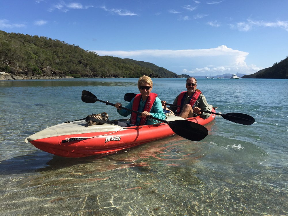
Leaving the Ngaro Cultural Site. Top Shelf is at the FAR end.

Leaving the Ngaro Cultural Site. Top Shelf is at the FAR end.

We paddled down to the far end of Nara Inlet where National Parks has provided a short walk and boardwalk to view an Ngaro aboriginal art cave. The Ngaro peoples appear to be one of the earliest groups of aborigines on the east coast of Australia. Archaeologists have dated their presence here back more than 6000 years. That all ended in 1870 though with colonisation. They were known as the saltwater people, travelling around the Whitsunday islands in their hand-sewn paperbark canoes, even as far out as the Reef. They were very accomplished mariners.

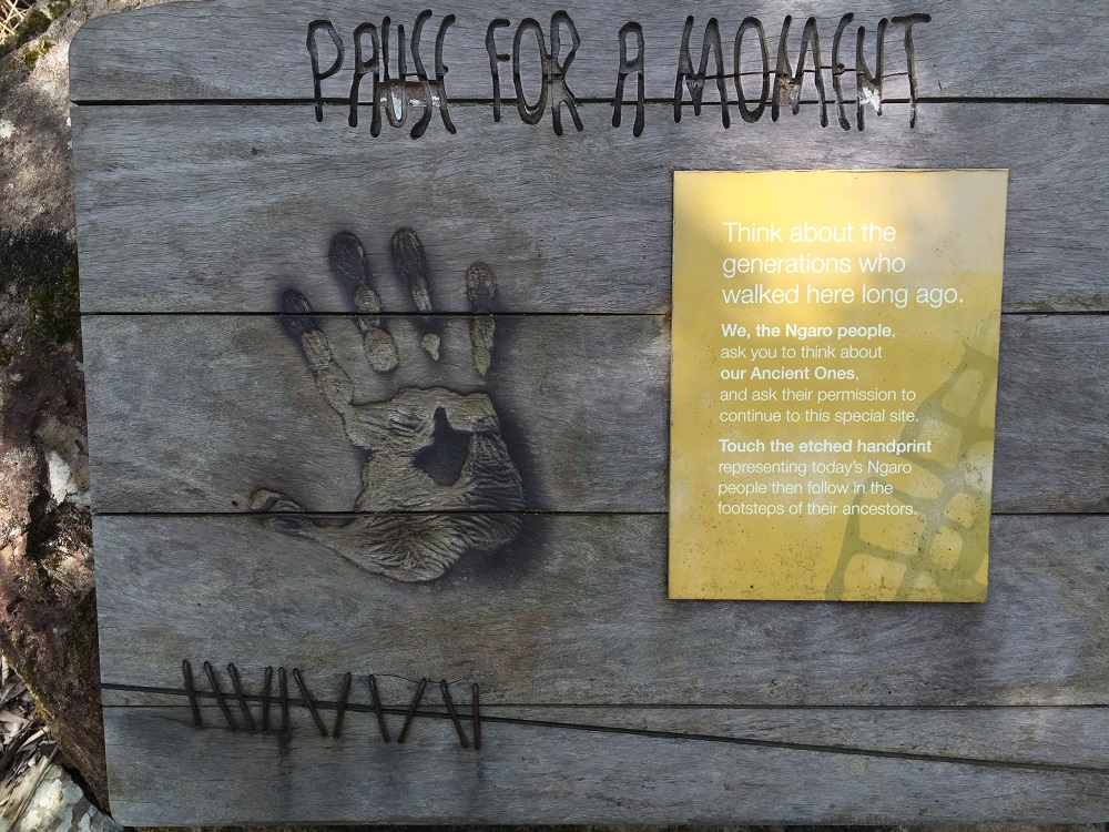
In aboriginal culture it is common to ask their ancestors for permission before entering certain sites. This sign asks the visitor to pause and think about the people who walked here before them and acknowledge the Ancient Ones by putting your hand over the handprint.

In aboriginal culture it is common to ask their ancestors for permission before entering certain sites. This sign asks the visitor to pause and think about the people who walked here before them and acknowledge the Ancient Ones by putting your hand over the handprint.

After visiting this Cultural site we paddled on down to the dry waterfall then headed back to Top Shelf- all up over an hour of kayaking – I’m going to be sore tomorrow!

Another view of Nara Inlet. See our kayak on the little beach in the foreground?

Another view of Nara Inlet. See our kayak on the little beach in the foreground?

To see more photos from this part of our trip CLICK HERE.

29th Sept: Lindeman Island

Ahh such a peaceful night! We were going to do so many things today, but just didn’t get around to it. We did take the tender ashore and explored a little stoney beach beside Plantation Bay, then went around a small headland to Plantation Bay which has a lovely sandy beach. I wonder why one is all stones and the one beside it sandy?
We’ve got one more day of light winds before it starts picking up and by the weekend we’ll have gale-force winds.
Our lovely quiet anchorage has 12 boats in it tonight, all moving gradually closer to a safe harbour.

The sandy beach at Plantation Bay.

The sandy beach at Plantation Bay.

To see photos from Plantation Bay on Lindeman Island, CLICK HERE.

(PS: Happy birthday Deb and Lynise)

25-26 Sept: Goldsmith Island

25th Sept

Left Brampton about 8am to catch the ebbing tide north.  South-easterly winds directly behind us and choppy seas made the sailing a bit hoo hum. When we turned northerly though for our approach to Goldsmith we fairly flew along. We’re snuggled in to Minnie Hall Bay in 2 meters of water at low tide, anchored just far enough away from the coral bommies on both sides of the channel to the beach.
Another very pretty bay – quite wide with 3 sandy beaches spread around it. After our exercise yesterday and sail this morning we didn’t want to do much. However we did go in to the beach. Steve thought it was close enough to row so didn’t put the outboard on the tender – big mistake! The distance was deceiving and he got a good work out.

26th Sept

We slept reasonably well last night. Bullets kept hitting us, but they ensured we stayed pointing into wind and we slept well. Roylen Bay is the next bay north on Goldsmith Island, which sounded very nice with its beautiful white beach. We up-anchored and motored the short distance on to it. It’s a smaller bay with a fringing reef just off the beach. We anchored just outside that, planning to not quite dry out, but be out of the way of the current.

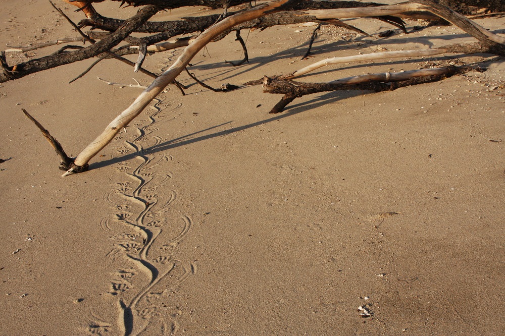
Sand goanna tracks. This was made by a pretty big old girl.

Sand goanna tracks. This was made by a pretty big old girl.

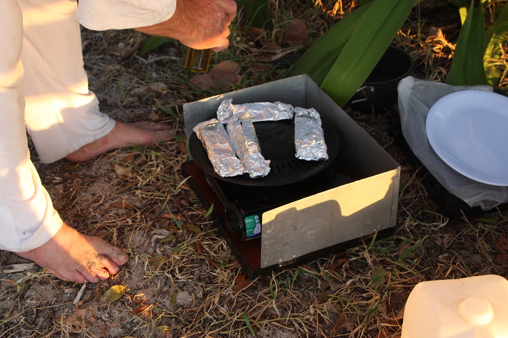
On the Wing‘ arrived midday with Ken and Ingrid who anchored near us. They’d snagged a lovely big mackerel on a lure on the way and asked us if we’d like to share it with them – Yes, please!  BBQ fresh fish on the beach tonight.
Just before low tide we went for a swim and snorkelled over the fringing reef. It’s just a small area but still had some quite lovely hard and soft corals with lovely rich colours – not many fish.

Beach BBQ of freshly caught mackerel, with our friends Ken and Ingrid.

Beach BBQ of freshly caught mackerel, with our friends Ken and Ingrid.


Watching the sun set while eating our delicious BBQ fresh mackerel at Roylen Bay, Goldsmith Island.

Watching the sun set while eating our delicious BBQ fresh mackerel at Roylen Bay, Goldsmith Island.

23-24 Sept: Brampton Island

23rd Sept
Quiet day today with only snorkelling just before low tide planned. The channel between Brampton and Carlisle has a central reef. I donned my stinger suit (a sight to behold!), Steve put on his wetsuit and off we went in the tender. The tide was so low we needed to go around Pelican Island to get to the channel. Steve’s snorkelling gear was a new purchase but took no time at all to get used to it. There was a lot of reedy sea grass growing, apparently smothering some of the coral bommies. We found a few not so badly affected and enjoyed seeing a few fish, some pretty corals, lots of sea slugs and quite a few sea urchins. A pleasant snorkel, but nothing to write home about.

24th Sept

Today we ‘do’ the walks.
Despite the circuit track apparently being closed indefinitely due to lack of maintenance we continued on. There were a couple of places where we had to scramble under or over fallen trees, but on the whole it was a well-constructed track that hadn’t suffered much from the neglect. We checked out Oyster and Dinghy Bays on the southern side for future reference, being anchorages in a northerly and climbed to Brampton Peak. All up a walk of around 14km.
We both voted it to be one of the best we’ve ever done. It had everything – thick rainforest, glades of lime-green strappy calves tongue, maidenhair ferns in the gullies, grass trees covering the slopes and beautiful big old hoop pines which are favoured by the screeching sulphur-crested cockatoos, standing sentinel over the southern bays.

Dinghy Bay, Brampton Island. Taken during our bushwalk on the Circuit Track.

Dinghy Bay, Brampton Island. Taken during our bushwalk on the Circuit Track.

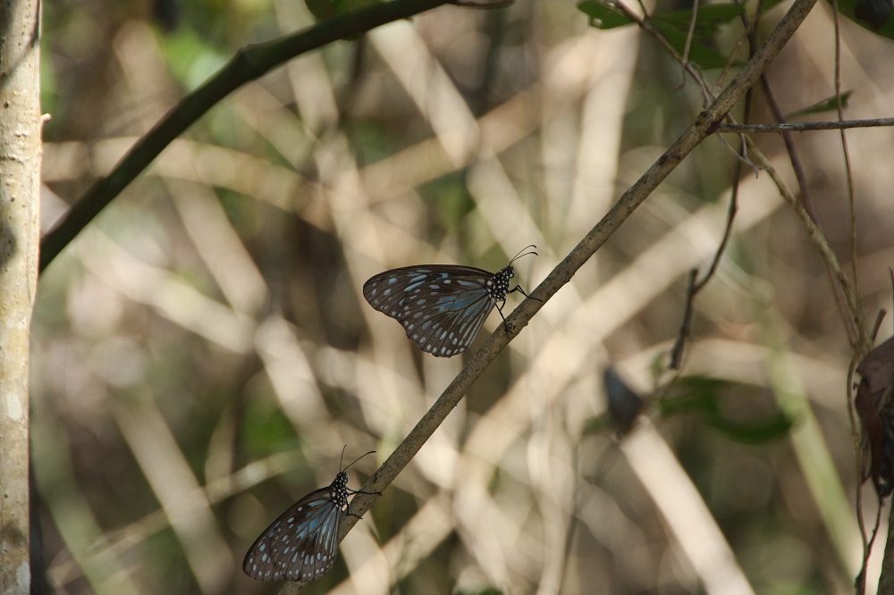
But the real highlight of the walk was the butterflies – thousands of blue tiger butterflies all around us as we walked. We could have been walking through a butterfly enclosure there were so many of them.

Blue tiger butterflies. There were clouds of these pretty butterflies surrounding us on our walk.

Blue tiger butterflies. There were clouds of these pretty butterflies surrounding us on our walk.

The climb to the peak was tough – a few hundred meters up over 2 km with lots of switchbacks. The views from the two lookouts were worth the effort – and we got enough internet cover to speak with our children.

The passage between Brampton and Carlisle at low tide. Taken from Brampton Peak.

The passage between Brampton and Carlisle at low tide. Taken from Brampton Peak. Note the disused airport runway.

At sundowners Ken and Ingrid from the ‘trailer tri’ On the Wing came over and shared stories about anchorages and boats.

To see more photos from this beautiful island and our walk CLICK HERE.

22nd Sept: Newry Is to Brampton Island

A calm anchorage like Newry’s is to be savoured. However it’s onward we sail. The forecast of 5 – 15 knots from the south east held on the 20+nm sail to Brampton Island. Brampton is directly east of Newry. Leaving mid-tide we allowed for the ‘ebb’ to firstly carry us north before the ‘flood kicked in to carry us back onto track. With wind and tide sorted all that was left for us to do was set the sails, get Ray going and sit back and enjoy the ride, which we did. The trip took about 6 hours.

Our destination -the gap between Carlisle Island on the left and Brampton Island on the right.

Our destination -the gap between Carlisle Island on the left and Brampton Island on the right.

After a rest we took the tender over to the resort. What a sobering experience. It’s been closed since January 2011. I think it was originally closed when a cyclone damaged the jetty and the light rail line that would take the holiday-makers from the boat to the resort. From the sea it is the vision of a perfect tropical island, golden sands, coconut palms, swimming pool on the edge of the sea, fringing coral reef and accommodation units tucked in amongst the tropical gardens. However close up, the pool, while undamaged is full of green water, the gardens are untended and overgrown, and coconuts and palms fronds litter the pathways. The accommodation units still contain their beds and washing machines and even electric clocks, the restaurant is full of chairs and tables, lounge chairs still in their original wrapping, apparently never been used, and just off the beach at the watersports hut are the surf cats and jet skis. All sadly abandoned!

The beach near the resort on Brampton Island.

The beach near the resort on Brampton Island.

Apparently United Petroleum owns the lease to the resort. They have been talking about redeveloping it for some time with rumoured construction and completion dates wafting past. The latest, published in the newspaper in July this year, is that approval has now been granted for a 7-star “boutique eco-resort featuring luxurious villas, a health spa, yoga platform, cinema, library and a three-hole golf course”, which will cater for … wait for it … a maximum 30 guests. I really felt this resort deserved to be reopened as it is arguably the most idyllic of the tropical north Queensland islands, but to make it so exclusive that few will experience its beauty is a travesty. Fortunately the majority of the island is National Park, but how access to the park will be facilitated is doubtful.

Back to Top Shelf for sundowners and a toast to the Brampton that was. The mournful cry of the curlews and an owl accompanied the somber mood.
A gentle swell and no wind to speak of will give us a restful night.

For photos of the very sad Brampton Island resort, CLICK HERE.

21st Sept: Mackay to Newry Island

We motored out of Mackay Harbour this morning at 6.30am – we left early to get as much assistance from the ebbing tide as we could. The winds were so light to start with that we motor-sailed for the first hour – quite a change from yesterday’s winds. Our track took us parallel to the coast passing Slade Pt, Dolphin Heads, Cape Hillsborough, Smally’s Beach, Seaforth. These are all locations we know well from our years living in Mackay and camping with the children.

The wind eventually settled into a gentle 10kn southeasterly accompanied by a 1/2 to 1 metre swell. The sailing was quite comfortable despite the occasional annoying jibe caused by the following wind. We breakfasted and snacked as we sailed, finally dropping anchor in a nice protected bay on the western side of Outer Newry Island. The 26nm trip took us 7 hours averaging 3.6kn. Two dolphins met us at the entrance to the bay and followed us to our anchorage – a lovely welcome after a long day.

A peaceful anchorage. Top Shelf in the foreground.

A peaceful anchorage. Top Shelf in the foreground.

We went ashore in the tender to do the walk to the other side of the island. Outer Newry Island is one of 9 islands in this National Park. As with most of the National Parks we’ve visited the facilities, while basic, are very good. The walk was only 400m one way and led us first to a picnic area with a fisherman’s hut that has been there for 30-odd years, in good repair and still well used. From there it led through eucalypts and flowering grass trees to a stony-beach bay on the ocean side.

Denise after walking across Outer Newry Island.

Denise after walking across Outer Newry Island.

A nearly full water tank beside the fisherman’s hut was cause for celebration! Fresh water is very precious when sailing so Steve returned after our walk to fill the solar shower for a nice hot, fresh-water shower tomorrow.

Who says you don't get exercise when boating?

Who says you don’t get exercise when boating?

The forecast for tonight is calm – as I write this the boat is gently rocking. I’m anticipating an excellent night’s sleep.
To view the photos from today CLICK HERE.

16 Sept: St Bees & Keswick

Surprisingly last night was pretty good. We righted at 8pm with the incoming tide, slept well until 4am when she dried out and went over again, but went back to sleep for another couple of hours. When we woke we went for a walk (easy, just jumped over the side) aound Homestead Bay. It’s pretty big, maybe about 5 acres between the arms of the bay. St Bees is predominantly a National Park apart from a small leasehold on the foreshore of Homestead Bay. There are a few shacks there that look like they’ve seen better days.  The walk was made all the more delightful by the millions of Blue Tiger butterflies everywhere. White cockatoos screeched in the gums around the bay and various seabirds, including an oyster catcher with its vivid red beak, wandered the shallows. Back on the boat in time for her to float we had breakfast and planned our day.

St Bees has a population of koalas that were brought here in the 1920s. These koalas have piqued the interest of scientists who study both the koalas and the changing ecosystem of the island, apparently the grasslands are being replaced by rainforest. We thought we’d climb up the ridge amongst the eucalypts to see if we could spot some koalas. The best place to find them is from Honeymoon Bay, so we took the tender over and prepared to climb. This was easier said than done, the mangroves lower down and the gums and fig trees higher up being interspersed with lantana and prickly pear to trap the unwary. We didn’t spot any koalas but the views from the top were outstanding and worth every loose rock and prickle. The water in the Whitsundays is a unique turquoise blue, and to see the verdant islands floating in this beautiful ocean is a joy.

Steve. Keswick to the right, St Bees to the left, Cockermouth at the far end of Egremont Channel.

Steve. Keswick to the right, St Bees to the left, Cockermouth at the far end of Egremont Channel.

Looking south from the ridge on St Bees Island. Idyllic coves abound!

Looking south from the ridge on St Bees Island. Idyllic coves abound!

We needed to move the boat before the tide went out again – another night on a slope wasn’t on the agenda. After motoring over to Horseshoe Bay on Keswick we picked up a mooring buoy using the technique we’d been taught during our sailing course. Instead of trying to hook it with the boat hook as you draw near to it, a manoeuvre thwart with danger (for your marriage, if nothing else!), you lasso the buoy and draw it onboard – very easy.

At the shop on Keswick. Runway and St Bees in the background.

At the shop on Keswick. The runway on Keswick and St Bees Island across Egremont Channel.

There were 3 other (large) yachts travelling together moored there. One of the couples dinghied over and invited us to drinks on board. Very friendly. Before drinks time though we took the tender to the boat ramp on Keswick and went for a walk along the runway and up to the store (not open).  On our hot, sticky return to Top Shelf we both jumped in off the boat to freshen up. We were in about 7 meters of water; I’m not comfortable jumping into water that appears bottomless, but did feel a million dollars once I got out.

Drinks on board Wilaprina with hosts Stephen and Kim, and their friends Janet and Mark (off Koonya) and Carol and Mike (off Mica) was very enjoyable. Back to Top Shelf for a BBQ salmon and veggies dinner and off to bed. The boat was rolling around a lot as we went to bed – hope it settles at change of tide.


Day 3: Iluka to Harwood

The big excitement for today is that the bridge that carries the Pacific Highway across the Clarence River at Harwood is too low to allow masted vessels to pass underneath. Hence the bridge can be raised with 24 hours notice. So today at 2.30pm we have the supreme power of stopping all the traffic on that very busy highway while we float graciously past. Should I be lazing on the bow with wine glass in hand as I simulate the Queen’s wave, or not?

Leaving Iluka was easy – I took her out, and though I was nervous the careful instructions given to me by the Skipper were followed to the letter and worked a treat. We just needed to round a couple of bends in the river to get the ‘fare winds’ from the right direction and up went the sails. Ahhh the bliss of turning off the motor and sailing – it’s pure joy. The winds were gentle and we probably didn’t exceed 3Knots but that took us at the perfect pace to enjoy the river and river bank as we went. Lots of lovely homes were built close to the banks – mostly on built-up pads. I wonder how they go when the river floods.

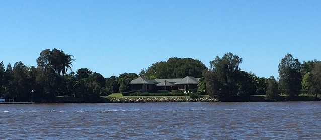
Classy riverside homes between Iluka and Harwood.

Classy riverside homes between Iluka and Harwood.

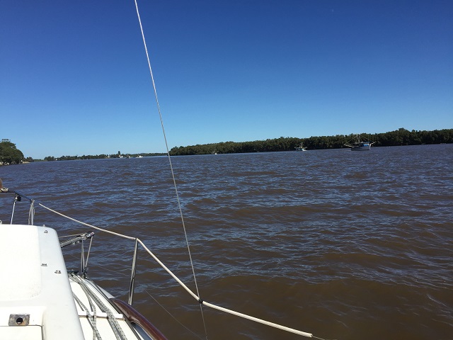
There were various industries along the riverbank too, such as slipyards, sugar cane farms and the sugar mill. The majority of other river traffic was prawn trawlers – and there were a lot of them! It was interesting watching them working. The river at the moment is the colour of chocolate with lots of flotsam from the recent heavy rains the district experienced. The locals tell us the river is much higher than usual and flowing very fast. Apparently the trawlers can’t work as far up the river as usual because the current is too strong for their nets.

Bit hard to see, but there's at least 7 prawn trawlers working the far side of the river in this photo.

Bit hard to see, but there’s at least 7 prawn trawlers working the far side of the river in this photo.

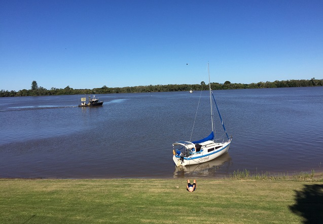
Wasn’t long before the Harwood Bridge came into sight and we had about an hour and a half to put in before it opened. We looked around for a place to pull over and found the Big River Sailing Club just before the sugar mill. No jetty, but a lovely little sandy beach beside a well-tended lawn leading up to their clubhouse.  We pulled Top Shelf in and had a picnic lunch on the lawn.

Whiling away an hour before the bridge is booked to be opened for us. Prawn trawler in river. Harwood

Whiling away an hour before the bridge is booked to be opened for us. Prawn trawler in river. Harwood

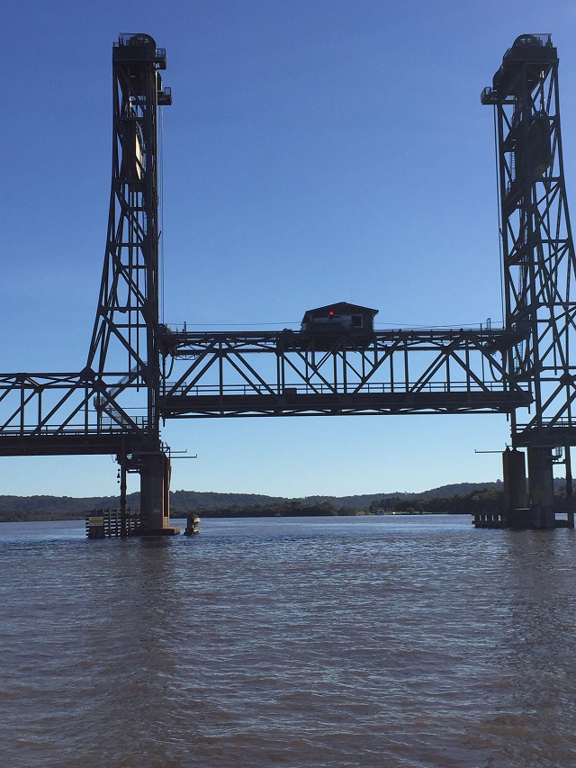
Eventually it was time for the bridge to open for us so we motored on over, the bridge man waved hello, stopped all the traffic and waved us on through. No I didn’t have the glass of wine in hand!

And up she goes! When the light on the control room turns green we can go under that part. Harwood Bridge

And up she goes! When the light on the control room turns green we can go under that part. Harwood Bridge

The Harwood island pontoon is just the other side of the bridge so we were tied up securely in no time at all. Took a walk around this delightful little town (doesn’t take long), back for a drink at the Harwood Hilton and a delicious meal onboard.


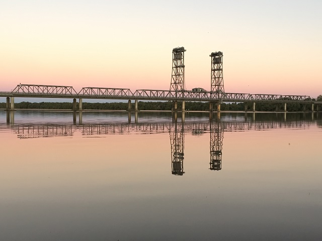
Sunset view of the Harwood Bridge from our mooring on the pontoon.

Sunset view of the Harwood Bridge from our mooring on the pontoon.

For more photos from today’s sail please click HERE.