Whale Sharks and Ningaloo

23rd June – 1st July 2017

Friday 23rd (Happy birthday Gill)

Today we’re swimming with whale sharks! Whale sharks are the largest fish in the oceans, thankfully plankton feeders. We met our boat and the other 18 excited tourists and 5 crew at the Tantabiddy boat ramp – Whale Shark n Dive is our tour group. There are 5 groups do the whale shark tours but I don’t reckon any of the others were as good as ours. Our boat, Kialla, is a 50ft dive boat which means there’s heaps of room in the wide, flat stern, hot freshwater showers, nice big toilets and broad ‘steps’ forming the ‘marlin board’ to easily enter and exit the water. The crew were all very professional, educational and fun. And the real ‘barista’ coffee we started the morning with was a great kick-starter.

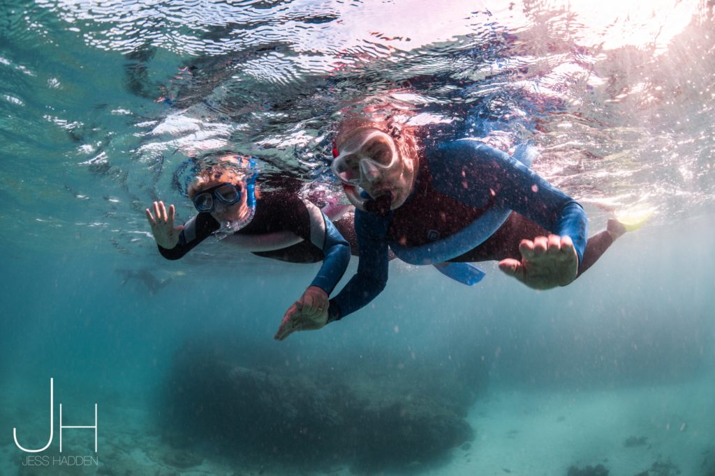
We were outfitted in wetsuits with snorkels, goggles and fins, though Steve and I had our own brand new ones. Snorkelling first – the coral bommies we snorkelled over weren’t very colourful but had a great variety of fish.
The spotter plane tells the boats where the whale sharks are – they’re solitary animals, always swimming alone. On the way out to see them and several other times during the day, we paused to watch the humpback whales swimming north, blowing plumes of water, saw their tail flukes and Steve saw a really spectacular whale breach (I was looking the wrong way – sad face).
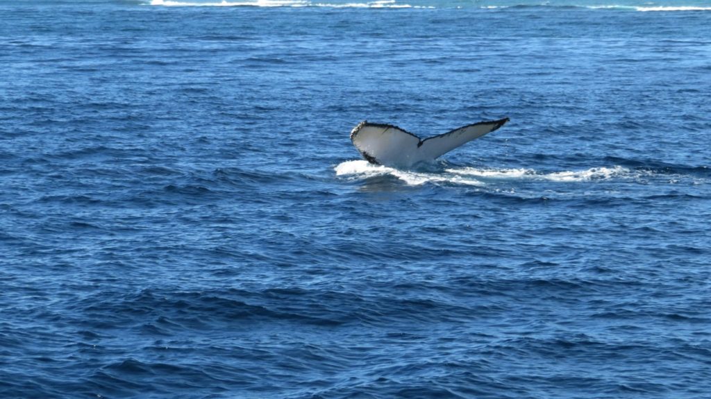
Classic photo – fluke of a humpback whale

We had 6 swims of 5-10 minutes each time with the whale sharks and I can honestly say it was one of the most awesome things I’ve ever done! These massive fish swim just underneath the surface at an easy enough pace that you can snorkel alongside them watching them. We went in in groups of 10 (no more than that permitted) and Steve and I both felt we had pretty amazing swims right beside the whale shark. If you get the opportunity to do this, don’t pass it up!
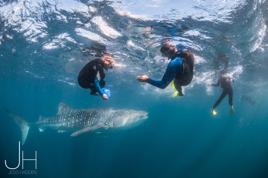
The spotter plane also spotted a group of manta rays feeding, so the boat headed there next and we swam with them for a while – beautiful, graceful animals.

On our way back to the jetty we also spotted a couple of dugongs (two-gongs, hee hee – Frankie, our skipper’s joke. He said last week they spotted five of them – penta-gongs!).

For more photos of our wonderful time with the whale sharks, whales, manta rays and dugongs CLICK HERE.

Back on shore we headed further south down the western coast of the Exmouth Peninsula and into Cape Range National Park. Very fortunately for us about 10 days ago another camper told us you have to book early to camp here. We wanted to stay for a week but even then weren’t able to book one site for that length of time. However there are lots of National Parks camps all along the beach so we booked two nights in each of 4 camps. Tonight we’re at North Mandu which only has room for 5 campers where we capped off a fantastic day sitting on the pebble beach with a scotch watching a perfect sunset.
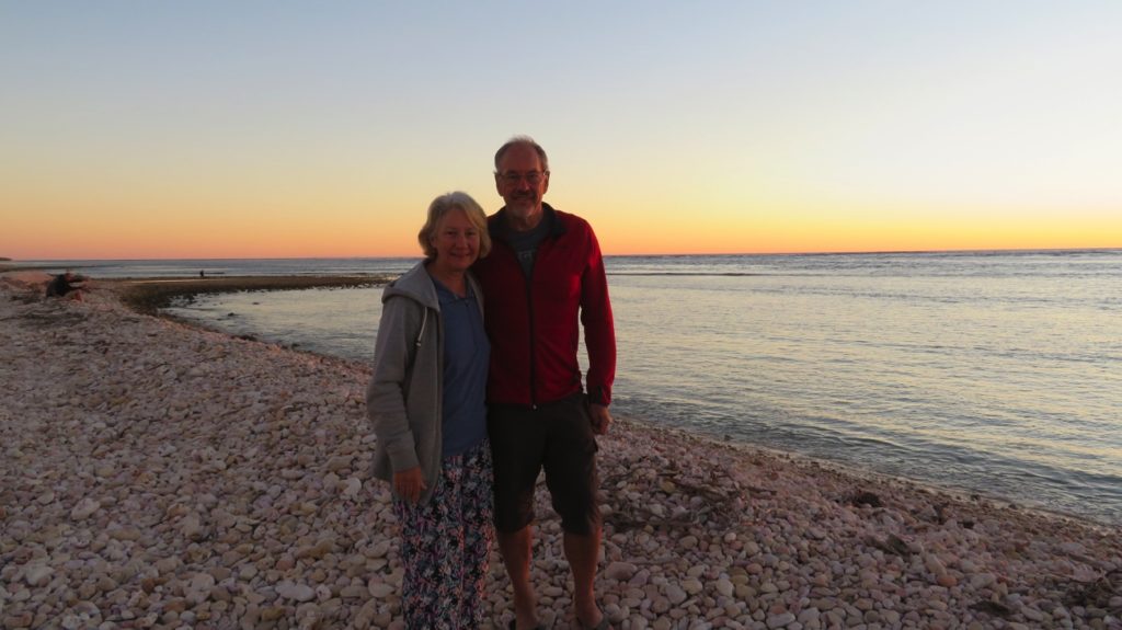
The pebble beach at North Mandu.

Saturday 24th – Friday 30th (Happy birthday Kimberly)

The World Heritage listed Ningaloo Reef at more than 300km long is the largest fringing coral reef system in Australia. As a keen snorkeller of coral reefs I’ve been looking forward to being here for many years. The reef varies from about 200 meters – 400 metres offshore in the Cape Range NP section where we’ll be camping. Inside the reef is a partially protected lagoon. Within this lagoon there are coral outcrops which can be accessed from the shore. The Oyster Stacks is recommended as a top spot so we went there on the first day. The entry into the water is difficult with jagged, weathered limestone rocks to negotiate.
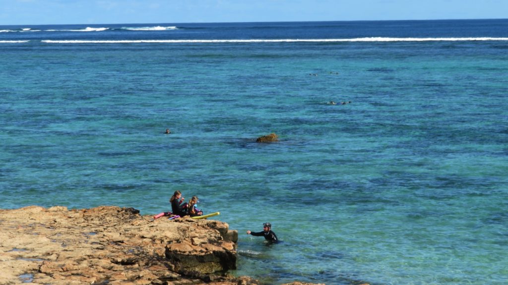
The Oyster Stacks. The bommies just offshore are where the fish and corals are.

The coral can’t compare to the beautifully coloured corals of the Great Barrier Reef – occasional areas of green, blue and purple staghorn corals, but on the whole it’s a dull brown. In its favour though are the abundant and beautifully colourful fish – and lots of schools of quite large fish too, trevally maybe. We returned here on our last day and I enjoyed a lovely swim with heaps of fish and a very graceful turtle.
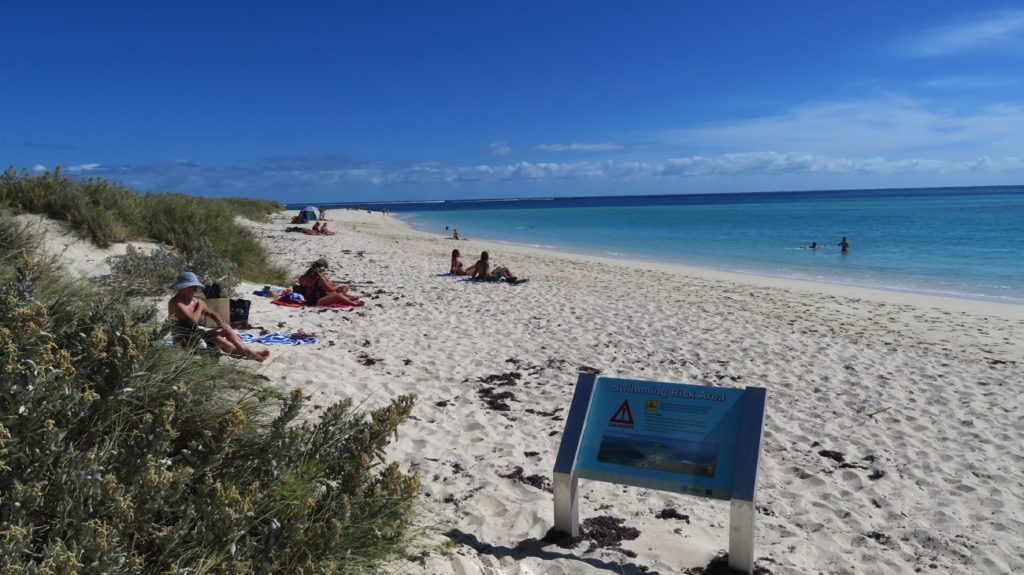
Turquoise Bay. Beautiful sandy beach. We did the ‘drift’ snorkel.

Another day we snorkelled at Turquoise Bay. This beautiful white sandy beach bay has a drift snorkel area where you start at one end and the current sweeps you down to the other end – taking care to stop though before being swept out to sea through the reef! As mentioned a really beautiful bay, but the same brown sponges and corals and not as many fish as Oyster Stacks, though we did see a very large turtle crunching on the coral.

The next couple of nights we spent at North Kurrajong campsite. Here the national parks have provided a covered picnic table on the foredunes behind which we’re camped. Sundowners while watching for whales at sunset is de riguer. We saw plenty of whales just on the other side of the reef and half a dozen dolphins playing in our lagoon. Lots of kangaroos, a few dingoes and even echidna call this park home.
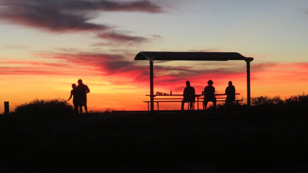
Enjoying sundowners at North Kurrajong campsite

On to Osprey Bay campsite which is huge, covering about 3 acres, all campsites level and well-spaced. Here there are no foredunes so views are directly to the ocean. The beach at one end has low, weathered cliff edges, the other end lovely and sandy.
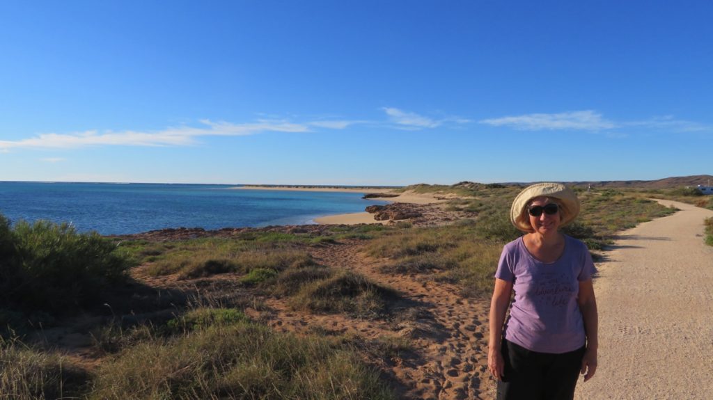
Walking along the beachside from Osprey campsite

Snorkelling along the edge of a rocky shelf about 100 metres offshore found the most fish – schools of all sizes of beautifully coloured fish and those great big trevally again – some would be a metre to a metre and a half long. A couple of turtles languidly floated on by and stingrays camouflaged themselves pretty well in the sandy bottom.

The downside has been the wind making it uncomfortable to sit outside, and one evening it blew so strongly all night that the motorhome was rocking. Tent campers and those who left annexes out overnight had a pretty rough time.

At the far end of Cape Range National Park is Yardie Gorge which has been carved out by Yardie Creek. We did the 2.5km Class 4 rock scramble up the sides of it to view from above one day. Like the other gorges we’ve seen it has striking high red cliff edges and is quite beautiful.
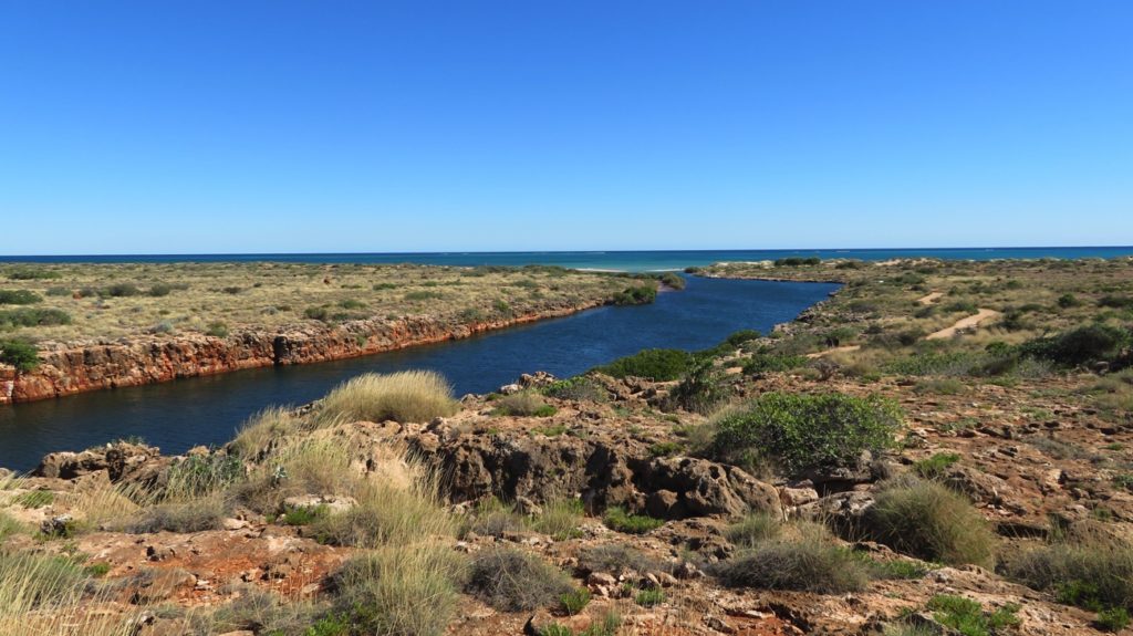
Yardie Creek at Ningaloo

The next day we put the kayak in and paddled up the creek. The water is so clear – and cold! We went to the far end, paddling against a gentle current and a strong wind in places. The Gorge is a rock wallaby protection zone. The return trip was a very pleasant drift sitting back admiring the cliffs, rock wallabies and nesting egrets – altogether a delightful way to spend a couple of hours.
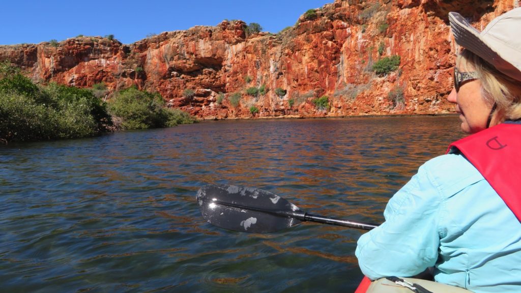
Yardie Creek Gorge

Click here to see our photos of Ningaloo campsites and snorkelling.
17-23rd Oct: Cid, Stonehaven, Nara

After farewelling Nick, Kim and the beautiful Baby John yesterday we re-provisioned at the store on Hamilton and prepared the boat to leave. Steve’s birthday in a few days called for a celebration at the seafood restaurant last night, and a toast to Hamilton Island.

The tender has a hole, possibly caused when dragging it on or off the boat. Fix-it kit comes into its own.

The strong winds are back but we’re off anyway! We waited for the change of tide to take us north and, along with the south easterlies and just a jib, we made good time to Cid Harbour on the western side of Whitsunday Island. This is a beautiful very large bay with several beaches and anchorages that comfortably accommodated at least 30 yachts on the three nights we spent here. Cid Harbour is very deep and protected from all directions except the west, a benefit during World War II when troop ships anchored here; today you’re more likely to find cruise ships.

Sawmill beach, Cid Harbour. A truly lovely, very protected, anchorage.

Sawmill beach, Cid Harbour. A truly lovely, very protected, anchorage.

On the short walk across to Dugong Beach we reminisced about camping here with the boys in the 80’s and more recently doing this walk with friends we bare boated with several years ago.

It rained on and off on our second day here- our books received lots of attention.

The tender continues to deflate slowly – not happy!

Tuesday

Happy birthday Steve!

The winds are finally dropping. We head for Stonehaven, a bay on the north of Hook Island. A swell made the trip roly until we cleared Hook Passage. We picked up a mooring buoy and prepared for snorkelling. The Great Barrier Reef Marine Park Authority has defined ‘no-anchor’ areas around many of the best fringing reefs to prevent them being damaged, installing mooring buoys for visiting boaties. These buoys have 2 hour  time limits on them, though if you’re on one at 3pm you can stay till the next day. The buoys are very good with long floating tags making it so much easier to pick up than the ones we learnt on – the boat hook was the way to go with these.

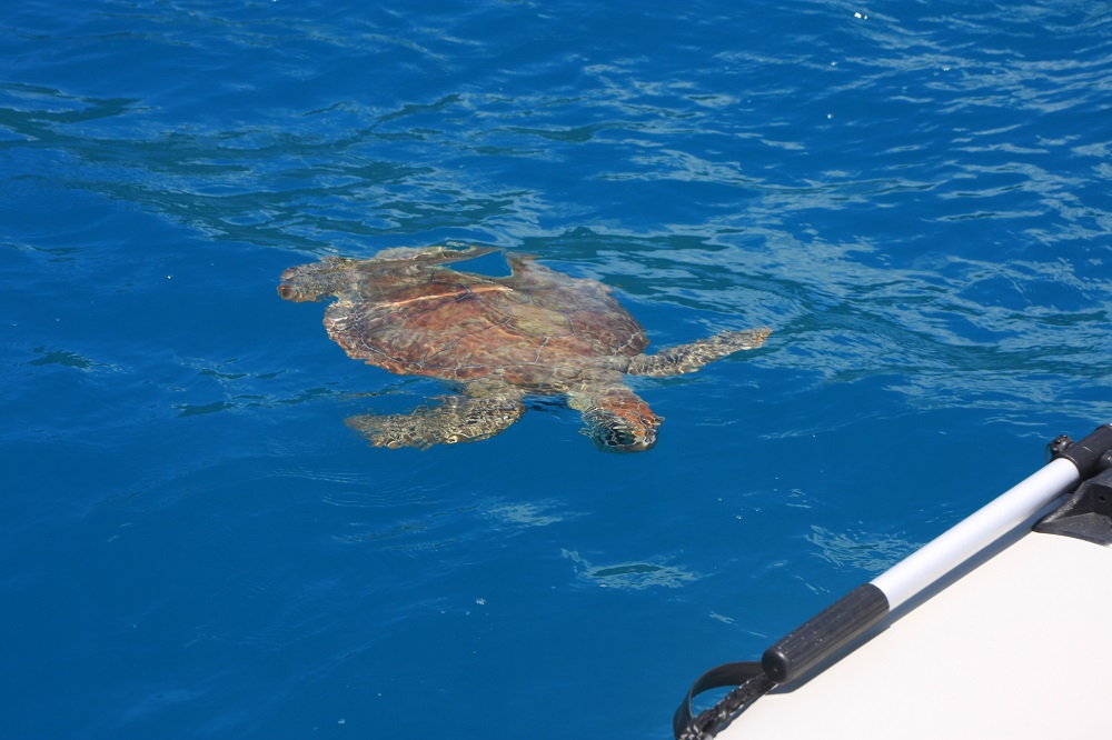
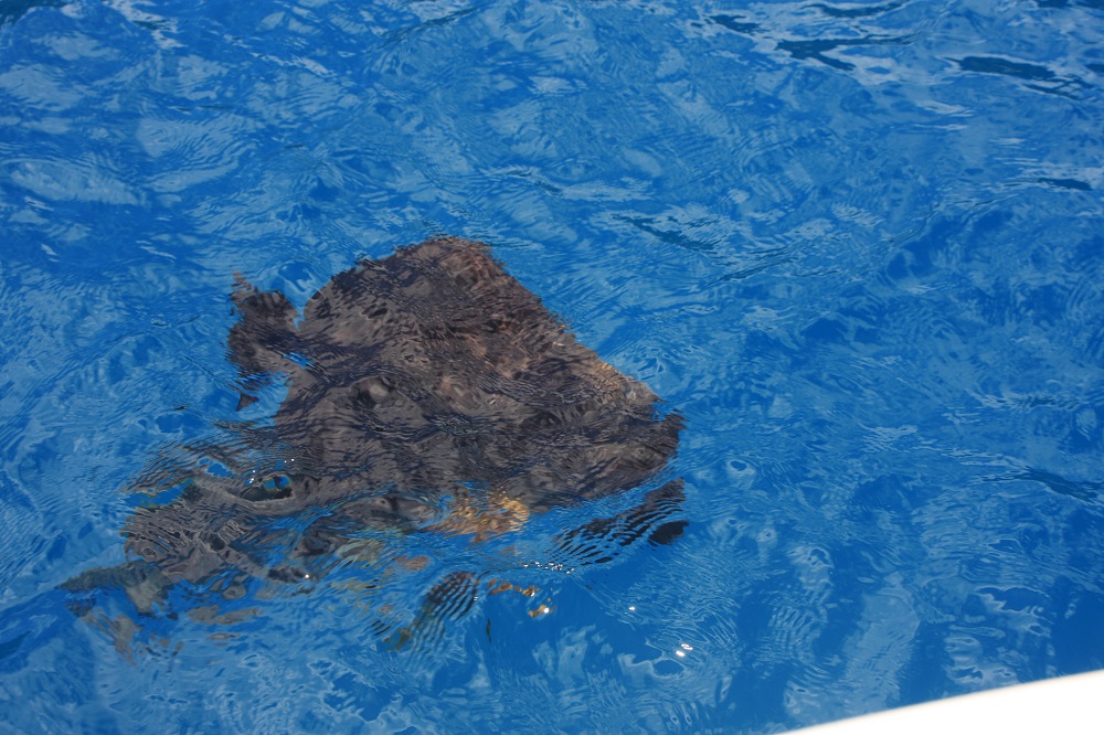
We’ve been welcomed, and farewelled, by turtles at EVERY anchorage we’ve been to so far. It’s uncanny. I’ve decided the turtles must have formed a Whitsunday Ambassadors group, taking it in turns to volunteer to welcome boats to the anchorages.

Turtles came to meet us, and farewell us, at every anchorage. I think they've formed a volunteer welcoming committee.

Turtles came to meet us, and farewell us, at every anchorage. I think they’ve formed a volunteer welcoming committee.

We arrived early to catch low tide, the best time for snorkelling, and snorkelled around the southern end. By lunchtime we were the only boat there so felt no guilt remaining on a mooring, though we did move to the eastern end in the hope the bullets coming down off the surrounding hills would be less. They weren’t – one bullet we measured at 35kn (70km/hr).

We stayed overnight, with all moorings taken by 5pm. Despite the bullets the anchorage was good as the boat turns bow into them – bullets are fine (when securely anchored/moored), it’s a swell that rocks the boat from side to side that makes life miserable.

Wednesday

After breakfast we motored the short distance over to Blue Pearl Bay on Hayman Island. This is reputably one of the best snorkelling and diving sites in the Whitsundays. Again we picked up a mooring to be surrounded immediately by beautiful bat fish. I’d guess that people feed them, hence their interest in us.

Dreadful photo, but you can see the size of the fish that were swimming around our boat at Blue Pearl Bay, Hayman Is.

Dreadful photo, but you can see the size of the fish that were swimming around our boat at Blue Pearl Bay, Hayman Is.

After pumping up the leaking rear side wall of the tender, again, we motored to the southern end of the bay for some snorkelling, but soon moved up into the central area where there’s a narrow marked channel for dinghy entry to the beach – this was the better spot for the amazing coral and fish. Steve videoed some of what we saw.
View a short video of our snorkelling – it’s only 2 mins.

We started to get cold, and the day-tripper boats were disgorging tourists by the score, so we lunched onboard then left, heading north around Hayman intending to spend the night in Butterfly Bay. But the wind was now moving around to the north and someone told us they’d had a very roly night there last night. We continued our circumnavigation of Hayman Island, putting up the sails as we turned west; exciting sailing as we watched for and prepared for the bullets to hit us. We finally anchored in Refuge Bay in Nara Inlet anticipating a quiet night.

Thursday

It was like a mill pond last night! We’d anchored in 9 meters of water, but noted as we drifted on the anchor the depth would drop (rise?) to 4 metres – still plenty of water for us. In the sunlight and with such beautifully crystal clear waters we could see we were drifting over corals. If the other name for this bay wasn’t ‘Shark Bay’, rumoured to be a breeding ground for hammer head sharks, I may have been tempted to snorkel over it.

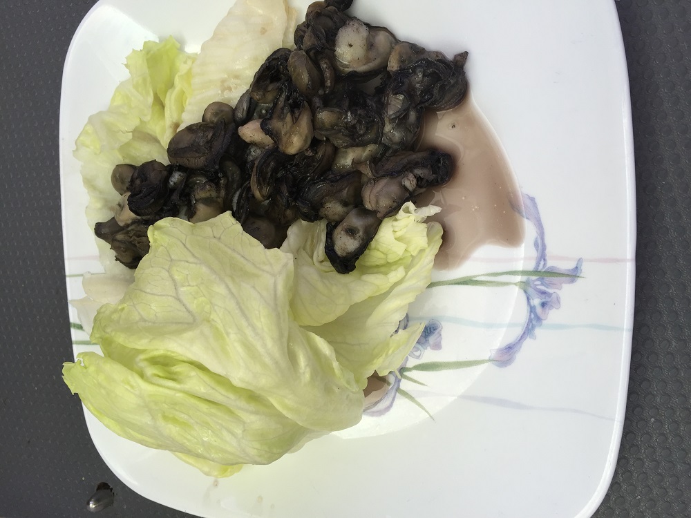
Today we went out to False Nara Inlet, a tiny bay just outside Nara destined to trick the unwary mariner. Here we picked up one of two mooring buoys then took the tender (after pumping up her broken wing again!) to the shore. The rocks were covered with the biggest oysters I’ve ever seen. This isn’t an often visited bay and few, if any, had been taken. Without moving more than 3 meters Steve had got a cup of oyster flesh for me – pity he doesn’t eat oysters!

My lunch today - 4 dozen oysters au beurre, fresh off the rocks at False Nara Inlet.

My lunch today – 4 dozen oysters au beurre, fresh off the rocks at False Nara Inlet.

A lovely swim followed then snorkelling over the coral bommies. I stayed mostly on the beach side so the coral was OK, but the fish kept me enthralled for ages – so beautiful. We investigated how we could get Top Shelf inside the fringing reef onto the gently sloping beach one day in the future to clean her hull – looks like a line from the middle of the two reef protection buoys on the southern side to the rock wall on shore looking out for two large bommies at the beginning. The water is so clear we’ll probably see them clearly.

We lunched here. By the time we’d finished there were three other yachts with us, one on the other buoy, and two anchored, one of which was a huge trimaran with about 20 bronzed, bikini-clad girls and half a dozen guys. They were ferried over to the reef to snorkel, which they seemed to enjoy, but they’d already missed the best time just before and during low tide.

I swear I’ve never seen anyone else at this little bay – seems like when one yacht anchors others just have to join them!

Back into Nara Inlet for another peaceful night.

Friday

The winds are back up again today – 20 knots from the north. No matter, we’re staying here today ready to sail to Airlie Beach tomorrow.

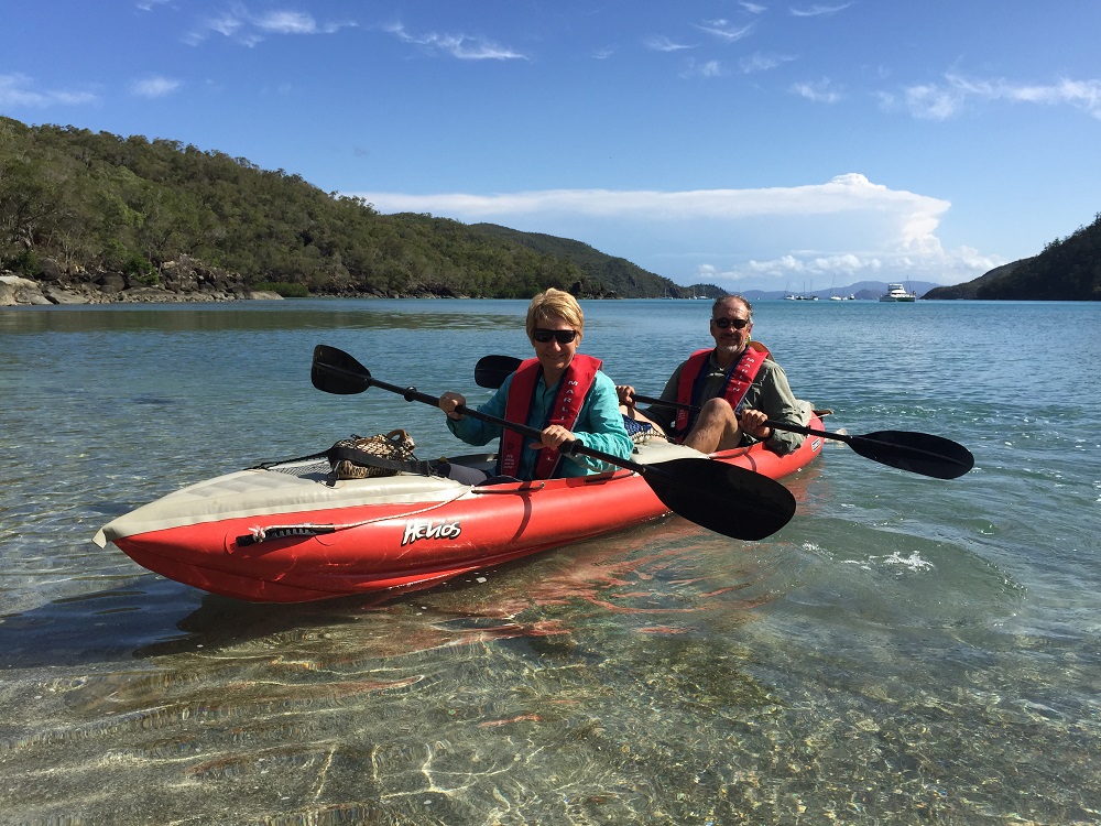
We spent a lazy morning attending to ‘business’ on our computers. I cooked one of my favourite meals, Pujabi lentils, while Steve inflated the kayak.

Leaving the Ngaro Cultural Site. Top Shelf is at the FAR end.

Leaving the Ngaro Cultural Site. Top Shelf is at the FAR end.

We paddled down to the far end of Nara Inlet where National Parks has provided a short walk and boardwalk to view an Ngaro aboriginal art cave. The Ngaro peoples appear to be one of the earliest groups of aborigines on the east coast of Australia. Archaeologists have dated their presence here back more than 6000 years. That all ended in 1870 though with colonisation. They were known as the saltwater people, travelling around the Whitsunday islands in their hand-sewn paperbark canoes, even as far out as the Reef. They were very accomplished mariners.

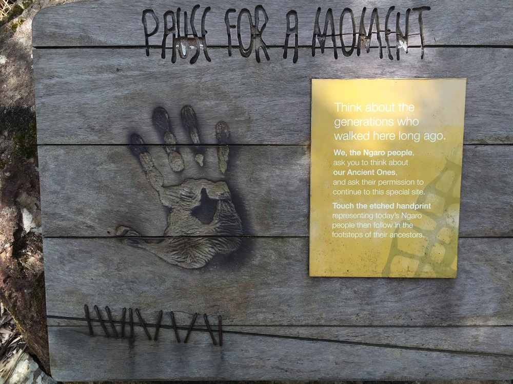
In aboriginal culture it is common to ask their ancestors for permission before entering certain sites. This sign asks the visitor to pause and think about the people who walked here before them and acknowledge the Ancient Ones by putting your hand over the handprint.

In aboriginal culture it is common to ask their ancestors for permission before entering certain sites. This sign asks the visitor to pause and think about the people who walked here before them and acknowledge the Ancient Ones by putting your hand over the handprint.

After visiting this Cultural site we paddled on down to the dry waterfall then headed back to Top Shelf- all up over an hour of kayaking – I’m going to be sore tomorrow!

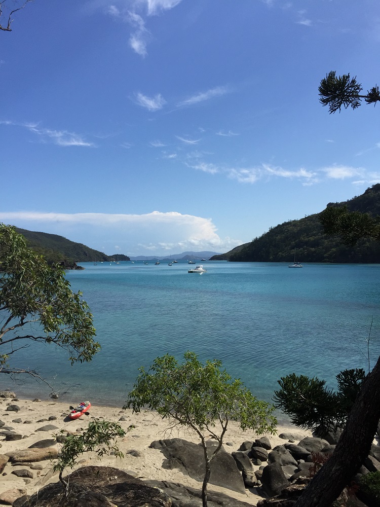
Another view of Nara Inlet. See our kayak on the little beach in the foreground?

Another view of Nara Inlet. See our kayak on the little beach in the foreground?

To see more photos from this part of our trip CLICK HERE.