19th – 26th September, 2017
Tuesday 19th
After seeing the crash repairer this morning we figured that, as there’s nothing we can do here now, we would continue with our plans to explore east of Perth.
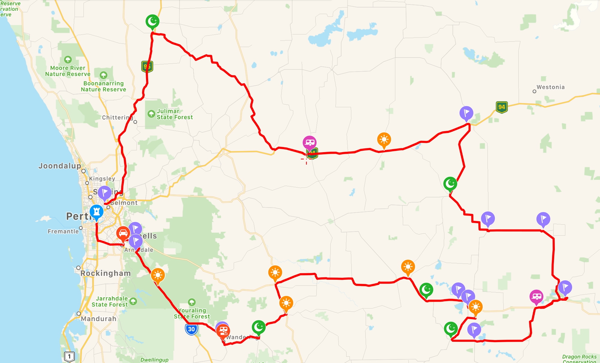
The route we took to explore the wheat belt out as far as Wave Rock.
Mid afternoon we found ourselves at Australia’s only monastic town, New Norcia, where in 1847 the Benedictine Monks established a monastery, school and farm. We spent a little time in the museum this afternoon before going to the beautiful old Hotel for a meal. Camping is on the cricket oval, $10 no facilities.
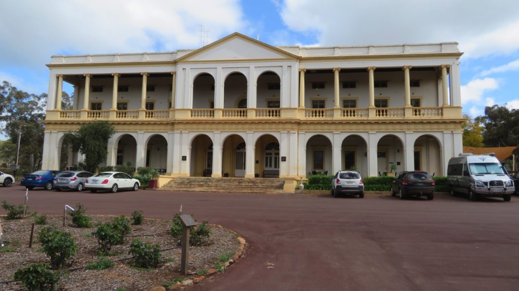
The hotel at New Norcia. It was built as a residence for parents whose children were at the school and needed somewhere to stay while they visited them.
Wednesday 20th
We did the 2 hour tour of New Norcia this morning. There are many heritage-listed buildings here, many of them quite beautiful. There are boys’ and girls’ orphanages and boys’ and girls’ boarding schools. It seems the orphanages were filled with aboriginal children. I felt quite sad viewing these buildings as they were “stolen generation” children. The Catholic Church has a very poor reputation for the way it treated children both in boarding schools and certainly the orphans in its care. In the museum is a ‘kind of’ apology to the children whose childhoods were less than ideal while in their care. According to the 2017 Royal Commission these colleges had the highest incidence of child sexual abuse of any Catholic institution in Australia. What a reputation! The schools and orphanages are all closed now.
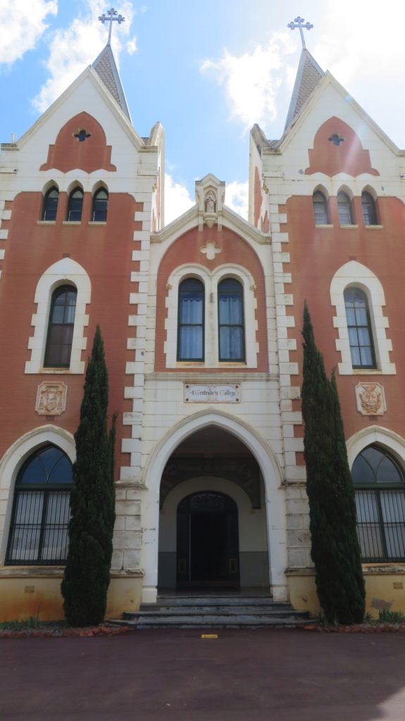
St Gertrude’s – the girls’ boarding school. New Norcia
Today there are 10 monks who live here.
This afternoon we arrived at Cunderdin. I was keen to see Cunderdin as my father was an instructor of pilots here during the war.
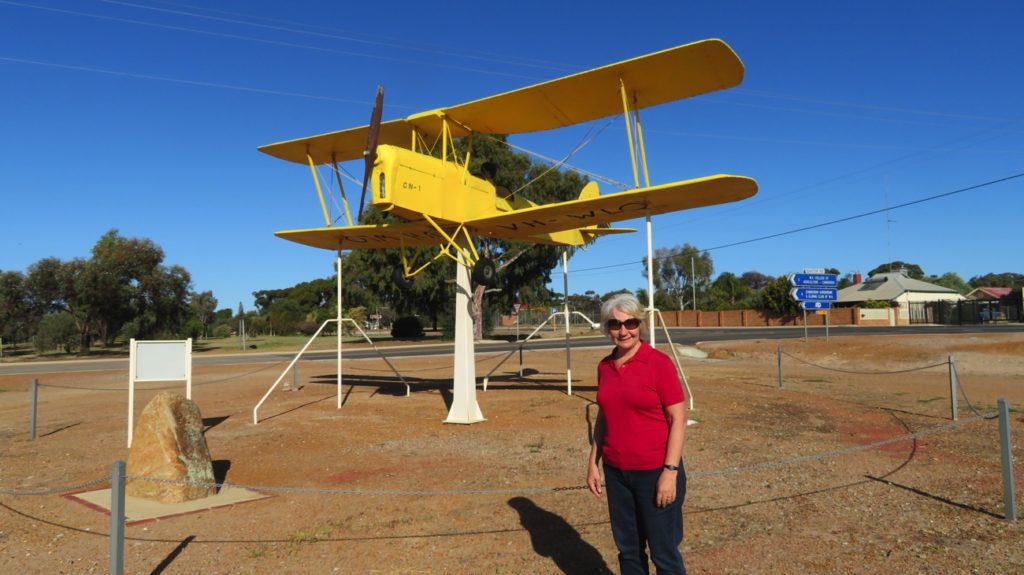
In memory of the many pilots trained at Cunderdin during World War II. Perhaps this was one that my dad flew in.
Tonight we’re at the Cunderdin CP – quite basic $25/n powered.
Thursday 21st
First stop today was at Kellerberrin where we eventually found the poorly signposted road to the lookout over this pleasant little rural town. Beyond the town limits it’s wheat as far as the eye can see. Nice lookout though – pity they haven’t put in a picnic table.
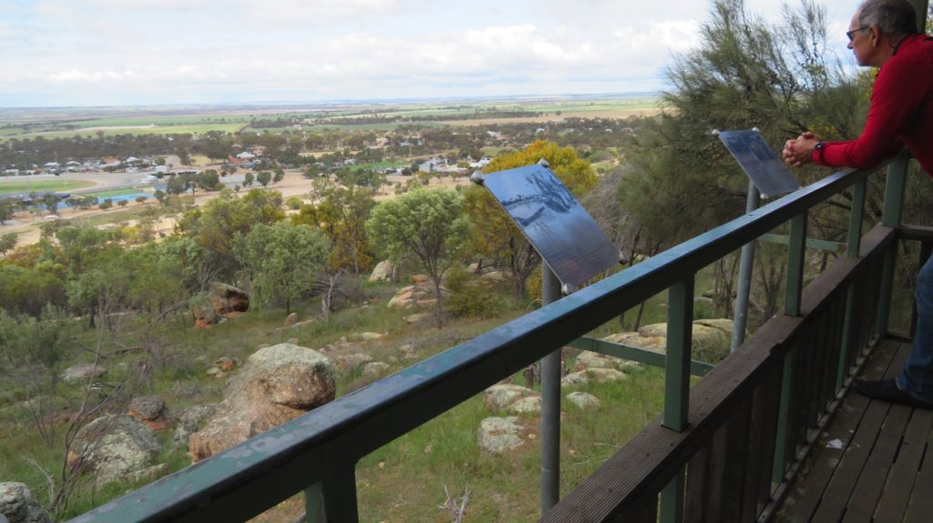
Overlooking Kellerberrin.
On through Merredin where the wheat silo has been painted. This has become a popular tourist attraction in South Australian wheat-growing towns with people doing silo tours. The one here at Merredin was only completed a few days ago. The Council needs to create a pull-over area so tourists can view and photograph it in safety. Hopefully on their agenda.
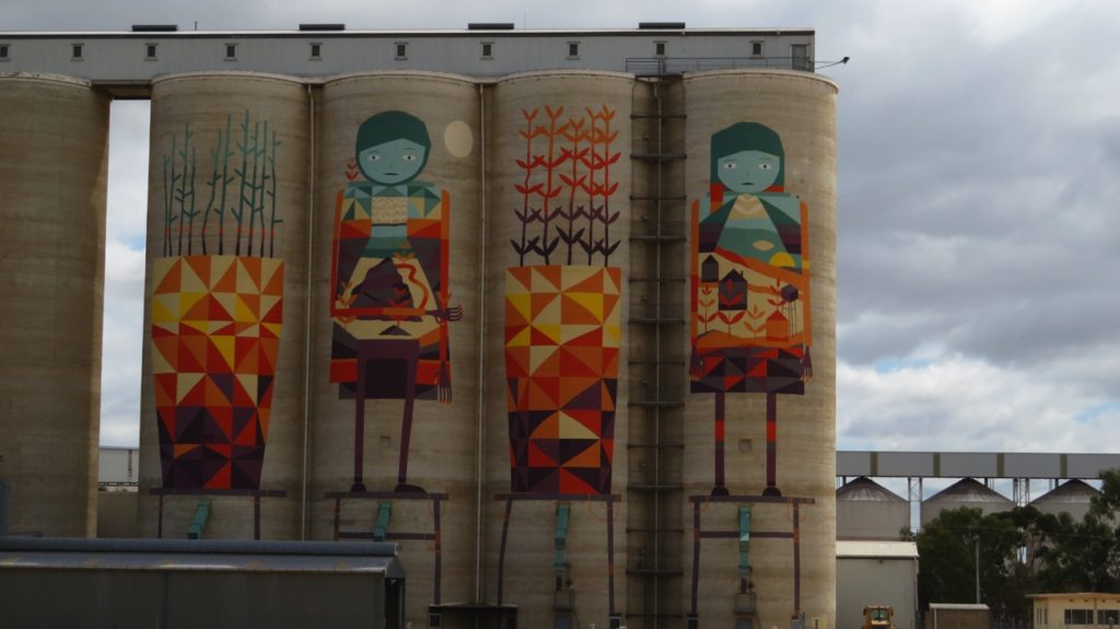
Silo art, Merredin.
Bruce Rock free camp is our destination tonight. We camped beside the sports complex. WA has had a program called “Royalties for Regions” where money gleaned from mining royalties is being invested into communities. Many (most) small towns are now the proud owners of beautiful football and cricket playing fields with night lights, 3 – 6 tennis courts, basketball/netball courts, swimming pool, etc. They really are impressive! Sadly though, even on weekends, we’ve yet to see anyone playing sport on them. Our campsite is on the edge of the cricket field tonight. I forgot to mention that they also have a new bar/function room/club house associated with them. We wandered up and had a pleasant drink at the bar this afternoon.
Friday 22nd
Bad weather has been forecast for today for the south-west corner reaching inland to where we are. It was windy and rained a bit last night. Regardless we set off today heading towards Wave Rock. At the Roadhouse at Narembeen is the Wheat Discovery Centre. Excellent display that explained the history of grain production in the district and how farming practices have changed with technology. It was very informative, one of the best displays I’ve seen.
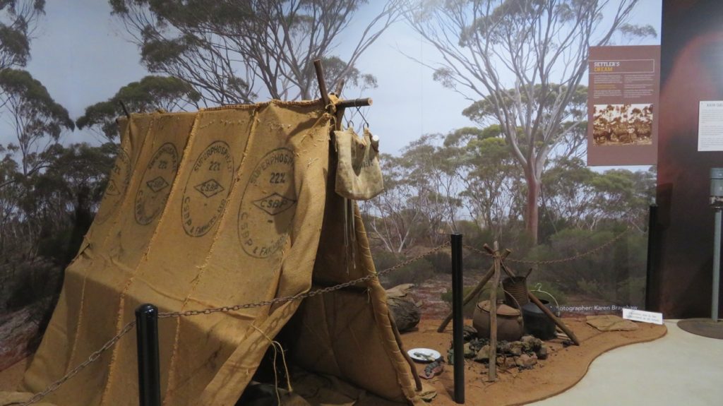
The displays were very effective. It’s easy to imagine someone living in this, though awfully pleased it isn’t me!
However with my knowledge of how bad high carbohydrate intake is for us and the description of how much herbicide and other chemicals are poured onto the crops, then fungicides over the stored grain it’s not encouraged me to eat it. The herbicides are very effective – even in the fields that have been left fallow since the last crop was harvested there’s not a blade of green to be seen.
Fortunately while we were in the Grain Discovery Centre the first of the cold fronts hit, with very strong winds and heavy rain. We continued on to Hidden Hollow, a granite rock where in years gone by the farmers channelled the rain coming off the rock into a small hollow, and here they washed their empty fertiliser bags, reusing them for their harvested grain. There’s a walk around the rock, but the inclement weather dissuaded us from doing it.
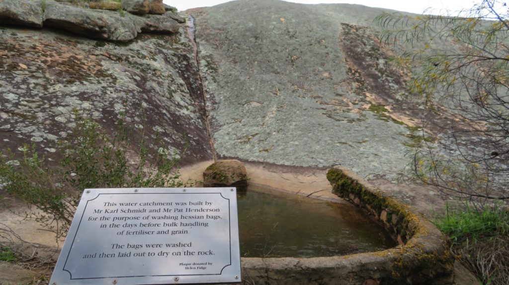
Hidden Hollow – using initiative to solve a problem.
With this cold, windy, rainy weather we decided not to go to Wave Rock today, finishing the day at Tressies CP ($27/n powered). We were lucky to get a spot – there’s a music festival on this long weekend at Wave Rock and the vans kept pouring in until late.
Saturday 23rd
The cold fronts moved through overnight leaving us with an overcast, chilly day, but no rain. Wave Rock is very impressive. From the early 1920s the locals had created a dam to one side, channeling the water from a portion of the rock, expanding it in the 1950s. Other than that, little attention was paid to the rock.
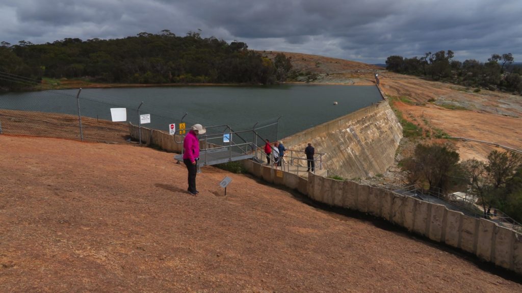
This dam created on Wave Rock provided a water supply for the local area.
In 1964 a photographer entered a photo of it into an international competition and won, and so began the tourism industry here. It’s well done and a credit to the local tourism group.
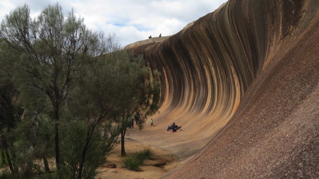
Wave Rock. Note the wall around the top – channelling water into the dam.
We did the walks around and over the rock – about 5km.
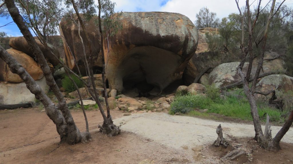
Hippos Yawn rock formation – aptly named! The result of a unique type of weathering. Near Wave Rock
The walk took us past Hippos Yawn then through the ‘lake’ area near the rock.
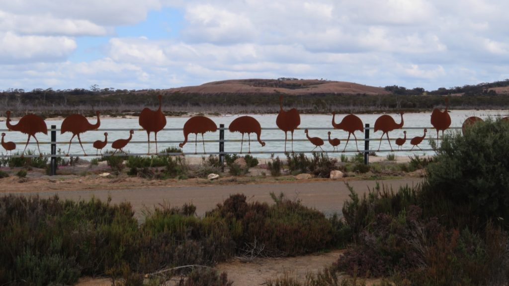
This beautiful emu fence made the walk around the lake at Wave Rock all the more interesting.
Before all the trees were cleared for the growing of wheat the lakes were freshwater with an abundance of bird life. Now the rising water table has caused them to become saline, killing the vegetation and no wildlife.
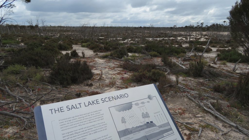
Here we see in the background just a small portion of the damage caused by the growing salinity problem.
This problem with salinity is seen all though the wheat belt as a result of widescale clearing of trees. Currently about 12% of once arable land is now useless and it’s expected to rise to 30% in the future. Some farmers are trying to reduce the damage by planting rows of trees, dividing their wheat fields into smaller paddocks, but not nearly as many as should be. Very short-sighted.
Before leaving Wave Rock we joined the music festival for a while – good fun.
Hyden is the town closest to Wave Rock. We stopped briefly and enjoyed their unique heritage sculptures highlighting various people and their occupations. Well done Hyden.
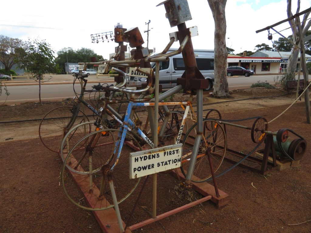
I like the chap on the end, singing as he pedals. Hyden.
10 or so kilometres before Kulin is the Tin Horse H’way. The townsfolk have had a lot of fun sculpting these horses from tin cans.
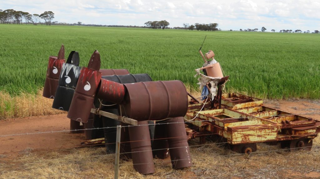
Imaginative horses on the Tin Horse Highway, approaching Kulin.
Tonight we’re in the amazingly good free camp in the centre of Kulin; an area flanked by beautiful flowering bushes. Thank you Kulin.
Sunday 24th
Didn’t go far today. First stopover at Yeerkine Rock. There seems to be lots of these huge granite slabs of rock that randomly appear surrounded by acres of low, flat farmland, the most famous of course being Wave Rock. Yeerkine, while being much smaller, isn’t without appeal. The walk from the car park through the bush was delightful – lots of wildflowers, many we hadn’t seen before. As happened at Wave Rock, the locals in the early 20th century built low walls around the top of the rock to channel the water toward a rock-lined channel they’d dug to a dam.
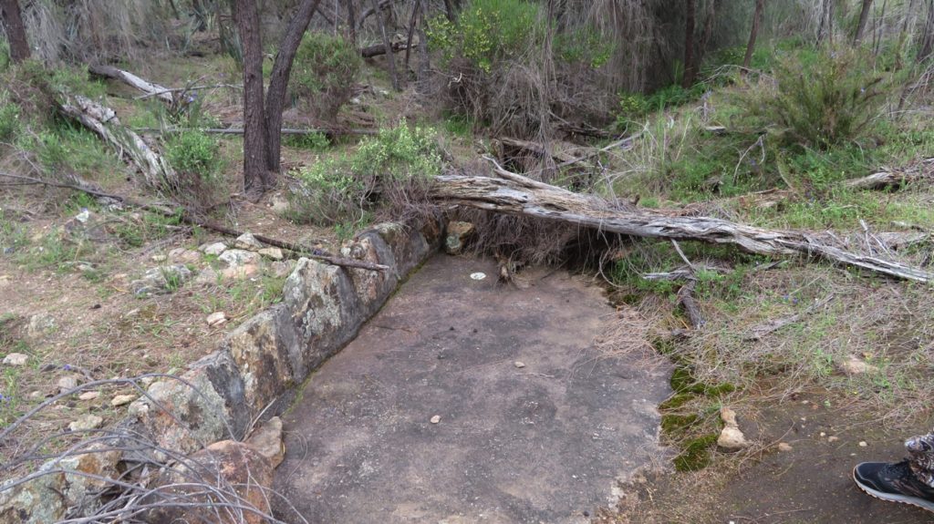
This rock-lined drain channelled water from the rock to a dam, about a kilometre away. Hark yakka went into this construction.
A steel sculpture has recently been installed on the top of the rock to commemorate the many men from the Kondinin area who joined the Light Horse brigade in WW1.
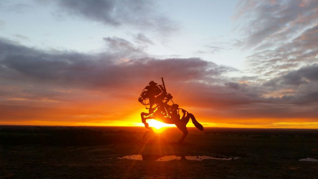
Dawn over the Light Horse Statue on Yeerkine Rock.
We brunched in Kondinin, just a tiny town, stopped at a Dam outside town where there are sculptures of farmers made from star pickets, before settling down for the rest of the day and night at Gorge Rock Pool near Corrigin.
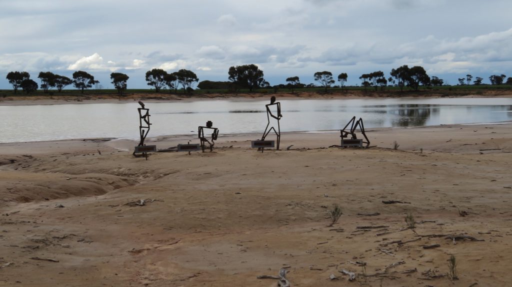
These statues are made from star pickets.
A short walk leads up onto this rock where the locals dammed the rain flow exit off the rock to create a recreational swimming pool. It would have been a great swimming pool back then – even had a diving board at the deep end.
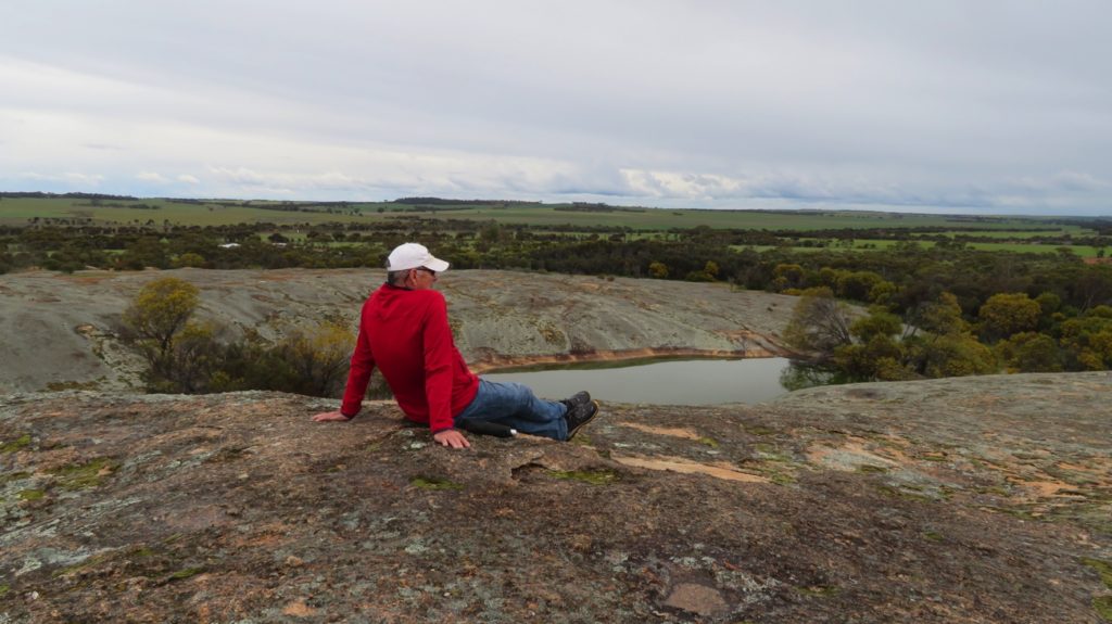
Another rock, another dam (though this one is a swimming pool), and lots more wheat fields.
Monday 25th
It rained a fair bit over night and is quite chilly – 9.5° at 10am!
As we head coastward the flat plains are being replaced with rolling hills, verdant with lush-looking wheat, or bright yellow with flowering canola. There are more trees here too, many planted to treat the salinity problem, the naturally occurring ones being so much taller than they were further inland. The roadside also has lots of flowering shrubs and low-growing wildflowers. Altogether a pleasant drive.
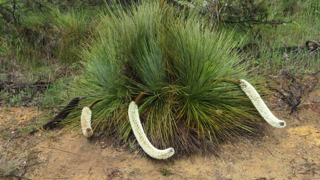
A different type of grass tree (for me, anyway).
Our first stop was Corrigin for a cuppa. Corrigin, apart from being a prosperous wheat-growing town, is ‘famous’ for utes and dogs, particularly the number of utes with a dog they could line up altogether – around 1300 or so, the current record holder in the Guiness Book of Records! Continuing the dog theme there’s also a dog cemetery just out of town – looking like every other cemetery in the country, though not dividing the Protestants from the Catholics!
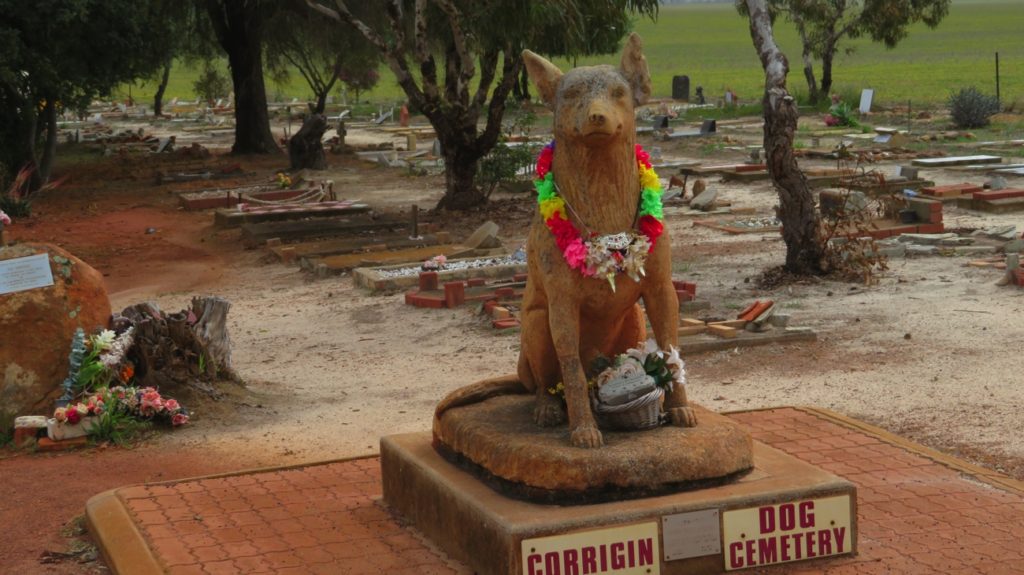
The Dog Cemetery, Corrigin.
Brookton was next. We brunched here in their Railway Siding gardens which are beautifully landscaped with lots of flowering shrubs and trees. Passenger trains no longer travel this route, however the railway station building and platform has been preserved and are a credit to the community.
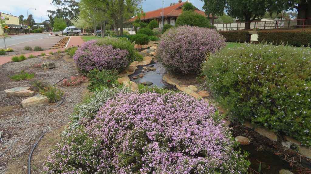
The beautiful wildflower gardens at the Brookton railway station rest area.
The roadside wildflowers continued to delight us.
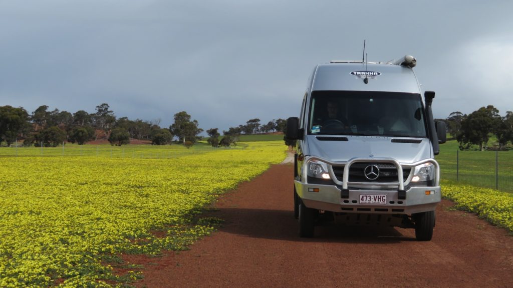
Yellow wildflowers by the roadside, leaving Wandering.
Pingelly was next, but not particularly inspiring, then on to Pumphrey’s Bridge, our campsite for the night. It was lovely to set up here beside the Hotham river. We spent a very quiet night here on our own.
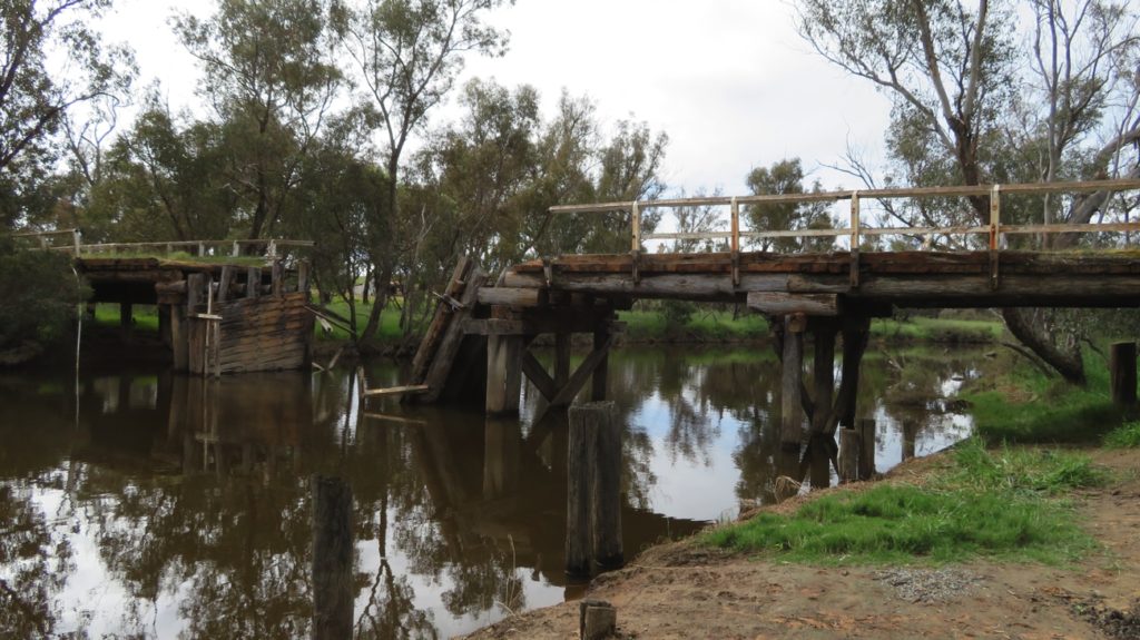
Pumphreys Bridge. Maybe just as well it’s no longer in use.
Tomorrow we head back to Perth. Another very enjoyable short trip completed.
To see more photos from our trip out to Wave Rock CLICK HERE.