The famous beehive domes of the Bungle Bungle Range are found in the East Kimberley in the UNESCO World Heritage listed Purnululu National Park. There’s some conjecture as to where the name Bungle Bungle came from, but consensus seems to be a derivative of the term “bundle bundle” referring to a local grass that grows in clumps. Purnululu is the local indigenous term for sandhills.
Friday
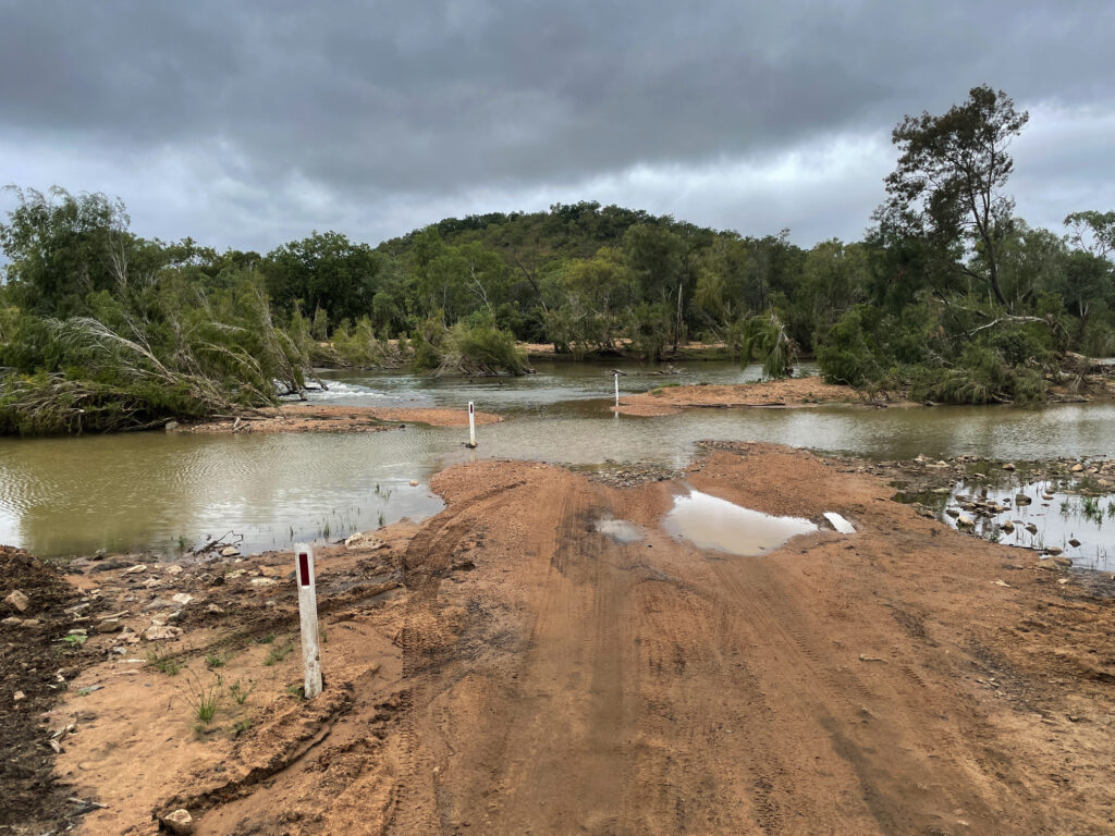
The road into Purnululu is infamous for its difficulty. A sign at the start warns that it’s suitable only for high-clearance 4-wheel drives. It is a 53 km (33 mile) drive to the Ranger Station, and the sign advises allowing 2 to 3 hours. We both agreed it was a pretty bad road with relentless corrugations and many water crossings — one of them quite deep and rocky requiring careful route-picking. Despite that, we made it in about 1.5 hours, and counted ourselves lucky.
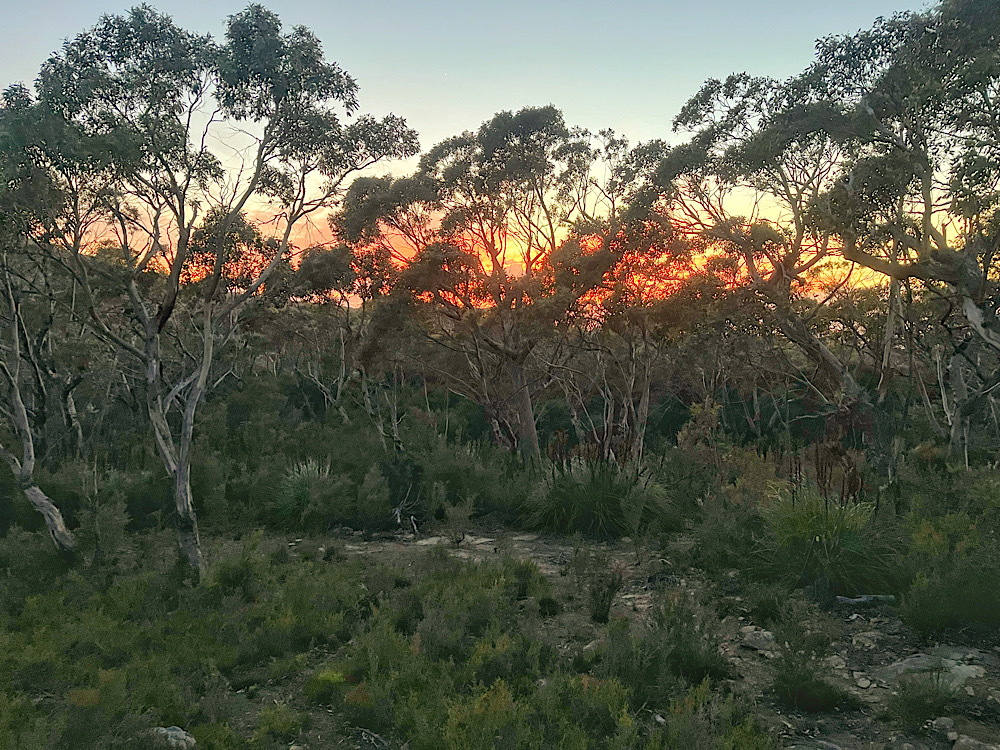
After setting up camp at Kurrajong campground ready to do the northern hikes in the Park tomorrow, we drove back to Kungkalanayi, the indigenous term for ‘lookout’, and watched the sun set over the Bungle Bungle Range.Steve, enjoying the sunset as he sits on his rock amongst the spinifex.
Saturday
Today’s goal is to complete all the hikes in the northern section of the park. First is the 4.4km Grade 3 hike to Homestead Valley.
A lovely hike amongst the livistona palms, acacias and grevillias.This is our first experience walking amongst the amazing rock formations of the Bungle Bungle Range. The path followed a dry, stony creek bed to emerge at the top of a valley.
Echidna Chasm, our next hike, is best viewed around the middle of the day when the sun is overhead lighting up the amazing chasm walls.
Approaching the chasm.The cleft is very narrow – the walls are conglomerate rock.The sunshine has now entered the main part of the chasm.The colours were outstanding.What a great experience!
For our final hike today we’ll do the Grade 4, 4.4km Mini Palms Trail. This hike followed the escarpment before steep slopes, narrow edges and large boulders to climb under, over or squeeze between brought us to two viewing platforms.
Sunday
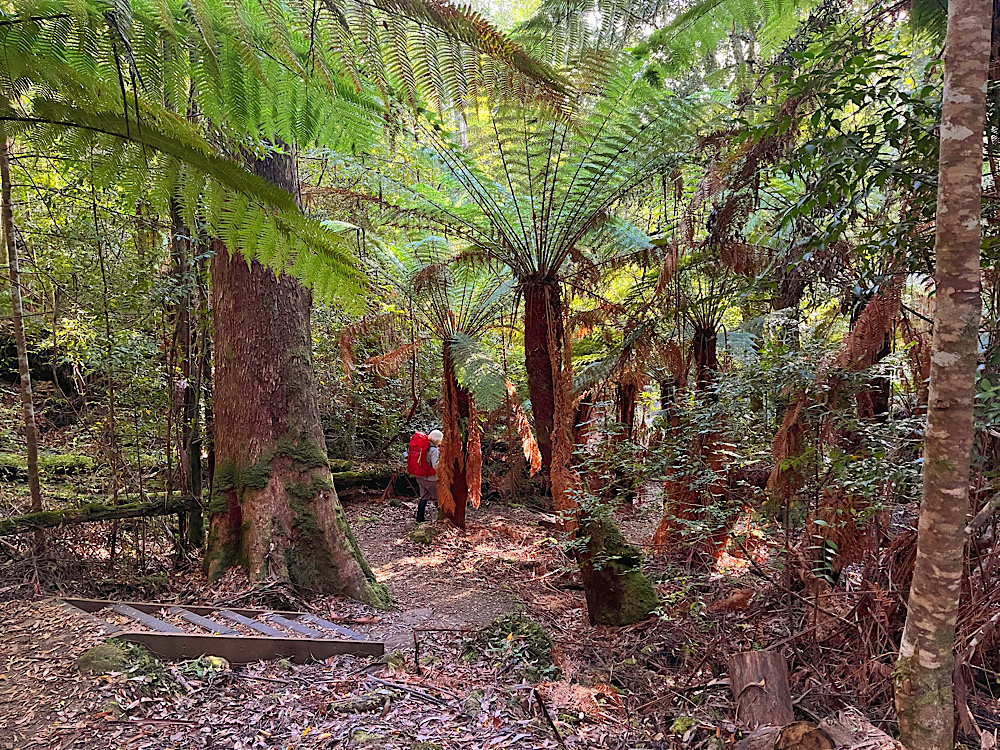
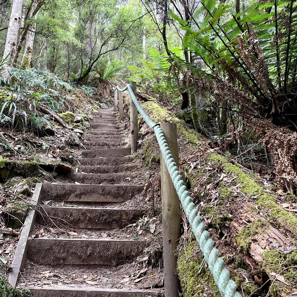
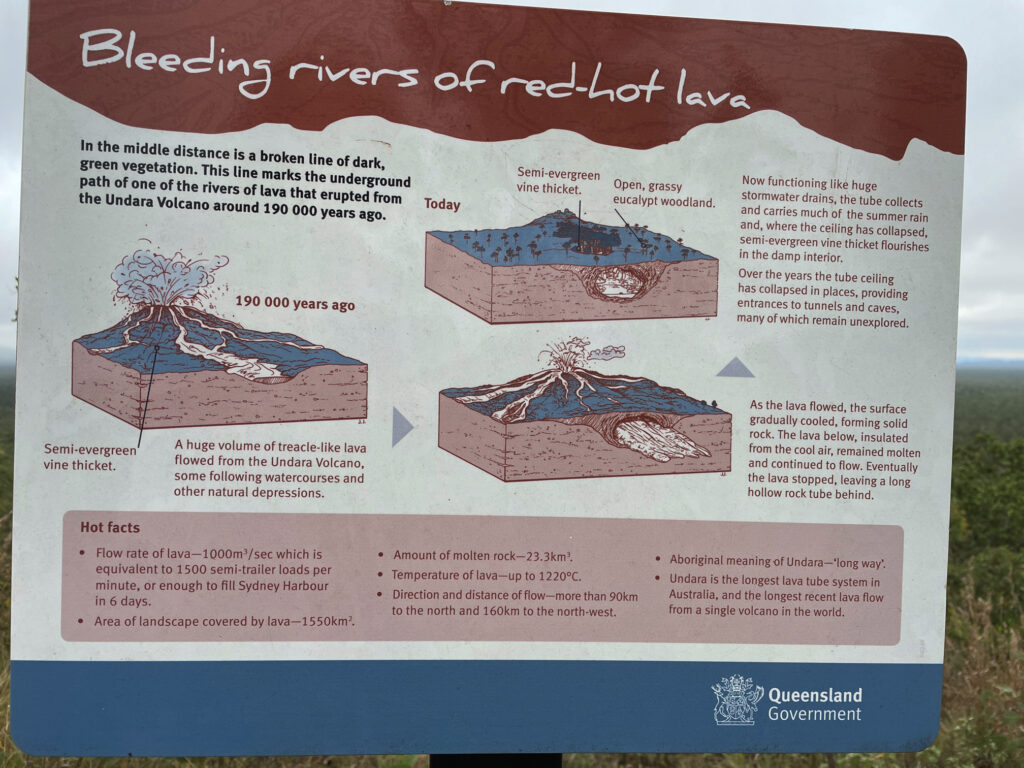
We moved camp this morning to Walardi, where we’ll be able to more easily access the southern hikes. This is where we first see the striped beehive domes that make Purnululu famous – and they’re every bit as incredible as we’d hoped. These ancient formations began taking shape over 350 million years ago, when rivers laid down layers of sandstone and conglomerate. Over the ages, wind, rain, and erosion sculpted them into the striking shapes we see today. The distinctive orange and dark grey bands come from differences in mineral content and moisture-loving bacteria, giving the domes their beautiful, banded beehive look.
All the hikes here start from the Piccaninny Trailhead and follow the course of Piccaninny Creek. We decided to head up the creek to Whipsnake Gorge, then explore the side tracks on our way back, covering a total of 13km. Although the creek wasn’t flowing, it held large, still pools that were sometimes tricky to skirt around. The trail itself was mostly soft sand, with stretches of river stones underfoot, and at one point, an extraordinary section of solid rock broken longitudinally with narrow, parallel clefts — the result of centuries of weathering. It made for a surprisingly varied and fascinating walk.
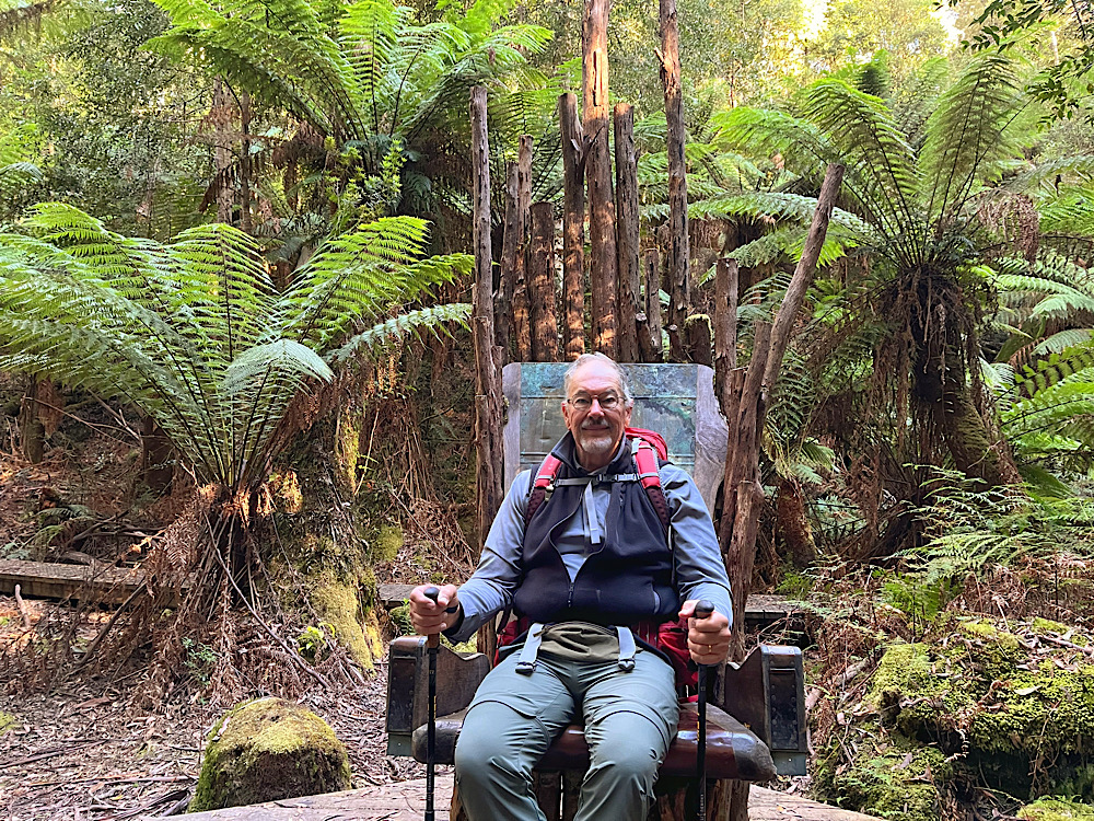
The trail followed the creek as it wound its way past those amazing domes.This section of the riverbed surprised me, having never seen granite laid down and weathered like this. A view along one of the clefts in the granite river bed.Such a beautiful hike.A natural window eroded through one of the domes perfectly frames scenic views of the Bungle Bungle Range.Cathedral Gorge is a breathtaking natural amphitheatre, carved from red rock over millions of years by the persistent force of water. During the wet season, a waterfall spills from the gorge’s roof into a now tranquil pool at its heart. This vast, circular cavern is famed for its remarkable acoustics. We were privileged to experience it as the haunting tones of a didgeridoo, played by an Indigenous musician, echoed through the ancient walls.
Monday
We’re leaving Purnululu today but not before we experience this amazing place from the air. Would you like to see my hundreds of photos – no, really. Well here’s just a few. Stills don’t do the flight or the National Park justice. On Tracks and Horizons YouTube channel you’ll find a video which brings it to life.
No doors to hold us in, but no doors to impede the view either. Just Steve and I and our pilot on our flight.The variety of different land formations stunned us. What we see from the ground is such a small fraction of the Park. Different formations again. And look at all those gorges – we only walked into a few gorges and were blown away by the vistas, rock formations, pools, etc. There must be hundreds more that are equally amazing.The beehive domes – fading off into the distance.Beehive domes from on top.
Completing our land exploration of the Kimberley here was an awe-inspiring finale to an epic Outback journey.
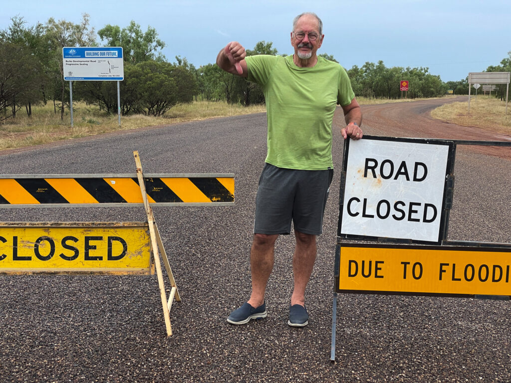
The Tanami Road follows an old cattle droving route from the MacDonnell Ranges just north of Alice Springs, stretching north-west across the Tanami Desert for 1,035km (643mi) to meet the Great Northern Highway near Halls Creek in Western Australia. This road takes the traveller, station hands, local indigenous people travelling to their communities and massive road trains through some of the most remote country in Australia. While Federal and State governments are working on sealing the road there are still long stretches of gravel road often with bad corrugations, potholes and washouts. After passing the community of Yuendumu there is no fuel, food or water available to tourists for 760km. Should it rain the road will be closed and the traveller stays put until it opens again. Travelling these outback roads is no casual undertaking.
Monday
We plan to complete the crossing in 5 days. We’re fuelled up, water tanks full and I think I’ve got enough food for 2 or more weeks (bit of overkill there!).
All good for the moment. The skies are blue and the forecast is good.These tree-less hills covered in spinifex started the day for us.Tilmouth Well – hmmm. We try to support all the little roadhouses and small towns we pass along the way, so dropped in here for a snack. The area in front of the shop was full of litter, the toilets were filthy and the snacks were all deep-fried, ready-made food. Not easy to give support in these cases.
The road so far is sealed – easy driving. We’ll cover about 300km today – a big day for us as we like to stop to stretch our legs and swap drivers, then have plenty of time to enjoy the destination.
Tonight’s camp is a flat area beside a windmill. Luckily it wasn’t a windy night.We’re now in flat country and the stars stretch from horizon to horizon.
Tuesday
We’ll cover another 300 or so kilometres today, but first just 22km on from last night’s campsite is Yuendumu, an obligatory refuelling stop for us if we’re to make the distance to Halls Creek.
Despite arriving half an hour after opening time, there wasn’t a soul in sight… and the self-serve fuel pump wasn’t working. Not a good sign. About an hour later, the storekeeper finally appeared and casually explained they were running low on fuel and waiting for the tanker to arrive. For a brief, uneasy moment, we imagined being stuck here for days. Then, with a shrug, he pulled out a key, pressed a few buttons, and got the pump going. Relief. Our long-range tanks hold 145 litres — and we made sure to fill them to the brim. With normal motoring (ie not 4×4) that should take us about 1000 km – but, there will be 4×4 driving happening.
Relieved to have fuel in the tank, we wandered into the grocery store — and couldn’t believe our eyes. There were stacks of eggs, when just days earlier there hadn’t been a single one to be found in the entire town of Alice Springs! To our surprise, it turned out to be a remarkably well-stocked little store, with everything from fresh fruit and vegetables to televisions, hardware… even tutus. Out here, you really do learn to expect the unexpected.
The sealed road disappeared all too soon. The bulldust cloud ahead of us is from a slow-moving road train, but not slow enough to overtake, particularly when you have no visibility once directly behind it. The road trains make a mess of the roads – we soon had big corrugations which forced us to drive slowly.Travelling slowly allowed us to enjoy the countryside even more. I know it’s hard to believe this is the desert, but the green you see isn’t grass, it’s spinifex. And just look at all those termite mounds – kilometre after kilometre of them.Catching up with our road train when he’d stopped to check his rig we had a bit of a chat – as one does when you’re about the only people you’ll see all day. He’s carrying concrete powder to a gold mine at The Granites. He’ll deliver today, drive back to Alice tomorrow and return with another load the next day. He told us there are 3 road trains doing this constantly – that’s a lotta concrete!
Tonight we camped at a roadside pullover ignominiously known as ‘Camel Toe Quarry’. There was a dam nearby, some of the prints in the dust could have been from camels, but most were cattle.
Wednesday
Big excitement today – we cross the border into Western Australia.
Sadly, neither the WA nor NT governments seemed to share our excitement about their border. The only marker was a cluster of empty bottles and a weathered, handwritten sign left behind by a traveller from who-knows-when. The border sign was leaning up against the rubbish bin. I just couldn’t believe the colours in the sky highlighting the spinifex at tonight’s campsite.
Thursday
Today’s adventure took us to Wolfe Creek Meteorite Crater — or as the exclamation goes, “that place from the horror movie”. For the record, even though the plot was loosely based on real crimes, NONE of the events in the unfortunately named Wolf Creek horror film happened here. Thankfully I haven’t seen the movie and would very much like to sleep tonight without imagining serial killers in the bushes.
Obviously NOT our Wolfe Creek! This road is sealed!!
The section of the Tanami Road we travelled today was in very poor condition. Deep potholes, washouts, thick bulldust, and heavy corrugations made for a difficult and slow drive. Even after turning onto Crater Road, the road surface remained rough and challenging.
Wolfe Creek Crater was formed approximately 120,000 years ago when a large meteorite struck the earth. It is the second-largest meteorite crater in the world, measuring 876 metres in diameter with an original depth of around 120 metres.
It is known as Kandimalal by the Jaru aboriginal people of the district. There are several creation stories explaining the crater. One describes two rainbow serpents meeting here, forming two of the local rivers. One of the serpents came out of the ground, forming the huge crater. Another Dreamtime story involves the evening star getting too close to the crescent moon and burning up, falling to earth, creating an enormous explosion and flash followed by a dust cloud.
The crater sides are steep, rocky and uneven. A 4km walking track around the rim couldn’t be ignored so, despite the terrain, we completed the circuit and took in the remarkable views of this ancient geological feature. This is indicative of the track, and yes, I did grizzle about it a lot. And while I’m still grizzling, let me assure you that spinifex does penetrate hiking pants and feels like needles digging into your skin.But the flowering spinifex is just so pretty. When the wind blows it ripples like water on a lake.
Friday
Our last day on the Tanami. The corrugations, bulldust, washouts, etc, etc continued for a while longer before the lovely smooth sealed road once again appeared. This is cattle country. Travelling these outback roads there is usually a lot of road kill, mostly kangaroos. Interestingly we’ve seen very little road kill and when we do see any it’s mostly cattle – the properties aren’t fenced.
Between some States and some areas of Australia there are quarantine borders to prevent the spread of agricultural pests. The only ‘contraband’ food items remaining in our pantry were onions and garlic. The regulations with these are that they must be peeled, hence my onions and garlic are now peeled ready for quick meal prep.
Meeting the Great Northern Highway is the end of the Tanami, but it really wasn’t a photo opportunity! We drove on to Halls Creek where we refuelled, filled our water tank, and bought some fruit and vegetables. There’s no where to stay in Halls Creek so we headed out of town to Sawpit Gorge.
Such a pretty gorge with a deliciously cool creek to take a swim. Totally relaxed after the long, dusty Tanami. Our campsite at Sawpit Gorge. Believe it or not another free campsite we had all to ourselves for two nights.
And so our Tanami adventure comes to an end. In summary, it’s a long, often lonely journey with few distractions along the way. The beauty out here isn’t in flashy landmarks — it’s in the remoteness, the ever-so-subtle shifts in the landscape and colours of the desert, and those endless horizons that invite you to never stop exploring. It’s a road that reminds you how big this country really is, and how small you are within it.
Three days in Alice Springs isn’t nearly enough particularly when we really needed to clean the motorhome, restock, refuel, carry out some repairs, and finally relax. Alice is a lovely town. Its isolation means everything you might need is conveniently clustered within a small area — hardware stores, hiking and camping supplies, well-stocked supermarkets (though eggs were in short supply!), and mechanical services. We even found two restaurants that turned out to be gems – an Indonesian and a Vietnamese. Thankfully we’ve had no mechanical issues, but will need to replace the filter on the drinking water tap.
Alice Springs from Anzac Hill, looking over the town to the West MacDonnell Ranges. For those not in the know, the flags are the Australian flag, the Northern Territory flag, the Aboriginal flag and the Torres Strait Islander flag.
Thursday, Friday, Saturday
Palm Valley, another highly recommended destination, is 123km SW of Alice in Finke National Park. To get there you travel through Hermannsburg and Namatjira country. Albert Namatjira (1902–1959), an Arrernte landscape artist born in Hermannsburg, captured the breathtaking beauty of this region in his distinctive paintings.
A monument to the great artist.This is the home Albert built for his family after he was granted Australian citizenship — the first Aboriginal person to receive it. (Pause a moment to consider the irony of this.) Despite achieving significant success and international recognition as an artist, restrictions placed on Aboriginal people at the time meant the government controlled his finances, preventing him from leaving the legacy he intended for his family.Finke National Park is named after the Finke River, the oldest river in the world based on studies of its geology. Now it only runs a few times a year. Our drive into Palm Valley necessitated us driving along its very rocky bed.After settling in to camp we walked back here to do the Mpaara Walk amongst all these amazing landforms.We decided this rock looked like a grouper (the fish!)The views just kept coming. Incredible country.Back at camp, we enjoyed a cold drink while admiring the brilliant colours of the mountain as the sun set. Next morning we embarked on the 13.5km moderately hard Palm Valley and Mpulungkinya Track. It is possible to drive 4 km closer, but the road is in very poor condition and 4K just isn’t worth damaging our motorhome for.Steve doing some arty photography. Palm CreekPalm Valley is named after the rare Red Cabbage Palm, a species found nowhere else but this valley. This photo shows a young plant, while the palms in the following images are fully grown, showcasing the mature form of this unique species.I took this photo after a lot of climbing got us to the top, then the arrow just pointed down, seemingly over the cliff edge! Yikes! It was a lovely walk alongside Palm Creek, then up and over the hill and back down again to follow the creek back to the trailhead. One tricky section had me balancing on a very narrow ledge clinging to the rock face by my fingertips while Steve put pressure on my back to prevent me falling. What one does, hey!
Next morning we headed back to Alice Springs to restock and prepare to head north.
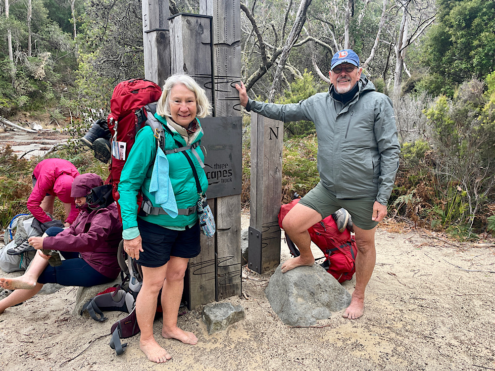
The much anticipated day of our third Tasmanian multi-day hike, the second with the Tasmanian Walking Company, dawned bright and clear with gentle winds – an important consideration! In Hobart we met our guide Bill and the other three couples we’d be walking and cohabiting with for the next 4 days. This hike, however has a major difference – we’ll be sailing between trailheads. A bus took us to Orford on the east coast where Lady Eugenie was anchored offshore.
The Lady Eugenie, a magnificent 75ft ketch-rigged yacht.
Lady Eugenie is beautiful – all polished and moulded timber and stainless steel. Each couple has their own cabin and ensuite. There’s heaps of room in the lounge below deck, which didn’t get much use due to the weather being so perfect, and the cockpit above where many deep, and not so deep discussions were had while we enjoyed our meals, a few wines and the incredible panorama. Hugo is the Skipper and Sam is first mate.
A short sail today across to Maria Island where the Lady Eugenie anchored off Hopground Beach. Hugo took us ashore in the dinghy, ready to start hiking. Here we joined the Frenches Farm Coastal Trail exploring the Painted Cliffs.
The vivid colours of the Painted Cliffs were formed when iron-enriched ground water soaked through the already formed sandstone layers – the iron interacting with the minerals in the sandstone forming swirls and waves and colours that range from rusty reds to oranges and even purples. It’s very beautiful, the cliffs extending for quite a distance.
Maria Island, like much of Tasmania, has convict labour to thank for the buildings on the island. Maria Island was declared a National Park in 1971. In recent years disease-free Tasmanian devils have been released on the island for the protection of the species.
Read about the history of Maria Island
Lunch today was at the Oast House. It’s one of the oldest oast houses in the country. In its heyday it was producing 3 tonnes of hops. Before you start imagining us at a lovely restaurant with a rustic menu I’ll mention that the Oast House is a ruin and our lunch was a pre-prepared salad we each carried in our backpacks.
It was built on two levels. The ventilation bricks can still be seen separating the two levels.
Darlington became the centre of activity during convict and early colonial days. Due to my sore knee I spent some time here exploring the old buildings and reading their history while the group continued their hike along the coast to the fossil cliffs.
I enjoyed the wildlife!A Cape Barron Goose‘Turbo chook’ is the affectionate name given to the Tasmanian Native Hen. However, they have no relationship to domestic chickens but belong to a group of waterfowl known as rails. Tasmanian Native Hens get their nickname from being a very fast runner, reaching speeds of 50 kph.
Dinner tonight in the cockpit, as it was every meal. Tonight we drifted to sleep gently rocked in our cosy bunks after a big day.
Mon 15th April
What a magic morning! After a lovely breakfast together sitting in the cockpit we had a magnificent sail for about 4 hours to get to Schouten Island. Rounding Maria Island the fossil cliffs plunging into the ocean were stunning.
I’d like to think the Skipper found my assistance invaluable. A little later we passed nearby to Iles de Phoques. A large colony of New Zealand fur seals call this tiny rocky island home.
Surprisingly there were seals high up on the rocky hill. These seals, unlike many other seal species, have jointed hips they can swivel which allows them to climb. It’s a noisy colony and the call of a seal is not melodious.
Definitely the best seat on the boat.A pod of dolphins joined us. Magic!Anchored off Moreys Beach on the northern side of Schouten Is. Lunch before starting the hike. Cathy, Sam (first mate and chef), Steve and Dee.
Once onshore on Schouten Island we checked out a few historical huts before beginning the hike.
The hike up Bear Hill starts at the end of Moreys Beach.Bear Hill is so named due to a rock formation that looks remarkably like a bear climbing the hill.
I elected not to do this climb feeling my knee was not quite up to this kind of a hike. The others reported the views from the top were wonderful, but questioned whether the difficult, rocky climb was really worth it – I was pleased I didn’t do it!
Yay! A successful, if very strenuous climb of Bear Hill. Bill, Steve in front, Kate, Dee, Cathy and Carl with Rick at the back.Back onboard Lady Eugenie Dee and I jumped in off the yacht for a swim.
The cold water really takes your breath away, but so refreshing. A warm shower later and afternoon tea turned out to be champagne and fresh oysters. I was in heaven!
Tuesday 16th April
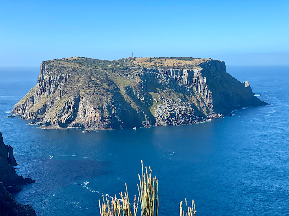
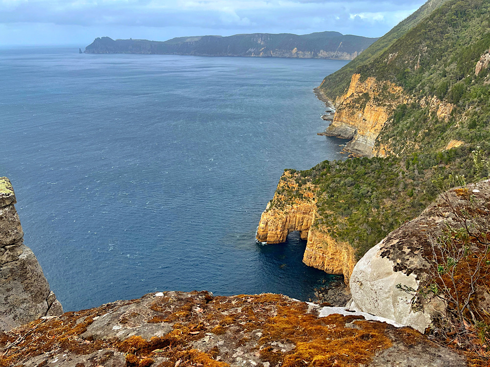
Todays sail took us to Bryans Beach at the southern tip of Freycinet Peninsula. The southern section of this spectacular peninsula is only accessible to hikers and boaties.
Arriving at Bryans Beach. Anticipating the hike to come.Bryans Beach with Lady Eugenie disappearing in the background. She’ll meet us again at Wineglass Bay.
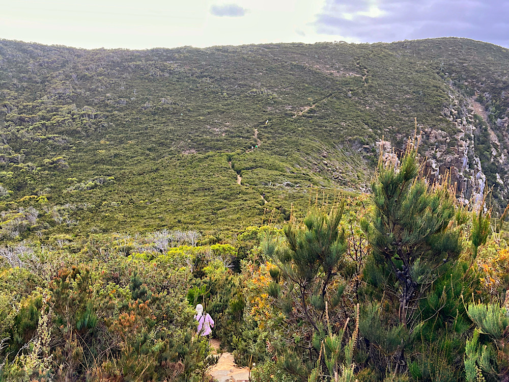
Today will be our longest hike – 15.5km from Bryans Beach across the headland to Cooks Beach, over another headland to hike the full length of Hazards Beach before crossing the Peninsula on the Isthmus Track to the northern end of Wineglass Bay where we’ll hike the length of it to meet Lady Eugenie at the southern end.
Cooks Cottage
This cottage, which is on the southern end of Cooks Beach was built by graziers in 1859. It was in serious disrepair before being restored in 2007 by volunteers using many of the original bricks. Today it is only to be used as an emergency shelter.
Bill boiling the water for our morning tea. The water tank is greatly appreciated by multi-day hikers.Morning tea (coffee, tea, hot chocolate and a bikkie) at Cooks Cottage. Carl, Dee, Michael (walking away), Cathy, Steve, Rick, Kate and Bill.The path down to Cooks BeachBanksia flowering.Lunch on the rocks! We’ve walked the length of Cooks Beach, crossed over another headland and arrived at Hazards Beach. Looking back down Hazards Beach – still more than half of it to go.
At the end of this beach we crossed over to the eastern side. Up until now the hike has been quite beautiful with the Hazards Range overlooking our every step, the bushland, some flowers, the birdlife and the crystal clear blue of the ocean lapping white beaches. Though it wasn’t long, the next section crossing the Peninsula was unattractive with dried up marshes and scant bushland.
Wow what a joy to come out at Wineglass Bay. So beautiful.
The beach hiking here though was really difficult, being high tide we were forced to hike in soft sand. Some found it a lot easier to take the boots off and walk on the wave line or even in the water.
Bill at Wineglass BayLady Eugenie in Wineglass Bay with the pink granite peaks of the Hazards Range watching over her.
Another refreshing swim off the yacht and a glass of wine before dinner ended another magical day of hiking.
Wed 17th April
The Lady Eugenie remained anchored in the protected southern part of Wineglass Bay overnight. This morning it was just a tender transfer back onto the beach for today’s hike.
A beautiful time of day to start our hike on Wineglass Bay
We farewelled Hugo and Sam, then headed off to hike the length of the beach before we joined the track.
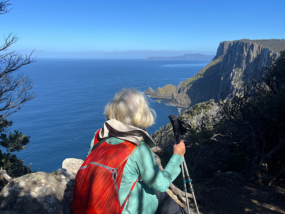
There’s 1000 stairs to climb to reach the Wineglass Bay Lookout. That’s not to be sneezed at! The views of this perfect bay were stunning – the tight-curve of the white sand beach forming a compact bay with deep blue ocean and a cloudless sky – perfection. The surrounding forested and bare pink granite mountains contrasted so starkly. It was a very powerful land- and sea-scape.
The crew at the Wineglass Bay Lookout
You can use your imagination as to why it’s called Wineglass Bay, but you’d probably be wrong. This was a whaling area and whales were dragged into this bay before being slaughtered. The waters of this magnificent bay ran red with their blood, making it look like a glass of red wine.
At the Wineglass Bay Lookout with the beautiful pink granite rocks around us.
Down the other side and we’re, sadly, back to civilisation with so many tourists and cars. We paused for a rest and enjoyed watching the tourists setting off to the Lookout. One man was overheard reassuring his reluctant wife that it was “only 3km” – he didn’t realise that was 1.5km of climbing and 1.5km of descent to get back.
This map shows the two hikes we did on the Freycinet Peninsula. Find Cooks Beach on the top right, then follow the path away to the unnamed beach, that’s Bryans Beach where we started yesterday. From Cooks Beach follow it to Hazards Beach then to the Isthmus Track then down to the far end of Wineglass Bay (where the tent symbol is). Today we hiked back along Wineglass Bay to the Wineglass Bay Track (and the 1000steps) to the Lookout then down the other side to where it says “You are here”. We then followed the yellow dotted trail hiking to Honeymoon Bay (off the map).
The hike to Honeymoon Bay was easy with the trail more-or-less following alongside the road. Despite most of it being through forest the rocky ranges of Mt Amos and Mt Dove towered above us. Honeymoon Bay was a delight – small, no one here and lovely warm granite rocks to sit on to eat our lunch while we watched several of our party swimming.
And so ended our wonderful sail/hike with these people who will remain friends.
After about an hour of delightful relaxation here the bus arrived to take us back to Hobart – but not before a lovely cheese platter and wine tasting at Darlington Vineyard just outside Orford. For those worried about my knee it was fine for the last two hikes and has continued to improve ever since.
We met up with Kate and Ric, and Dee and Carl at the Blue Eye restaurant at Salamanca Place where we enjoyed a seafood dinner before farewelling them and heading back to our cosy motorhome for a restful sleep in our own bed. A great time of sailing and hiking.
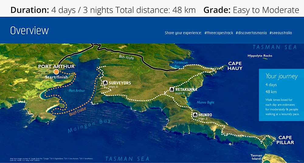
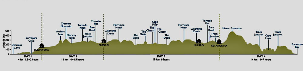
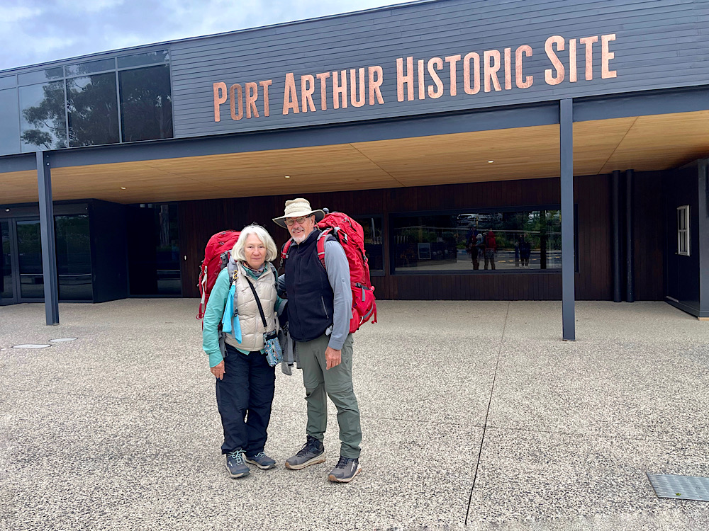
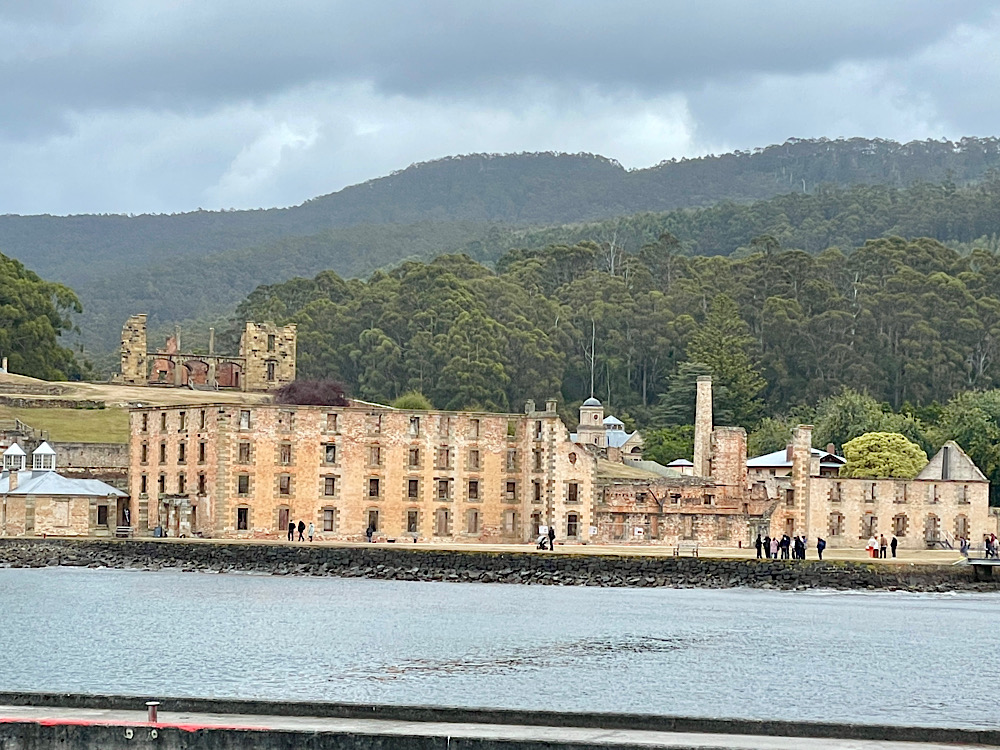
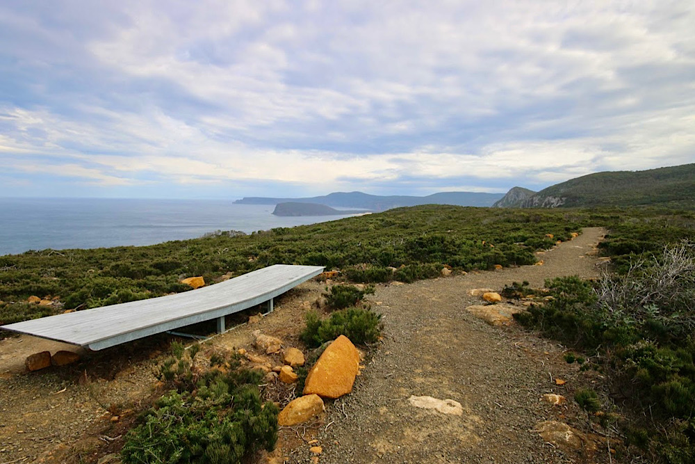
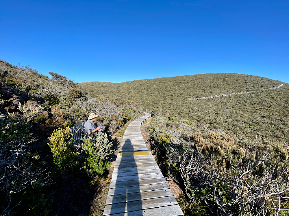
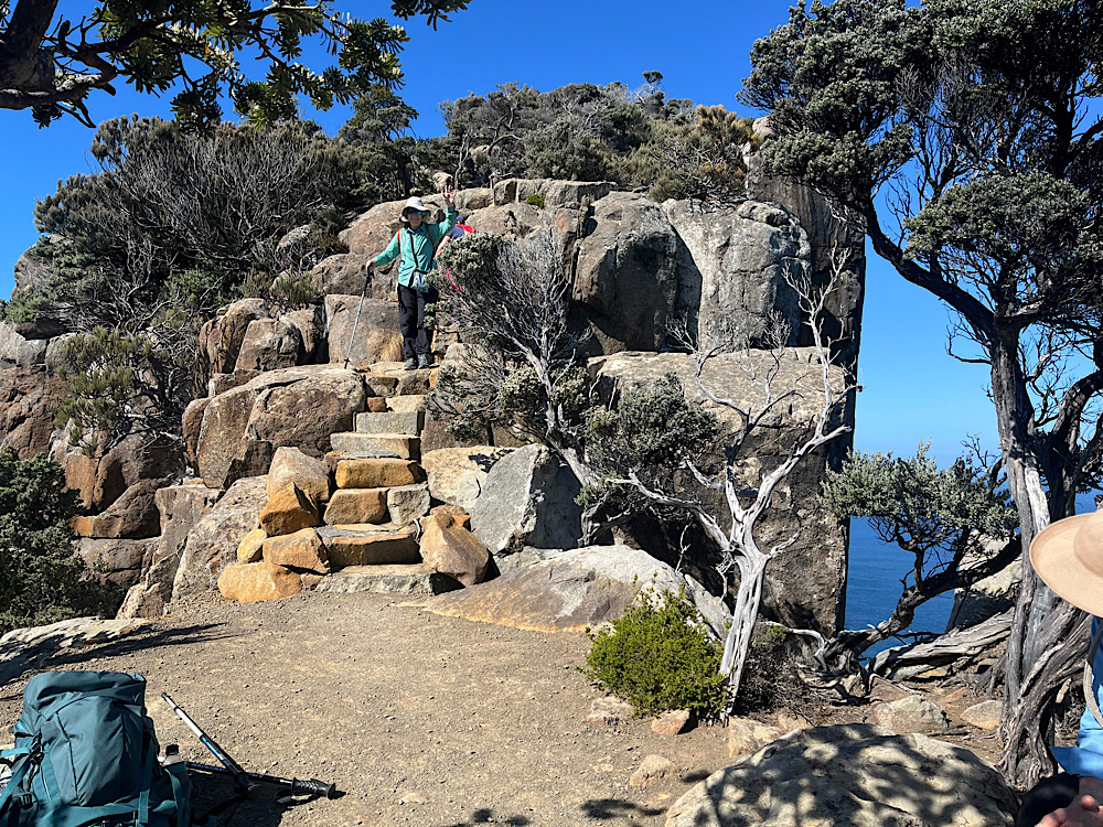
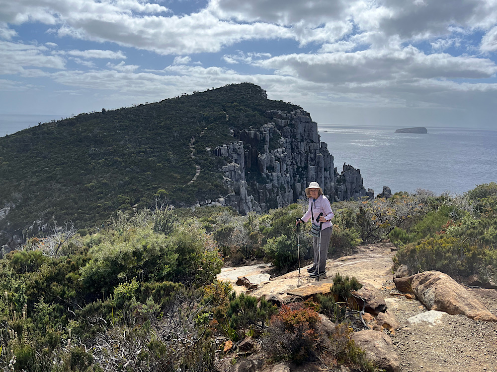
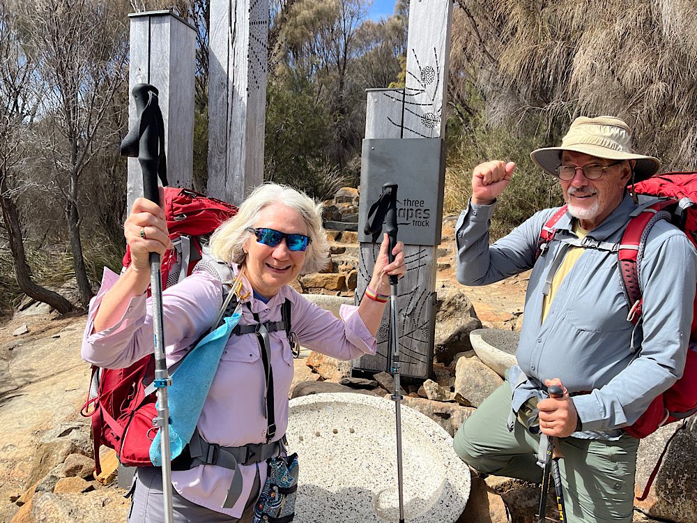
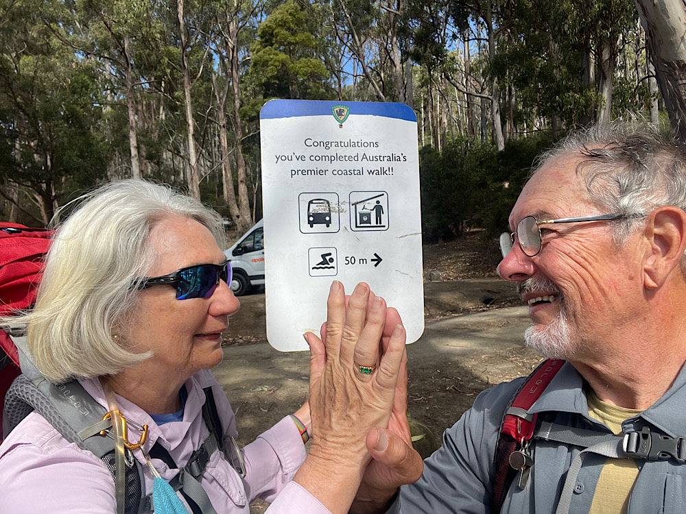
This multi-million dollar track on Tasmania’s south east coastline is one of the best hikes you’ll ever do. Over four days we followed the amazing Three Capes Track for 48km around the Tasman Peninsula. It’s rated an easy to moderate trail, but considering the pack weight of any multi-day hike and the amount of ascending and descending to be done each day (after the first), a good degree of fitness (or youth!) is required. The trail starts and ends at the Port Arthur Historic Site, a two-year pass to the site is included in your track fee. We booked to do it as a self-guided hike staying in the public huts – it’s a very popular walk with only 48 hikers permitted to leave each day. We both carried packs weighing around 13 – 14kg, which thankfully didn’t have to include tents or sleeping mats. All our own food, plates and cutlery, sleeping bags, pillows and clothing to deal with cold and wet conditions made up the weight.
The white dotted line is the hiking track.Track elevation
Day 1: Port Arthur -> Denmans Cove (boat) -> Surveyors Hut (~4km hike)
Ready for anything!
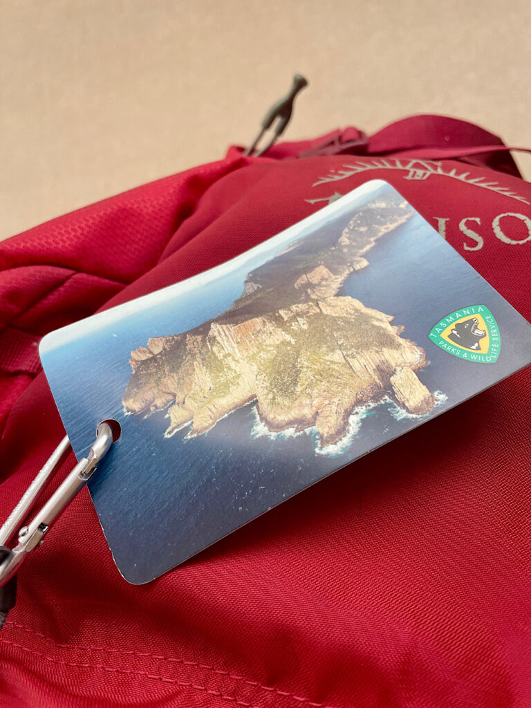
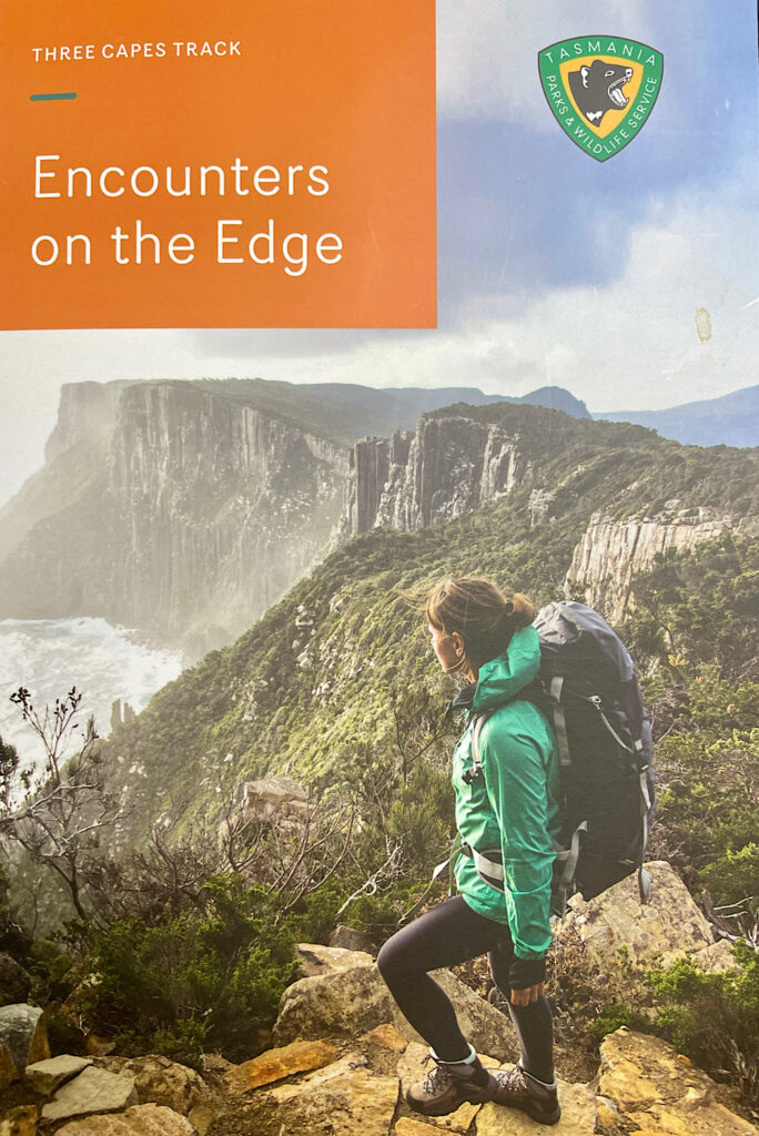
We’re booked on the 11.30am boat and arrived in plenty of time to drop off our packs and park Harvey in the long-term parking bay in the sun to keep the batteries charged and the fridge cold. Registering for the hike we were given our access cards and an excellent book called Encounters on the Edge filled with cultural, geographic and just plain fun facts – like how to recognise whose poo belongs to who.
This tag has my name and the dates I’m walking the track and must be attached to my backpack.An excellent guide and souvenir of the track
The book and the Park Rangers at each hut encourage us to hike slowly and mindfully. To further support this the huts and beds are pre-assigned for the whole hike – no dashing in to get the best bed.
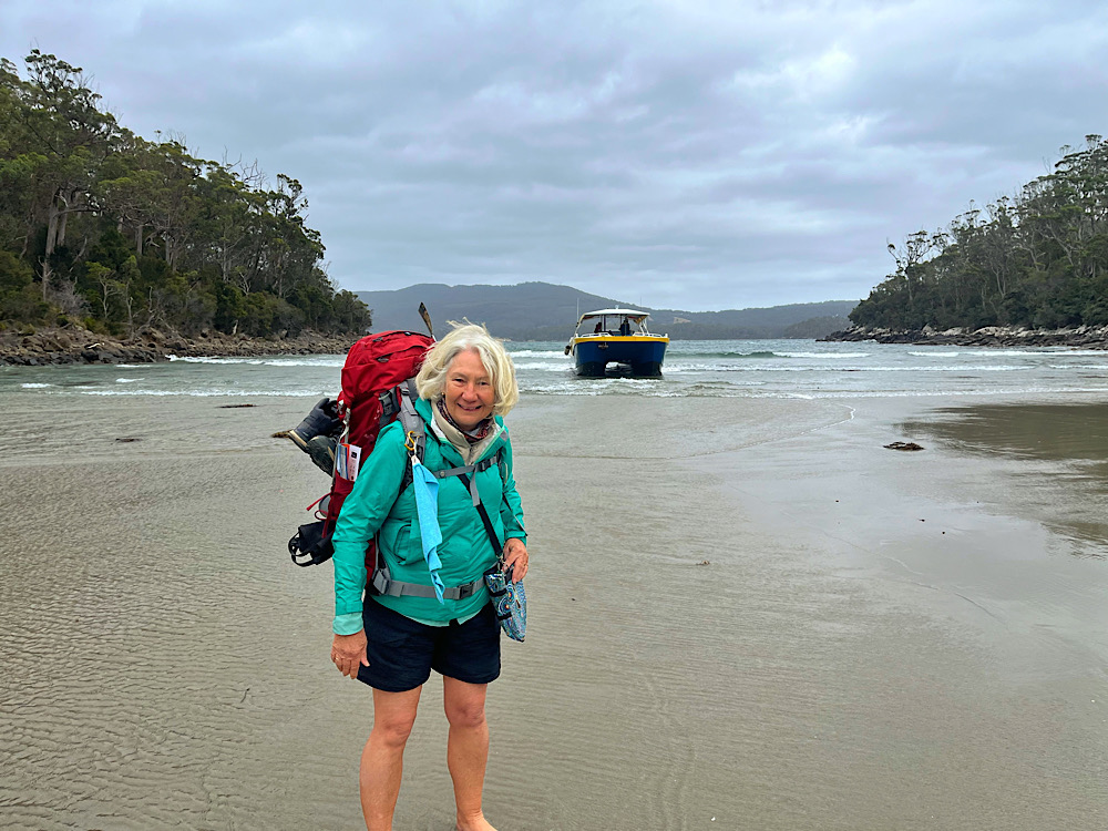
Leaving Port Arthur for Denmans Cove.
You’ll notice in the map above that it all starts with a cruise from Port Arthur to Denmans Cove. Our cruise was cut short due to rough seas and strong winds. At Denmans Cove the boat isn’t able to get into the shore so we zipped off the bottoms of our pants, wore our boots dangling around our necks and hoped like crazy we wouldn’t fall in with full packs as we negotiated the knee deep water and wave surges.
Landed safely – dry from the knees up.At the trailhead – boots and long pants to put on.
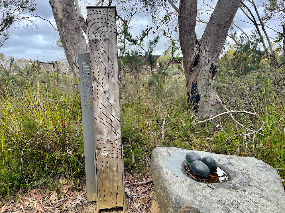
Today’s hike is short – 4 km along a well-defined natural path. With half the day still in front of us we took in the sights and sounds as we wandered, resetting ourselves to once more enjoy the pleasure of just walking through a beautiful landscape. Along the way are story seats designed by UTAS furniture design students. Each of these seats is linked to a story in the Encounters on the Edge book. These were a highlight of the hike which everyone enjoyed. Initially we hiked through coastal heath and eucalypt forest until reaching Surveyors Cove. This little cobblestone beach was a great place to pause, rest, eat our lunch and continue that recalibrating that is so hard to do in a busy world.
Surveyors Cove
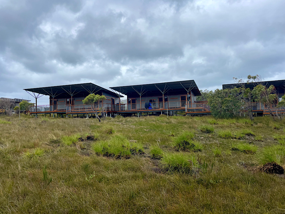
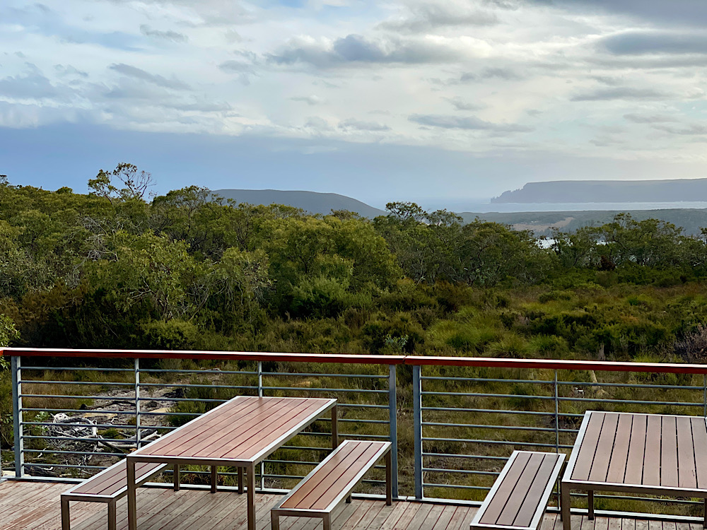
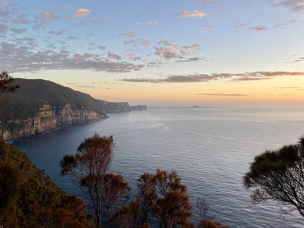
From here it was a surprisingly steep little climb up to our hut for the night. Surveyors Hut is situated in the middle of a buttongrass plain and has amazing views over the ocean to Cape Raoul and the setting sun.
Art works at as we approached the hutSurveyors Hut
The huts are all environmentally designed. Two large kitchens with gas stoves, pots, pans, cooking utensils (but not cutlery), power points and USB charging stations, a pellet heater and a comfortable community sitting area created a warm and friendly atmosphere at each of the huts. Big covered and open decks surrounded the huts and all were linked by covered walkways. We were assigned a room with two double bunks which we shared with a couple from North Queensland. The beds have a triple layer memory foam mattress. With our sleeping bags and blow-up pillows we were both very comfortable. The ablutions block was about 50 metres away – no showers, just composting toilets and sinks on the deck. Lighting is only in the common rooms – a head torch to use in our own rooms and walking around after dark was essential.
Surveyors Hut was unique in that it had several big BBQs which we’d been told about and came prepared with sausages and my spicy bean chilli for a hearty meal tonight. Each evening the resident Park Ranger shares information about the hut and tells us what to expect for the next day’s walk. They also spent some time talking about the history, geology and fauna and flora of the track. Excellent talks we looked forward to.
Open decks with lovely views.Who you lookin’ at?
Day 2: Surveyors Hut to Munro Hut (11km)
Being the first time we’ve done this kind of hike, ie staying in shared huts, I slept badly, woke early and, due to no lighting in the huts, went over to the kitchen/common room. Another newbie to the experience was there and we got the pellet heater cranking, but neither of us had tea bags or coffee with us. Lesson learnt! As everyone started waking and Steve was up we gathered our food bag and enjoyed our overnight oats and a coffee as we chatted with others. Backpacks repacked, boots back on we left the hut about 8.30am.
Off through the eucalypts
The first of many Story Seats for today “From Punishment to Playground” wasn’t far down the track and afforded views across to Point Puer and Port Arthur. Point Puer was the children’s prison where our guidebook tells us ‘despicable acts’ took place. Today it’s a golf course.
Point Puer on the right.
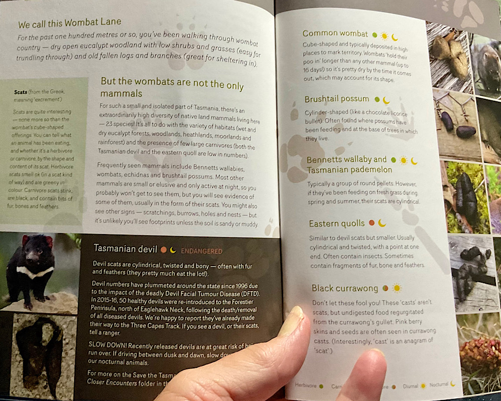
Moving along, the dry eucalypt woodland with low shrubs and grasses is wombat territory. The Story Seat here is quite fun – it looks like wombat poo. The guide book describes the scat of animals we may see as we walk, Tasmanian devils, brush tail possums, wallabies and pademelons, quolls and currawongs.
Wombat poo: cube-shaped and typically deposited in high places to mark their territory. Wombats hold their poo in longer than any other mammal, up to 16 days, so it’s pretty dry when it comes out and may account for its shape.Scat guide!
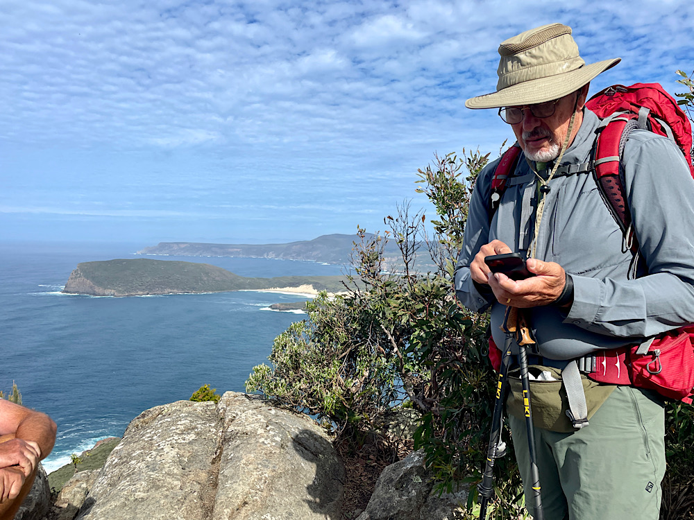
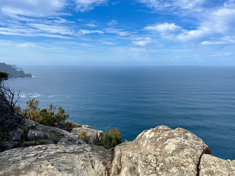
The sharp climb up Arthur’s Peak followed – some switch-backs, some steps, some just straight up. Once at the top though the views were worth every step.
Steve making sure we’re not lost. Crescent Bay across to Brown Mountain and Cape Raoul from Arthur’s Peak.From Arthur’s Peak to the south and some of the highest sea cliffs in Australia.
With no reason to rush we relaxed here watching the seabirds searching for their lunch and appreciating the calm ocean after the last couple of days of wild weather. Despite our next climb up Crescent Mountain being even higher than Arthur’s Peak it was a gentler climb interspersed with points of interest, such as Jurassic Crack. All the rock we see on the track, and covering 1/3 of Tasmania is a Jurassic age igneous rock called dolerite. Dolerite is a very strong rock but cracks in huge columns. See the rock in the photos above and particularly the ones to come.
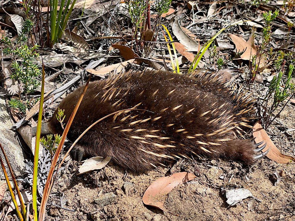
We saw several echidnas alongside our path today. This little fellow is pretending he isn’t there, hoping we won’t notice him.
Emerging from the forest onto a ridge of very evenly low shrubs we see why it’s known as Tornado Ridge. The first European bushwalkers here described it as if a tornado had ripped through levelling the forest. Nothing as dramatic as that, but it is as a consequence of the wind. Ellarwey Valley is also named by these bushwalkers, though the name comes from them saying “where the ‘ell are we”. True story.
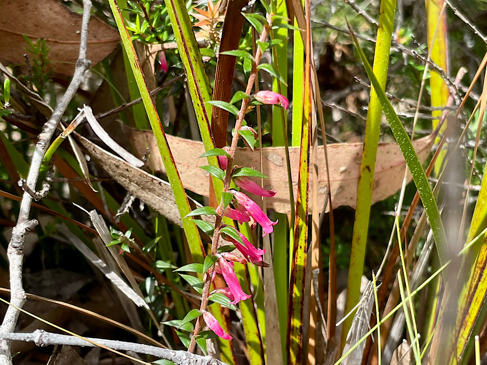
Story seat on Tornado Ridge to read the entertaining story of ‘Where the ‘ell are we’ in our guide book.Flowering heath. This shrub grows to about a metre.
At a crossroad we turned south for the hour-long hike through thick forest once more to Munro Hut. This has to be the best hut on the hike. For a start there are showers – open air, in a 2/3 corrugated water tank. First get a bucket of hot water, fill the shower bucket with it and hoist into the air. It may be primitive but it felt like pure luxury. Next was the viewing deck, with binoculars, cantilevered over the forest for views along the coast to Cape Hauy. Of no less stunning a location is the helipad. The downside – the toilet block is 200 – 300 meters away from the huts on a good path through the forest. Not designed well for the quick dash at 2am!
Views from the deck. Munro Hut
We’re getting to know many of our fellow hikers as we share story seats, kitchens and even food – freeze-dried ice cream isn’t that great! Tonight we were challenged to a game of Oh Hell (a 500 spin-off) with several other hikers. Lots of raucous fun and cries of ‘oh hell’!
Day 3: Munro Hut to Cape Pillar to Retakunna Hut (19km)
The longest day today as we leave through the silver gums to see Cape Pillar, the highest sea cliffs in the Southern Hemisphere. We were both awake before dawn, packed up quietly and after a delicious hot coffee headed off, but not before a sunrise photo from the viewing deck.
Looks like a beautiful day for hiking. Sunrise from Munro Hut.
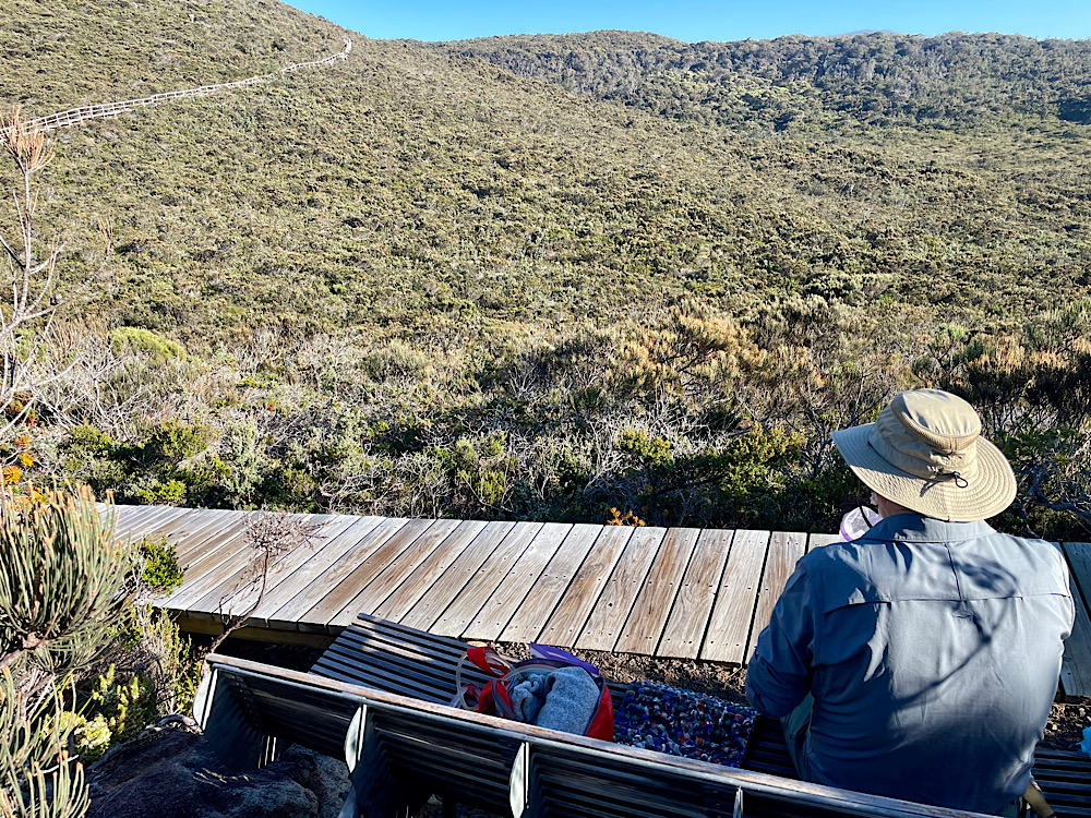
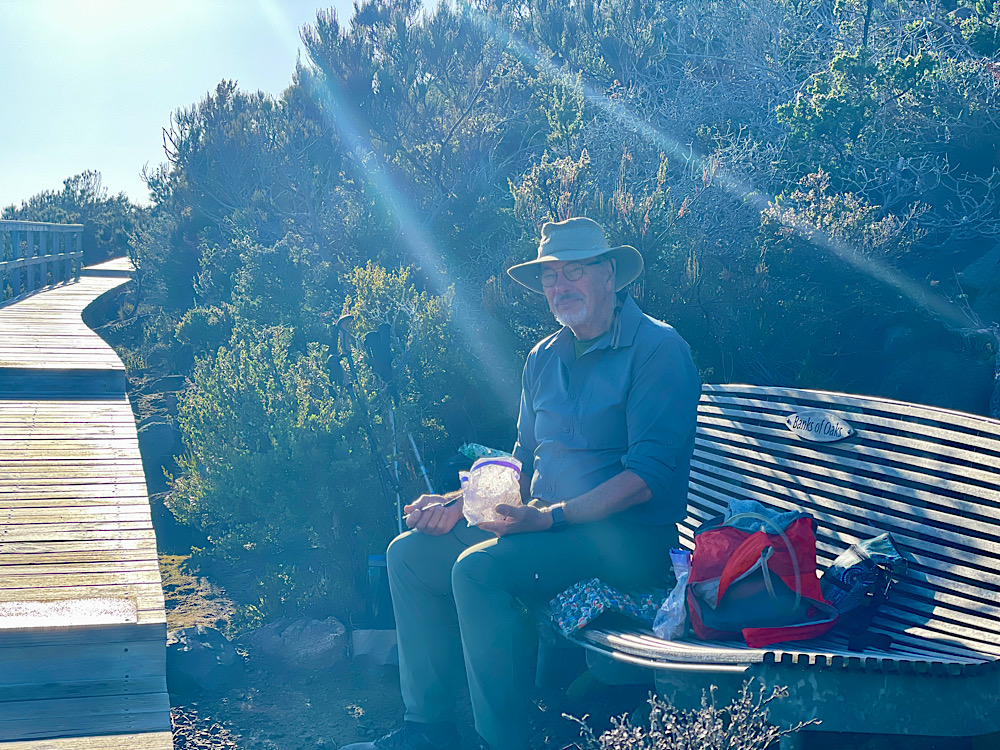
As it’s out and back to Cape Pillar we left our big packs in a storage shed, taking only day packs with water, food, first aid and wet weather gear (you never know in Tassie). Today’s track is either gravel or boardwalk and easy hiking despite starting with a couple of ascents. After about an hour and a half of hiking we came across carefully placed stones representing the tail of a snake which led onto a boardwalk. This is one of the art installations made in conjunction with the local indigenous people. It represents the rainbow serpent. 2.8km later, when the boardwalk ends, is the snake’s head.
The beginning of the Serpent boardwalk.We’ve crossed to the southern side and are getting views across a forest of old-growth trees, eucalypts regenerated after fire, shrubs, sedges, etc. Looking back along the boardwalk. With a couple of hours walking done this was the perfect spot to enjoy our delicious breakfast peacefully.The Banks of Oaks Story SeatThe flora here is all banksias and sheoaks, a dramatic change from the tall eucalypts we’d been walking through. The guide book describes how nature’s gardening tools, wind and fire, have shaped it. The fierce winds prune the vegetation to an even height and fire creates an even-aged stand. Banksias and sheoaks need fire to regenerate.This stunning Story Seat is titled ‘Sex on the Cape’. It’s all covered in the guide book – the birds, the bees and … the antechinus. All female antechinus come on heat at the same time. The males go into a frenzy of copulation over the next two to three weeks, then … they die … all of them …at the same time … at the same age.
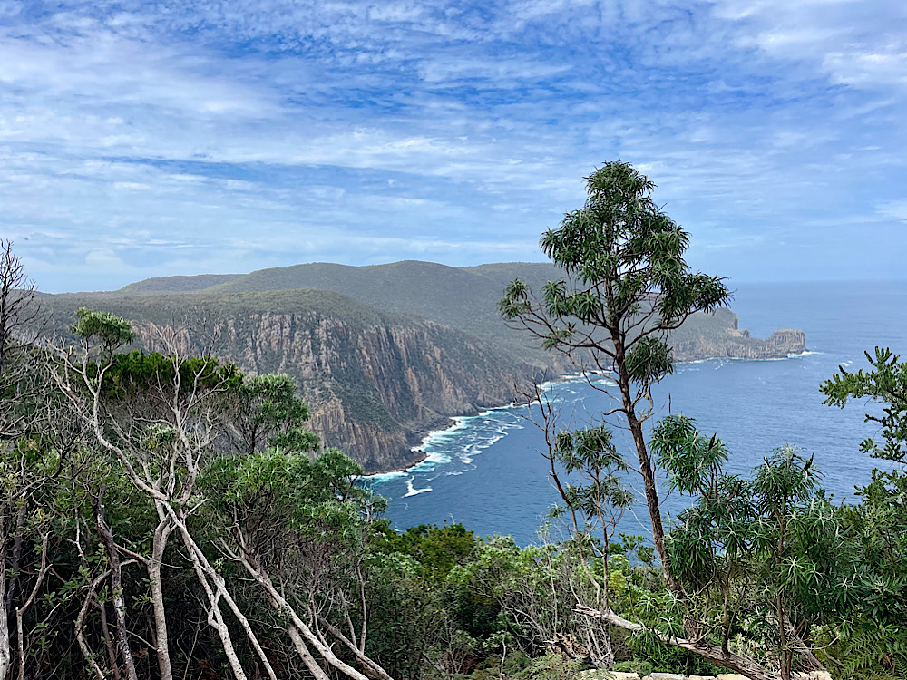
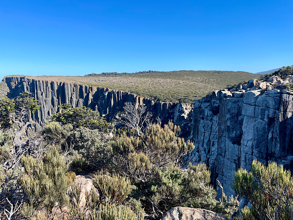
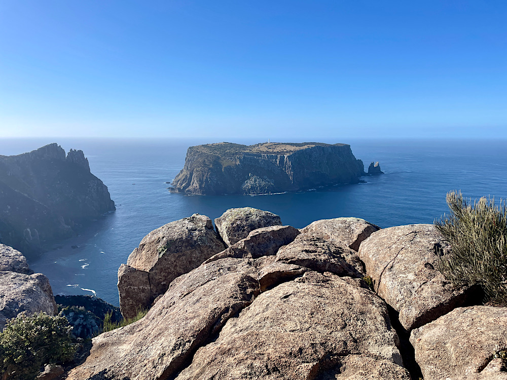
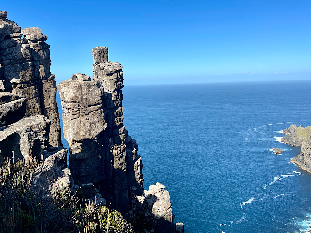
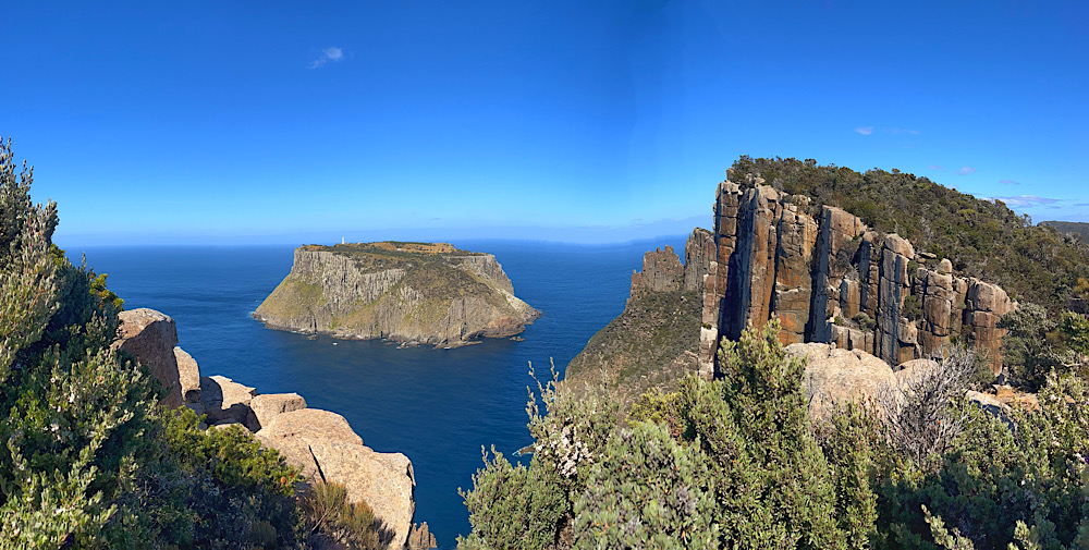
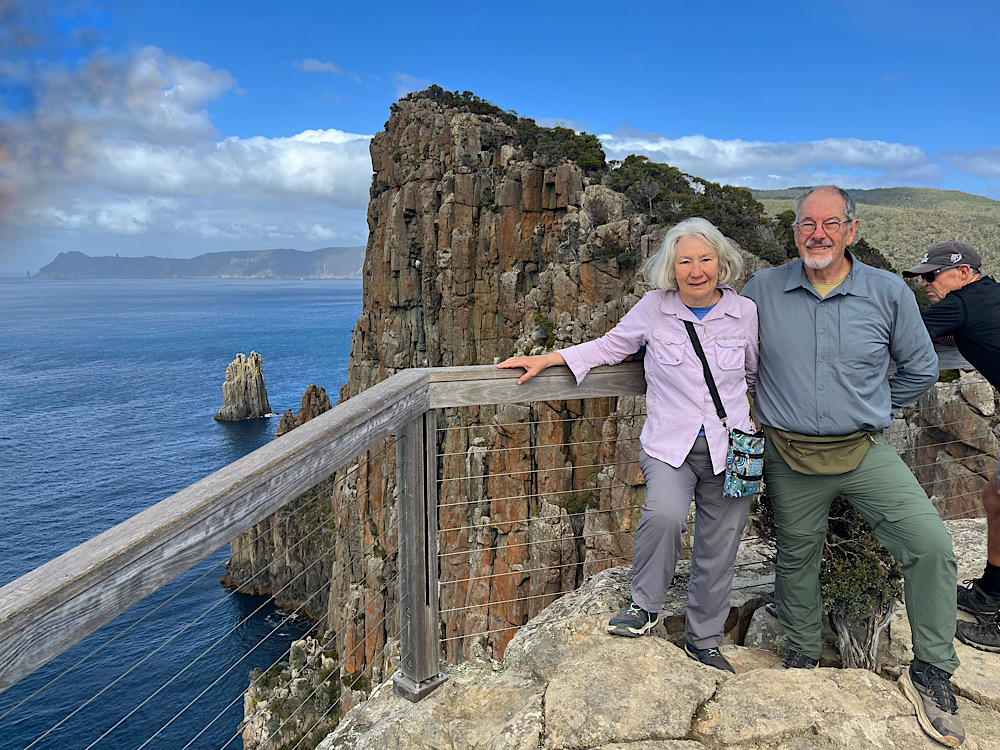
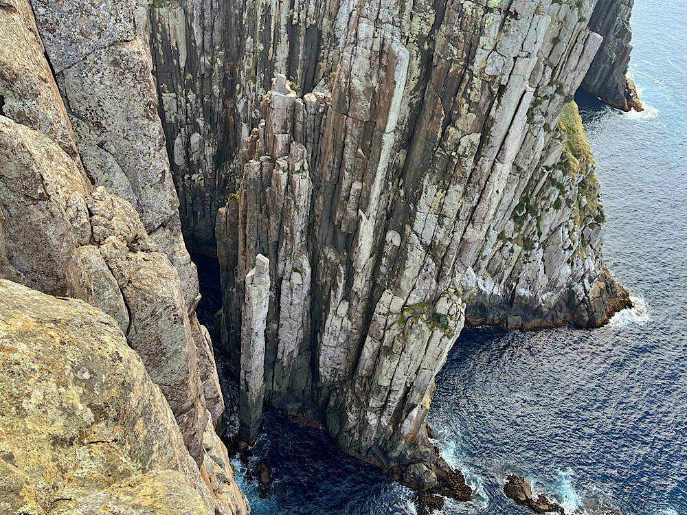
We’re nearly at Cape Pillar now. Tasman Island with its lighthouse and fascinating stories from the days of lighthouse keepers is coming into view as are the incredible dolerite cliffs.
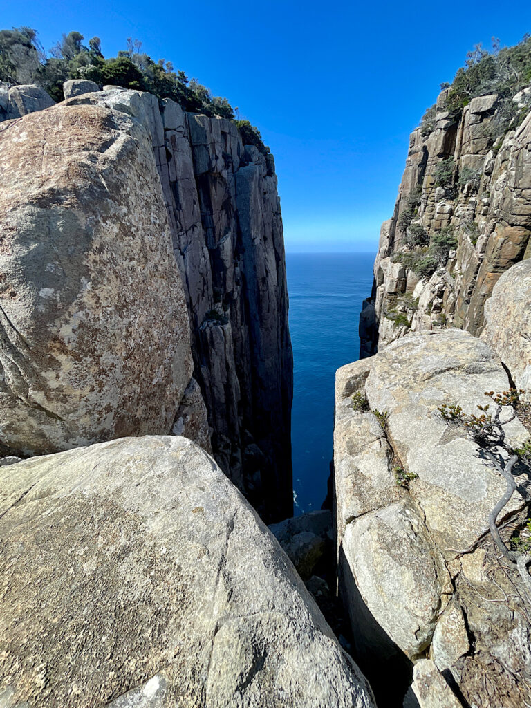
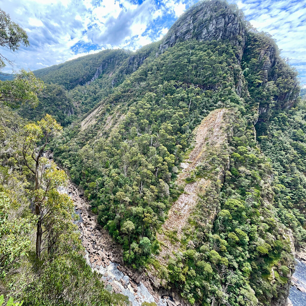
Dolerite cliffs. Note the columnar shape.Tasman Island from Seal Spa. Australian fur seals gather in the waters at the base of these cliffs. Tasman Island. Note the lighthouse. Can you see the Zigzag Track. It leaves from near where the yacht is anchored and zigzags up to the top. A pensive moment.And more stunning dolerite rocks.The (in)famous Blade. A challenge to every hiker. Yes I took up the challenge and stood at the top point. Scary and tricky! Just completed The BladeThe ChasmWe made it! Cape PillarThe view from Cape Pillar in one direction. You can also see out to Cape Raoul to the west and Cape Hauy to the east.
After awhile of resting and taking in the extraordinary views we retraced our footsteps to Munro Hut, repacked our big backpacks and hiked the hour or so further on to Retakunna Hut. Another beautifully designed hut, similar to the others, nestled at the base of Mt Fortescue amongst eucalypts and moorlands with wallabies grazing. Another pleasant evening chatting, stretching on the yoga mats, then dinner, another hotly contested game of cards and off to bed to sleep soundly.
Day 4: Retakunna to Cape Hauy to Fortescue Bay (14km)
Today isn’t the longest day, but it is the toughest. Today we climb a mountain, wander through a rainforest, be stunned by the views and the number of steps to be negotiated to see them, before finishing at a pristine beach to complete this wonderful experience.
Up before the sun. Beautiful watching the sunrise over the forest.Retakunna HutWe’ve got more company for our early morning coffee today. There are two buses to take us back to Port Arthur from the end of the track. One leaves at 2.30pm, the second at 4.30pm. The early-bus hikers need to leave early to get there in time. We’re on the late bus, but will leave early and have our breakfast on the track again – it was so lovely yesterday.
Last night the Ranger warned us we’d be climbing 482m to summit Mount Fortescue first thing this morning. Surprisingly the climb up Mt Fortescue is one of the highlights of the trip. This coastal temperate rainforest has beautiful tall stringy barks with their dark green leaves, fallen logs and rocks covered in lichens and mosses, tree ferns that tower over your head and the earthy aroma of damp humus-rich soil. It’s also very peaceful – darker, quieter and cooler. The perfect place to meditate on the Story Seats.
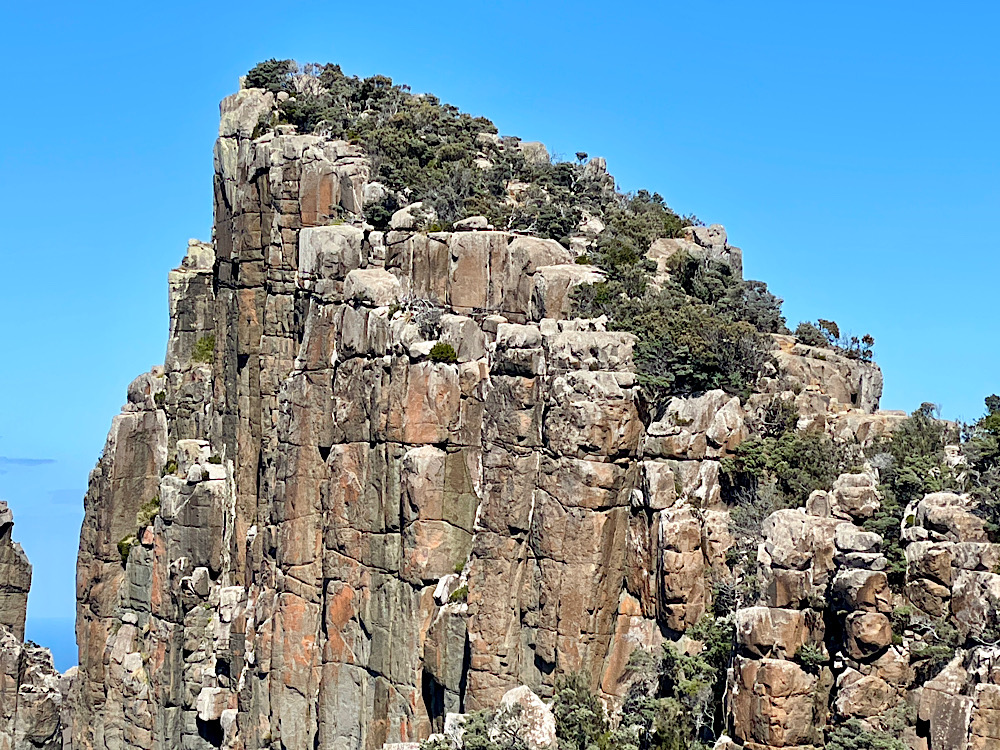
Enjoying the moment at the summit of Mt FortescueAnd down the other side. Aren’t those tree ferns amazing? Just one of the many Story Seats. To this point we’ve already learned about the creepy crawlies of the forest, the critters that live in and on the soil, the travellers that pass through here, ie humpback and southern right whales and the shearwaters, and the fauna that links us to the other countries that formed Gondwana. Taking time to read these stories at each seat elevates this hike to one of the best. Once more we walk along the amazing coastline. Big backpacks dropped at the turnoff to Cape Hauy we begin the descent, ascent, descent, ascent, descent and final ascent to the point of the Cape. All of this is on steps. Over 2000 of them apparently – one way! Repeat on the way back.Keep going – yes that track of more steps ahead has yet to be climbed!Yay! Cape Hauy! Just stunning! Look over the edge and you’ll see the Totem Pole. It rises from the ocean and rock climbers love this challenge! In the photo it’s the single column closer in.
With the highlight of Cape Hauy committed to memory we headed back up and down those steps! The final ascent to the corner to pick up our backpacks was brutal! Worse still was putting our heavy backpacks back on – it’s been a tough day and we still have an hour to hike to Fortescue Beach and the end of the trail.
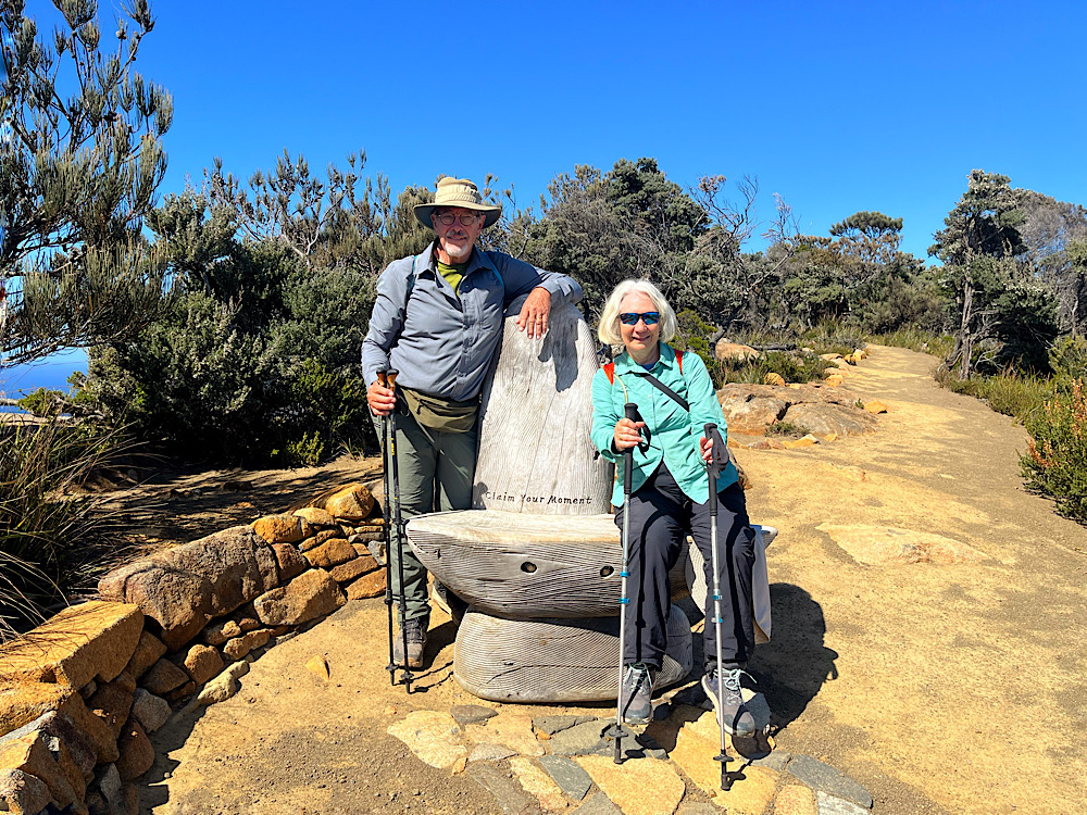
Yay! Two happy hikers.
The beach and waters of Fortescue Bay are pristine and very inviting, but no swimming this time. We chilled and chatted and reminisced on one of the great hikes with our fellow hikers as they wandered in. Granted it’s among the more expensive hikes, but the design and maintenance of the track, the fabulous Story Seats, the hut amenities, the attention of the Rangers and the sheer beauty of this trail makes it worth every cent. It’s so good I may even do it again one day.
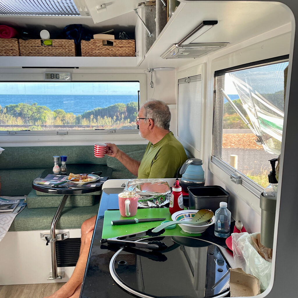
The weather was very average, with lots of wind. The first 3 hours on the Spirit of Tasmania crossing Port Phillip Bay were blissfully calm, but … Bass Strait was choppy! Our booked recliner chairs were at the stern of the ship which I’m led to believe is the best spot in rough seas. Once we were in the Strait I only got up once to go to lunch and very nearly wished I hadn’t.
Recliner chairs on the Spirit. Could that be a green tinge to my face?
Anyway one book nearly finished and 11 hours later we disembarked in Devonport, Tasmania! So exciting! Tonight we’re staying at the Ulverstone Golf Club camping area.
Saturday 3rd
A slow start to the day as we planned the next couple of weeks, replenished the fridge and settled in for the night at a quiet, pretty campsite on the banks of the Leven River.
Sunday 4th
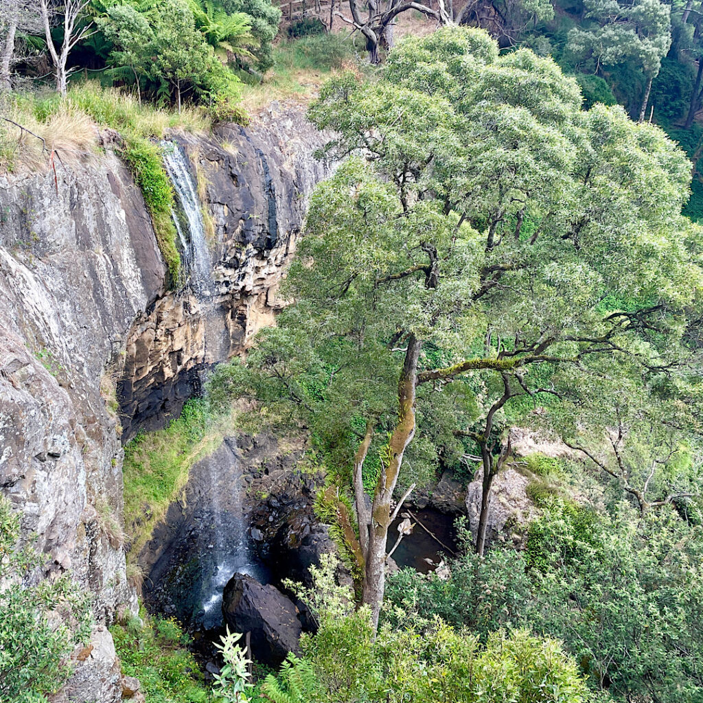
Ahhh Tasmania! It really is relaxing with its rolling hills, green pastures, chubby cattle and sheep and, at the moment, clear blue skies. A drive south climbing through majestic eucalypts brought us to Preston Falls. A well-constructed 200m track with a few stairs led to a viewing platform on the cliff edge above a pretty waterfall dropping about 25m.
Preston Falls
Back on the road southward Leven Canyon was our goal. The Leven River has carved the deepest canyon in Tasmania, some 275 metres below the lookouts. A large parking and picnic area was nearly full when we arrived. It’s also a free camp.
There are two lookouts over the canyon which can be accessed separately by short out-and-back walks, or a circuit which joins both lookouts together by “the steps”. Purposefully choosing to ascend “the steps”, we set off clockwise. A well-constructed path led downward through tall, mossy-trunked gums which sheltered a glade of giant man ferns (the term Tasmanians use for tree ferns).
Leven Canyon from The Edge Lookout.
At The Edge Lookout a viewing platform is suspended above the cascading rapids of the Leven River. After enjoying the view we headed back a little way to where the track branched to go up the steps.
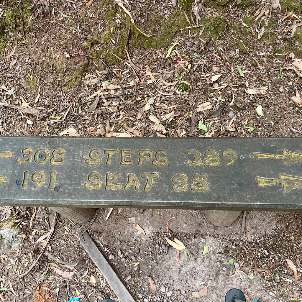
Just a very few of the 697 steps on Leven Canyon walk.
697 steps, to be precise! Bench seats along the way were engraved with the number of stairs you’d already done, the number to go, and how many stairs before the next bench seat. My walking poles were a godsend!
A bench seat (one of many) on the Leven Canyon walk, indicating how many steps to go and how many you’ve already done. And how many steps since the last bench seat and how many before the next one.
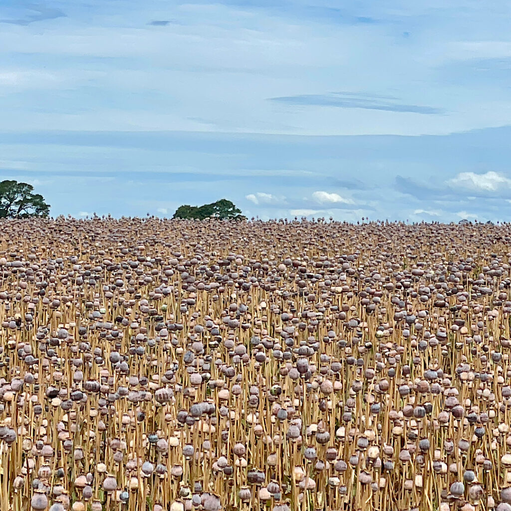
Back at the car we descended the range coming out in mixed farming country again. Tasmania supplies 75% of the World’s legal poppies for making codeine and morphine. Sadly we’ve missed the flowering stage, however the poppy heads are still on the plants, drying out before harvesting.
Poppy field.
Our campsite tonight is a free camp on the coast near Penguin ignominiously called Sulphur Creek. No it didn’t smell of sulphur!
Breakfast at Sulphur Creek. Just west of Penguin.
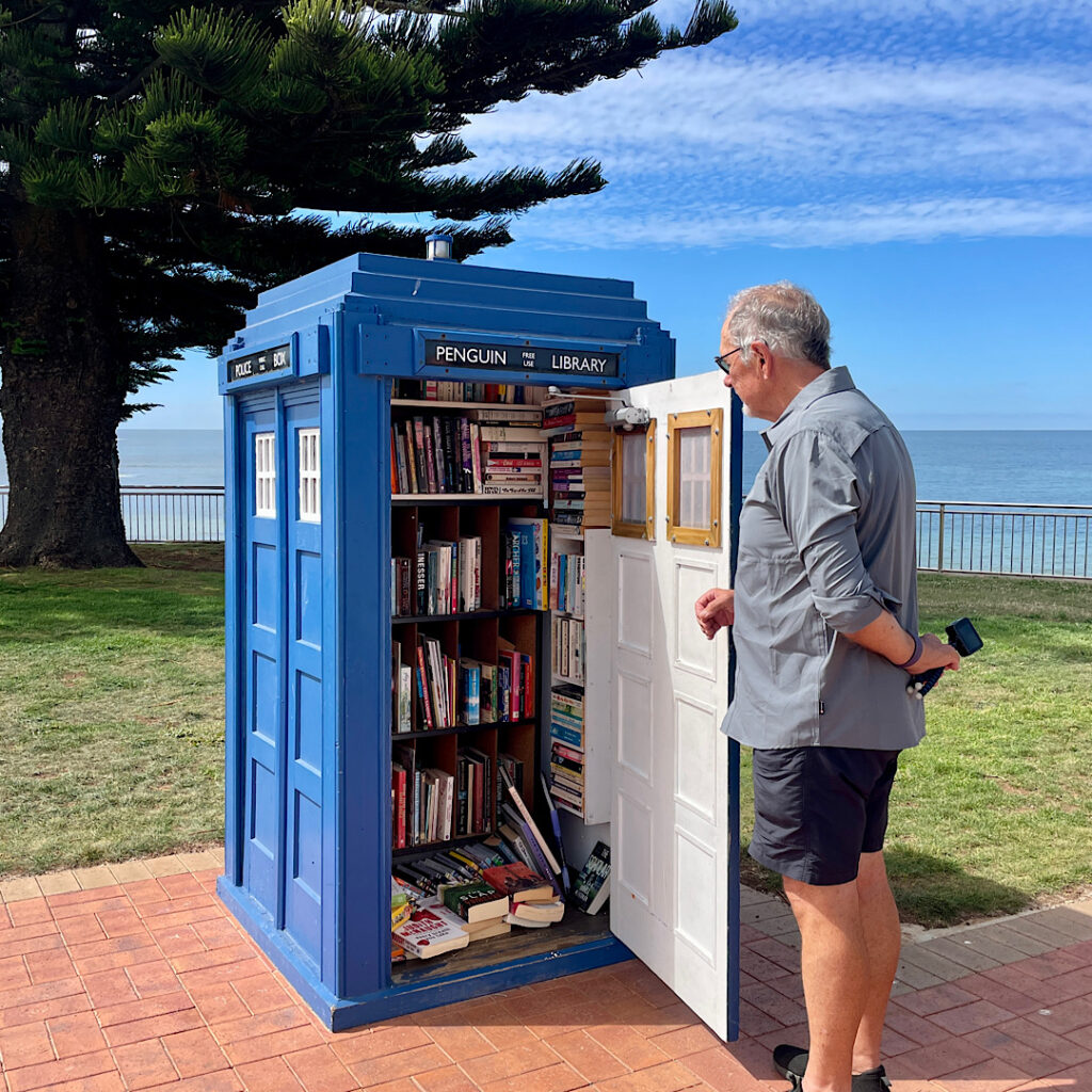
But first we picked up a few groceries in Penguin, wandered the streets a little and had a beer at the Penguin Brewing company – delicious it was too!
A couple of craft ales from the Penguin Brewing Co. Mine is the ‘Little Penguin’ and Steve’s the ‘Emperor Penguin’. Both excellent.What a delightful street library at Penguin.
At the campsite we spent a pleasant Happy Hour with Explorer owners Margie from Melbourne and Kev and Denise from Buderim. Explorer motorhome owners are well-connected through a Facebook group, and it just so happened that quite a few of us happen to have chosen Tasmania to visit this year.
Monday 5th
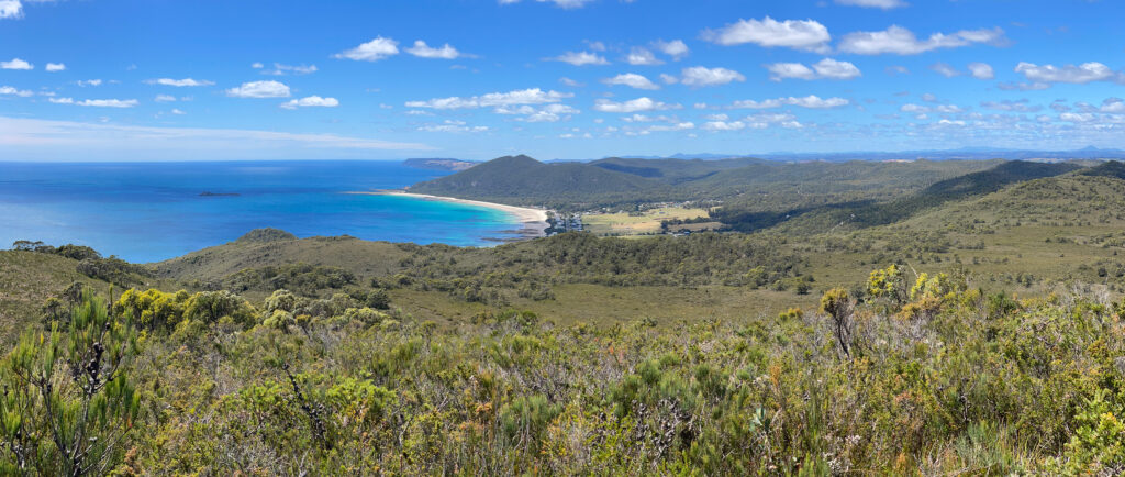
Continuing westward we found a walk to do at Rocky Cape National Park – the 11km Broadview Circuit Track. It starts with a steep climb (does any hike not start with a steep climb!!) before entering the National Park. A well-defined sandy path through heathlands gives great views back to Sisters Beach, our starting point, before coming to the junction to summit Broadview Hill. The hilltop provides sweeping views of the coastline, and our path yet to tread.
Sisters Beach from Broadview Summit
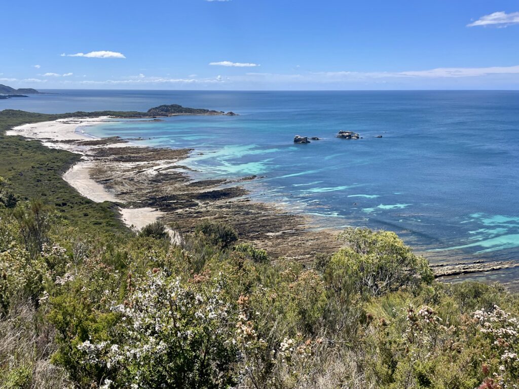
Back on the good path we headed to Anniversary Point. A steep descent brought us down onto the beach where we were fortunate to have arrived at low tide – good, firm sand to walk on. This interesting little bay has offshore rocks known as The Five Sentries.
Anniversary Bay. Broadview. Hiking track includes full length of beach. Note the Five Sentries just offshore.
About a kilometre along the beach it becomes quite rocky with a wide wave-cut platform making for fun rock-hopping.
The climb back off the beach again is, once-more, very steep. The flora is now predominantly a banksia grove, with the largest banksias I’ve ever seen – some trunks being so big you couldn’t get your arms around them to hug.
Banksias on the Broadview Circuit Track.
Lee Archer Cave at the bottom of a steep descent back down to the beach contains a midden and artefacts deposited over thousands of years, and are still used by the Aboriginal community for shelter and ceremony. Respectfully being asked not to enter the cave meant there wasn’t a lot to see from the mouth of this wide, deep cave.
Lee Archer Cave – on the Broadview Circuit Track.
Climbing back to the path again we continued on to Wet Cave – a narrow opening leads downwards into a wide, deep cave with a pool at the end. Soon after leaving the cave the track leads back onto the beach for a short walk to the boat ramp and back to Harvey, our motorhome. And so ended another enjoyable hike with an array of flora and lots of birdlife and lizards.
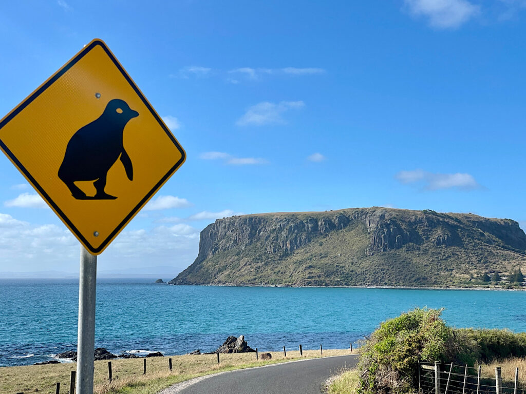
A drive to Stanley and an early night after a well-deserved shower was in order.
Tuesday 6th – Wednesday 7th
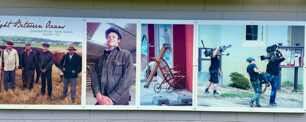
Stanley is a pretty little town with its many beautifully preserved historic buildings from its heyday as the centre of the Van Diemen Land Company and also the birthplace of Joseph Lyons, Australian Prime Minister (1932 – 39). Consequently Stanley became the perfect choice to film the movie The Light Between Oceans, a post World War I drama.
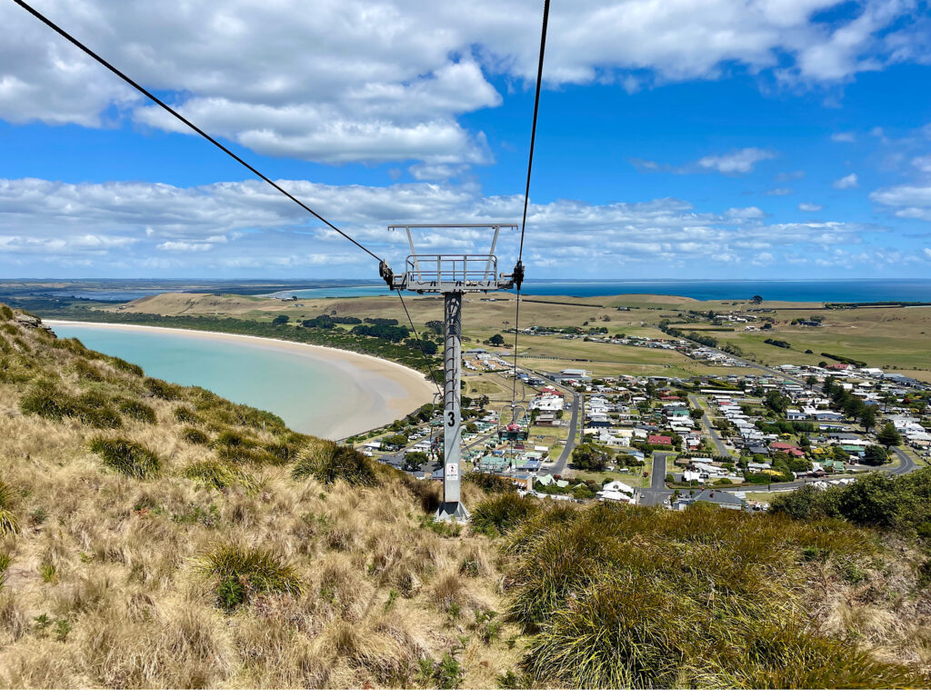
But the most striking landmark in Stanley is The Nut! In 1798 Matthew Flinders described it as “a cliffy round lump that resembles a Christmas cake”. This stump of an old volcano rises some 150 metres above sea level.
The Nut or is it a Christmas Cake, Stanley.
We climbed the very steep path to the top and wandered the 2.5km circuit path that follows the cliff line. A pretty and varied walk with unobstructed views all around.
Stanley from the chairlift. Looking west.Enjoying a night out with friends. Stanley Hotel
Thursday 8th Feb
Not far out of Stanley is Highfield House, the now restored 1830’s home of Edward Curr, the Chief Agent of the Van Diemens Land Company. The history of this first settlement in north-west Tasmania is a sordid one with maltreatment of the convicts assigned to the Company and a massacre of the local aboriginals.
Highfield House from The Nut. Looking north
Popping into many of the little beachside communities along the northern coastline as we returned eastward rewarded us with unspoilt white beaches with the bluest ocean lapping at the shores.
Of interest is the 1.8km long jetty at Port Latta. Iron ore, mined at Savage River, is made into a slurry and transferred to the Port via an 85km long pipeline. Here it is converted into pellets and exported, mostly to Japan.
Rolling hills with grazing sheep and cattle, fields of onions, potatoes, poppies and tulips brought us to another volcanic plug known as Table Cape. Tulips have been grown on these rich basalt soils since 1984, the bulbs now being exported to Holland.
Table Cape. Imagine those bare fields covered in poppy and tulip flowers.
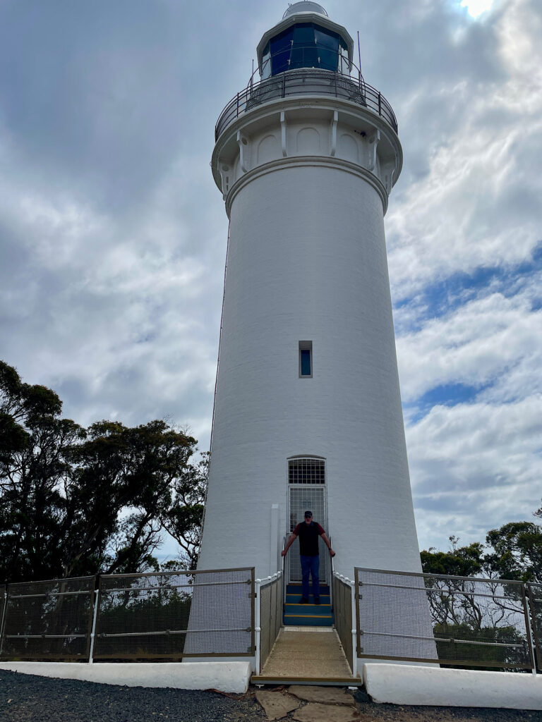
A lighthouse built in 1888 still warns shipping of the perils of this rocky coastline.
Steve just finishing an arduous shift saving ships from certain disaster, Table Cape Lighthouse.
Friday 9th Feb
Today we mixed it with the locals. Don and Jan from Burnie, RVing friends from way back, met up with their traveling crew of about 5 other motorhomes at Hagley and invited us to join them. Tales of travels done and yet to do provided great entertainment.
Saturday 10th – Monday 12th Feb
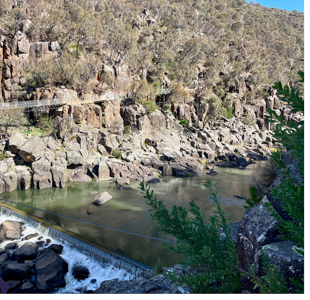
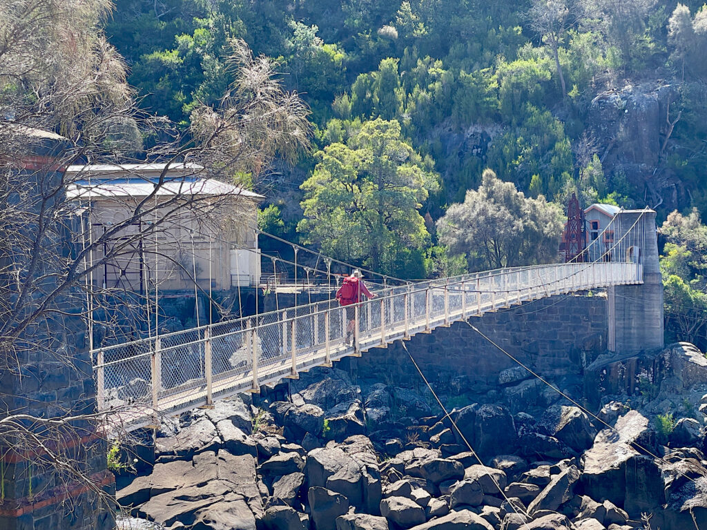
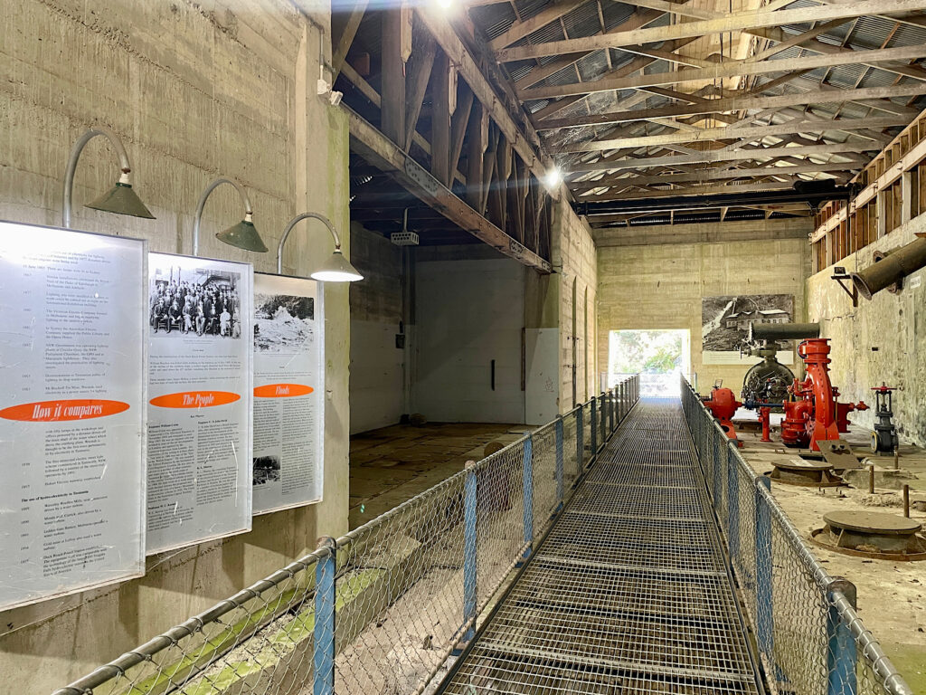
No trip to Launceston would be complete without a visit to Cataract Gorge. This beautiful gorge formed by the South Esk River has a cafe, large grassed picnic area, a swimming pool, a chair lift and lots of walking tracks. We headed off on the 6km return walk along the cliff edges of the gorge to the Duck Reach power station. This station, one of the earliest hydro-electric power stations in the world, operated from 1895 to 1955.
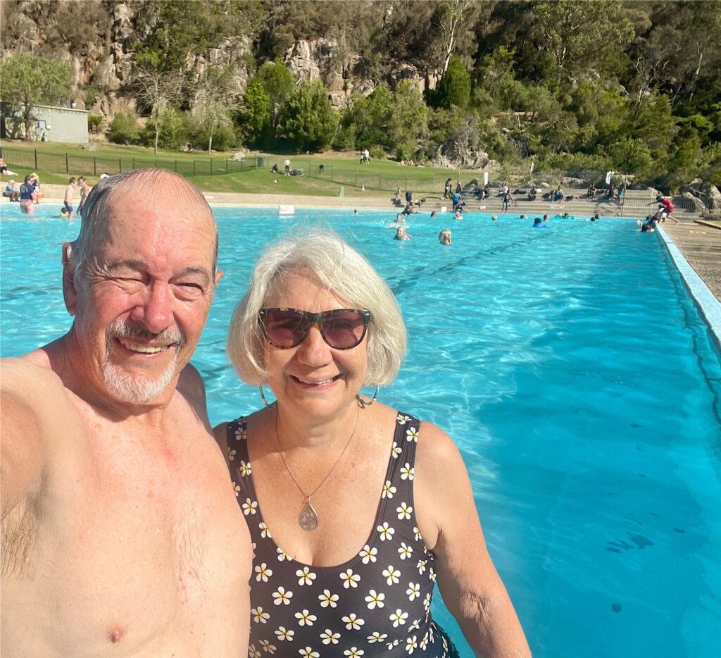
The walking track to Duck Reach power station.Crossing the river to the power station. Duck Reach power stationA well-deserved swim at the Gorge pool
Saturday night we camped at Old Mac’s Farm ($20) after spending the afternoon reminiscing as we wandered the Lonnie CBD.
Sunday night was at Honeysuckle Banks free camp near Evandale where preparations were in full swing for next weekend’s penny farthing races.
It wouldn’t be the first time Steve has ridden a penny farthing.
Our backpacks were emptied and repacked and weighed several times before we were finally satisfied. But generally we (particularly me) just tried to keep the nerves in check. Sunday night we camped in the carpark of the Red Feather Inn at Hadspen, the meeting point for the hike. This 6-day, 64+km hike in the Tasmanian Highlands is going to be a challenge.
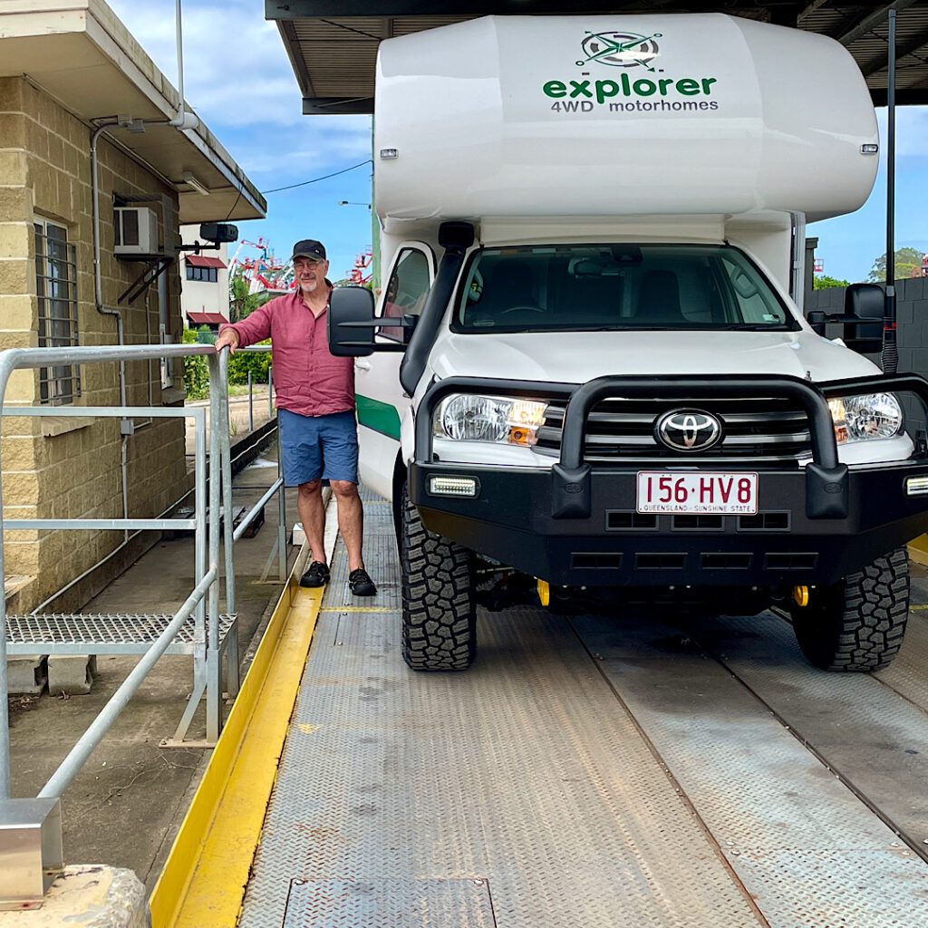
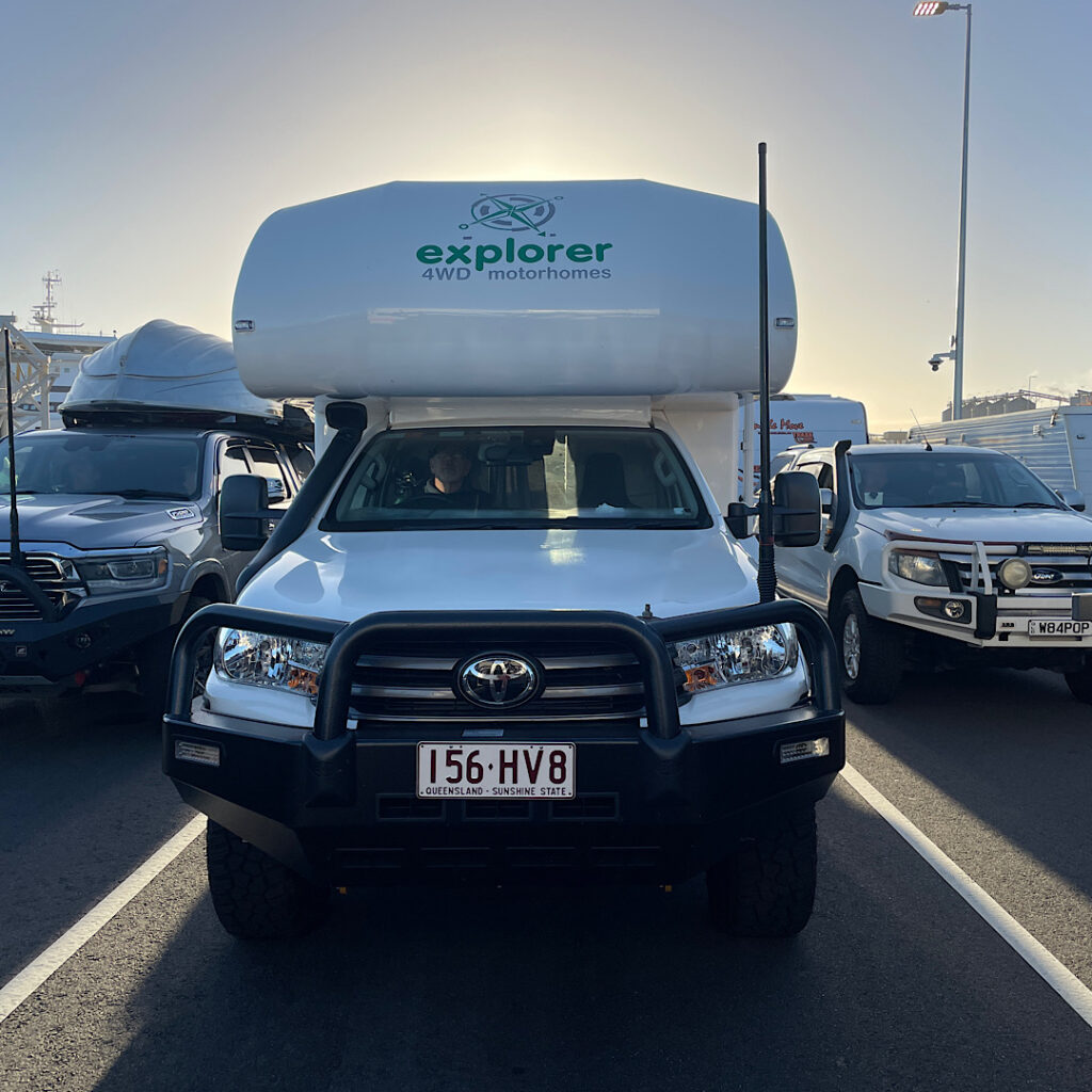
We sold Priscilla, our 4×4 Mercedes Sprinter at the end of 2022 and ordered Harvey another 4×4, this time an Explorer motorhome built on a Toyota Hilux base, taking delivery in August 2023. This is to be our first ‘big’ trip since 2022 -we’ve missed that wonderful feeling of freedom that a long trip with not much planned gives us.
13th January – 1st February 2024
Weighing Harvey fully loaded as we leave for Tasmania.
Our first stop was the public weigh-bridge at Caboolture. Our total weight came in with a bit to spare – that was a big relief! Tasmania, here we come.
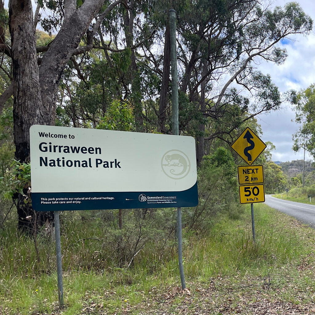
Night 1 was spent with our friends Bryan and Trish in Boonah. Next morning we all breakfasted at our ‘regular’ in Boonah before we farewelled Bryan and Trish, then dropped in on my aunt in Warwick. About 2.30pm we arrived at Girraween National Park.
On went the packs and the boots for the hike to Castle Rock. The huge granite rocks of this area are amazing.
Trail to Castle Rock. Huge granite rocks everywhere.
Monday 15th Jan
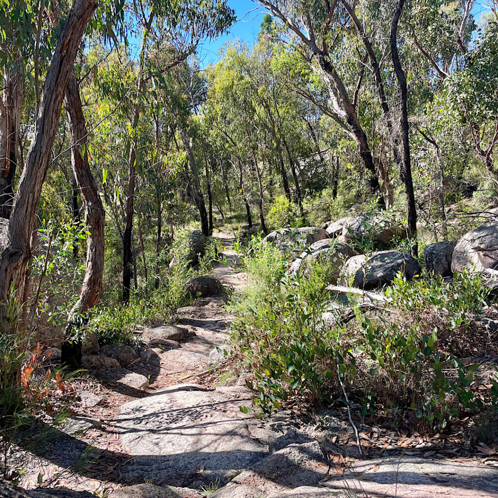
We’re heading off today but not before doing another bush walk. We went the opposite direction to yesterday’s hike following Bald Rock Creek to its junction with Ramsay Creek where their waters will flow on to eventually join the Murray Darling system.
Pretty waterfall cascading over the granite slabs.
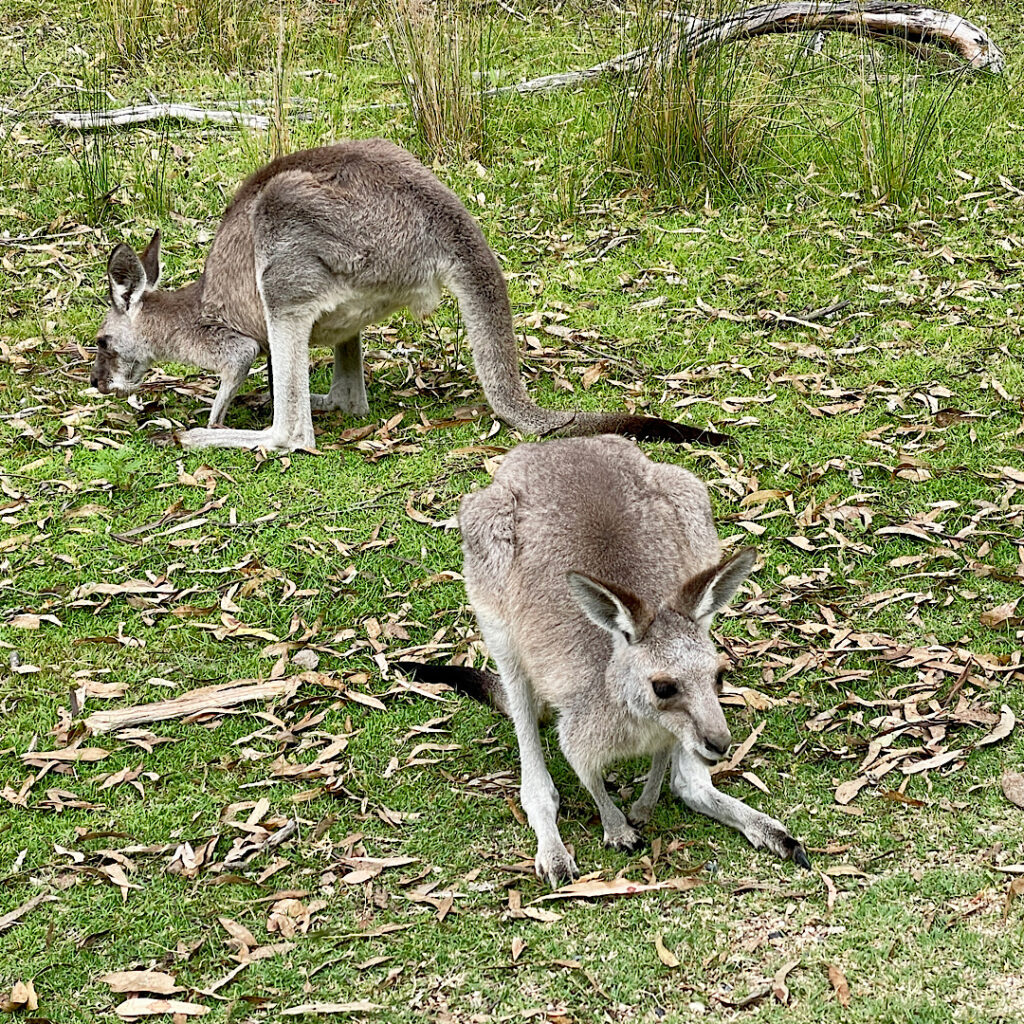
It was easy, flat walking with lots of delightful little waterfalls and beautiful spots to stop for a dip in the crystal clear waters. Lazy goannas soaking up the sunshine, little lizards scurrying away on their back legs with head raised, several red-necked wallabies and some Eastern Greys and countless birds and flowers made for an enjoyable hike. About 6km round trip.
Eastern Grey Kangaroos
Leaving Queensland a productive morning was spent solving the world’s problems in Tenterfield with our friends and previous travel companions Pammy and Milton before continuing the journey to camp in the rain at Mother of Ducks Lagoon outside Guyra, with about 20 caravans!
Tuesday 16th Jan
Still drizzling and cold this morning we were happy to get back on the road early heading straight to Tamworth to our favourite cafe, Rubys, for brunch. Once off the New England Tableland the temperatures once again rose to the low 30s despite the cloud cover and we had an easy drive to The Black Stump Rest Area for a peaceful night as its only residents.
On Wednesday when we stopped at Molong for lunch the rain started and got heavier and heavier, particularly during the 15 minutes Steve had to stand outside filling the water tank. On the rain radar it showed a break coming up so we continued on to Bendick Murrell Rest Area south of Cowra for the night – another peaceful night on our own.
Thursday 18th Jan
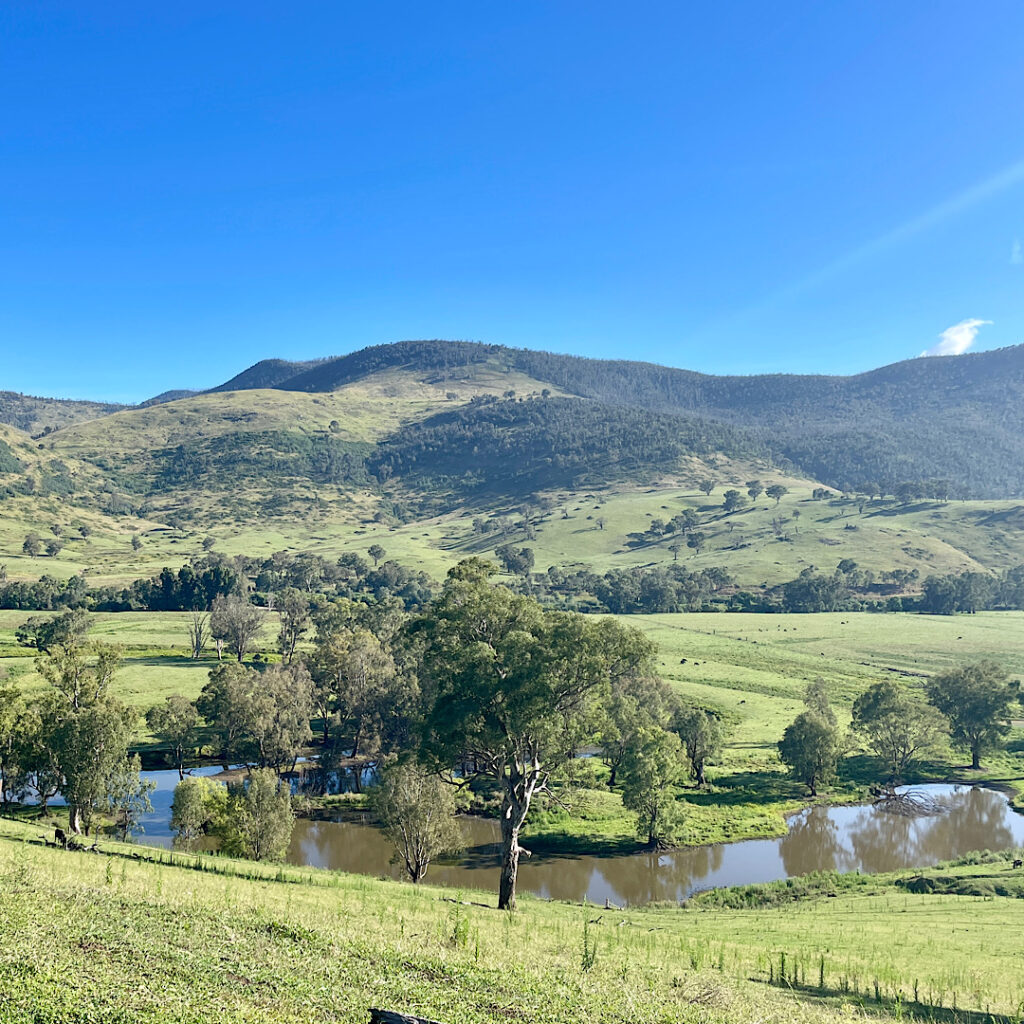
The rain cleared this morning to a beautiful day. The drive through Young for a coffee at the cafe, Tarcutta for brunch and Holbrook before arriving at Gadds Bend for the night is one of the prettiest drives we’ve done. The rolling hills, getting higher the further south we travelled were all a deep emerald green, while the black Angus cattle and the white sheep contrasted so beautifully against the background.
Perfect reflections in the Murray River as seen from Mt Alfred.
Gadds Bend, on the Murray River just over the border into Victoria, must be one the the best free camps we’ve stayed in. We first stayed here in 2017 and it hasn’t changed at all. It’s a very big, grassed area along about 200 meters of the river which is lined with big River Red Gums reflecting perfectly in the swiftly flowing waters. Another perfect, peaceful night.
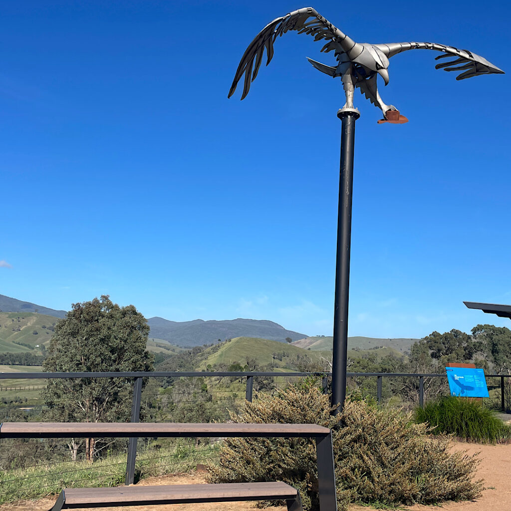
At the picnic area, Mt Alfred. Note the object in the wedge-tailed eagle’s claw.
Friday 19th Jan
Today we head to Kosciuszko National Park for some walking. Wow that road up the mountain sure is steep and winding. As the passenger I had wonderful views of the mountains, gullies and trees. It was interesting watching as the flora changed from thick rainforest-type vegetation to alpine vegetation as we drove higher. The line markings on the road changed from white to yellow and tall guide posts with reflectors at the top signaled the beginning of the snow line – as well as pull-over bays for drivers to fit chains to their tyres. No snow today, but the temperature was dropping.
First stop the Information Centre at Jindabyne where we recall an excellent cafe from our previous visit. We also bought a 2-day Park Pass for $34 then headed out to Sawpit Creek to do the 6+km walk to the waterfall. A pleasant walk with a stunning waterfall.
Sawpit Creek Waterfall
Then off to Island Bend campground – our favourite from our last visit 7 years ago. Surprise, surprise it’s changed! Back then we had a lovely camp on the grass right beside the river, and we were the only ones there. Now they have campsites starting from right up on the main road all the way down the hill, and they were nearly all full (OK it is Friday night during the school holidays). To get to our previous camp it’s noted to be 4-wheel-drive only. We walked it – very big holes and washouts! And the grass camping is only for tents. We did find a spot up the hill a bit and had a good night, but it was very disappointing.
Saturday 20th Jan
Tell me again why we’re both smiling!
Today we walked the Main Range Circuit track to Mt Kosciuszko and the Summit Track to complete the circuit- 23km! It really is a stunning walk through alpine country. It starts at Charlotte Pass and immediately heads downhill fairly steeply for about a kilometre to the Snowy River which, due to recent rains, is flowing swiftly and is relatively wide. This has to be crossed on stones of various sizes and width and stability. With our big packs weighing more than 10kg I found it a very daunting crossing, which I’m grateful to say I crossed without incident. From there the track just went up, and up and up.
Yes Steve that is our path. Keep going. Mt Kosciuszko in the too far distance to see just yet!Steve on the Main Range hike to Mt Kosciuszko.Lunch break overlooking Lake Alpina. Main Range hike to Mt Kosciuszko.
It took about 4.5 hours to finally reach the summit of Mt Kosciuszko, Australia’s highest mountain. The Main Range section is stunningly beautiful. The surrounding ranges fade off into the distance as we walked along mountain-sides overlooking pristine crater lakes.
The downside was the track construction. Some of the Main Range track was natural surface, excellent to walk on, large sections were granite paving stones of different sizes and surfaces which was not only very hard underfoot but dangerous to not be watching every footfall for fear of tripping. There was one section about 3km long of raised steel boardwalk – bliss. The Summit Track, to complete the circuit back to Charlotte Pass, was predominantly large stony gravel, very difficult to walk on.
On the top of Australia
Finishing the walk about 6pm, both exhausted, we decided not to go back to Island Bend but stayed at a picnic area beside Sawpit Creek. An early night tonight.
Sunday, Monday, Tuesday 21st – 23rd Jan
After a slow start to Sunday the drive to Corryong where we camped at the recreation grounds alongside the golf course, was short.
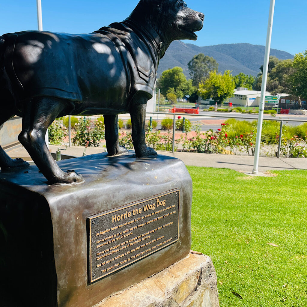
Horrie the Wog Dog was befriended in the Middle East during WWII where he reputably had extraordinary hearing, alerting the troops to enemy aircraft. He was smuggled back into Australia and lived out his remaining years in Corryong. Note he’s wearing his Corporals uniform.
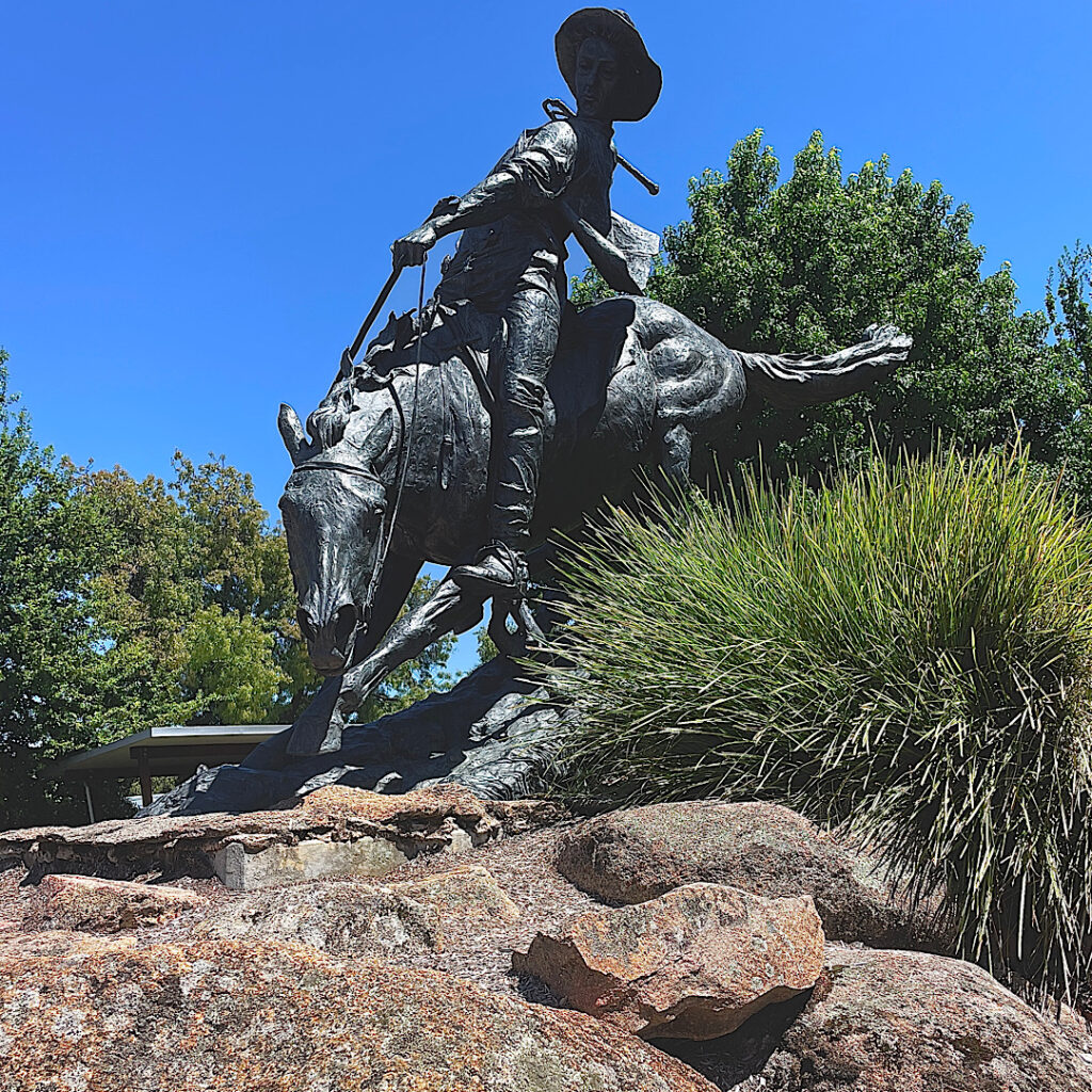
Monday, with a little more energy, we walked around town where the “tourist drawcard” is the local lad Jack Riley who is thought to be the drover referred to in the Banjo Paterson poem The Man From Snowy River. The 6km walk included summiting Playse Lookout.
The Man from Snowy River
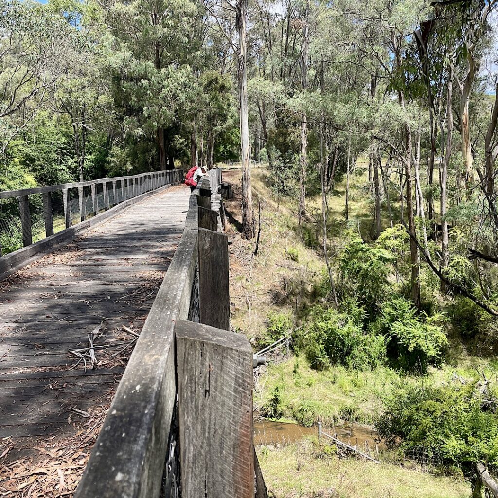
Next morning, on the way to Tallangatta, we popped in to see the 77m double storied ‘trestle bridge’ over Boggy Creek, a part of the old railway line which had carried supplies for the Snowy Mountain Scheme since 1887, closing down in 1978. Discovering this was part of the Victorian High Country Rail Trail we decided to walk 10km of it. Sleep wasn’t a problem tonight – we’re both exhausted!
Steve on the trestle bridge.
Wednesday, Thursday 24th – 25th
Before leaving Tallangatta, a drive to the lookout above gave us a magnificent view of this pretty little town nestled along the Hume Dam. It’s known as ‘the town that moved’ – in 1956 all timber homes were moved 8km west, while the brick homes, churches, etc were flooded when Lake Hume was dammed.
A beautifully scenic drive through the Kinglake Valley to Tolmie was rewarded with cool temperatures at last, though rain was threatened. The Tolmie Recreation ground surrounded by tall eucalypts made a quiet, restful camp for two nights. It rained all day Thursday and into the night.
Friday, Saturday, Sunday 26 – 28th
Australia Day, we followed the unsealed Murrindindi Road through State Forest tall trees looking for a good hike to do that wasn’t busy with long-weekend campers. Myrtle Gully Trail was the chosen one though it turned out to be in disrepair with many fallen trees across the track. Still it was just the hike we needed – 11km through the most glorious tall tree forest (lots of Myrtles and Soft Fern Trees), and what better activity to do on Australia Day than being out enjoying the beautiful Aussie bush.
Walking amongst the majestic Tree FernsI’m pleased we weren’t on the track when this came down!
Onward to Toolangi Recreation Reserve for two nights.
Leaving Toolangi and the beautiful tall tree forests behind we descended into bushland, then cattle country then vineyards as far as the eye could see. Lunch was at Lilydale – thought it was a village but it may as well be a suburb of Melbourne. We skirted around Melbourne to stay the night at the Lang Lang Showgrounds. Grassy, quiet, lots of birds – that’s about it.
Monday, Tuesday 29 – 30th, Wednesday 31st
Long lunches, cocktails, a walk, and lots of chatter made for a very pleasant and relaxing time with Maree and Carl in Balnarring, Mornington Peninsula.
Thursday 1st February
The drive down the western side of Mornington Peninsula to Sorrento reminded us what a pretty area this is with so many things to do and places to explore. From Sorrento the car ferry took us to Queenscliff then it was a short drive on to Corio Bay in Geelong, the departure point for the Spirit of Tasmania. A drive down to see where we’d have to come first thing tomorrow morning to board the Spirit proved to be a good move! This evening’s Spirit was in dock getting ready to sail, so we stayed to watch it go, then spoke with some other RVers who told us they were staying (camping) in the queue overnight, all ready to go tomorrow morning. So, that’s what we did too! No stress for us tomorrow morning.
6.30am, just woke up and ready to board the Spirit of Tasmania
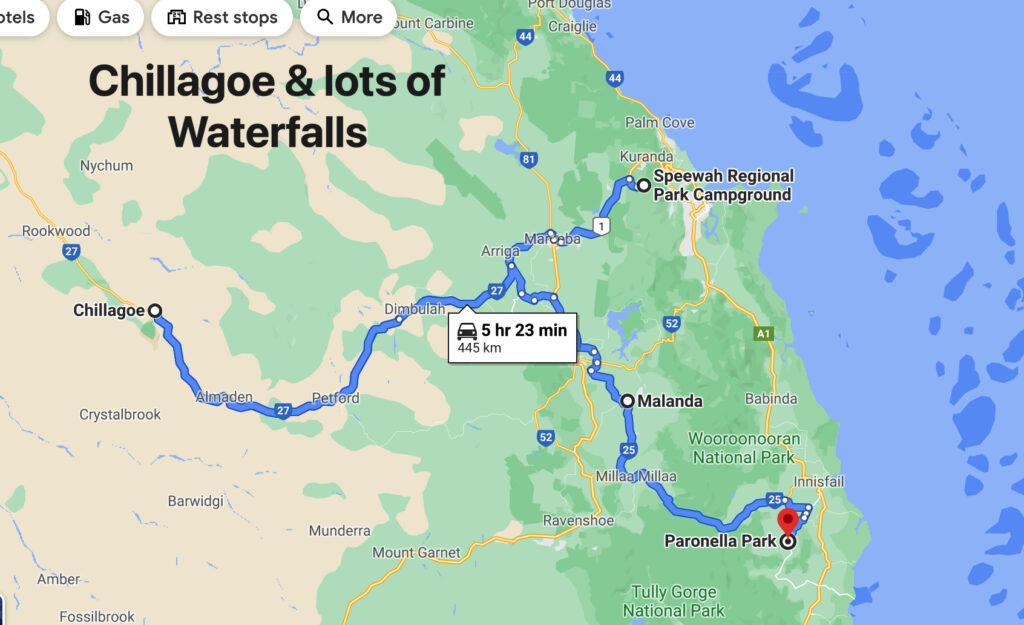
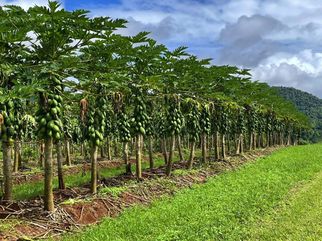
Originally we’d planned to visit Chillagoe when we left Karumba via the Burketown Development road but it was closed due to flooding, hence the zigzagging across the Tablelands. Surprisingly, as we left the Tableland, we passed through rich agricultural lands with avocado, mango, banana, citrus, grapes and sugarcane, and other crops we didn’t recognise, stretching for many kilometres. Before long though we were back in cattle country.
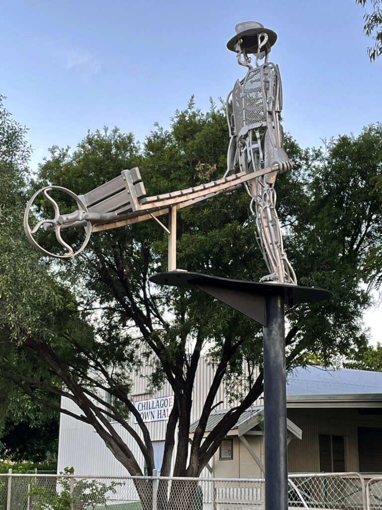
Pawpaws – or red papayas. Absolutely delicious eating. Outside BabindaThe Wheelbarrow Way, one of many tourist trails that highlight our history. Chillagoe
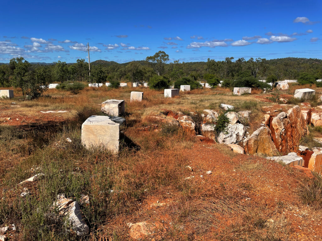
Chillagoe has a population of a bit more than 200. It struck us as a tough little town, its residents having weathered many ups and downs as most mining towns have. Over the years huge deposits of silver, lead, zinc, gold, limestone and marble have been mined here. The lime stone and marble mines are still working, with a few small silver, lead and zinc operations continuing. Chillagoe lime has the sugarcane industry more or less cornered but unfortunately, while beautiful marble is mined here, most of it is sent overseas for treatment. Most of the marble in Parliament House came from Chillagoe.
Marble blocks awaiting orders before shipping to their destination.
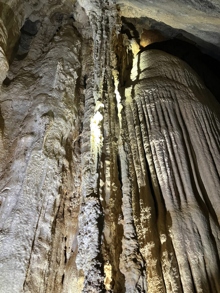
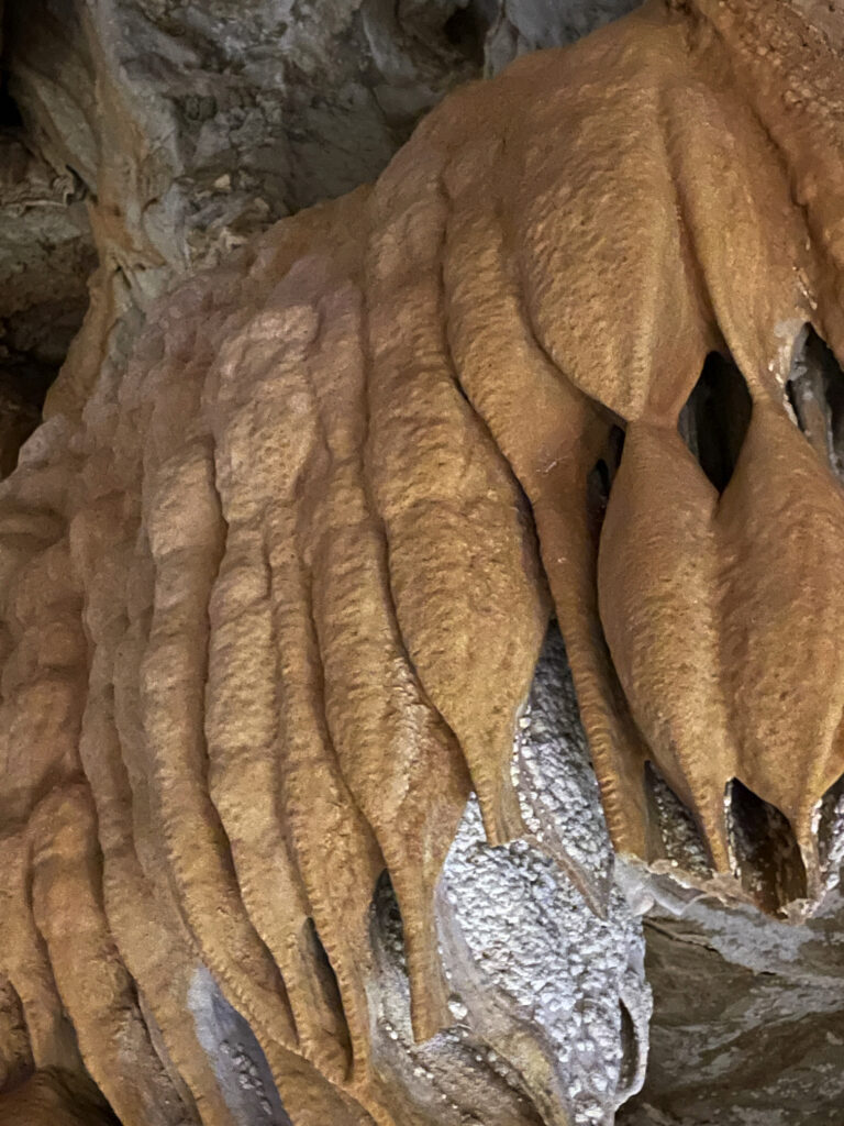
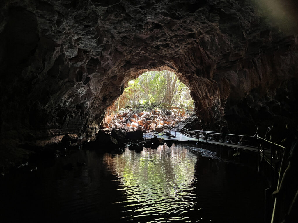
But we’re here for the caves. Back around 400 million years ago the limestone laid down under shallow oceans was lifted, towering above the surrounding countryside where weathering and erosion and fluctuating groundwater levels slowly dissolved some of the limestone, creating caverns and passages, now rich with stalactites, stalagmites and flowstones. We visited three caves today with the ranger – Donna, Trezkinn and Royal Arch. All were outstanding, as was the infrastructure allowing us to view them without causing damage.
Chillagoe CavesChillagoe Caves
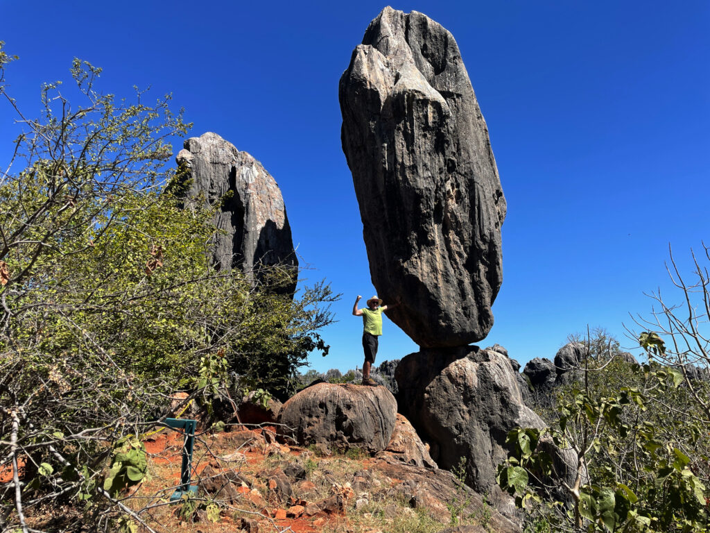
Between cave tours we walked out to the Balancing Rock. I’ve seen many Balancing Rocks, but this is a pretty good one, and the bush walk, after yesterday’s marathon effort, was good to keep the muscles moving.
‘Saving’ the balancing rock – Chillagoe
Dinner at the Cockatoo Pub tonight, behind which we’re camped for 2 nights.
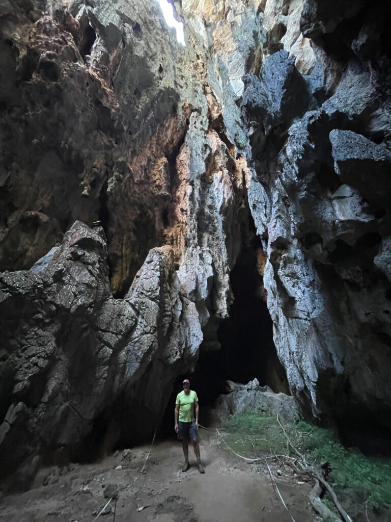
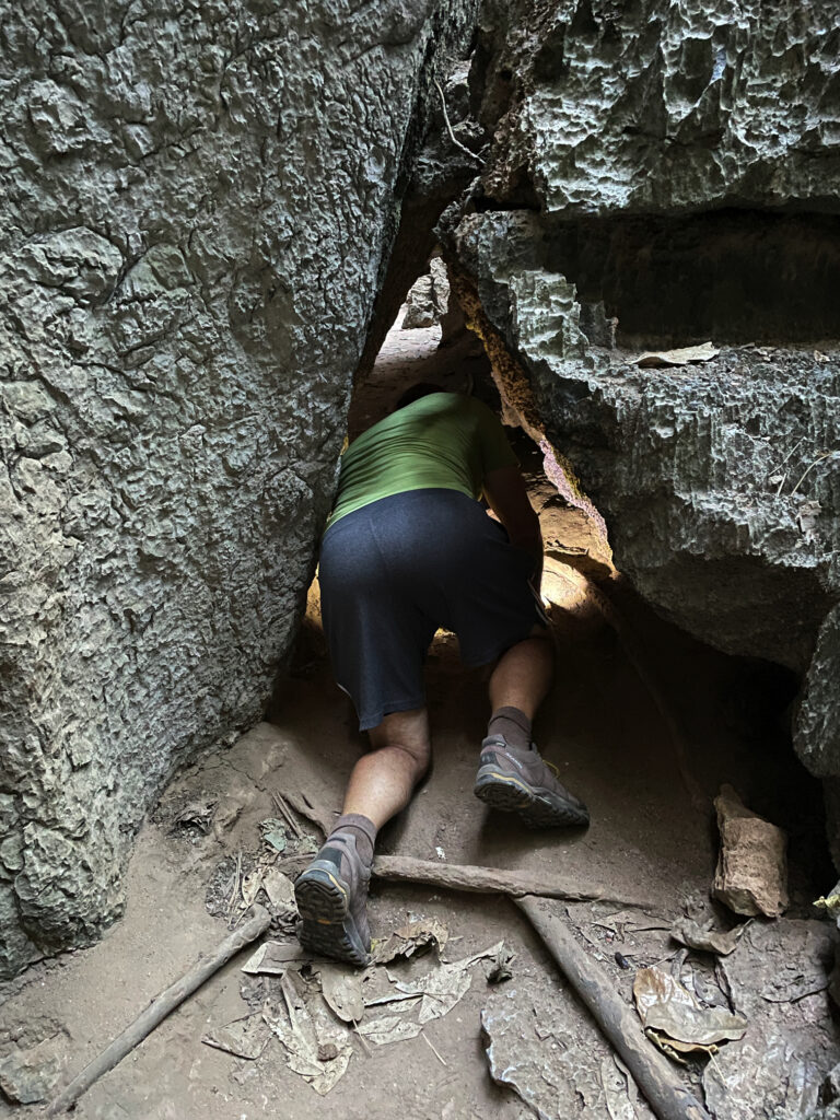
Before leaving Chillagoe this morning we drove out to the Archway caves, which are self-guided.
The approach to the very sinister-looking Royal Arch caves.
Other than the extraordinary, gothic-like appearance of the limestone karsts in which the caves form, we weren’t impressed with this section, nor game enough to go crawling into little spaces by ourselves with just a head torch.
Exploring the caves at Chillagoe
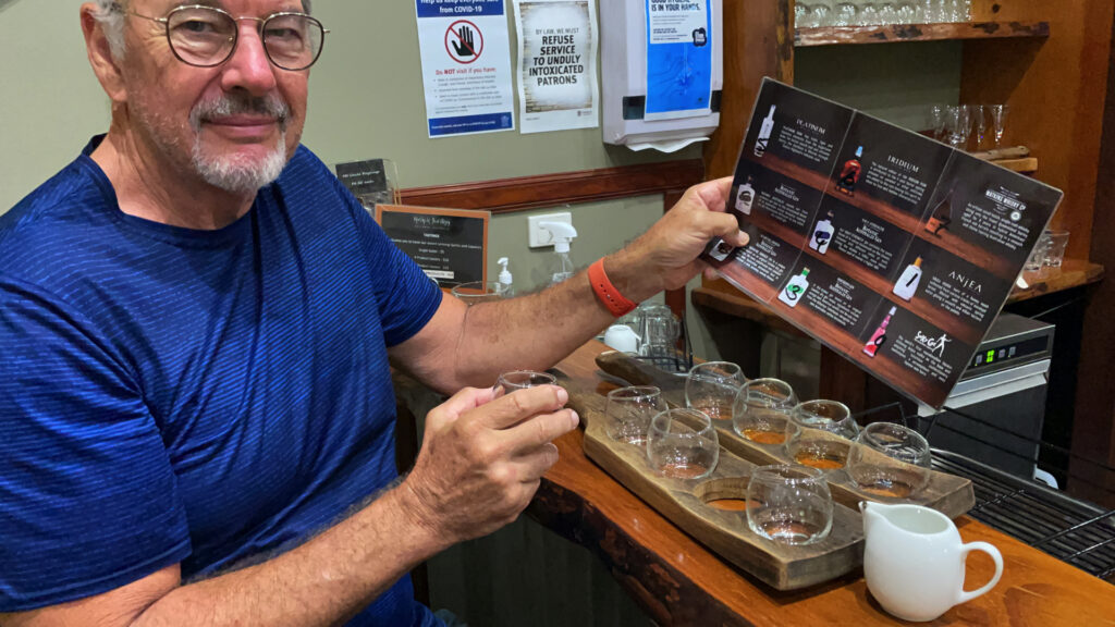
Back through the savanna and the rich agricultural farms and orchards to the Tableland. On the way we dropped in to the Mount Uncle Distillery. A tasting board of spirits was set before us – a pleasant time was spent tasting them all, buying a couple of bottles, and then wandering their beautiful grounds, lush with tropical plants and vegetable gardens and lots of peacocks!
A delightful time taste-testing at Mt Uncle Distillery.
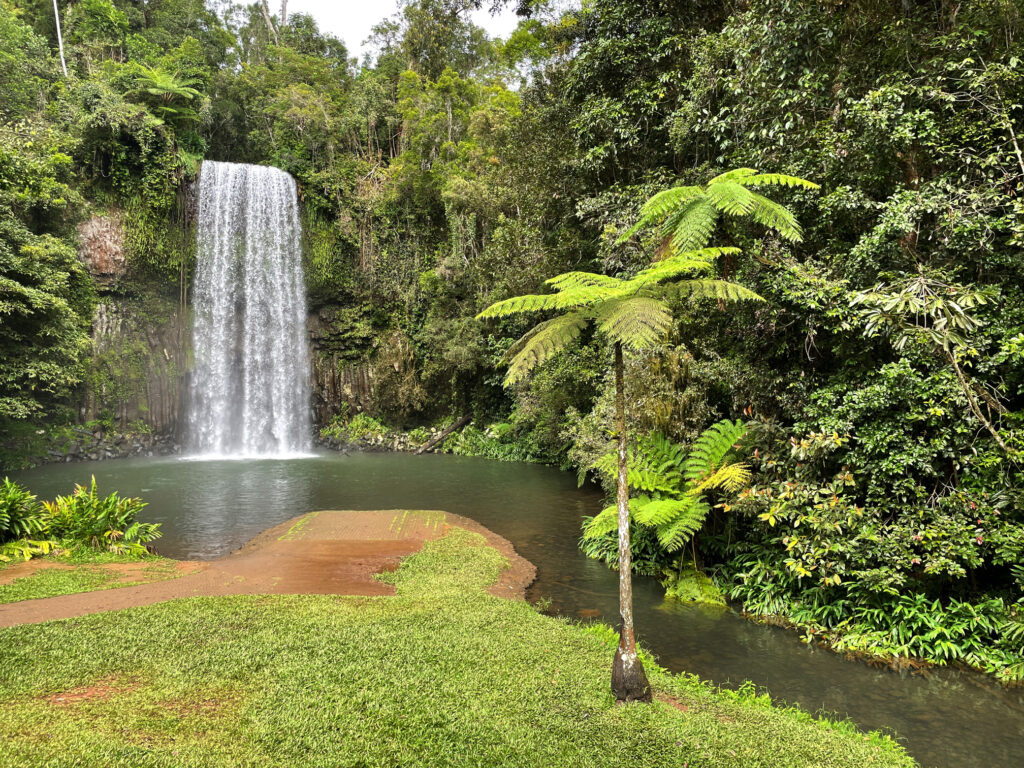
By the time we’d done that and made ourselves a cuppa we were sober enough to continue our journey to Malanda where we booked in to the caravan park. The Malanda Falls are beside the CP, but we weren’t that impressed, looking more like a weir than anything. A quiet night, other than for the curlews which seem to be at every campsite!
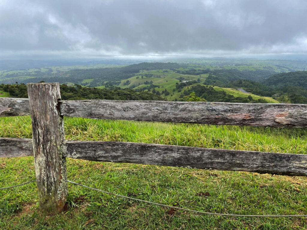
Still chasing waterfalls today we’re following the Waterfall Way to the southern Tablelands. First stop was Millaa Millaa Lookout, which promised amazing views out to Mt Bartle Frere and Bellenden Ker. However, this section is known as the “misty mountains’, hence no mountains seen, but the rolling countryside and magnificent valleys filled with rainforest was absolutely beautiful.
The view from Millaa Millaa Lookout. On a clear day you can see Mt Bartle Frere and Bellenden Ker – not today. But beautiful nevertheless.
Next stop, Millaa Millaa Falls, the most-photographed falls in Australia. They are “perfect” falls, coming out of thick rainforest in one reasonably wide band of water and falling to a large pool below. Despite the cooler weather I had a swim here, swimming over to and behind the falls. A wonderful experience.
The very beautiful Millaa Millaa Falls.
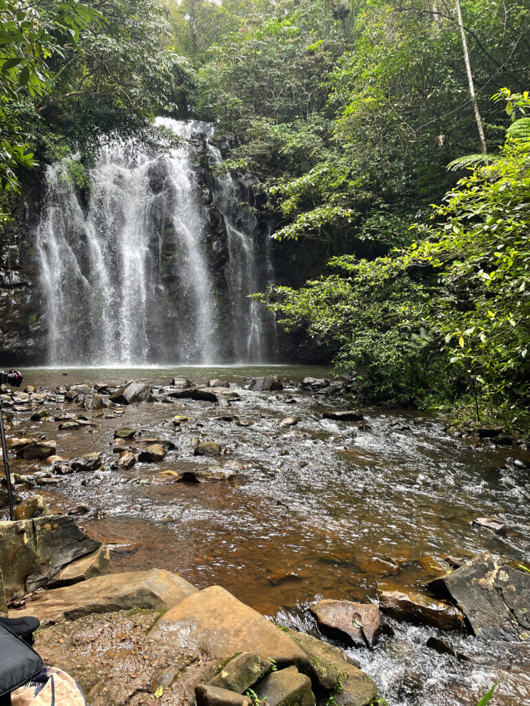
Next stop, Zillie Falls then on to Elinjaa Falls where there’s a steep path of about 500m to get to the base. It’s possible to swim here too.
Elinjaa Falls
By now it was lunchtime and the cafe at the biodynamic dairy at Mungalli was calling to us. A very filling cheese platter, followed by the best ice cream I’ve ever had (Espresso flavour) replenished our energy levels. The countryside is so pretty – hills, gullies, rainforest and the lushest grass you can imagine. It’s no wonder the dairy cows give such beautiful milk.
The most delicious lunch at the Mungalli Biodynamic dairy farm.
Continuing our meandering drive through the tiny town of Mungalli, which also has a waterfall, though more like steep rapids, we descended and descended until reaching Henrietta Campsite in Wooroonooran National Park. We’ve stayed at lots of National Parks over the years – they’re a credit to our country. This one has a large open area to kick a ball, an electric BBQ, covered tables, toilets and a shower (cold). The campsites are all nestled into the rainforest all around and beside Henrietta Creek. Most have bush walks or other activities. Here we decide to do the walk to Nandroya Falls, a return walk of about 7km. A couple of rock-hopping water crossings and a narrow path ascending and descending alongside the river gave us a bit of a workout. First we came to Silver Falls and finally Nandroya. These are a favourite of Steve’s as they fall spectacularly from a narrow gap in the sheer cliff face to the pool below, then from that they tumble down again over a wide cliff to the next level.
Nandroya Falls – such interesting falls.The lovely Silver Falls, seen along the walk to Nandroya Falls.
Back at camp we took our chairs down the steep little path to sit by the river contemplating life, the universe and everything, and hoping to spot a platypus. Alas no platypus, but we did get up close and personal with a few too many leeches! A quiet night anticipated with just us and one caravan.
Relaxing at our campsite at Henrietta NP campground.
We leave ‘the West’ now for the Atherton Tableland, but not before a dip in the hot mineral waters of Innot Springs. The water leaves the ground here at around 75°C. At the park there are 6 pools each with a controlled temperature ranging from cool to so hot just a few minutes in it is long enough! We moved between two medium temperature pools having a lovely rejuvenating soak.
With wrinkly skin we left the pools to view Millstream Falls about 30km up the road. These falls are the widest single-drop falls in Australia, flowing over the end of a basalt lava flow. A walk from the car park winds down to a viewing platform where, due to the big wet season the area has experienced, the falls are spectacular.
Millstream Falls, Atherton Tablelands
We pass through Ravenshoe, the highest town on the Tableland to stay the night at a caravan park in Herberton. Herberton has a truly wonderful Historic Village where we spent several hours the next day. I’m not a great fan of these historic displays, but this one is not to be missed!
Herberton Historical Village. School room. Don’t know that I’d do particularly well on this test.
The countryside has changed so much within the space of a day’s drive. From the eucalypt woodland savanna we’re now in full tropical rainforests, lush rolling hills with grass so high the cattle are nearly hidden and the most beautiful tropical plants – and it’s a lot cooler. Lake Barrine is one of two crater lakes, on the Tableland, Lake Eacham being the other. These two lakes were formed around 10 – 17,000 years ago when the earth’s magma contacted the ground water creating steam which blew the top off forming a crater which subsequently filled with water. We’d planned to kayak around Barrine, but the weather is still a bit rainy at times and lovely and cool now, so instead we walked around them both, and may have had a coffee and something sticky to eat at the Tea House on Lake Barrine.
If it weren’t so windy we’d have kayaked around. Steve, on the walk around Lake Barrine.
We spent two nights at the Lakeside Caravan Park on Lake Tinnaroo and took the time to drive around visiting local attractions such as Nerada Tea Plantation, Gallo Dairy and Chocolate shop and the delightful town of Yungaburra.
Enjoying the perfect cuppa at the Nerada Tea plantation.
However being the beginning of a long weekend and Lake Tinnaroo being a favourite for the local water skiers, jet ski owners and just generally noisy boats, we were pleased to leave.
Our campsite on the banks of Lake Tinnaroo. Temporarily quiet, until tomorrow!
1st May: We descended to the coast via the Gillies Highway, a Highway famous for its 263 corners and 800m elevation change in just 19km. It was built in 1925 and I’m rather proud to say my grandfather was one of the surveyors for this road. The scenery was absolutely spectacular, unfortunately the lookouts were all on the ascending side of the road making it a bit dangerous for us to pull over to take our time enjoying it.
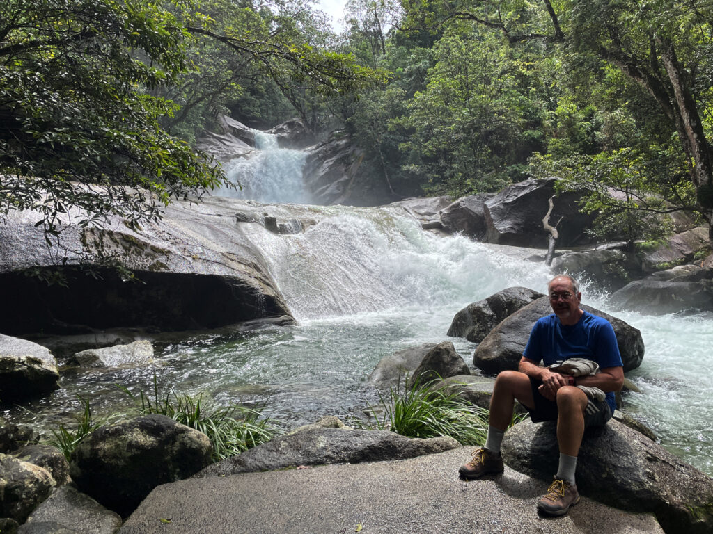
Babinda Boulders is our destination today, but first the highly rated Josephine Falls near Mt Bartle Frere. In ‘usual’ conditions these falls provide an ideal natural waterslide – way too much water at the moment though.
Enjoying the spectacular Josephine Falls
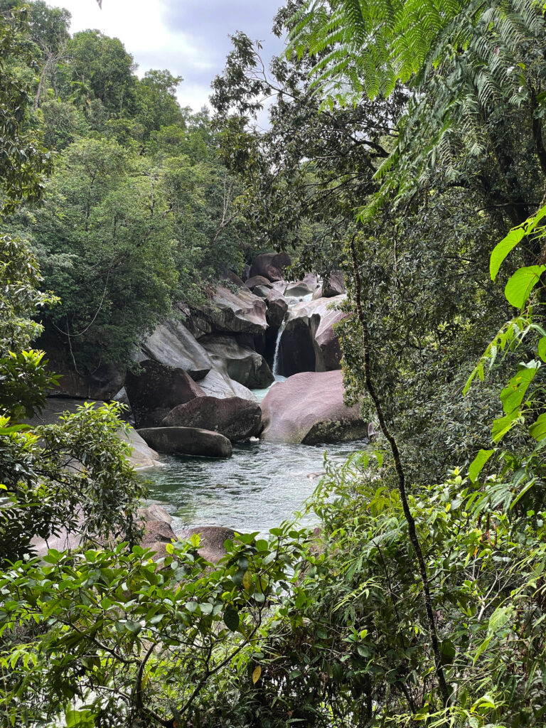
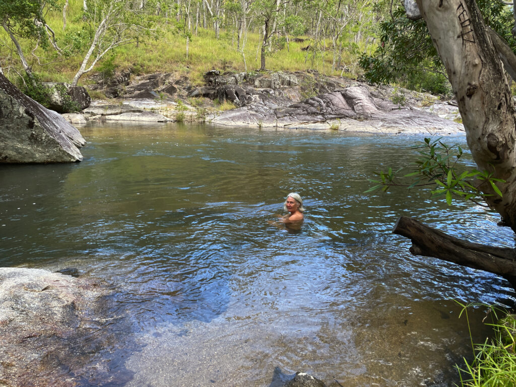
The Babinda Creek is a fast-flowing creek that winds its way through huge boulders forming large pools ideal for swimming. Still a bit overcast and cool for swimming but I did wade in and enjoy the refreshing waters here.
Very beautiful, but very dangerous for swimming, at Babinda Boulders
There’s a nice-looking free camp here, but we decide to go back to Babinda where there’s a large free camp beside the river. Most memorable about this campsite is the rooster that crowed the wake-up alarm right outside my window from 4.45am for at least half an hour. I dare say I’m not the only camper who had visions of roast chicken!
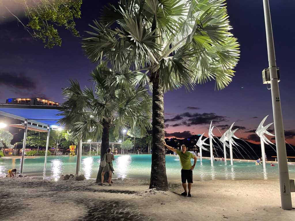
2nd – 4th May: We’re now having a holiday in the middle of our trip – three nights at the Doubletree Hilton in Cairns! The hotel is fabulous, particularly the beautiful atrium with a pond with barramundi that swim through lush tropical plants. We are both impressed with Cairns – the Council has done a marvellous job with tropical plants everywhere, an excellent walkway/cycle way the length of the foreshore with sculptures, parks, impressive playgrounds and exercise stations and a beautiful swimming lagoon.
The beautiful pool area on the Cairns Esplanade
On our last day we rode our bikes to the Botanic Gardens where the local and exotic tropical plants stunned us with their lushness and colours and variety. It’s such a large Gardens we’re pleased we rode our bikes, covering several kilometres within the gardens to visit all the areas.
The amazing plants at the Cairns Botanic Gardens
We also had dinner with Philippa and Andrew, new friends we first met at Boodjamulla, then again in Karumba. And when we weren’t doing all these activities we swam in the hotel pool and spa, lazed poolside reading, or had a few drinks at the outdoor bar and restaurant.
Enjoying sundowners at the cafe at Doubletree Hilton
5-7th May
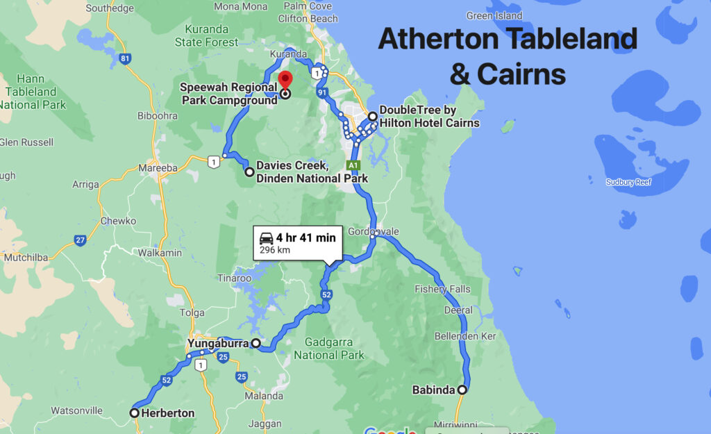
We return to Atherton Tableland this time via the Kuranda Highway. On previous visits we’ve come up to Kuranda on the cable car and the train – both highly recommended, but this is the first time we’ve driven. Not quite as spectacular, but still a fabulous drive.
Barron Falls – a spectacular waterfall near Kuranda
Kuranda … disappointing .. lots of shops closed and the feel was mass-produced tourist trinkets. After wandering around for a while, trying to give the place a chance, we drove out to Barron Falls Lookout. Wow those falls are amazing. A kilometre-long walkway took us to a couple of lookouts over the falls and down the range to the coast. Interestingly the river above the falls was dammed for hydroelectricity for a while in the early 20th century.
A view down the valley, taken on our Barron Falls walk
Moving on from here our campsite tonight turned out to be one of the best we’ve ever stayed in! Upper Davies Creek campsite in Dinden NP, site#2. We seemed to climb a long way on an unsealed road before reaching the campsite, but 4×4 only needed at the very end to get into the campsite. The next nearest camp was a long way away (and no one there anyway). The creek came down a small waterfall then over rapids before forming a large pool right beside where we were camped, leaving the pool via more rapids. It was stunningly beautiful.
I swear this has to be the best campsite ever. Upper Davies Creek
A thoughtful previous camper left wood beside the fire pit where we cooked our dinner. Swimming was chilly and did involve a lot of resolve to fully submerge. Unfortunately we’d only booked one night here, but we stayed until quite late in the afternoon making the most of it before leaving.
Enjoying a swim at Upper Davies Creek – our own private slice of heaven
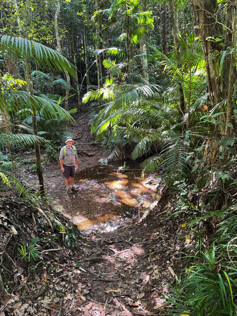
Speewah campsite in Barron Gorge NP was also lovely – only 3 campsites, each on a well-formed pad with large grassy areas and a patch of natural bush between each site. On our first full day we set off to do some walking. Phew … that was more than we’d bargained for. The walk was through thick rainforest which was magnificent and a treat to be immersed in.
Beautiful rainforest walking at Speewah NP
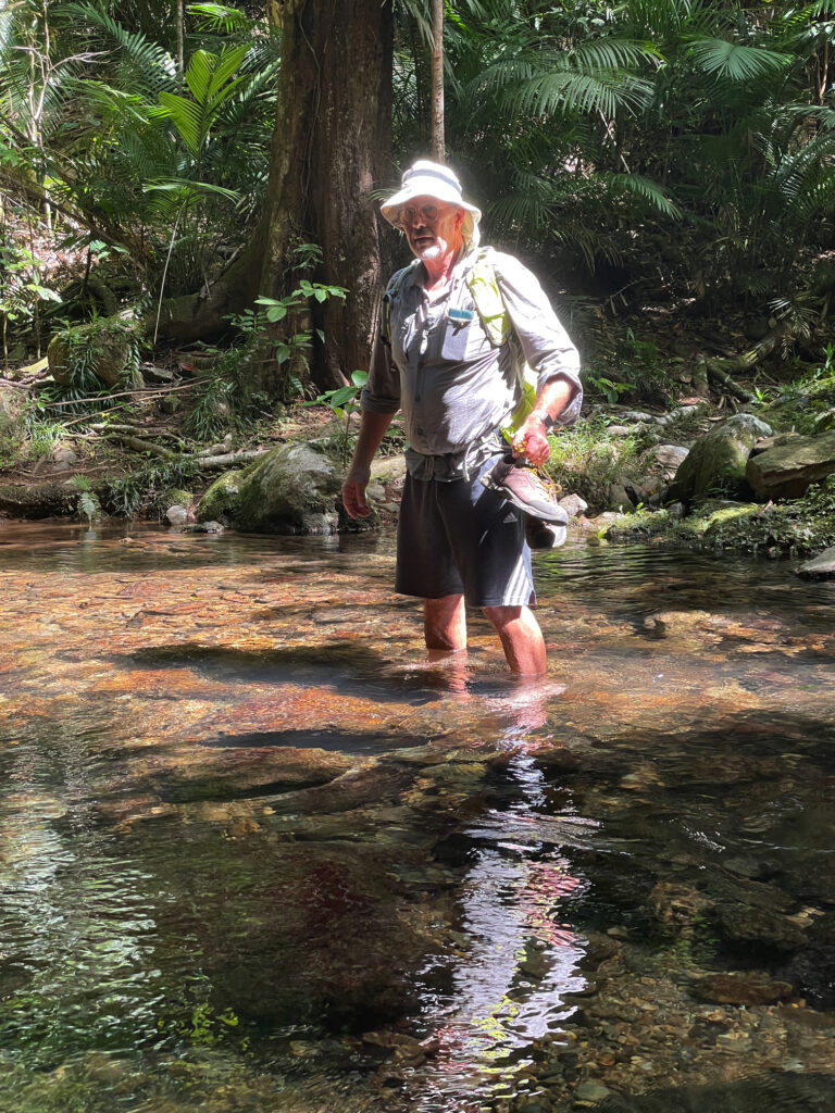
However it has rained a lot here recently and in quite a few places the track was in very poor repair, with many fallen trees and their multiple branches to scramble through. In one section a wide fire trail we were following was so badly washed out and eroded it’d be impossible to drive on it. There were 5 water crossings, two where we needed to wade through, rather than rock-hop over.
And yet another water crossing on the Speewah walk
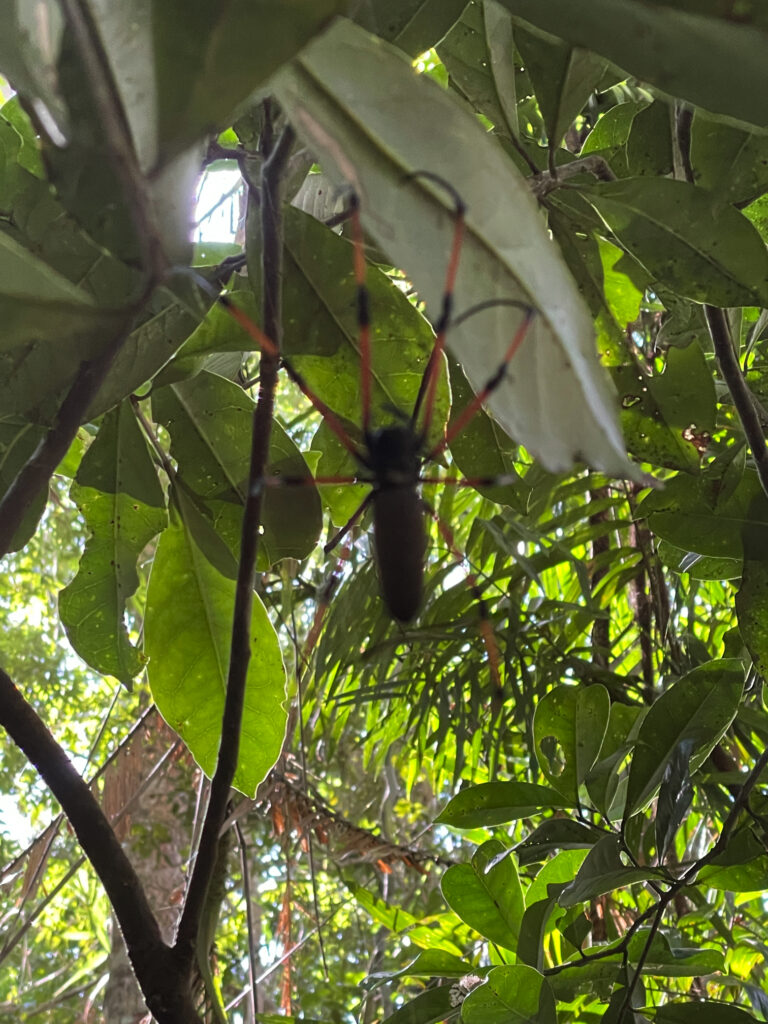
But of greatest difficulty were the many steep ascents and descents, not short ones either! Along the way Steve managed to pick up a few leeches and get caught in lawyer vine enough to draw blood, and I came face-to-face with many golden orb spiders whose massive sticky webs were built right across the track. These spiders from toe to toe would have been as big as my hand.
One of many giant Golden Orb spiders that formed their webs right across the track.
Our GPS told us we walked for 5.5 hours over 18km – I don’t know it was that far, but it was a tough walk however far it was. A chilly shower on return restored feeling to weary bodies!
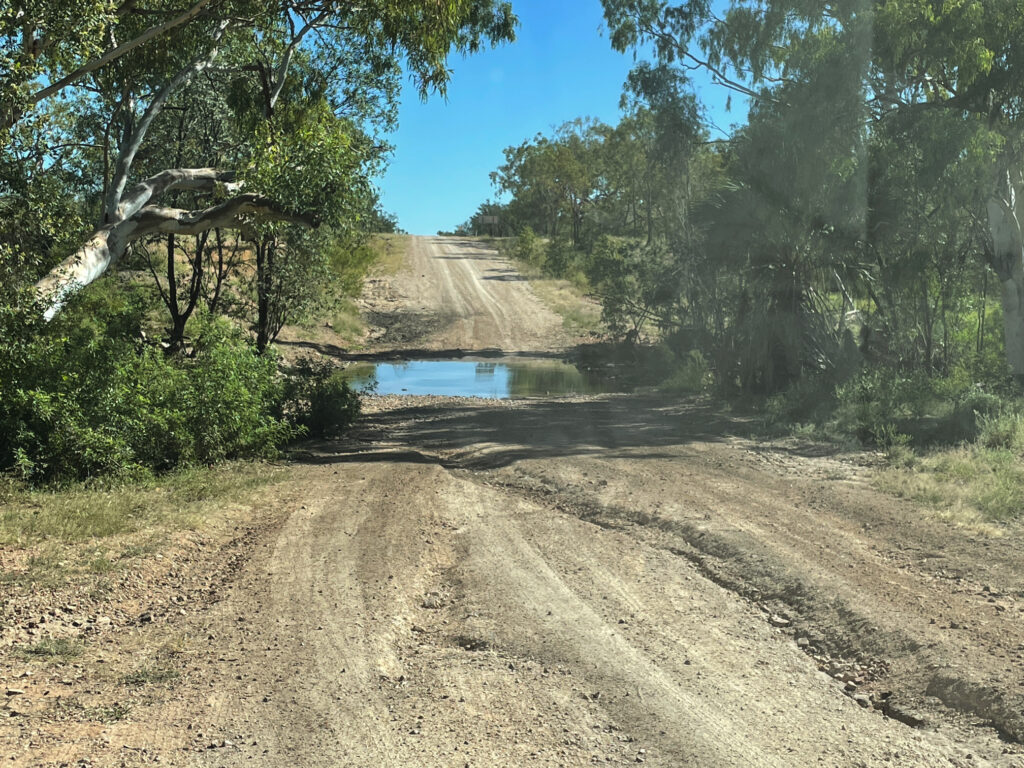
For many, many years people have raved to us about how wonderful Lawn Hill Gorge is (Boodjamulla National Park), and finally, finally we’re going to see it for ourselves. From Mt Isa we headed north on the Camooweal Rd, another really bad road, to Miyumba camp, the southern-most camp in the National Park. The road was rocky, and when not rocky, it was corrugations, plus a few water crossings thrown in for good measure. We drove ‘according to conditions’ and arrived intact.
Poor condition of road on the way north to Riversleigh
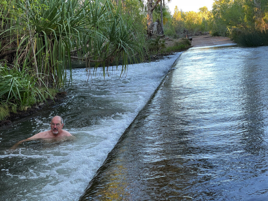
The final water crossing, just 100m short of our camp was over the Gregory River. It was flowing quite swiftly, about shin deep – no drama for Priscilla. Once camped (only ones there) we walked back to the river and had a lovely, cool, spa bath right there beside the road.
Having a ‘spa’ on the side of the road in the swiftly flowing Gregory River
The night was magic – no lights, no moon and millions of stars from horizon to horizon. These are the nights we especially love.
14th – 17th April Boodjamulla NP
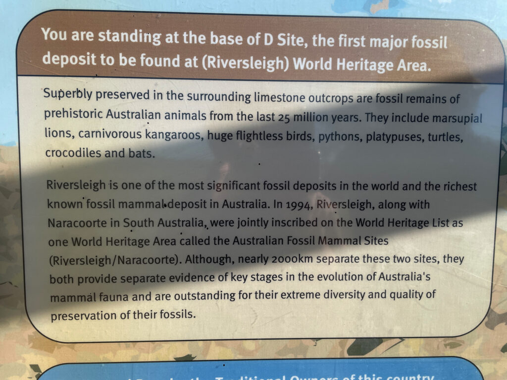
Riversleigh World Heritage Area
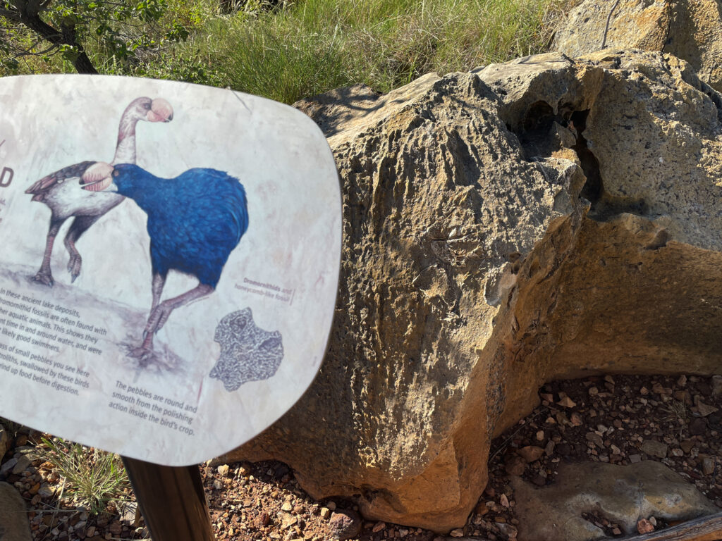
Next morning, continuing north, we stopped at the Riversleigh World Heritage site renown as a dinosaur fossil site. It’s very well presented and interesting with large fossils evident in the rocks along an 800m path.
The signage and displays at Riversleigh were very good.
The gorge part of Boodjamulla is 55km north. A large commercial campsite at Adels Grove, just outside the NP, provides accommodation for the on-road vehicles and caravans and those who didn’t book early enough to get into the NP. The National Park campsite is 10 km down the road at the Gorge. The road was improved significantly.
Over the next 4 days we did a twilight walk up to Duwadarri Lookout completing the circuit via Indarri Falls, a walk to the Cascades, then back to walk to the Upper Gorge. These walks were lovely in places, stunning in others and difficult in parts, but well worthwhile. Another day we took the kayak up the river, marvelling at the stunning cliffs through which we paddled.
At Indarri Falls we ‘portered’ the kayak along the path to bypass it, then continued right up to the Upper Gorge where we found a fabulous landing spot at rapids where we stopped for lunch, a swim and a massage under the rapids. We were lucky to have the place to ourselves for more than an hour. On our last day we kayaked up to Indarri Falls then spent quite a few hours there, swimming, getting massaged by the falls, chatting to other kayakers, relaxing and staying cool.
We both enjoyed Boodjamulla, and while a longer stay wasn’t necessary, I wouldn’t mind coming back another time. The only thing that spoilt our visit was the weather – it’s very hot, 35/36° for the first 3 days, cool breeze on the last.
19th – 22nd April
We saw the Gulf of Carpentaria from the west in our Arnhem Land trip in 2019 and now, heading to Karumba I’m planning to get my feet wet in the eastern Gulf. But first the drive from Boodjamulla was pleasant on good unsealed roads, just a few small washouts and corrugations as we traversed the grass lands stopping for a coffee and a highly-touted muffin at Murray’s Place in Gregory. From here we headed north (on sealed roads) to Burke for a look around town, sitting in a park having lunch at the same time the ABC News that night informed us it was the hottest town in Queensland! Back south again to stay the night at Leichhardt Falls.
Leichhardt R falls – free camp
Leichhardt Falls, on the Leichhardt River is not much more than a puddle during the dry season, but at the moment the water is roaring over the falls. A croc was spotted just down from the base of the falls – no swimming! Watching the road trains navigate the long, single-lane bridge that crossed the river gave me an even greater respect for those drivers.
Not a long drive today. The road to Karumba is unsealed, but mostly pretty good. At Camp 119 we viewed the blazed trees and read the story of Burke and Wills most northerly campsite. They tried to walk further on to the coast, but as it was the wet season (crazy!!) it was too swampy to reach.
The most northerly campsite of Burke and Wills in 1861
Another rest stop at Normanton proved interesting for not only the story of Krys, the largest crocodile ever, but also the Information Centre told the story of the beef industry here and the important role of the native stockmen.
Krys, the largest crocodile ever seen in Australia. This magnificent creature was dozing on a riverbank when a crocodile hunter shot it dead. So sad.
A cruise on into Karumba was easy driving before we found our campsite at Ronnies and settled in. First point of call was to buy prawns for our lunch.
Karumba prawns for lunch. Delicious
Karumba exists to service the commercial prawning trawlers, the commercial barramundi fishers, to a lesser extent the export of zinc from Century mine and, of course, tourism. The prawning industry started in the early 1960’s when a wealthy businessman managed to talk the CSIRO into jointly funding an exploration in the Gulf and the highly sought-after banana prawns were found in abundance.
The purpose of the Barramundi Discovery Centre is to maintain the stocks of barramundi by breeding them to fingerling size then releasing back into the wild. It was begun some years ago by the local commercial fishermen who saw the need to protect the barramundi from over-fishing. Smart move! The Centre was recommended to us by other travellers and I must say it is really interesting and not to be missed, though the tour at $50 each, was overpriced.
Karumba has been recognised for their efforts to maintain a sustainable seafood industry. Well done Karumba.
While here we did a sunset cruise (so so) and enjoyed meals at the End Of the Road restaurant one night and the Sunset Tavern another – seafood meals, of course, while sipping cocktails and watching magnificent sunsets.
Sunset over the Gulf of Carpentaria. Karumba
Road closure due to flooding changed our route of departure to the sealed section of the Savannah Way – traversing rich grasslands once more.
Darn! That was our intended route.
22nd – 23rd April
The highlight of a night at Gilbert River West (free camp, no facilities) was seeing the foaming waters of the river in flood, not far beneath the long one-lane bridge.
Viewing the flooding Gilbert River – not over the road, fortunately!
Next morning we moseyed on into Georgetown to stay at the CP, the power giving our batteries a boost. A walk around town left us with the impression of a small town with plenty of pride.
They’re pretty laid-back in Georgetown
24th – 25th April
On towards Cobbold Gorge over unsealed roads in pretty good condition with just a few shallow water crossings. On the way a cuppa stop at Forsayth and a wander around town found this town to be as impressive as Georgetown with its beautiful, restored buildings and well-tended parks.
I was very excited to get to Cobbold Gorge – the photos I’d seen of the gorge were stunning and it didn’t disappoint. The beauty of the narrow gorge (only about 2 meters wide in some places) was only discovered a few years ago by the current owners of Robin Hood Station, the cattle station it is in.
Cobbold Gorge
A LOT of private/public funding has gone into developing the tourist facility here which includes a large reception area with souvenirs, a small grocery stocking basics, a large open-air restaurant beside the pool which has a swim-up bar, a function hall as well as very well laid-out RV and camping areas.
Apart from the Gorge itself there’s a large dam with free kayaks, several bush walks and mountain bike trails (BYO bike) and some four-wheel drive tracks to points of interest and the gem fields (agate mostly).
On our first afternoon, after settling in, we did an 8km walk up to a lookout, then back for a swim and cocktail at the swim-up bar.
Chilling at the swim-up bar at Cobbold Gorge
The Gorge is several kilometres away from the resort and only accessible on tours in an effort to maintain its pristine condition. We did the boat tour next morning. The guide was particularly good sharing historical, geological and botanical knowledge with us. The boat, an open punt, has a silent electric motor.
The amazing narrow gorge of Cobbold Gorge
It was a stunning experience with the walls of the gorge towering up beside us, close enough in places to touch both sides at the same time, while we glided silently along. Back at the start we then walked up onto the huge sandstone rock that encloses the gorge, crossing over the gorge on a glass bridge.
On the glass bridge over Cobbold Gorge
That afternoon we’d signed up for the SUP tour. If this morning’s tour was stunning, the SUP induced awe. This morning’s boat held 14 people, plus the guide and while everyone was quiet, just soaking it all in, the guide, naturally talked a fair bit. With the SUP there were only 7 of us and we all headed off separately, so Steve and I were able to enjoy the gorge more or less alone. It was every bit as wonderful as I’d hoped – and I didn’t fall in!
Denise, just finishing the return trip of Cobbold Gorge on the SUP
26th – 27th April
Leaving Cobbold Gorge we did one of their 4-wheel drive trips up to the Quartz Blow – a hill of beautiful white quartz which gave us views across to the horizon all around.
Steve, contemplating geological wonders from atop the Quartz Blow, Cobbold Gorge
We’d asked around about the road through to Einasleigh and been rewarded with a shrug and “it’s OK”, so off we went, and it was “OK” – some bitumen, some corrugations, some washouts – OK. What we failed to ask about was the road from Einasleigh to the Gregory Developmental Rd! The Einasleigh River was over the causeway and flowing pretty fast.
The Einasleigh River in flood. And we need to cross it.
As all good 4x4ers who don’t want to walk a river crossing do, we parked to the side and made ourselves some lunch and a cuppa. Sure enough 3 vehicles came down and we watched them cross, noted where it was washed out, noted their track and safely followed on.
Kalkani Crater, a very typical cone-shaped hill with a perfectly round rim that drops away into the middle was a great little walk on our way to the Undara Experience, the resort set up at the Lava Tubes.
Undara Experience, the accommodation associated with the lava tubes, was moderately busy as a music festival had just finished yesterday. It’s quite a resort here with lots of units, and heaps of powered and unpowered camping, a large open air cafe / restaurant, pool … you get the idea.
“The lava tubes and caves were formed when rivers of lava confined to a valley crusted over and formed a roof. Insulated in its casing of solidified lava, the lava flow carried on for tens of kilometres before draining out, leaving an empty tube of lava. Weaker sections of the roof of the tubes later collapsed to form caves and depressions. More than 70 caves have been found in the park.” (Text from NP literature) The lava flowed more than 90km to the north and 160km to the north-west at a rate of 1,000m3 per second!
How the Undara Lava Tubes were formed.
Access to the caves is restricted to approved scientists, speleologists and guided tours. The area has received 3 times its usual annual rainfall in the last few months and the caves have been full of water, a rare event. We had the amazing experience of walking through the caves on the walkways with crystal clear, chilly water up to our shins.
Undara lava tube.
There are several bush walks starting from the camping ground, the longest being the Rosella Trail at about 14km. This trail took us to several lookouts from which we could trace the track of collapsed tubes by the bright green vegetation that grows in the protected stream bed.