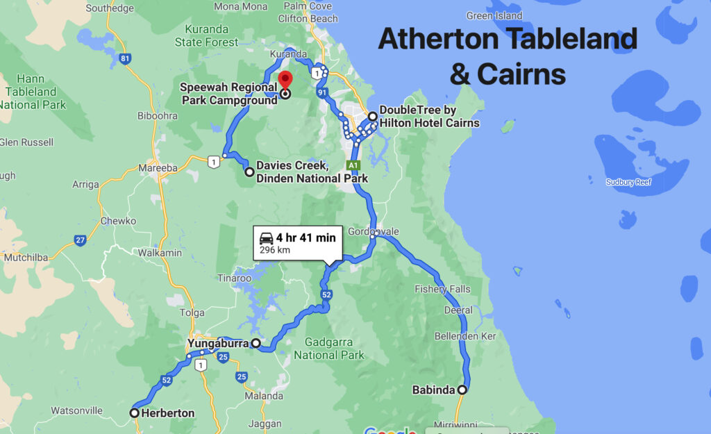
Chillagoe and lots of Waterfalls

8th-12th May

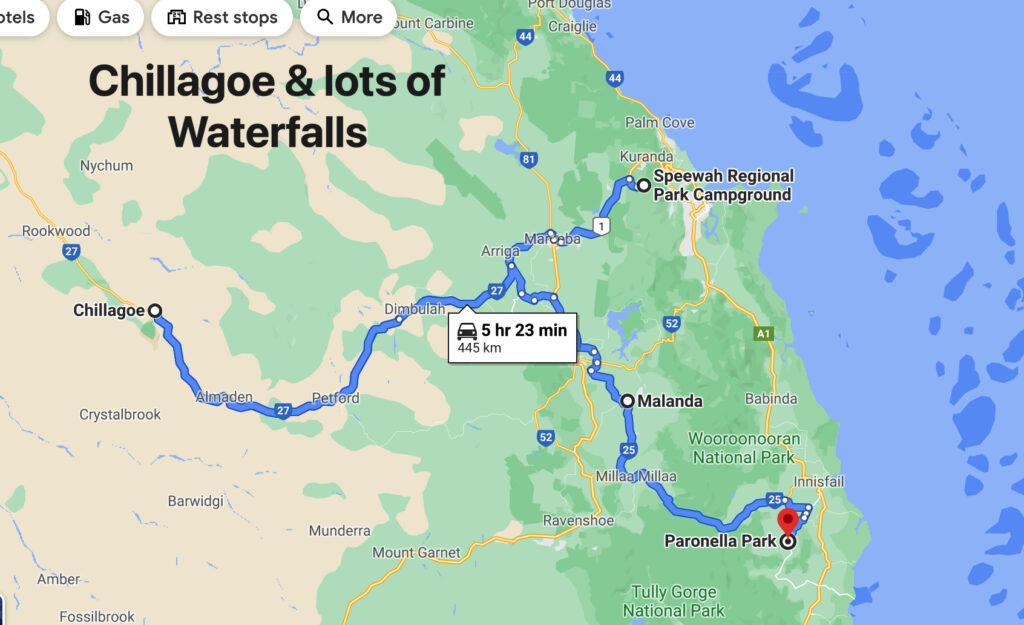
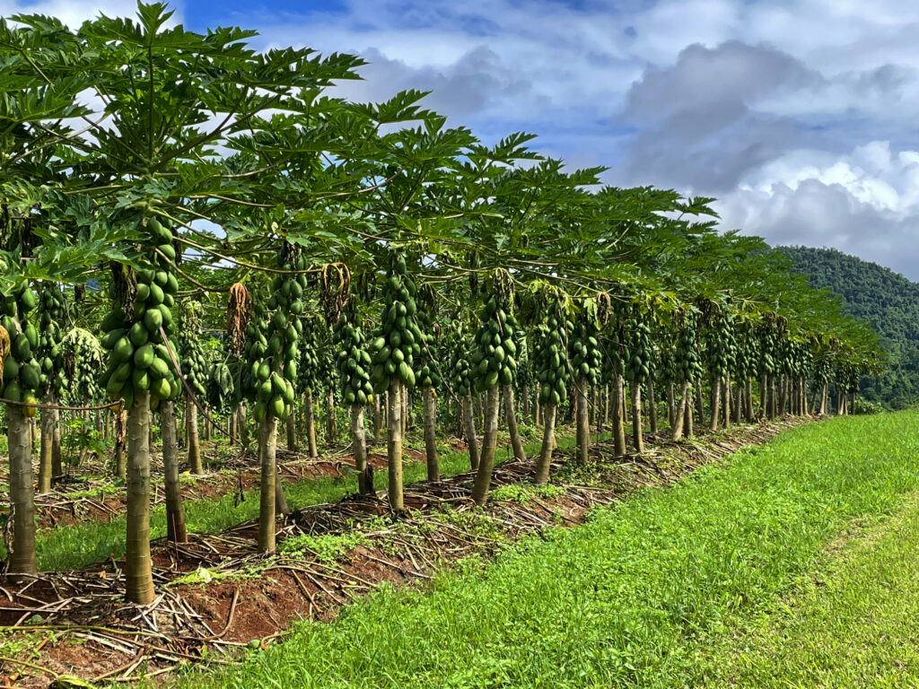
Originally we’d planned to visit Chillagoe when we left Karumba via the Burketown Development road but it was closed due to flooding, hence the zigzagging across the Tablelands. Surprisingly, as we left the Tableland, we passed through rich agricultural lands with avocado, mango, banana, citrus, grapes and sugarcane, and other crops we didn’t recognise, stretching for many kilometres. Before long though we were back in cattle country. 

Pawpaws – or red papayas. Absolutely delicious eating. Outside Babinda
The Wheelbarrow Way, one of many tourist trails that highlight our history. Chillagoe

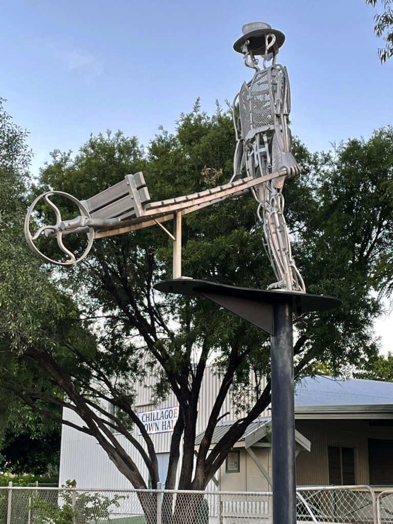
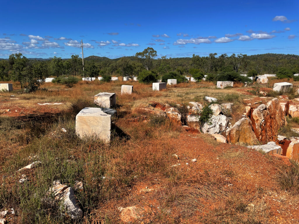
Chillagoe has a population of a bit more than 200. It struck us as a tough little town, its residents having weathered many ups and downs as most mining towns have. Over the years huge deposits of silver, lead, zinc, gold, limestone and marble have been mined here. The lime stone and marble mines are still working, with a few small silver, lead and zinc operations continuing. Chillagoe lime has the sugarcane industry more or less cornered but unfortunately, while beautiful marble is mined here, most of it is sent overseas for treatment. Most of the marble in Parliament House came from Chillagoe. 

Marble blocks awaiting orders before shipping to their destination.

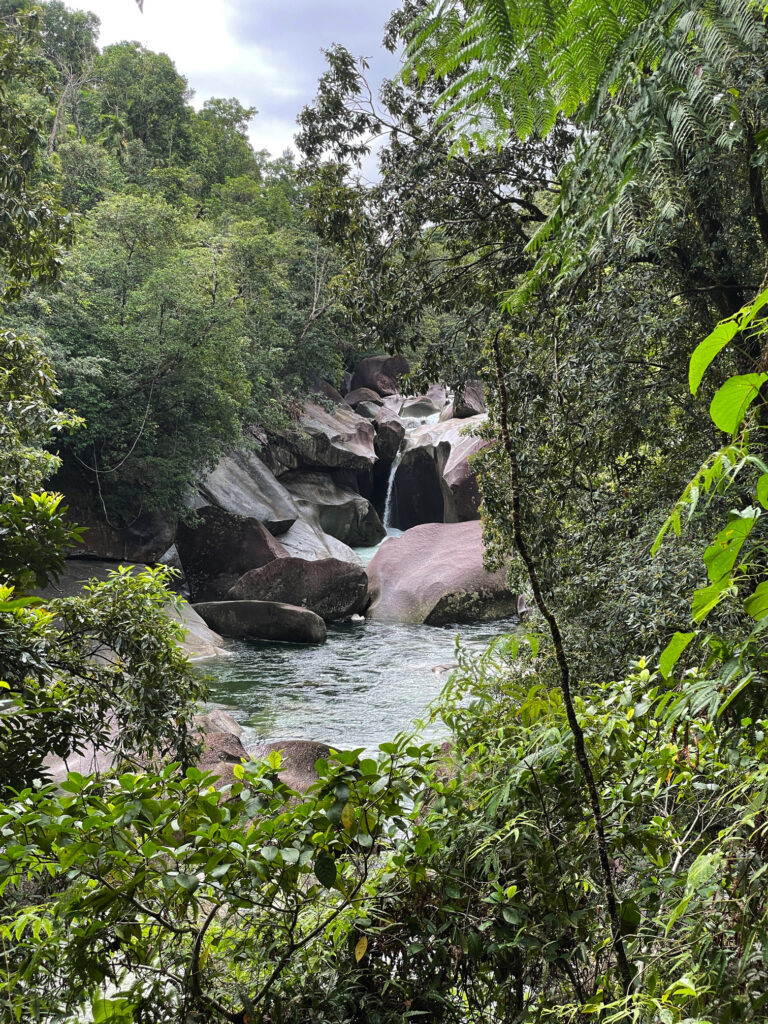
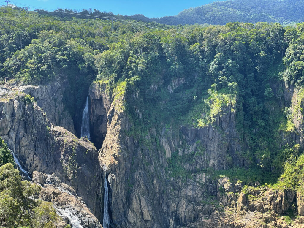
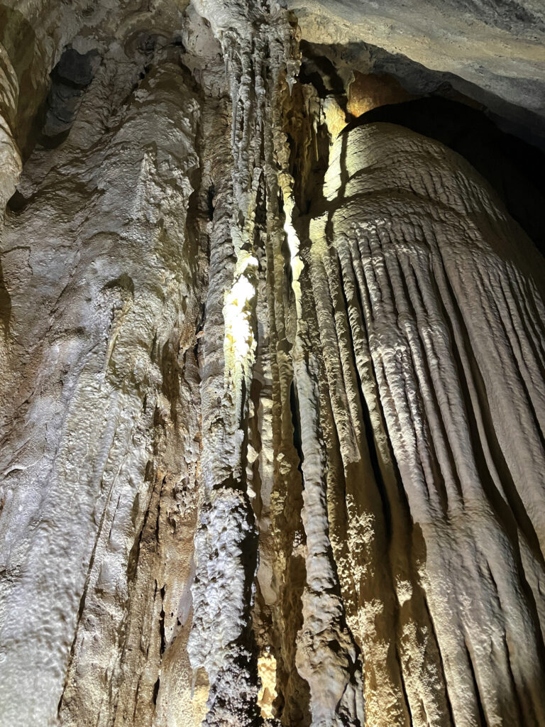
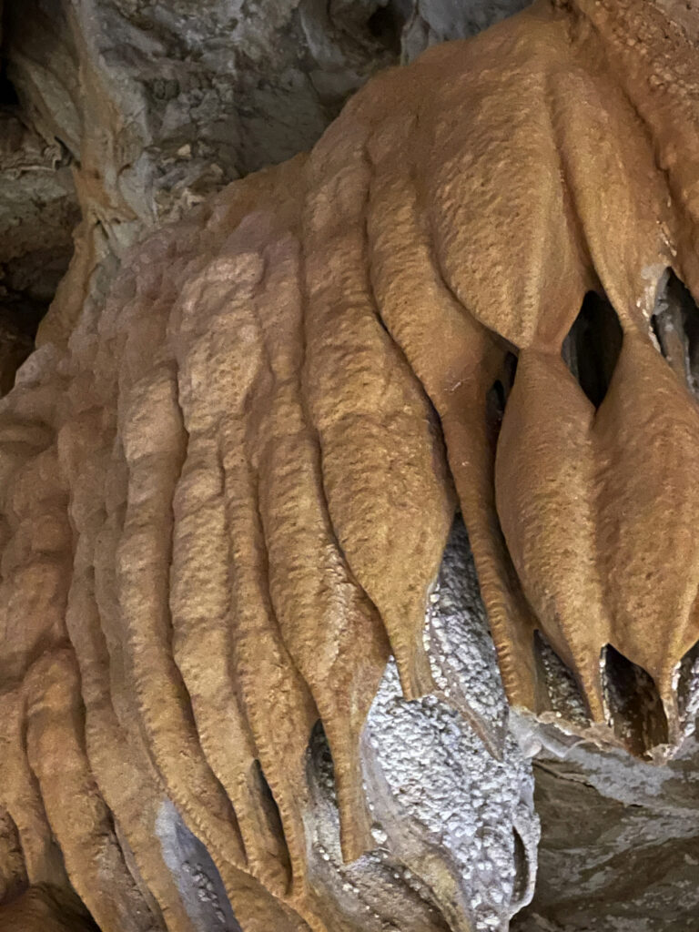
But we’re here for the caves. Back around 400 million years ago the limestone laid down under shallow oceans was lifted, towering above the surrounding countryside where weathering and erosion and fluctuating groundwater levels slowly dissolved some of the limestone, creating caverns and passages, now rich with stalactites, stalagmites and flowstones. We visited three caves today with the ranger – Donna, Trezkinn and Royal Arch. All were outstanding, as was the infrastructure allowing us to view them without causing damage.

Chillagoe Caves
Chillagoe Caves

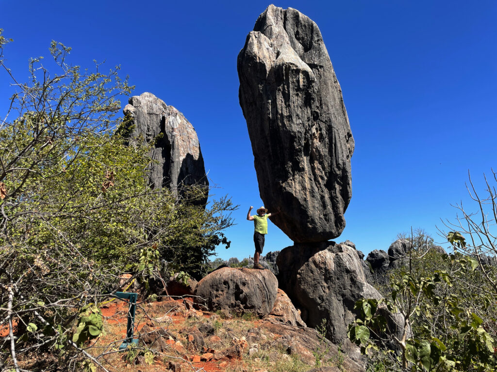
Between cave tours we walked out to the Balancing Rock. I’ve seen many Balancing Rocks, but this is a pretty good one, and the bush walk, after yesterday’s marathon effort, was good to keep the muscles moving.

‘Saving’ the balancing rock – Chillagoe

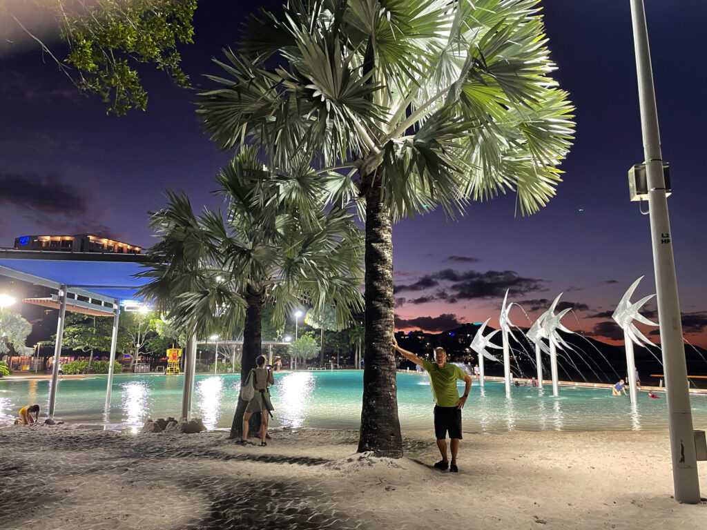
Dinner at the Cockatoo Pub tonight, behind which we’re camped for 2 nights. 

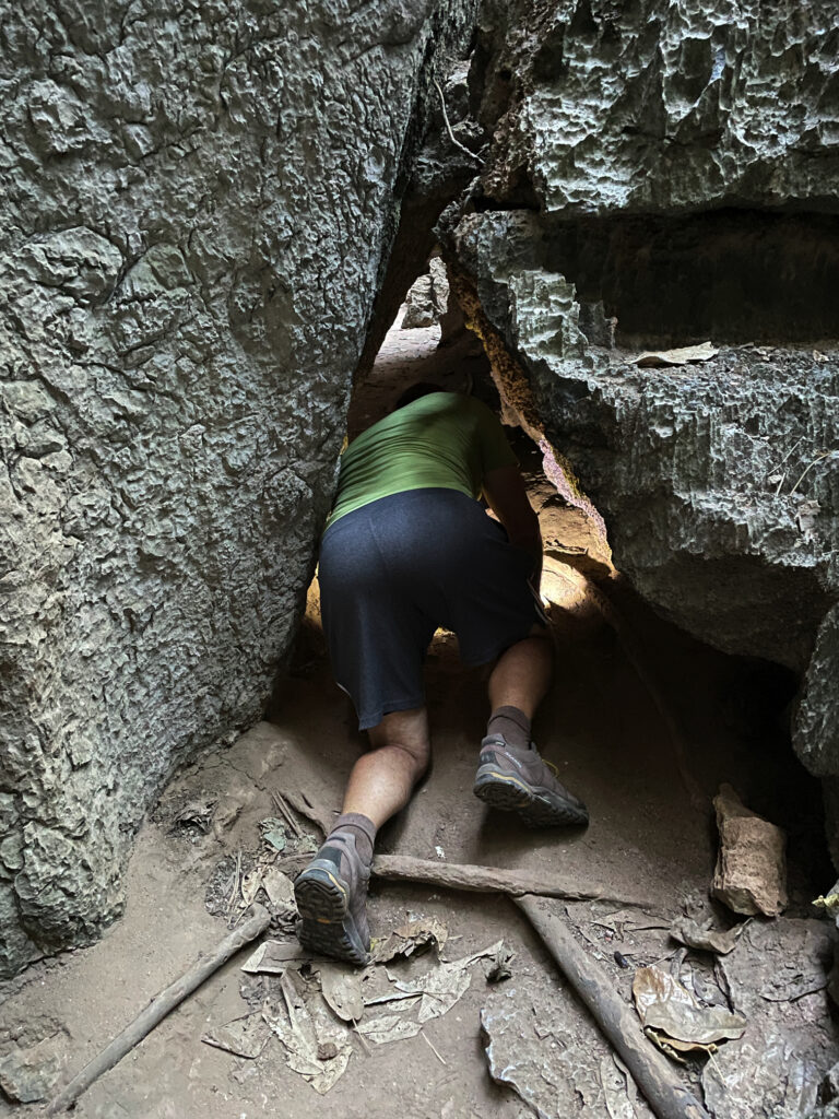
Before leaving Chillagoe this morning we drove out to the Archway caves, which are self-guided.

This image has an empty alt attribute; its file name is 05_10_chillagoe-768x1024.jpg
The approach to the very sinister-looking Royal Arch caves.

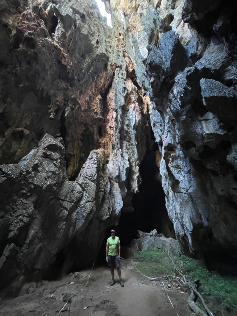
Other than the extraordinary, gothic-like appearance of the limestone karsts in which the caves form, we weren’t impressed with this section, nor game enough to go crawling into little spaces by ourselves with just a head torch. 

This image has an empty alt attribute; its file name is 05-09_Chillagoe08-768x1024.jpg
Exploring the caves at Chillagoe

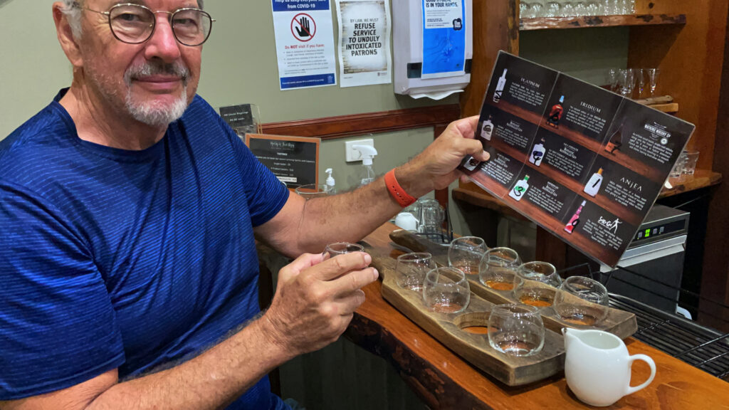
Back through the savanna and the rich agricultural farms and orchards to the Tableland. On the way we dropped in to the Mount Uncle Distillery. A tasting board of spirits was set before us – a pleasant time was spent tasting them all, buying a couple of bottles, and then wandering their beautiful grounds, lush with tropical plants and vegetable gardens and lots of peacocks!

This image has an empty alt attribute; its file name is 05_10_distillery-1024x576.jpg
A delightful time taste-testing at Mt Uncle Distillery.

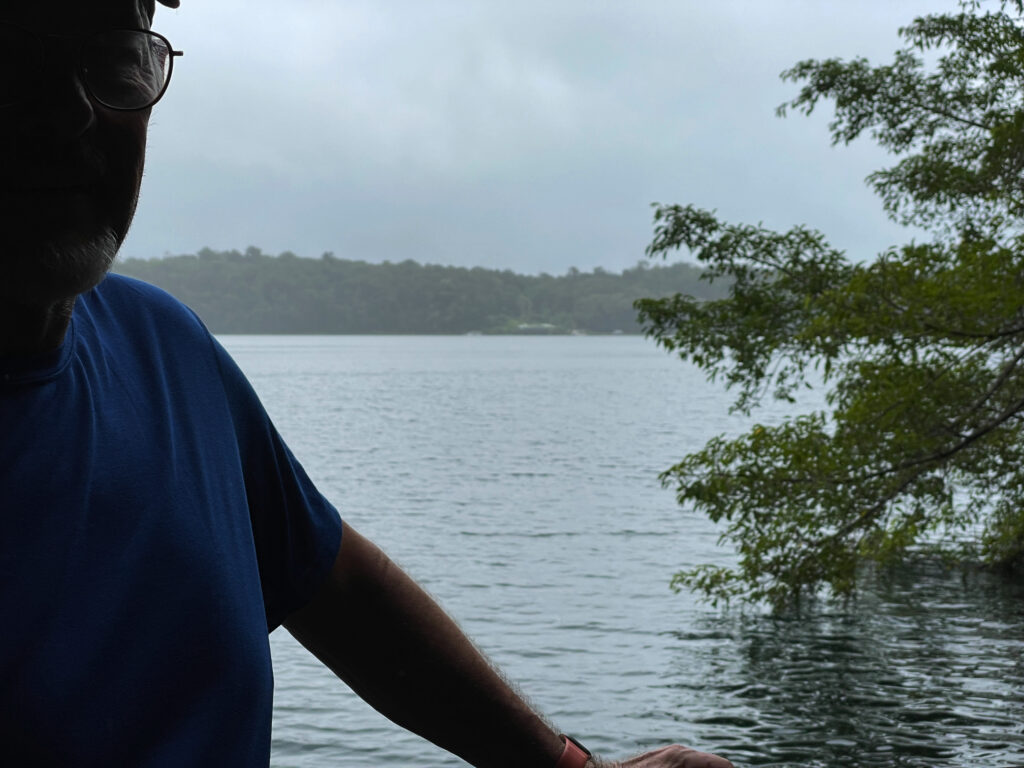
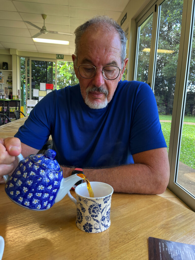
By the time we’d done that and made ourselves a cuppa we were sober enough to continue our journey to Malanda where we booked in to the caravan park. The Malanda Falls are beside the CP, but we weren’t that impressed, looking more like a weir than anything. A quiet night, other than for the curlews which seem to be at every campsite!

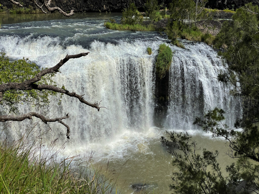
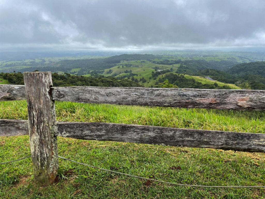
Still chasing waterfalls today we’re following the Waterfall Way to the southern Tablelands. First stop was Millaa Millaa Lookout, which promised amazing views out to Mt Bartle Frere and Bellenden Ker. However, this section is known as the “misty mountains’, hence no mountains seen, but the rolling countryside and magnificent valleys filled with rainforest was absolutely beautiful.

This image has an empty alt attribute; its file name is 05_11_millaa-lookout-1024x768.jpg
The view from Millaa Millaa Lookout. On a clear day you can see Mt Bartle Frere and Bellenden Ker – not today. But beautiful nevertheless.

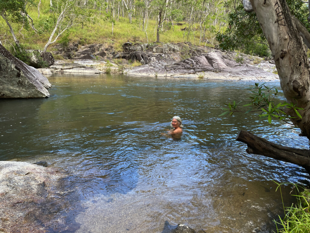
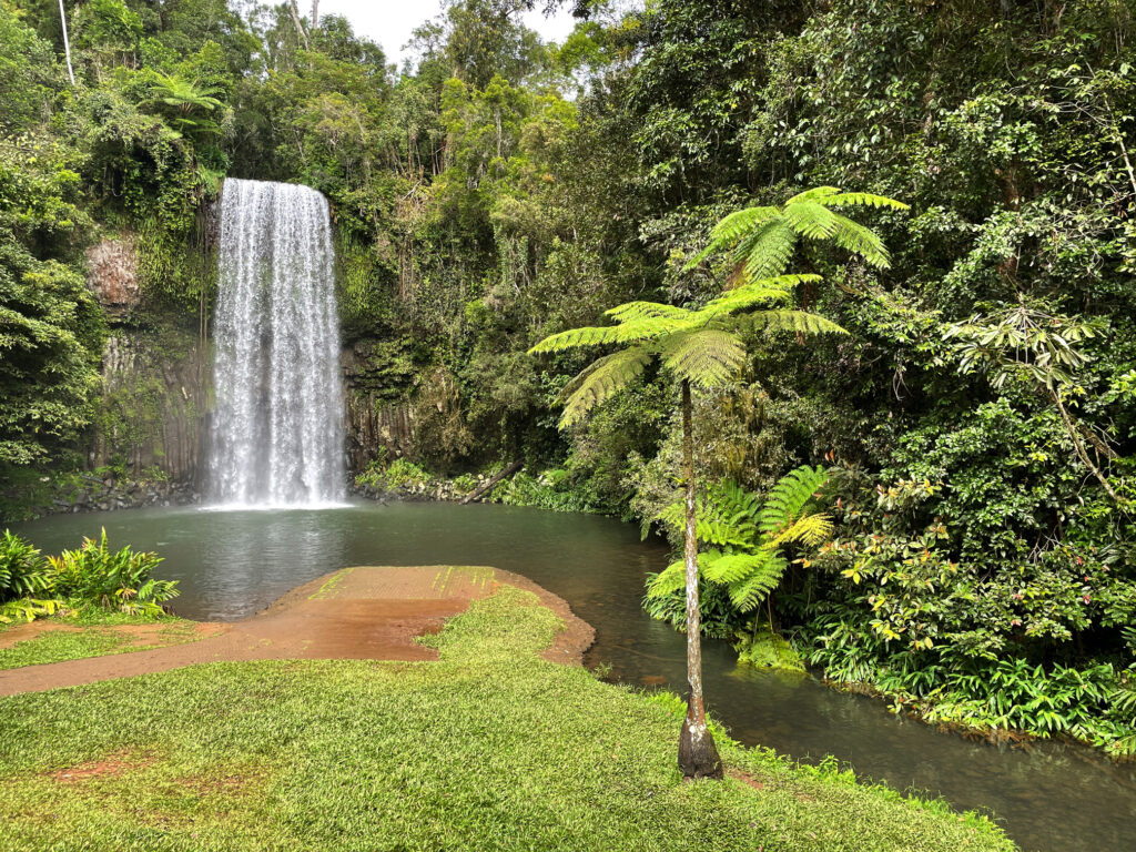
Next stop, Millaa Millaa Falls, the most-photographed falls in Australia. They are “perfect” falls, coming out of thick rainforest in one reasonably wide band of water and falling to a large pool below. Despite the cooler weather I had a swim here, swimming over to and behind the falls. A wonderful experience. 

This image has an empty alt attribute; its file name is 05_11_millaa_falls-1024x768.jpg
The very beautiful Millaa Millaa Falls.

Next stop, Zillie Falls then on to Elinjaa Falls where there’s a steep path of about 500m to get to the base. It’s possible to swim here too. 

This image has an empty alt attribute; its file name is 05_11_elinjaa_falls-768x1024.jpg
Elinjaa Falls

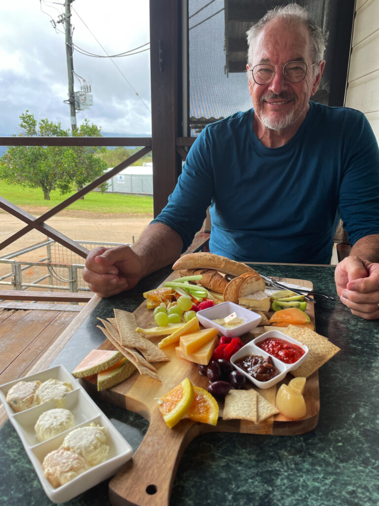
By now it was lunchtime and the cafe at the biodynamic dairy at Mungalli was calling to us. A very filling cheese platter, followed by the best ice cream I’ve ever had (Espresso flavour) replenished our energy levels. The countryside is so pretty – hills, gullies, rainforest and the lushest grass you can imagine. It’s no wonder the dairy cows give such beautiful milk.

This image has an empty alt attribute; its file name is 05_11_mungalli-lunch-768x1024.jpg
The most delicious lunch at the Mungalli Biodynamic dairy farm.

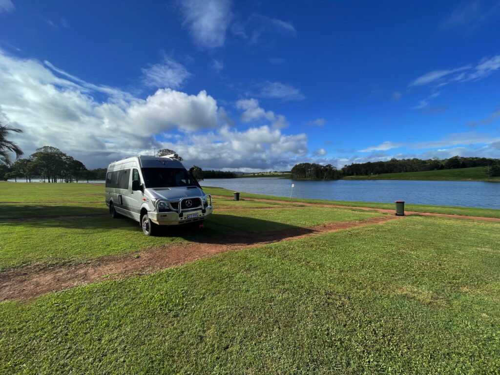
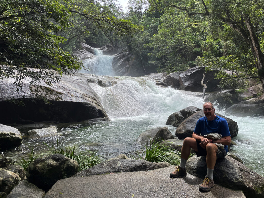
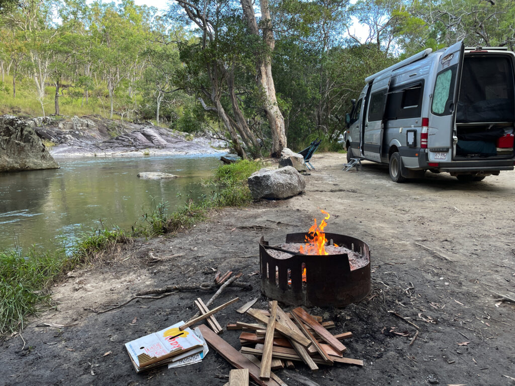
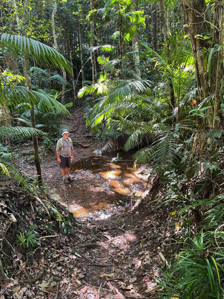
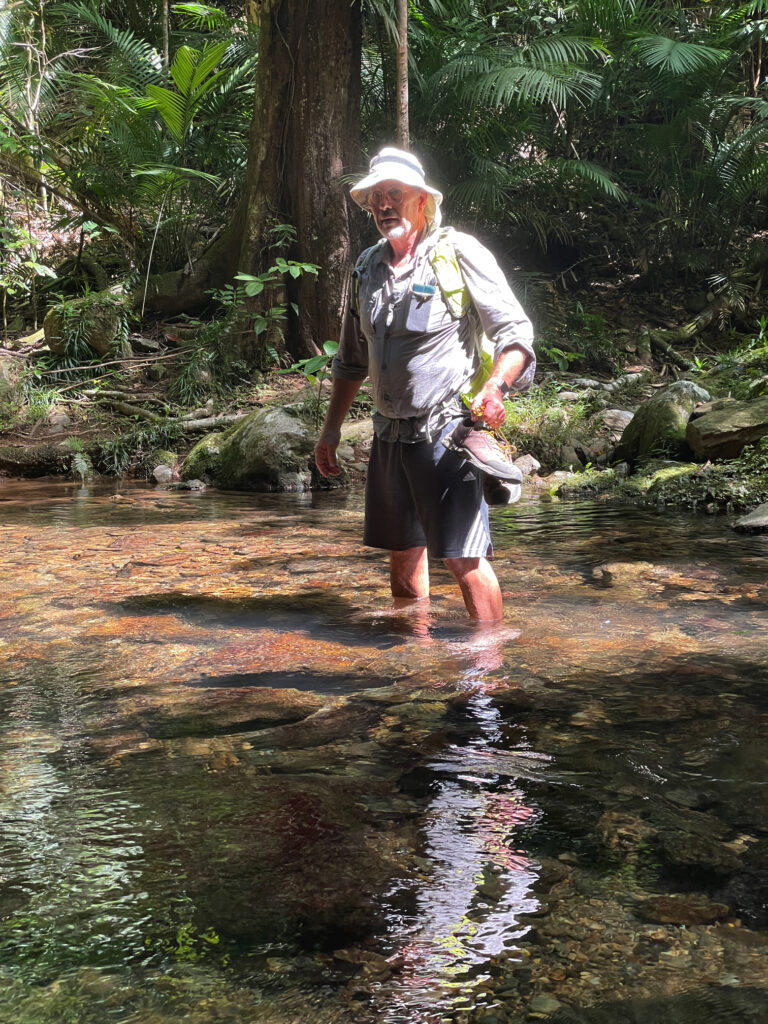
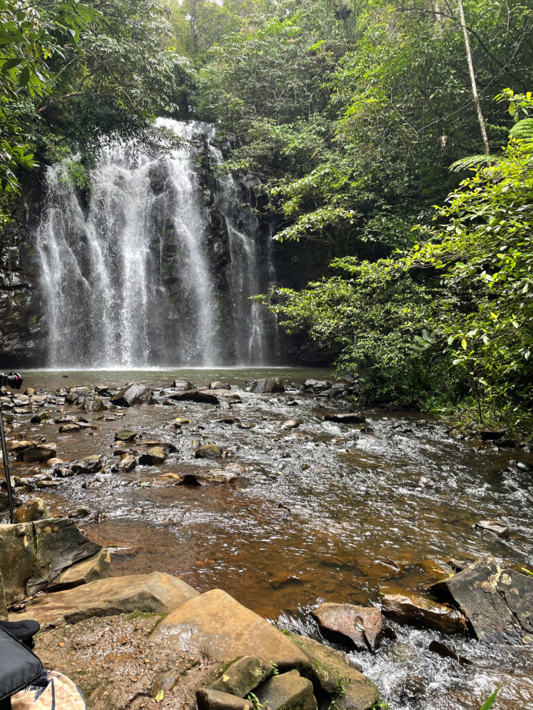
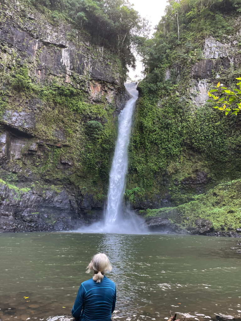
Continuing our meandering drive through the tiny town of Mungalli, which also has a waterfall, though more like steep rapids, we descended and descended until reaching Henrietta Campsite in Wooroonooran National Park. We’ve stayed at lots of National Parks over the years – they’re a credit to our country. This one has a large open area to kick a ball, an electric BBQ, covered tables, toilets and a shower (cold). The campsites are all nestled into the rainforest all around and beside Henrietta Creek. Most have bush walks or other activities. Here we decide to do the walk to Nandroya Falls, a return walk of about 7km. A couple of rock-hopping water crossings and a narrow path ascending and descending alongside the river gave us a bit of a workout. First we came to Silver Falls and finally Nandroya. These are a favourite of Steve’s as they fall spectacularly from a narrow gap in the sheer cliff face to the pool below, then from that they tumble down again over a wide cliff to the next level. 

This image has an empty alt attribute; its file name is 05_11_nadroya-falls-768x1024.jpg
Nandroya Falls – such interesting falls.
This image has an empty alt attribute; its file name is 05_11_silver-falls-1024x768.jpg
The lovely Silver Falls, seen along the walk to Nandroya Falls.

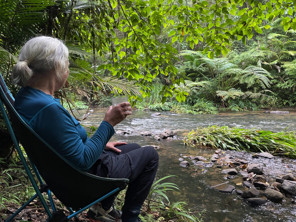
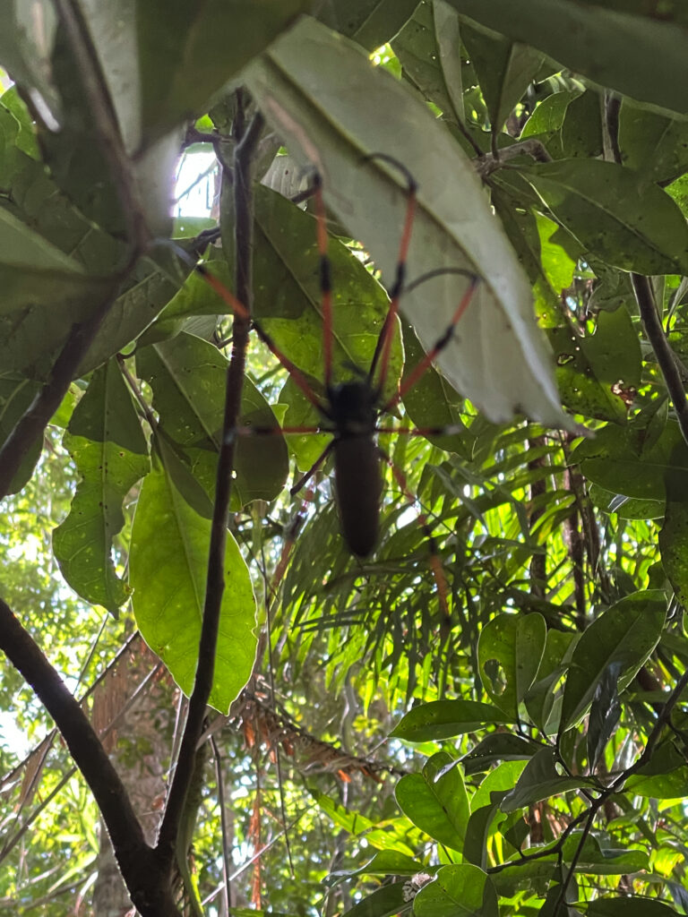
Back at camp we took our chairs down the steep little path to sit by the river contemplating life, the universe and everything, and hoping to spot a platypus. Alas no platypus, but we did get up close and personal with a few too many leeches! A quiet night anticipated with just us and one caravan. 

This image has an empty alt attribute; its file name is 05_11_henrietta-campsite-1024x768.jpg
Relaxing at our campsite at Henrietta NP campground.

Atherton and Cairns

28th April – 7th May

We leave ‘the West’ now for the Atherton Tableland, but not before a dip in the hot mineral waters of Innot Springs. The water leaves the ground here at around 75°C. At the park there are 6 pools each with a controlled temperature ranging from cool to so hot just a few minutes in it is long enough! We moved between two medium temperature pools having a lovely rejuvenating soak.

With wrinkly skin we left the pools to view Millstream Falls about 30km up the road. These falls are the widest single-drop falls in Australia, flowing over the end of a basalt lava flow. A walk from the car park winds down to a viewing platform where, due to the big wet season the area has experienced, the falls are spectacular. 

Millstream Falls, Atherton Tablelands

We pass through Ravenshoe, the highest town on the Tableland to stay the night at a caravan park in Herberton. Herberton has a truly wonderful Historic Village where we spent several hours the next day. I’m not a great fan of these historic displays, but this one is not to be missed! 

Herberton Historical Village. School room. Don’t know that I’d do particularly well on this test.

The countryside has changed so much within the space of a day’s drive. From the eucalypt woodland savanna we’re now in full tropical rainforests, lush rolling hills with grass so high the cattle are nearly hidden and the most beautiful tropical plants – and it’s a lot cooler. Lake Barrine is one of two crater lakes, on the Tableland, Lake Eacham being the other. These two lakes were formed around 10 – 17,000 years ago when the earth’s magma contacted the ground water creating steam which blew the top off forming a crater which subsequently filled with water.
We’d planned to kayak around Barrine, but the weather is still a bit rainy at times and lovely and cool now, so instead we walked around them both, and may have had a coffee and something sticky to eat at the Tea House on Lake Barrine.

If it weren’t so windy we’d have kayaked around. Steve, on the walk around Lake Barrine.

We spent two nights at the Lakeside Caravan Park on Lake Tinnaroo and took the time to drive around visiting local attractions such as Nerada Tea Plantation, Gallo Dairy and Chocolate shop and the delightful town of Yungaburra.

Enjoying the perfect cuppa at the Nerada Tea plantation.

However being the beginning of a long weekend and Lake Tinnaroo being a favourite for the local water skiers, jet ski owners and just generally noisy boats, we were pleased to leave.

Our campsite on the banks of Lake Tinnaroo. Temporarily quiet, until tomorrow!

1st May: We descended to the coast via the Gillies Highway, a Highway famous for its 263 corners and 800m elevation change in just 19km. It was built in 1925 and I’m rather proud to say my grandfather was one of the surveyors for this road. The scenery was absolutely spectacular, unfortunately the lookouts were all on the ascending side of the road making it a bit dangerous for us to pull over to take our time enjoying it. 

Babinda Boulders is our destination today, but first the highly rated Josephine Falls near Mt Bartle Frere. In ‘usual’ conditions these falls provide an ideal natural waterslide – way too much water at the moment though.

This image has an empty alt attribute; its file name is 05_01_Babinda_boulders-1024x768.jpg
Enjoying the spectacular Josephine Falls

The Babinda Creek is a fast-flowing creek that winds its way through huge boulders forming large pools ideal for swimming. Still a bit overcast and cool for swimming but I did wade in and enjoy the refreshing waters here.

This image has an empty alt attribute; its file name is 05_01_Babinda_boulders2-768x1024.jpg
Very beautiful, but very dangerous for swimming, at Babinda Boulders

There’s a nice-looking free camp here, but we decide to go back to Babinda where there’s a large free camp beside the river. Most memorable about this campsite is the rooster that crowed the wake-up alarm right outside my window from 4.45am for at least half an hour. I dare say I’m not the only camper who had visions of roast chicken!

2nd – 4th May: We’re now having a holiday in the middle of our trip – three nights at the Doubletree Hilton in Cairns! The hotel is fabulous, particularly the beautiful atrium with a pond with barramundi that swim through lush tropical plants. We are both impressed with Cairns – the Council has done a marvellous job with tropical plants everywhere, an excellent walkway/cycle way the length of the foreshore with sculptures, parks, impressive playgrounds and exercise stations and a beautiful swimming lagoon.

This image has an empty alt attribute; its file name is 05_02_cairns_esplanade-1024x768.jpg
The beautiful pool area on the Cairns Esplanade

On our last day we rode our bikes to the Botanic Gardens where the local and exotic tropical plants stunned us with their lushness and colours and variety. It’s such a large Gardens we’re pleased we rode our bikes, covering several kilometres within the gardens to visit all the areas.

This image has an empty alt attribute; its file name is 05_04_gardens1-1024x768.jpg
The amazing plants at the Cairns Botanic Gardens

We also had dinner with Philippa and Andrew, new friends we first met at Boodjamulla, then again in Karumba. And when we weren’t doing all these activities we swam in the hotel pool and spa, lazed poolside reading, or had a few drinks at the outdoor bar and restaurant. 

This image has an empty alt attribute; its file name is 05-04_CairnsHilton01-768x1024.jpg
Enjoying sundowners at the cafe at Doubletree Hilton

5-7th May

We return to Atherton Tableland this time via the Kuranda Highway. On previous visits we’ve come up to Kuranda on the cable car and the train – both highly recommended, but this is the first time we’ve driven. Not quite as spectacular, but still a fabulous drive. 

Barron Falls – a spectacular waterfall near Kuranda

Kuranda … disappointing .. lots of shops closed and the feel was mass-produced tourist trinkets. After wandering around for a while, trying to give the place a chance, we drove out to Barron Falls Lookout. Wow those falls are amazing. A kilometre-long walkway took us to a couple of lookouts over the falls and down the range to the coast. Interestingly the river above the falls was dammed for hydroelectricity for a while in the early 20th century. 

A view down the valley, taken on our Barron Falls walk

Moving on from here our campsite tonight turned out to be one of the best we’ve ever stayed in! Upper Davies Creek campsite in Dinden NP, site#2. We seemed to climb a long way on an unsealed road before reaching the campsite, but 4×4 only needed at the very end to get into the campsite. The next nearest camp was a long way away (and no one there anyway). The creek came down a small waterfall then over rapids before forming a large pool right beside where we were camped, leaving the pool via more rapids. It was stunningly beautiful.

I swear this has to be the best campsite ever. Upper Davies Creek

A thoughtful previous camper left wood beside the fire pit where we cooked our dinner. Swimming was chilly and did involve a lot of resolve to fully submerge. Unfortunately we’d only booked one night here, but we stayed until quite late in the afternoon making the most of it before leaving. 

Enjoying a swim at Upper Davies Creek – our own private slice of heaven

Speewah campsite in Barron Gorge NP was also lovely – only 3 campsites, each on a well-formed pad with large grassy areas and a patch of natural bush between each site. On our first full day we set off to do some walking. Phew … that was more than we’d bargained for. The walk was through thick rainforest which was magnificent and a treat to be immersed in.

Beautiful rainforest walking at Speewah NP

However it has rained a lot here recently and in quite a few places the track was in very poor repair, with many fallen trees and their multiple branches to scramble through. In one section a wide fire trail we were following was so badly washed out and eroded it’d be impossible to drive on it. There were 5 water crossings, two where we needed to wade through, rather than rock-hop over.

And yet another water crossing on the Speewah walk

But of greatest difficulty were the many steep ascents and descents, not short ones either! Along the way Steve managed to pick up a few leeches and get caught in lawyer vine enough to draw blood, and I came face-to-face with many golden orb spiders whose massive sticky webs were built right across the track. These spiders from toe to toe would have been as big as my hand.

One of many giant Golden Orb spiders that formed their webs right across the track.

Our GPS told us we walked for 5.5 hours over 18km – I don’t know it was that far, but it was a tough walk however far it was. A chilly shower on return restored feeling to weary bodies!