North West Tasmania

2nd – 12th February

Friday 2nd

The weather was very average, with lots of wind. The first 3 hours on the Spirit of Tasmania crossing Port Phillip Bay were blissfully calm, but … Bass Strait was choppy! Our booked recliner chairs were at the stern of the ship which I’m led to believe is the best spot in rough seas. Once we were in the Strait I only got up once to go to lunch and very nearly wished I hadn’t.

Recliner chairs on the Spirit. Could that be a green tinge to my face?

Anyway one book nearly finished and 11 hours later we disembarked in Devonport, Tasmania! So exciting! 
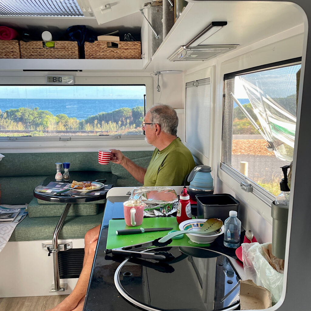
Tonight we’re staying at the Ulverstone Golf Club camping area.

Saturday 3rd

A slow start to the day as we planned the next couple of weeks, replenished the fridge and settled in for the night at a quiet, pretty campsite on the banks of the Leven River.

Sunday 4th

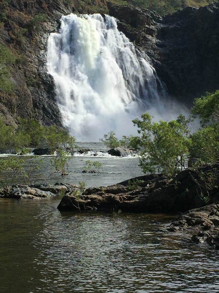
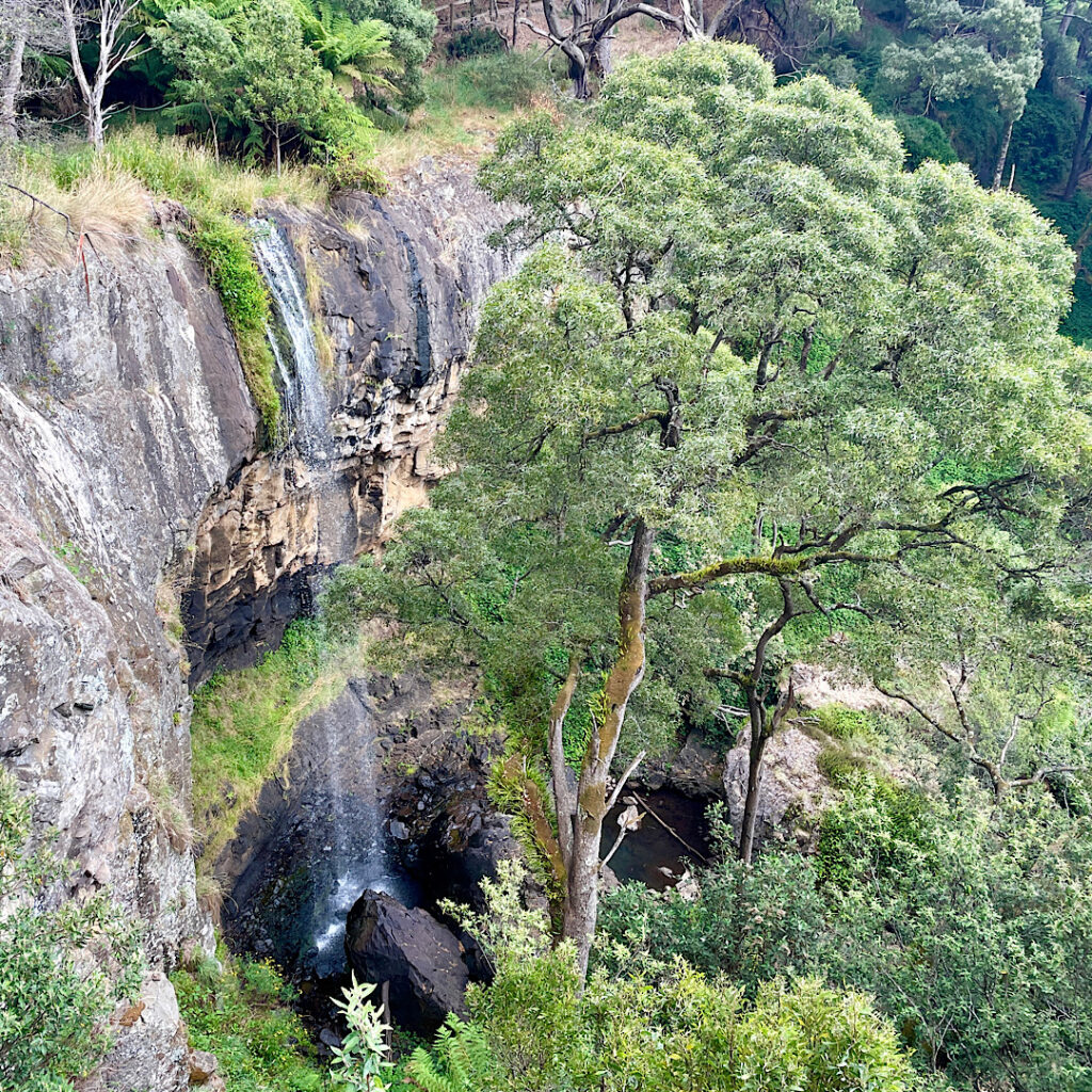
Ahhh Tasmania! It really is relaxing with its rolling hills, green pastures, chubby cattle and sheep and, at the moment, clear blue skies. A drive south climbing through majestic eucalypts brought us to Preston Falls. A  well-constructed 200m track with a few stairs led to a viewing platform on the cliff edge above a pretty waterfall dropping about 25m.

Preston Falls

Back on the road southward Leven Canyon was our goal. The Leven River has carved the deepest canyon in Tasmania, some 275 metres below the lookouts. A large parking and picnic area was nearly full when we arrived. It’s also a free camp.

There are two lookouts over the canyon which can be accessed separately by short out-and-back walks, or a circuit which joins both lookouts together by “the steps”. Purposefully choosing to ascend “the steps”, we set off clockwise. A well-constructed path led downward through tall, mossy-trunked gums which sheltered a glade of giant man ferns (the term Tasmanians use for tree ferns).

Leven Canyon from The Edge Lookout.

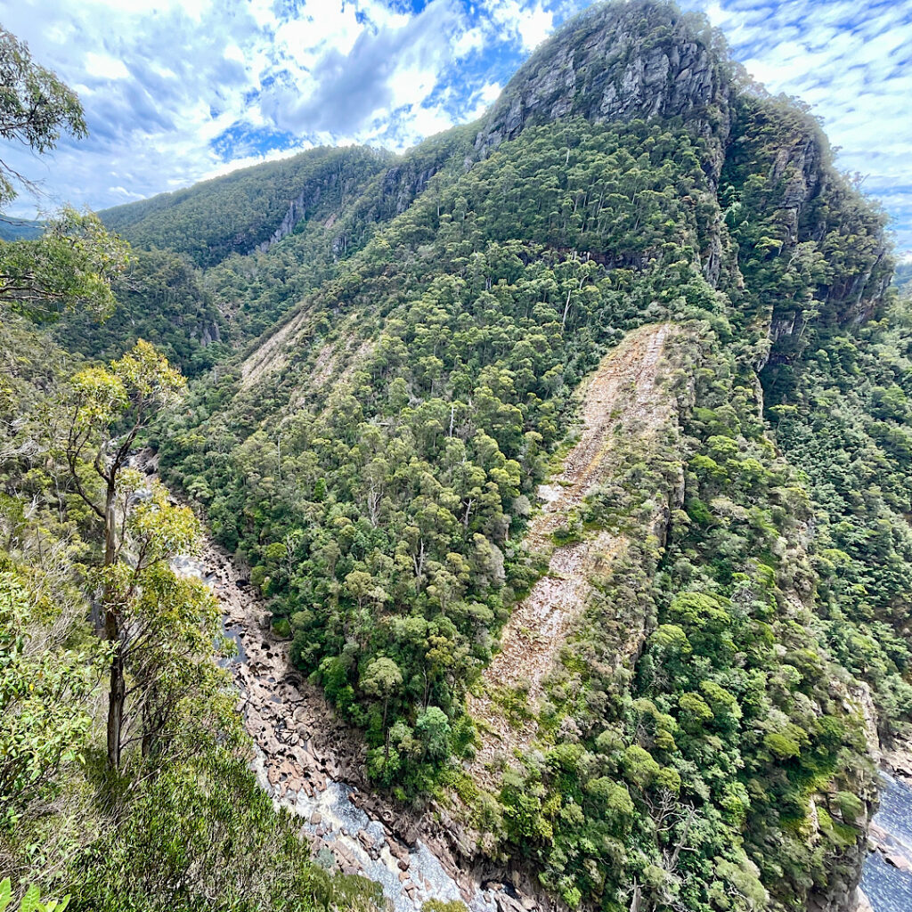
At The Edge Lookout a viewing platform is suspended above the cascading rapids of the Leven River. After enjoying the view we headed back a little way to where the track branched to go up the steps.

Just a very few of the 697 steps on Leven Canyon walk.

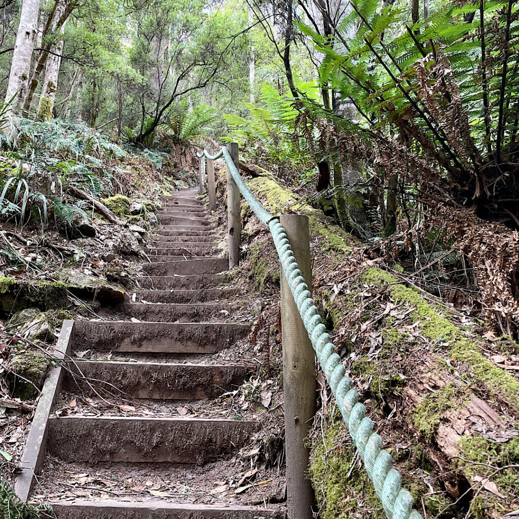
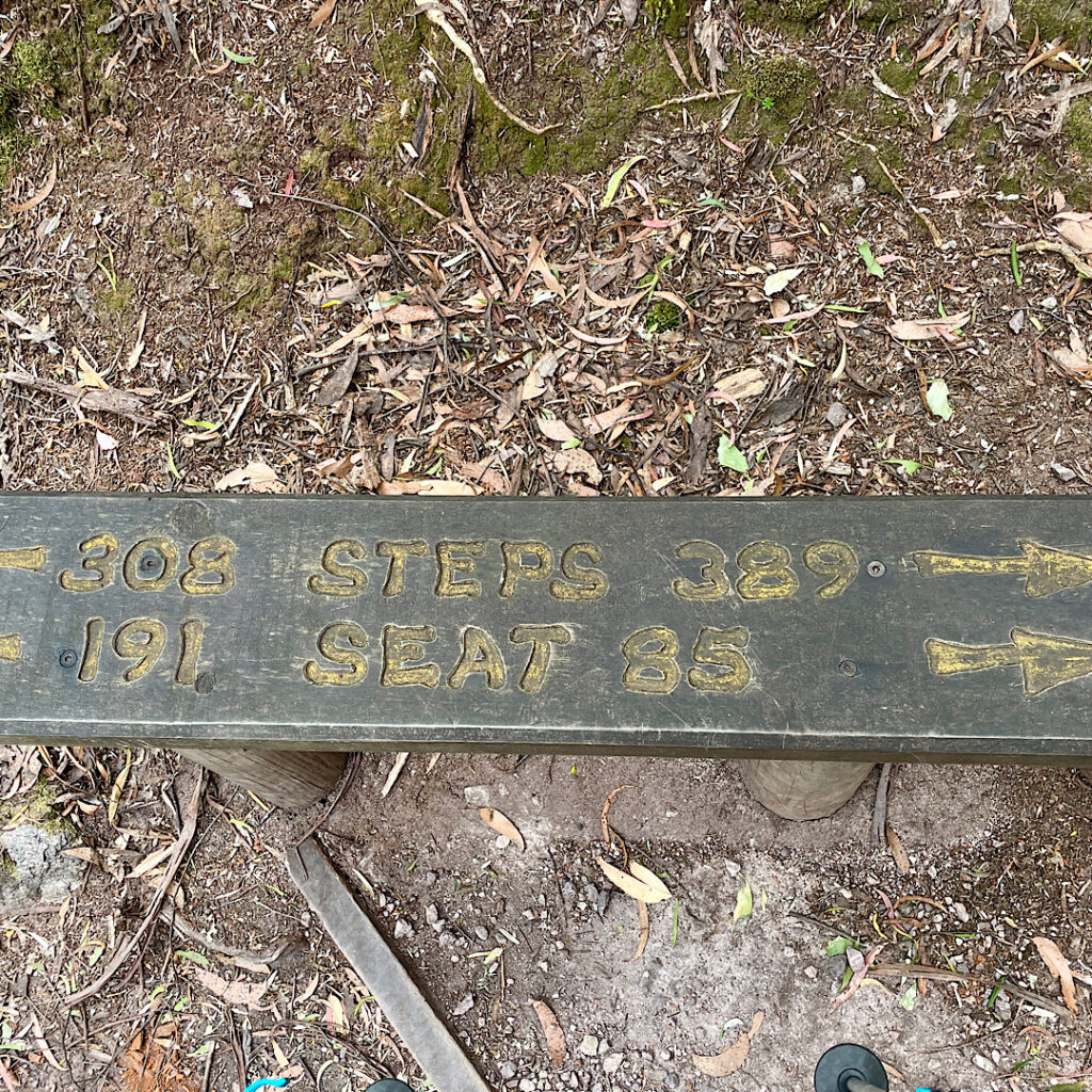
697 steps, to be precise! Bench seats along the way were engraved with the number of stairs you’d already done, the number to go, and how many stairs before the next bench seat. My walking poles were a godsend!

A bench seat (one of many) on the Leven Canyon walk, indicating how many steps to go and how many you’ve already done. And how many steps since the last bench seat and how many before the next one.

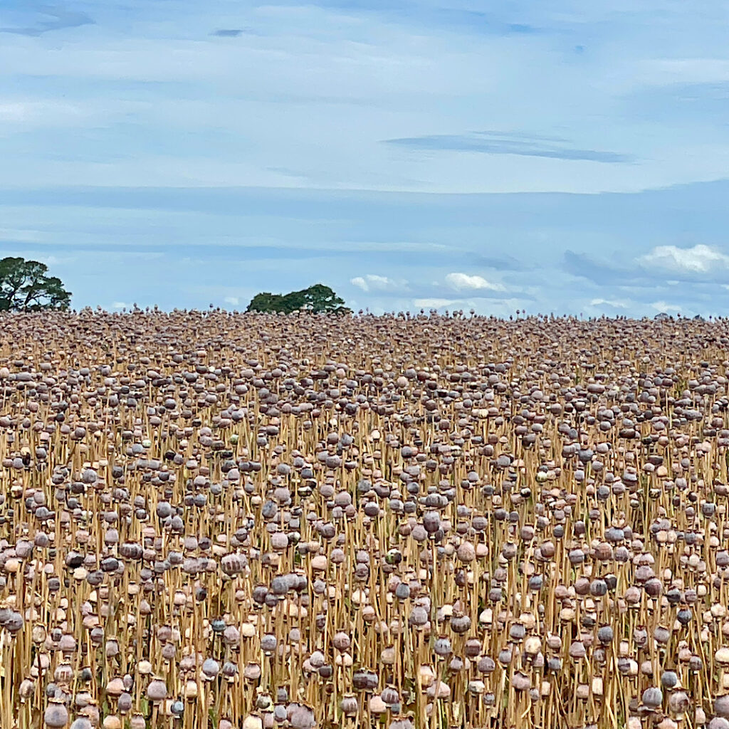
Back at the car we descended the range coming out in mixed farming country again. Tasmania supplies 75% of the World’s legal poppies for making codeine and morphine. Sadly we’ve missed the flowering stage, however the poppy heads are still on the plants, drying out before harvesting.

Poppy field.

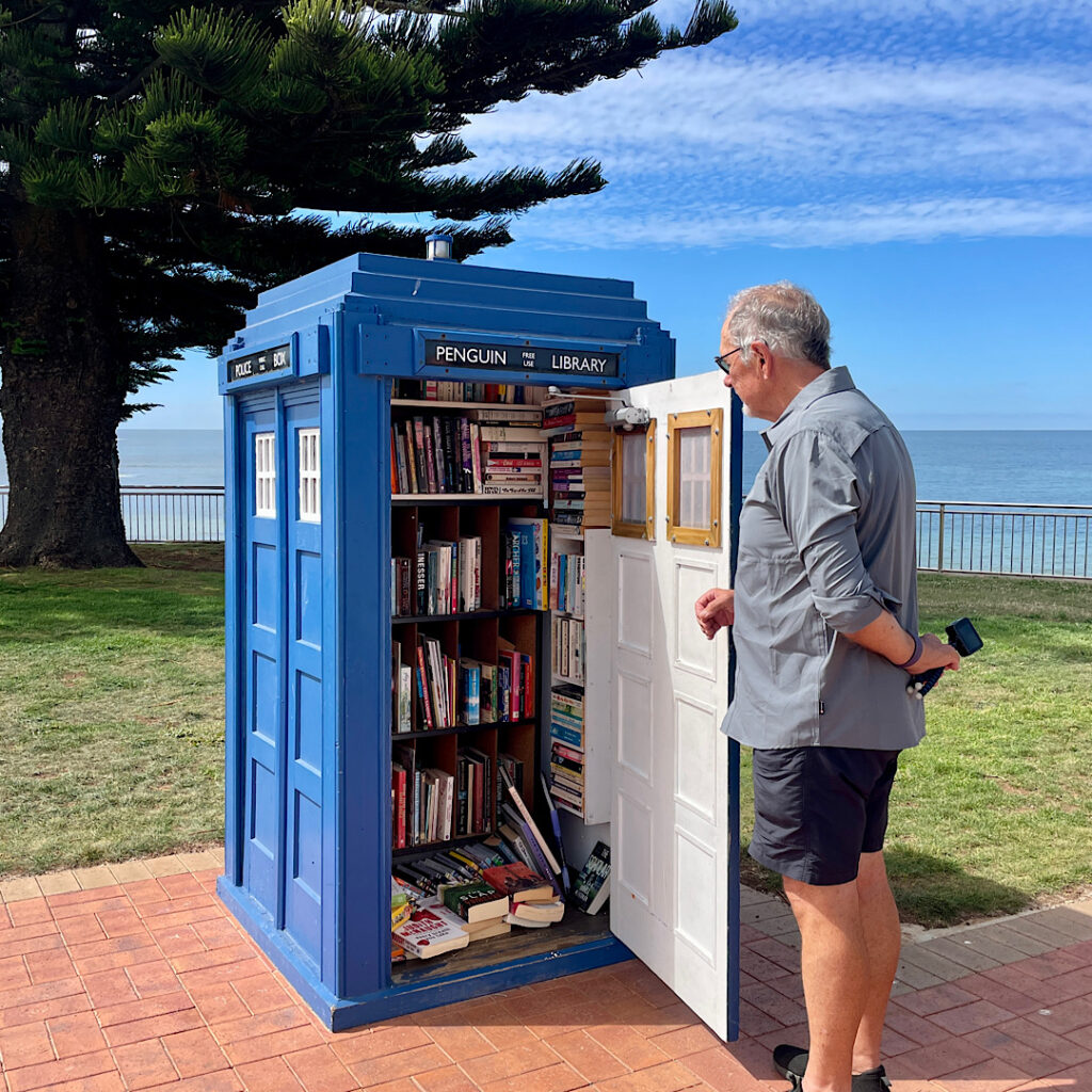
Our campsite tonight is a free camp on the coast near Penguin ignominiously called Sulphur Creek. No it didn’t smell of sulphur!

Breakfast at Sulphur Creek. Just west of Penguin.

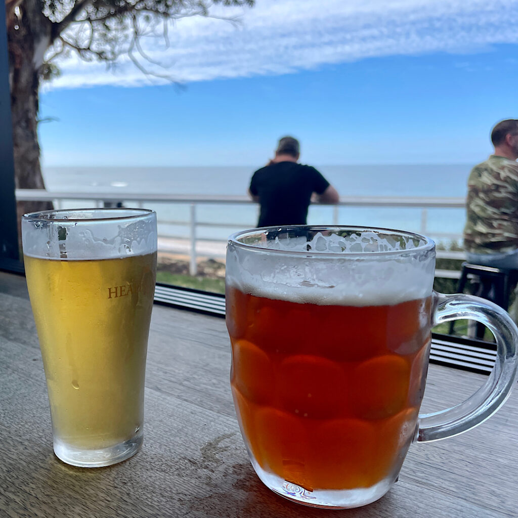
But first we picked up a few groceries in Penguin, wandered the streets a little and had a beer at the Penguin Brewing company – delicious it was too!

A couple of craft ales from the Penguin Brewing Co. Mine is the ‘Little Penguin’ and Steve’s the ‘Emperor Penguin’. Both excellent.
What a delightful street library at Penguin.

At the campsite we spent a pleasant Happy Hour with Explorer owners Margie from Melbourne and Kev and Denise from Buderim. Explorer motorhome owners are well-connected through a Facebook group, and it just so happened that quite a few of us happen to have chosen Tasmania to visit this year.

Monday 5th

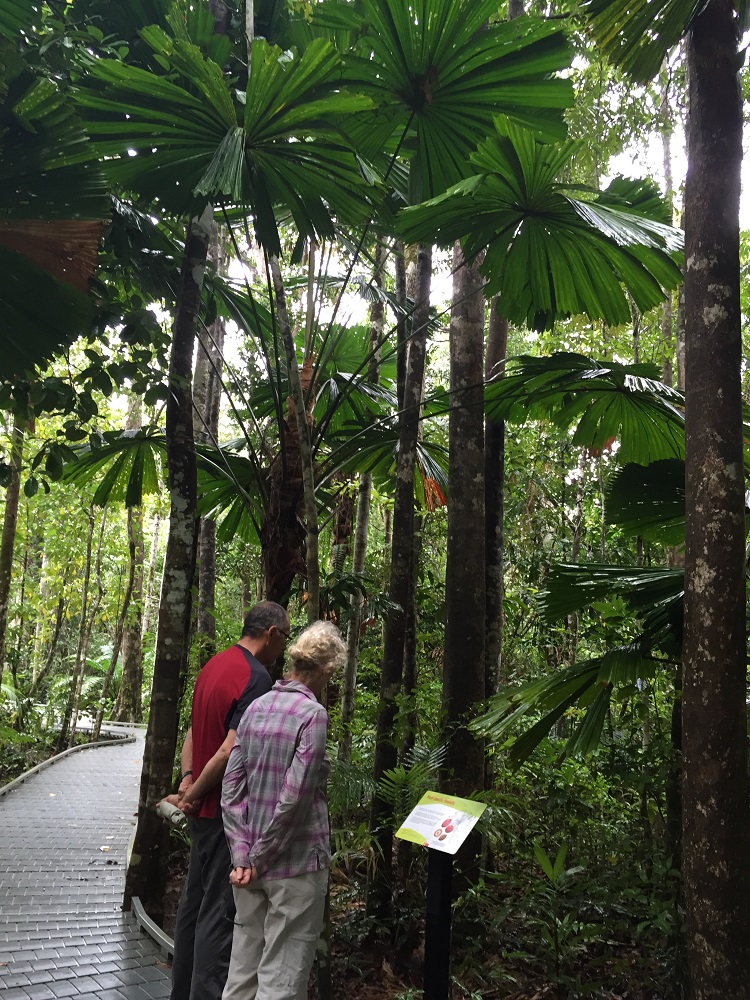
Continuing westward we found a walk to do at Rocky Cape National Park – the 11km Broadview Circuit Track. It starts with a steep climb (does any hike not start with a steep climb!!) before entering the National Park. A well-defined sandy path through heathlands gives great views back to Sisters Beach, our starting point, before coming to the junction to summit Broadview Hill. The hilltop provides sweeping views of the coastline, and our path yet to tread.

Sisters Beach from Broadview Summit

Back on the good path we headed to Anniversary Point. A steep descent brought us down onto the beach where we were fortunate to have arrived at low tide – good, firm sand to walk on. This interesting little bay has offshore rocks known as The Five Sentries.

Anniversary Bay. Broadview. Hiking track includes full length of beach. Note the Five Sentries just offshore.

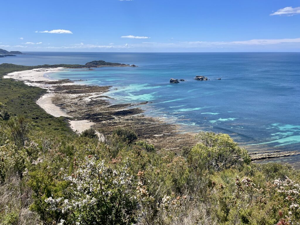
About a kilometre along the beach it becomes quite rocky with a wide wave-cut platform making for fun rock-hopping. 

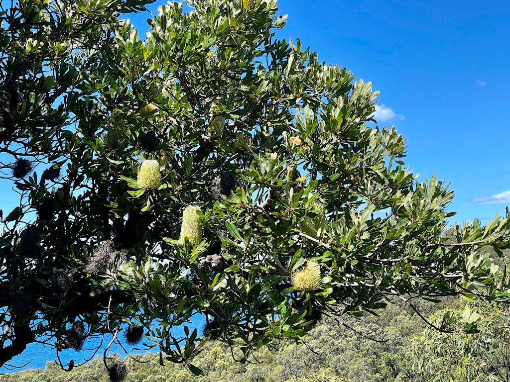
The climb back off the beach again is, once-more, very steep. The flora is now predominantly a banksia grove, with the largest banksias I’ve ever seen – some trunks being so big you couldn’t get your arms around them to hug.

Banksias on the Broadview Circuit Track.

Lee Archer Cave at the bottom of a steep descent back down to the beach contains a midden and artefacts deposited over thousands of years, and are still used by the Aboriginal community for shelter and ceremony. Respectfully being asked not to enter the cave meant there wasn’t a lot to see from the mouth of this wide, deep cave. 

Lee Archer Cave – on the Broadview Circuit Track.

Climbing back to the path again we continued on to Wet Cave – a narrow opening leads downwards into a wide, deep cave with a pool at the end. Soon after leaving the cave the track leads back onto the beach for a short walk to the boat ramp and back to Harvey, our motorhome. And so ended another enjoyable hike with an array of flora and lots of birdlife and lizards.

A drive to Stanley and an early night after a well-deserved shower was in order.

Tuesday 6th – Wednesday 7th

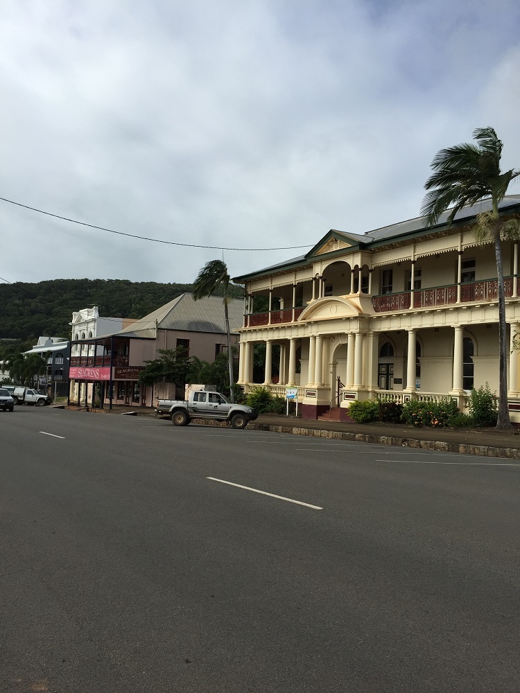
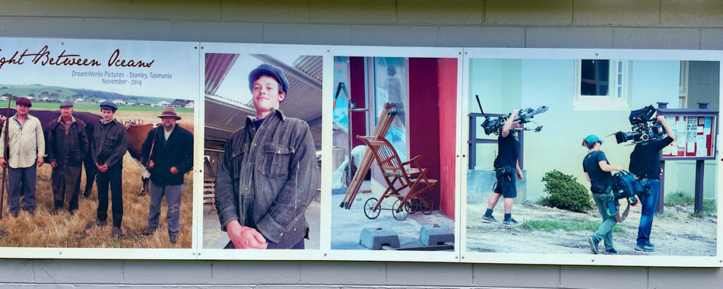
Stanley is a pretty little town with its many beautifully preserved historic buildings from its heyday as the centre of the Van Diemen Land Company and also the birthplace of Joseph Lyons, Australian Prime Minister (1932 – 39). Consequently Stanley became the perfect choice to film the movie The Light Between Oceans, a post World War I drama.

But the most striking landmark in Stanley is The Nut! In 1798 Matthew Flinders described it as “a cliffy round lump that resembles a Christmas cake”. This stump of an old volcano rises some 150 metres above sea level.

The Nut or is it a Christmas Cake, Stanley.

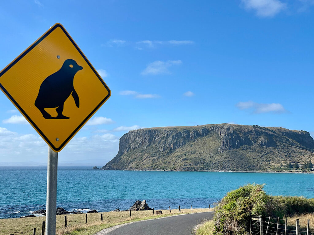
We climbed the very steep path to the top and wandered the 2.5km circuit path that follows the cliff line. A pretty and varied walk with unobstructed views all around.

Stanley from the chairlift. Looking west.
Enjoying a night out with friends. Stanley Hotel

Thursday 8th Feb

Not far out of Stanley is Highfield House, the now restored 1830’s home of Edward Curr, the Chief Agent of the Van Diemens Land Company. The history of this first settlement in north-west Tasmania is a sordid one with maltreatment of the convicts assigned to the Company and a massacre of the local aboriginals.

Highfield House from The Nut. Looking north

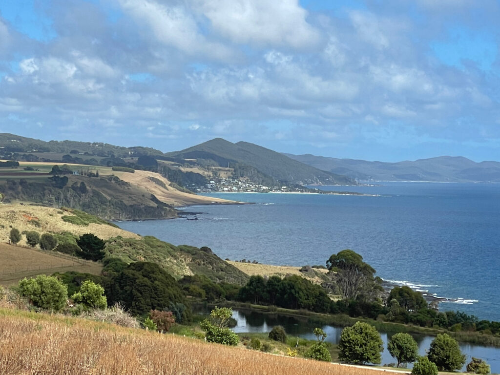
Popping into many of the little beachside communities along the northern coastline as we returned eastward rewarded us with unspoilt white beaches with the bluest ocean lapping at the shores.

Of interest is the 1.8km long jetty at Port Latta. Iron ore, mined at Savage River, is made into a slurry and transferred to the Port via an 85km long pipeline. Here it is converted into pellets and exported, mostly to Japan.

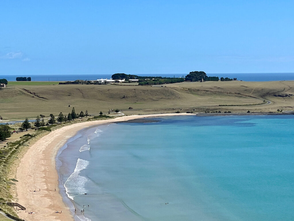
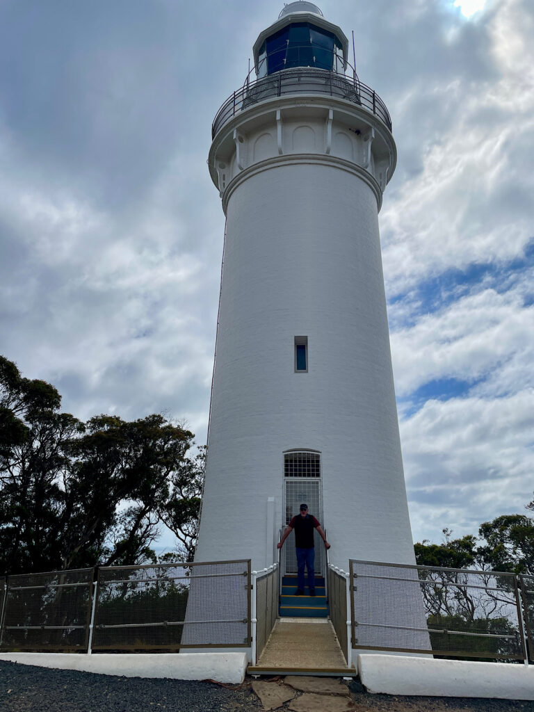
Rolling hills with grazing sheep and cattle, fields of onions, potatoes, poppies and tulips brought us to another volcanic plug known as Table Cape. Tulips have been grown on these rich basalt soils since 1984, the bulbs now being exported to Holland.

Table Cape. Imagine those bare fields covered in poppy and tulip flowers.

A lighthouse built in 1888 still warns shipping of the perils of this rocky coastline.

Steve just finishing an arduous shift saving ships from certain disaster, Table Cape Lighthouse.

Friday 9th Feb

Today we mixed it with the locals. Don and Jan from Burnie, RVing friends from way back, met up with their traveling crew of about 5 other motorhomes at Hagley and invited us to join them. Tales of travels done and yet to do provided great entertainment.

Saturday 10th – Monday 12th Feb

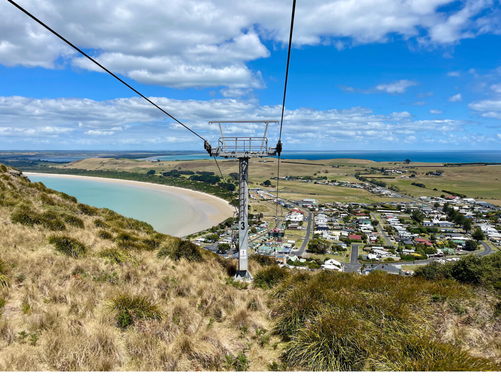
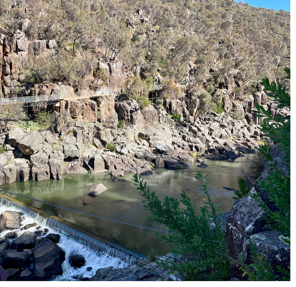
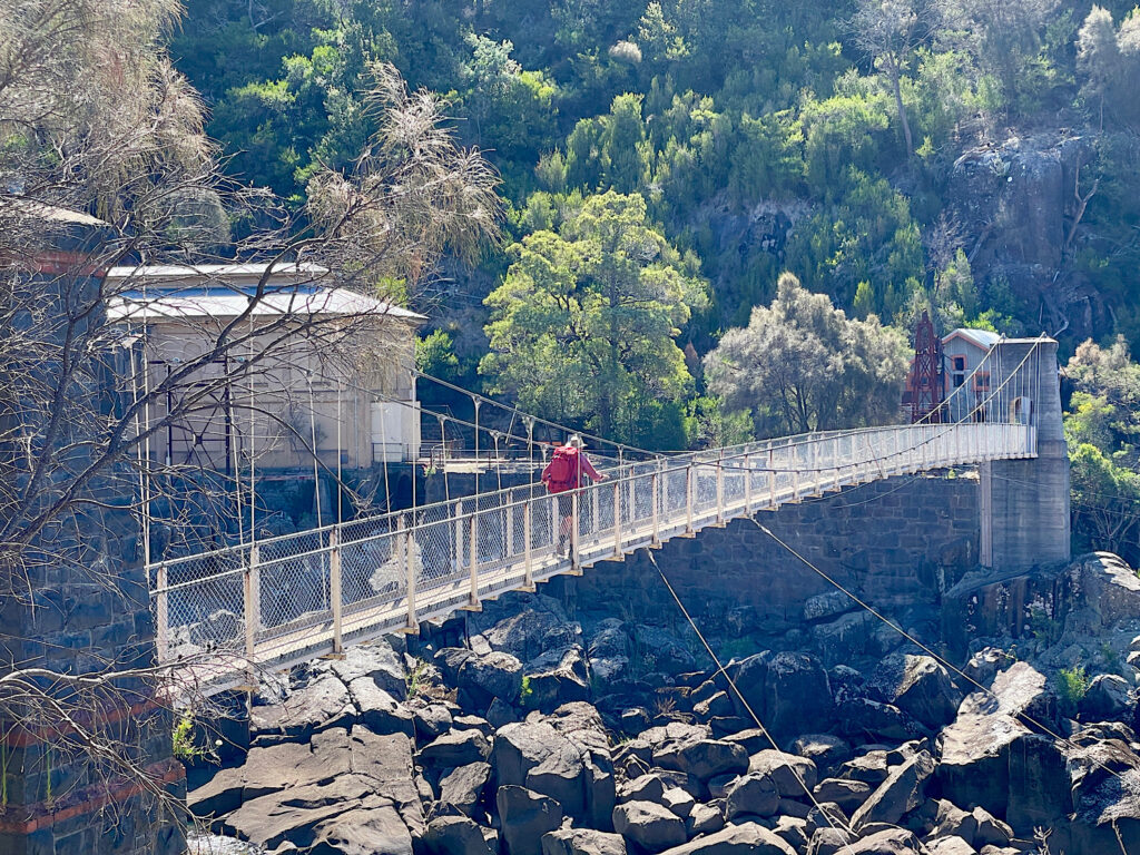
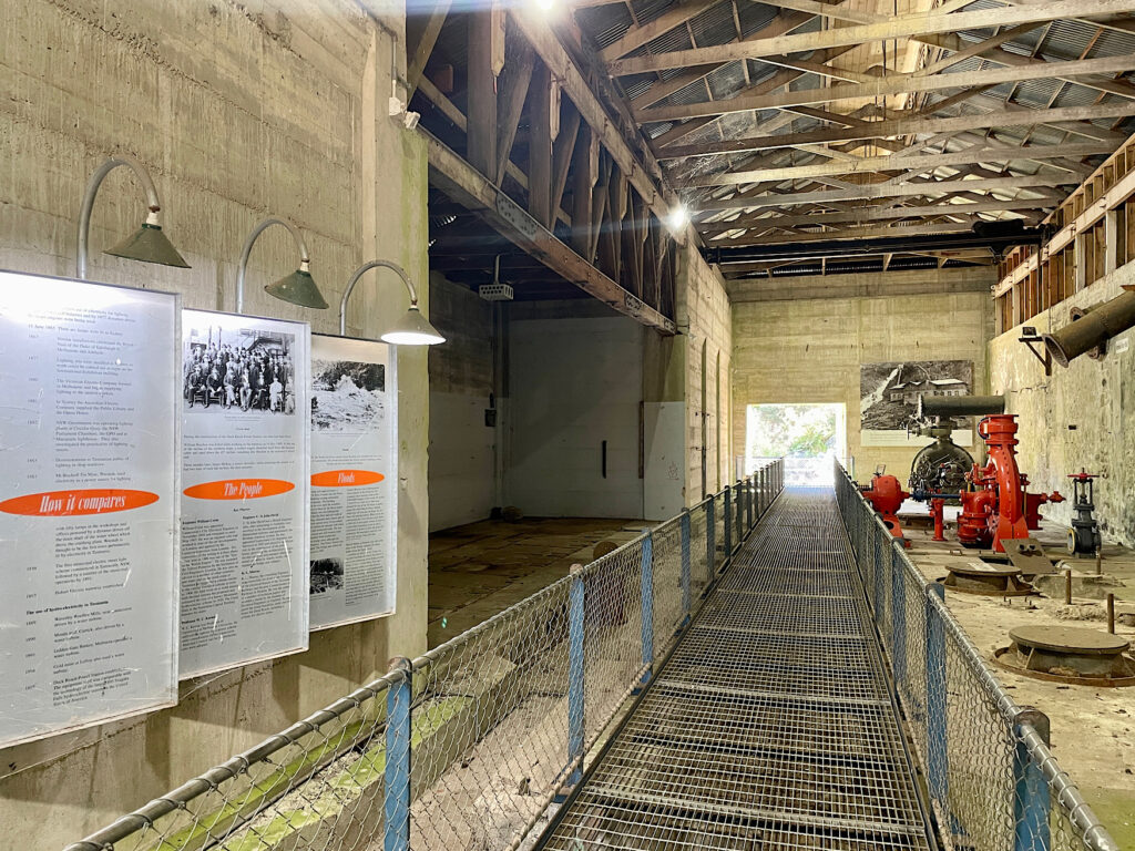
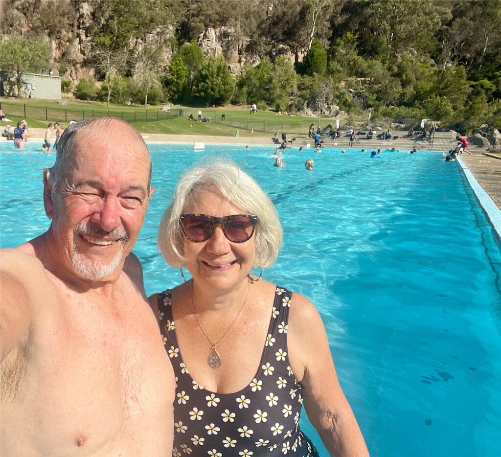
No trip to Launceston would be complete without a visit to Cataract Gorge. This beautiful gorge formed by the South Esk River has a cafe, large grassed picnic area, a swimming pool, a chair lift and lots of walking tracks. We headed off on the 6km return walk along the cliff edges of the gorge to the Duck Reach power station. This station, one of the earliest hydro-electric power stations in the world, operated from 1895 to 1955.

The walking track to Duck Reach power station.
Crossing the river to the power station.
Duck Reach power station
A well-deserved swim at the Gorge pool

Saturday night we camped at Old Mac’s Farm ($20) after spending the afternoon reminiscing as we wandered the Lonnie CBD.

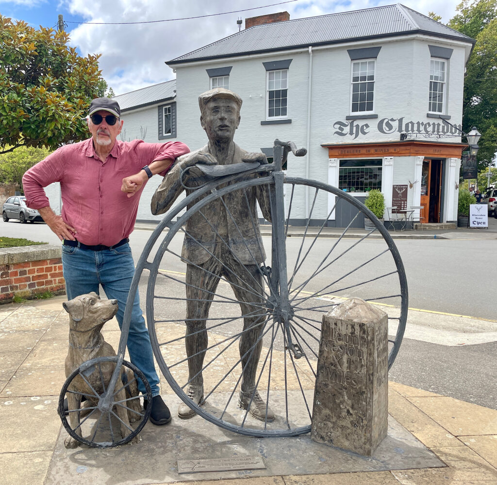
Sunday night was at Honeysuckle Banks free camp near Evandale where preparations were in full swing for next weekend’s penny farthing races.

It wouldn’t be the first time Steve has ridden a penny farthing.

Our backpacks were emptied and repacked and weighed several times before we were finally satisfied. But generally we (particularly me) just tried to keep the nerves in check. Sunday night we camped in the carpark of the Red Feather Inn at Hadspen, the meeting point for the hike. This 6-day, 64+km hike in the Tasmanian Highlands is going to be a challenge.

9 – 14 September: Home to Mackay

9 – 11th September, 2015

After much planning, and with great excitement we finally left home today towing Top Shelf to launch in Mackay, sail around the southern Whitsunday Islands before heading up to the main islands – length of trip -> TBA. Pam and Milton arrived a couple of days ago to settle in and get last-minute instructions on looking after our home while we’re away, so we’re now foot-loose and fancy-free. Whitsundays here we come!

As I don’t tow we didn’t go too far today – just up the road to Gin Gin. We’re staying in the boat as we travel – may as well, afterall it’s all set up. We did get lots of stares and quite a few comments along the lines of ‘expecting rain?’, etc. Anyway, the showgrounds where we stayed was very good. Lots of room, a friendly caretaker, clean amenities and not too far to the pub for a counter meal tonight.

Next day we stayed the night at Waverley Creek Rest area just south of St Lawrence. This excellent, free, overnight rest stop has good, clean facilities and lots of parking spots, though it does fill up quickly. It’s right beside the road, but despite that we weren’t disturbed by traffic overnight.

Next day, just a short 200km to the marina at Mackay Harbour. We decided we’d stay on the boat in the carpark again tonight and launch tomorrow. We met up with another couple of Noelex owners (Tony and Dave) up here with their boats planning two weeks of sailing.

Unfortunately the weather does not look good – it’s drizzling rain and very windy, with the forecast to stay with high winds for another few days. We’ve made a policy that seeing we’re here for the pleasure of sailing, and we’re not in a hurry, we don’t sail in winds stronger than 15kn. We may be here for a few days. Dinner at the Thai restaurant here at the marina with Tony and Dave and their crew – mates who had flown up today from Melbourne.

Top Shelf at Mackay marina.

Top Shelf at Mackay marina.

12 – 14 September

We’ve been cooling our heels here at the marina for the last few days. While we’d love to be out sailing, this isn’t too bad a place to be held up. The marina has coffee shops, restaurants, fish and chip shops, a pub (useful for Steve as the football was on) and a small chandlery at the marina office. We also have our car here so have spent our time looking around Mackay, went to the Botanic Gardens, picked up forgotten items at the shops, and today (14th) we’ve provisioned the boat, fuelled up and are all ready to go, weather permitting.

Is this some kind of alien beetle? At Mackay Botantic Gardens.

Is this some kind of alien beetle? At Mackay Botantic Gardens.

Days 21, 22: Bramwell Station; Jardine River

27th June, 2015

Leaving Chilli Beach today we did a detour back to Lockhart River for fuel, water and a few groceries, stopped off at the airport to have a look. I was particularly interested in seeing this as my father piloted planes to New Guinea during WWII and in all probability landed here on the way up.
The road out was even more muddy and slippery as we’d had a little rain one evening. Wasn’t a problem for us – into 4WD and power on through it.

That's where we're ultimately headed! I like the name Pajinka - nicer than Cape York, or 'the Tip' as most people call it.

That’s where we’re ultimately headed! I like the name Pajinka – nicer than Cape York, or ‘the Tip’ as most people call it.

Tonight we’re staying at Bramwell Station. This is a private property, a 132,00 ha cattle property established in 1930 and now diversified to include tourism. In the early days the cattle had to be walked a very long way to the Mareeba Salesyards, or to Bamaga. With the road being opened up and a bridge over the Wenlock River they’re moved by road trains these days.
There are extensive camping grounds around the homestead, a bar, some cabins and warmish showers. It’s very popular with there being around 50 or more campers here. The tour bus companies also come here. You can order meals at the bar, but it was booked out – probably just as well, it didn’t look that appetizing.

Our campsite beside the cattle yards at Bramwell Station.

Our campsite beside the cattle yards at Bramwell Station.

At ‘sundowners’ around the bar we had live music entertainment (pretty good) and one of the managers told us the history of Bramwell Station. It’s only changed hands twice. The original owner had considerable help from a local aboriginal family and when he died he left a part-share of the property to the family – unusual in those days! The current owner purchased it in 2001. Anyway with the current price of beef being very favourable, the roads making it very accessible for tourists, also owning Bramwell Junction Roadhouse which charges over $2/L for diesel, and a road work team that is kept constantly employed on these roads, the Station should be doing very well for itself.

28th June, 2015

Lost your number plate? Maybe it's here.

Lost your number plate? Maybe it’s here.

The highlight today is going to be Fruit Bat Falls. After leaving the Station we stopped at Bramwell Junction Roadhouse to refuel. This is where the Old Telegraph Track starts. On a tree there are dozens of number plates nailed – lost from cars attempting the unforgiving OTT. Fuel was exorbitant – $2.20/L.

Onward to the Falls. Our friend Bryan was part of the crew that installed the microwave telephone towers up here some 40 years ago. It was one of his crew, a young lad who loved to eat fruit and whose nick-name was Fruit Bat, who ‘discovered’ the falls and after whom they were subsequently named. (My brush with fame!)
Anyway the Falls are just fan-tas-tic! Crystal clear water cascading down a 2 metre drop in the middle of beautiful, lush heathlands. The swimming was heavenly. We had a picnic lunch here before continuing our trip to camp at the Jardine River ferry – ready to cross tomorrow morning.

Really enjoyed our swim and the beauty of these delightful little falls.

Really enjoyed our swim and the beauty of these delightful little falls.

The roads are very corrugated, and dusty – red bulldust! When you pass or are overtaken by a vehicle visibility drops to mere metres. Travelling close behind someone would be very unpleasant, and dangerous. Road trains travel the road taking supplies and fuel to the tip and it’s not fun being stuck behind one.

To see our photos from this part of the adventure CLICK HERE.

Days 18-20: Lockhart R, Chilli Beach

24th June, 2015

Leaving Gills Moon Lagoon we continued on into Lockhart River. The road was … variable. Mostly it was pretty good though there were some very wet, slippery parts, some river crossings and a few bad potholes that nearly swallowed us.

Pascoe River crossing, Portland Roads Rd

Pascoe River crossing, Portland Roads Rd

Iron Range National Park, which is were we are now is unique in that it has stunted heathlands with she-oaks, grevilleas, banksias and sedges around the Mt Tozer area before moving into the largest remnant of lowland rainforest left in Australia. Another truly beautiful drive. We stopped at the Mt Tozer viewing platform to see the heathlands close up, with Mt Tozer in the distance.

Coastal heathland backing on to Mt Tozer

Coastal heathland backing on to Mt Tozer

The studio where the Lockhart River Gang artists work is a home converted for the purpose. The front two rooms are crowded with prints and paintings. Ric and Gill chose 4 pieces they liked and we chose 3 that we liked – one of them is a crab, my star sign – significant with my birthday less than a month away.

Our purchases

Our purchases, with the artistic director.

We also chose a Silas Hobson black and white print, and a  Patrick Butcher lino print hand coloured. We were incredibly lucky to have both of these artists drop in to the studio before we left and posed for a photo with us. Patrick Butcher spent quite a bit of time describing his print and what it all meant. Wow – how good is that!

The artist, Patrick Butcher, explaining the meaning behind his art.

The artist, Patrick Butcher, explaining the meaning behind his art.

We picked up a few extra groceries at the general store in Lockhart River – I feel so sorry for the locals for the price they have to pay for groceries and fuel – and headed to Chilli Beach. This road had lots of ‘dips’ all potentially with little stream crossings or washouts at the bottom of them, and one quite long river crossing which was good – not too deep. The road quality wasn’t too bad – corrugations in patches and some soft sand.

Our campsite here at Chilli Beach is perfect. Here on the eastern coastline of the Peninsula the wind blows constantly, only varying in intensity. Our campsite is a short 20 meters from the beach, but tucked in behind huge mangrove trees which are so thick overhead that even when it rained we were well protected. Campsite 20 for future reference!

Campsite 20! Well protected from the constant SE winds, ocean views just there, between the trees, and well shaded from above. Great campsite.

Campsite 20! Well protected from the constant SE winds, ocean views just there, between the trees, and well shaded from above. Great campsite.


25th June, 2015

On our first full day here we did the beach walk to the mouth of Chilli Creek – 10K return. The beach is thickly lined with overhanging coconut palms and has to be the prettiest tropical beach you’ll find. We all loved it – it was just so perfect … except for one thing!

The idyllic Chilli Beach

The idyllic Chilli Beach

This was a very sobering sign to read. What a mess our oceans must be in if that much rubbish gets washed up on just this one little beach.

This was a very sobering sign to read. What a mess our oceans must be in if that much rubbish gets washed up on just this one little beach.

Unfortunately it’s also perfectly located for the ocean to deposit it’s rubbish on it. Just above the high tide line is littered with plastic bottles and rubbish which mostly originates from other countries and ships. More than 5 tonnes of rubbish is removed from the 6.5km beach each year. Most deadly of the rubbish are the ghost nets – fishing nets that are cut adrift to float the oceans ensnaring fish and turtles and condemning them to die a slow death.

Ghost nets tangle fish and turtles, condemning them to a slow death.

Ghost nets tangle fish and turtles, condemning them to a slow death.

A campfire tonight! Not too successful though because those south-easterlies did make it a bit chilly to sit out.

26th June, 2015

The beach at Portland Roads.

The quiet beach at Portland Roads.

After a bit of a wander on the beach we headed to Portland Roads. During WWII an airstrip was established just outside Lockhart River. A road was constructed to Portland Roads where there was already a jetty servicing the local gold mines. The jetty has been swept away, but the original footings are still there. Portland Roads is a very quiet little hamlet with a few homes for fisherman, a bed-and-breakfast accommodation, and a cafe where you can reputedly get the best seafood on the Peninsula. How could we not go there!

A truly delicious meal in a unique little restaurant, Portland Roads

A truly delicious meal in a unique little restaurant, Portland Roads

To see all our photos from our stay at Chilli Beach CLICK HERE.

Days 15, 16 Coen to Oyala NP

Day 15 – 21st June
Coen today. Ric and Gill are having hassles with their fridge and an overnight on 240 volt might just be the cure so we’re heading for the roadhouse and a powered site for them. We’ve been told that the free camp down by the river is lovely, but I must admit that camping on grass behind the pub with a clean toilet and lovely hot showers was a bigger draw card for me.

Day 16 – 22nd June
We’ve booked the Mango 1 campsite in Oyala Thumotang (pronounced oy-a-la toom-o-tongue) National Park for two nights. We’re lucky in that they’ve only just opened it this week after being closed for the wet season, however that’s made us a bit concerned about what state  the road would be in. We needn’t have worried – they  were grading and repairing it as we drove in and the majority of it was very good. A few sandy patches and muddy ‘dips’ benefited from 4WD. The road leading from the Roylen Rd into the park was two wheel tracks for about 12K, but still quite good.

Really lovely drive in to the National Park.

Really lovely drive in to the National Park.

Here we started to see more termite mounds. There was one vividly white, very tall and narrow mound that was stunning and I regret not stopping to photograph it. The Archer and Coen Rivers form part of this park with the majority of the vegetation being dry open eucalypt woodlands and melaleuca swamps.
Mango Lagoon turned out to be not that nice – dirt and stubbly grass recovering from a recent burn off and the lagoon was pretty ordinary. We decided to take a look at Coen 2 campsite and it was lovely so we set up there for the night. It had steep sides down to the river with fallen trees giving it interest and we could see the water flowing – and we were on grass.

Set-up complete - just need to fill the chairs and the glasses.

Set-up complete – just need to fill the chairs and the glasses.

This afternoon we walked to Chong Swamp, another campsite within Oyala NP which was very pretty – covered in water lilies. It would have been a lovely spot to camp too.

To see more photos from our trip today CLICK HERE.

Day 12: Cooktown to Old Laura

18th June, 2015

Took a drive up Grassy Knoll for fantastic views over Cooktown and surrounds, then re provisioned, refuelled and we headed towards Laura. We’re planning on attending the Laura dance Festival on Friday afternoon and Saturday.

Panorama of Cooktown from Cooks Lookout. Cooktown is to the left, Mt Cook in the distance. Click on this photo to see it full size - it's worth it.

Panorama of Cooktown from Cooks Lookout. Cooktown is to the left, Mt Cook in the distance.
Click on this photo to see it full size – it’s worth it.

The small aboriginal township of Laura is in Quinkan Country which is nationally and internationally significant for its ancient rock art, particularly their depiction of “Quinkans”. Quinkans are spirits from aboriginal legend. There are two types of quinkan, the Imjim (bad) and the Timara (good). The Imjin were small and fat-bellied, with large ugly heads, long teeth and claws. They stole children and took them to their caves. They travel in giant leaps across the land. The Timara were amusing, unusual spirits who like to play tricks on people. The Timara were very tall with big ears and so skinny they could live in the cracks in the rocks.  At Split Rock we did a self-guided tour of the rock before before going to the Quinkan Centre in Laura to book our tour for tomorrow.

Rock art at Split Rock depicting Quinkans

Rock art at Split Rock depicting Quinkans

The Quinkan Centre is an information centre illustrating the area, its geographical, aboriginal and white history. A great educational resource which we really enjoyed wandering around and learning so much.
Then it was off to Old Laura to camp at the old Homestead. The Homestead had been pivotal in the pastoral industry supplying meat for the goldfields.  There were other campers there but we couldn’t see them or hear them. Our campsite was huge, amongst shady trees – no facilities. Ahh peaceful bliss.

Ric and Gill were a bit worried their vehicle might not make it to the Cape and back. They may have had a point!

Ric and Gill were a bit worried their vehicle might not make it to the Cape and back. They may have had a point! At Old Laura Homestead.

For more photos from our adventure today CLICK HERE.

Day 11: Cooktown

17th June, 2015

The weather is finally clearing. Strong gusts of wind at night that sound like a freight train inside the tent, but no rain.
James Cook came ashore here in June 1770 (245 years ago this month!), spending 7 weeks repairing his ship, the Endeavour after it was holed running into the Great Barrier Reef. It was where he saw his first gangurru, which he misinterpreted as kangaroo.

The man himself!

The man himself!

Cooktown was a small settlement until gold was discovered in the Palmer River in 1872. Cooktown was established as the port for the goldfields and became the second largest town in Queensland. The legacy of that was many beautiful old buildings.

Tourist Information Centre, Cooktown.

Tourist Information Centre, Cooktown.

A walk around town has lots of interesting history points and the botanical gardens are a lovely cool retreat.

Loved our lunch on the Verandah Cafe. What a great spot!

Loved our lunch on the Verandah Cafe. What a great spot!

The boys went to the Cooktown Pub to watch the football State of Origin and Gill and I read our books.

To see photos from Cooktown CLICK HERE.

Day 9: Noahs Beach to The Lions Den

15th June, 2015

It rained last night, at times quite heavily. We were snug and dry in the rooftop tent, but it meant we had a wet tent to pack up – and the ground was muddy! Anyway after brekkie we packed up, went for another walk along the beach, then drove back a couple of K to do the Marrja Botanical walk.

When you're up this way be sure you do this excellent walk.

When you’re up this way be sure you do this excellent walk.

Sheltered from above by the fan palm. Excellent boardwalk with lots of informational signage.

Sheltered from above by the fan palm. Excellent boardwalk with lots of informational signage.

This was truly fascinating as it took us from rainforest, across Oliver Creek and immediately we were in mangroves. I didn’t realise there were so many different types of mangrove. The explanatory signs along the boardwalk made it a very interesting walk. Well done National Parks!

On to Cape Tribulation, where the rainforest meets the sea – stunning scenery.
The Bloomfield Track begins just north of Cape Trib. The road follows an ancient aboriginal walking track and has quite a chequered history as environmentalists fought to have its construction stopped for fear of the effect it would have on the coral reef just off the coast. Nevertheless it went ahead and became infamous as a slippery dirt road with very steep ascents, descents and creek crossings – a challenge for 4WD enthusiasts. So it was with some trepidation that we began this section.

The beginning of the Bloomfield Track is the beginning of many kilometers of dirt roads over the next few weeks.

The beginning of the Bloomfield Track is the beginning of many kilometers of dirt roads over the next few weeks.

It wasn’t long before the tyre pressures were reduced and the car put into low lock. We’d timed the creek crossing for low tide when the creek would be lowest but with a firm rocky bottom it wasn’t too much of a challenge. No argument, the ascents and descents were very steep, but the worst ones had been concreted which helped. It took some expertise to drive it, but I reckon we’ve been on worse.

It wasn't long before we came to our first river crossing; the first of many.

It wasn’t long before we came to our first river crossing; the first of many.

The bitumen began at Wujal Wujal where we stopped to look in the community art gallery and to have some lunch. A diversion to the Bloomfield Falls was well worth it – thunderous falls into a big, wide river – very picturesque.

The Bloomfield Falls - breathtaking! I can't imagine what they'd be like in the wet season.

The Bloomfield Falls – breathtaking! I can’t imagine what they’d be like in the wet season.

Not much further on we arrived at our destination for the night – The Lions Den Hotel – an historic and quite quirky hotel that has camping behind it. Dinner of barramundi and chips in the pub tonight.

Enjoying a well-earnt drink at The Lions Den bar.

Enjoying a well-earnt drink at The Lions Den bar.

To see other photos from our lovely drive today CLICK HERE.

Day 8: Port Douglas to Noahs Beach

14th June, 2015

Organisation at it's best!

Organisation at it’s best!

After packing up the cars with the last minute shopping – oh if only we could tell how much food we’d need, we finally got away about 10am. I was pretty industrious before leaving home and froze quite a few cooked meals in readiness, to Ric’s great amusement.


Leaving wasn’t that easy – the Cairns Ironman competition was on and the main road out of town was closed. We weren’t delayed too long.

First stop Mossman, for fuel, and we were off. Lots of sugarcane!

Gill outside the Mossman Gorge Centre. Lots of aboriginal art and sculptures on display.

Gill outside the Mossman Gorge Centre. Lots of aboriginal art and sculptures on display.

From here we went to Mossman Gorge. Mossman Gorge forms a part of the World Heritage Listed Daintree Rainforest and contains the oldest, continuously surviving rainforest on earth being over 135 million years old.  This spectacular gorge and river is now under the care of the local aboriginal group. An excellent information centre at the beginning has lovely art to purchase and of course, the tickets. You have to catch the bus up to the gorge and from there you do the walks. Magnificent, fast-flowing river, crystal clear water, with perch easily seen swimming in the quieter parts. Swimming is sometimes permitted, but not this time – the river is flowing too fast. The rainforest walk was delightful – magnificent trees and that lovely feeling of life all around you.

A fine looking couple at Mossman Gorge.

A fine looking couple at Mossman Gorge.

Apparently there's over 3,000 species of plants in this rainforest. And look how beautiful they can be!

Apparently there’s over 3,000 species of plants in this rainforest. And look how beautiful they can be!

Crossing the Daintree on the car ferry.

Crossing the Daintree on the car ferry.

On to the Daintree Ferry to cross the Daintree River. We stopped at the Daintree Discovery Centre but didn’t go into it ($68/person). There was another walk nearby that we enjoyed – free.

Our destination was the campsite at Noah’s Beach, a National Parks campsite. Once more they didn’t let us down – basic facilities, just a loo, but right on the beach. Went for a long walk along the beach with Ric, Gill and Steve, photographed the wonderful patterns made by the ghost crabs on the beach, back to camp for dinner, a few vinos, some fun and laughter with our friends and off to bed. Early night getting prepared for the famous Bloomfield Track tomorrow.

Noahs Beach

Noahs Beach

Wine o'clock on Noahs Beach.

Wine o’clock on Noahs Beach.

To see all our photos from today CLICK HERE.

Days 1 – 7: Home to Port Douglas

7th – 13th June, 2015

Our next adventure, exploring Cape York, began with a long, fast ‘transfer’. A ‘transfer’ is driving just to get somewhere else.  It took us 4 days to cover the 1833K from home to Port Douglas where we met our friends Gill and Ric. From home we went up the Burnett Hwy to meet the Bruce Highway just north of Maryborough. Stopping at Biggenden we were surprised to meet Keiran and Alan in their Jabiru – small world. Lunch turned out to be coffee and cake – public holiday and only the pub was open. That night we spent at Alan and Cheree’s home in Gladstone. A very pleasant evening.

Next day on to and past Mackay to camp beside the Leap Hotel. The Leap was named after the story of a young aboriginal mother who was being pursued by the police (conflict between aboriginals and white settlers in the early days of white settlement was frequent). Rather than be captured, the mother, carrying her infant, climbed Mt Mandurana (now commonly known as ‘The Leap’) and jumped to her death. Her baby girl survived the fall.

This very well patronised, free campsite is well grassed and pleasant and the Hotel amenities are available to campers. We had an average dinner there before settling down for the night. Not a good night’s sleep though. Getting used to a different bed is always unsettling, but the traffic was just a bit much – after all we were right beside the Bruce Highway!

Early morning at The Leap - bit chilly!

Early morning at The Leap – bit chilly!

Off to Townsville next day, but first a stop at Whitsunday Gold just outside Proserpine – a coffee plantation and cafe we discovered on our last trip here. The coffee was just as delicious as ever, and the savoury muffins were to die for. Don’t miss this little gem when you’re up this way.

Enjoying morning tea at Whitsunday Gold.

Enjoying morning tea at Whitsunday Gold.

Arriving in the afternoon at Townsville we booked into the Rowes Bay Caravan Park. It’s fair enough – very clean amenities and a grassy place to set up camp. Because it wasn’t such a long day today we went for a walk along the coastal walk from there to The Strand and back, stopping for a meal on the way. The council has done a lot of work on this part of Townsville. The walk follows the coast all the way, with a very impressive boardwalk to take you around Kissing Point. Also the area that had been army land on Kissing Point has now been redeveloped and is excellent – lots of sculptures, information about the indigenous and white history, a layout of the Battle of the Coral Sea and first hand reports of being in Townsville during WWII when it was being bombed. Excellent work Council.

Interesting sculptures along the coastal walk in Townsville.

Interesting sculptures along the coastal walk in Townsville.

Next morning off to Port Douglas, via Cairns where we stopped for lunch at the Paleo Cafe. Arrived in Port Douglas about 3.30pm relieved we’d be having a rest for a few days. Here Ric and Gill had very conveniently arrived a few days earlier and booked into a two-bedroom apartment. We’ve spent the last 3 days here relaxing, soaking up the tropical, tourist atmosphere, doing an anti-rain dance (it’s rained heavily every night – not good for our 4WD tracks) and eating way too much. This is a beautiful place. It’s great to be in the tropics this winter, and Port Douglas just shouts of tropical paradise.
This afternoon Gill and I re-provisioned and now we’re prepared for every eventuality, we hope!

To see more photos from this part of the trip CLICK HERE.

Beautiful Port Douglas, from the lookout.

Beautiful Port Douglas, from the lookout.