On this 8-week journey we experience the most awe-inspiring gorges, caves, country towns, waterfalls and scenery that is northern Queensland. To follow our travels in chronological order click on Home to Mt Isa, to be taken to the beginning, then follow on our journey by clicking the link at the end of the post on the right for the next exciting instalment. (hee hee)
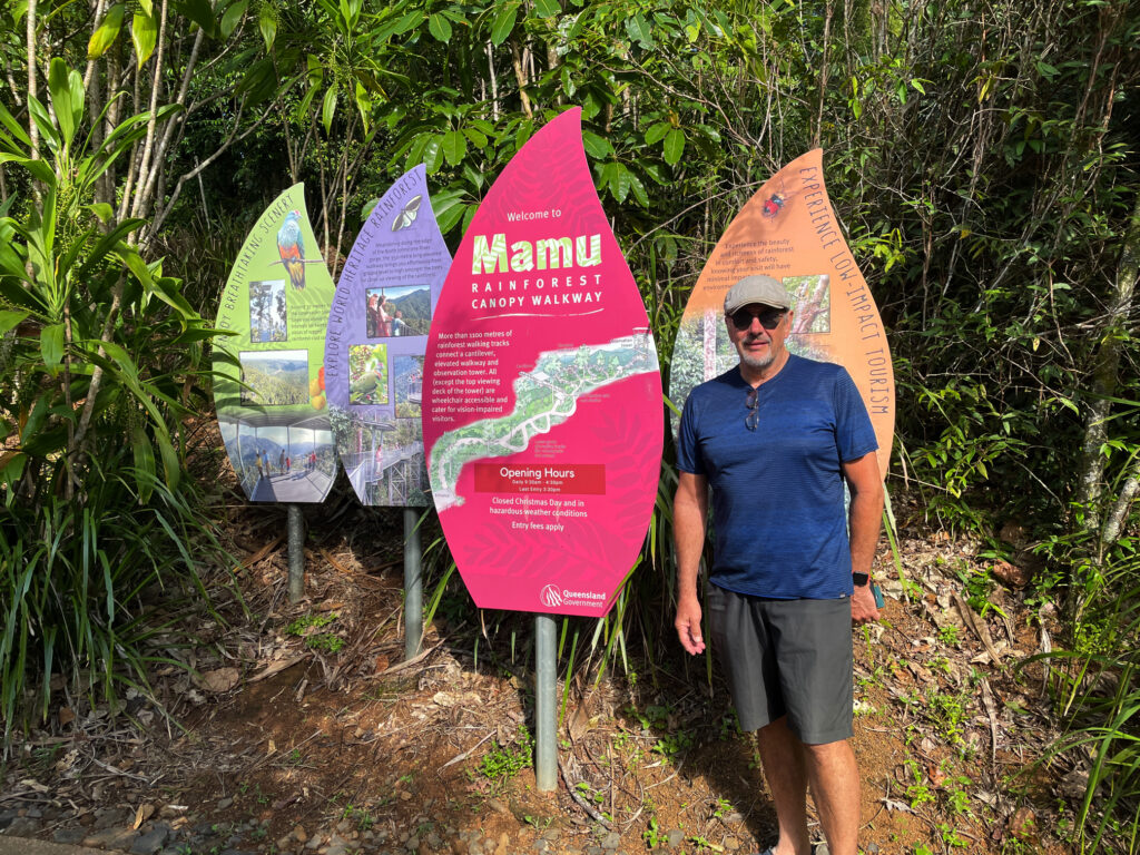
Just a few kilometres down the road is Mamu Tropical Skywalk. On arrival we downloaded the app then set off on the kilometre or so walk through the rainforest with the audio (from the app) telling us the story of the area, the plants, the cyclones and other interesting info.
At Mamu Skywalk
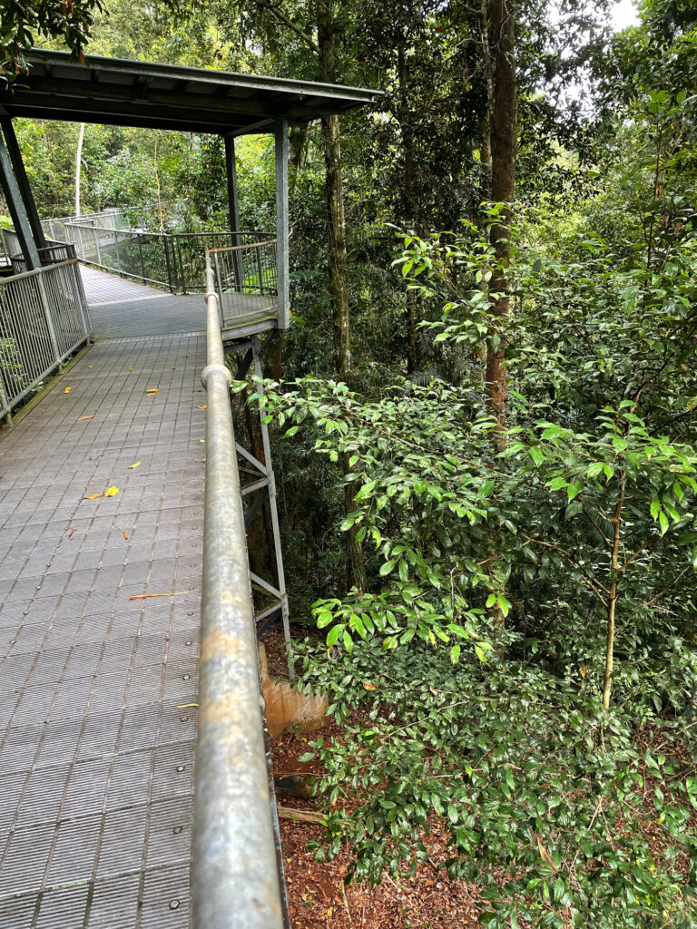
A 350m section of elevated walkway leads to a cantilever 15m above ground right in the rainforest. The view of the rainforest beneath us and to the sides was fascinating, just looking at the different trees and epiphytes.
Mamu walkway. Excellent infrastructure designed to showcase the area at its best without damaging any of the flora.
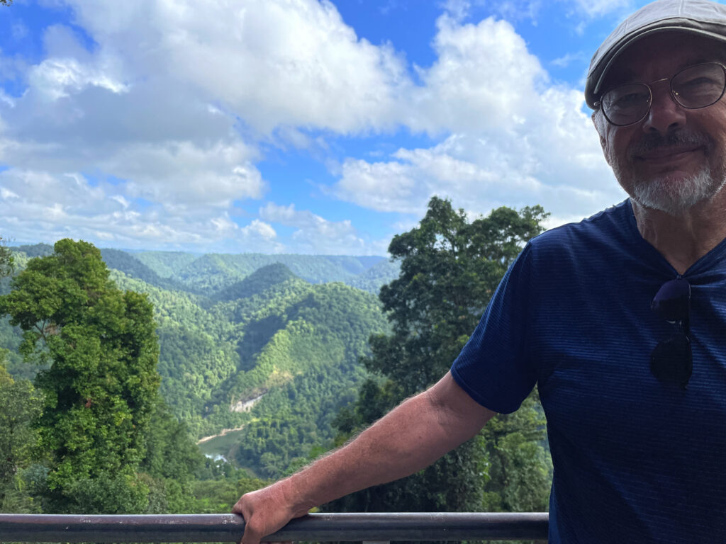
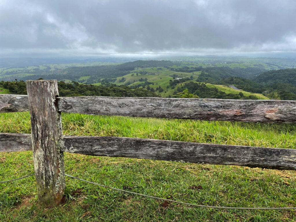
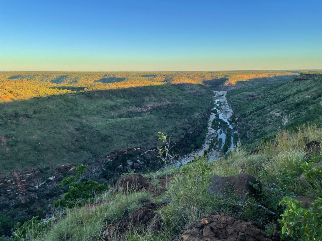
But also straight ahead was the Johnson R Gorge. This is such beautiful country. Further on is ‘the tower’. This 37m tower, with many, many steps to reach the top, looks out over the tops of the trees and across gorges. Fantastic!
The view down the valley from the Mamu boardwalk.
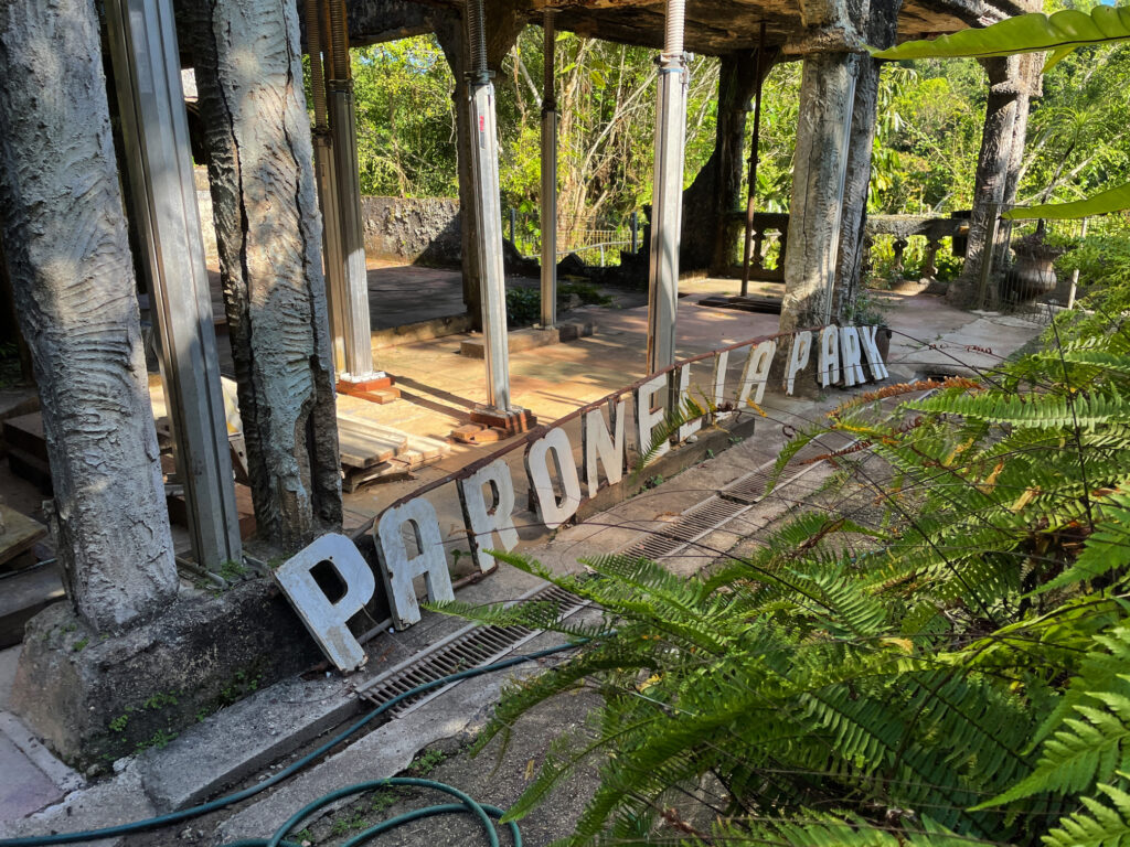
Paronella Park is the main destination for today, with camping onsite. For years people have been telling us about this place. It’s one man’s dream of having a European Castle in Australia. José Paronella nearly single-handed built his home and his castle over a 6-year period. A grand staircase leads from the beautiful grounds and tennis courts past the fountains to a ballroom, which used to hold dances and show movies, with refreshments provided from the refreshment rooms.
Rustic Paronella Park
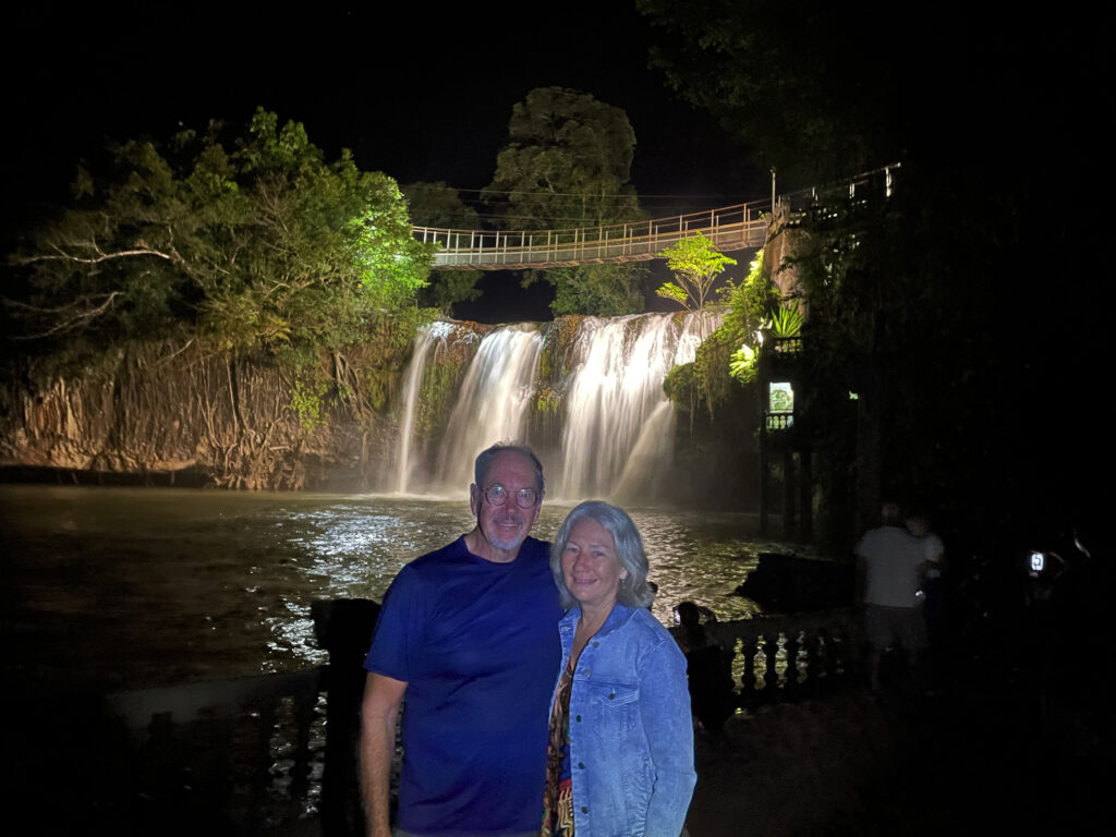
Mena Creek enters the property via a waterfall into a large swimming pool. The hydroelectric power plant José established here provided electricity to the property fully 30 years before the local townsfolk had power. In its heyday Paronella Park was an exotic playground for the locals as well as many servicemen during WWII.
The falls on Mena Creek – a part of Paronella Park. A hydroelectricity unit was built here to power the park and is still functional today.
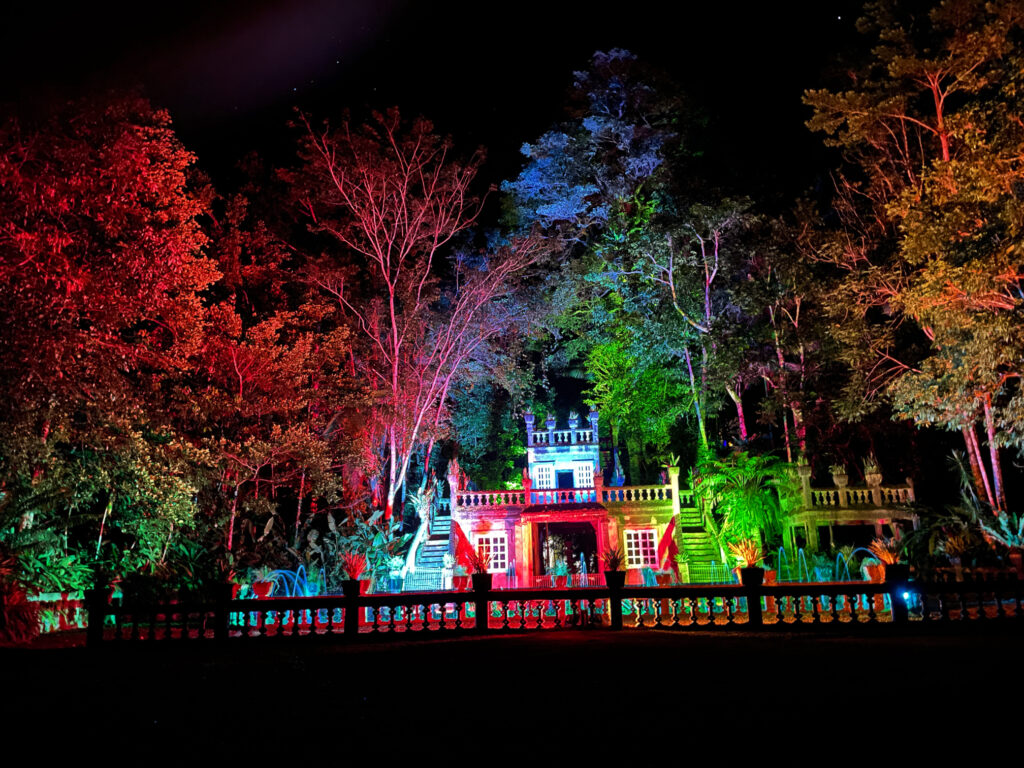
These days, the gardens and fountains are still beautiful, but following floods, cyclones and a fire it’s just the shell of the castle that remains. We stayed in the caravan park on the grounds and did the daytime tour as well as a night tour where the castle is lit beautifully and accompanied by an original music score. Altogether a very enjoyable stay.
The light and music show at Paronella Park is quite special.
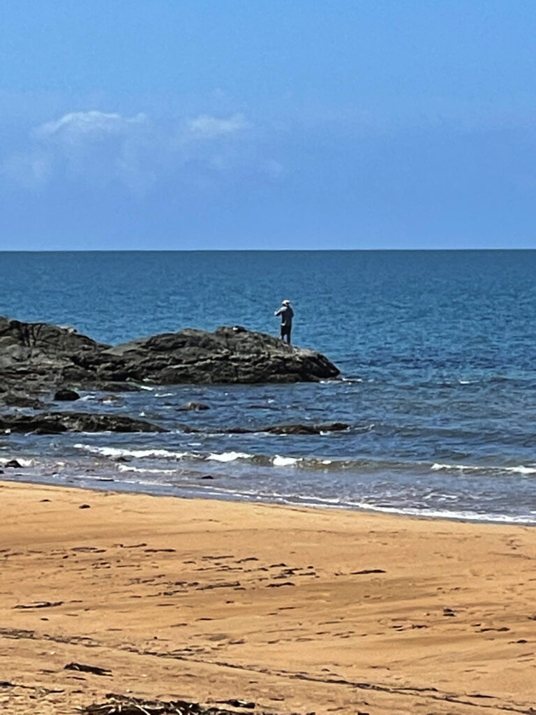
13th May. Bingil Bay
Bingle Bay has a reputation of being a highly desirable camping spot, with only 8 sites and no reservations taken, ie first in, first served. This meant an early departure for the drive to the coast.
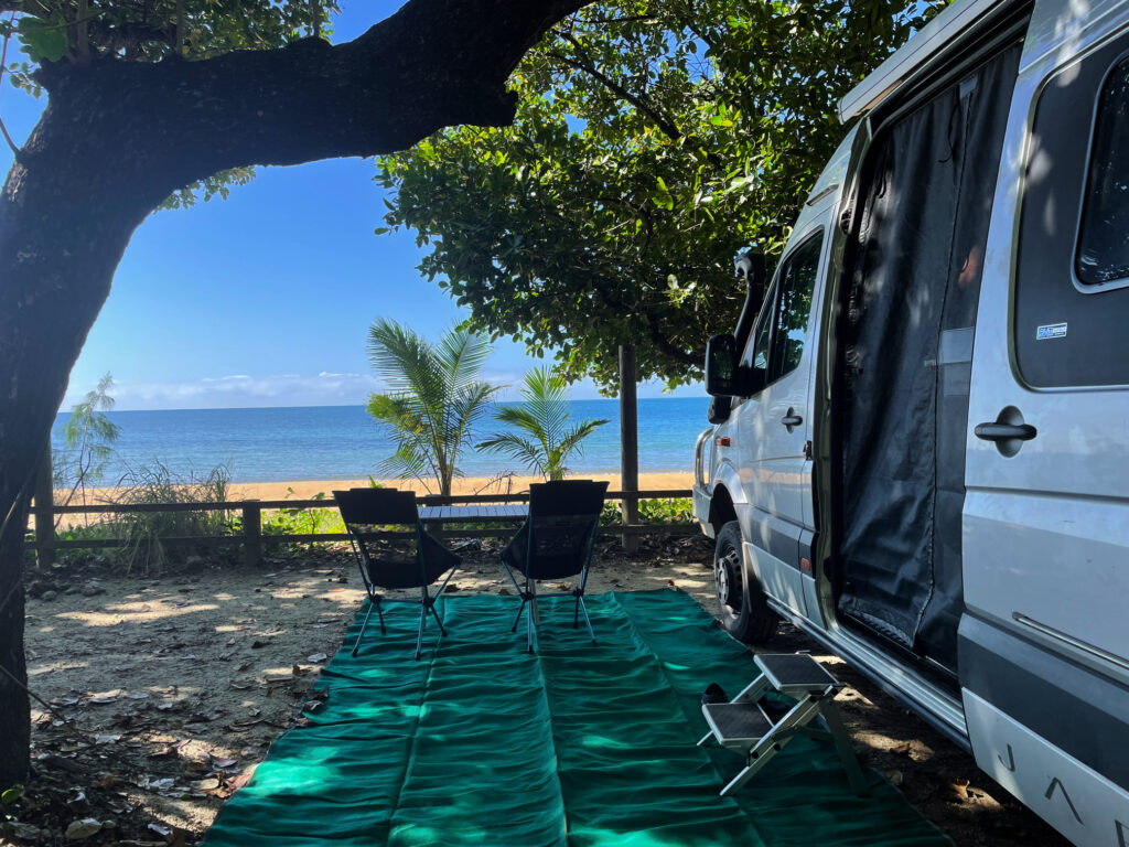
Our campsite at Bingil Bay. Perfect!
We arrived just as the couple who had the best site (that is site 6) were packing up to leave! Walking on the beach, a quick swim (crocs and stingers uppermost in my mind) and lots of sitting back reading was the order of the day.
Steve spent a relaxing hour or so fishing. Bingil Bay
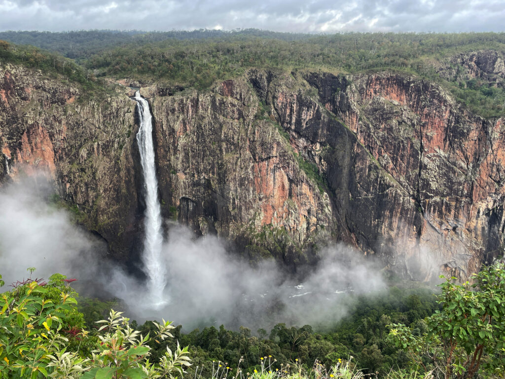
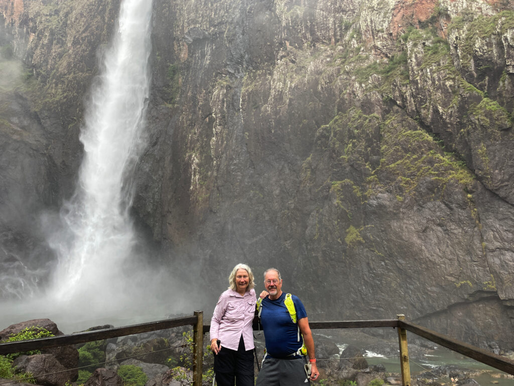
14th May. Wallaman Falls
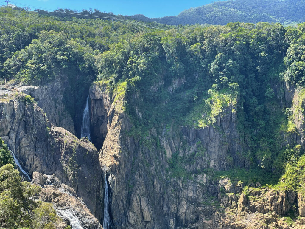
The last of the waterfalls for us on this trip also happens to be the highest permanent waterfall in Australia.
The very spectacular Wallaman Falls.
We camped in the NP campground and, after admiring the falls from the lookout, did the 3.5km return walk to the base of the falls – a very steep descent, followed, unsurprisingly, by a very steep ascent to return. We were both pretty chuffed at how well we managed it – all those Devonshire teas haven’t wreaked too much damage. Once more, a spectacular geographical, or should that be geological, feature.
The walk to and from the base of the falls is quite a trek, but well worth it.
15 – 16th May.
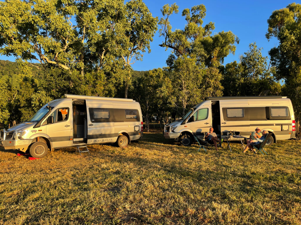
Heading south now quite quickly. We stopped for brunch at the TYTO Wetlands RV camp (looks good for future reference), and a cuppa at Saunders Beach (nice beach, but camp site in carpark) before pulling up for the night at the free camp at Giru. Next night we headed for Lake Proserpine (also currently a free camp) where we’re meeting up with our old travelling buddies Ken and Wendy. Lake Proserpine is a huge campsite alongside the dam. A pleasant camp, particularly our time with our friends.
Back with a great travelling mates, Ken and Wendy, for the last time. 🙁 They’re selling their Trakka. At Lake Proserpine
17th – 19th May
A night at Waverley Creek Rest Area – a good roadside rest area OK for one night. Then on to Wreck Rock camping ground in the Deepwater NP. The road to it from Agnes Water heading south is in very poor condition, so we came up from the southern side on a good dirt road. We spent two days here, mostly relaxing and going for lovely long walks on the beach. A pleasant stay.
Wreck Rock campsite. Another lovely campsite beside the beach south of Agnes Water.
20th – 21st May
We spent our last night before arriving home with good friends Ric and Gill on the Sunshine Coast. Needless to stay a good night was had by all. But there’s no place like home, and it was lovely to arrive back home.
Summary Duration: 54 days Distance driven: 7,471 km Fuel cost: $1410 Campsites: 18 nights in 9 National Parks Free camps – 15 Cost of camping – $766 (+$459 at hotel Cairns) Activities: $791
Brunch at Whitsunday Gold coffee roastery with mates Ken and Wendy.
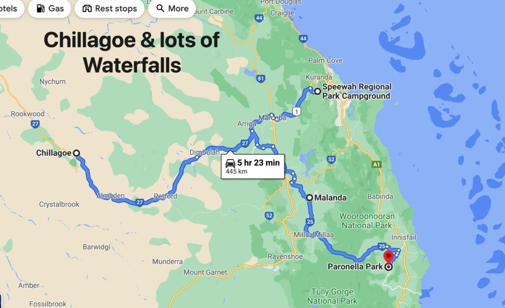
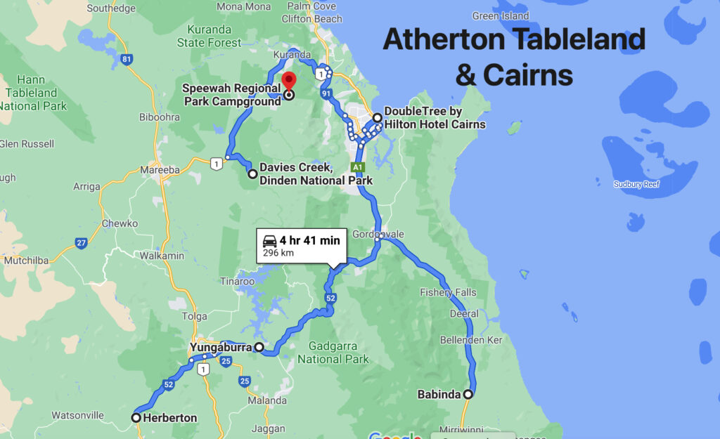
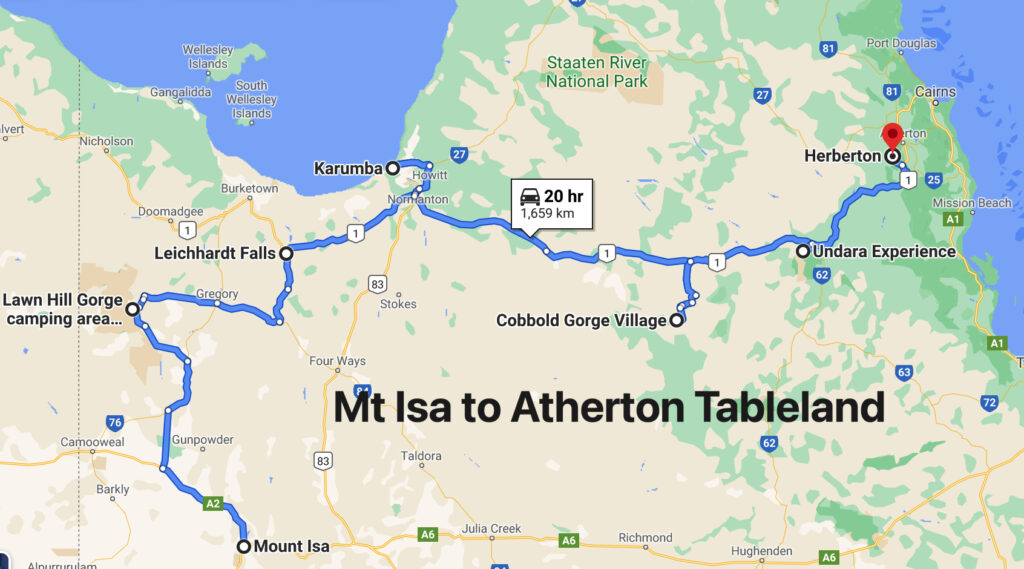
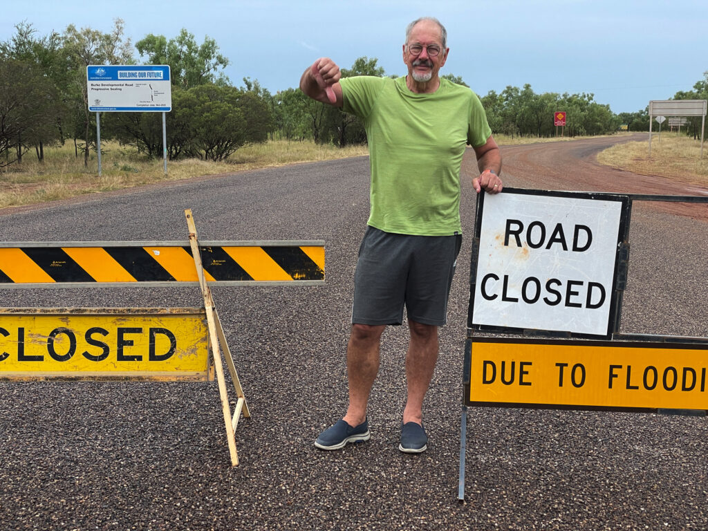
Originally we’d planned to visit Chillagoe when we left Karumba via the Burketown Development road but it was closed due to flooding, hence the zigzagging across the Tablelands. Surprisingly, as we left the Tableland, we passed through rich agricultural lands with avocado, mango, banana, citrus, grapes and sugarcane, and other crops we didn’t recognise, stretching for many kilometres. Before long though we were back in cattle country.
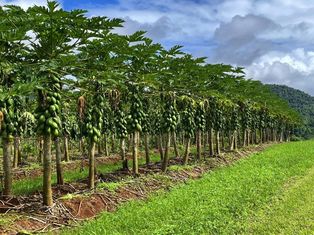
Pawpaws – or red papayas. Absolutely delicious eating. Outside BabindaThe Wheelbarrow Way, one of many tourist trails that highlight our history. Chillagoe
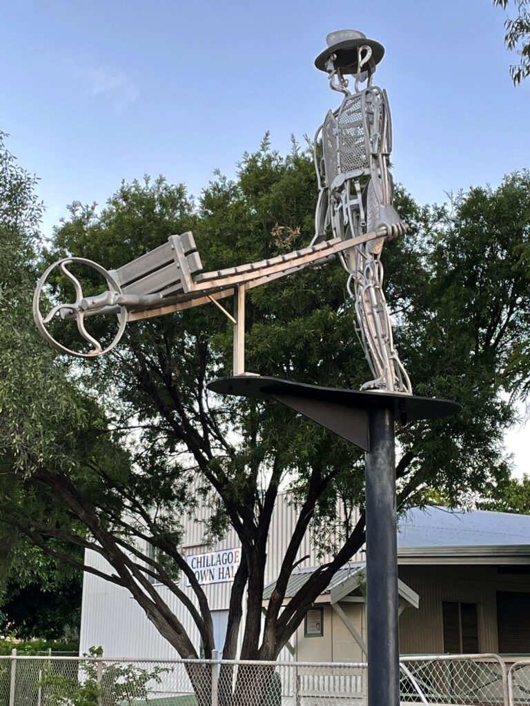
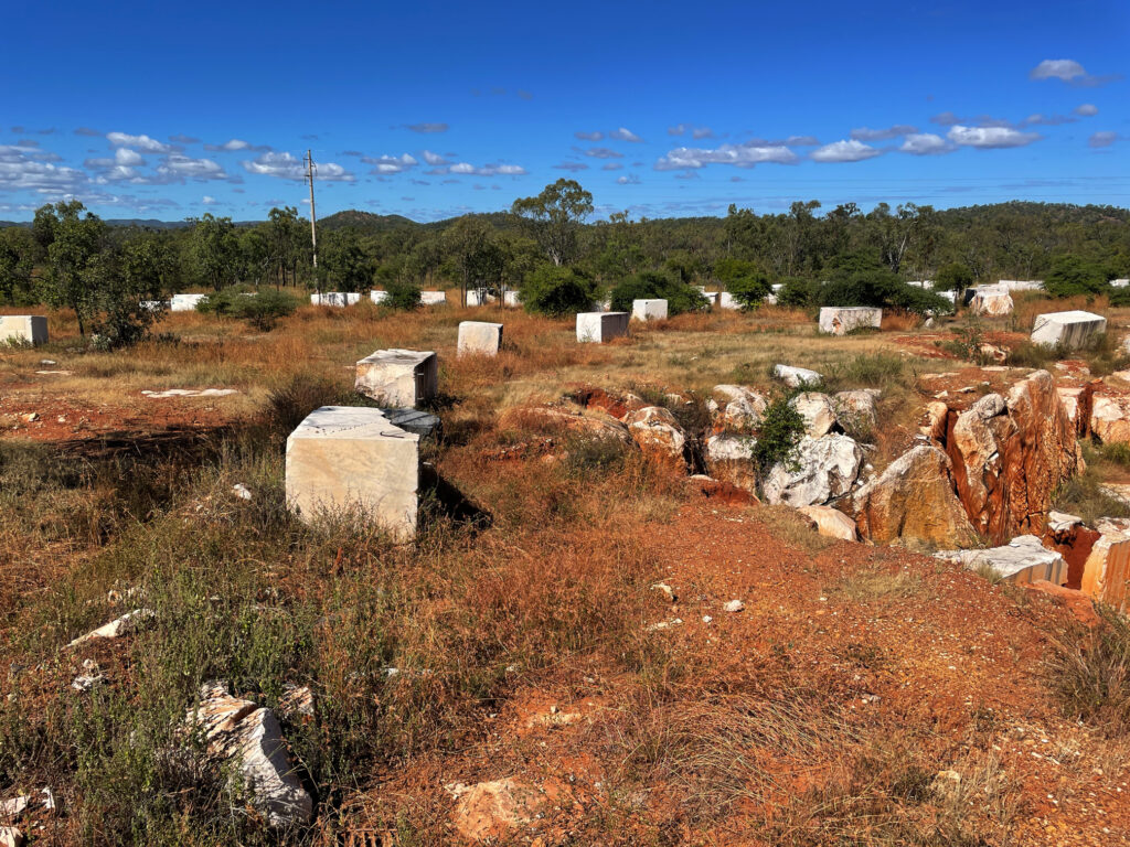
Chillagoe has a population of a bit more than 200. It struck us as a tough little town, its residents having weathered many ups and downs as most mining towns have. Over the years huge deposits of silver, lead, zinc, gold, limestone and marble have been mined here. The lime stone and marble mines are still working, with a few small silver, lead and zinc operations continuing. Chillagoe lime has the sugarcane industry more or less cornered but unfortunately, while beautiful marble is mined here, most of it is sent overseas for treatment. Most of the marble in Parliament House came from Chillagoe.
Marble blocks awaiting orders before shipping to their destination.
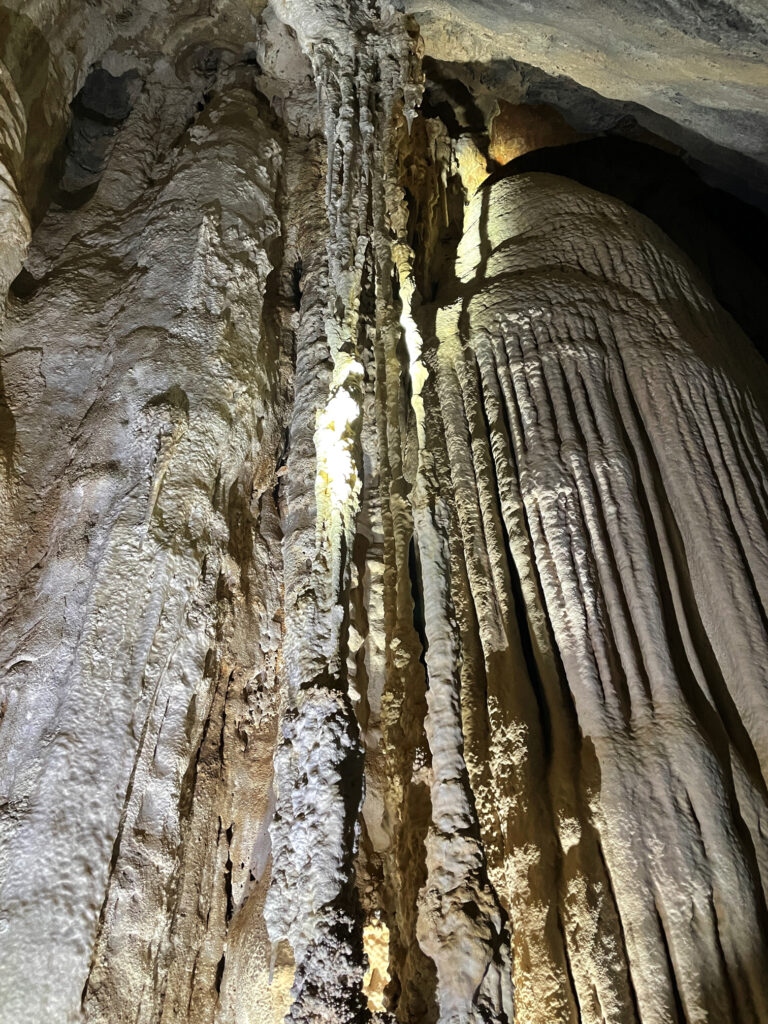
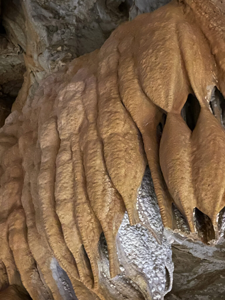
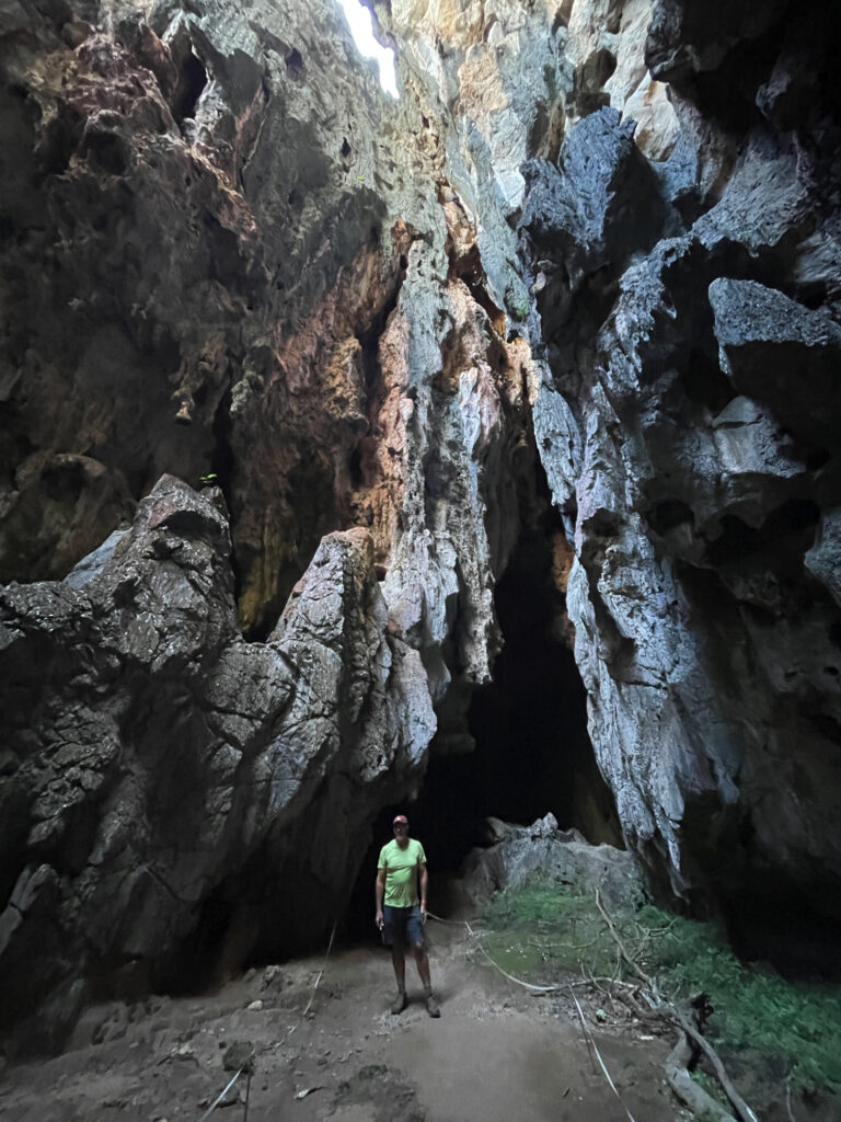
But we’re here for the caves. Back around 400 million years ago the limestone laid down under shallow oceans was lifted, towering above the surrounding countryside where weathering and erosion and fluctuating groundwater levels slowly dissolved some of the limestone, creating caverns and passages, now rich with stalactites, stalagmites and flowstones. We visited three caves today with the ranger – Donna, Trezkinn and Royal Arch. All were outstanding, as was the infrastructure allowing us to view them without causing damage.
Chillagoe CavesChillagoe Caves
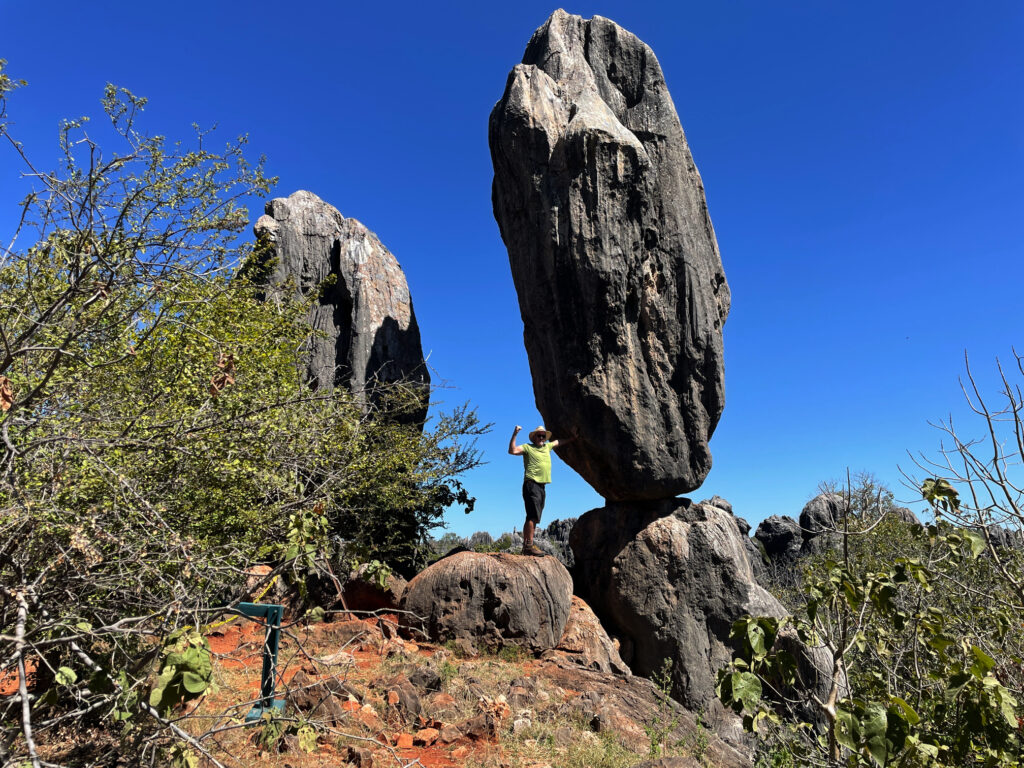
Between cave tours we walked out to the Balancing Rock. I’ve seen many Balancing Rocks, but this is a pretty good one, and the bush walk, after yesterday’s marathon effort, was good to keep the muscles moving.
‘Saving’ the balancing rock – Chillagoe
Dinner at the Cockatoo Pub tonight, behind which we’re camped for 2 nights.
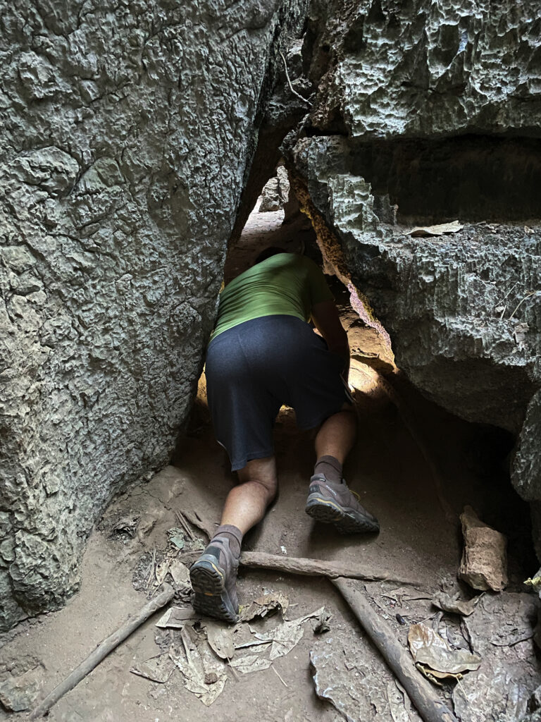
Before leaving Chillagoe this morning we drove out to the Archway caves, which are self-guided.
The approach to the very sinister-looking Royal Arch caves.
Other than the extraordinary, gothic-like appearance of the limestone karsts in which the caves form, we weren’t impressed with this section, nor game enough to go crawling into little spaces by ourselves with just a head torch.
Exploring the caves at Chillagoe
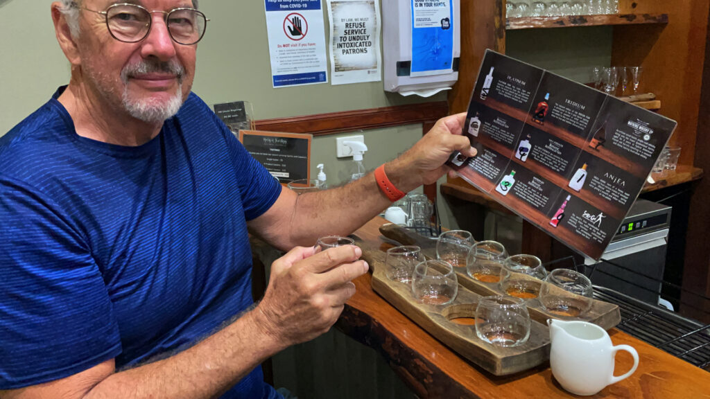
Back through the savanna and the rich agricultural farms and orchards to the Tableland. On the way we dropped in to the Mount Uncle Distillery. A tasting board of spirits was set before us – a pleasant time was spent tasting them all, buying a couple of bottles, and then wandering their beautiful grounds, lush with tropical plants and vegetable gardens and lots of peacocks!
A delightful time taste-testing at Mt Uncle Distillery.
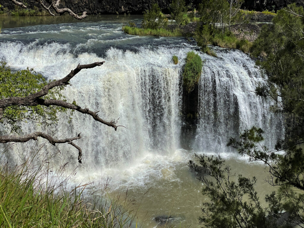
By the time we’d done that and made ourselves a cuppa we were sober enough to continue our journey to Malanda where we booked in to the caravan park. The Malanda Falls are beside the CP, but we weren’t that impressed, looking more like a weir than anything. A quiet night, other than for the curlews which seem to be at every campsite!
Still chasing waterfalls today we’re following the Waterfall Way to the southern Tablelands. First stop was Millaa Millaa Lookout, which promised amazing views out to Mt Bartle Frere and Bellenden Ker. However, this section is known as the “misty mountains’, hence no mountains seen, but the rolling countryside and magnificent valleys filled with rainforest was absolutely beautiful.
The view from Millaa Millaa Lookout. On a clear day you can see Mt Bartle Frere and Bellenden Ker – not today. But beautiful nevertheless.
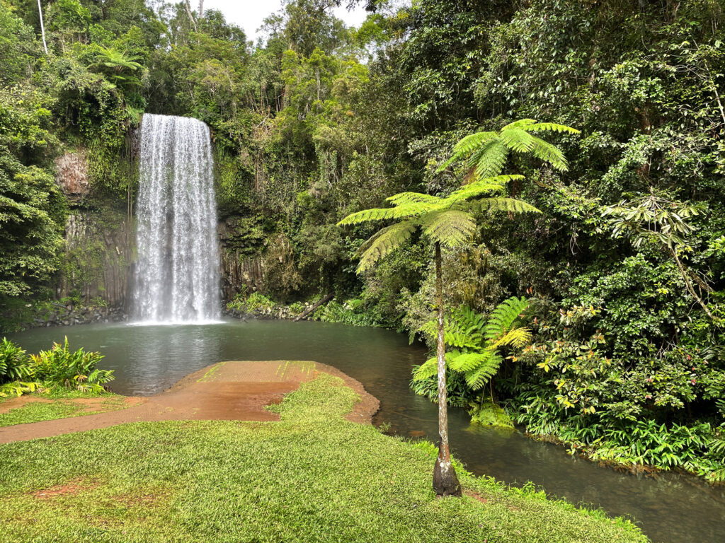
Next stop, Millaa Millaa Falls, the most-photographed falls in Australia. They are “perfect” falls, coming out of thick rainforest in one reasonably wide band of water and falling to a large pool below. Despite the cooler weather I had a swim here, swimming over to and behind the falls. A wonderful experience.
The very beautiful Millaa Millaa Falls.
Next stop, Zillie Falls then on to Elinjaa Falls where there’s a steep path of about 500m to get to the base. It’s possible to swim here too.
Elinjaa Falls
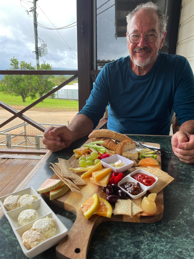
By now it was lunchtime and the cafe at the biodynamic dairy at Mungalli was calling to us. A very filling cheese platter, followed by the best ice cream I’ve ever had (Espresso flavour) replenished our energy levels. The countryside is so pretty – hills, gullies, rainforest and the lushest grass you can imagine. It’s no wonder the dairy cows give such beautiful milk.
The most delicious lunch at the Mungalli Biodynamic dairy farm.
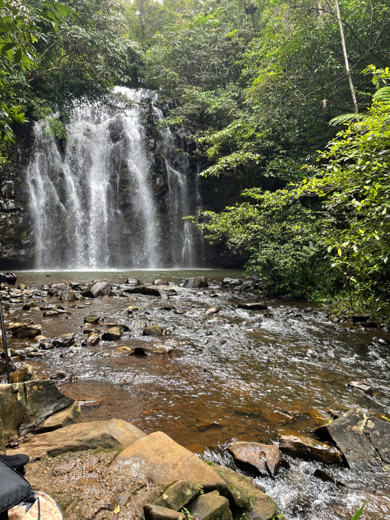
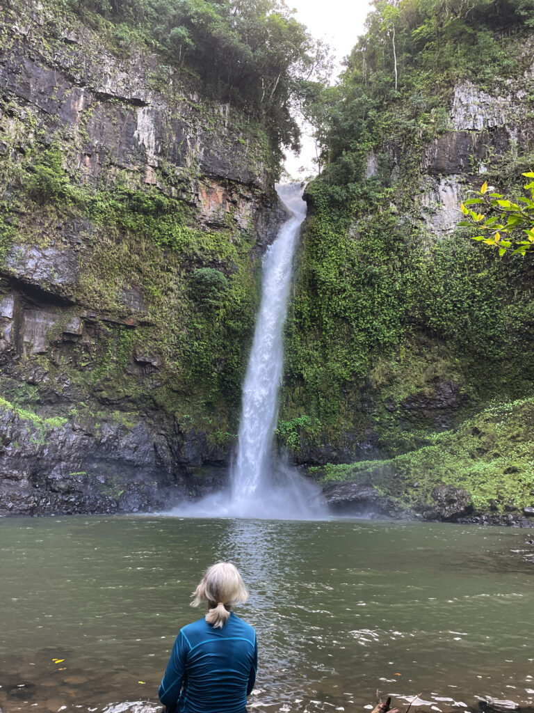
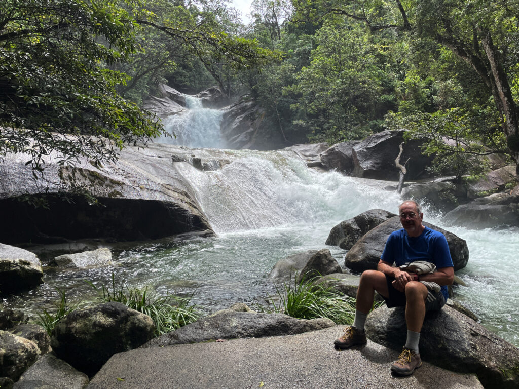
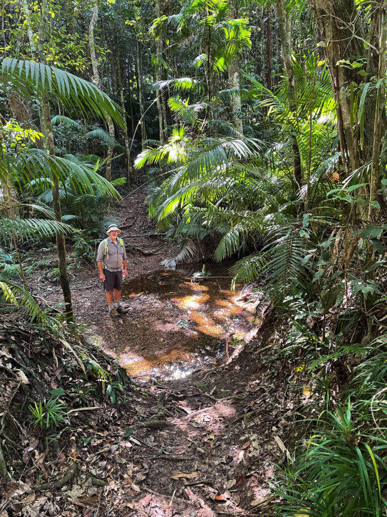
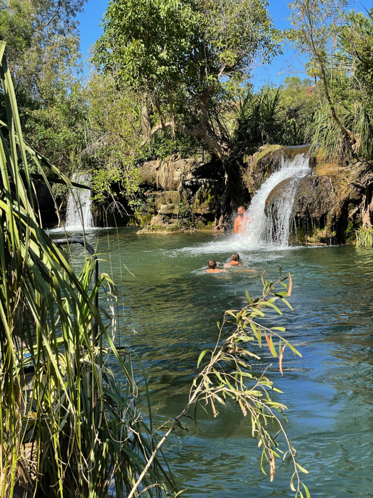
Continuing our meandering drive through the tiny town of Mungalli, which also has a waterfall, though more like steep rapids, we descended and descended until reaching Henrietta Campsite in Wooroonooran National Park. We’ve stayed at lots of National Parks over the years – they’re a credit to our country. This one has a large open area to kick a ball, an electric BBQ, covered tables, toilets and a shower (cold). The campsites are all nestled into the rainforest all around and beside Henrietta Creek. Most have bush walks or other activities. Here we decide to do the walk to Nandroya Falls, a return walk of about 7km. A couple of rock-hopping water crossings and a narrow path ascending and descending alongside the river gave us a bit of a workout. First we came to Silver Falls and finally Nandroya. These are a favourite of Steve’s as they fall spectacularly from a narrow gap in the sheer cliff face to the pool below, then from that they tumble down again over a wide cliff to the next level.
Nandroya Falls – such interesting falls.The lovely Silver Falls, seen along the walk to Nandroya Falls.
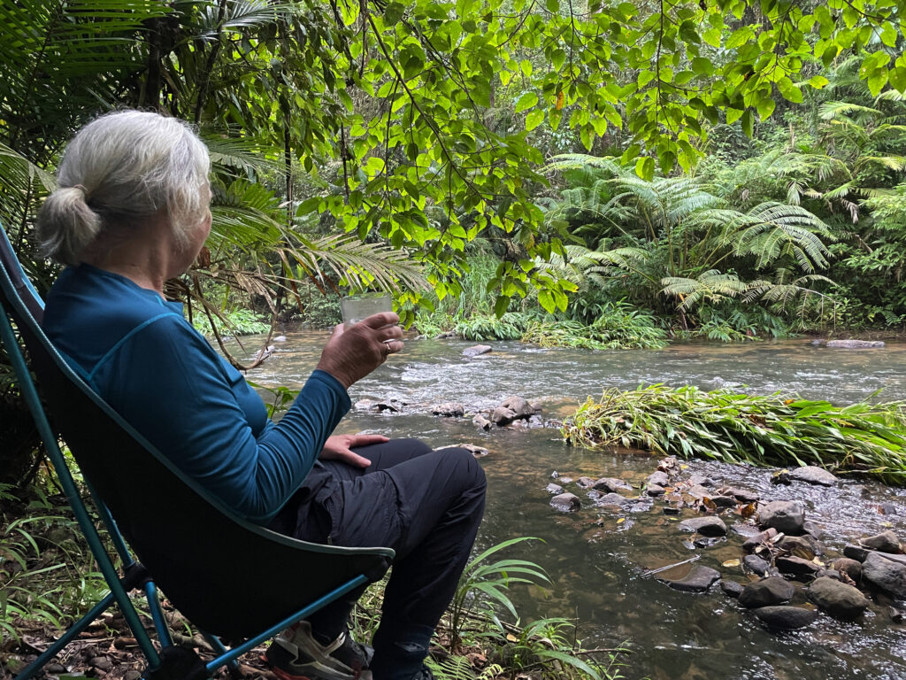
Back at camp we took our chairs down the steep little path to sit by the river contemplating life, the universe and everything, and hoping to spot a platypus. Alas no platypus, but we did get up close and personal with a few too many leeches! A quiet night anticipated with just us and one caravan.
Relaxing at our campsite at Henrietta NP campground.
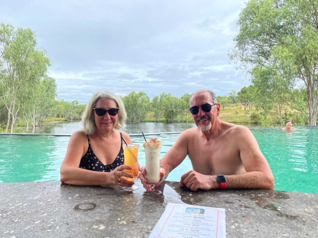
We leave ‘the West’ now for the Atherton Tableland, but not before a dip in the hot mineral waters of Innot Springs. The water leaves the ground here at around 75°C. At the park there are 6 pools each with a controlled temperature ranging from cool to so hot just a few minutes in it is long enough! We moved between two medium temperature pools having a lovely rejuvenating soak.
With wrinkly skin we left the pools to view Millstream Falls about 30km up the road. These falls are the widest single-drop falls in Australia, flowing over the end of a basalt lava flow. A walk from the car park winds down to a viewing platform where, due to the big wet season the area has experienced, the falls are spectacular.
Millstream Falls, Atherton Tablelands
We pass through Ravenshoe, the highest town on the Tableland to stay the night at a caravan park in Herberton. Herberton has a truly wonderful Historic Village where we spent several hours the next day. I’m not a great fan of these historic displays, but this one is not to be missed!
Herberton Historical Village. School room. Don’t know that I’d do particularly well on this test.
The countryside has changed so much within the space of a day’s drive. From the eucalypt woodland savanna we’re now in full tropical rainforests, lush rolling hills with grass so high the cattle are nearly hidden and the most beautiful tropical plants – and it’s a lot cooler. Lake Barrine is one of two crater lakes, on the Tableland, Lake Eacham being the other. These two lakes were formed around 10 – 17,000 years ago when the earth’s magma contacted the ground water creating steam which blew the top off forming a crater which subsequently filled with water. We’d planned to kayak around Barrine, but the weather is still a bit rainy at times and lovely and cool now, so instead we walked around them both, and may have had a coffee and something sticky to eat at the Tea House on Lake Barrine.
If it weren’t so windy we’d have kayaked around. Steve, on the walk around Lake Barrine.
We spent two nights at the Lakeside Caravan Park on Lake Tinnaroo and took the time to drive around visiting local attractions such as Nerada Tea Plantation, Gallo Dairy and Chocolate shop and the delightful town of Yungaburra.
Enjoying the perfect cuppa at the Nerada Tea plantation.
However being the beginning of a long weekend and Lake Tinnaroo being a favourite for the local water skiers, jet ski owners and just generally noisy boats, we were pleased to leave.
Our campsite on the banks of Lake Tinnaroo. Temporarily quiet, until tomorrow!
1st May: We descended to the coast via the Gillies Highway, a Highway famous for its 263 corners and 800m elevation change in just 19km. It was built in 1925 and I’m rather proud to say my grandfather was one of the surveyors for this road. The scenery was absolutely spectacular, unfortunately the lookouts were all on the ascending side of the road making it a bit dangerous for us to pull over to take our time enjoying it.
Babinda Boulders is our destination today, but first the highly rated Josephine Falls near Mt Bartle Frere. In ‘usual’ conditions these falls provide an ideal natural waterslide – way too much water at the moment though.
Enjoying the spectacular Josephine Falls
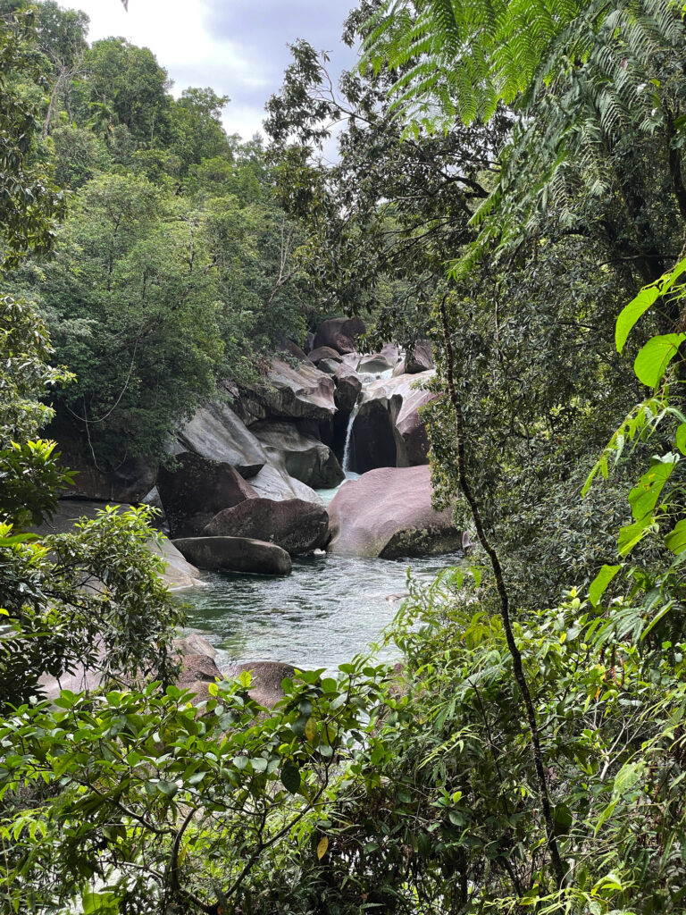
The Babinda Creek is a fast-flowing creek that winds its way through huge boulders forming large pools ideal for swimming. Still a bit overcast and cool for swimming but I did wade in and enjoy the refreshing waters here.
Very beautiful, but very dangerous for swimming, at Babinda Boulders
There’s a nice-looking free camp here, but we decide to go back to Babinda where there’s a large free camp beside the river. Most memorable about this campsite is the rooster that crowed the wake-up alarm right outside my window from 4.45am for at least half an hour. I dare say I’m not the only camper who had visions of roast chicken!
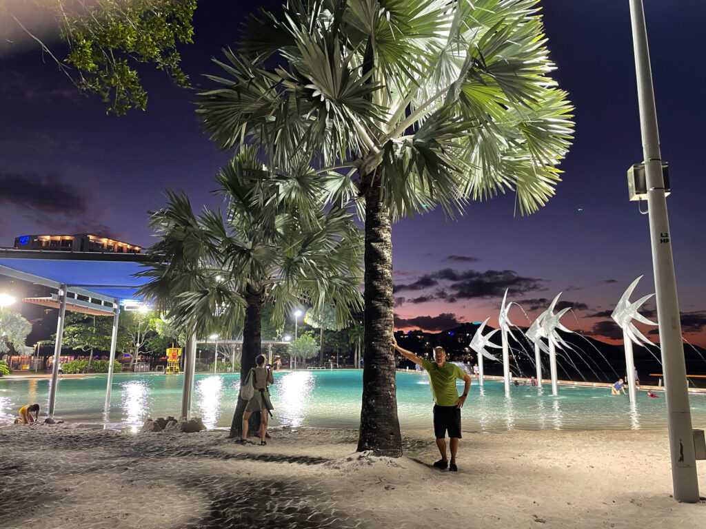
2nd – 4th May: We’re now having a holiday in the middle of our trip – three nights at the Doubletree Hilton in Cairns! The hotel is fabulous, particularly the beautiful atrium with a pond with barramundi that swim through lush tropical plants. We are both impressed with Cairns – the Council has done a marvellous job with tropical plants everywhere, an excellent walkway/cycle way the length of the foreshore with sculptures, parks, impressive playgrounds and exercise stations and a beautiful swimming lagoon.
The beautiful pool area on the Cairns Esplanade
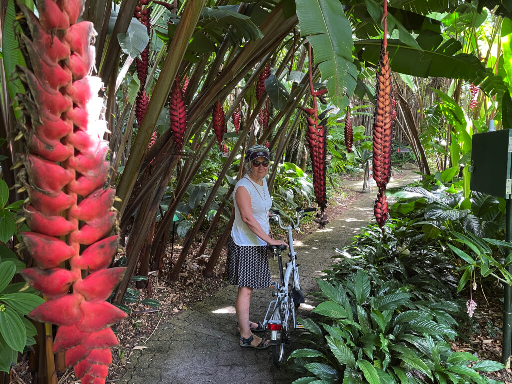
On our last day we rode our bikes to the Botanic Gardens where the local and exotic tropical plants stunned us with their lushness and colours and variety. It’s such a large Gardens we’re pleased we rode our bikes, covering several kilometres within the gardens to visit all the areas.
The amazing plants at the Cairns Botanic Gardens
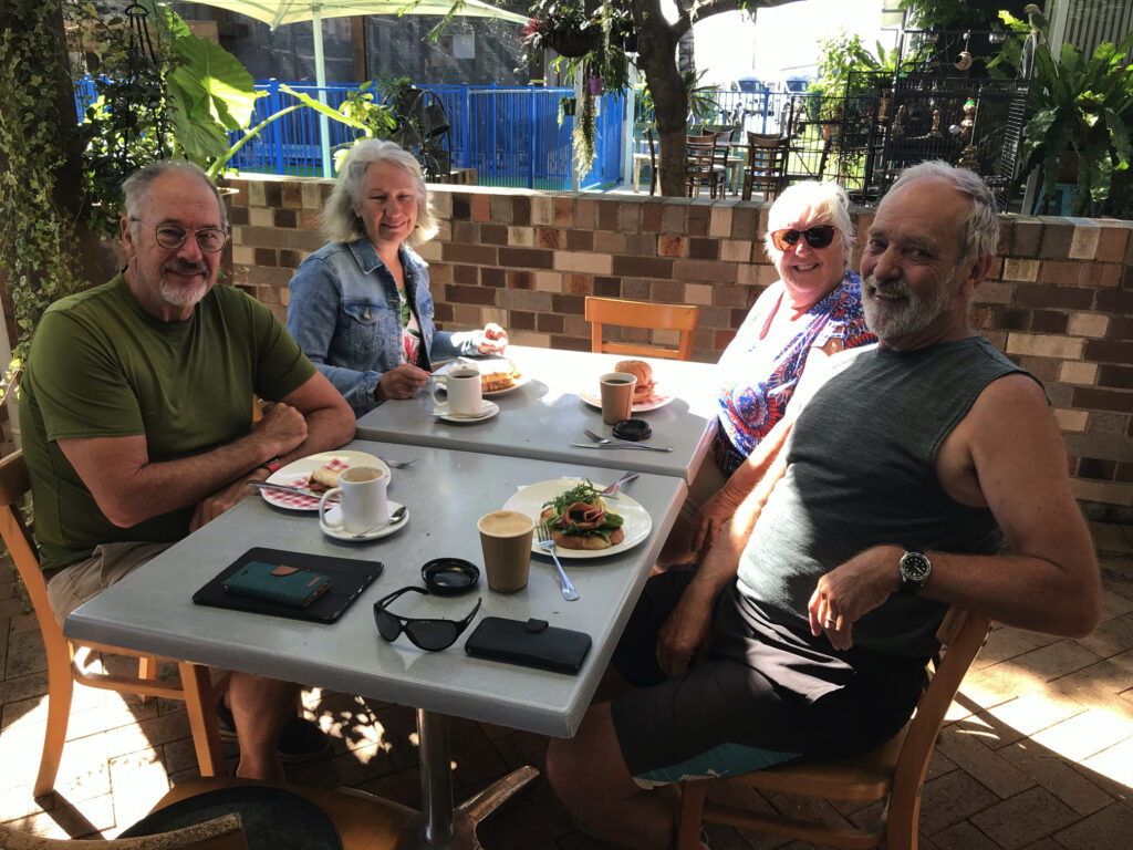
We also had dinner with Philippa and Andrew, new friends we first met at Boodjamulla, then again in Karumba. And when we weren’t doing all these activities we swam in the hotel pool and spa, lazed poolside reading, or had a few drinks at the outdoor bar and restaurant.
Enjoying sundowners at the cafe at Doubletree Hilton
5-7th May
We return to Atherton Tableland this time via the Kuranda Highway. On previous visits we’ve come up to Kuranda on the cable car and the train – both highly recommended, but this is the first time we’ve driven. Not quite as spectacular, but still a fabulous drive.
Barron Falls – a spectacular waterfall near Kuranda
Kuranda … disappointing .. lots of shops closed and the feel was mass-produced tourist trinkets. After wandering around for a while, trying to give the place a chance, we drove out to Barron Falls Lookout. Wow those falls are amazing. A kilometre-long walkway took us to a couple of lookouts over the falls and down the range to the coast. Interestingly the river above the falls was dammed for hydroelectricity for a while in the early 20th century.
A view down the valley, taken on our Barron Falls walk
Moving on from here our campsite tonight turned out to be one of the best we’ve ever stayed in! Upper Davies Creek campsite in Dinden NP, site#2. We seemed to climb a long way on an unsealed road before reaching the campsite, but 4×4 only needed at the very end to get into the campsite. The next nearest camp was a long way away (and no one there anyway). The creek came down a small waterfall then over rapids before forming a large pool right beside where we were camped, leaving the pool via more rapids. It was stunningly beautiful.
I swear this has to be the best campsite ever. Upper Davies Creek
A thoughtful previous camper left wood beside the fire pit where we cooked our dinner. Swimming was chilly and did involve a lot of resolve to fully submerge. Unfortunately we’d only booked one night here, but we stayed until quite late in the afternoon making the most of it before leaving.
Enjoying a swim at Upper Davies Creek – our own private slice of heaven
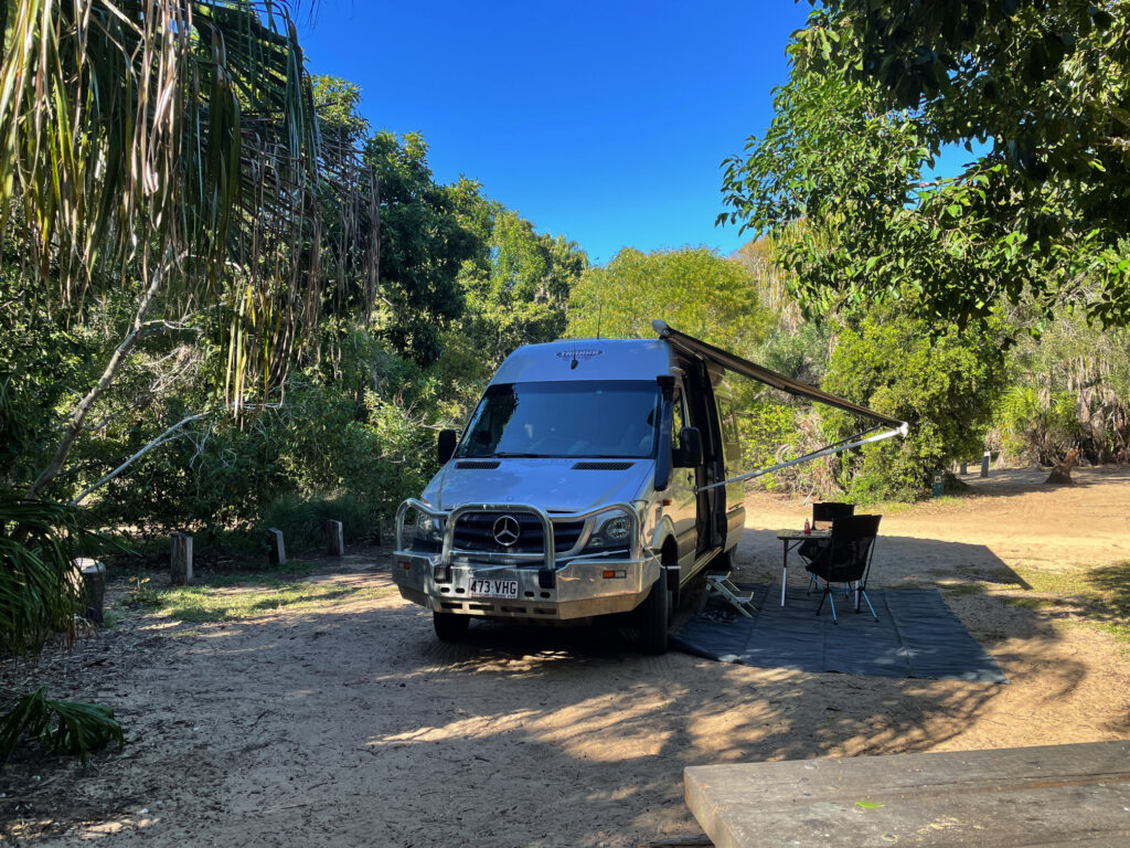
Speewah campsite in Barron Gorge NP was also lovely – only 3 campsites, each on a well-formed pad with large grassy areas and a patch of natural bush between each site. On our first full day we set off to do some walking. Phew … that was more than we’d bargained for. The walk was through thick rainforest which was magnificent and a treat to be immersed in.
Beautiful rainforest walking at Speewah NP
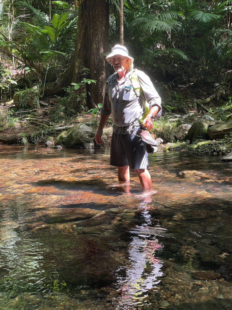
However it has rained a lot here recently and in quite a few places the track was in very poor repair, with many fallen trees and their multiple branches to scramble through. In one section a wide fire trail we were following was so badly washed out and eroded it’d be impossible to drive on it. There were 5 water crossings, two where we needed to wade through, rather than rock-hop over.
And yet another water crossing on the Speewah walk
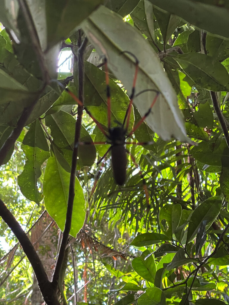
But of greatest difficulty were the many steep ascents and descents, not short ones either! Along the way Steve managed to pick up a few leeches and get caught in lawyer vine enough to draw blood, and I came face-to-face with many golden orb spiders whose massive sticky webs were built right across the track. These spiders from toe to toe would have been as big as my hand.
One of many giant Golden Orb spiders that formed their webs right across the track.
Our GPS told us we walked for 5.5 hours over 18km – I don’t know it was that far, but it was a tough walk however far it was. A chilly shower on return restored feeling to weary bodies!
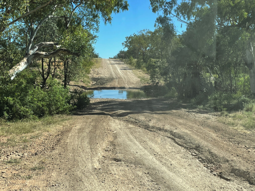
For many, many years people have raved to us about how wonderful Lawn Hill Gorge is (Boodjamulla National Park), and finally, finally we’re going to see it for ourselves. From Mt Isa we headed north on the Camooweal Rd, another really bad road, to Miyumba camp, the southern-most camp in the National Park. The road was rocky, and when not rocky, it was corrugations, plus a few water crossings thrown in for good measure. We drove ‘according to conditions’ and arrived intact.
Poor condition of road on the way north to Riversleigh
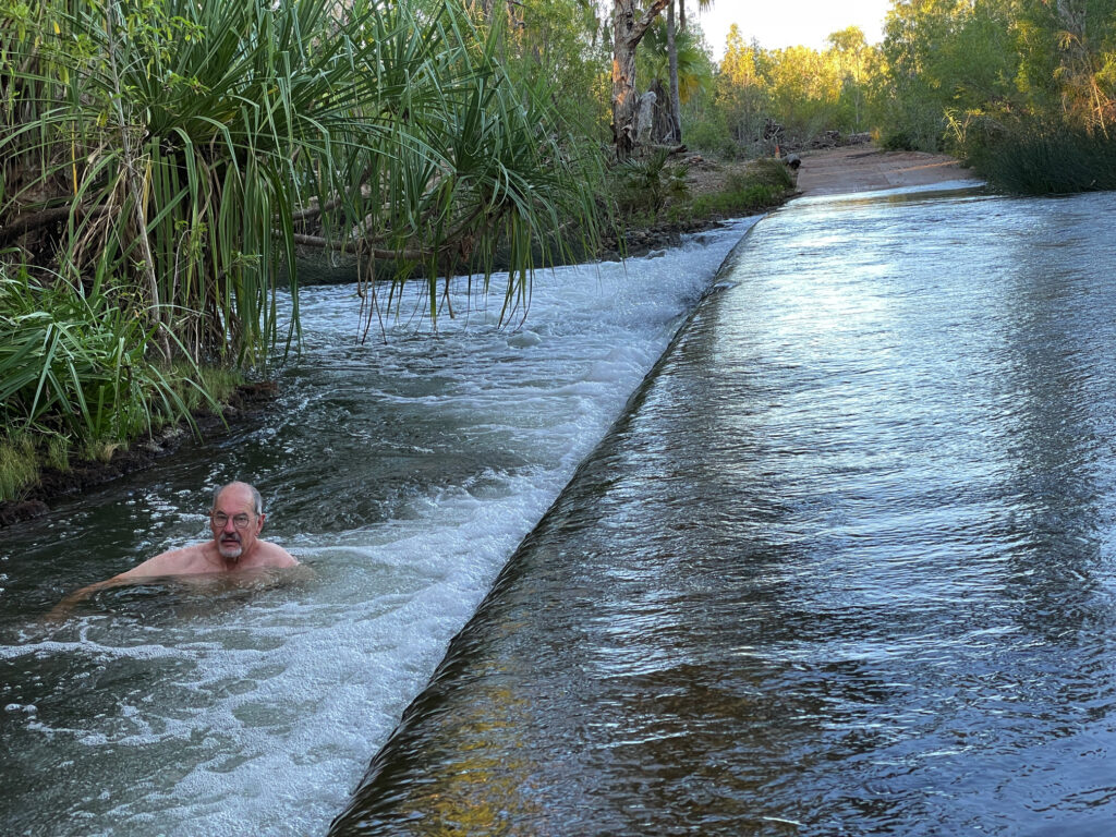
The final water crossing, just 100m short of our camp was over the Gregory River. It was flowing quite swiftly, about shin deep – no drama for Priscilla. Once camped (only ones there) we walked back to the river and had a lovely, cool, spa bath right there beside the road.
Having a ‘spa’ on the side of the road in the swiftly flowing Gregory River
The night was magic – no lights, no moon and millions of stars from horizon to horizon. These are the nights we especially love.
14th – 17th April Boodjamulla NP
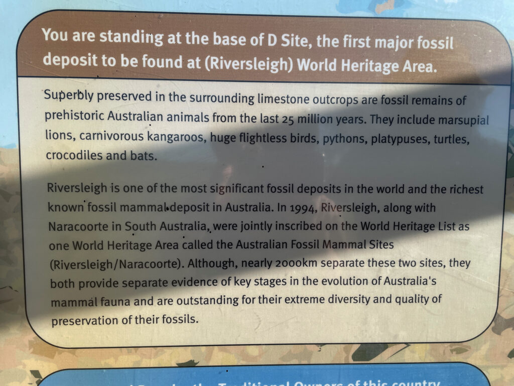
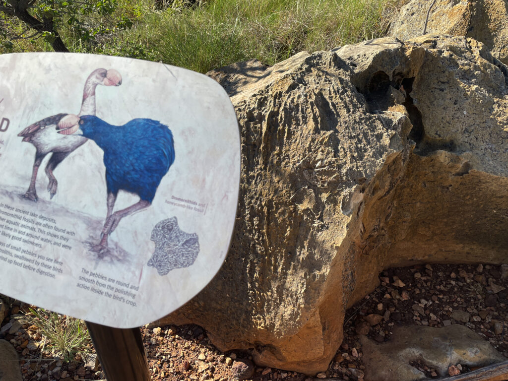
Riversleigh World Heritage Area
Next morning, continuing north, we stopped at the Riversleigh World Heritage site renown as a dinosaur fossil site. It’s very well presented and interesting with large fossils evident in the rocks along an 800m path.
The signage and displays at Riversleigh were very good.
The gorge part of Boodjamulla is 55km north. A large commercial campsite at Adels Grove, just outside the NP, provides accommodation for the on-road vehicles and caravans and those who didn’t book early enough to get into the NP. The National Park campsite is 10 km down the road at the Gorge. The road was improved significantly.
Over the next 4 days we did a twilight walk up to Duwadarri Lookout completing the circuit via Indarri Falls, a walk to the Cascades, then back to walk to the Upper Gorge. These walks were lovely in places, stunning in others and difficult in parts, but well worthwhile. Another day we took the kayak up the river, marvelling at the stunning cliffs through which we paddled.
At Indarri Falls we ‘portered’ the kayak along the path to bypass it, then continued right up to the Upper Gorge where we found a fabulous landing spot at rapids where we stopped for lunch, a swim and a massage under the rapids. We were lucky to have the place to ourselves for more than an hour. On our last day we kayaked up to Indarri Falls then spent quite a few hours there, swimming, getting massaged by the falls, chatting to other kayakers, relaxing and staying cool.
Indarri Falls. Boodjamulla NP
We both enjoyed Boodjamulla, and while a longer stay wasn’t necessary, I wouldn’t mind coming back another time. The only thing that spoilt our visit was the weather – it’s very hot, 35/36° for the first 3 days, cool breeze on the last.
19th – 22nd April
We saw the Gulf of Carpentaria from the west in our Arnhem Land trip in 2019 and now, heading to Karumba I’m planning to get my feet wet in the eastern Gulf. But first the drive from Boodjamulla was pleasant on good unsealed roads, just a few small washouts and corrugations as we traversed the grass lands stopping for a coffee and a highly-touted muffin at Murray’s Place in Gregory. From here we headed north (on sealed roads) to Burke for a look around town, sitting in a park having lunch at the same time the ABC News that night informed us it was the hottest town in Queensland! Back south again to stay the night at Leichhardt Falls.
Leichhardt R falls – free camp
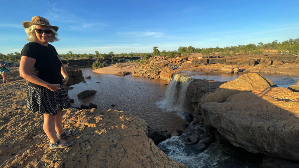
Leichhardt Falls, on the Leichhardt River is not much more than a puddle during the dry season, but at the moment the water is roaring over the falls. A croc was spotted just down from the base of the falls – no swimming! Watching the road trains navigate the long, single-lane bridge that crossed the river gave me an even greater respect for those drivers.
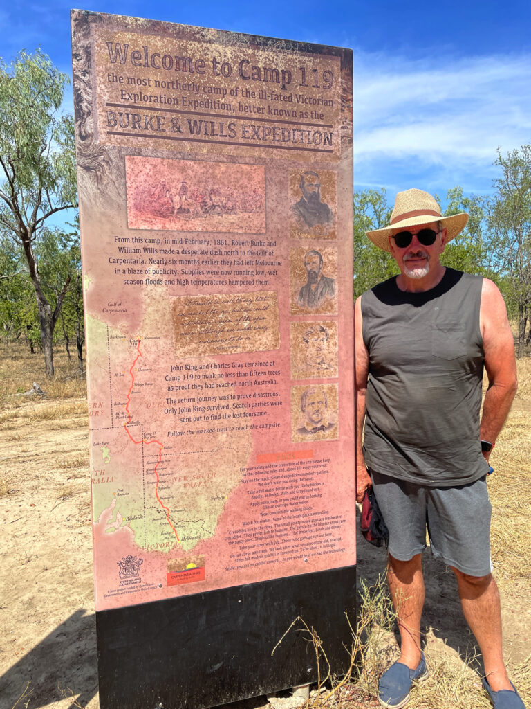
Not a long drive today. The road to Karumba is unsealed, but mostly pretty good. At Camp 119 we viewed the blazed trees and read the story of Burke and Wills most northerly campsite. They tried to walk further on to the coast, but as it was the wet season (crazy!!) it was too swampy to reach.
The most northerly campsite of Burke and Wills in 1861
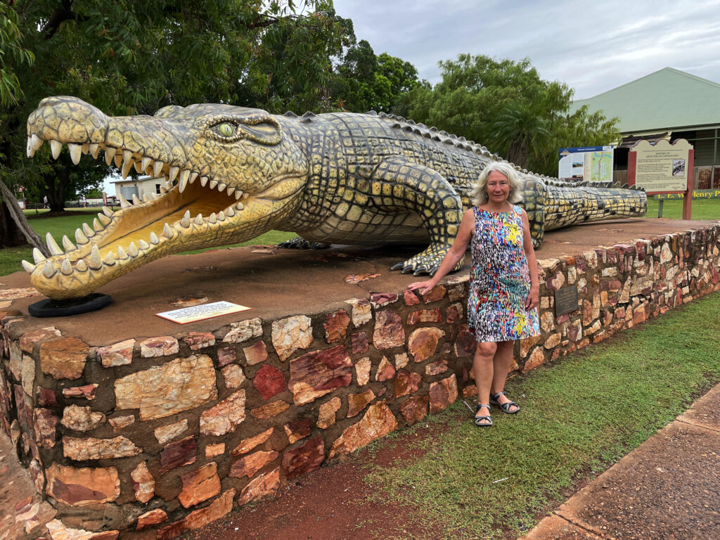
Another rest stop at Normanton proved interesting for not only the story of Krys, the largest crocodile ever, but also the Information Centre told the story of the beef industry here and the important role of the native stockmen.
Krys, the largest crocodile ever seen in Australia. This magnificent creature was dozing on a riverbank when a crocodile hunter shot it dead. So sad.
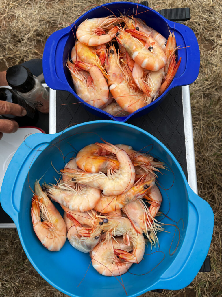
A cruise on into Karumba was easy driving before we found our campsite at Ronnies and settled in. First point of call was to buy prawns for our lunch.
Karumba prawns for lunch. Delicious
Karumba exists to service the commercial prawning trawlers, the commercial barramundi fishers, to a lesser extent the export of zinc from Century mine and, of course, tourism. The prawning industry started in the early 1960’s when a wealthy businessman managed to talk the CSIRO into jointly funding an exploration in the Gulf and the highly sought-after banana prawns were found in abundance.
The purpose of the Barramundi Discovery Centre is to maintain the stocks of barramundi by breeding them to fingerling size then releasing back into the wild. It was begun some years ago by the local commercial fishermen who saw the need to protect the barramundi from over-fishing. Smart move! The Centre was recommended to us by other travellers and I must say it is really interesting and not to be missed, though the tour at $50 each, was overpriced.
Karumba has been recognised for their efforts to maintain a sustainable seafood industry. Well done Karumba.
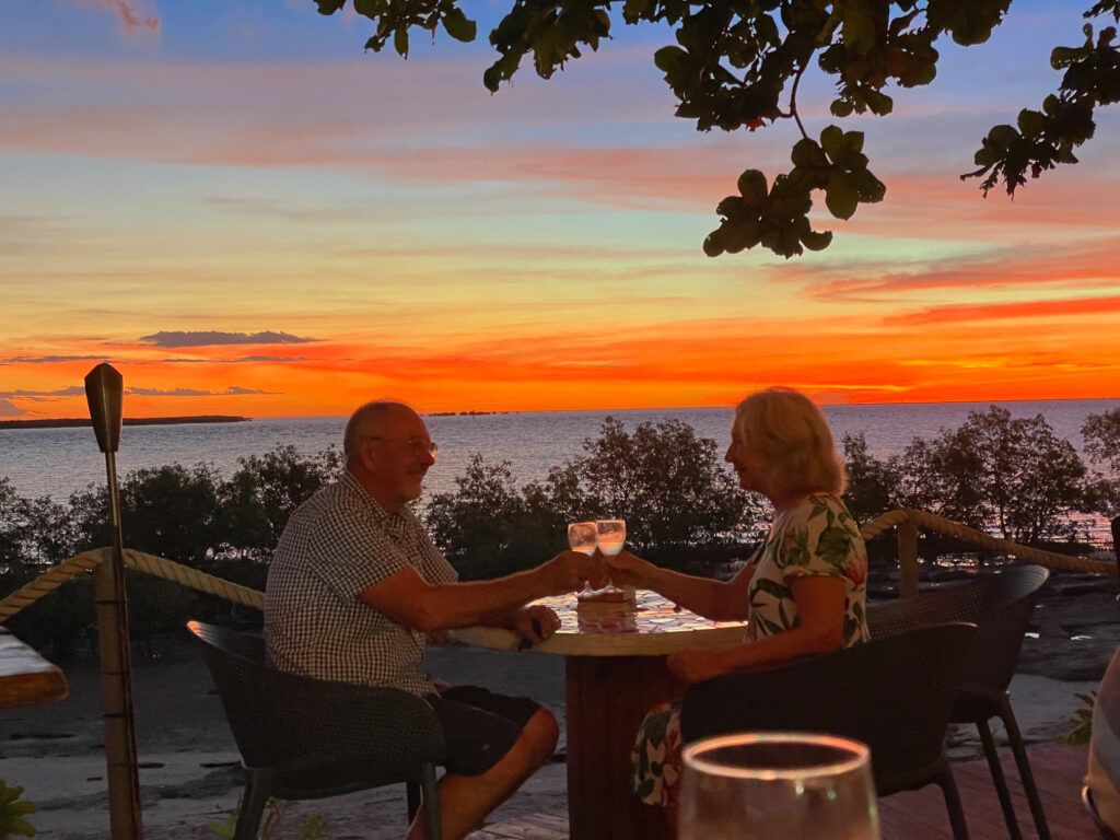
While here we did a sunset cruise (so so) and enjoyed meals at the End Of the Road restaurant one night and the Sunset Tavern another – seafood meals, of course, while sipping cocktails and watching magnificent sunsets.
Sunset over the Gulf of Carpentaria. Karumba
Road closure due to flooding changed our route of departure to the sealed section of the Savannah Way – traversing rich grasslands once more.
Darn! That was our intended route.
22nd – 23rd April
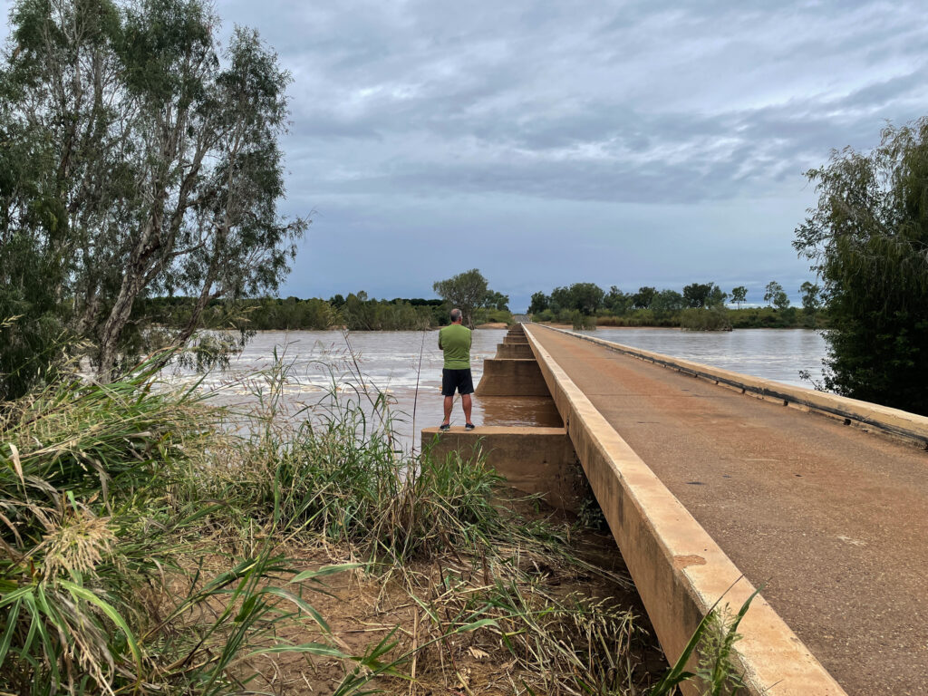
The highlight of a night at Gilbert River West (free camp, no facilities) was seeing the foaming waters of the river in flood, not far beneath the long one-lane bridge.
Viewing the flooding Gilbert River – not over the road, fortunately!
Next morning we moseyed on into Georgetown to stay at the CP, the power giving our batteries a boost. A walk around town left us with the impression of a small town with plenty of pride.
They’re pretty laid-back in Georgetown
24th – 25th April
On towards Cobbold Gorge over unsealed roads in pretty good condition with just a few shallow water crossings. On the way a cuppa stop at Forsayth and a wander around town found this town to be as impressive as Georgetown with its beautiful, restored buildings and well-tended parks.
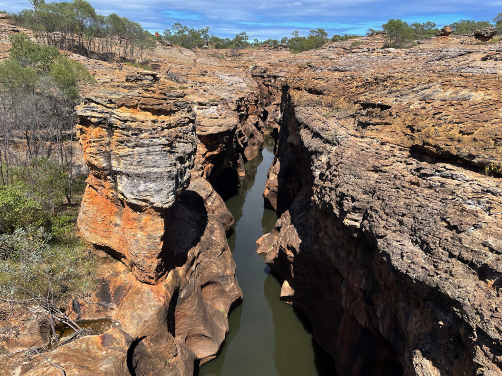
I was very excited to get to Cobbold Gorge – the photos I’d seen of the gorge were stunning and it didn’t disappoint. The beauty of the narrow gorge (only about 2 meters wide in some places) was only discovered a few years ago by the current owners of Robin Hood Station, the cattle station it is in.
Cobbold Gorge
A LOT of private/public funding has gone into developing the tourist facility here which includes a large reception area with souvenirs, a small grocery stocking basics, a large open-air restaurant beside the pool which has a swim-up bar, a function hall as well as very well laid-out RV and camping areas.
Apart from the Gorge itself there’s a large dam with free kayaks, several bush walks and mountain bike trails (BYO bike) and some four-wheel drive tracks to points of interest and the gem fields (agate mostly).
On our first afternoon, after settling in, we did an 8km walk up to a lookout, then back for a swim and cocktail at the swim-up bar.
Chilling at the swim-up bar at Cobbold Gorge
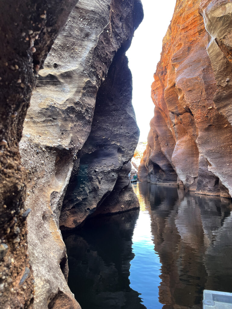
The Gorge is several kilometres away from the resort and only accessible on tours in an effort to maintain its pristine condition. We did the boat tour next morning. The guide was particularly good sharing historical, geological and botanical knowledge with us. The boat, an open punt, has a silent electric motor.
The amazing narrow gorge of Cobbold Gorge
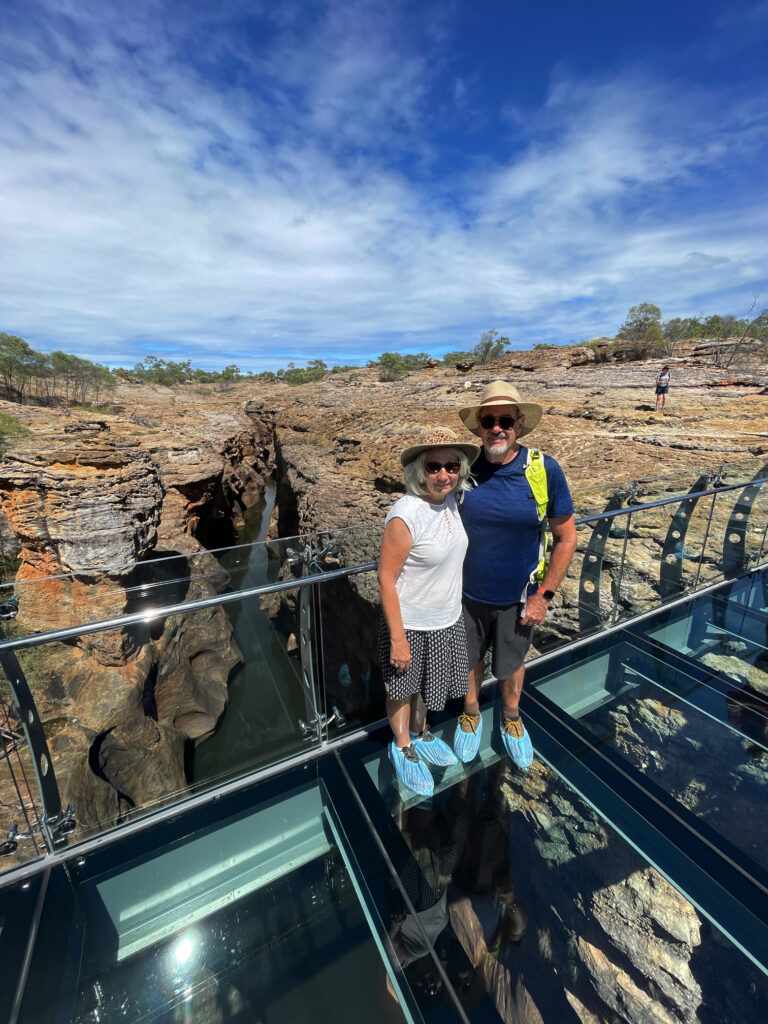
It was a stunning experience with the walls of the gorge towering up beside us, close enough in places to touch both sides at the same time, while we glided silently along. Back at the start we then walked up onto the huge sandstone rock that encloses the gorge, crossing over the gorge on a glass bridge.
On the glass bridge over Cobbold Gorge
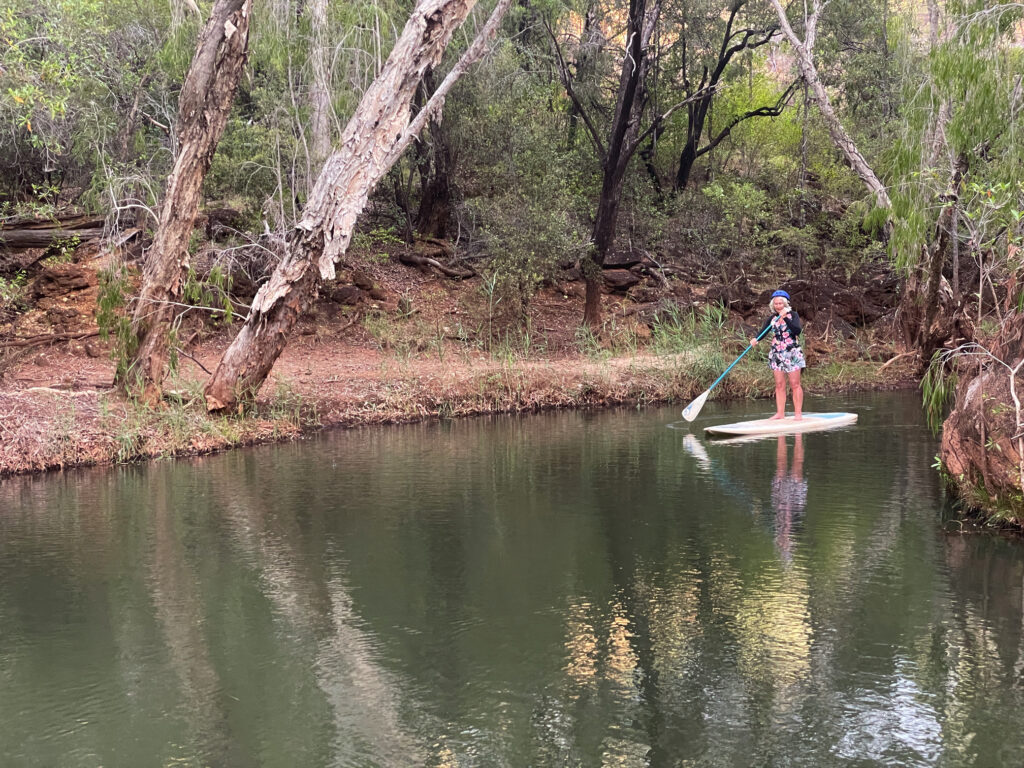
That afternoon we’d signed up for the SUP tour. If this morning’s tour was stunning, the SUP induced awe. This morning’s boat held 14 people, plus the guide and while everyone was quiet, just soaking it all in, the guide, naturally talked a fair bit. With the SUP there were only 7 of us and we all headed off separately, so Steve and I were able to enjoy the gorge more or less alone. It was every bit as wonderful as I’d hoped – and I didn’t fall in!
Denise, just finishing the return trip of Cobbold Gorge on the SUP
26th – 27th April
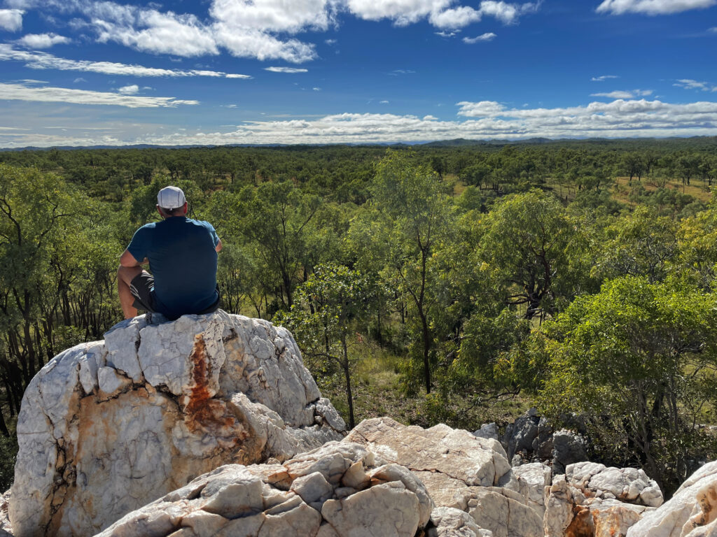
Leaving Cobbold Gorge we did one of their 4-wheel drive trips up to the Quartz Blow – a hill of beautiful white quartz which gave us views across to the horizon all around.
Steve, contemplating geological wonders from atop the Quartz Blow, Cobbold Gorge
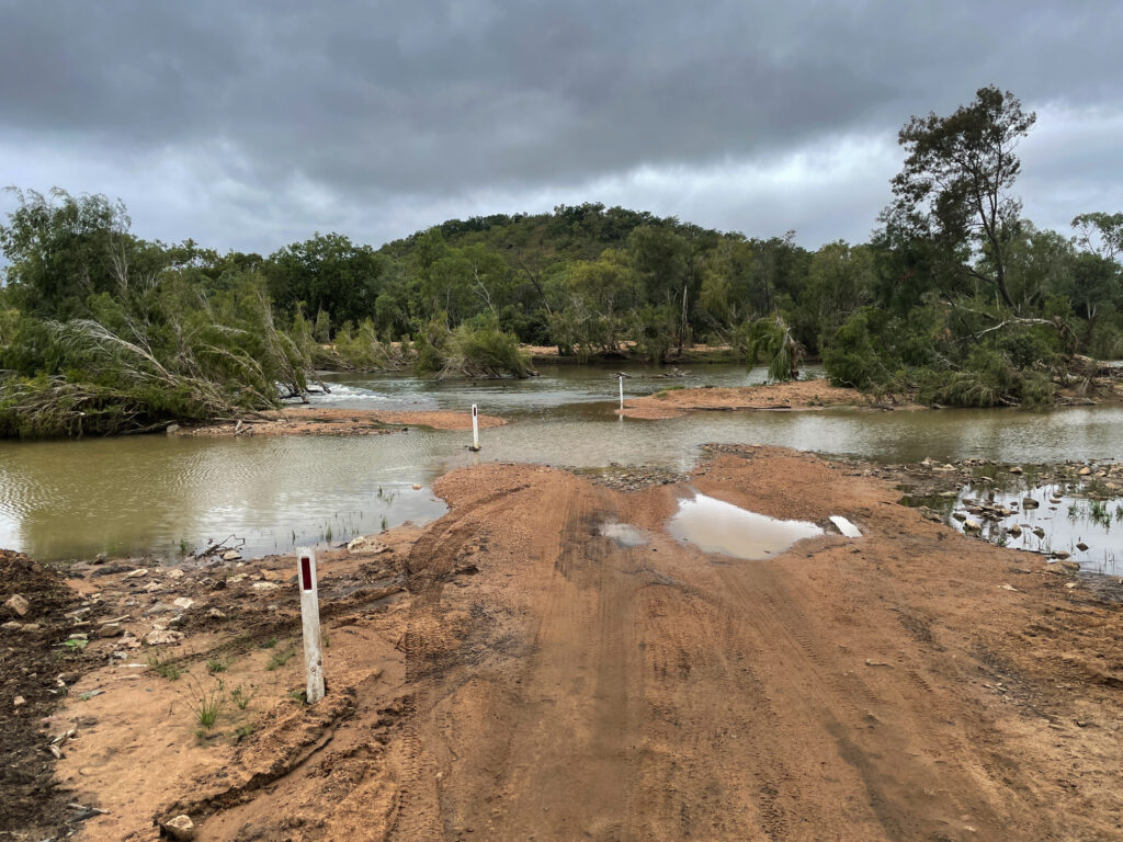
We’d asked around about the road through to Einasleigh and been rewarded with a shrug and “it’s OK”, so off we went, and it was “OK” – some bitumen, some corrugations, some washouts – OK. What we failed to ask about was the road from Einasleigh to the Gregory Developmental Rd! The Einasleigh River was over the causeway and flowing pretty fast.
The Einasleigh River in flood. And we need to cross it.
As all good 4x4ers who don’t want to walk a river crossing do, we parked to the side and made ourselves some lunch and a cuppa. Sure enough 3 vehicles came down and we watched them cross, noted where it was washed out, noted their track and safely followed on.
Kalkani Crater, a very typical cone-shaped hill with a perfectly round rim that drops away into the middle was a great little walk on our way to the Undara Experience, the resort set up at the Lava Tubes.
Undara Experience, the accommodation associated with the lava tubes, was moderately busy as a music festival had just finished yesterday. It’s quite a resort here with lots of units, and heaps of powered and unpowered camping, a large open air cafe / restaurant, pool … you get the idea.
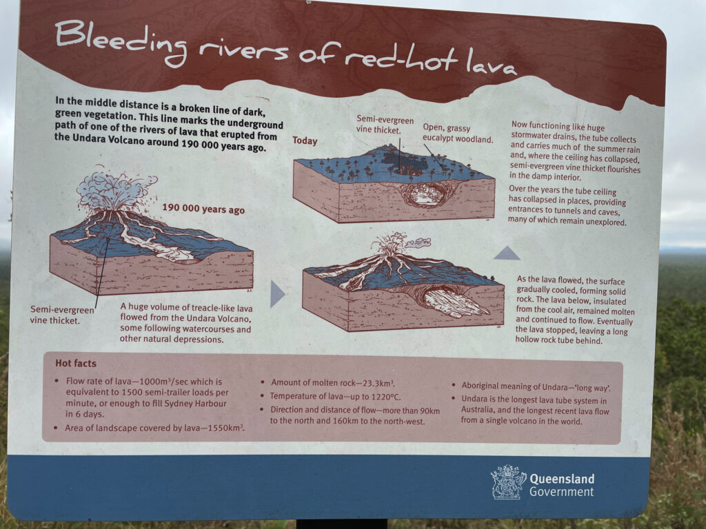
“The lava tubes and caves were formed when rivers of lava confined to a valley crusted over and formed a roof. Insulated in its casing of solidified lava, the lava flow carried on for tens of kilometres before draining out, leaving an empty tube of lava. Weaker sections of the roof of the tubes later collapsed to form caves and depressions. More than 70 caves have been found in the park.” (Text from NP literature) The lava flowed more than 90km to the north and 160km to the north-west at a rate of 1,000m3 per second!
How the Undara Lava Tubes were formed.
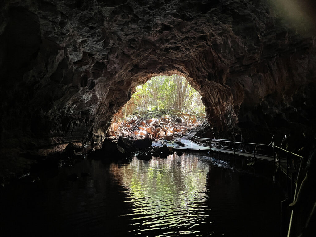
Access to the caves is restricted to approved scientists, speleologists and guided tours. The area has received 3 times its usual annual rainfall in the last few months and the caves have been full of water, a rare event. We had the amazing experience of walking through the caves on the walkways with crystal clear, chilly water up to our shins.
Undara lava tube.
There are several bush walks starting from the camping ground, the longest being the Rosella Trail at about 14km. This trail took us to several lookouts from which we could trace the track of collapsed tubes by the bright green vegetation that grows in the protected stream bed.
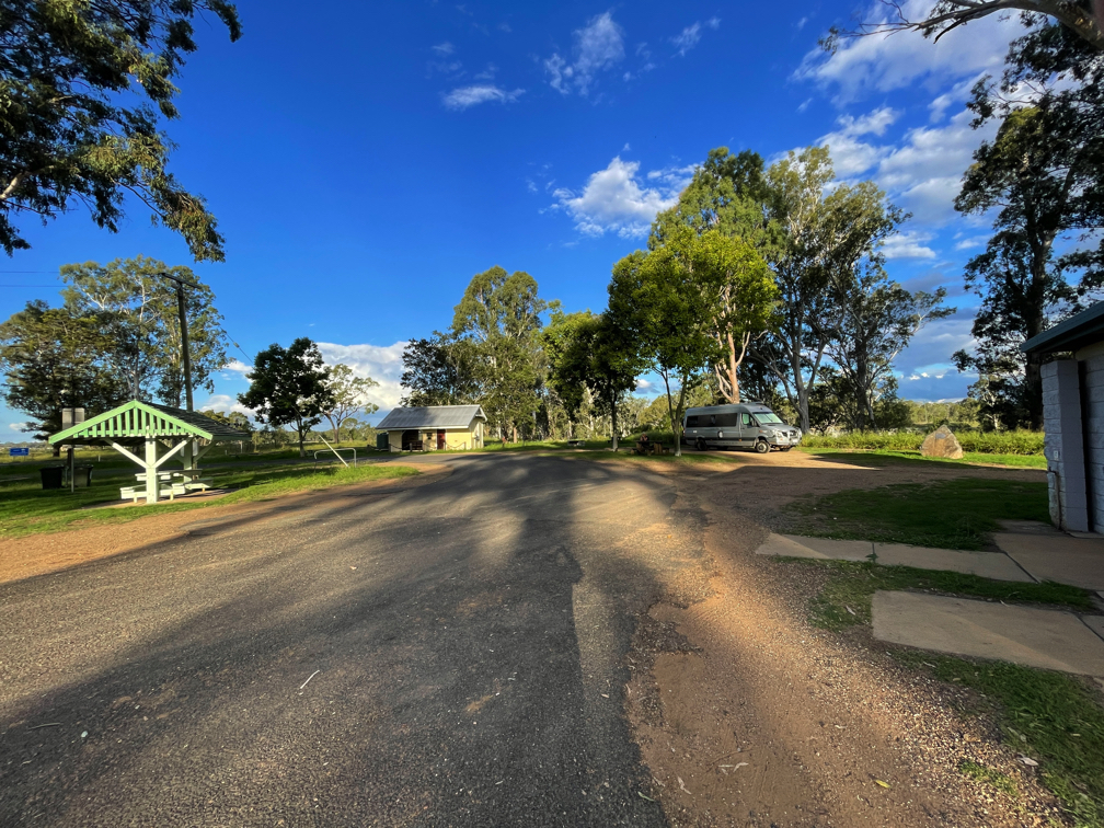
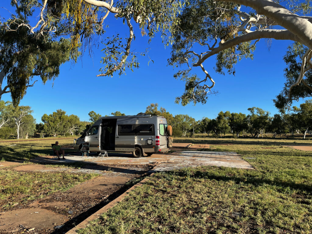
Well that wasn’t my most favourite departure. We’d not intended to leave for another week, however with the possibility of a COVID lockdown looming we decided to leave early, and not as well prepared as we’d hoped to be. It’s easy to self-isolate in a motorhome and to continue to follow the isolation rules. Got away about 2pm, travelling only about 90km, up to the free camp at Kilcoy. Tuesday 30th we stopped for lunch in Kingaroy and a brisk walk along the rail trail before lodging for the night at Cerotodus, a lovely free camp near Monto where the old railway building and switching points provide an insight into travel as it was done. This is also the home of several free-range roosters who take their morning alarm duties seriously.
A beautiful campsite at the old Cerotodus railway station, beside the Burnett River
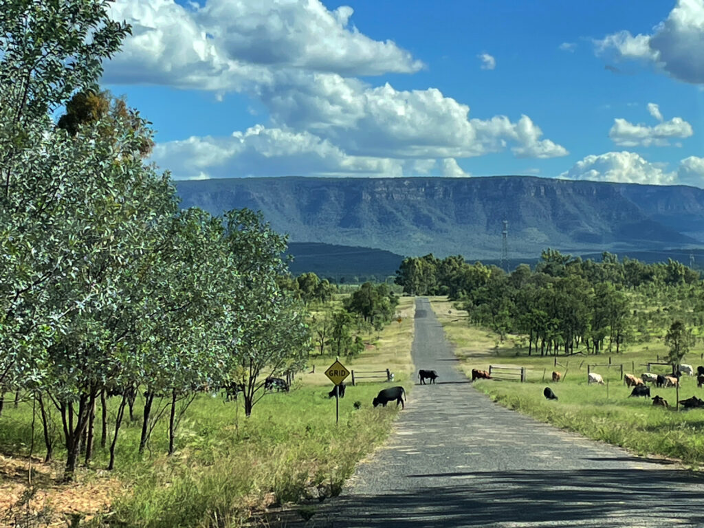
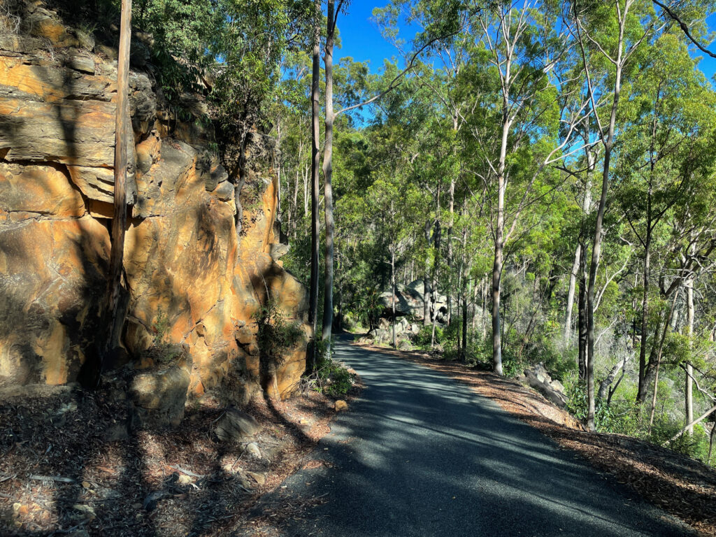
Wednesday 31st begins our new adventure in earnest, or so I thought, as we camp at Munall Campground at Blackdown National Park. A beautiful flat road through rolling green hills with cattle, emus, brolgas and kangaroos doesn’t prepare you for the very steep, winding ascent of Blackdown Range.
Blackdown National Park looms in front of us.
The views for the passenger are spectacular looking down over the cliff edges, but the driver who dares not shift his gaze sees nothing but a narrow, steep, twisting gravel road in the best parts, a little bitumen added to the worst parts.
A narrow, winding road took us up the mountain to Blackdown NP
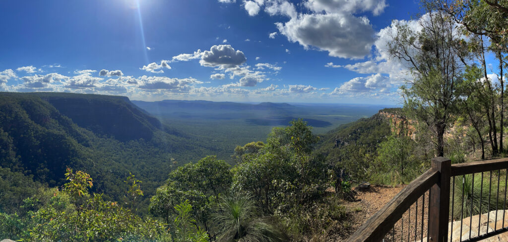
We paused at the top to take in the view from Yaddamen Dhina and do the 4km walk to the gorgeous waterfalls at Goodela.
Magnificent views down the valley from Yaddamen Dhina, Blackdown NP
Small falls tumble into a pretty pool that continues downward over smoothe rocks and then into oblivion.
The small pool was enticing for a swim, but it’s after 4 now and we’ve yet to cover the 8 unsealed kilometres to our campsite.
Thursday 1st – 4th April. Not an April Fools Day joke, unfortunately. Steve spent a sleepless night coughing, and woke with a sore throat. In view of having Covid-19 in our home area before we left we decided we should get tested, so down the mountain we drove. The small town of Blackwater was the nearest place offering this service, but not till 3pm. Blackwater is OK – it’s known as the Coal Capital of Queensland and has an apparently world class mining museum to see – not that we saw it, being responsible citizens we were self-isolating.
After the swabs were taken we drove on to the free camp in Emerald, between the railway line and the highway(!), but right beside their magnificent Botanical Gardens. Nothing to report now for 3 days as we continued to self-isolate until we finally got the all-clear on Easter Sunday afternoon! (No photos – we didn’t do anything!)
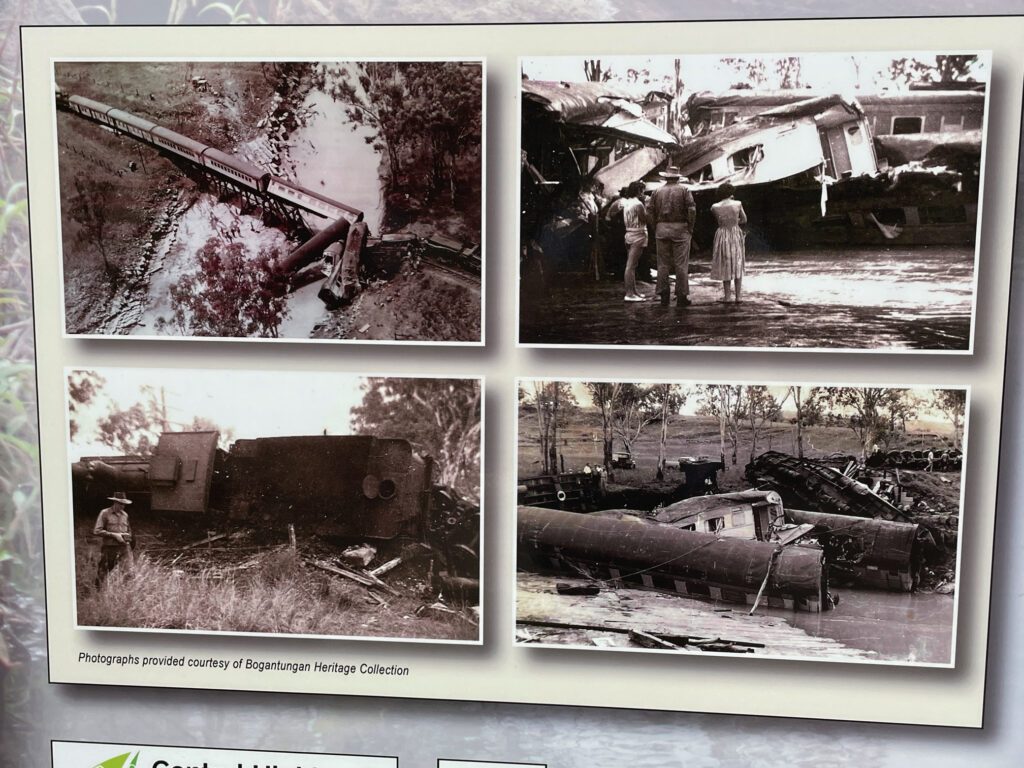
Free to travel at last we headed to the caravan park at Alpha. But first a break at Bogantungan. The name derives from the aboriginal words “bogan” meaning grass and “tungan” meaning tree.
In February 1960 Bogantungun was the site of the Medway Train Disaster, one of Queensland’s worst train accidents. As the train passed over the flooded Medway Creek just west of town the bridge collapsed. 4 passengers and 3 crew were killed, with 43 injured.
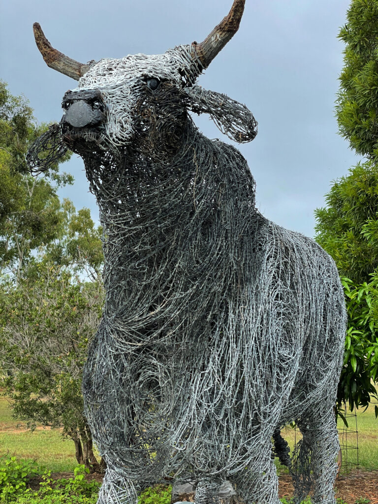
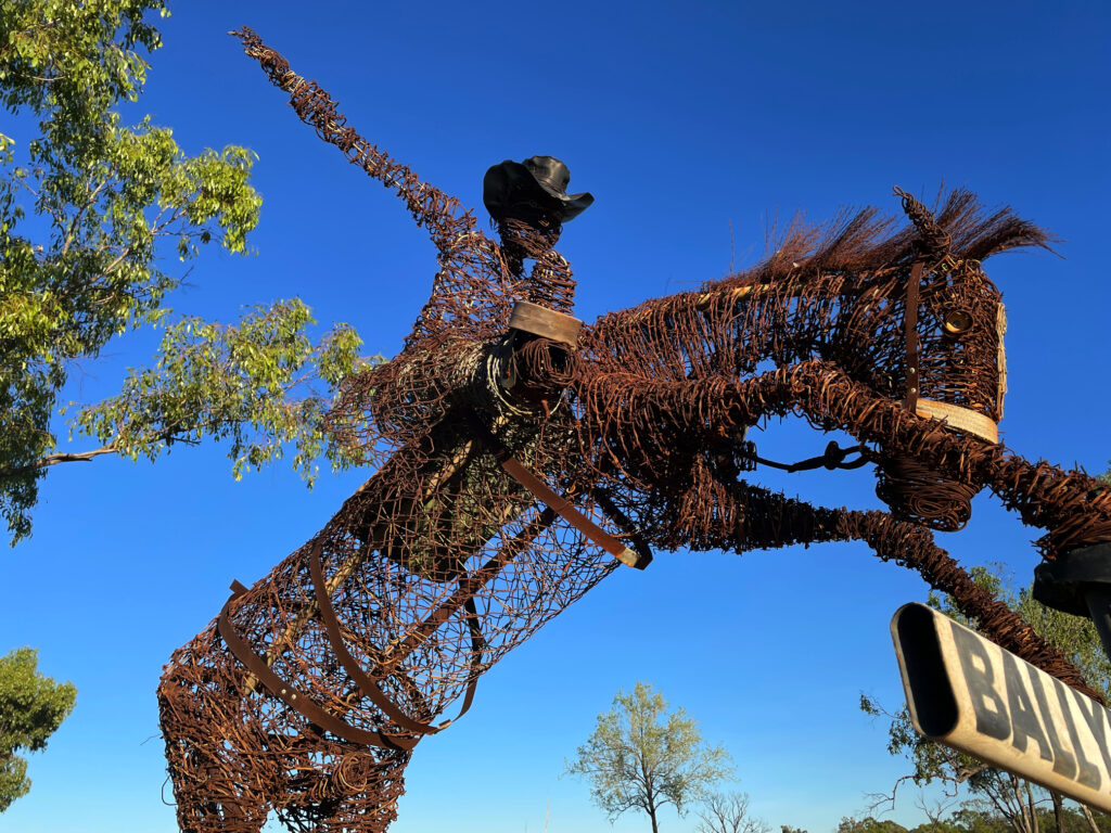
Alpha is known for its murals and its fossilised wood sculptures. And also a bull sculpture made out of barbed wire. All were very good.
The magnificent barbed wire bull at Alpha.
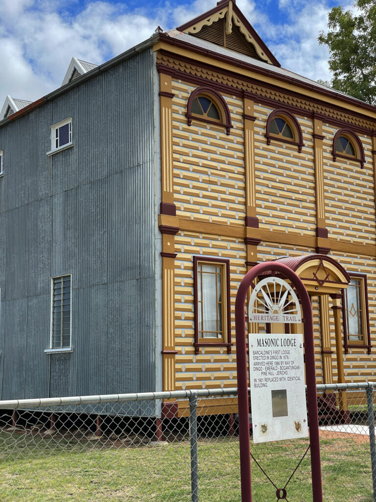
At Barcaldine we viewed the left-wing Tree of Knowledge (again), then the architecture of the right-wing Masonic Hall. Built in 1901 of timber and corrugated iron, they ‘did up’ the facade to replicate stone-work.
The iconic Masonic Hall at Barcaldine. Built in 1901 is iron-clad with an imitation-stone front wall. it was decorated to appear as if it were made of stone blocks, and adorned with columns, friezes, semi circular windows and a porch.
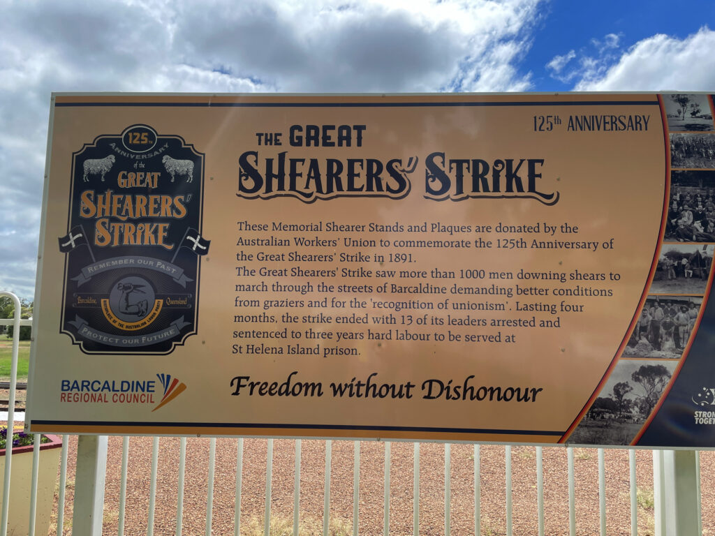
We also spent a little time reading about the Great Shearer’s Strike of 1891. There’s a very good display and sculptures explaining the reason for it and the outcome.
Barcaldine
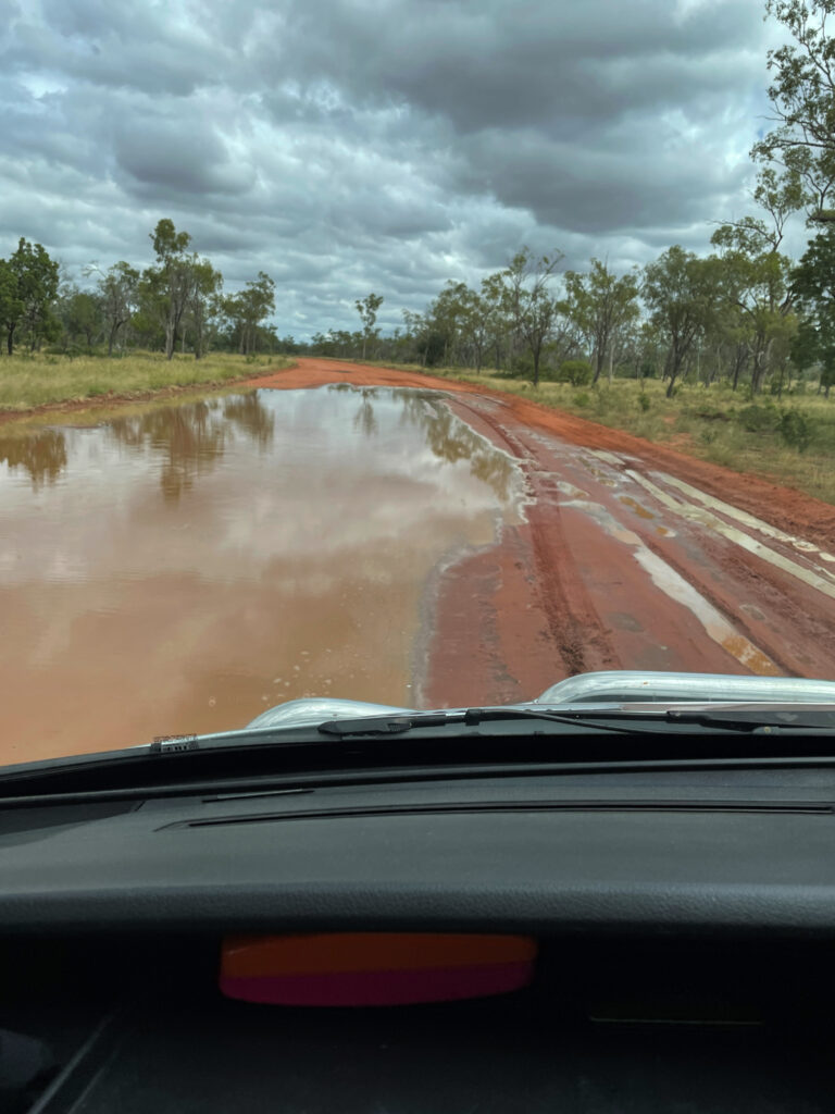
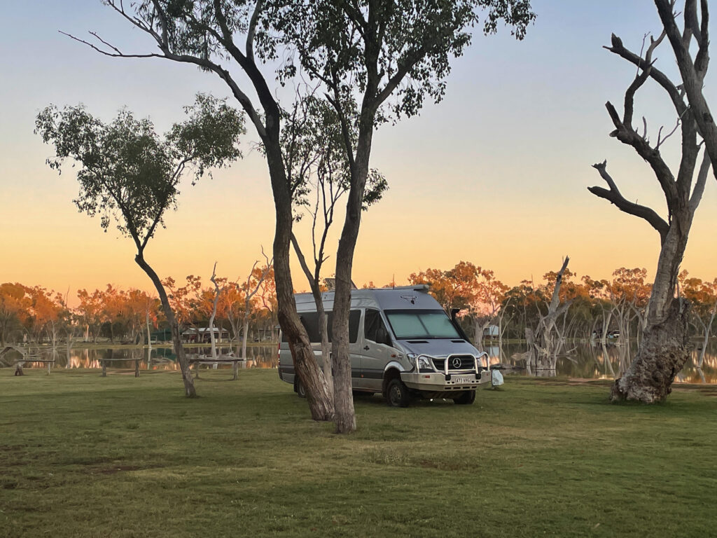
5th – 7th April. Apparently it rained a lot at Lara Wetlands last night. Oblivious to this we drove in over 13km of flooded dirt roads. It was still water, so not dangerous. Two vans came in after us before they closed the road to entry.
The road in to Lara Wetland – bit wet!
We’re here for 3 nights – by our last day we were the only campers. So peaceful for a normally very popular camp.
Our campsite at a very quiet Lara Wetland
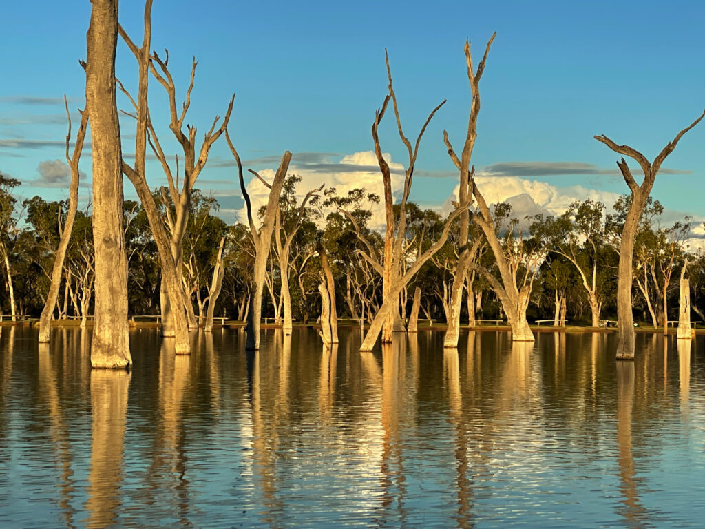
Lara Wetland is a large shallow lake fed by a century-old artesian bore on a 15,000 acre working cattle station. The starkly white dead ghost gums in the lake provide homes and hunting vantage spots for the many, many birds that live here.
Lara Wetland, from the kayak.
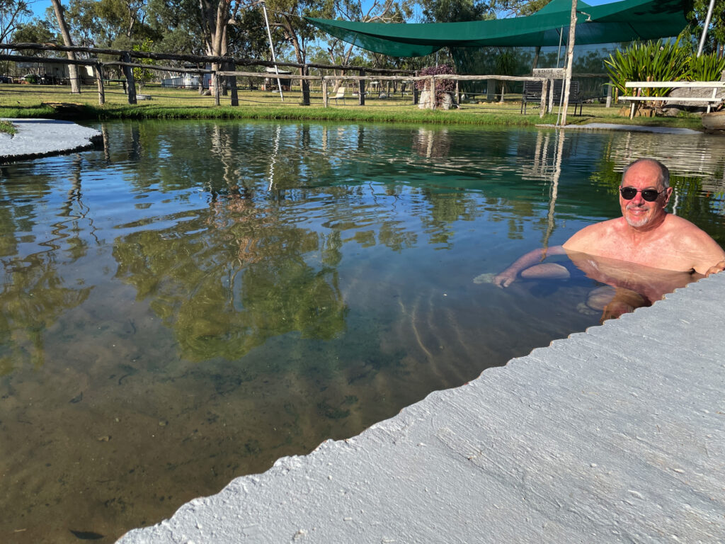
Kayaking, soaking in the hot artesian pool, walking, birdwatching and relaxing filled our days.
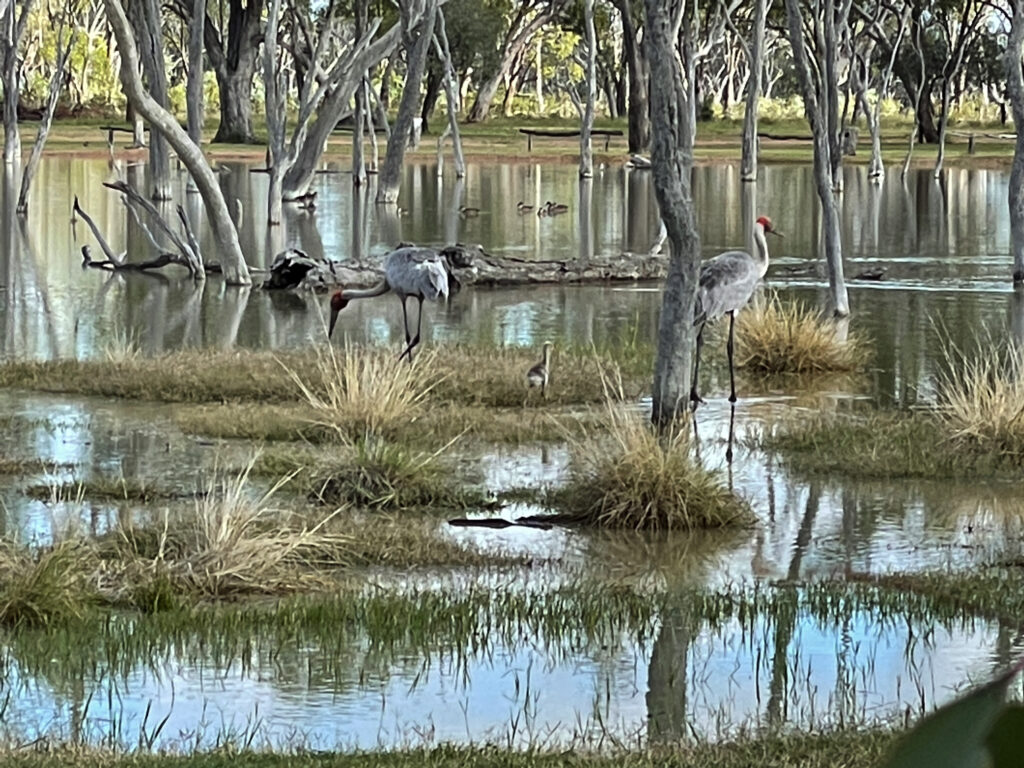
Steve soaking in the artesian pool at Lara Wetland.Brolgas at Lara Wetland – can you see the chicks?
8th – 9th April Leaving Lara Wetland today the road is now open, though there’s still water over the road and it’s been cut up quite a bit by the departing vehicles. We headed north to Aramac where the chap at the Council told us a section of the unsealed road on the 200km long Lake Dunn Sculpture Trail is closed. No problem, it’s a circuit so we went the opposite direction.
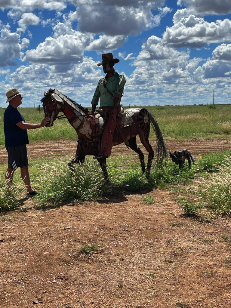
The Sculpture Trail sculptures, 40 of them with more being added, have all been created out of junk by a local artist, Milynda Rogers. We stopped at each sculpture, some very good, others OK.
Lake Dunn Sculptures
This western section of the trail is a sealed road through rich grasslands where the cattle are chubby and we had to pause to allow emus and kangaroos to cross the road. Tonight we’re camped about half way around the sculpture circuit at Lake Dunn, a large lake where fishing, water skiing and birdwatching are the main activities. Not a favourite camp – too busy with camp spots alongside the road.
Stockman and dog. Lake Dunn Sculptures
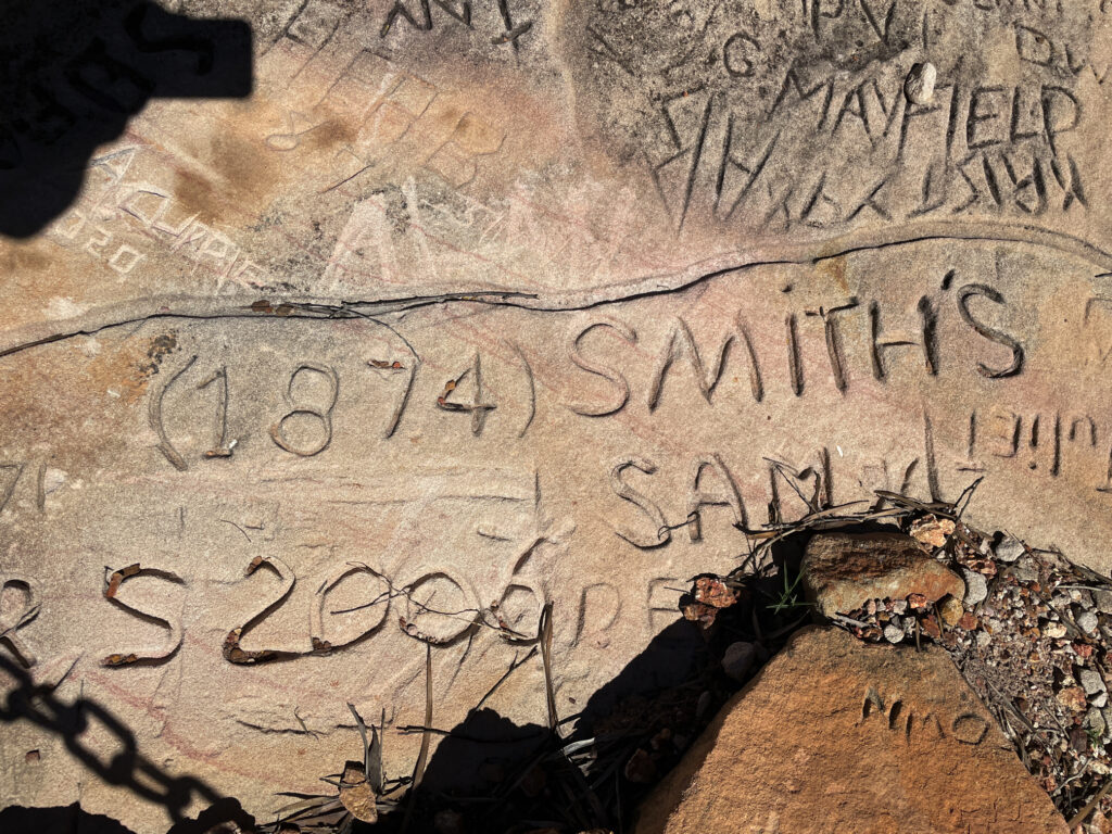
Rumour amongst the campers has the unsealed remaining sections of the road open now so we left very early to complete the sculpture trail. As well as the sculptures on the trail there’s a Healing Circle, apparently joined spiritually to only 5 other places around the world, and interesting history at Gray Stones where passengers from the Cobb and Co coaches running in the late 19th and early 20th centuries carved their names into the sandstone when they paused here for a rest.
Names scratched into the sandstone go back to the late 1800s from the Cobb and Co passengers. Lake Dunn Sculptures
At Alice Ck water covered a good 100m of the road, reaching to Steve’s knee height at its deepest. As the surface was firm we drove on through without a problem.
9th – 10th April: Porcupine Gorge, north of Hughenden, is our destination tonight. It was a very long drive through very flat, lush grasslands. One 25km section between Aramac and Torrens Creek was unsealed – a very rough, corrugated section!
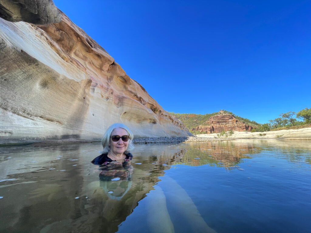
The Porcupine River has formed a long, deep gorge through this flat country which is now protected by the national park. We’re camped at the Pyramid campground for two nights allowing us to do some walking in the gorge. It’s quite a steep track down roughly-made stone steps to the bottom of the Gorge, followed, of course, by the corresponding climb up the track in what is now very hot weather. Many of our fellow campers balked at going down. However with the promise of a swim in the cool refreshing waters of the river we headed down. The swim was delightful.
Enjoying a well-deserved swim in Porcupine Gorge.
Late afternoon, near sunset when the heat had gone out of the day, we walked along the ridge to see the length of the gorge from above.
The Gorge. Porcupine Gorge.
11th April Julia Creek (Happy wedding anniversary Laura and Stu)
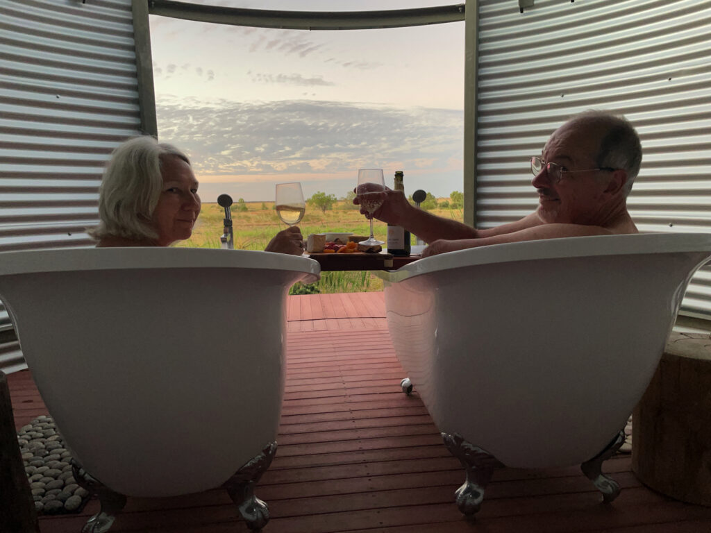
Pat and Dick gave us a ‘heads up’ to book ASAP for the sunset time slot for the ‘artesian baths’ at the Julia Creek CP – a difficult task as the CP wouldn’t answer their phone. Anyway we did score the last booking and had a lovely hour or so soaking in the baths, snacking on our grazing platter and sipping sparkling wine.
Enjoying the view, a soak and a wee drop or two. Julia Creek
12th April (our 46th wedding anniversary)
First stop today was Cloncurry where we had a cuppa at the painted water tower overlooking town, then stopped to view the Burke and Wills plaque showing where they passed through on their south to north exploration. A little further along a memorial to our First Australians was quite poignant – too poignant for some as it had been defaced.
Our campsite for tonight is the abandoned site of Mary Kathleen. Mary Kathleen was an architect-designed ‘model’ town with homes, a post office, cinema, sports ovals, a school, banks and a community store built in 1956 to service a uranium mine. When mining finally finished in 1982 the infrastructure of the town was completely removed and the mine site rehabilitated. Nothing remains here now except the cement slabs of the buildings, the mine tailings and a huge hole in the ground half-filled with water.
Our campsite at the ghost town of Mary Kathleen. We’re camped on the slab that used to be the Post Office.
Camping is free and was quite pleasant – a dry stream bed lined with beautiful ghost gums cast lots of shade as did the trees planted around the town, while contented cows wandered freely keeping the grass trimmed.
A beautiful, quiet evening at Mary Kathleen
We drove over a really terrible road up to look at the view from the hill above, but had had enough of dodging huge potholes and rocks to bother going on to see the mine site some 6km from town.
Still heading west we stopped at Mt Isa for fuel and to restock the larder before the next stage of our big adventure.