
March 29th – April 13th
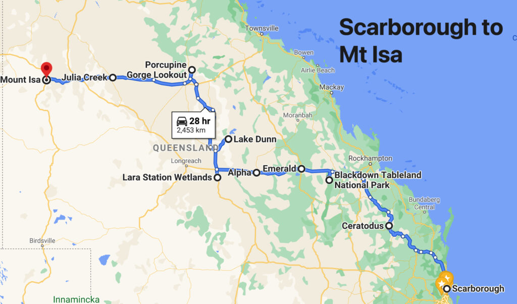
Well that wasn’t my most favourite departure. We’d not intended to leave for another week, however with the possibility of a COVID lockdown looming we decided to leave early, and not as well prepared as we’d hoped to be. It’s easy to self-isolate in a motorhome and to continue to follow the isolation rules. Got away about 2pm, travelling only about 90km, up to the free camp at Kilcoy. Tuesday 30th we stopped for lunch in Kingaroy and a brisk walk along the rail trail before lodging for the night at Cerotodus, a lovely free camp near Monto where the old railway building and switching points provide an insight into travel as it was done. This is also the home of several free-range roosters who take their morning alarm duties seriously.
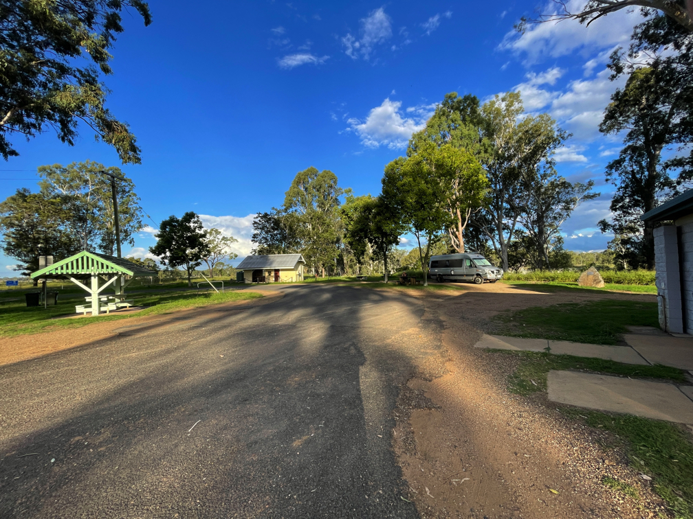
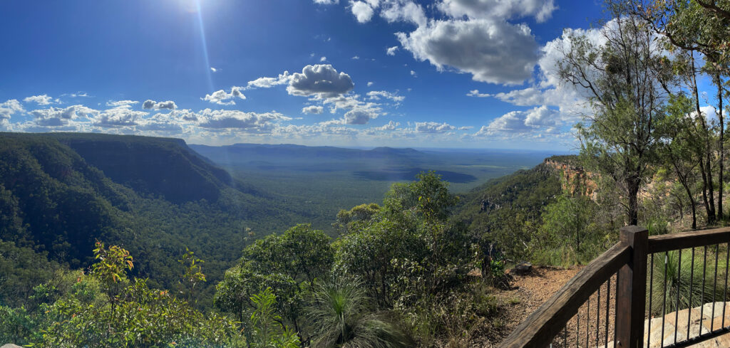
Wednesday 31st begins our new adventure in earnest, or so I thought, as we camp at Munall Campground at Blackdown National Park. A beautiful flat road through rolling green hills with cattle, emus, brolgas and kangaroos doesn’t prepare you for the very steep, winding ascent of Blackdown Range.
The views for the passenger are spectacular looking down over the cliff edges, but the driver who dares not shift his gaze sees nothing but a narrow, steep, twisting gravel road in the best parts, a little bitumen added to the worst parts.
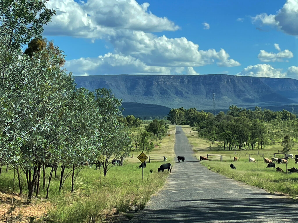
We paused at the top to take in the view from Yaddamen Dhina and do the 4km walk to the gorgeous waterfalls at Goodela.
Small falls tumble into a pretty pool that continues downward over smoothe rocks and then into oblivion.
The small pool was enticing for a swim, but it’s after 4 now and we’ve yet to cover the 8 unsealed kilometres to our campsite.
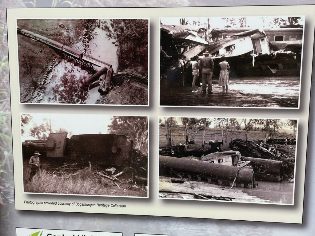
Thursday 1st – 4th April. Not an April Fools Day joke, unfortunately. Steve spent a sleepless night coughing, and woke with a sore throat. In view of having Covid-19 in our home area before we left we decided we should get tested, so down the mountain we drove. The small town of Blackwater was the nearest place offering this service, but not till 3pm. Blackwater is OK – it’s known as the Coal Capital of Queensland and has an apparently world class mining museum to see – not that we saw it, being responsible citizens we were self-isolating.
After the swabs were taken we drove on to the free camp in Emerald, between the railway line and the highway(!), but right beside their magnificent Botanical Gardens. Nothing to report now for 3 days as we continued to self-isolate until we finally got the all-clear on Easter Sunday afternoon! (No photos – we didn’t do anything!)
Free to travel at last we headed to the caravan park at Alpha. But first a break at Bogantungan. The name derives from the aboriginal words “bogan” meaning grass and “tungan” meaning tree.
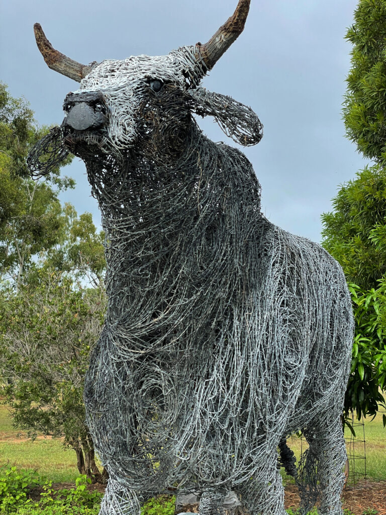
Alpha is known for its murals and its fossilised wood sculptures. And also a bull sculpture made out of barbed wire. All were very good.
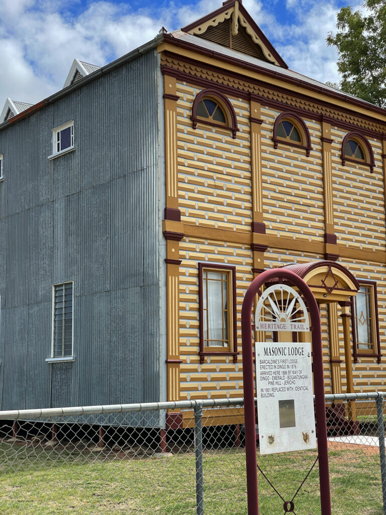
At Barcaldine we viewed the left-wing Tree of Knowledge (again), then the architecture of the right-wing Masonic Hall. Built in 1901 of timber and corrugated iron, they ‘did up’ the facade to replicate stone-work.
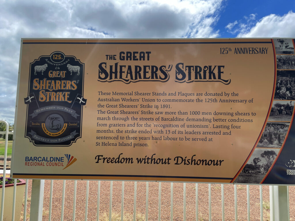
We also spent a little time reading about the Great Shearer’s Strike of 1891. There’s a very good display and sculptures explaining the reason for it and the outcome.
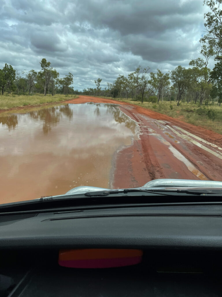
5th – 7th April. Apparently it rained a lot at Lara Wetlands last night. Oblivious to this we drove in over 13km of flooded dirt roads. It was still water, so not dangerous. Two vans came in after us before they closed the road to entry.
We’re here for 3 nights – by our last day we were the only campers. So peaceful for a normally very popular camp.
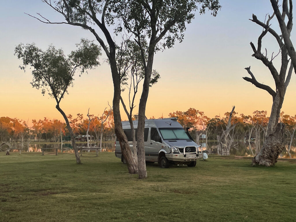
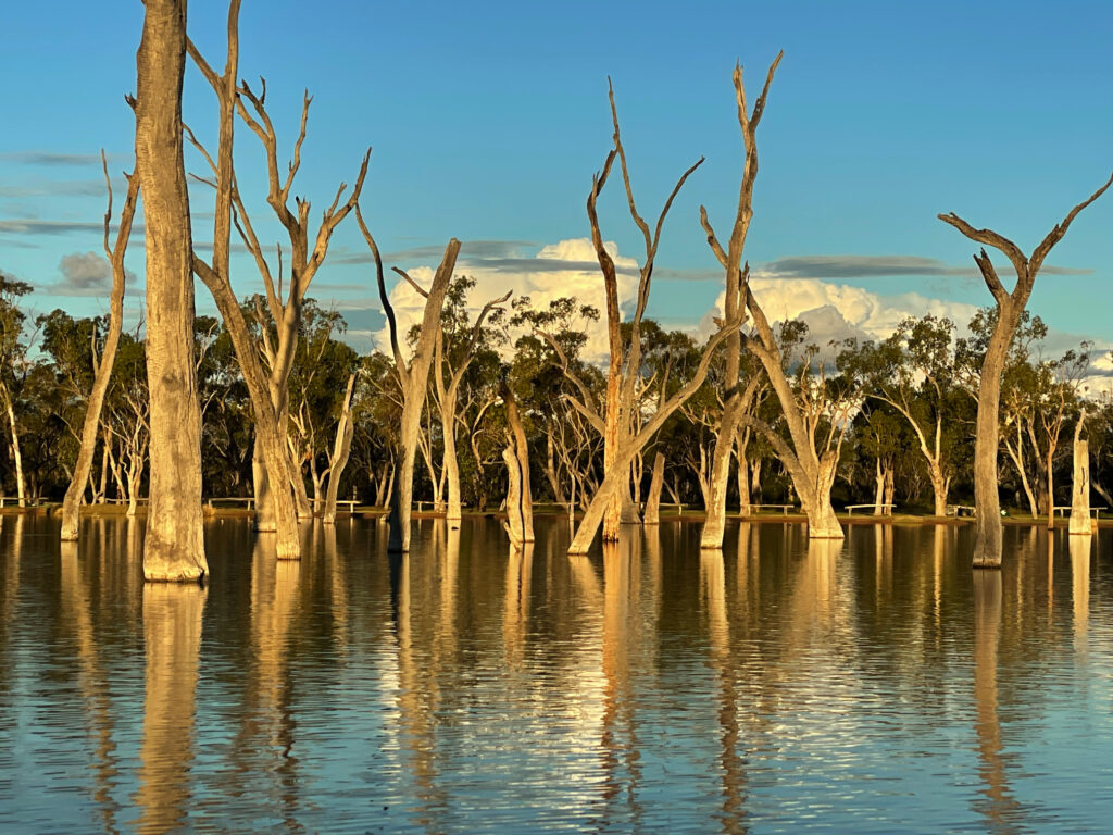
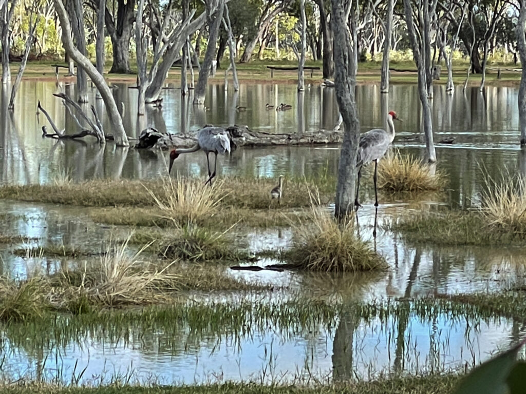
Lara Wetland is a large shallow lake fed by a century-old artesian bore on a 15,000 acre working cattle station. The starkly white dead ghost gums in the lake provide homes and hunting vantage spots for the many, many birds that live here.
Kayaking, soaking in the hot artesian pool, walking, birdwatching and relaxing filled our days.
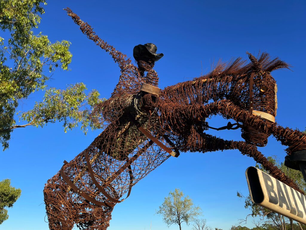
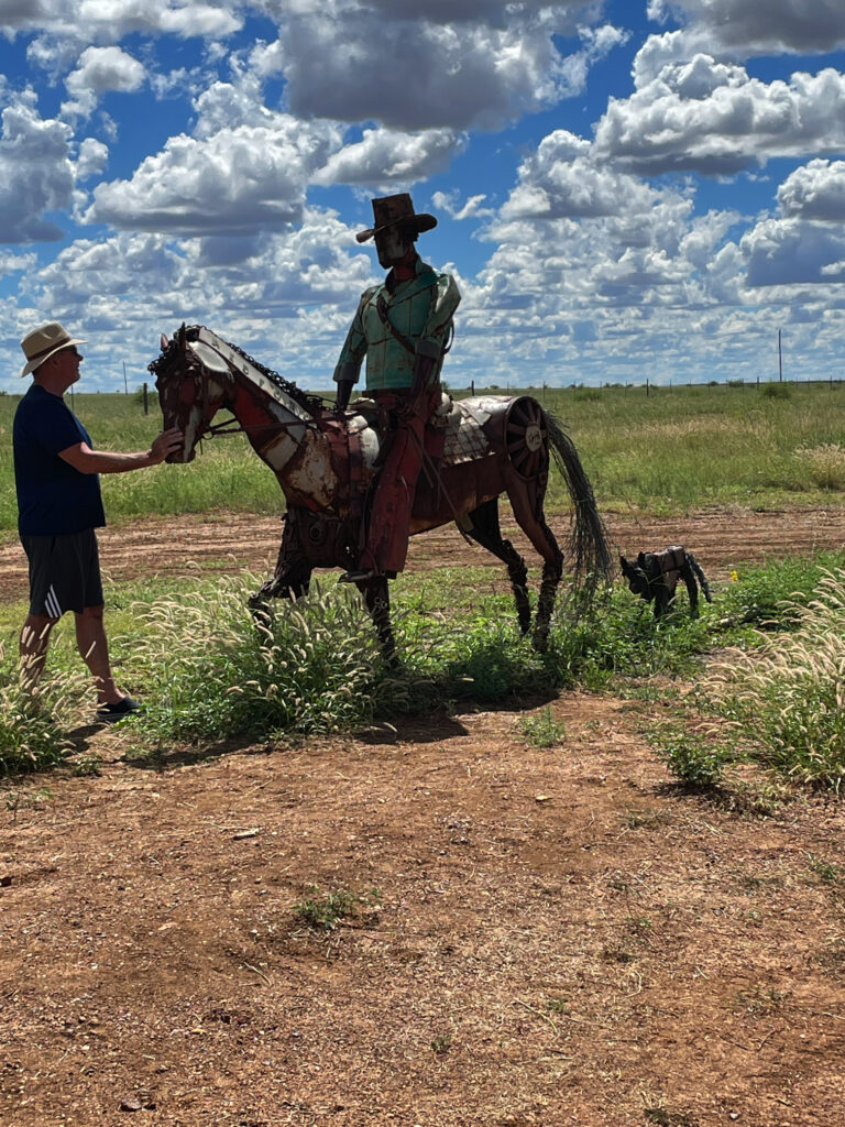
8th – 9th April Leaving Lara Wetland today the road is now open, though there’s still water over the road and it’s been cut up quite a bit by the departing vehicles. We headed north to Aramac where the chap at the Council told us a section of the unsealed road on the 200km long Lake Dunn Sculpture Trail is closed. No problem, it’s a circuit so we went the opposite direction.
The Sculpture Trail sculptures, 40 of them with more being added, have all been created out of junk by a local artist, Milynda Rogers. We stopped at each sculpture, some very good, others OK.
This western section of the trail is a sealed road through rich grasslands where the cattle are chubby and we had to pause to allow emus and kangaroos to cross the road. Tonight we’re camped about half way around the sculpture circuit at Lake Dunn, a large lake where fishing, water skiing and birdwatching are the main activities. Not a favourite camp – too busy with camp spots alongside the road.
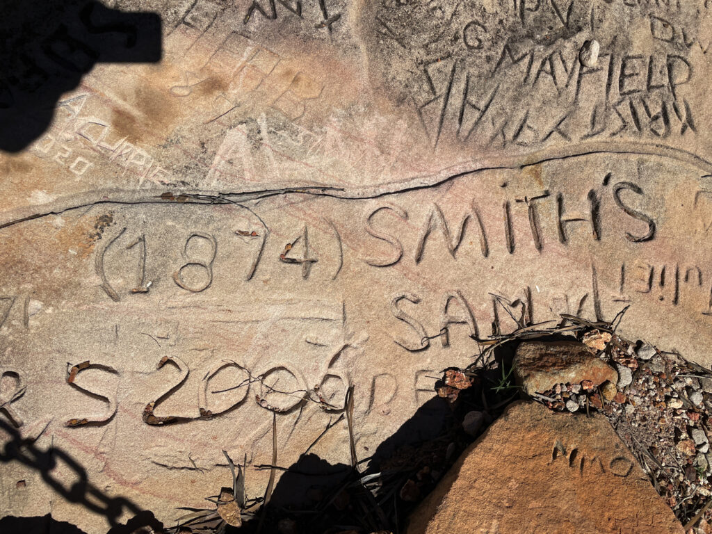
Rumour amongst the campers has the unsealed remaining sections of the road open now so we left very early to complete the sculpture trail. As well as the sculptures on the trail there’s a Healing Circle, apparently joined spiritually to only 5 other places around the world, and interesting history at Gray Stones where passengers from the Cobb and Co coaches running in the late 19th and early 20th centuries carved their names into the sandstone when they paused here for a rest.
At Alice Ck water covered a good 100m of the road, reaching to Steve’s knee height at its deepest. As the surface was firm we drove on through without a problem.
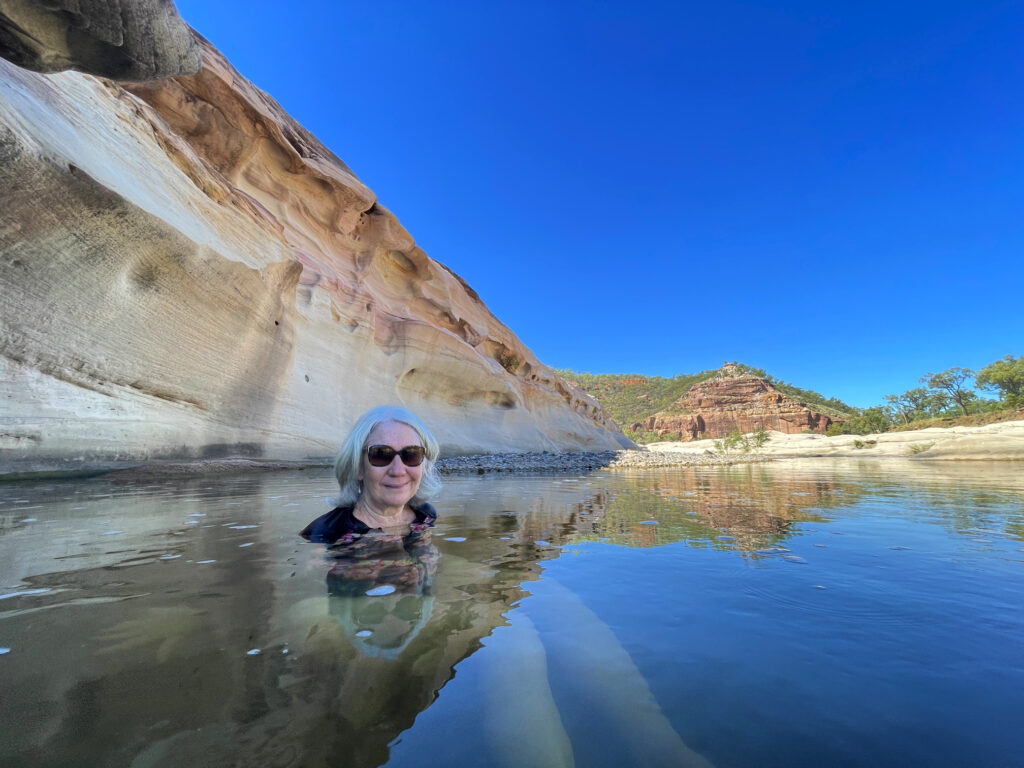
9th – 10th April: Porcupine Gorge, north of Hughenden, is our destination tonight. It was a very long drive through very flat, lush grasslands. One 25km section between Aramac and Torrens Creek was unsealed – a very rough, corrugated section!
The Porcupine River has formed a long, deep gorge through this flat country which is now protected by the national park. We’re camped at the Pyramid campground for two nights allowing us to do some walking in the gorge. It’s quite a steep track down roughly-made stone steps to the bottom of the Gorge, followed, of course, by the corresponding climb up the track in what is now very hot weather. Many of our fellow campers balked at going down. However with the promise of a swim in the cool refreshing waters of the river we headed down. The swim was delightful.
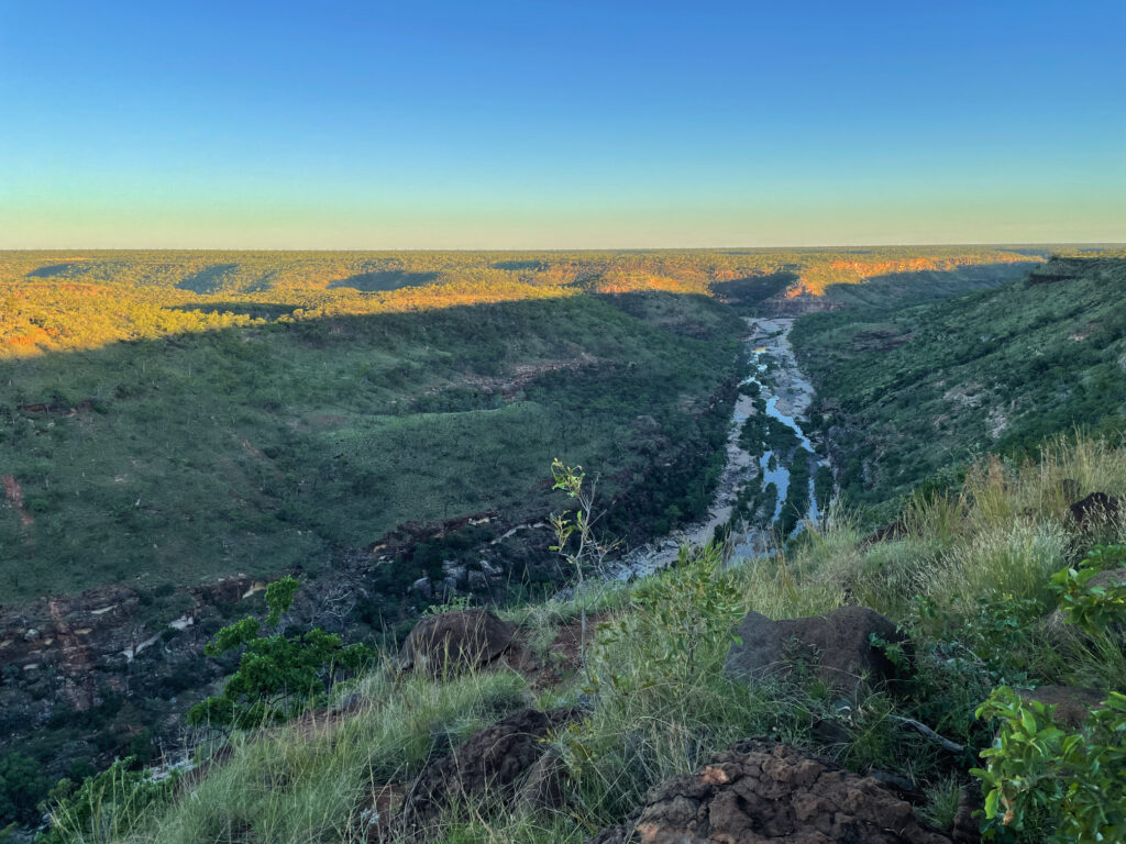
Late afternoon, near sunset when the heat had gone out of the day, we walked along the ridge to see the length of the gorge from above.
11th April Julia Creek (Happy wedding anniversary Laura and Stu)
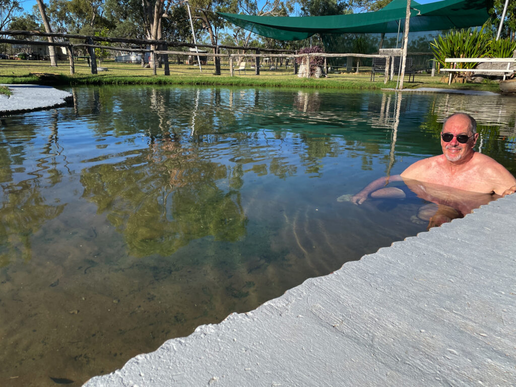
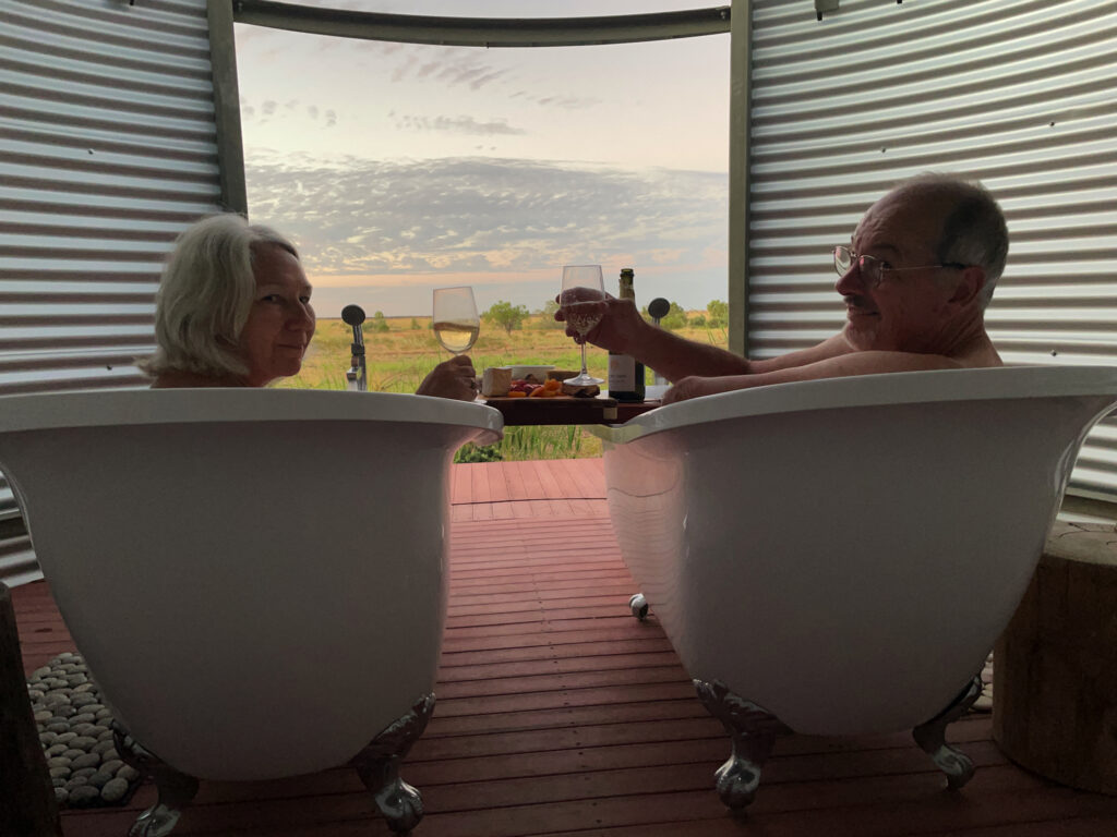
Pat and Dick gave us a ‘heads up’ to book ASAP for the sunset time slot for the ‘artesian baths’ at the Julia Creek CP – a difficult task as the CP wouldn’t answer their phone. Anyway we did score the last booking and had a lovely hour or so soaking in the baths, snacking on our grazing platter and sipping sparkling wine.
12th April (our 46th wedding anniversary)
First stop today was Cloncurry where we had a cuppa at the painted water tower overlooking town, then stopped to view the Burke and Wills plaque showing where they passed through on their south to north exploration. A little further along a memorial to our First Australians was quite poignant – too poignant for some as it had been defaced.
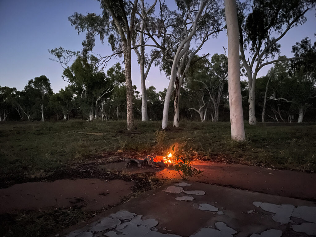
Our campsite for tonight is the abandoned site of Mary Kathleen. Mary Kathleen was an architect-designed ‘model’ town with homes, a post office, cinema, sports ovals, a school, banks and a community store built in 1956 to service a uranium mine. When mining finally finished in 1982 the infrastructure of the town was completely removed and the mine site rehabilitated. Nothing remains here now except the cement slabs of the buildings, the mine tailings and a huge hole in the ground half-filled with water.
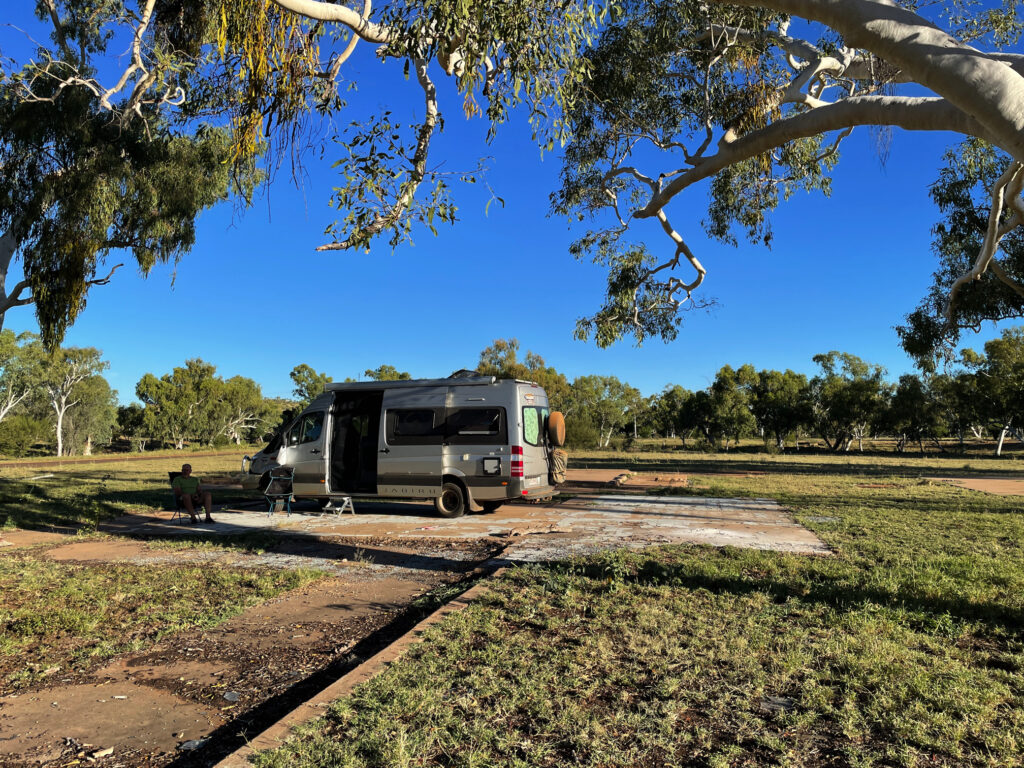
Camping is free and was quite pleasant – a dry stream bed lined with beautiful ghost gums cast lots of shade as did the trees planted around the town, while contented cows wandered freely keeping the grass trimmed.
We drove over a really terrible road up to look at the view from the hill above, but had had enough of dodging huge potholes and rocks to bother going on to see the mine site some 6km from town.
Still heading west we stopped at Mt Isa for fuel and to restock the larder before the next stage of our big adventure.