30th Sept 2016: Home to Crows Nest 85K
Yay, we’re off again! We’ve been attending to home matters for the last couple of months and not able to get away – but today’s the day! We’re taking a week to drive to Canberra to attend the week-long CMCA Rally, then about 3 weeks to drive back home again. Western New South Wales has had lots of rain lately and so we’re hoping to travel that way to enjoy the green.
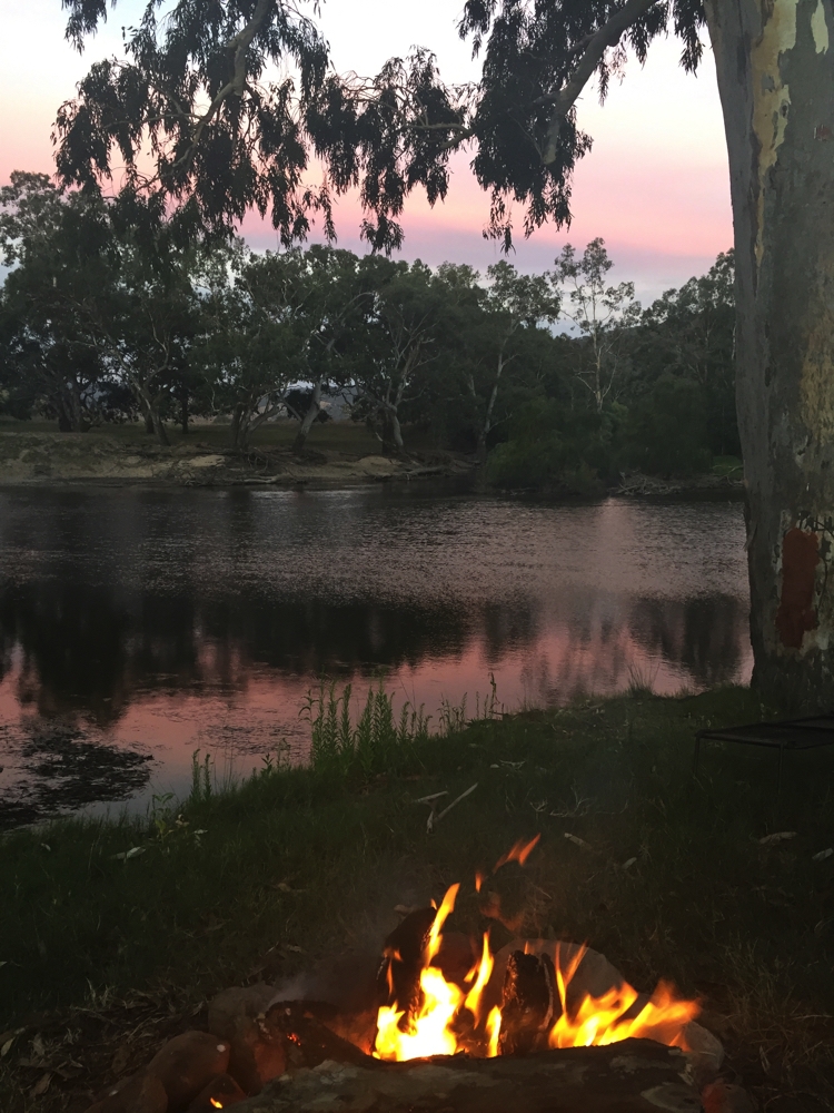
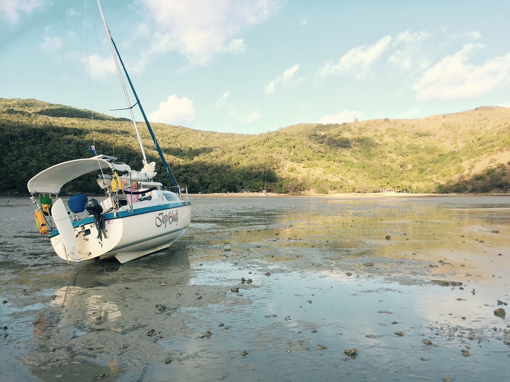
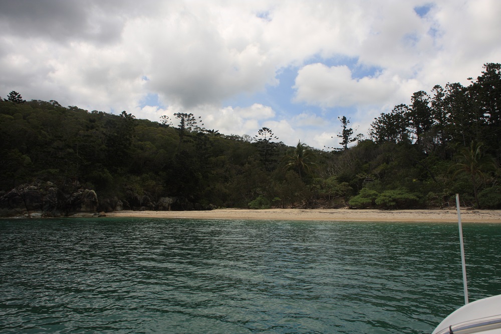
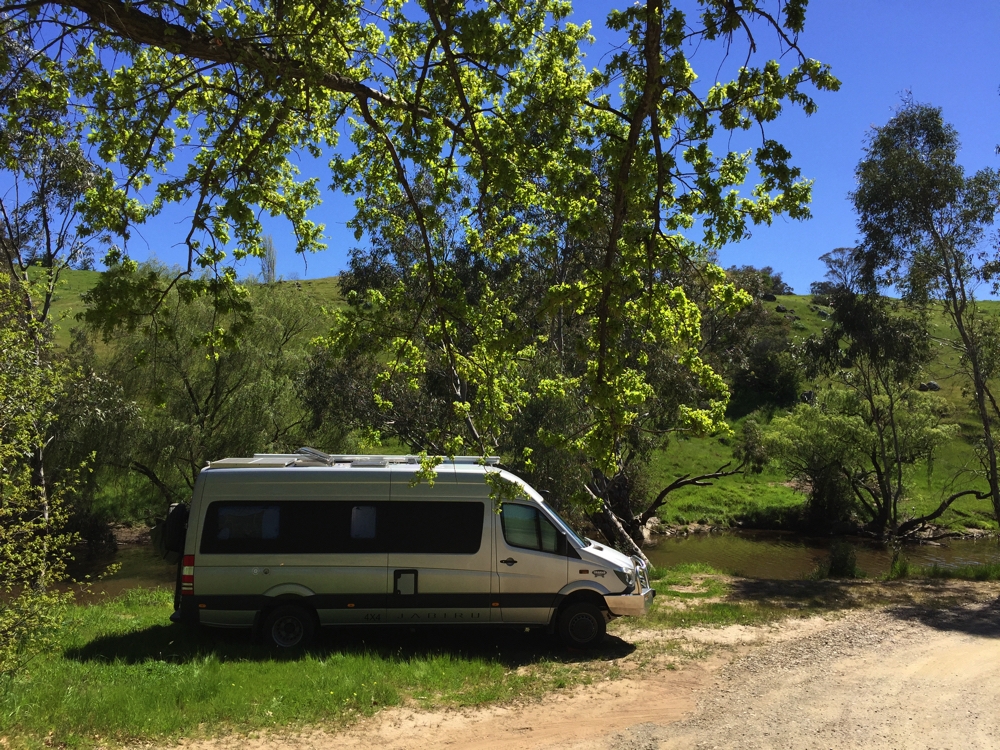
We got away about 2.30pm with just a short 85km to travel to stay with friends Randall and Catherine in Crows Nest. Nevertheless we did stop at the rest area near Ravensbourne NP to enjoy a cuppa and settle in to the lifestyle.
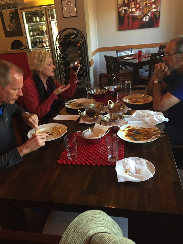
It was a really good evening catching up with old friends and meeting new friends, Caroline and Brian, in their other dinner guests. Thanks for a great evening and overnight stay C&R.
1st October: Crows Nest to Boomi 360km
We’ve bought a book called, “The Thermal Way” which describes all of Australia’s thermal pools. As our plan to head further west than usual took us through artesian basin country we decided to visit some of these pools.
Our journey took us through the pretty city of Toowoomba, looking particularly good following the Carnival of Flowers, then south west on the Gore Highway. At Millmerran we happened upon the Australian Camp Oven Festival. This festival is pretty well iconic so we couldn’t just drive on past. It’s very well organised with parking some distance away, but free mini busses every few minutes to take you to the venue. Entry fee was a bit steep ($30 ea), particularly as we knew we could only stay a short while. Anyway we wandered around checking out all the displays and camp ovens bubbling away, enjoyed the country musician while we ate lunch, bought some jerky to snack on our travels and continued our journey.
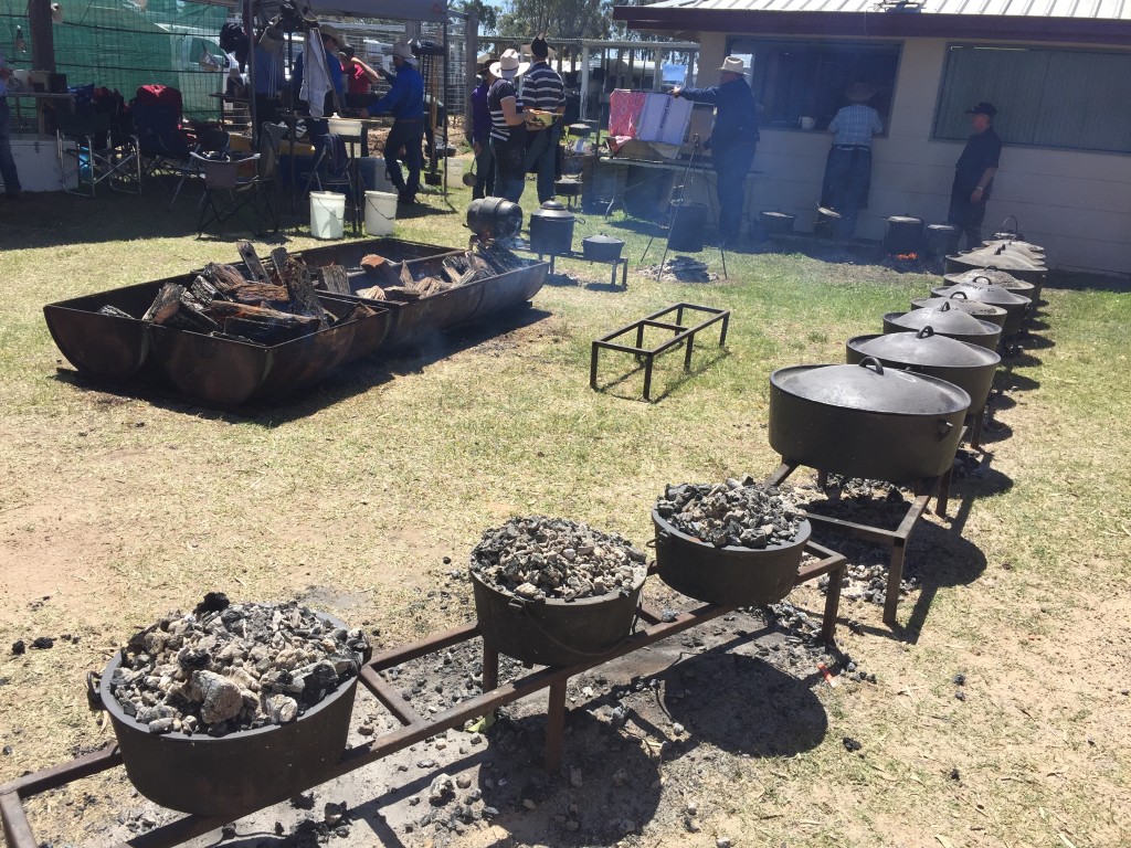
Camp ovens everywhere!
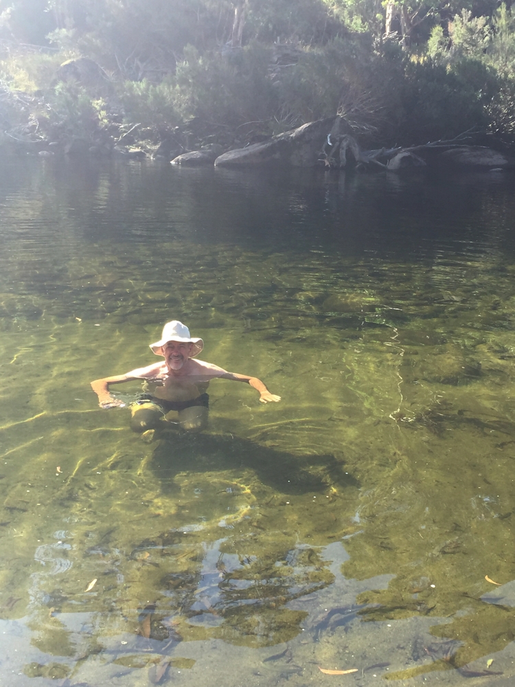
We paused for a cuppa on the banks of the MacIntyre River at Goondiwindi, the border town between NSW and Qld and home of Australia’s most famous horse, Gundsynd. Despite there being thermal pools here we continued on to our ultimate destination for the evening, Boomi (pronounced boom-eye) where we checked in at 4.30pm, half an hour before the thermal pool closed!
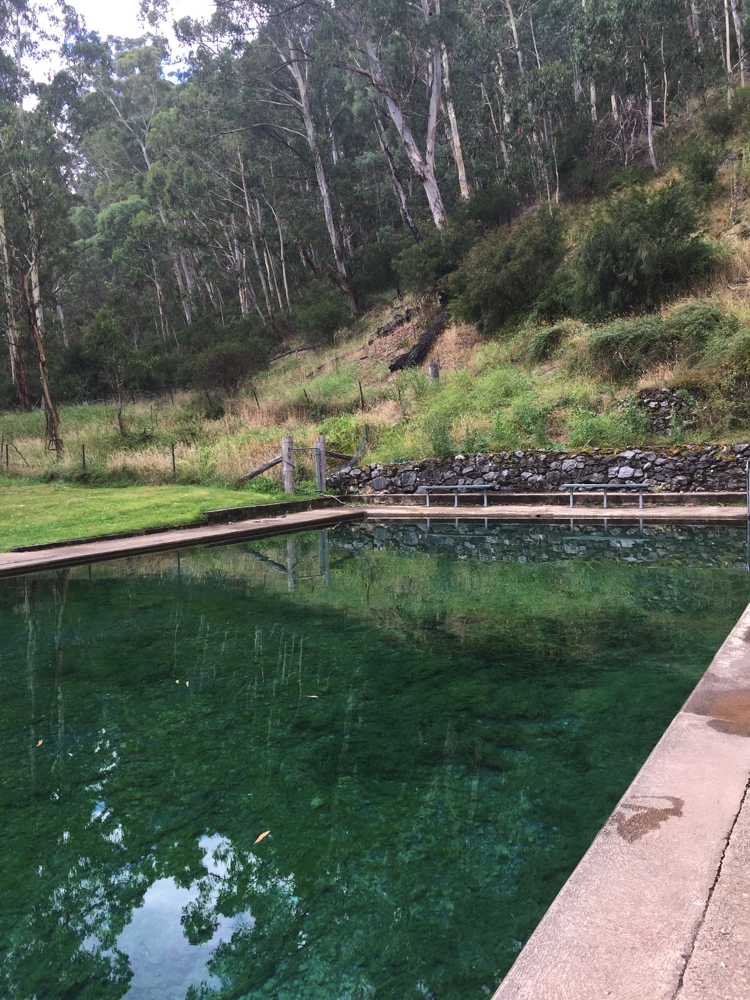
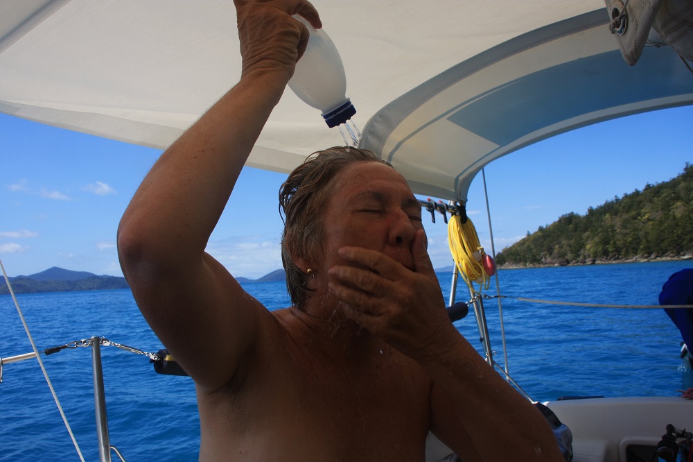
That was long enough to change into swimmers and soak up ‘the waters’ – our weary driving muscles very appreciative. Divine. The pool is small, maybe 10 metres by 3, but had underwater jets and water pouring in from pipes above water as well – perfectly placed for massaging. A lovely pool I highly recommend.
What a hotty! Boomi Thermal Spring
This bore draws water from the artesian basin some 1000m below. It was constructed in 1905 and revamped in 1975. The water in the pool is maintained at between 37 and 38 degrees. The township is very small and was in decline before a group of locals formed a cooperative which runs the General Store and camping area beside the thermal pool, and organised re-opening of the post office and a fuel station (the pub had continued to do well!). Tourism, particularly by those who like to soak in hot pools, increased dramatically as evidenced by there being about 15 RVs here tonight.
Camp: quiet, on bitumen, $10 per night unpowered plus $5 ea for access to the pool. Not a scenic campsite.
2nd Oct: Boomi to Collarenabri 195km
After a peaceful night’s sleep we headed back to the pool for another dip before continuing our journey. That’s definitely the way to start a day – very invigorating.
As previously mentioned it’s been raining out west – raining a lot! So much so that the Newell, one of our busiest highways, particularly for heavy transports, is flooded over quite a large area. Needless to say when that road is closed, there’s lots of others that are too.
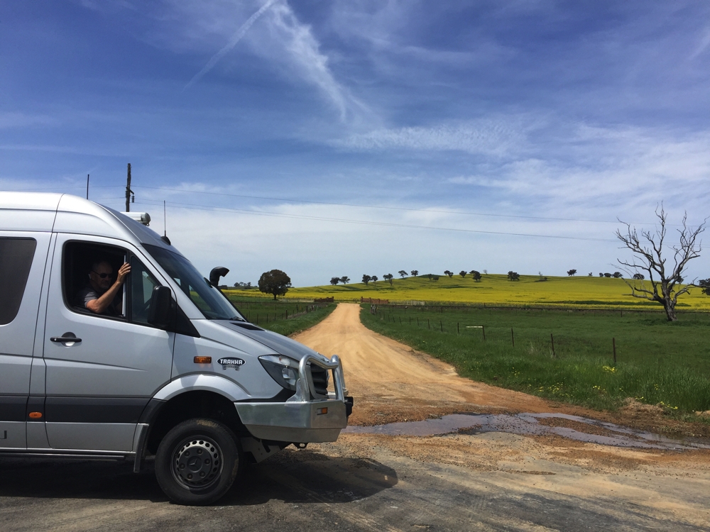
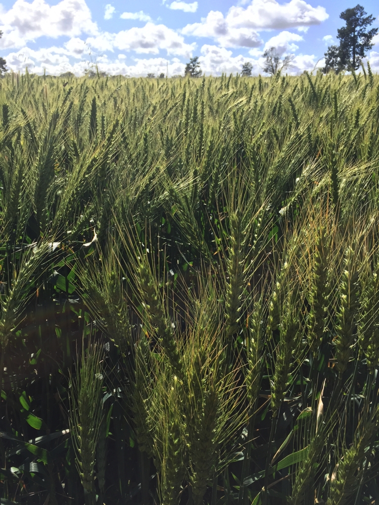
Our plan is to visit the thermal pool at Mundingi (mund-ng-i) but the unsealed road that is the shortest route to it has a ‘water over road’ warning on it. I rang the police station and they said it’s open so go for it. It was a lovely, lonely drive through green wheat fields and flat as far as the eye can see. I see why they named this area the ‘western plains’. When it’s not wheat the paddocks are covered in yellow or purple wildflowers which look stunning against the crystal clear blue skies.
We came to the ‘water across road’ – about 50 metres of the road was flooded with still water. In good 4WD fashion I hopped out and walked it, checking for depth, potholes and stability of the surface and crocodiles! (No I’m not serious about the crocs!)
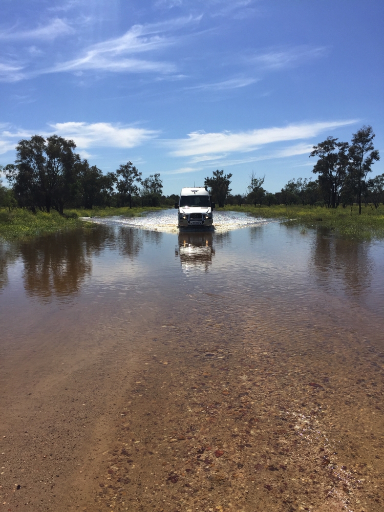
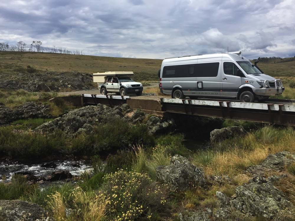
Fun roads to travel! From Boomi to Mundingi
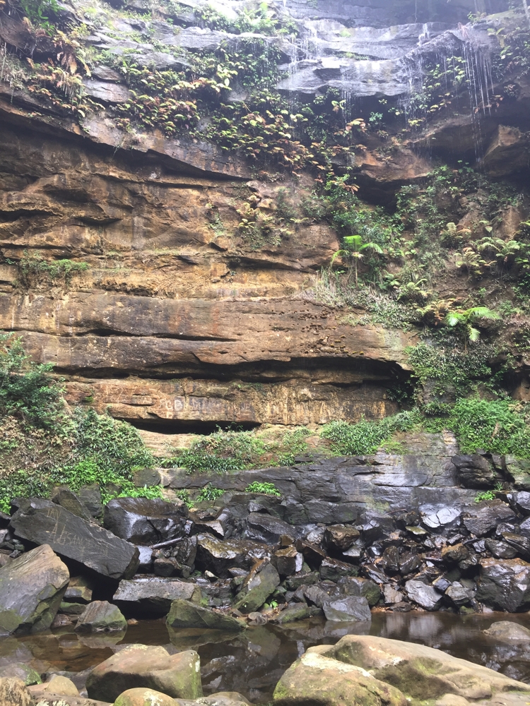
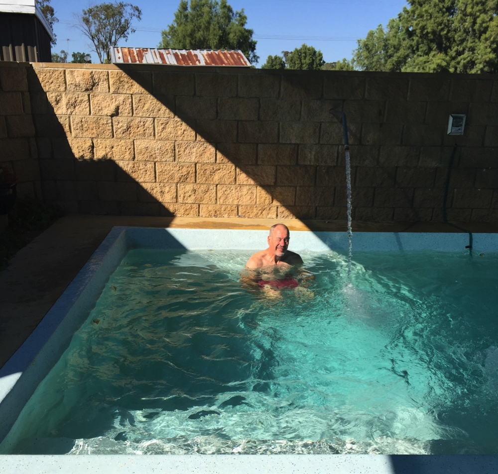
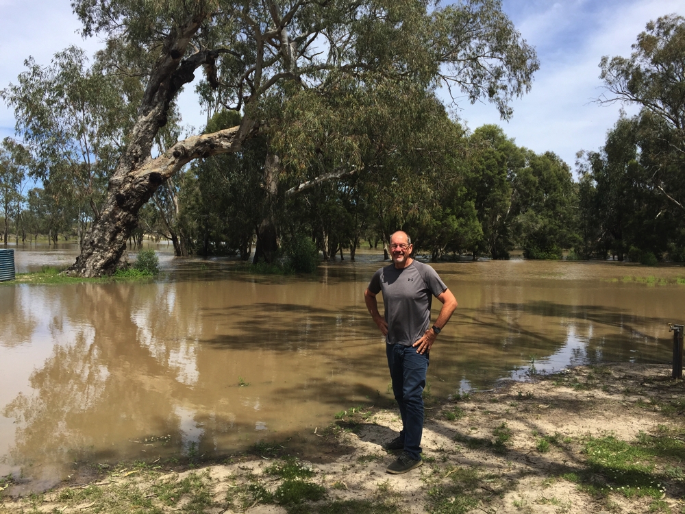
Arriving in Mundingi we stopped outside the thermal pool but neither of us felt like a swim so we drove to the rest area by the Barwon River and had a cuppa. The Barwon, which is flooded and still rising, forms a section of the border between Qld and NSW.
Steve checking out the flood waters. Barwon River, Mungindi
While there, a Council worker pulled in for a break. Our next leg, to Collarenabri, was also over an unsealed road which had been noted as closed – until today. I asked the chap what it was like and he said it is open but very rough and advised we take a different route – still unsealed, but not in such bad condition. Great advice!
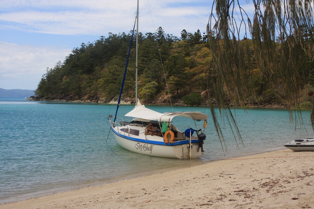
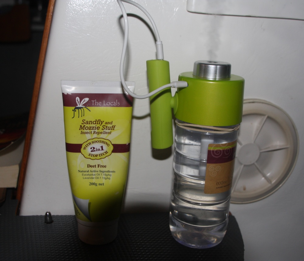
At Colly, as it’s known to the locals, we camped at the free camp just out of town with about 5 other RV’s. Plenty of room for all. A very good camp with clean amenities, including hot showers. We went for a walk over the bridge over the Barwon River and around a town block. It’s Sunday and everything is closed, with heavy duty roller doors (ominous!) – no window shopping here. Stopped at the pub to have a drink and to show support for a little town that supports travellers, then back to Priscilla for dinner. The mozzies were plentiful, but not a problem with our screens and mozzie mister.
However … the house batteries were flat. There was very little draw on them. Even after starting the car they only held that charge for another couple of hours. Damn! Looks like we need new batteries. That changes our plans!
3rd Oct: Collarenabri to Boggabri 255km
Instead of continuing our planned western adventure we turned towards Tamworth where we could get new batteries. Today though is a public holiday so nothing can be done until tomorrow.
We got away early, around 9.15, and headed down to the thermal pool at Burren Junction. This bore was sunk to 690 metres back in 1921 and flows into a ‘pool’ with a diameter of 15 metres. It’s raining today, and cold. The campsite beside the ‘pool’ where we’d planned to stay, is muddy. Anyway it took a bit of convincing but we did slip into our togs and dashed to the pool. Not a salubrious pool – just a round tank really with very hot water pouring in from a pipe. It was too deep to touch the bottom and the narrow underwater seat around the edge was covered in slime. Still, a quick dog paddle around the tank and back to hold on to the steps while chatting to the only other couple there was refreshing. And the dash through the cold and rain to the motorhome even more invigorating.
We continued the trip via Narrabri and on to Boggabri, stopping at the delightful, low cost campsite at the Old Baan Baa State School for a cuppa. Wish we could have stayed there, but they didn’t have powered sites and we need power now to keep our fridge going.
Stayed tonight on a powered site at Boggabri Showgrounds ($22). Site grassy, but amenities not great.
Are you seeing a theme here with the town names? They’re all aboriginal words from the Kamilaroi people with various aptly descriptive meanings, and rhyme with ‘by’.
4th Oct: Boggabri to The Black Stump 315km
We were up early this morning and away by 7.45. Not knowing how long they’d take replacing the batteries we wanted to give them maximum time. We travelled to Tamworth via Gunnedah, which is a very attractive town. At Tamworth we went straight to Battery World and they fitted us in immediately.
We wandered over the road to Ruby’s Cafe which really is a gem, and not only in name! Very friendly staff, fantastic service and we both enjoyed a delicious breakfast. What we saw of Tamworth we really liked.
Two hours later we were off with two new batteries, and quite a few less dollars.
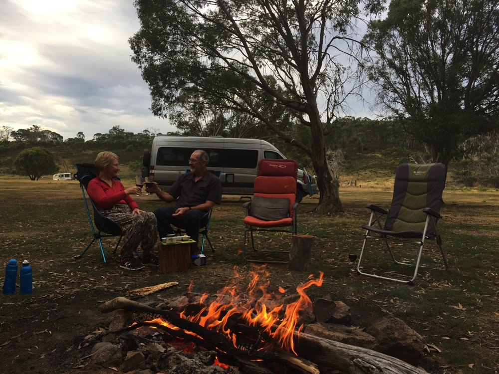
Continuing our south-westward travels we cut across to Werris Creek and then via Colly Blue (what a great name for a town) to our camp for the night at The Black Stump, a free camp. We much prefer ‘the roads less travelled’ and really enjoyed this part of the trip through rolling green hills with hardly any other traffic.
In the early 1800’s there was a property in this area called Black Stump, The local Aboriginal Gamilaraay people were said to have called the area ‘Weetalibah-Wallangan’, meaning, ‘the place where the fire went out and left a burnt stump’. The common Aussie saying, ‘beyond the black stump’ means beyond the limits of civilisation. And that’s where we are now.
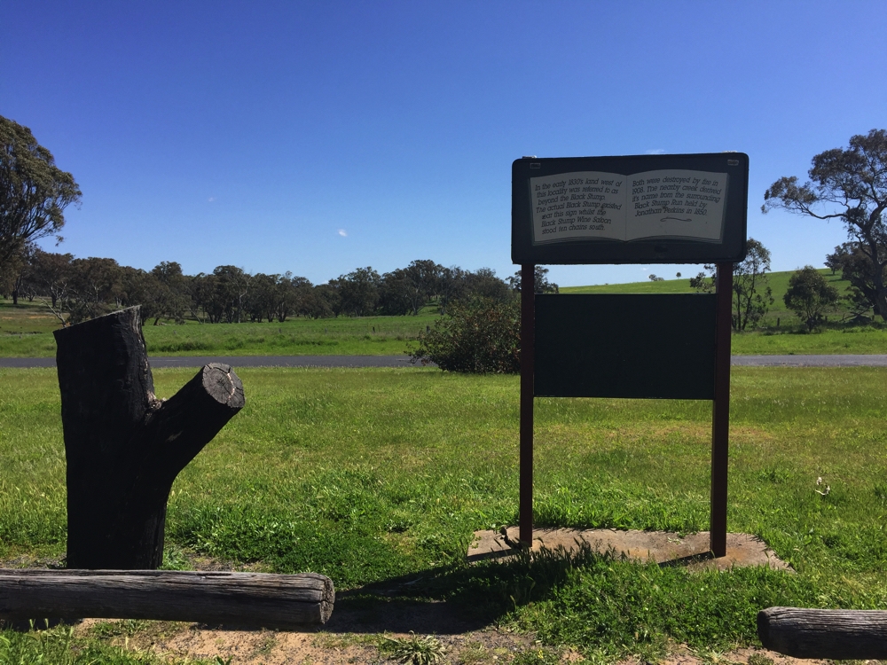
We’re camped for the night just behind the photographer.
This afternoon we snuck through the fence behind the camping area and took a walk up the paddock to the top of a hill. Up the top the farmer has a couple of paddocks of sheep. With the recent rain and such lovely rich soil everywhere it’s so green and the sheep look particularly healthy – and the many lambs so cute.
A quiet night with only two other RVs, but pretty chilly.
5th Oct: The Black Stump to Kandos (208km)
We were reluctant to leave here this morning. It’s such a pretty outlook and a day of no travel wouldn’t go astray. We took the country roads, avoiding the highway as much as we could, to Mudgee. I know Australia has many differing landscapes all with their own beauty, but I must say my favourite is rolling hills and valleys, particularly when they’re as lush and green as they were today. It was mostly sheep and cattle, some coal mines and then the vineyards started. Lovely drive.
At Mudgee we had a hot drink at a cafe, then lunch by the river before seeking out a vineyard to sample some of their wares. Couldn’t leave without supporting the local industry now could we?
From Mudgee we continued via the back roads to Kandos. It’s raison d’etre used to be mining for lime and the cement industry. This little town supplied much of the cement for the Sydney Harbour Bridge. But that was some time back and both industries have long since closed and today it’s a quiet little town with an ever increasing number of closed stores.
We’re camped at the Old Railway Station – a very good free camp on well-tended grass. Very quiet, no traffic and just one other RV. This is not a friendly town – no one spoke to us except a local complaining we were blocking the entry to the Men’s Shed.
6th Oct: Kandos to Boorowa (280km)
Another beautiful drive today with limestone mining, cattle and sheep farms giving way to spectacular fields of bright yellow canola flowers.
Had to stop to photograph this lovely countryside.
We passed through Bathurst where they were getting ready for the Bathurst 500 (motor racing) this weekend at Mt Panorama and headed down to Cowra. We’ve visited Cowra previously but had never been to the Japanese Gardens. During WWII Japanese prisoners were held here and staged a quite famous escape. Some were killed in the attempt and buried here, their graves cared for respectfully by the locals. When the town decided to create these gardens in memory of those times Japan was quite generous in their donations of money and expertise in thanks for their care of the war graves. We lunched at the cafe before exploring the magnificent gardens. It’s a place you mustn’t miss.
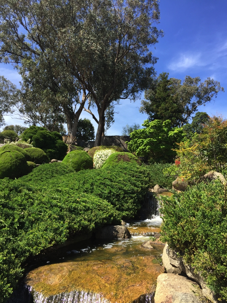
These gardens leave you feeling very serene.
At Boorowa we camped at the caravan park. We walked into town and were struck by how friendly everyone in this little town is. A drink at the pub was made fun by the bright and chirpy barmaid who happily chatted to us and later we enjoyed a chat with the happy publican.
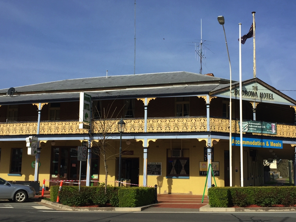
Boorowa Hotel
To see more photos from the first week of our trip click on this link.
7th – 15th Oct Boorowa to EPIC, Canberra.
We left Boorowa early this morning covering the 115km pretty quickly.
Here we are at the CMCA Rally, along with about 760 other motorhomes. The CMCA has taken over the EPIC site in Canberra entirely. We’ve been cited on the oval, which is quite pleasantly grassed. It’s all very well organised by a large group of volunteers. We’ve got a powered site and water close enough to hook up to to fill the tanks.
All the activities are in the buildings around the grounds with marketing displays, a food court, seminar rooms, the main conference area and numerous other buildings for craft activities, small meetings or just for a cuppa.
On the Saturday morning the farmers markets were on. Wow! Great markets! Lots of stalls selling grass-fed meat, organic chicken, pastured eggs and organic veggies. I stocked up on all of these. Unfortunately we were often too busy to cook a proper meal.
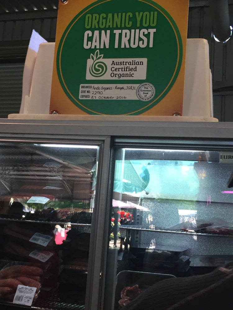
Wonderful organic or free-range produce available every Saturday at the Farmer’s Market at EPIC.
Apart from all the activities organised for us we also rode the bikes into Dickson, wandered the shops and had a meal out at a Japanese restaurant. Another day we caught the bus (free public transport for us!) into the city.
The evening entertainment was mostly very good, with an excellent Big Band with great vocalists one night and a fantastic comedian another night being highlights. Most nights we danced a little to the music. Friday night was the Ball. That was fun with most dressed up in outfits befitting Floriade. At our table we were with new friends Marianne and Robert from Adelaide.
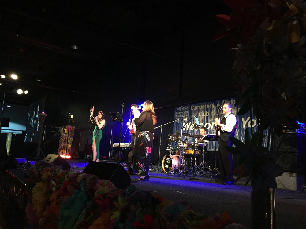
The nightly entertainment was excellent. We were treated to excellent bands and entertainers.
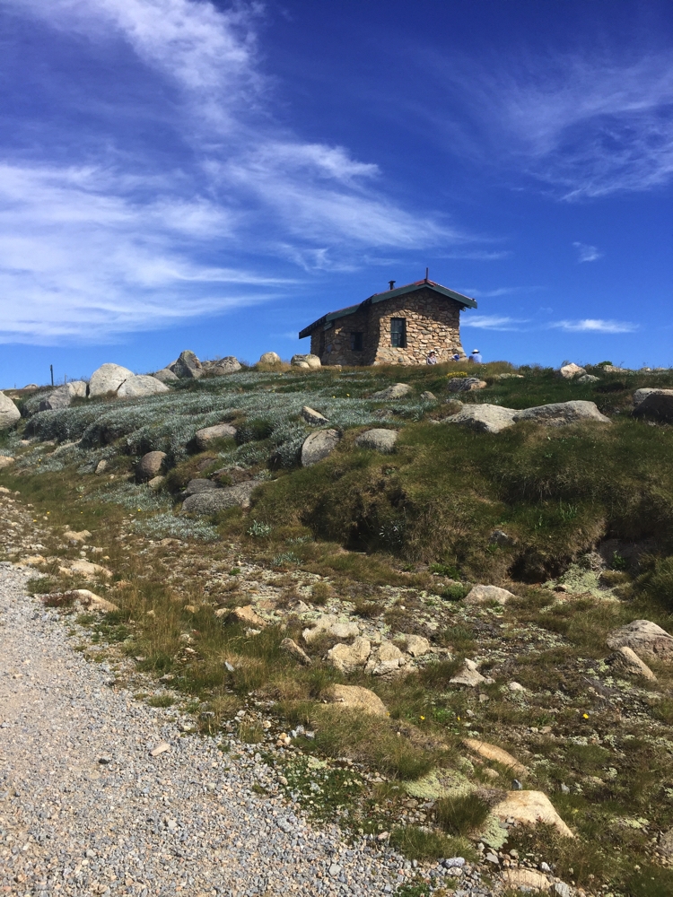
From the list of seminar sessions we chose to attend the ones that suited us. After the ‘RV-ing in USA’ session Steve has wiped that idea off the Bucket List, and I’ve put our conquering of the Canning Stockroute on indefinite hold. We both enjoyed the sessions on volunteer tutoring for isolated children, insurance and also how to use the Geowiki. A couple of the sessions weren’t very professionally presented, unfortunately. But, I guess they’re all volunteers.
I did a couple of craft lessons, making Christmas decorations for the grandchildren one day, and learning a new stitch to make a bookmark (like I need another bookmark!) on another day. They were both enjoyable workshops chatting with the other women.
We booked a tour to Floriade one day. The tour guide was a real fizzer, but the tulips at Floriade quite spectacular.
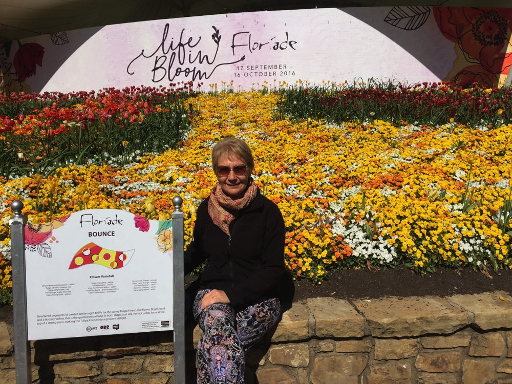
The sign describes the theme for this particular garden bed.
After we’d finished there we met friends Brenda and Owen from Cairns and their 3 daughters, their partners and grandson for lunch at Regatta Point Cafe. Great to catch up with the whole family after many, many years and Regatta Point is in a great location overlooking the lake.
The following day we did the ‘Nooks and Crannies of the Parliamentary Zone’ tour. That was very good. The guide took us to places you might not normally go to, such as the High Court, Reconciliation Place and the National Library. We also spent some time at the National Portrait Gallery – checking out the Archibald Prize entries from this and previous years.
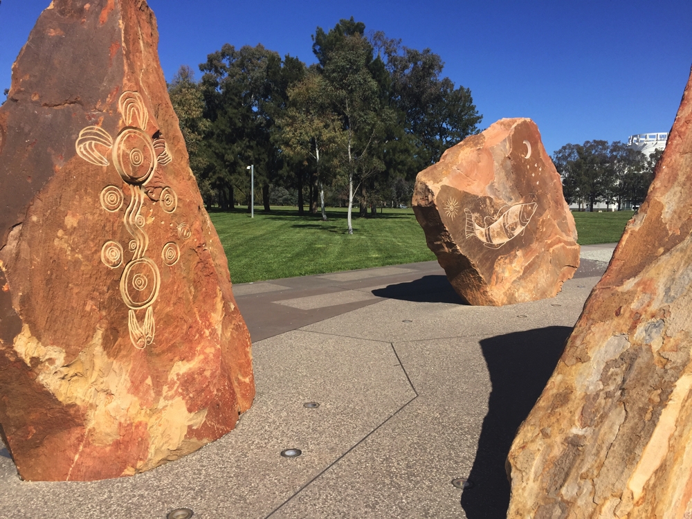
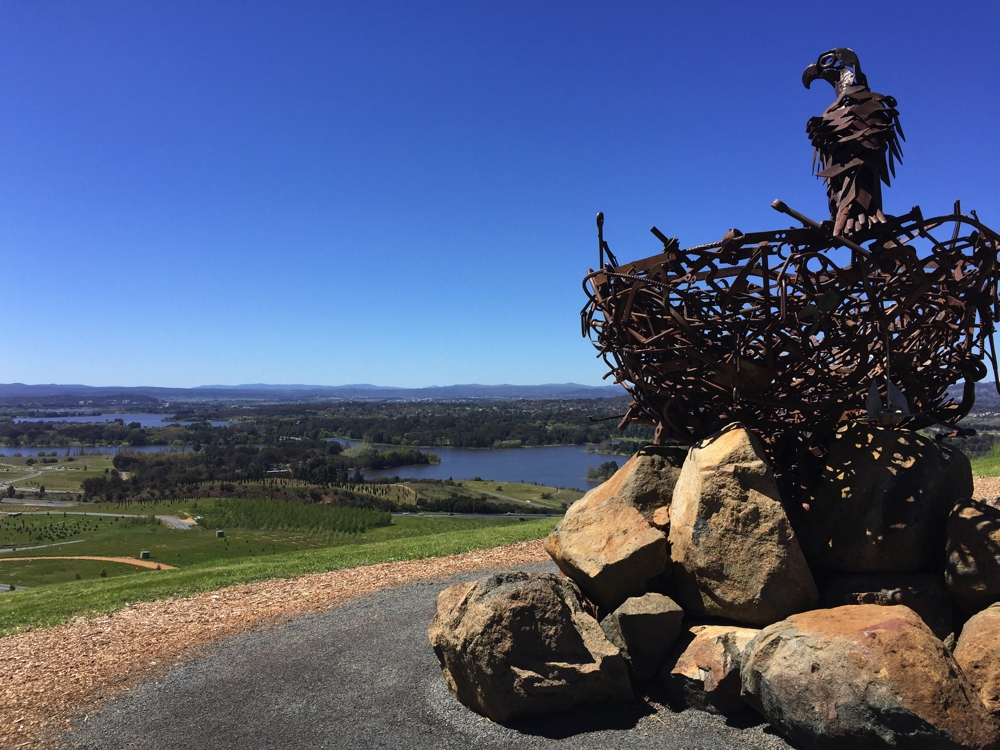
Sculptures in Reconciliation Place.
15th, 16th October EPIC Canberra to Yass 99km
The Rally is over. But it’s market day – a happy hour was spent buying organic fruit, veggies, meat and eggs at the EPIC Farmers’ Market, before heading off. On the way out we went to see the arboretum.
The National Arboretum features 94 forests of rare, endangered and symbolic trees from around Australia and the world. Many of the trees are still young but two of the forests are nearly 100 hundred years old. Over 44,000 trees from over 100 countries are growing across the huge 250 hectare (618 acre) site, making it one of the world’s largest living collections of rare, endangered and significant trees.
We didn’t feel inclined to view the information centre but enjoyed our drive up to Dairy Farmers Hill Lookout through many of these established and establishing forests. The view over the arboretum to Canberra and the lake is superb, as is the opposite direction to the Australian Alps.
The National Arboretum continues to grow, under watchful eyes.
To see more photos from our week in Canberra click on this link.
We headed off towards Yass, only to be waylaid by signs directing us to Wily Trout Vineyard and lunch at Poachers Pantry. Mmmm a delay thoroughly enjoyed.
At Yass, an RVFT, we camped right beside the Yass River at Joe O’Connor Park, a free camp. This is a beautiful spot – very scenic and quiet. Our campsite opens up onto the river just a couple of metres away with a grassy hill on the opposite side. Definitely recommend it. We’re staying here for two nights.
A beautiful free camp alongside the Yass River. Quiet and very relaxing.
We’d picked up a walking tour of the town leaflet from the Information Centre on our way into town, so on our rest day we took a look around. Yass is a beautiful town with many historical buildings, most well cared for. It’s an easy walk along pathways from the camping area to the weir, then over the bridge and into town. This is the warmest and sunniest day we’ve had since leaving home making our walk even more pleasant.
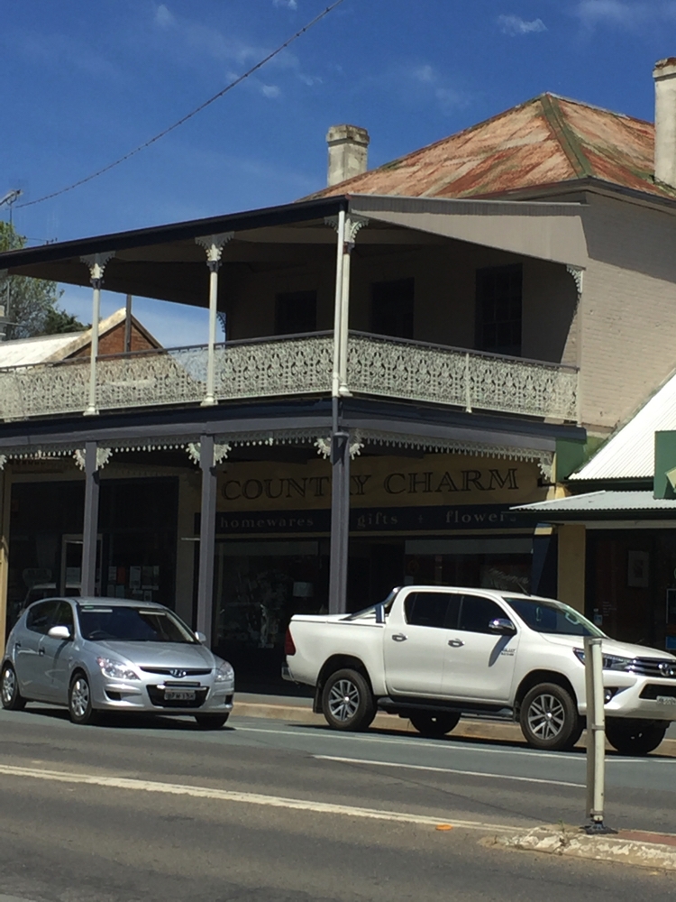
Country Charm indeed! Look at that intricate iron lace work. Yass
Apart from the ‘best coffee ever’ from the Rose Cafe, a highlight was Banjo Paterson Park. Banjo grew up around this district, just up the road at Binalong. What an interesting life he led.
The afternoon was spent reading and cooking, while the Superb Fairy Wrens flitted about and the ducks made swimming look easy.
17th October: Yass to Temora 153 km
A family mob of about 6 or 7 kangaroos grazing directly across the river from us made my morning cuppa in bed all the more enjoyable.
Today we drove past lush green fields, a few canola farms just beginning to bloom, many sheep properties with lots of lambs and one or two Angus cattle farms. The countryside is still rolling hills, but we’re starting to see more plains now.
At Binalong we drove around the town – a prosperous, cared-for town with many of its historical civic buildings still being used.
At Springdale we stopped, thinking we may spend the night, but it’s still early and there are many trucks on this road and the campsite is alongside the road. The Newell Highway is still closed south of Forbes and I think truck traffic is heavier here because of it. The roads are in pretty poor condition – potholes everywhere.
We headed on to Temora and parked in the free camp beside the railway station. The railway station has been restored beautifully, bringing back memories of a bygone era. We enjoyed a 3km or so walk through town past beautiful old buildings built in the early 1900’s to the Information Centre. Here we were treated to all the entries in this year’s Bald Archies. The Bald Archy prize was created as a spoof of the ‘serious’ Archibald Prize for portraiture. It’s an opportunity for artists to create their portrait paintings of humour, dark satire, light comedy or caricature. It’s usually quite topical, of people who made headlines in the previous 12 months. Bronwyn Bishop, Malcolm Turnbull of course and the tennis player Kyrios featured a few times as did Clive Palmer. Most of them were very good.
I asked about the possibility of trains through the night and was assured by the lovely Information lady that only one or two trains a week went through. Guess how many I counted between arriving back from our walk and leaving the next day …. NINE!! Not a restful night.
18th October: Temora to Yarran Farm, Weethalle 176km
Today we’ve booked in to a You Camp farmstay outside Weethalle (pronounced w’tharly). On the way we stopped at the historic town of Arian Park. All the now-closed shops in the Main Street have their front windows set up to display historical items and lifestyles – the only places still open in the town are the pub and a cafe, but not when we were there (mid morning on a week day!)
Yarran Park Farmstay is in the middle of wheat and sheep country. Keith, the owner, breeds angora goats, merino sheep, alpacas and grows wheat, oats and barley. It’s a 1600 acre farm he manages on his own. He’s keen to farm as sustainably and ethically as he can. He’s selectively breeding merinos that won’t need mulesing, which is a barbaric practice you can google if you want to know about it, and angoras and alpacas with very fine wool. He has two Maremma dogs he runs with the angoras that are having kids. They are such gorgeous dogs and keep the goats safe from dingoes and foxes.
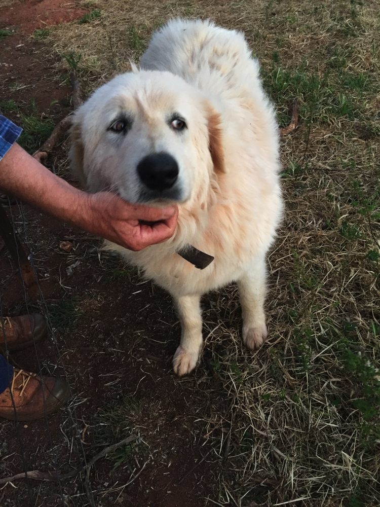
One of the two Maremma dogs used to guard the angora goats at Yarran Farm.
He farms his crops without fertilisers and uses a minimum of weed killer. His property has been planned using some permaculture techniques to protect and enrich the soil and swales to help with water retention. It’s certainly working – his crops are lush and healthy.
19th, 20th October Yarran Farm to Griffith 120km
This morning I did a two hour farm tour with Keith which I thoroughly enjoyed. It has really renewed my faith in some farmers at least doing their best to protect and enhance their farm soils.
Keith assured me this is a very healthy crop. He feels his farming practices of caring for the soil and using an absolute minimum of chemicals is why his crops are so healthy.
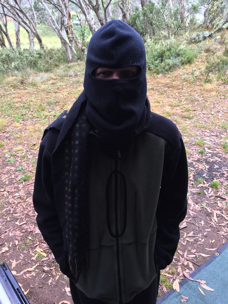
Poor Steve is suffering severely with hay fever, particularly his eyes – rye grass is blooming everywhere!
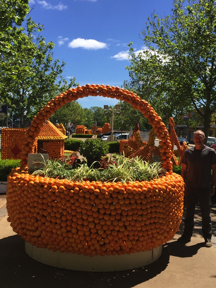
Keith recommended we go to Griffith which has just had its garden festival and still has the orange sculptures lining the Main Street. These were fun to see.
Griffith is an interesting town, designed by Burley Griffin. The Italian mafia moved in here and established a thriving drug trade back in the mid 20th century, achieving scandalous notoriety for the murder of anti-drugs campaigner Donald Mackay which even I still remember. There are many mansions in the town and the cemetery has huge family mausoleums made of Italian marble. Italian ethnicity here is about 60% of the population.
The parks around the town centre are pretty amazing. The children’s park is huge and has every possible climbing or swinging apparatus ever made, even a pretty cool flying fox.
20th October: Steve’s birthday. Today was a day of indulgences. We started the day at McWilliams Wines where we booked in for the tour of the vineyard and a tasting platter to complete the tour. Its a huge business and they’re expanding. I particularly liked the first vines grown in the area, and the laboratory where there were wine tasters tasting an array of wines – so seriously though, not the way I like to taste wine!
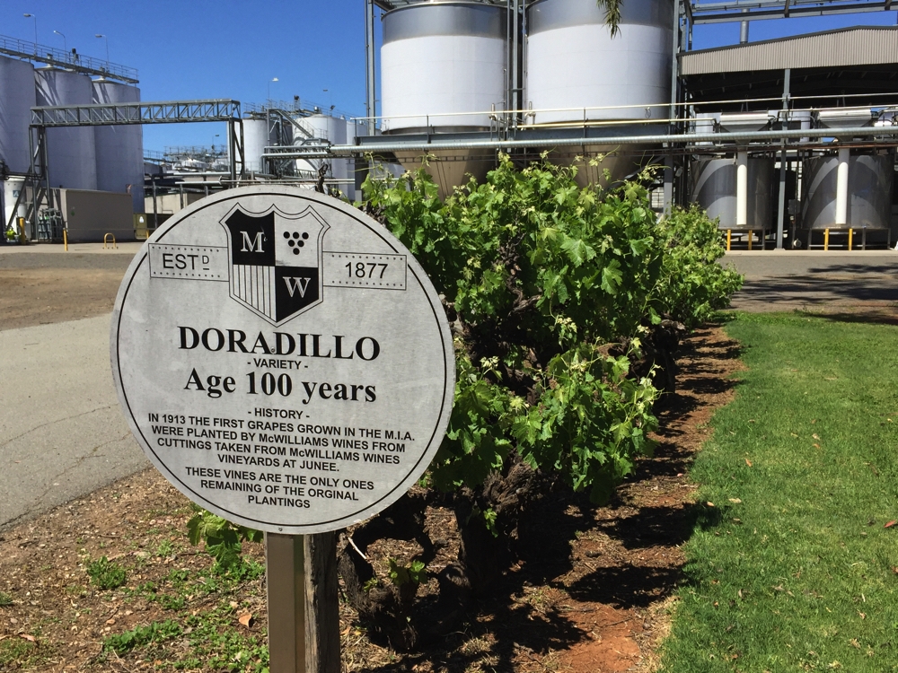
A little history of the first vines grown (MIA = Murrumbidgee Irrigation Area). Those vines have seen many changes to the art and science of viticulture and wine making.
From there we went to DeBortoli and did a little more sampling. We may have had to buy a bottle or two at each of these places, just to support the town though!
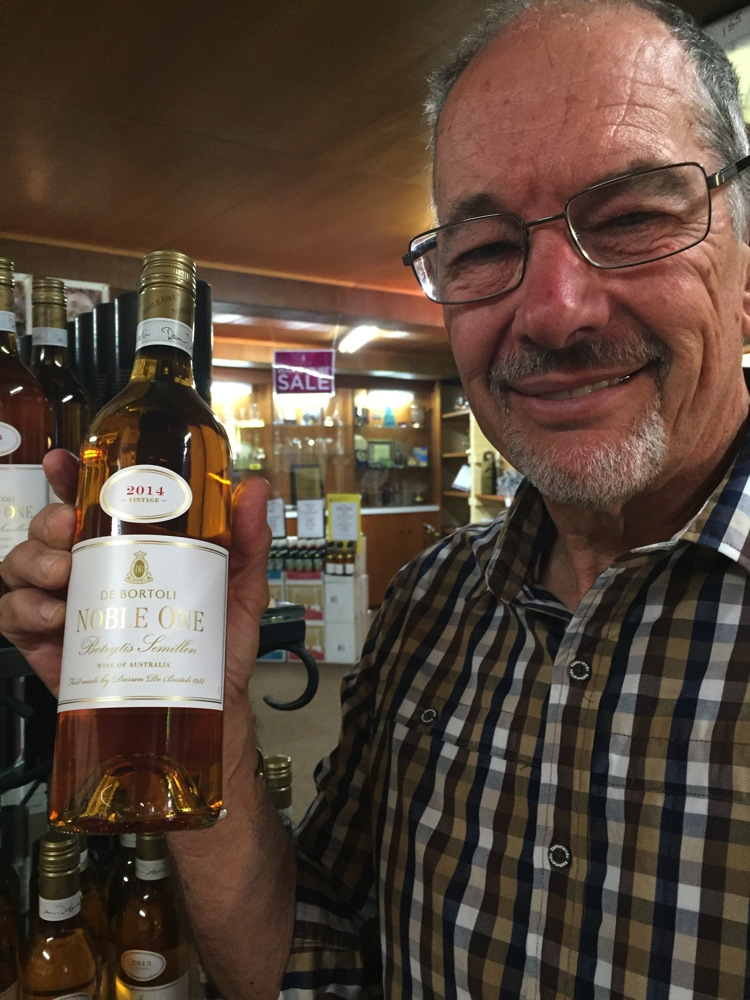
Ah he’s found his favourite wine, which just happens to be his namesake.
After that it was back to Priscilla to get ready for our big night out. We had the most divine meal at Limone. This small restaurant is constructed out of all recycled timbers and has an open kitchen – only maybe 8 tables. The menu was a set 3 courses, and used all local produce, either from their own farm or from local growers. Between courses, and after the meal, they offered us delicious canapés and tasters. It was a wonderful evening to celebrate Steve’s birthday.
21st October: Griffith to Beckom (94km)
Time to start heading home. Our plans are being dictated to us by road closures. The Newell Highway south of Forbes is still closed and the Kidman Way, our preferred route, is also closed not far north of here.
But before leaving, the local small goods manufacturer, Codemo, has been recommended to us. A tasting of their salamis proved to be a worthy recommendation, and we left with two lovely salamis and some bacon. The butcher strongly recommended we visit Calabria Wines, not far from them, so we did. Their wines were very good and a few more bottles found their way into the motorhome. Up to the lookout over Griffith next. Not many hills around Griffith, but this one is quite nice and an added interest is the hermits cave. After WWII a man came up here and lived his life in an open cave, terracing a little of the hill to grow vegetables and flowers. There’s also a museum up here explaining the Italian settlement here and the Murrumbidgee irrigation scheme, but we didn’t visit as we were heading back for the tour of the Fruit Salad farm.
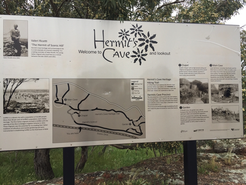
An information board about the Hermit of Griffith. He sounded like a very interesting person in his day.
Joe has lived on this 50 acre farm since his father bought it 55 years ago. They have several different fruit and nut trees, but predominately they grow grapes and sugar plums. The plums are first dried, on their property, ie, now prunes, then sold to Ardmona. Sugar plums are my favourite plum and command a good price for the farmer, but Joe can’t sell his that way because his trees are much older and haven’t been grown correctly for the harvester. As it is he has a ‘shaker on the back of his tractor which attaches to each trunk and shakes the tree until the fruit fall off onto a large tarp on the ground. It’s a bit more sophisticated than I’ve described, but that’s the principle.
We left Joe’s with a bag of prunes, a bottle of his red wine and a bottle of mustard that his wife makes. It was a good tour, more so in learning about their farming way of life, now and back then.
We’d already spent two nights at the 24-hour-only free camp beside the river so we headed off eastward, farewelling Griffith, to find a place for the night. The little town of Beckom had a good write up in WikiCamps, offering power and water at a free site beside their disused bowling club. A drink at the pub a little later found us chatting away to the very friendly locals. The flood waters had once again flooded some houses in their main street – many still hadn’t moved the sand bags.
22nd October Beckom to Carcoar Dam 302km
Today was decision day – keep heading north, or head east first. Steve’s hay fever has been quite severe and another week of rye grass wasn’t appealing, so eastward we travelled via West Wyalong, Grenfell, Cowra to Carcoar Dam. As we left the irrigated Griffith area orange orchards and vineyards very quickly were replaced by wheat and sheep again, and soon the flat plains became rolling hills, all so green and pretty.
We drove around the historic village of Carcoar before heading up to the dam for the night. It was quite busy but we managed to snag ourselves a level spot (not many of them) with great views over the dam to the green, sheep-dotted hills, boasting an array of wind turbines on the ridge.
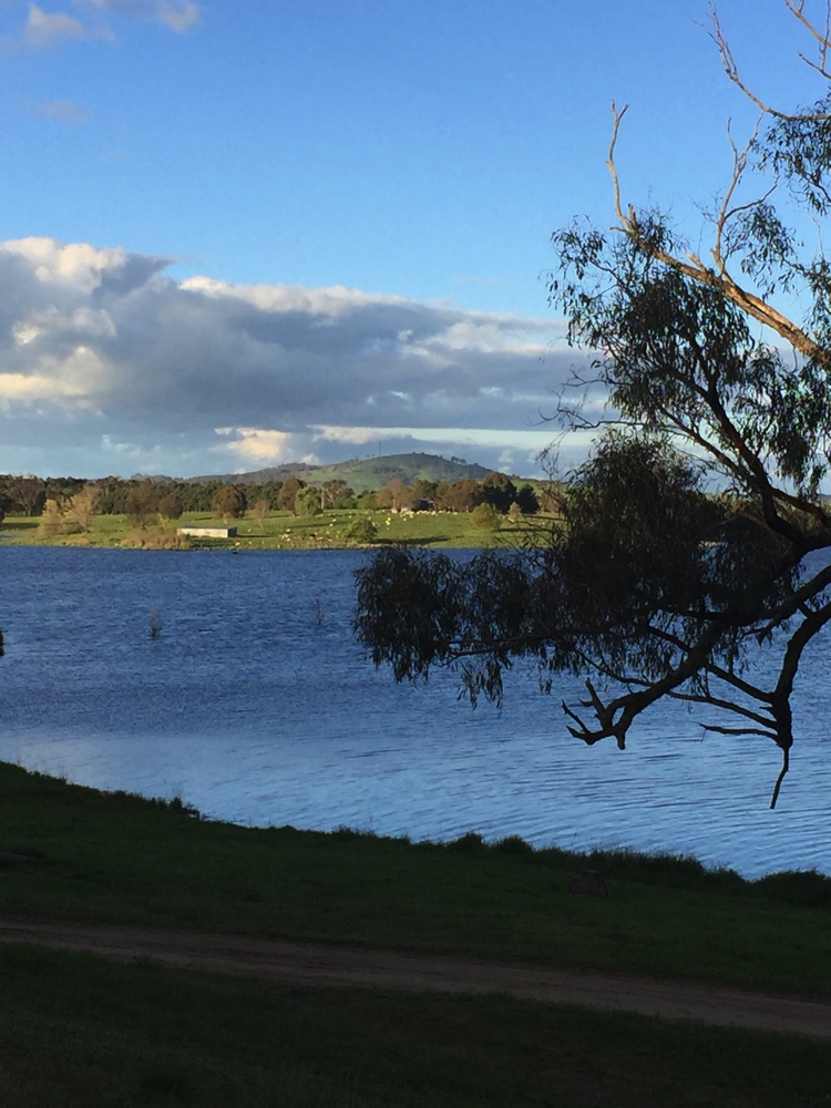
Sunset from our campsite at Carcoar Dam.
23rd October: Carcoar Dam to First Fleet Memorial Park Wallabadah 439km
Another long drive today north then east again via Bathurst, Mudgee and Scone to Wallabadah and Steve’s hay fever has improved!
This campsite offers hot showers, flushing loos and beautiful gardens commemorating the arrival of the First Fleet and Australia’s first white settlers, and merely ask for a donation of $10 – well worth it! The names of all those on each of the ships has been carved by a stonemason onto tablets distributed around the garden pathways. The stories of those who arrived on the ships, their life, and first encounters with the Australian country are presented throughout the Garden. Well done and thank you Wallabadah.
Beautifully presented gardens with lots of information on the First Fleets.
To see more photos from this week of our travels click on this link.
24th -25th October Wallabadah to Wollomombi 207km
We’d passed a couple of National Parks on our way north but all were closed due to the recent heavy rains. We were both getting a bit ‘titchy’ doing long drives along roads with white lines, much preferring the little roads with overhanging trees and no lane markings. At this point we could either continue west of the Great Dividing Range or head for the coast. Seeing Steve was now feeling much better we decided to remain west-ish and see if we could get some bushwalking in. We travelled north to Tamworth and stopped at Moonbi Lookout for lunch before heading on towards Armidale.
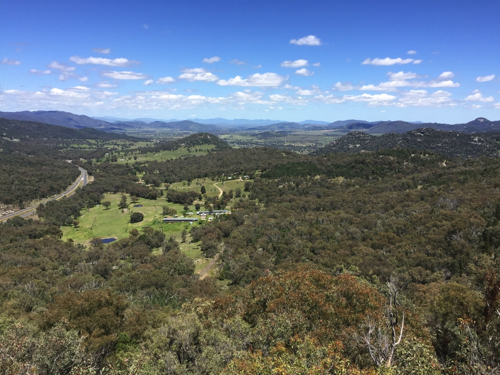
The view down the New England Highway towards Tamworth from Moonbi Hill Lookout.
At Armidale we at last left the highway to spend the night at Wollomombi Falls Campground in the Oxley Wild Rivers National Park We’ve walked these walks before with Trish and Bryan, though there is promise of more water in the waterfalls this time!
We stayed two nights thoroughly enjoying the break from the road and giving us plenty of time to do all the walks.
This campsite has excellent campfire facilities, even providing firewood. Both nights we cooked our meal on the BBQ. Our two nights camped here in the bush were very quiet with only one or two other campers. Saw a lyrebird, but he wasn’t nterested in calling.
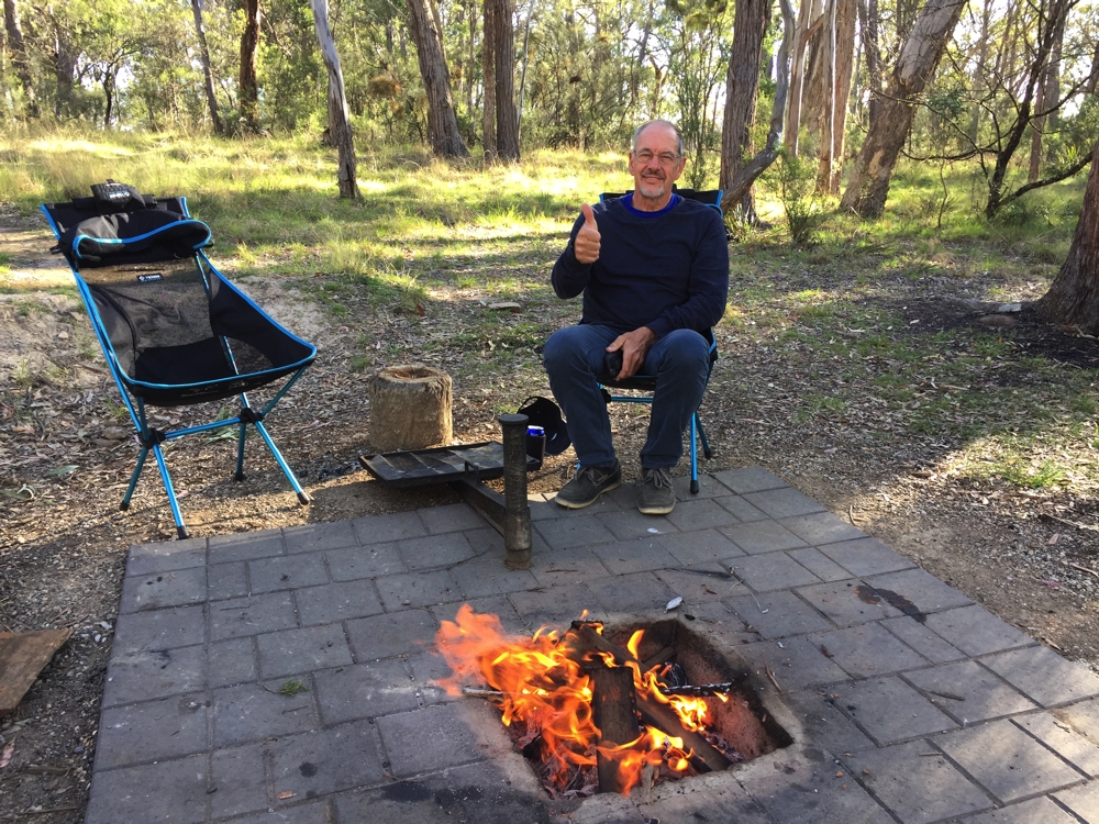
Yes Steve, that fire deserves a thumbs up.
26th – 27th October: Wollomombi to Mann River Nature Reserve 189km
We stopped at Glen Innes as we left to catch up on all things electronic (no wifi at Wollomombi, nor where we’re headed for the next few days). We picked up lots of maps at the Information Centre then headed out to Mann River Nature Reserve. Our sources said it was a tricky road in and they weren’t wrong, the last 14km being a sealed, single lane, very steep downhill road with tight hairpin bends.. We had no trouble coming down in 2nd gear, but we were pleased we didn’t meet a vehicle on the way up.
We were surprised to find 4 other campers there, though shouldn’t have been as it’s a beautiful location right beside the Mann River which bubbles over granite rocks right beside our campsite. The camp grounds are large and mowed, with lots of whip-tail kangaroos, some so placid you can stroke them.
The Mann River and wildflowers taken from our campsite.
There’s a walk to Tommy’s Rock Lookout just up the road from here. Tommy was an aboriginal bushranger who was a bit of a larrikin. I knew when we parked Priscilla at the start to the walk that I’d regret this! The walk was 4.5 km just about straight up along a fire trail. There was a warning sign saying it was very steep. They weren’t wrong! It went relentlessly upward and very steeply with countless 2-3 metre high conservation mounds every few metres, some so steep it was hard to walk up them. And the road base was pebbly, making slipping and falling a constant worry. It took us 2 hours to walk up (I don’t do hills very fast) and 1 hour for the 4.5km descent. Once at the top the fire trail branched with no signs indicating which way to go. We must have chosen the wrong way as we didn’t find a lookout. The exercise was badly needed, so not complaining – much!
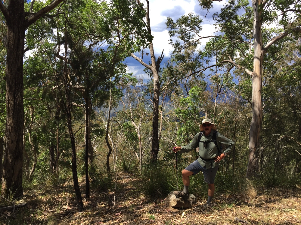
This was the only view we got of anything other then trees and a steadily increasing slope in front of us. Halfway up the Tommy’s Rock Lookout walk.
Good facilities at this campsite too for campfires and BBQs but no wood.
28th – 29th October: Mann River to Boundary Campsite, Washpool NP (49km
Short drive today up the mountain and along the Gwydir H’way to Boundary Campsite, just at the boundary (fancy that!) of Washpool NP. We were late to leave and once set up here neither of us felt like doing the walks yet; besides it kept sprinkling with rain.
Steve managed to get a reasonably good fire going despite the wet timber and we BBQ’d our dinner.
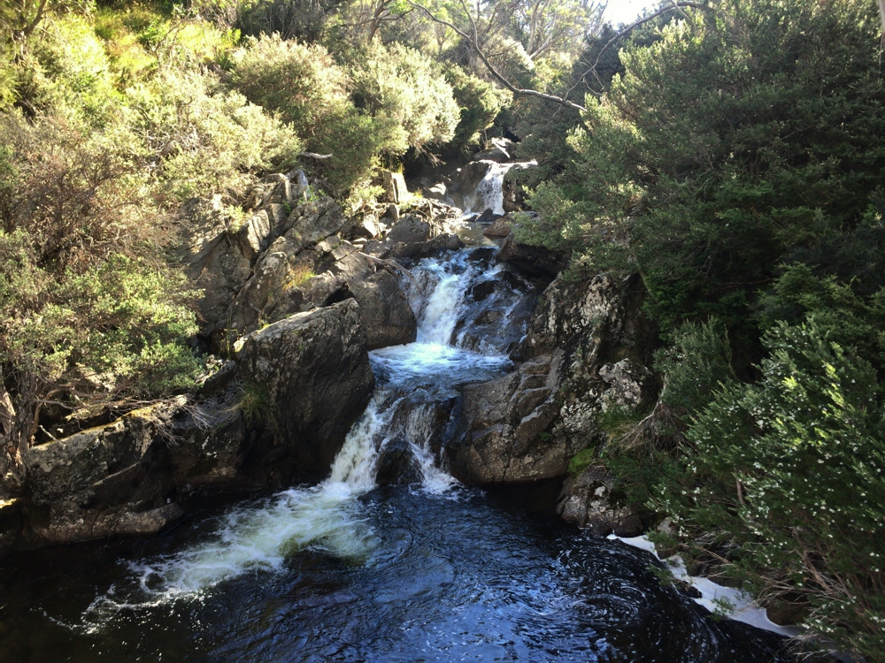
29th: Walk day today. We set off under lovely clear skies and pleasant temperature to walk the 8km return to Duffer Falls, then the 2.5km return to Lyrebird Falls lookout, then the 400 metres return (including 120 steps!) to the base of Boundary Falls.
The path down to Duffer Falls.
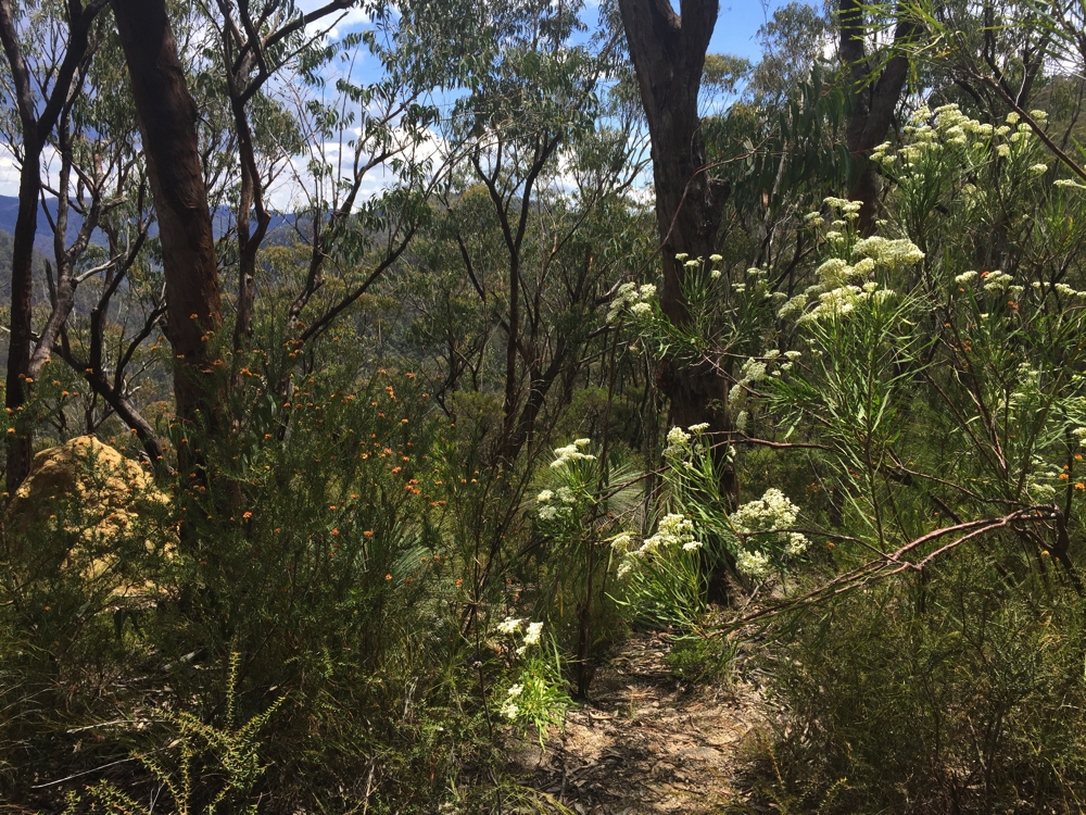
The track to Duffer Falls was mostly along fire trails with just the last 250 metres a narrow, steep path down to the falls. The gorges here are quite spectacular. The wildflowers on this walk were beautiful. Not long after we left the falls big, black clouds started rolling in and the thunder was quite intimidating; however, luckily we didn’t get more than a few spits on us. On our return it looked like it had rained pretty heavily on the last part of the track and at the campsite.
Boundary Falls was just wonderful. Not particularly high, or gushing but coming over the granite cliff into a beautiful pool then flowing gently out via a shallow, granite rock lined creek. Just beautiful.
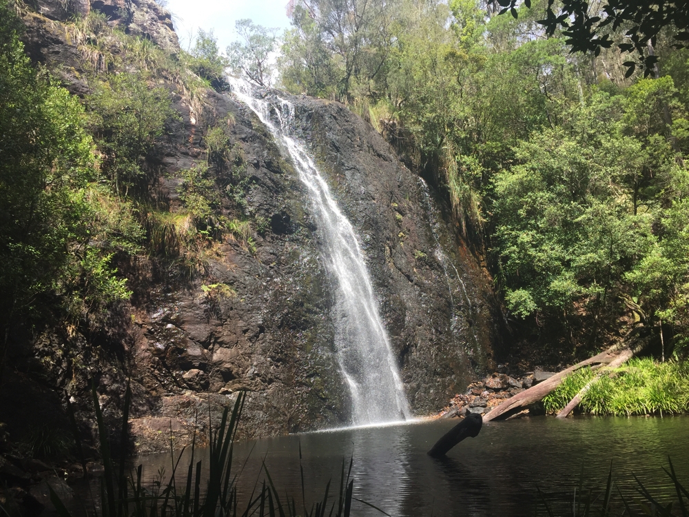
Boundary Falls. Well worth all those steps.
30th October: Boundary Campsite to Tenterfield 199km
Today we headed for Tenterfield to spend the night with our good friends Pammy and Milton. From Glen Innes we took the “Tourist Route” via Emmaville, Torrington and Stannum. Lovely drive, mostly sealed roads and the unsealed sections were in good condition. We stopped for lunch beside the bridge over Beardy Creek – great spot, level area off the road beside the very pretty creek under pine trees – we both thought this would make a great free camp for one day in the future. Also, just before we hit the New England highway was a camping area which has 5 stars on WikiCamps and good comments. Worthwhile remembering.
We had our usual great evening with Pammy and Milton, assisting Milton to reduce his cellar by two bottles of red both over 10 years old, catching up on families and talking motorhoming.
31st Oct – 4th Nov: Tenterfield to Girraween NP (37km)
We drove through rain and arrived at Girraween in the drizzle. Yet another time the motorhome comes into its own – we just made ourselves compfy, made lunch and relaxed until the rain stopped. Trish and Bryan arrived mid afternoon and we spent the afternoon and evening catching up and BBQ-ing dinner. Coincidently we’d nearly finished cooking our food when I saw a man looking around to see which BBQ he could use, so I called out to offer him ours. Turns out it was Brian and Caroline, the new friends we met at Randall and Catherine’s the very first night of this trip.
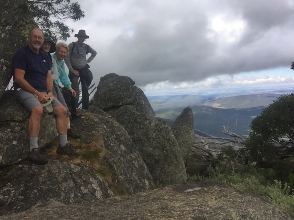
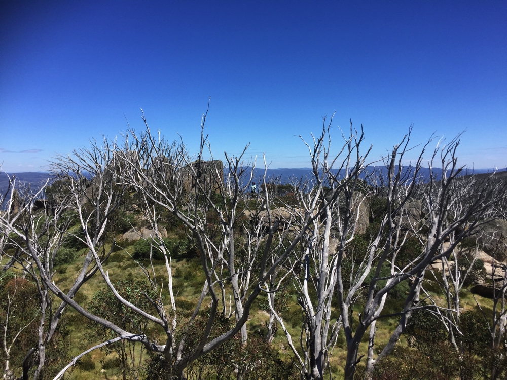
The next two days was spent predominantly doing the walks. The longest, steepest and most difficult was Mt Norman, the rewards of spectacular views and an amazing array of wildflowers was well worth it. We completed the Sphinx and Castle Rock walks on the way.
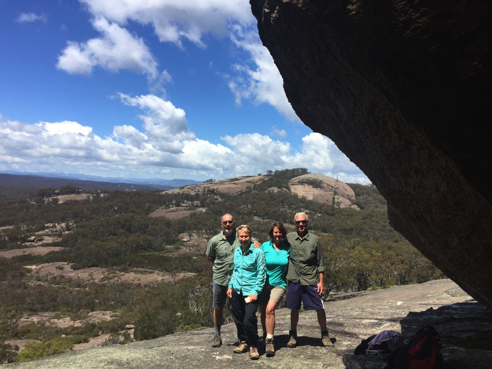
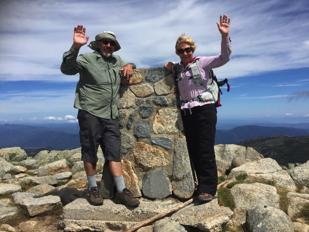
Yay! We all made it to the top. Mt Norman, Girraween NP
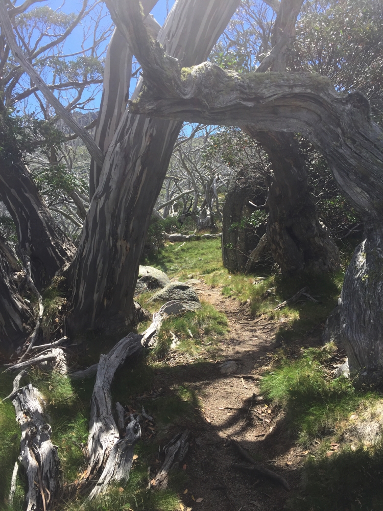
The next day we walked the southern walks along the creeks and to the junction of Ramsay and Bald Rock Creeks, with a little stopover at the Arch on the way. In the afternoon we took a drive to a local vineyard, just to make sure we didn’t run out of supplies.
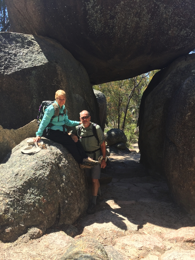
Posing, at The Arch.
There was no more rain after the first morning and the weather was beautiful, though still chilly at night.
Thursday Bryan and Trish headed home and we spent the last day of our holiday totally resting, reading books.
5th November: Girraween to home 287km
Well that was a very enjoyable 5 weeks away. We went places we haven’t been before and learnt how we best like to travel. We’re settling in to how we use Priscilla better and are feeling much more prepared for some long trips away now.
To see the photos from our last two weeks of travels click on this link.
To see all the photos from this trip click on this link.