Millstream Chichester National Park

17th – 19th June 2017

Saturday 17th

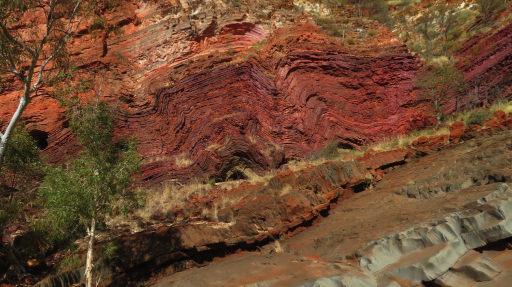
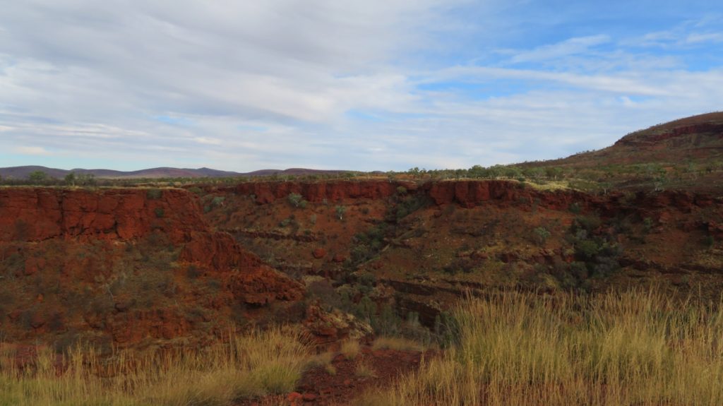
Leaving our campsite we descended for about 5 km into Rio Tinto Gorge via a sealed, one lane road. A lovely drive made better by not meeting any road trains coming the other way!

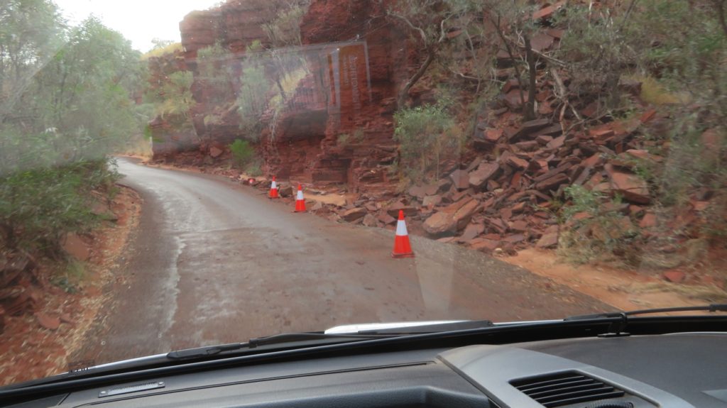
Heading into Rio Tinto Gorge as we left the campsite at Hamersley Gorge turnoff.

Once at the bottom 162km of dirt road with all its corrugations took us to Millstream Chichester NP. The countryside through which we drove continues to surprise us with its beauty – we followed ranges and water courses, some, like Hooley Creek where we stopped for a cuppa, having water in them.

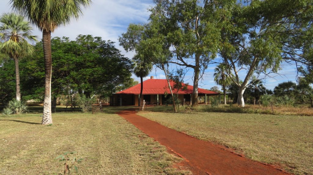
Millstream Homestead.

At the NP the Millstream Homestead is now set up with information displays, each room covering either geology of the region, indigenous life before white settlement, or the pastoralists. It’s a lovely homestead with big wide verandahs all around, lovely lawns and once upon a time had an ant-bed tennis court. The owners ran sheep mostly, but also some cattle, and had a large kitchen vegetable garden which was very productive. The spring-fed Fortescue River at the bottom of the garden provided a permanent supply of sparklingly clear water.

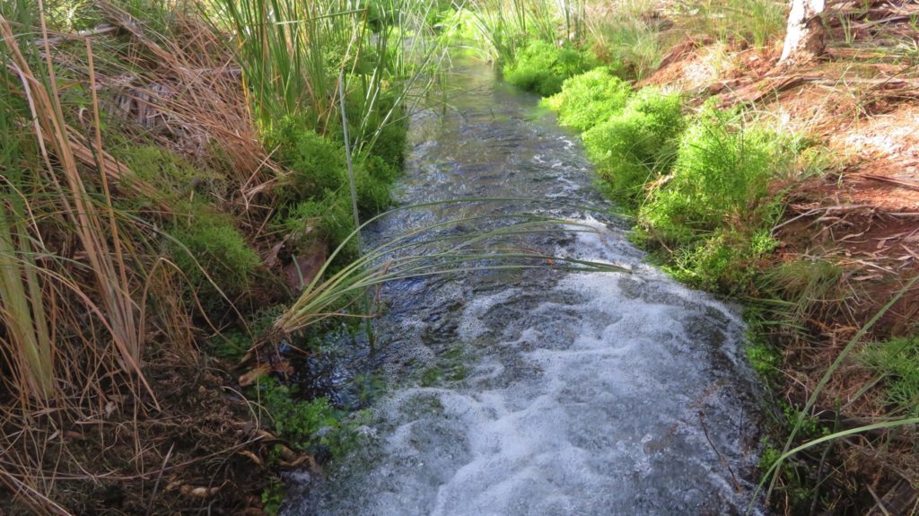
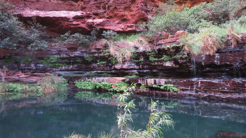
Fast-flowing little creek that runs at the bottom of the Homestead’s garden. This was used by the settlers to bathe in and to water their extensive vegetable gardens. Before white settlers the local aboriginal people kept these creeks pristine and bathing/swimming in it was not permitted – sensible when it’s your water supply.

Apart from the economical difficulties of dingoes killing the lambs and falling beef prices, life here would have been very pleasant. A quiet night at Miliyanha campsite ($13.20/n) which has a new camp kitchen, gas stove top, gas BBQs and several picnic tables. Nice place.

Sunday 18th

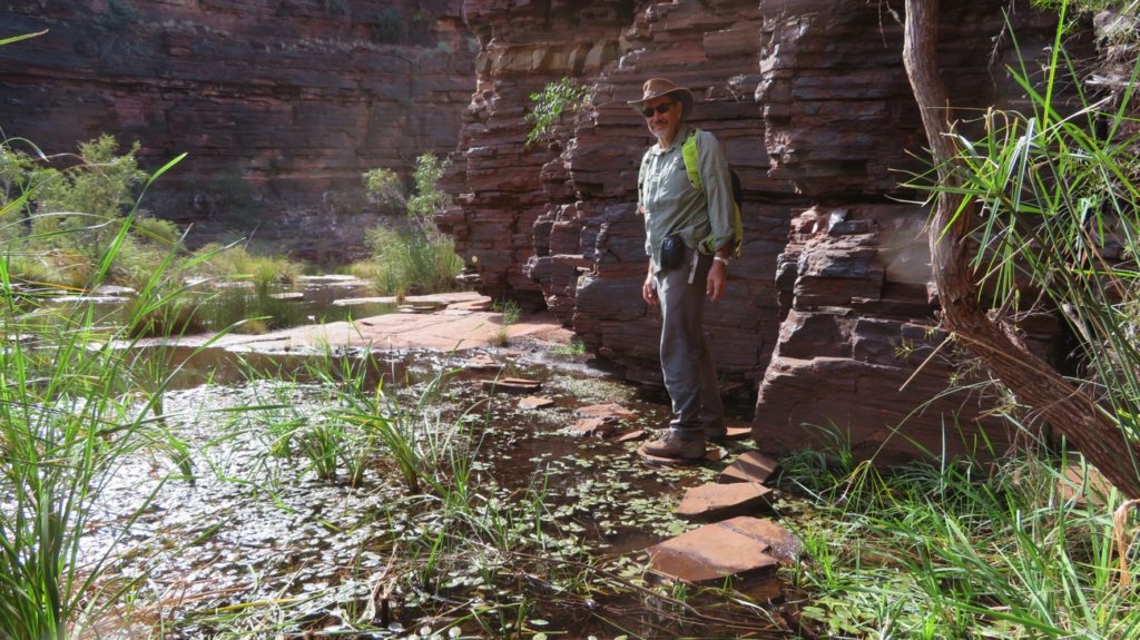
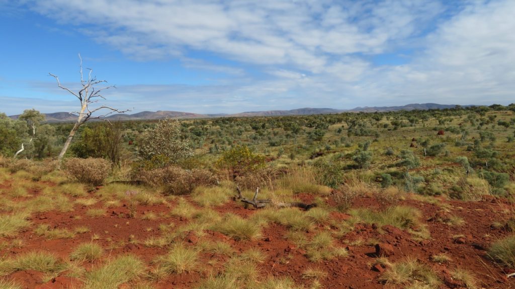
This morning we did the 9.5km walk from the homestead to Cliff Lookout above the Fortescue River. The walk started near the river, which is quite narrow but only followed it for a little while before heading through palms, acacias and grasses, which had not long ago been burnt. We returned via the cycle path which was even further from the water – not one of our most memorable walks. 

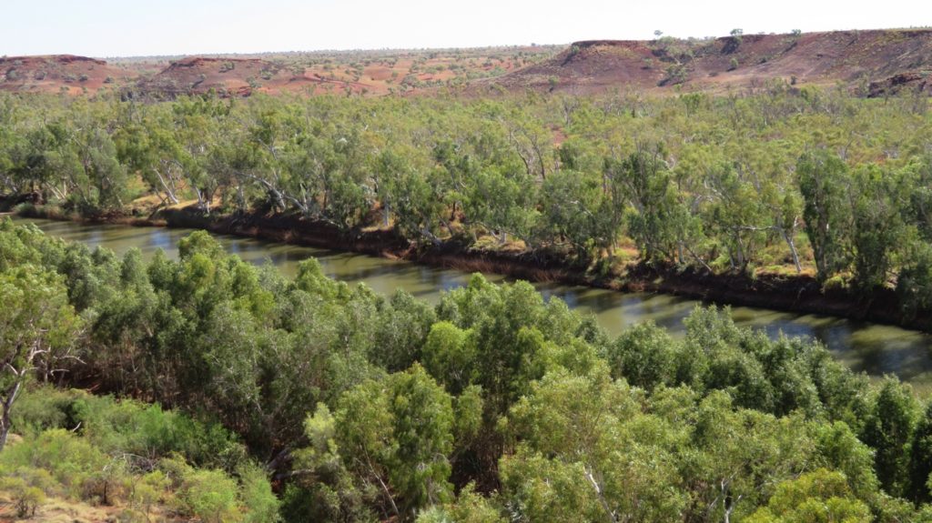
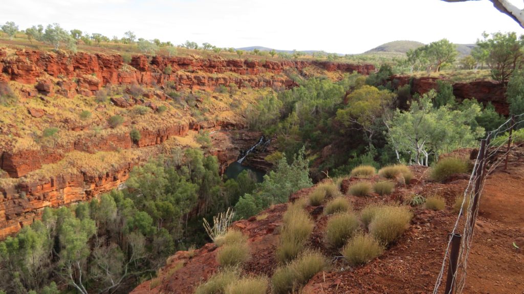
The views from Cliff Lookout over the Fortescue River were pretty good. Just look at that horizon disappearing in the far distance. Amazing country.

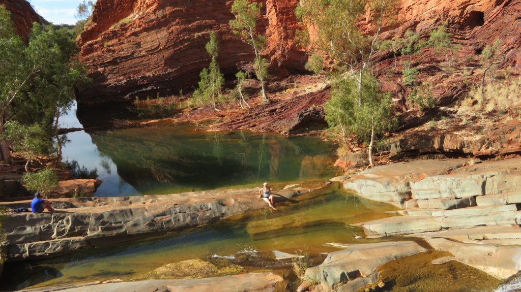
Back at camp we drove to Deep Reach, which is a beautiful, long, wide part of the river lined with palms and acacias. The white cockatoos call it home, very raucously.

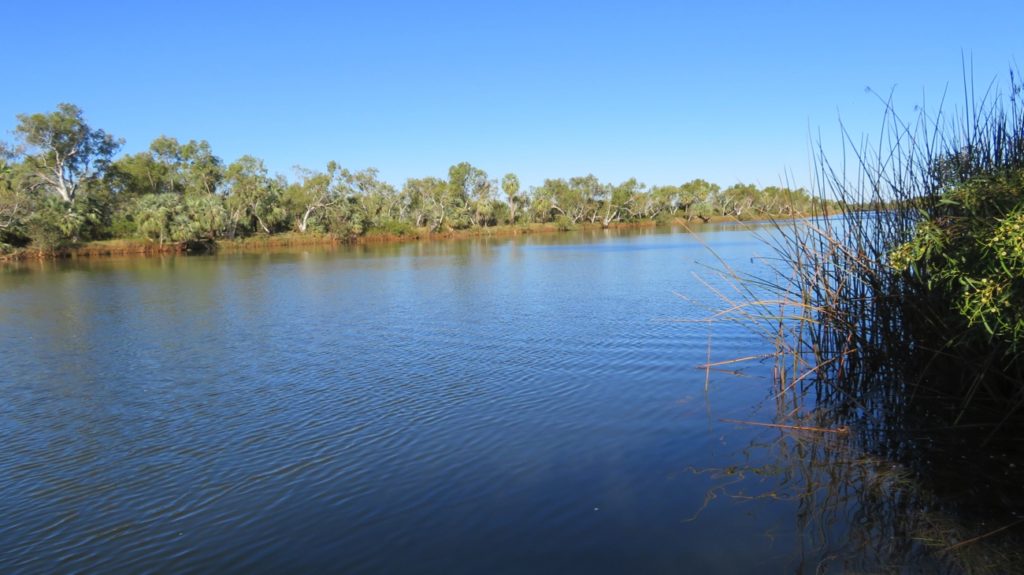
Wow! Now look at the Fortescue River – bit bigger than just a few kilometres back at the Homestead. This is Deep Reach.

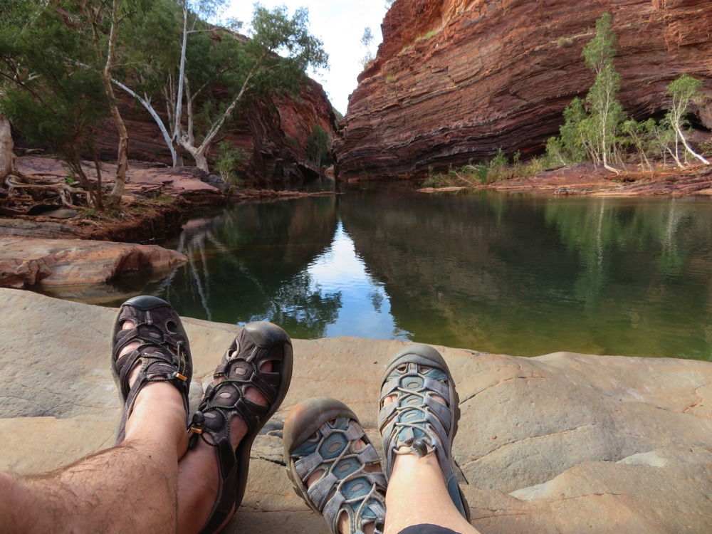
National Parks has done an outstanding job here providing lots of covered picnic tables and 3 gas BBQs set amongst the natural vegetation. A wide lookout with seating showcases the river and safe concrete steps lead into the water. The water was beautiful for swimming, pleasantly cool. The rainbow serpent, Wayu lives in this pool and it’s said to be so deep as to be bottomless. After a refreshing swim we stayed here reading and relaxing until near sunset.

Sunset at Deep Reach.

Unfortunately there was no break between the flies going in and the mossies coming out. We beat a hasty retreat to Stargazers campground, the other site within in Park, where we BBQd our meal along with a few other campers and the camp hosts. A very pleasant evening with good company and no mossies.

Monday 19th

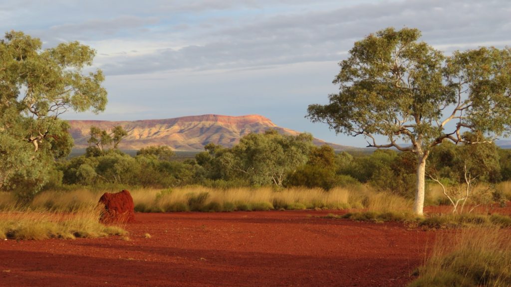
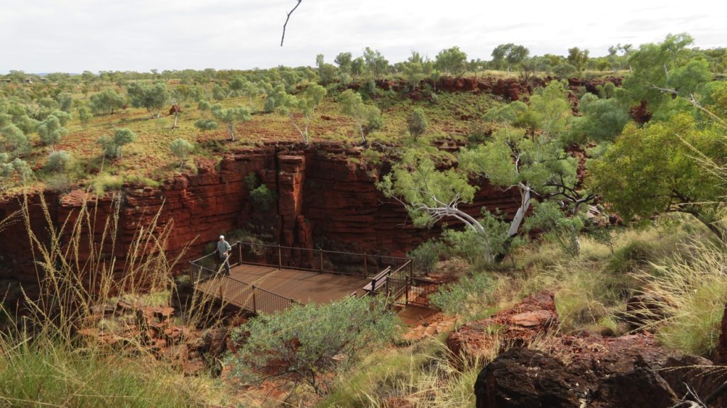
The highlight today before we left Millstream Chichester NP was our brunch break at Python Pool. An unsealed road running alongside the railway line, where we saw several very, very long ore trains, took us there, the last 5km or so, from the railway to the Pool, in pretty bad repair. However, that was when the scenery was most spectacular.

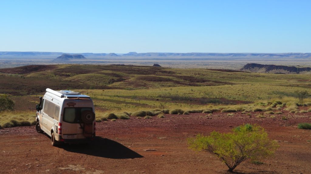
What a spot for a cuppa! Northern section of Millstream Chichester National Park – on the way to Python Pool

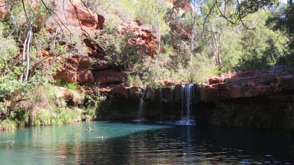
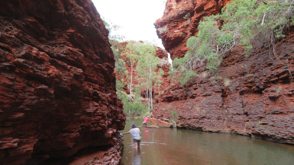
This is a small pool, its feature being the enormous cliffs that bound it – though thankfully not on the side we access it from. Yes the water was chilly but the chill soon wears off and it was another delightful swim.

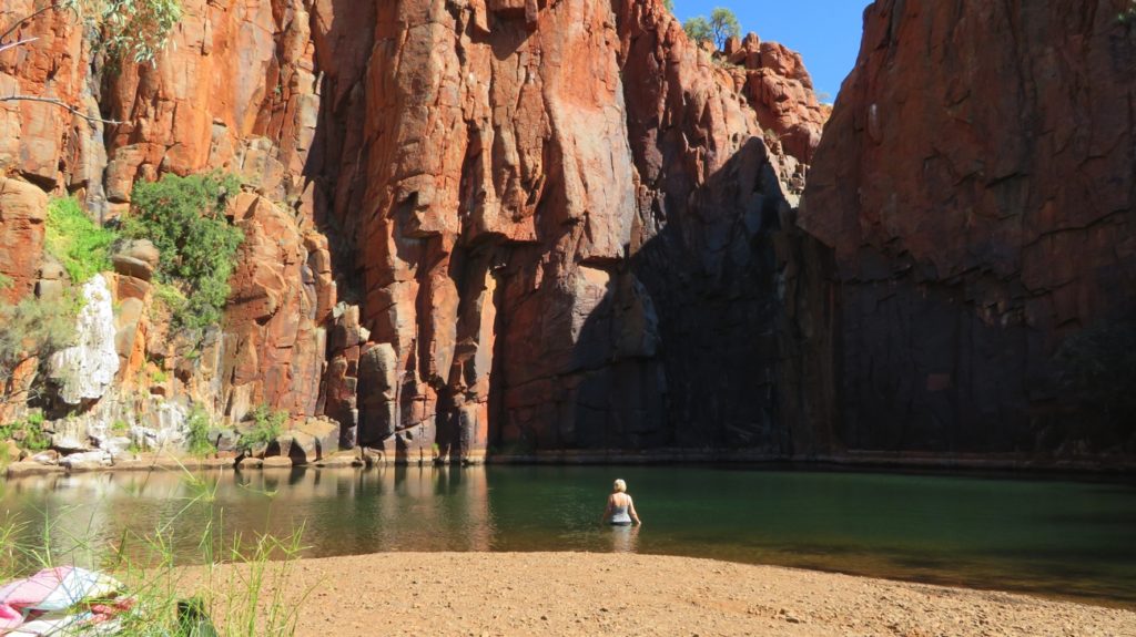
Slowly entering Python Pool

To see more of our photographs from Millstream Chichester Park CLICK HERE

Hamersley Gorge

14th – 16th June 2017

The next two days were spent in the mining town of Tom Price. Neat little town, well organised though the caravan park was a bit far out of town ($42/n). Washing, shopping, cooking and catching up on emails and internet filled our days.
We were all prepared to travel the Rio Tinto rail road with the required permit, having watched the videos on what you could and couldn’t do – like wear a red shirt .. it’s a danger signal to the train drivers. However the lady at the Tourist Info centre said the road was in pretty bad shape as lots of B Doubles were using it, recommending we take the Shire road instead to go to Millstream NP. Going this way we’ll be able to see another section of Karijini NP.
Friday 16th we headed off – the Shire road is unsealed and though it’s OK for 2WD it’s a bit rough and corrugated. We went as far as Hamersley Gorge on the north-west corner of Karijini NP. This Gorge has a similar red, layered rock, but the fold lines in the strata are amazing. This rock was folded like pastry a million years ago!

The folds in the rock are the most striking feature of Hamersley Gorge.

The river through the Gorge flows down sloping rocks forming small waterfalls and lovely pools before disappearing between narrow chasm walls to continue on. We jumped into the chilly water for a very refreshing and invigorating swim – thought briefly about swimming through the chasm to see the Gorge downstream, but without a wetsuit it was just too chilly for us. I enjoyed sitting under the waterfall with lots of 2 – 3 inch-long fish swimming around my feet.

Sunbaking at Hamersley Gorge.

The few people who were here when we arrived left and we spent a tranquil hour or so lazing on the sun-drenched rocks enjoying the total peace of this amazing place.

The perfect way to spend a lazy afternoon. Hamersley Gorge

There’s no camping allowed here, however about 2km away, just outside the National Park, there’s a large, cleared area for free camping. It’s a top spot surrounded on all sides by mountains with Snappy Gums and spinifex providing dividers and shade for campers. Sundowners was greatly enjoyed watching the sunset on the hills.

Sunset at our campsite just outside Hamersley Gorge.

Surprisingly this remote location has 4G – there’s a mine in the mountains to our north-west … that’s the reason for it.

To see more photos from our day at Hamersley Gorge CLICK HERE.

Karijini National Park

12th – 14th June 2017

A couple of hours drive up the road is Karijini National Park – our destination for the next few days. Our drive along the Great Northern H’way was very pleasant as the landscape once again became covered in trees, still plenty of spinifex though, and hills and mountain ranges began to appear. We stopped to look for the Manna Munna aboriginal rock paintings but there was no signage and as we walked in, (rocky, washed out areas on road) we didn’t want to explore fruitlessly too far.
The whole of the Hamersley Ranges area was known to the indigenous people as Karijini – it’s only the national park that now respects that name. The tourist brochures describe the park as one of the most spectacular sights in the Pilbara. We can’t argue.
The camping area is huge with very well-spaced, numbered sites. We paid $55 for an annual WA Parks Pass, which we plan to make good use of over the next couple of months, and $13.40 per night (senior’s discount) to camp at Dales Campground. The access into Dales Gorge blessfully has a series of steel steps and landings that must go for 250m – it’s a very steep-sided, deep Gorge.

Dales Gorge from the rim - Fortescue Falls seen in the centre of the photo.

Dales Gorge from the rim – Fortescue Falls seen in the centre of the photo.

We walked to Fern Pool at one end, then along the Gorge floor to the opposite end passing Fortescue Waterfall and Pool, doing lots of rock-hopping, scrambling, climbing, descending and river crossing to get to Circular Pool at the other end.

Ferm Pool, Dales Gorge.

Ferm Pool, Dales Gorge.

I’ve been in quite a few gorges now and this has to be the most stunning. The pools are fed by waterfalls and have crystal clear water right to their depths. The river that joins them and has formed the Gorge is in some places narrow and traverses the rocky platforms as rapids while just a little further on it will open out into a wide, quiet expanse bordered by water plants and bulrushes.

The very beautiful walk along the floor of Dales Gorge.

The very beautiful walk along the floor of Dales Gorge.

The walls of the Gorge are sheer on both sides with dark red bands of compressed iron and silica coming down to what looks like layers of slate. Where the two meet the water seeps out from the cliff edge providing an ideal environment for ferns to grow on their steep sides.
This whole Gorge is a special place for the indigenous people, with Circular Pool being the sacred home of the Wargu. There’s no swimming or loud noises permitted here. Steve and I were lucky enough to have this beautiful pool entirely to ourselves for about half an hour – it really did feel like a very spiritual place.

The beautiful, tranquil Circular Pool at the far end of Dales Gorge.

The beautiful, tranquil Circular Pool at the far end of Dales Gorge.

We returned to our campsite after climbing steep rocky steps to the top of the Gorge above Circular Pool, then walking along the rim to our starting point getting spectacular views of the Gorge from above.

The meeting of two gorges - Dales Gorge.

The meeting of two gorges – Dales Gorge.

Tuesday 13th
A drive to Weano Gorge this morning, still within Karijini NP – there’s camping there, but it’s privately run and 3 times the price we’re paying at Dales.

The beautiful landscapes of this country. Near Karijini NP

The beautiful landscapes of this country. Near Karijini NP

We started at Joffre Falls Lookout. Lovely waterfall cascading into a big pool. We could see the walk down from the lookout and it involved lots of scrambling down the slate-like rocks – long arms and long legs an advantage.

Steve at the Lookout into Joffre Falls and gorge.

Steve at the Lookout into Joffre Falls and gorge.

We decided to head over to Weano Gorge and walk it instead. Once more the descent was very steep down uneven steps. At the bottom we headed to Handrail Pool – to get there involved walking in the creek. We took off our shoes and waded in but it got deeper and slipperier as we progressed so turned back and walked the length of the Gorge, admiring the completely different range of plants compared to those above. We returned via the rim walk.

Weano Gorge base walk. Challenging in places - but very beautiful.

Weano Gorge base walk. Challenging in places – but very beautiful.

Next was Hancock Gorge, the Amphitheatre and Kermits Pool. I’d seen photos of Kermits Pool and was keen to see it for myself, despite the “Class 5 – for very experienced bushwalkers” warning notices placed strategically all around. The descent was similar – steep, uneven steps, then a steel ladder and more steep steps. Tumbled down slabs of rock alongside the burbling stream had to be negotiated, the Gorge all the while becoming narrower and narrower until finally we were clinging to jutting out slabs of rock while edging carefully along inch-wide ledges above the water.

This is the way you go to get to the Amphitheatre, Hancock Gorge.

This is the way you go to get to the Amphitheatre, Hancock Gorge.

A temporary widening of the chasm allowed us a moment to relax before it was inevitable we’d have to wade through the water for some 30 metres, fortunately not so deep now, though it was still up to my backside. This time we left our boots on and didn’t bother to try to keep our clothes dry – the boots decision was a good one – not so slippery, feet protected from sharp stones. We came out at the very aptly named semicircular Amphitheatre, the tiered ‘seating’ being formed by the slabs of stone and the stage being a delightful, tranquil pool.

The narrow chasm at the end of the pool leads to Kermits Pool, from the Amphitheatre Weano Gorge

The narrow chasm at the end of the pool leads to Kermits Pool, from the Amphitheatre Weano Gorge

Kermits Pool was still further on. We watched a few people negotiating the ‘Spider Walk’ through the very narrow chasm entrance to it before our attempt. It’s so narrow that to enter we had one foot and one hand on either side of the chasm, finding grooves and barely-there ledges to put a foot on or grasp for support while taking another step. Challenging, and just a little scary when your legs aren’t that long! Anyway we both made it unscathed and were rewarded with the truly beautiful Kermits Pool.

Kermit Pool Hancock Gorge. Though the walk looks cloudy, it isn't. It's crystal clear as deep as you can see.

Kermit Pool Hancock Gorge. Though the walk looks cloudy, it isn’t. It’s crystal clear as deep as you can see.

It was so magnificent that a swim just had to happen. We both stripped off (not everything!) and jumped in. Well … I have never been in water so cold. It was only 20 metres to the opposite side but I was worried I wasn’t going to make it I was so cold. The narrow Gorge continues beyond that point and looks pretty amazing but entry is forbidden – too dangerous I’d guess. After getting my breath back and a little warmth into my bones we then had to repeat the swim back, the Spider Walk, the clinging-to-ledges, the wading through the chasm, the rock scrambling and finally the tricky ascent back to the top of the Gorge. Definitely worth every second of all that effort, fear and cold.
Sadly we leave Karijini now. If ever we’re back I’d like to do it all again and take an extra couple of days to slowly enjoy the place.

For more photos of this time in Karijini NP CLICK HERE