Days 17, 18, 19: Canberra

Friday: At last – the whole reason for the trip -> to welcome Rachael to Australia and introduce Priscilla to Rachael and James. Once more we caught the bus into the city from Epic and met Rachael at the National Library for lunch (delicious!). The Library had a display about Australia during WWI. It was very good. Some of the recruiting posters were very powerful – I nearly signed up there and then! Must have been hard the men who didn’t enlist. Interesting that compulsory conscription went to a referendum twice, and lost both times. We left Rachael to keep on working and did a bit of shopping.

That evening when James got home from work we went out for dinner at The Loading Dock and had a lovely evening together.

dinner

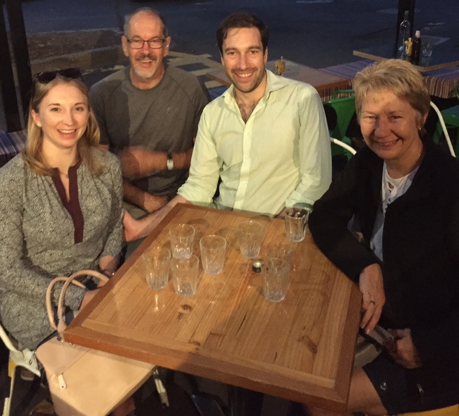
Dinner with two very special people.

Saturday: The farmers markets are on in the Epic showgrounds every Saturday morning. We had a lovely wander through them, bought some organic meat and fruit and veges, and some black garlic (interesting) and had breakfast there, before driving in to the city because we planned to do a bike ride with James and Rachael around Lake Burley Griffin on our Bromptons – their first real trial. Unfortunately I can’t say they were a howling success this time – both Steve and I having problems with the gearing. Anyway that is fix-able and we’re still very optimistic about future rides while travelling. The bike path around the Lake is excellent – great views, well maintained – iconic really!
After a shower we wandered in to the city to see the Multicultural Festival. Wow – it’s certainly big, with lots of stalls from just about everywhere. Crowded!!! So much so it wasn’t pleasant. We saw a few dances on the main stage, bought some ethnic food and headed back to James’s for dinner, drinks, chatting and back to Epic for us, rather late.

multicultural festival

Multicultural Festival

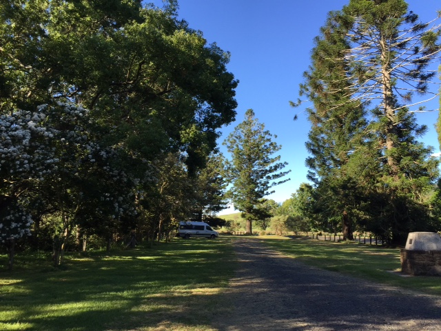
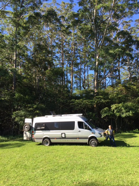
Sunday: We left Epic this morning, found a great park right outside James’s unit. Today we’re all lunching with Nicola and her husband, good friends of J and R’s, at Poachers Pantry. Love this place – they have their own smokehouse and delicious smoked meats and fish. Nicola’s mother Pauline was also there – she’d been the principal of an international school in Burma for the last 8 years. Fascinating stories.

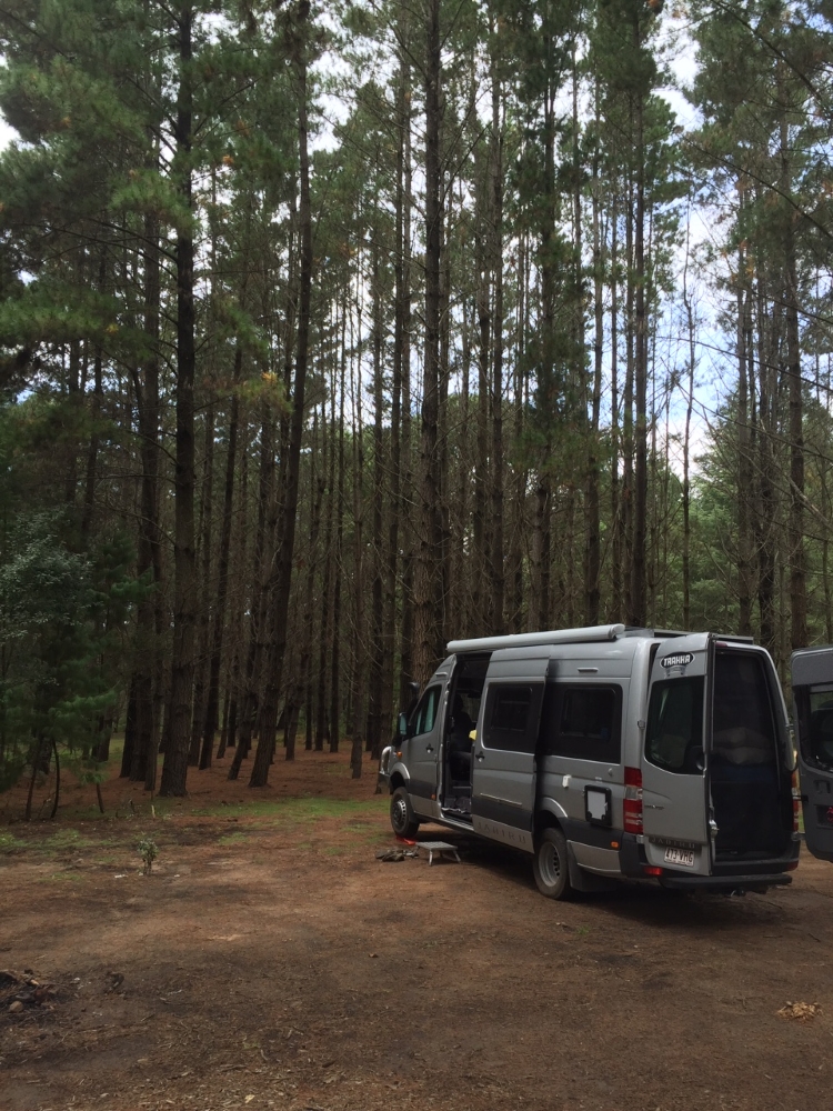
Tonight we stayed in a carpark at Yarralumla Bay which is a popular free camp. What can I say – it’s a carpark beside the lake, lots of vanpackers. We spent a quiet night, can’t complain.

Days 15, 16: to Bungendore and Canberra

These two days were mostly ‘transfers’. We took our time driving to Bungendore, stopping for coffee, lunch, etc. Stayed at the Showgrounds in Bungendore – fair enough, old but clean facilities, plenty of level areas, other campers, but not crowded. $20 per night.

Thursday we headed to Canberra and booked into Epic. There’s a very good bus service from Epic into the city so we spent the afternoon wandering around the city, checked out the Craft and Design Centre then back home to get ready for dinner with our friends Brenda, Owen and their daughter Diana and hubby Chris. Over a meal at a Vietnamese restaurant we caught up on a lot of news, not having seen them for many years. Drove back to Epic and settled in for the night.

The camping area is very large, and pretty full – really it’s just a caravan park. The amenities block is clean and costs around $35 a night.

tea cosies2

Aren’t these the coolest tea cosies? at Craft and Design Centre

tea cosie1

If you are feeling generous I’d love it if you made me the yellow chook tea cosy. Seen at Craft and Design Centre.

Day 14: Wingello to Carrington Falls

wingello_sf

Campsite at Wingello SF

This campsite is quite large, in a clearing amongst the pine trees. The area is large, reasonably level and there’s a toilet but no other facilities. The State Forest has many trail bike rides through it. These are well signposted so we did the 6k circuit this morning – walking, not cycling! Not much in the way of views, being all pine trees, but the bird life on the edges was pretty good and we found a few wombat holes – first I’ve ever seen. They’re quite big, as you’d expect, and very well constructed.

bushwalking

Bushwalking the bike trails.

This wombat thinks you can't see his hole.

This wombat thinks you can’t see his hole.

See! Wombat hole!

See! Wombat hole!

Off to Bowral then, which is the home of Don Bradman, the greatest cricketer of all time (apparently). We went to the Bradman Museum which is particularly well presented and interesting enough to hold the attention of a  ‘minimally interested in cricket’ person (AKA me) for at least a couple of hours. Well done Bowral. Then we did one of the tourist drives recommended by the lady at the Tourist Information Centre. We’ve found these Information Centres to be excellent. Always lovely helpful staff with lots of brochures highlighting what’s best to see in the district, and so far they’ve been happy for us to fill our water tank from their taps. Which reminds me, this district is the first in Australia to ban the disposable water bottles.

bradman statue

Two greats! At Bradman Oval

The Tourist Drive was very good, taking us past a large dam and through pretty little villages. Carrington Falls is on the route and was very impressive, and only about 50 metres off the road (no having to walk many K’s to see a waterfall!) By the time we reached these falls it was getting late so we sought out the camping ground, which is only intended for tent camping – ie not strictly legal for us to stay. There’s a toilet and you are supposed to book and pay for camping. We settled down for another peaceful night with just us and a million stars. Bliss.

carrington falls

Beautiful Carrington Falls, part of Kangaroo River. Budderoo National Park

Day 9: Laurieton to Coopernook

Distance: 68K
Weather: warm

Mozzies weren’t the only problem yesterday – the 3/4G was very poor too, so we decided to go into Laurieton and sit in a park for a while and get our internet fix, and maybe an occasional coffee and something gooey at the cafe.

Before going in though we checked out the camping areas in Crowdy Bay NP with view to going there tonight. The first was just like a caravan park, even had kerb and channeling and, of course, lots of caravans. The other one was also not appealing as you couldn’t see the beach and the scrub looked like great mozzie breeding grounds – once bitten, twice shy (though it was more than once!)

brekkie

Breakfast with a view – North Haven

We got a very pleasant surprise in Laurieton when another Trakka Jabiru 4×4 pulled in beside us. Jean-Claude and Veronique purchased theirs about 6 months ago and are building a ‘home base’ in the local area. As soon as that’s built their plans for travelling Australia are similar to ours. We’ve exchanged contacts and hope we’ll share some adventures with them in the future.

jc and steve

Boys and their toys.

We decided to head to Coopernook where we’d stayed on our previous trip – a good, mostly quiet, free camp behind the Coopernook pub where we arrived just on dark.

Day 8: Wollomombi to Laurieton

Distance: 309K
Weather: low 20s
Refuelled: Wauchope – 130.9c/L

After farewelling Bryan and Trish who were heading home we continued southward via Armidale, the pretty and historic Uralla where we stopped for morning tea, Walcha and on to Tia Falls where we stopped for lunch and did the short walk to the falls. These falls are quite impressive with a good flow of water – must be outstanding when the district has had good rainfalls.

tia gorge

All these gorges are quite outstanding.

Tia_Falls

Tia Falls – not quite so far to walk to see this one.

From here we drove down, and down, and down the range (wish I’d thought to count the number of hairpin bends!), around a 1000 meter drop to Wauchope. This is a drive we both enjoyed, though as the driver at the time I was pretty exhausted by the time we got to sea level.

We decided to stay at the beach tonight so booked into the Diamond Waters Caravan Park, just south of Laurieton and north of Crowdy Bay National Park. This caravan park is at the waters edge and we were allotted a shady site on lush grass just a stone’s throw from the water. Lovely spot – only one problem … MOSQUITOES!! We went for a walk down to the jetty and around the caravan park, which has a lot of permanents in cabins and vans, followed by a quick drink outside before the mozzies chased us in. Spent an unhappy night swatting mozzies that had managed to get into the van.

Day 6: Dangars to Wollomombi Gorge

Distance: 61K
Weather: cool, cloudy

After breakfast we headed back to Armidale, restocked, refilled water tanks and caught up on emails and news before heading the 40 or so K along The Waterfall Way to Wollomombi Gorge. This campsite is similar to last night’s but the sites are level with bitumen roads and really good fire pits – wood provided once more. $5 per adult per night here.

This evening we were delighted to see a Superb Lyrebird and be entertained for ages by his many different songs, then have the rare and endangered Brush Tail Wallaby grazing just near our campsite.

Quiet evening sitting around a great campfire chatting with Trish and Bryan.

Day 5: Dangars Gorge

salisbury waters

Early breakfast followed by bushwalking. We began with the idea we might go as far as Salisbury Waters which was the full walk – an out and back. We stopped at all the lookouts on the way, did the side trips (McDirty’s, Sarum Hill, The Falls, Dangar Falls – the gorges certainly are spectacular, the walking tracks taking us along the cliff edges all the way. However they’ve not had much rain here lately and most waterfalls were either dry, or just a trickle. The last 2K to Salisbury Waters involved a 400m descent, which means a 400m ascent to return, and by that time we knew we wouldn’t see too much water in the river anyway, and the track was in quite poor condition – no one minded not doing it.
Generally the track was OK, much of it was very stoney and difficult to walk on and, in some sections through the bush, particularly to the side gorges, the track was quite faint and difficult to discern. Signage could be improved too.
In total we walked 16.3K – pretty good!

gorge view

Spectacular views the whole walk.

mihi_gorge

At the brink – of Mihi Gorge

The campsite is fair – pretty good actually considering it’s free! Each site is cleared and has its own fire pit, with wood provided, and our site had a picnic table. The sites aren’t level. There’s a tap with ‘boil before consuming’ noted and a long-drop toilet which was clean. No phone/internet.

We had a pleasant evening resting our weary legs around a lovely campfire where we barbecued our dinner. The kangaroos, with joeys in pouch, came quite close to our camps – as did possums that had a dark tail – haven’t seen them before.

dangars gorge campsite

Sunset at Dangar’s Gorge campsite

Days 2 & 3: Castle Rock Camping area, Girraween National Park

Distance travelled: 0 (by vehicle that is)
Weather: Beautiful – blue skies, fluffy clouds, pleasant temperature, a light breeze

Bushwalking and relaxing are our goals here. Girraween National Park is fair and square in the granite belt, speaking of ancient volcanic activity. Today the park is covered in enormous granite boulders and granite flows. It has several creeks that flow through the park and a pretty good average rainfall of 800+mm annually which supports a reasonably lush sclerophyll bush. Because of its elevation it’s significantly cooler than the plains with average maximum in summer of about 30C. We were lucky with the weather during our stay as you can see.

Girraween is an Australian Aboriginal word meaning ‘place of flowers’ and despite a bad bushfire in the park only 3 months ago there are pretty wildflowers and new growth on the trees everywhere.

On our first day here we decided to do the ‘moderately difficult’ walks of The Sphinx, Turtle Rock and Castle Rock – which will be about 8 – 9K with the climb to the summit of Castle Rock being graded as ‘difficult’. There was lots of ups and not nearly enough downs and millions of granite steps. They took us past gigantic granite rocks strewn around like marbles, lots of interesting bushes, many of which are flowering with the prettiest little intricate flowers, bird life which was mostly heard rather than seen and lots of delightful Cunninghams skinks. The Sphinx was pretty impressive, and so was Turtle Rock for its sheer size, but you needed a better imagination than I have to make out a turtle shape. Castle Rock was pretty incredible for many reasons, one of which was the effort it takes to climb it. However the views are outstanding and well worth the difficult scrambling and fear-inducing slope down to infinity to see.

south_girraween

girraween_steve

Steve, with The Sphinx behind him

from_castle_rock

Granite, just as far as the eye can see.

Second day here (Happy Birthday Nick) we had a late leisurely start before completing the walks to the Granite Arch, the Bald Rock Creek circuit and Wyberba circuit. These are easy walks on predominantly flat routes. Bald Rock Creek is unique in that it winds its way around granite rocks and across a granite bed – there are small waterfalls and little rapids. It’s flowing very well at the moment. The Wyberba Circuit took us further downstream where the creek was fairly wide and had a beautiful swimming hole – tempting, but not hot enough for me to swim. The creeks of Girraween feed the Murray-Darling rivers.

bald_rock_creek

Bald Rock Creek – beaustiful, babbling and cool

granite_arch

Do I see movement? Don’t look up now Steve!

regrowth

Regrowth everywhere after the fires only 3 months ago.

Sitting at our campsite this afternoon within minutes we had spotted magpies, currawongs, kookaburras, fairy wrens, crimson rosellas and heard the songs of others we couldn’t identify. There’s a mob of kangaroos that feed on the short grass in the camping area and a couple of hares that are probably too small to make a good stew!

I’m sure as our travels continue we’ll stay in many National Parks. We are indeed blessed with a fantastic network of Parks. The walks are clearly marked and well maintained – taking in the full range of difficulty to cater for the predominantly sedentary to the keen bushwalker. They have excellent camping facilities with this one having free hot showers, flush toilets (both very clean), large grassy areas for games, picnic tables and BBQs (these are wood BBQs and it is BYO wood). All this for the princely sum of $5.20 per person per night (in Qld, anyway).

campsite_girraween

Our personal slice of heaven.

Day 5: Lowanna to Old Bonalbo

Weather: hot – very hot!
Distance: 262K
Refuelled Grafton: odometer: 796 ; litres: 107.5 ; $/L: $1.389

Got away mid-morning after another quiet sleep with only birdsong to disturb us. We’re getting the hang of slow mornings – this is unusual for us.

Janelle suggested a route down the range via Glenreagh and on to Grafton which she said was very pretty. And she was so right. The trip from their place to Glenreagh was through rain forest and tall trees covered in staghorns and climbers – absolutely stunning.

leaving Robindell

One of the prettiest drives you could do.

We stopped at Grafton for lunch, at Corcoran Park – a lovely spot on the Clarence River. As we arrived there was a man launching a trailer sailer. Well blow me down if it wasn’t Simon Carter. I’ve been following the YouTube blog of his sailing adventures for a while now, most recently his single-handed sail from Brisbane to the Whitsundays and back. We said hello and had a cuppa and a chat under the tree for a while. He’s going to be sailing the Clarence over the next few weeks and is going to make a vlog of it – great, that’s a sail that’s on our to-do list too.

Onward to Old Bonalbo. We’d had our driving adventure for the day and decided to take the road ‘more travelled’ and went via Casino. We were briefly tempted to take a drive into the RV park, it being one of the first places we stayed at in 2007 in Helon, our previous motorhome.

Old Bonalbo is 11K up the road from Bonalbo, which is a very pleasant country town with a well-stocked Foodworks and a helpful man behind the counter from whom we bought frozen yoghurt iceblocks … really appreciated this weather. Old Bonalbo with a population of around 200 has a small general store/post office, but we drove straight through to Pioneer’s Park on the banks of Duck Creek. This park is another freebie that is cared for by the council and provides the traveller with a pleasant overnight site, grassy area to camp, a couple of shelter sheds and picnic tables and spotlessly clean toilets. Beef cattle is the main industry around here, with timber plantations being established. The district was once logged for red cedar.
We were the only ones camped here.

Another of the Jabiru’s features we love is being able to sleep with the two back doors and the sliding side door wide open, allowing the breeze to flow straight through – they’re both flyscreened. It kept us cool this evening.

Old Bonalbo

Thanks Old Bonalbo – we enjoyed your hospitality.

Day 4: Coopernook to Robbindell, Lowanna

Weather: sunny and hot!
Distance: 257K

We looked forward to today’s destination as it’s the first time we’ve used a Youcamp site. We got away from Coopernook without any problems and headed to Kempsey where we had morning tea and popped into the shopping centre for a few items. We didn’t like the look or feel of Kempsey. Headed to Coffs Harbour for a lovely lunch at the harbour. The park was busy with families and young people enjoying the beach. Coffs is a much nicer town.

We then turned westward towards the Great Dividing Range and up we climbed – it was a good pull with lots of hairpin bends – into 4WD again when the bitumen ran out, though it would be possible to do it in a tough 2WD. The countryside became thick rainforest with lots of bird life. Over the range we didn’t descend too far into the valley before turning off towards Lowanna where we found our host’s home. And the temperature had dropped about 4 heavenly degrees. A huge plus for the Jabiru has been its navigation system – took us directly to this place which is well and truly out of the way.

Kevin and Janelle own the property and Kevin directed us through a couple of gates and over paddocks down to the banks of Mole Creek. After deciding which direction to park the van (not an easy decision!) we explored the creek and relaxed until it was time for sundowners when Janelle, Kevin and their young son joined us. Janelle was born here – her grandfather was a bullocky and bought the property to graze his team, and her father was a gold miner. George’s Gold Mine is just up the road and marked on all the maps. Kevin enjoys panning for gold and offered to take us out fossicking – there’s gold in them thar hills! Next time!
Kevin was employed at the local sawmill until it closed down – logging has been the industry of this district for a long time.
There’s also, apparently, platypus in the creek though needless to say I didn’t see any.

Robbindell campsite

Beside Mole Creek at Robbindell