17-23rd Oct: Cid, Stonehaven, Nara

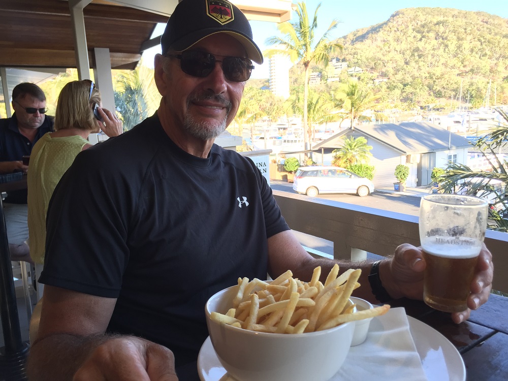
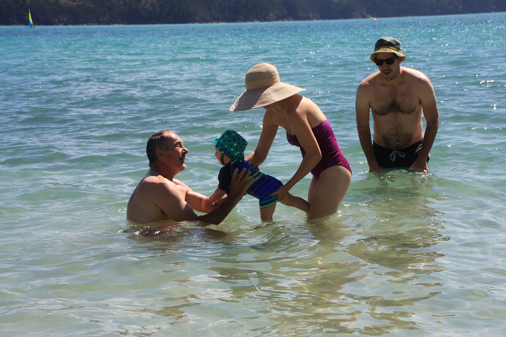
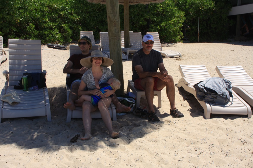
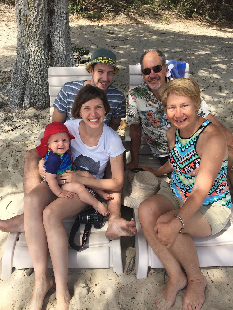
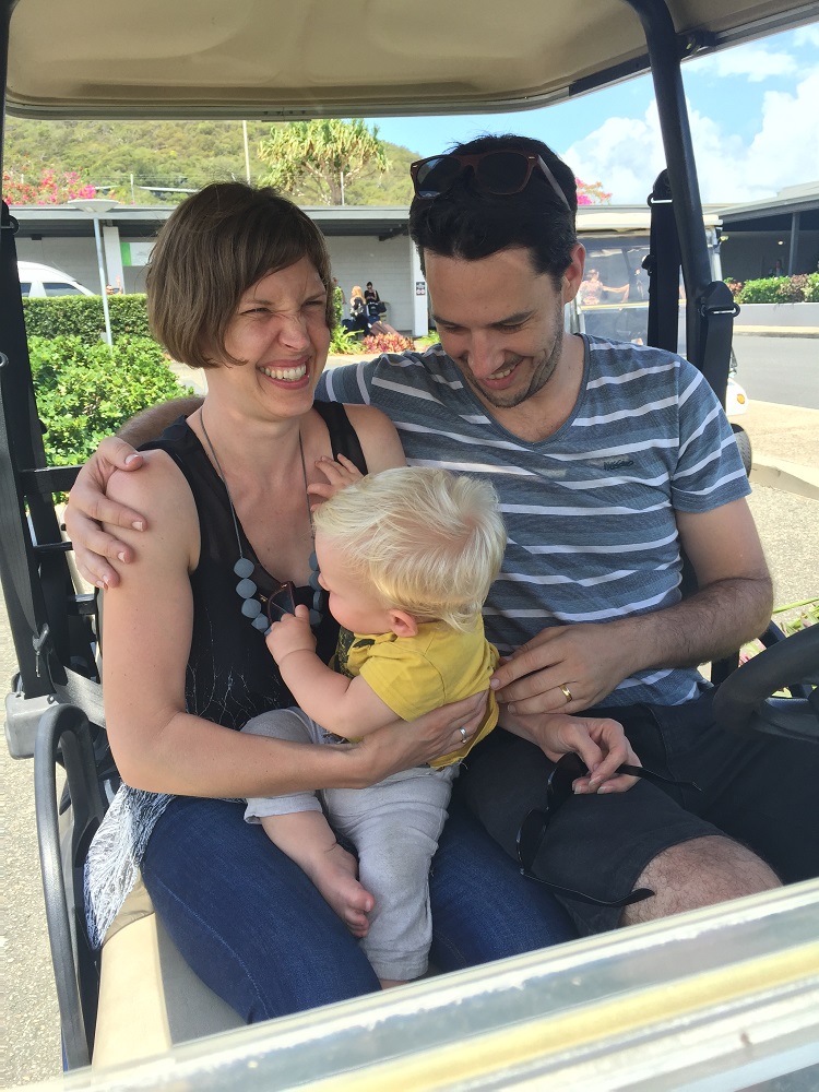
After farewelling Nick, Kim and the beautiful Baby John yesterday we re-provisioned at the store on Hamilton and prepared the boat to leave. Steve’s birthday in a few days called for a celebration at the seafood restaurant last night, and a toast to Hamilton Island.

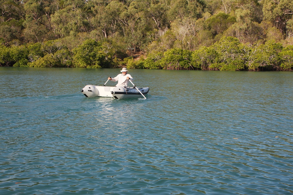
The tender has a hole, possibly caused when dragging it on or off the boat. Fix-it kit comes into its own.

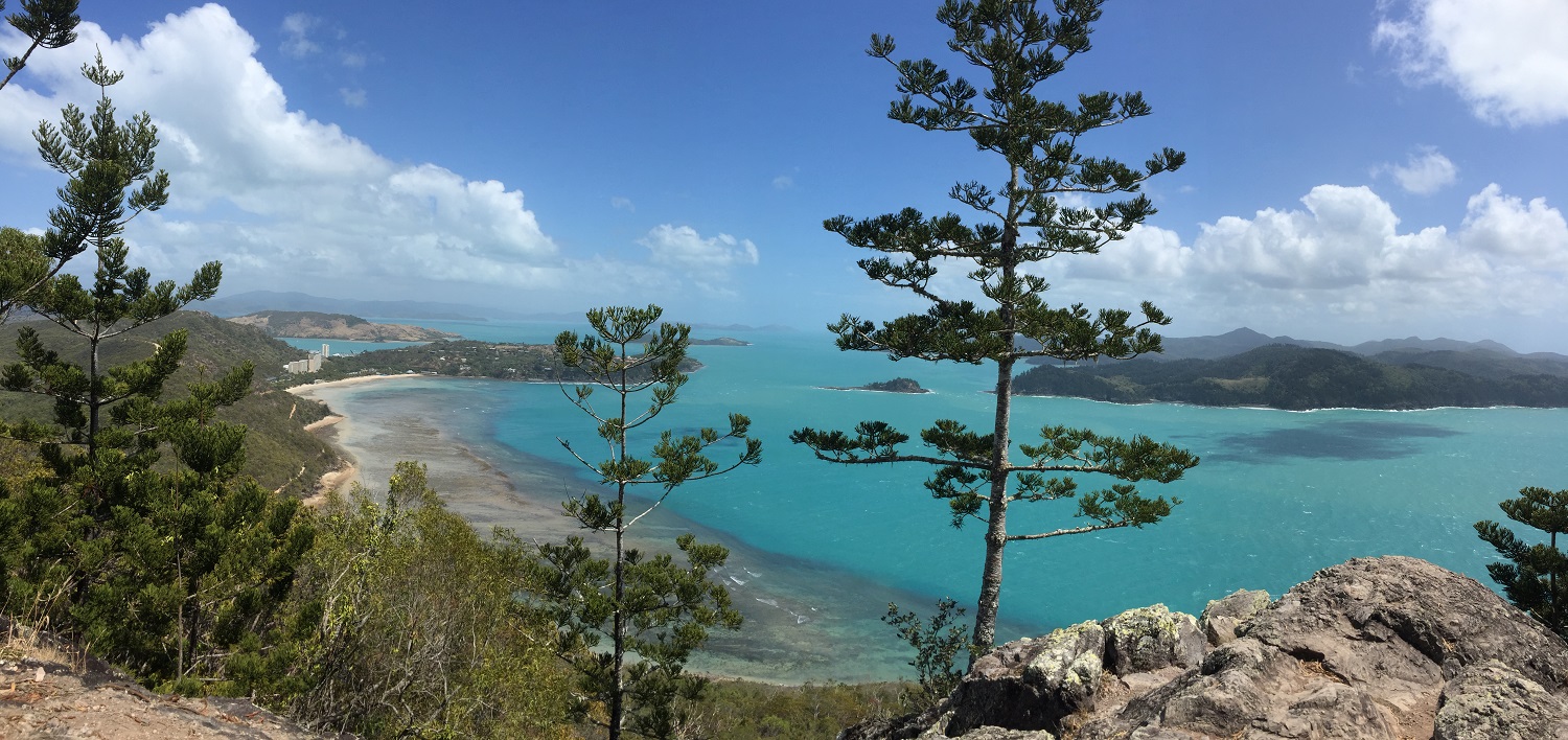
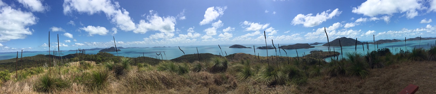
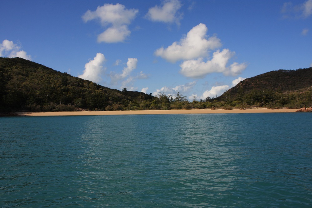
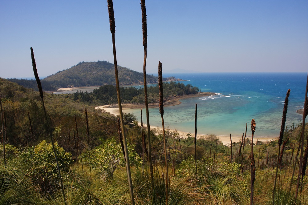
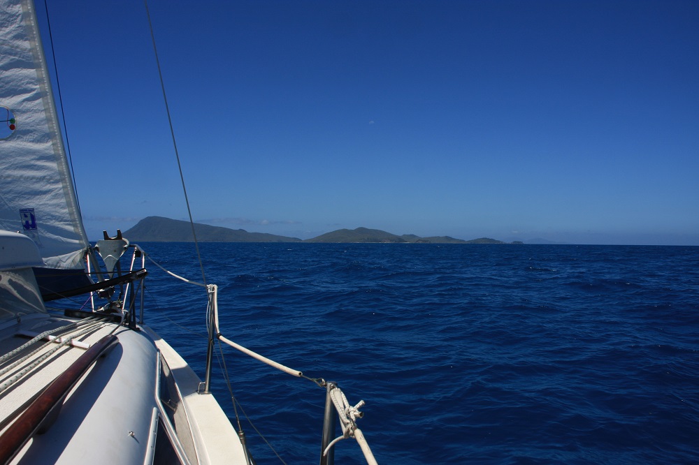
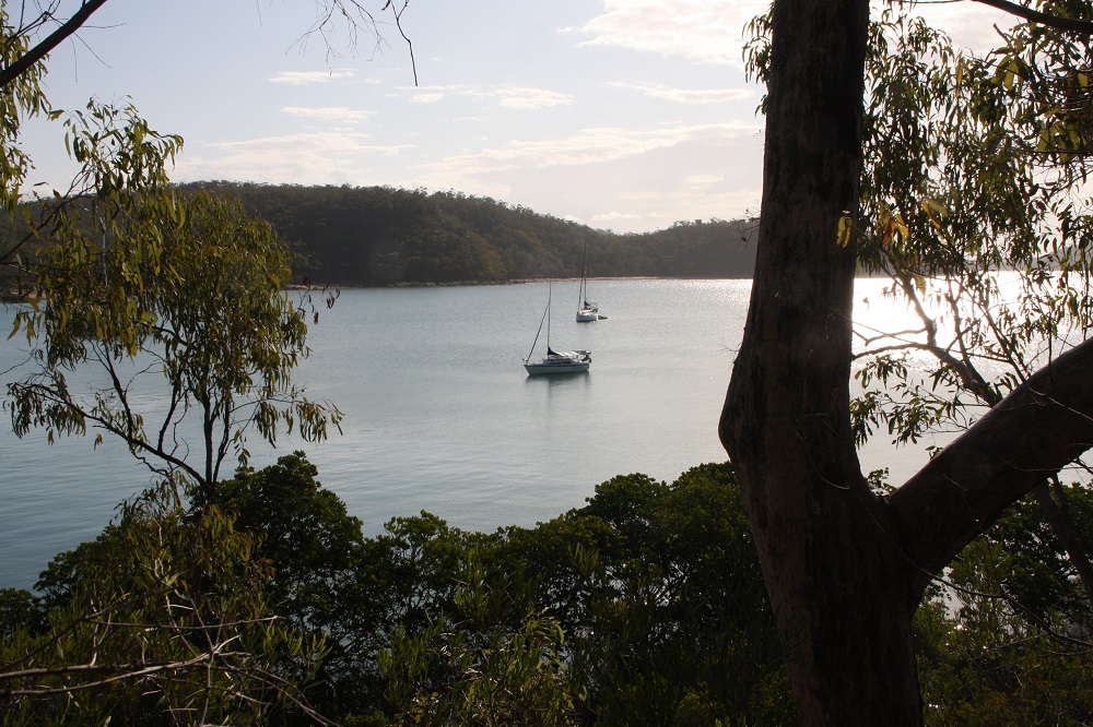
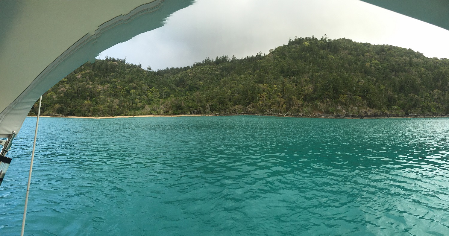
The strong winds are back but we’re off anyway! We waited for the change of tide to take us north and, along with the south easterlies and just a jib, we made good time to Cid Harbour on the western side of Whitsunday Island. This is a beautiful very large bay with several beaches and anchorages that comfortably accommodated at least 30 yachts on the three nights we spent here. Cid Harbour is very deep and protected from all directions except the west, a benefit during World War II when troop ships anchored here; today you’re more likely to find cruise ships.

Sawmill beach, Cid Harbour. A truly lovely, very protected, anchorage.

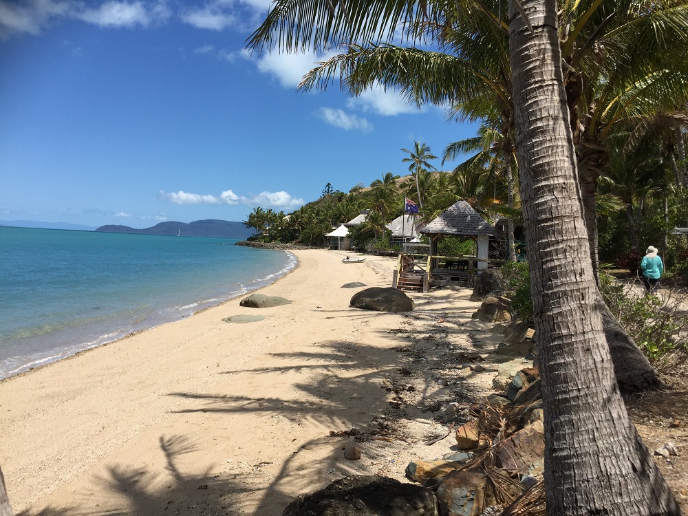
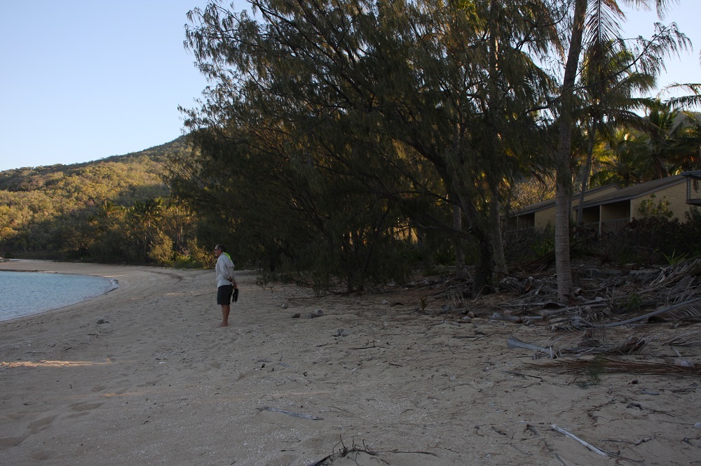
On the short walk across to Dugong Beach we reminisced about camping here with the boys in the 80’s and more recently doing this walk with friends we bare boated with several years ago.

It rained on and off on our second day here- our books received lots of attention.

The tender continues to deflate slowly – not happy!

Tuesday

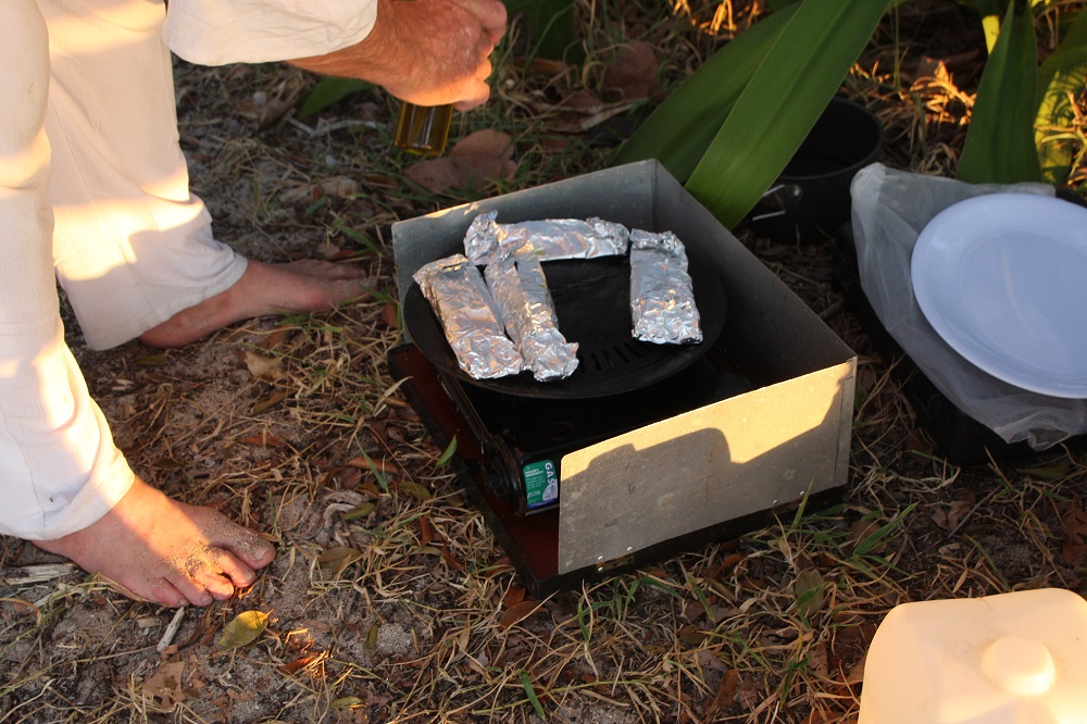
Happy birthday Steve!

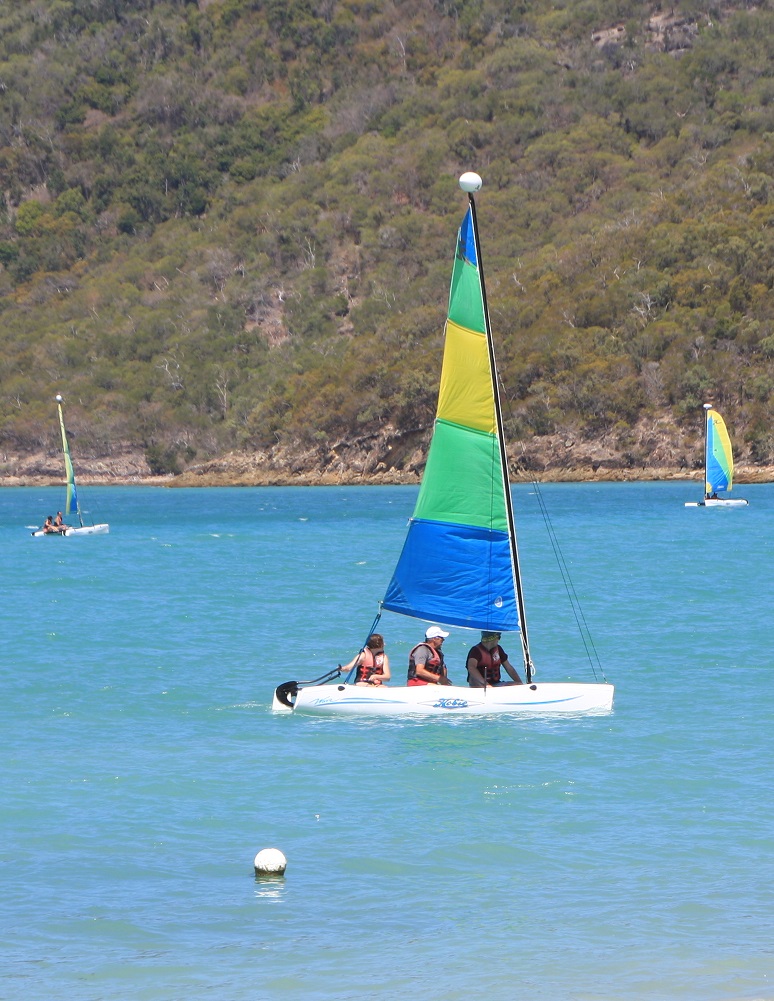
The winds are finally dropping. We head for Stonehaven, a bay on the north of Hook Island. A swell made the trip roly until we cleared Hook Passage. We picked up a mooring buoy and prepared for snorkelling. The Great Barrier Reef Marine Park Authority has defined ‘no-anchor’ areas around many of the best fringing reefs to prevent them being damaged, installing mooring buoys for visiting boaties. These buoys have 2 hour  time limits on them, though if you’re on one at 3pm you can stay till the next day. The buoys are very good with long floating tags making it so much easier to pick up than the ones we learnt on – the boat hook was the way to go with these.

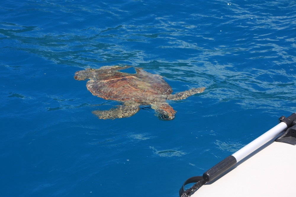
We’ve been welcomed, and farewelled, by turtles at EVERY anchorage we’ve been to so far. It’s uncanny. I’ve decided the turtles must have formed a Whitsunday Ambassadors group, taking it in turns to volunteer to welcome boats to the anchorages.

Turtles came to meet us, and farewell us, at every anchorage. I think they've formed a volunteer welcoming committee.
Turtles came to meet us, and farewell us, at every anchorage. I think they’ve formed a volunteer welcoming committee.

We arrived early to catch low tide, the best time for snorkelling, and snorkelled around the southern end. By lunchtime we were the only boat there so felt no guilt remaining on a mooring, though we did move to the eastern end in the hope the bullets coming down off the surrounding hills would be less. They weren’t – one bullet we measured at 35kn (70km/hr).

We stayed overnight, with all moorings taken by 5pm. Despite the bullets the anchorage was good as the boat turns bow into them – bullets are fine (when securely anchored/moored), it’s a swell that rocks the boat from side to side that makes life miserable.

Wednesday

After breakfast we motored the short distance over to Blue Pearl Bay on Hayman Island. This is reputably one of the best snorkelling and diving sites in the Whitsundays. Again we picked up a mooring to be surrounded immediately by beautiful bat fish. I’d guess that people feed them, hence their interest in us.

Dreadful photo, but you can see the size of the fish that were swimming around our boat at Blue Pearl Bay, Hayman Is.

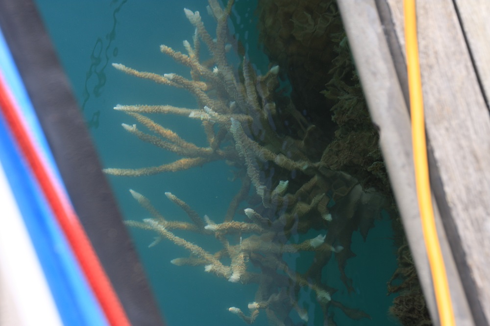
After pumping up the leaking rear side wall of the tender, again, we motored to the southern end of the bay for some snorkelling, but soon moved up into the central area where there’s a narrow marked channel for dinghy entry to the beach – this was the better spot for the amazing coral and fish. Steve videoed some of what we saw.
View a short video of our snorkelling – it’s only 2 mins.

We started to get cold, and the day-tripper boats were disgorging tourists by the score, so we lunched onboard then left, heading north around Hayman intending to spend the night in Butterfly Bay. But the wind was now moving around to the north and someone told us they’d had a very roly night there last night. We continued our circumnavigation of Hayman Island, putting up the sails as we turned west; exciting sailing as we watched for and prepared for the bullets to hit us. We finally anchored in Refuge Bay in Nara Inlet anticipating a quiet night.

Thursday

It was like a mill pond last night! We’d anchored in 9 meters of water, but noted as we drifted on the anchor the depth would drop (rise?) to 4 metres – still plenty of water for us. In the sunlight and with such beautifully crystal clear waters we could see we were drifting over corals. If the other name for this bay wasn’t ‘Shark Bay’, rumoured to be a breeding ground for hammer head sharks, I may have been tempted to snorkel over it.

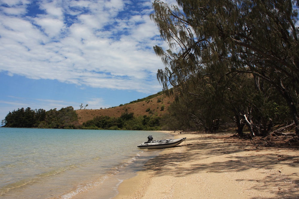
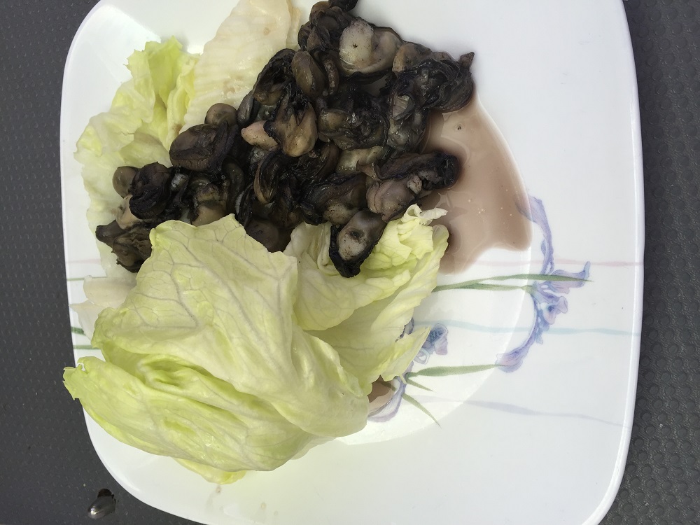
Today we went out to False Nara Inlet, a tiny bay just outside Nara destined to trick the unwary mariner. Here we picked up one of two mooring buoys then took the tender (after pumping up her broken wing again!) to the shore. The rocks were covered with the biggest oysters I’ve ever seen. This isn’t an often visited bay and few, if any, had been taken. Without moving more than 3 meters Steve had got a cup of oyster flesh for me – pity he doesn’t eat oysters!

My lunch today - 4 dozen oysters au beurre, fresh off the rocks at False Nara Inlet.
My lunch today – 4 dozen oysters au beurre, fresh off the rocks at False Nara Inlet.

A lovely swim followed then snorkelling over the coral bommies. I stayed mostly on the beach side so the coral was OK, but the fish kept me enthralled for ages – so beautiful. We investigated how we could get Top Shelf inside the fringing reef onto the gently sloping beach one day in the future to clean her hull – looks like a line from the middle of the two reef protection buoys on the southern side to the rock wall on shore looking out for two large bommies at the beginning. The water is so clear we’ll probably see them clearly.

We lunched here. By the time we’d finished there were three other yachts with us, one on the other buoy, and two anchored, one of which was a huge trimaran with about 20 bronzed, bikini-clad girls and half a dozen guys. They were ferried over to the reef to snorkel, which they seemed to enjoy, but they’d already missed the best time just before and during low tide.

I swear I’ve never seen anyone else at this little bay – seems like when one yacht anchors others just have to join them!

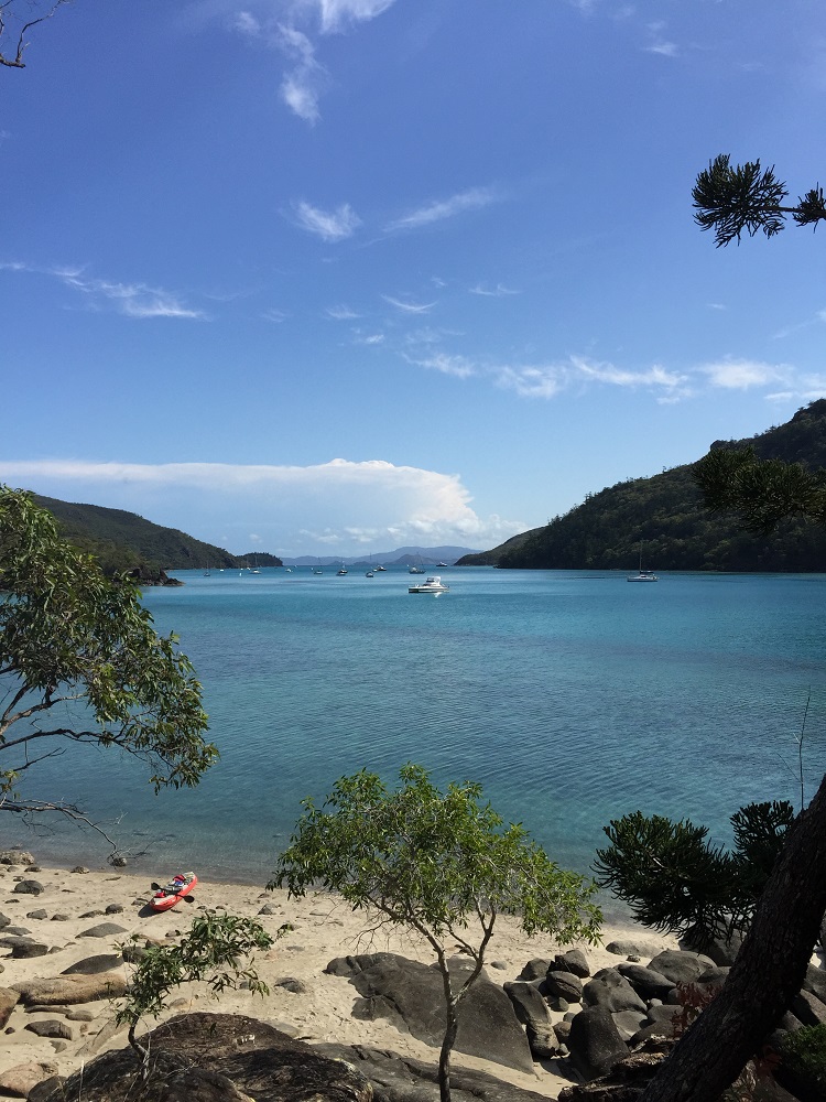
Back into Nara Inlet for another peaceful night.

Friday

The winds are back up again today – 20 knots from the north. No matter, we’re staying here today ready to sail to Airlie Beach tomorrow.

We spent a lazy morning attending to ‘business’ on our computers. I cooked one of my favourite meals, Pujabi lentils, while Steve inflated the kayak.

Leaving the Ngaro Cultural Site. Top Shelf is at the FAR end.

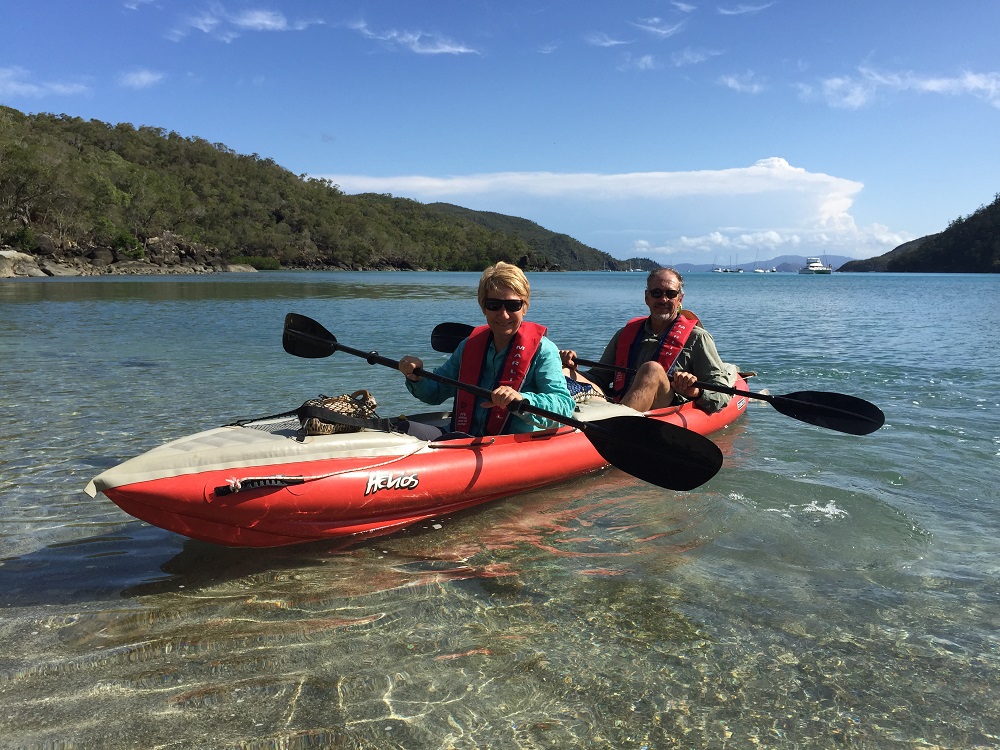
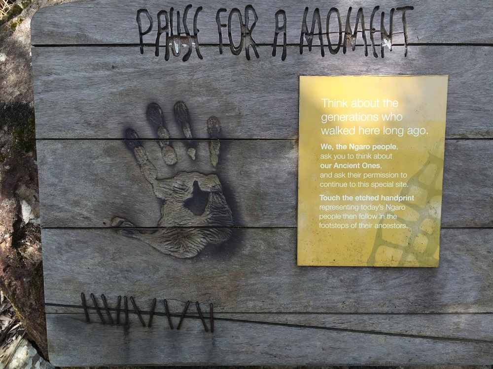
We paddled down to the far end of Nara Inlet where National Parks has provided a short walk and boardwalk to view an Ngaro aboriginal art cave. The Ngaro peoples appear to be one of the earliest groups of aborigines on the east coast of Australia. Archaeologists have dated their presence here back more than 6000 years. That all ended in 1870 though with colonisation. They were known as the saltwater people, travelling around the Whitsunday islands in their hand-sewn paperbark canoes, even as far out as the Reef. They were very accomplished mariners.

In aboriginal culture it is common to ask their ancestors for permission before entering certain sites. This sign asks the visitor to pause and think about the people who walked here before them and acknowledge the Ancient Ones by putting your hand over the handprint.

After visiting this Cultural site we paddled on down to the dry waterfall then headed back to Top Shelf- all up over an hour of kayaking – I’m going to be sore tomorrow!

Another view of Nara Inlet. See our kayak on the little beach in the foreground?

To see more photos from this part of our trip CLICK HERE.

1 – 16th Oct: Hamilton Island

Yes, it’s true – we spent 16 days in the marina at Hamilton Island! The winds just blew and blew and blew! The first week was actually lots of fun. I mean it’s hard to get sympathy when you’re stuck on a tropical island as good as Hamilton!

We admired the island

Lovely to eventually see a beautiful resort giving lots of people lots of happiness.

Lovely to eventually see a beautiful resort giving lots of people lots of happiness.

We enjoyed the free entertainment.

A very good muso - entertaining us on the marina lawn.

A very good muso – entertaining us on the marina lawn.

We blew our diet.

There goes 10 days of healthy eating! From the Pub on the marina side.

There goes 10 days of healthy eating! From the Pub on the marina side.

We climbed to Passage Peak. No mean feat as those who have done it will attest.

Catseye Beach. Taken during our walk to Passage Peak.

Catseye Beach. Taken during our walk to Passage Peak.

We relaxed by the pool.

Listening to live music beside the swim-up Cocktail Bar. Yep, that's relaxing!

Listening to live music beside the swim-up Cocktail Bar. Yep, that’s relaxing!

We didn’t have to go snorkelling to see coral and tiny fish.

There's also quite an advanced staghorn growing on the pontoon.

There’s also quite an advanced staghorn growing on the pontoon right beside us.

we joined in some activities – yoga, tai chi and ‘learn to husk a coconut’.

A coconut husking lesson.

A coconut husking lesson.

We ran in the inaugural Hamilton Island 5km Parkrun.

Steve, competing in the inaugural Hamilton Island ParkRun

Steve, competing in the inaugural Hamilton Island ParkRun

For more photos from the last 12 days on Hamilton, CLICK HERE.

And then the most exciting part happened! Nick, Kim and Babyjohn arrived for a 4-day stay.

Swimming with Opa.

Swimming with Opa.


Timeout, on Catseye Beach.

Timeout, on Catseye Beach.


Kim, bringing them in.

Kim, bringing them in.


We had great times together on Hamilton.

We had great times together on Hamilton.


Very special, happy little family.

Very special, happy little family.

To see more photos of our time with Nick, Kim and John on Hamilton Island, CLICK HERE.

30th Sept: Lindeman to Gulnare Inlet

The forecast is for strong to gale force winds for a few days starting from Friday – darn! We were intending to drop into Hamilton or Airlie soon anyway to replenish supplies so it is rather timely. We’ve still got today with pleasant sailing!

In the absence of the promised mooring buoys off Lindeman Resort we anchored and went ashore. This is another deserted resort. It was closed in January 2012 citing the downturn caused by the GFC and cyclone damage. White Horse Ltd, a Chinese subsidiary purchased it soon after and currently has a proposal in for 335 suites and villas across 5 precincts including 5 and 6 star accommodation, golf course, marina, upgraded airfield, etc, etc. At least this will be a resort that lots of people will be able to enjoy one day, unlike Brampton’s plans.

The resort has 3 caretakers who keep the grounds in reasonable condition. The buildings aren’t being maintained and one of the caretakers told us the basic infrastructure for water, sewerage, electricity is in poor condition. The resort will be bulldozed – but goodness knows when they’ll start works.

The empty beach on such a perfect day tells its own story of this resort.

The empty beach on such a perfect day tells its own story of this resort.

We were keen to walk to the top of Mt Oldfield, having been told the views are very good. The caretaker directed us to the beginning of it at the far end of the airfield. Another enjoyable walk of about 8km. The 360 degree views from the grassy knoll at the top gave us almost a bird’s eye view of the ocean and islands surrounding Lindeman. The islands seem to float in the subtly graded blues of the ocean and sky.

Panorama from Mt Oldfield.

Panorama from Mt Oldfield.

To view our photos from Lindeman Resort and Mt Oldfield CLICK HERE

Back at the boat we up-anchored and headed towards Gulnare Inlet, not far north of Hamilton Island. This is a narrow and fairly shallow Inlet that is very well protected from winds from nearly every direction. The sailing was enjoyable with Ray on the helm. Passing between Hamilton and Dent Islands the waters were really weird – like a washing machine, but that soon passed and after carefully following the geographical leads into Gulnare Inlet we anchored and prepared for a very peaceful night. Ingrid and Ken (On the Wing) were also anchored there but we didn’t catch up with them

29th Sept: Lindeman Island

Ahh such a peaceful night! We were going to do so many things today, but just didn’t get around to it. We did take the tender ashore and explored a little stoney beach beside Plantation Bay, then went around a small headland to Plantation Bay which has a lovely sandy beach. I wonder why one is all stones and the one beside it sandy?
We’ve got one more day of light winds before it starts picking up and by the weekend we’ll have gale-force winds.
Our lovely quiet anchorage has 12 boats in it tonight, all moving gradually closer to a safe harbour.

The sandy beach at Plantation Bay.

The sandy beach at Plantation Bay.

To see photos from Plantation Bay on Lindeman Island, CLICK HERE.

(PS: Happy birthday Deb and Lynise)

27-28 Sept: Thomas Island to Lindeman Island

27th Sept

Had a lousy sleep last night – we may have been out of the current, but we were so shallow that the swell became waves under us. At low tide it was like being on a roller coaster – maybe not that bad, but for a couple of hours until the tide came in a bit we were miserable campers..
Decided to move on to Thomas Island. This is in the Lindeman Islands National Parks group.

To make the most of the ESE winds we came up the eastern side of Thomas. The seas were choppy, and while we made really good time, averaging 4.5kn, it wasn’t a pleasant sail. Just off the northern tip of Thomas Is there’s a small island, Dead Dog Island and just off that a huge rock called Fairlight Rock. Our route went between them. The book did say to watch out for ‘overfalls’ when the current is maximum, which it was … We went through the gap very fast! The swell was about 2 – 3 meters, breaking waves to the side of us, and we were being swept towards the rock. Fortunately just before we entered the pass Steve put the motor on and made sure we had control. We were relieved when that was behind us.

Our journey finished at ‘Naked Lady Beach’ ( true, that is its name). Around low tide we went ashore with oyster knife and bucket. Tonight for dinner I had four dozen black-lip oysters gently sautéed in coconut oil with a dash of tamari – heaven!

The very pretty Naked Lady Beach on Thomas Island.

The very pretty Naked Lady Beach on Thomas Island.

28th Sept

For an hour or so around low tide the boat rolled very uncomfortably – unfortunately this was just before dawn, so we both started the day less perky than usual. Fortunately it only got better from there on.
The book mentioned you could walk across the island from Naked Lady Beach. This little bay has to be the prettiest we’ve seen, and that’s saying a lot. We found the path and followed it through mangroves, melaleucas, grass trees and finally coming out to a tiny, rocky bay with a pumice-stone beach. It was so picturesque. Thoughtful previous visitors had constructed a driftwood lean-to giving great shade. They must have been builders – it was so well constructed using only driftwood and rocks. We sat in the shade under it for a while watching the crystal clear water lapping the rocks with the brilliant turquoise ocean beyond. It was pretty close to a spiritual experience.

Time to meditate, at our secret bay.

Time to meditate, at our secret bay.

This driftwood lean-to was fabulous to sit in the shade and look at the ocean.

This driftwood lean-to was fabulous to sit in the shade and look at the ocean.

To view more photos from our time at Thomas Island CLICK HERE.

Back to the boat we had some lunch and got ready to sail, catching the ebbing tide north again. Burning Point on Shaw Island was our destination. The sailing started very slowly with light winds, so light we motor-sailed for half an hour. Once we changed direction and cleared the island we made good time just sailing. A change of wind direction though meant our chosen anchorage wasn’t the best. A quick look at the book and we decided on Plantation Bay on Lindeman Island instead – good decision! It’s a very calm anchorage – no rocking and rolling. There’s just us and a catamaran here.

Full moon tonight – always spectacular when viewed from the cockpit of a yacht.

Full moon over Lindeman Island.

Full moon over Lindeman Island.

25-26 Sept: Goldsmith Island

25th Sept

Left Brampton about 8am to catch the ebbing tide north.  South-easterly winds directly behind us and choppy seas made the sailing a bit hoo hum. When we turned northerly though for our approach to Goldsmith we fairly flew along. We’re snuggled in to Minnie Hall Bay in 2 meters of water at low tide, anchored just far enough away from the coral bommies on both sides of the channel to the beach.
Another very pretty bay – quite wide with 3 sandy beaches spread around it. After our exercise yesterday and sail this morning we didn’t want to do much. However we did go in to the beach. Steve thought it was close enough to row so didn’t put the outboard on the tender – big mistake! The distance was deceiving and he got a good work out.

26th Sept

We slept reasonably well last night. Bullets kept hitting us, but they ensured we stayed pointing into wind and we slept well. Roylen Bay is the next bay north on Goldsmith Island, which sounded very nice with its beautiful white beach. We up-anchored and motored the short distance on to it. It’s a smaller bay with a fringing reef just off the beach. We anchored just outside that, planning to not quite dry out, but be out of the way of the current.

Sand goanna tracks. This was made by a pretty big old girl.

Sand goanna tracks. This was made by a pretty big old girl.

On the Wing‘ arrived midday with Ken and Ingrid who anchored near us. They’d snagged a lovely big mackerel on a lure on the way and asked us if we’d like to share it with them – Yes, please!  BBQ fresh fish on the beach tonight.
Just before low tide we went for a swim and snorkelled over the fringing reef. It’s just a small area but still had some quite lovely hard and soft corals with lovely rich colours – not many fish.

Beach BBQ of freshly caught mackerel, with our friends Ken and Ingrid.

Beach BBQ of freshly caught mackerel, with our friends Ken and Ingrid.


Watching the sun set while eating our delicious BBQ fresh mackerel at Roylen Bay, Goldsmith Island.

Watching the sun set while eating our delicious BBQ fresh mackerel at Roylen Bay, Goldsmith Island.

23-24 Sept: Brampton Island

23rd Sept
Quiet day today with only snorkelling just before low tide planned. The channel between Brampton and Carlisle has a central reef. I donned my stinger suit (a sight to behold!), Steve put on his wetsuit and off we went in the tender. The tide was so low we needed to go around Pelican Island to get to the channel. Steve’s snorkelling gear was a new purchase but took no time at all to get used to it. There was a lot of reedy sea grass growing, apparently smothering some of the coral bommies. We found a few not so badly affected and enjoyed seeing a few fish, some pretty corals, lots of sea slugs and quite a few sea urchins. A pleasant snorkel, but nothing to write home about.

24th Sept

Today we ‘do’ the walks.
Despite the circuit track apparently being closed indefinitely due to lack of maintenance we continued on. There were a couple of places where we had to scramble under or over fallen trees, but on the whole it was a well-constructed track that hadn’t suffered much from the neglect. We checked out Oyster and Dinghy Bays on the southern side for future reference, being anchorages in a northerly and climbed to Brampton Peak. All up a walk of around 14km.
We both voted it to be one of the best we’ve ever done. It had everything – thick rainforest, glades of lime-green strappy calves tongue, maidenhair ferns in the gullies, grass trees covering the slopes and beautiful big old hoop pines which are favoured by the screeching sulphur-crested cockatoos, standing sentinel over the southern bays.

Dinghy Bay, Brampton Island. Taken during our bushwalk on the Circuit Track.

Dinghy Bay, Brampton Island. Taken during our bushwalk on the Circuit Track.

But the real highlight of the walk was the butterflies – thousands of blue tiger butterflies all around us as we walked. We could have been walking through a butterfly enclosure there were so many of them.

Blue tiger butterflies. There were clouds of these pretty butterflies surrounding us on our walk.

Blue tiger butterflies. There were clouds of these pretty butterflies surrounding us on our walk.

The climb to the peak was tough – a few hundred meters up over 2 km with lots of switchbacks. The views from the two lookouts were worth the effort – and we got enough internet cover to speak with our children.

The passage between Brampton and Carlisle at low tide. Taken from Brampton Peak.

The passage between Brampton and Carlisle at low tide. Taken from Brampton Peak. Note the disused airport runway.

At sundowners Ken and Ingrid from the ‘trailer tri’ On the Wing came over and shared stories about anchorages and boats.

To see more photos from this beautiful island and our walk CLICK HERE.

22nd Sept: Newry Is to Brampton Island

A calm anchorage like Newry’s is to be savoured. However it’s onward we sail. The forecast of 5 – 15 knots from the south east held on the 20+nm sail to Brampton Island. Brampton is directly east of Newry. Leaving mid-tide we allowed for the ‘ebb’ to firstly carry us north before the ‘flood kicked in to carry us back onto track. With wind and tide sorted all that was left for us to do was set the sails, get Ray going and sit back and enjoy the ride, which we did. The trip took about 6 hours.

Our destination -the gap between Carlisle Island on the left and Brampton Island on the right.

Our destination -the gap between Carlisle Island on the left and Brampton Island on the right.

After a rest we took the tender over to the resort. What a sobering experience. It’s been closed since January 2011. I think it was originally closed when a cyclone damaged the jetty and the light rail line that would take the holiday-makers from the boat to the resort. From the sea it is the vision of a perfect tropical island, golden sands, coconut palms, swimming pool on the edge of the sea, fringing coral reef and accommodation units tucked in amongst the tropical gardens. However close up, the pool, while undamaged is full of green water, the gardens are untended and overgrown, and coconuts and palms fronds litter the pathways. The accommodation units still contain their beds and washing machines and even electric clocks, the restaurant is full of chairs and tables, lounge chairs still in their original wrapping, apparently never been used, and just off the beach at the watersports hut are the surf cats and jet skis. All sadly abandoned!

The beach near the resort on Brampton Island.

The beach near the resort on Brampton Island.

Apparently United Petroleum owns the lease to the resort. They have been talking about redeveloping it for some time with rumoured construction and completion dates wafting past. The latest, published in the newspaper in July this year, is that approval has now been granted for a 7-star “boutique eco-resort featuring luxurious villas, a health spa, yoga platform, cinema, library and a three-hole golf course”, which will cater for … wait for it … a maximum 30 guests. I really felt this resort deserved to be reopened as it is arguably the most idyllic of the tropical north Queensland islands, but to make it so exclusive that few will experience its beauty is a travesty. Fortunately the majority of the island is National Park, but how access to the park will be facilitated is doubtful.

Back to Top Shelf for sundowners and a toast to the Brampton that was. The mournful cry of the curlews and an owl accompanied the somber mood.
A gentle swell and no wind to speak of will give us a restful night.

For photos of the very sad Brampton Island resort, CLICK HERE.

21st Sept: Mackay to Newry Island

We motored out of Mackay Harbour this morning at 6.30am – we left early to get as much assistance from the ebbing tide as we could. The winds were so light to start with that we motor-sailed for the first hour – quite a change from yesterday’s winds. Our track took us parallel to the coast passing Slade Pt, Dolphin Heads, Cape Hillsborough, Smally’s Beach, Seaforth. These are all locations we know well from our years living in Mackay and camping with the children.

The wind eventually settled into a gentle 10kn southeasterly accompanied by a 1/2 to 1 metre swell. The sailing was quite comfortable despite the occasional annoying jibe caused by the following wind. We breakfasted and snacked as we sailed, finally dropping anchor in a nice protected bay on the western side of Outer Newry Island. The 26nm trip took us 7 hours averaging 3.6kn. Two dolphins met us at the entrance to the bay and followed us to our anchorage – a lovely welcome after a long day.

A peaceful anchorage. Top Shelf in the foreground.

A peaceful anchorage. Top Shelf in the foreground.

We went ashore in the tender to do the walk to the other side of the island. Outer Newry Island is one of 9 islands in this National Park. As with most of the National Parks we’ve visited the facilities, while basic, are very good. The walk was only 400m one way and led us first to a picnic area with a fisherman’s hut that has been there for 30-odd years, in good repair and still well used. From there it led through eucalypts and flowering grass trees to a stony-beach bay on the ocean side.

Denise after walking across Outer Newry Island.

Denise after walking across Outer Newry Island.

A nearly full water tank beside the fisherman’s hut was cause for celebration! Fresh water is very precious when sailing so Steve returned after our walk to fill the solar shower for a nice hot, fresh-water shower tomorrow.

Who says you don't get exercise when boating?

Who says you don’t get exercise when boating?

The forecast for tonight is calm – as I write this the boat is gently rocking. I’m anticipating an excellent night’s sleep.
To view the photos from today CLICK HERE.

18 – 20 Sept: Mackay Harbour

Outside of the Mackay Marina breakwater. 20 knots blowing.

Outside of the Mackay Marina breakwater. 20 knots blowing.

The strong winds came in as predicted at about 8am. We went for a walk along the marina breakwater to view the seas; if we said it once we said it a dozen times: good decision to come back. It is frustrating not to be continuing our trip, but this is a pleasure trip, the winds will abate, and we’ve got plenty of time. The harbour breakwater has just been reopened following significant re-engineering after the damage it sustained during Cyclones Ului in 2010 and Dylan in Feb 2014. It’s certainly an impressive structure now with a two-way roadway and wide running/cycling path the length of it (maybe 1km). It’ll be a nasty cyclone that damages this breakwater.

Inside the Mackay Marina breakwater. 20 knots. Note the number of boats here sheltering.

Inside the Mackay Marina breakwater. 20 knots. Note the number of boats here sheltering.

Over the next couple of days we got ready to sail again – cleaned the boat, washed our clothes at the laundromat, caught the bus into town to top-up the provisions and cooked a couple of meals ready to eat on the days we do long sails.

Our friends from Egremont Channel all came over here on Thursday too to sit out the winds and for Koonya (Janet and Mark) to have the rigger fix a broken side shroud (the wire holding the mast up!). We caught up with them for sundowners last night. We’re all planning to leave Monday morning – Koonya, Mica (Mike and Carol) and Wilparina (Steve and Kim) heading south, us north.

Sundowners on Wilparena with hosts Steve and Kim. and Mike and Carol from Mica, and Janet and Mark from Koonya.

Sundowners on Wilparina with hosts Steve and Kim. and Mike and Carol from Mica, and Janet and Mark from Koonya.