24th April – 2nd May 2017
Monday 24th
We sadly farewelled Tez, Greg and doggy Daisy this morning and headed directly to Tyrepower to get the tyre fixed. Excitedly we head north now to the Flinders Ranges. We’ve heard so much about them.
The Stuart Hwy took us to Snowtown for brunch and a break. The gruesome Snowtown murders of the early 1990s are unfortunately remembered by many Aussies. There were 8 murders here the details of which I sharn’t go into. The town has suffered because of its reputation and today it is a pretty sad and sorry looking place. It had been mooted to change its name, which I think was a good idea, but obviously it didn’t get up.
However, on the upside, the Ranges that run north-south to the west of Snowtown are apparently perfect for wind turbines and there are about 70 or more turbines that generate enough electricity to keep 350,000 homes going. In the park at Snowtown is one of the blades (yep, they’re big) and an excellent information board describing the project.
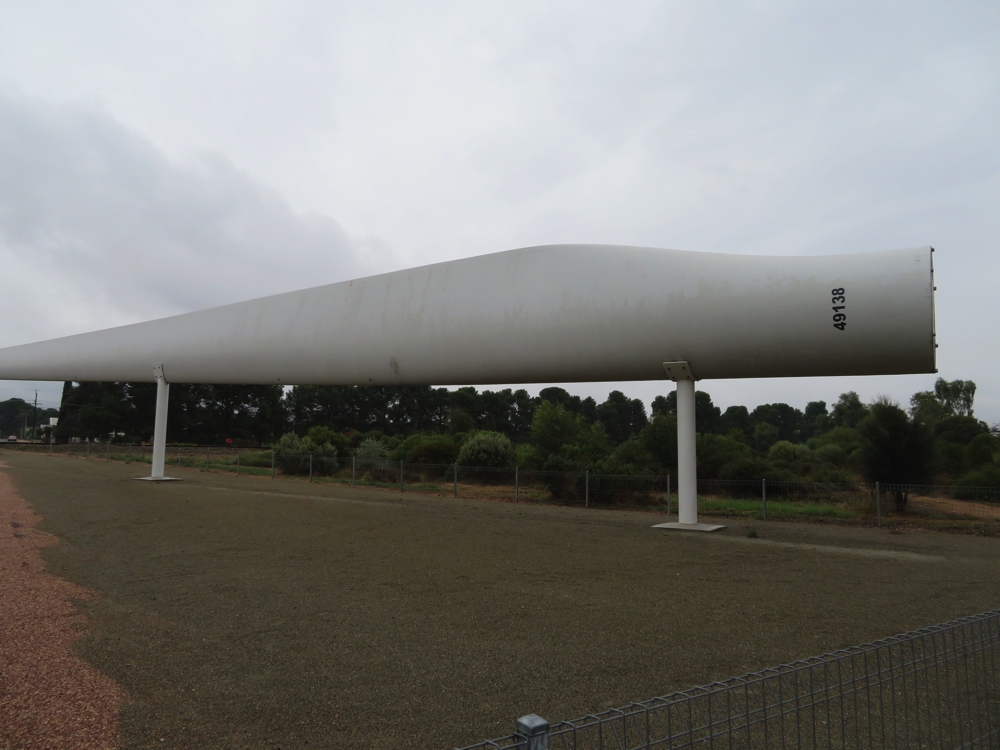
Just in case you didn’t know what a blade from a wind turbine looked like … Snowtown.
It started raining as we continued north and didn’t stop. We were a bit worried about the roads into Mambray Creek camping area at Mt Remarkable but needn’t have been – sealed right to our campsite. Ahhh the beauty of a motorhome – we pulled into our site, turned the chairs around and spent a warm, dry, comfortable afternoon reading and watching movies – no need to go out in the rain for anything. Wouldn’t swap my motorhome for any other kind of rig!
Mt Remarkable is in the southern Flinders Ranges.
Tuesday 25th
Today dawned sunny with a few scattered clouds, still cool. We did a couple of the walks – the Wirra Water Walk alongside Mambray Creek and the Baroota Hike to the Baroota station homestead ruins and the station cemetery. Lovely walk along the dry creek bed (despite it raining all day yesterday, go figure). The old red gums are so beautiful, lots of birds and a few kangaroos for company.
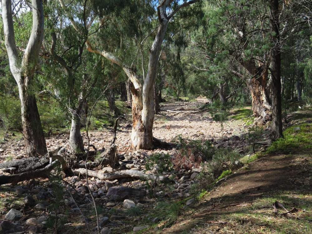
The very beautiful River Red Gums that grow in the riverbed of Mambray Creek. They know where to find the deep-down underground water.
The cemetery dates from the early 1800’s and is so sad – so many children. The property did well in the first years it was established, but being right on Goyders Line years of drought followed, then flooding rains and heartbreak. It was a very tough life. The homestead had a lovely location with views to the mountain range in one direction and across the plains to Spencer Gulf in the other.
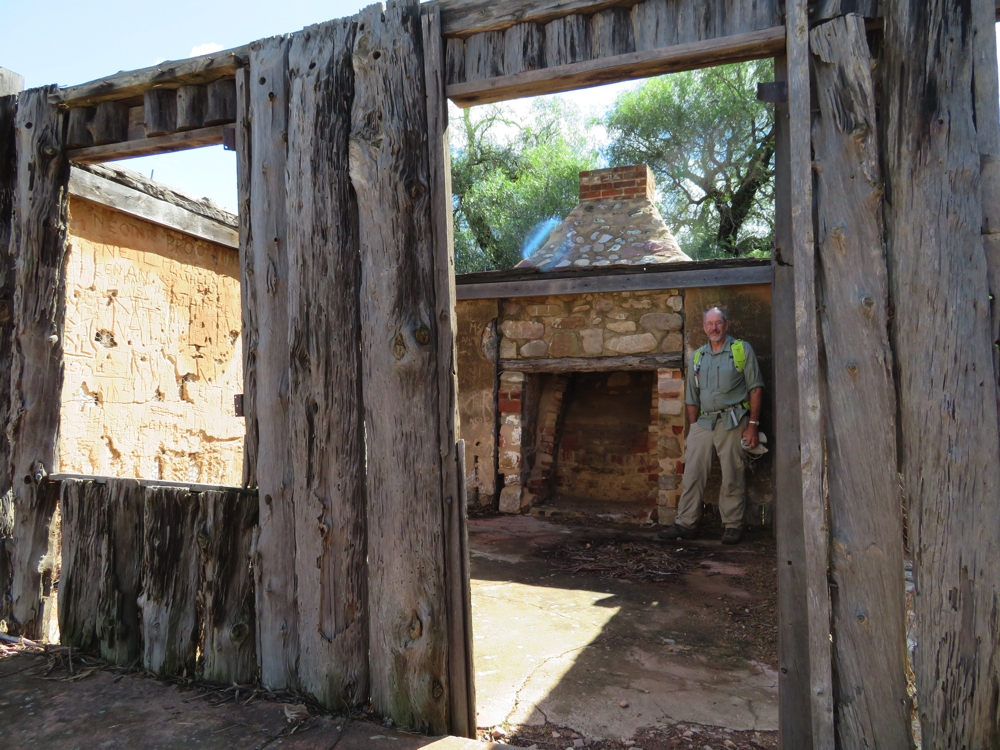
Steve examining the ruins of the Baroota homestead. I guess there were many happy times in front of this fire, before the many sad ones that led to its demise.
For the record this is an excellent campsite – well-spaced sites, flushing loos, hot showers and located in a very attractive part of the national park ($20/night + NP entry). We walked the Alligator Creek section of Mt Remarkable on our way to the Eyre Peninsula – that was the eastern side and this is the western side.
Wednesday 26th
We’d planned to do another walk here before we leave today, but we awoke to a strong, cold wind blowing – not going to happen! Quorn is next on the agenda. The Old Ghan Heritage Trail starts here and we figured we might follow it for as far as the road will permit us. This trail follows the original Ghan railway as closely as possible, including along the Oodnadatta Track to Oodnadatta before branching off and heading more directly to Alice Springs.
The railway stopped running to Quorn in 1957, however a local enthusiasts’ group maintains the rolling stock and lines between Quorn and Port Augusta running tourist trips currently on Thursdays and Sundays, ie not today. There are some majestic old stone buildings in Quorn, testament to the historical prosperity of the town. The Information Centre is now housed in the Railway Station.
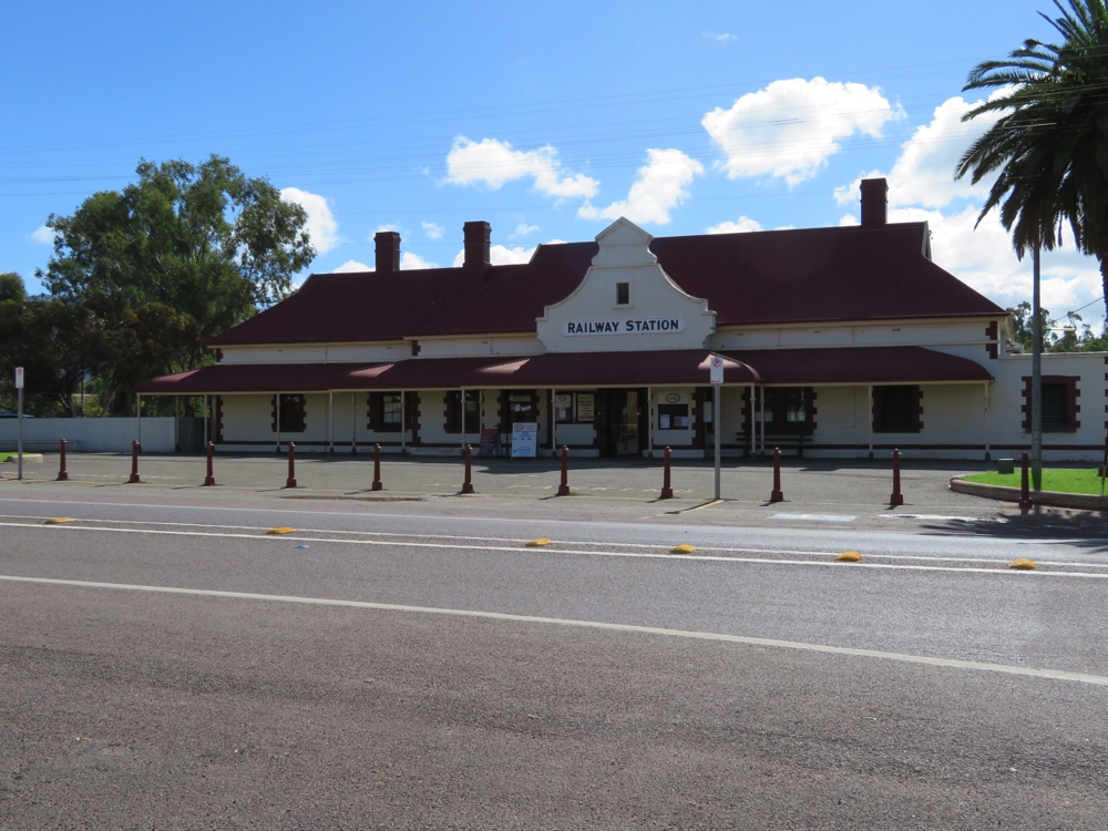
The railway station at Quorn. Once used for the Ghan, now the Pitchi Ritchi Railway has tourist trains leaving here a couple of times a week.
Still keen on getting some walking in we headed for Warren Gorge. This council-managed Gorge and camping area ($15/night) is about 20 or so km to the north west of town. The area over which you can camp is huge which always makes it hard to choose a spot – ‘is this the best spot, or is that one over there better?’. Finally set up with views over pine trees to the striking red cliff walls of the Gorge we once again decided it was too cold to walk so hunkered down inside watching movies.
Thursday 27th
A lovely sunny morning with no wind left us with no excuses. The Gorge Loop walk follows the creek, which is flowing albeit only a pace or two wide. At the far end the path climbs the steep Gorge wall and continues back to the trailhead on the other side of the range. We enjoyed the walk as it was quite varied in flora, lots of birds and the occasional rock wallaby. The views down the Gorge from the far end were beautiful. The Smoko Lookout overlooked not only the valley on the other side of the Gorge but also the unsealed road north, the condition of which no one in Quorn could tell us about.
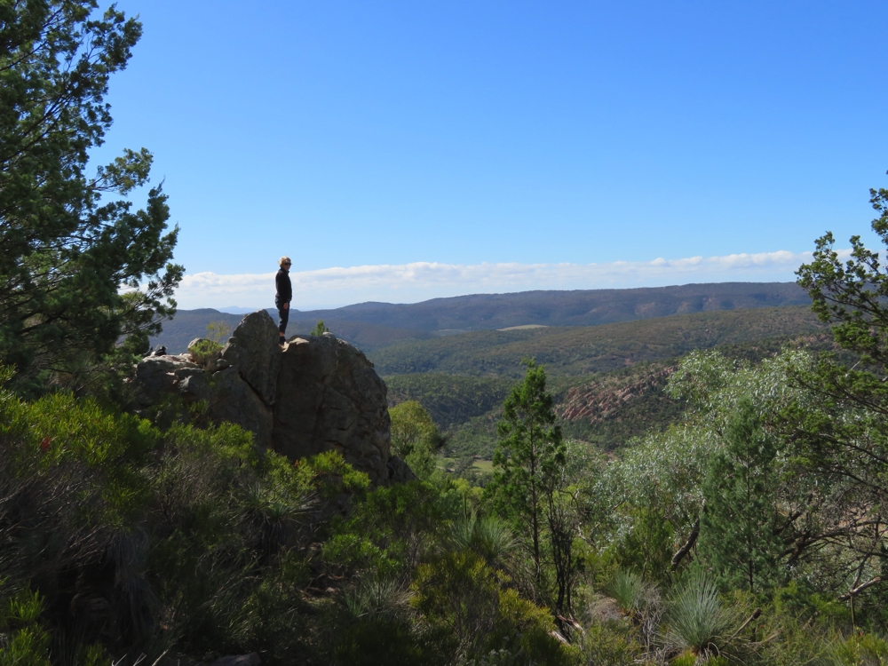
The lookout on the Warren Gorge walk.
The road looked good, from up on high, so when we returned to Priscilla we headed off along it. With recent rains everywhere is now green. The road wound its way further up this scenic valley taking us past ruins of homesteads and towns – the fickleness of the weather is not a farmer’s friend.
Back on the Stirling North Road we stopped at Kanyaka Ruins for lunch and a look around. Kanyaka Station was a sheep station though it began as a cattle station in 1852. Because of the difficulties of transport, the station had to be self-sufficient and Kanyaka station grew to supporting 70 families and included a large homestead, cottages for workers, workshops, huts and sheds, mostly built from local stone due to limited supplies of workable local timber. Extended drought in the 1860’s saw the demise of the sheep station and it was resumed by a pastoral company for growing wheat. The stone walls and floors are all that now remain of this once thriving enterprise.
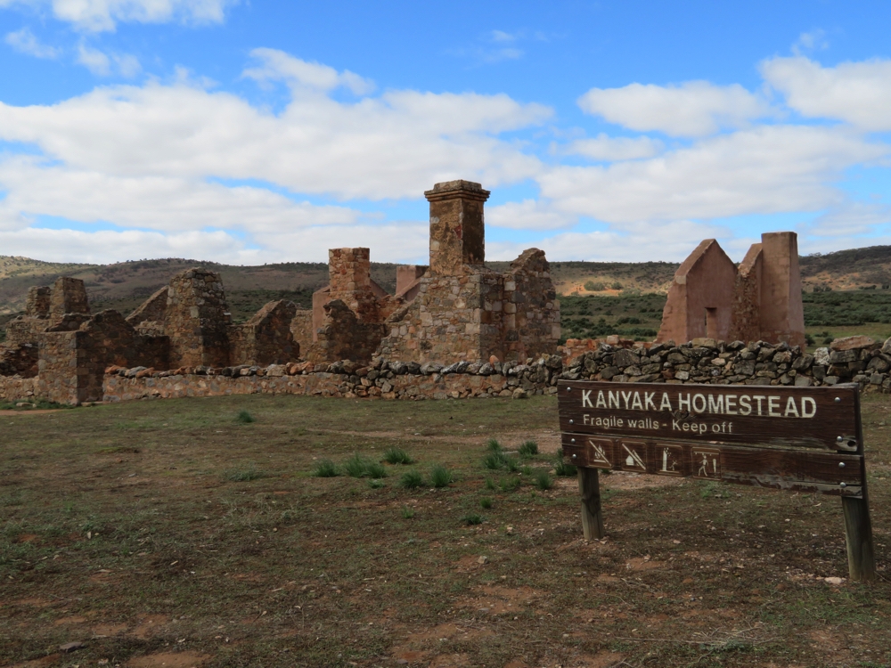
Kanyaka Homestead. It would have been an impressive place to live, in its day.
Continuing north through Hawker we turned off on the Moralana Scenic Drive, an unsealed road which cuts westward between Elder Range and Wilpena Pound Range following the Moralana Creek (dry). The Ranges on either side were spectacular, particularly as the afternoon sun lit up the red cliffs of the Elder Range. The old, gnarled River Red Gums along the creek were striking and the drive made even more enjoyable by the many family groups of emus and kangaroos. A road sign suggested a great place for photographs – a walk up a very steep, shale hill – the views definitely worth the effort though. The restored ‘cueing yards’ where the bullockies, who carted the felled cypress pine, shoed their bullocks was interesting.
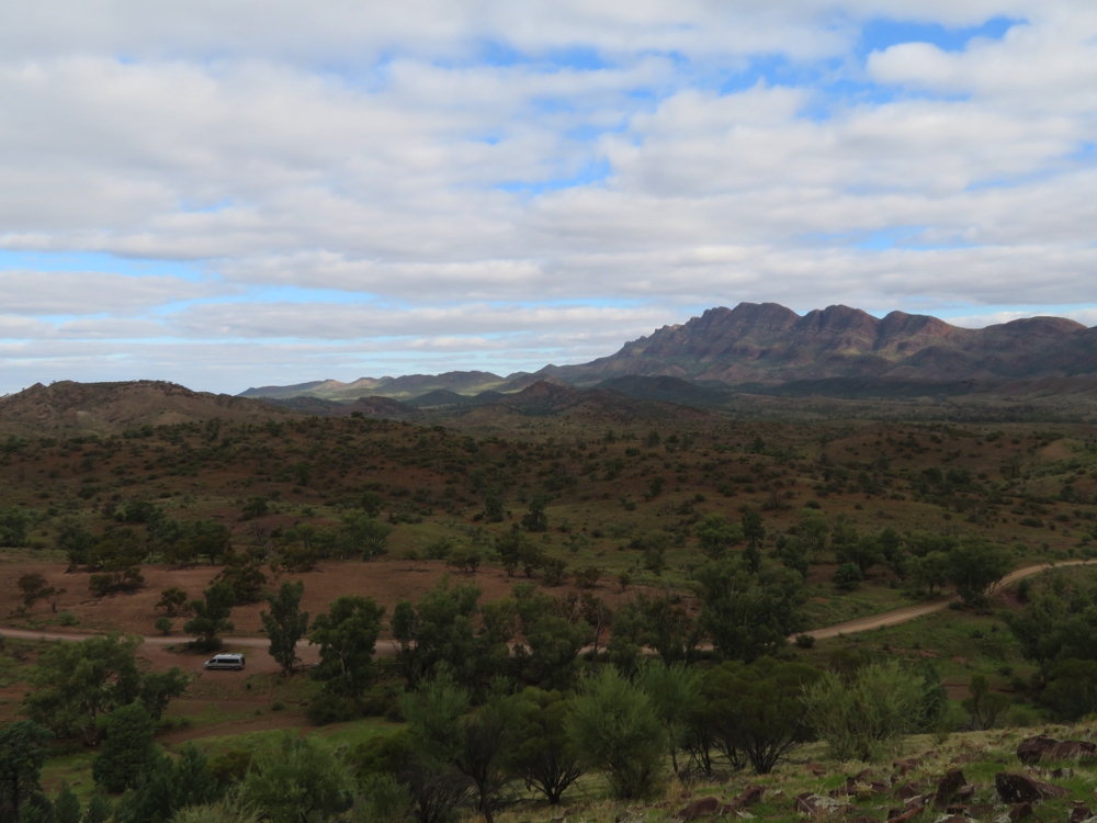
Yes we did hike up this very steep hill to take a photo of Priscilla, and the Flinders Ranges. Moralana Scenic Drive
Heading southward on the Parachilna Rd towards Hawker, to complete the loop, we came across a parking area just off the road with heaps of room for camping and views to the Ranges in every direction. A quiet evening after a full day is anticipated.
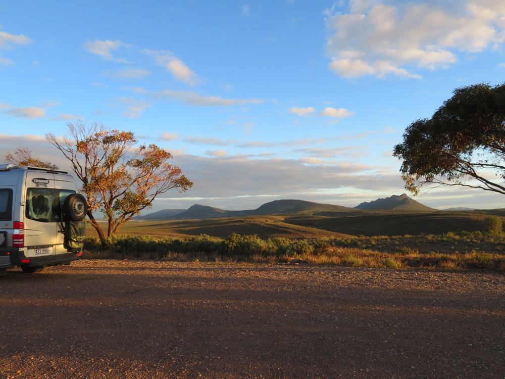
Sunset at our free camp just north of Hawker.
Friday 28th
I’d been looking forward to seeing the Old Ghan railway station at Hawker as I believe it is well preserved and now functions as a restaurant and art gallery … but it’s not open this morning! Oh well, a photograph of the outside will have to suffice.
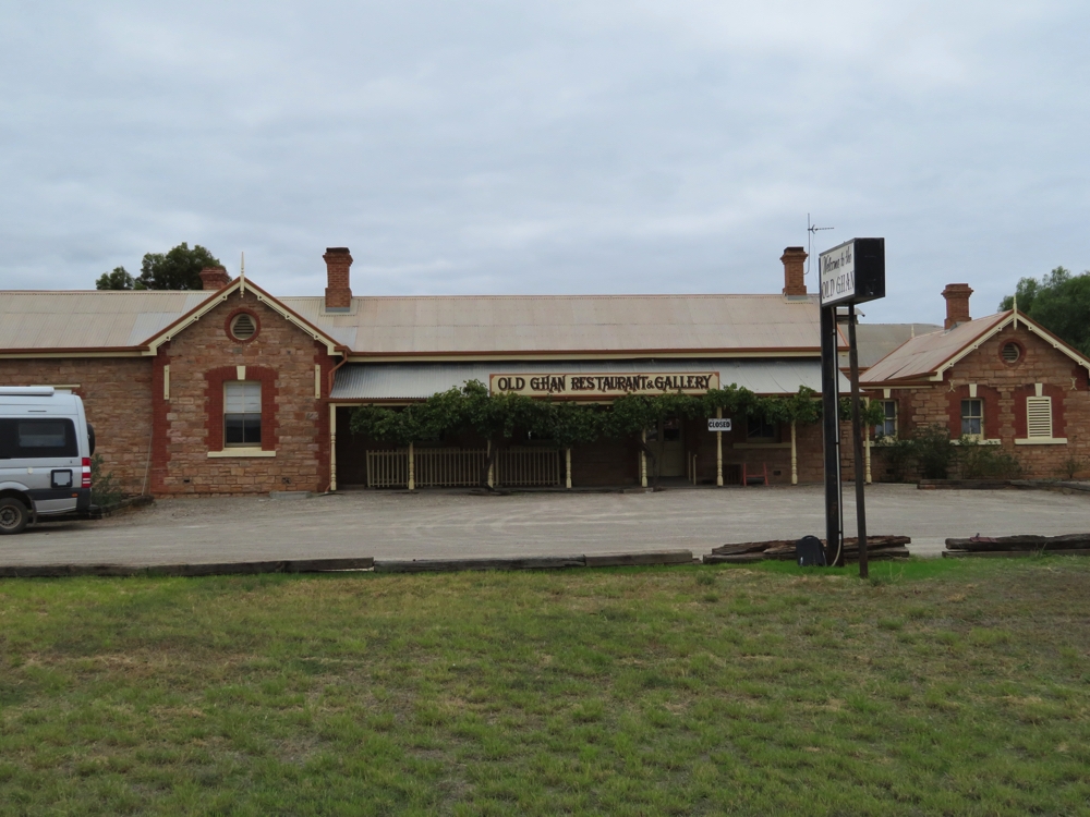
The railway station at Hawker is now a restaurant and art gallery. Not open when we visited, unfortunately.
From Hawker we headed to Wilpena Pound and into the Flinders National Park.
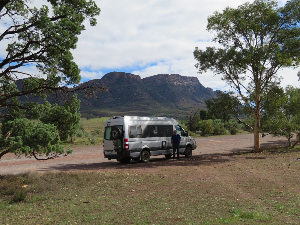
The Wilpena Ranges, on the drive to enter the park.
This is the favourite walking location for our friends Ric and Gill, so we’re filled with high expectations. After choosing our camping spot we headed off on the 7.8km Wangarra Lookout walk. The first few kilometres follows Wilpena Creek, which, like the walk at Mambray Creek, is lined with spectacular river red gums. This creek though has a permanent spring and it’s lovely to see flowing water in a creek out here. Further on is Hill’s Homestead with signage describing life in the Pound in the early 1900’s. A sculpture also tells the aboriginal story of the creation of the Pound.
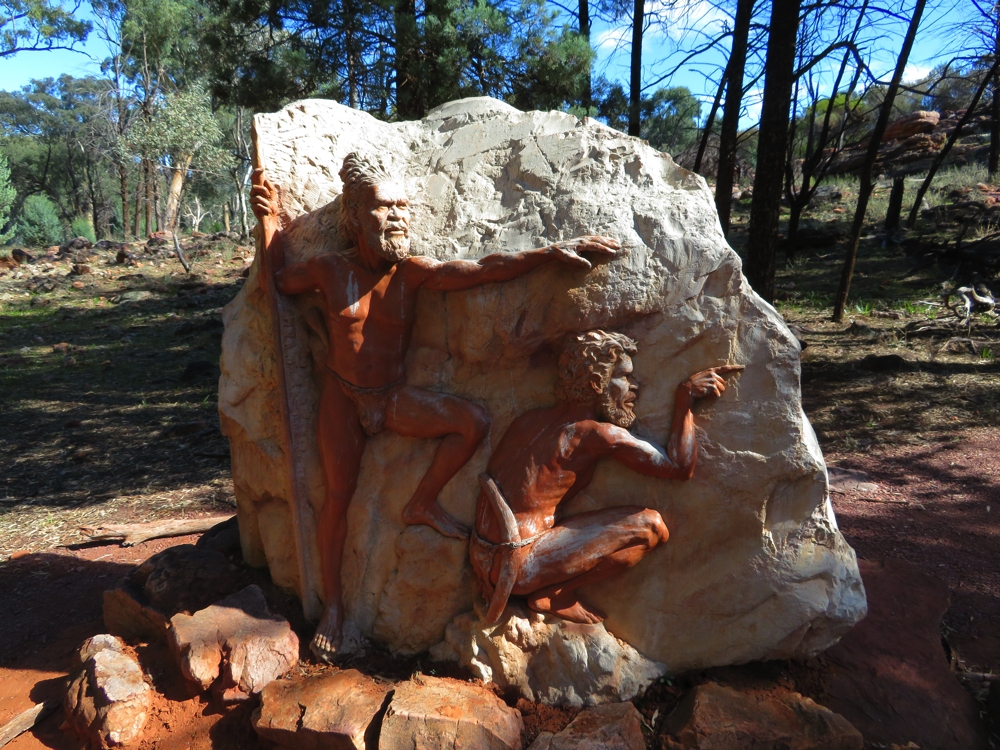
A ‘small’ tribute to the original inhabitants of this area. Wilpena Pound.
Our walk, however, now took us upward – why do lookouts always have to be on the top of a mountain (rhetorical question, don’t answer!). After some sweating and a bit more heavy breathing we made it to the Lookout. The western section of the Pound lay before us. It is pretty amazing – a plain, entirely enclosed by mountains. Beautiful. OK Ric and Gill, I can see why you love this place so much.
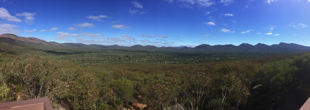
Panorama of Wilpena Pound. From here it’s easy to see the enclosing mountain range with the flat plain in the middle.
Saturday 30th
St Mary’s Peak is the highest point in the Flinders Ranges. At a round trip distance of 21.5km from camp and the warning that it is ‘STRENUOUS’ in the walk descriptor we knew it would not be a ‘walk in the park’. The first hour was very pleasant amongst the river red gums, followed by cypress pines as we moved away from water. Then we started to climb! The track became shaley with rocks of every size, boulders that had to be scaled to get onto rock ledges, and just before reaching the saddle was a sheer rock face where both hands were needed to pull ourselves up.
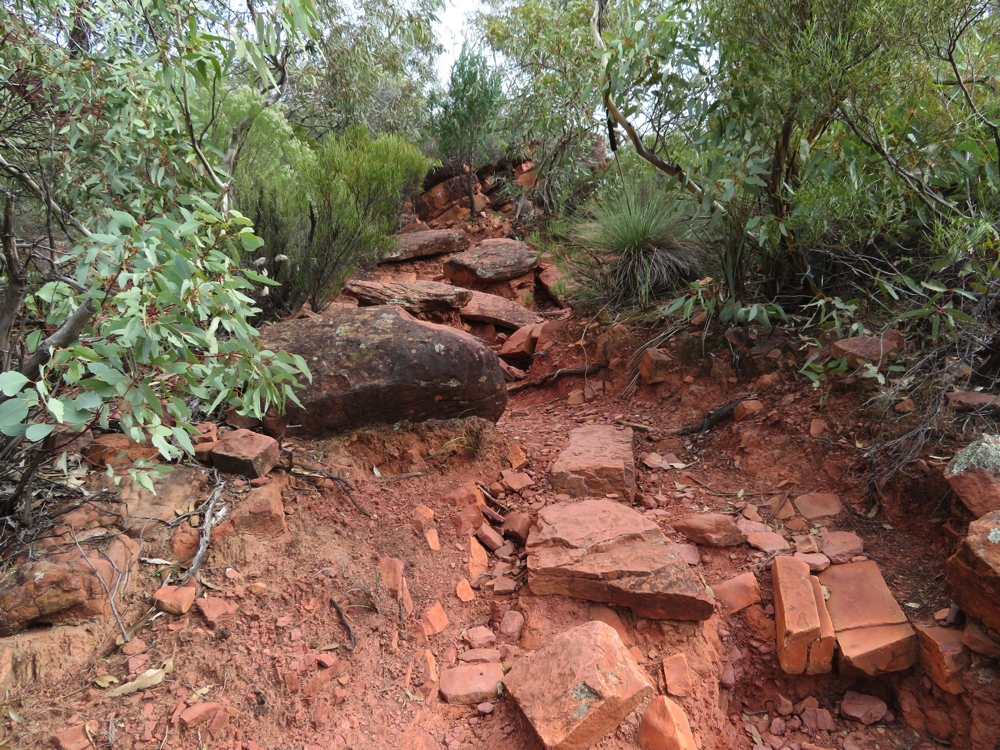
As the track went upward, the condition of it got much tougher. (This bit was easy compared to what was coming up.) On the way to St Mary’s Peak.
Added to the concern of the climb was the poor track marking – the painted blue arrows on the rocks worn away almost totally and only occasional blue reflectors indicating where you should be next, but not how to get there. They did say in the literature that the climb was dangerous, and so it was in places. The magnificent views, when we had the energy to look, were all to the outside of the Pound. Finally at Tanderra Saddle we stopped for lunch and congratulated ourselves on having made it. The view over the Pound in one direction and to the outside in the other was lovely. The actual Peak is another 1.5km, however the peak itself is sacred to the local indigenous people who’ve lived here forever and have asked us not to climb it. No argument from me!
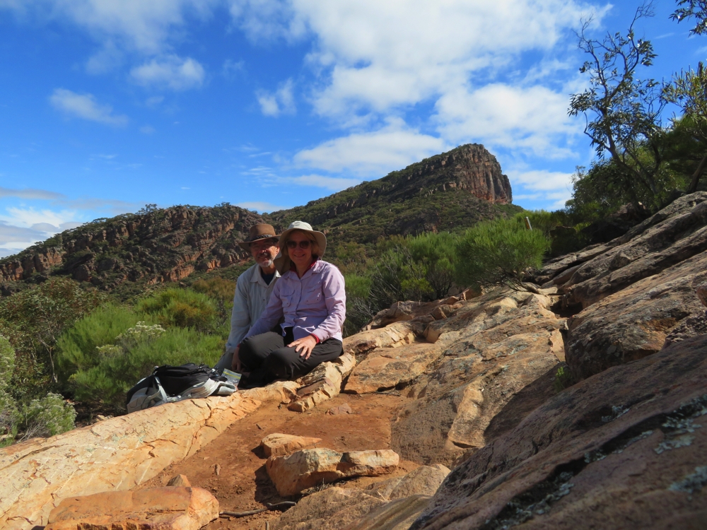
After a VERY tough climb we’re at Tanderra Saddle with St Mary’s Peak behind us.
The return journey wasn’t quite as difficult. Rather than the shorter, steep incline of the ‘outside’ track, the ‘inside’ track’s slope is quite reasonable but the first 4km of this descent is extremely rocky before reaching the plain of the Pound. These paths do not make for pleasant walking, eyes glued to the ground for fear of a sprained ankle. The next 8km was easy walking through cypress, occasional stoney, dry creek beds, river red gums and emus, kangaroos and birds. All up we were gone from camp for 6.5 hours and returned pleased with ourselves, but very tired.
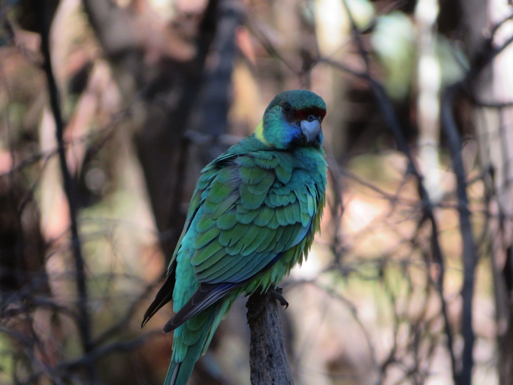
An Australian Ringneck Parrot, Port Lincoln variety. Lots of them all around Wilpena Pound.
Sunday 31st
Surprisingly we both woke this morning with minimal aches and pains – all this bushwalking we’re doing is definitely toughening us up. Today was a day to relax. A short 3 – 4 km walk along the beautiful Wilpena Creek and up, but not too far up, the range at the side of it and back to camp kept our muscles loose.
Monday 1st May
The Bunyeroo Scenic Drive leaves Wilpena and winds through the Flinders Range to Aroona on the northern edge of the park.
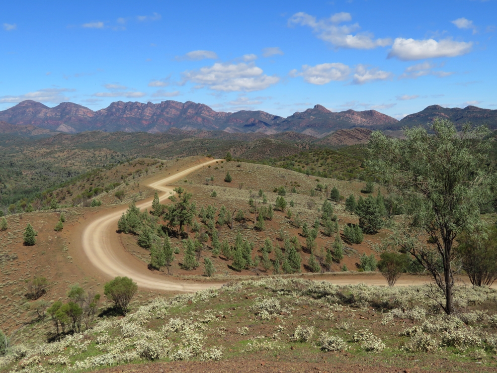
Ok, I can see where we’re headed. Bunyeroo Scenic Drive
This is a magnificent 4WD drive between Ranges, into gorges, over water crossings (with running water!) into Bunyeroo Gorge and finally to the Aroona Ruins where there is a campsite. No other campers here in this remote spot.
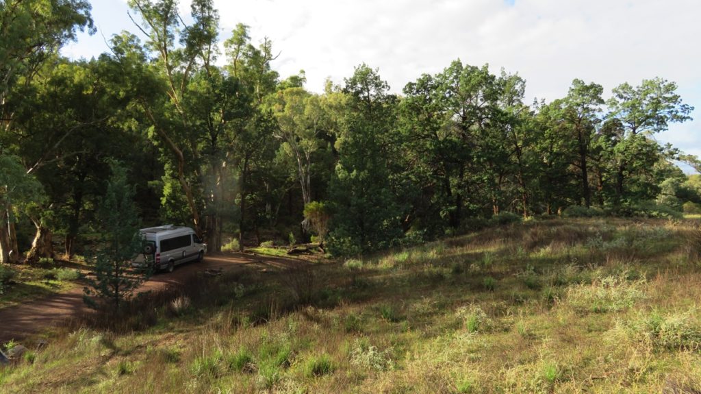
We’ve had many beautiful campsites on this trip, but this has to be among the most beautiful. Aroona Ruins.
After setting up camp beside the dry creek bed, surrounded by river red gums with a backdrop of red cliffs we headed off on the Yuluna Hike. This absolutely beautiful hike took us across the plain, along several dry creeks, up escarpments and to lookouts down the Gorge. We both loved this 9km hike.
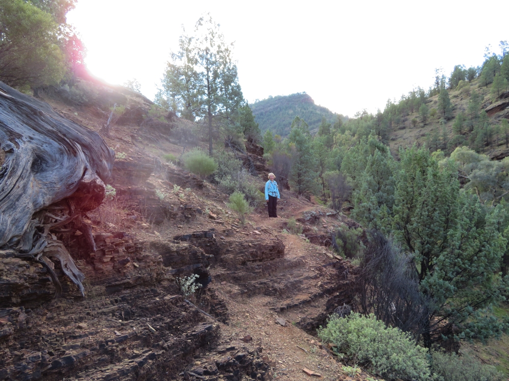
The path here is narrow and shaley on the cliff edge above the creek. The beautiful views continued as we climbed upwards. Yuluna Hike.
The ‘Aroona’ incident occurred here. This very embarrassing incident resulted in a policeman waking us up at midnight to check we’re OK. We’d inadvertently put a ‘help’ meassage on our tracking map (see ‘Where are we now’ menu) and our family reacted accordingly. Good to know the system works well, but acutely embarrassed that we had worried and inconvenienced so many people. A big thank you to all involved, not forgetting the SA Police and very amiable Sergeant James who drove from goodness knows where along rugged a 4WD track in the pitch dark to find us.
Tuesday 2nd
We leave the Flinders Ranges today via Brachina Gorge. This gorge is a geologists nirvana with fantastic examples of geological changes that have occurred here over the last 600 million years. The drive is well signposted for non-geologists to understand what they’re looking at. Apart from that it’s another awesome drive through a spectacular Gorge.
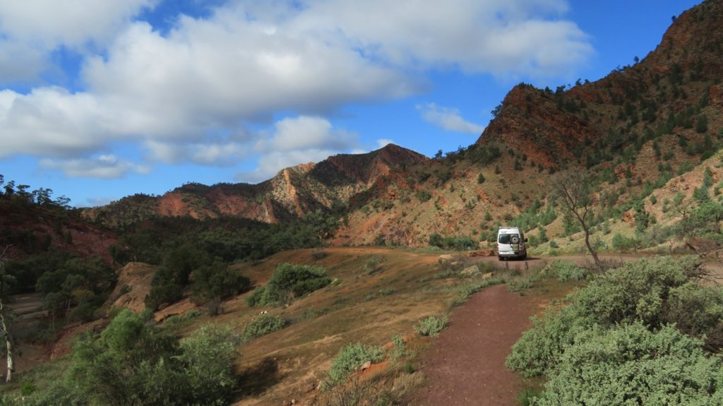
Stopped for some looking around, on the Brachina Gorge road.
For more photos from our time in the Flinders Ranges CLICK HERE.