
6th – 8th May 2017
Saturday 6th
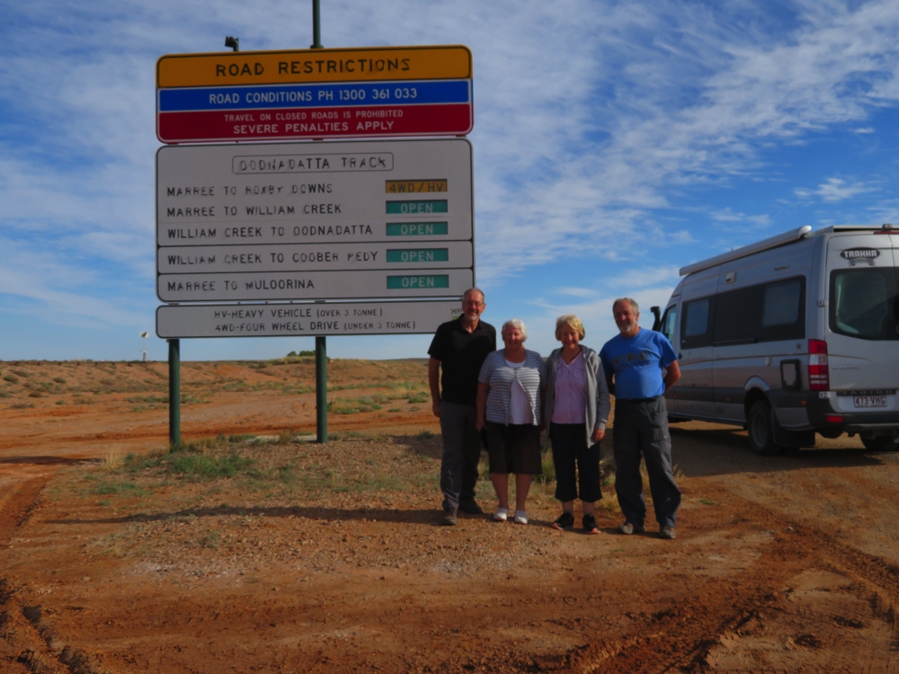
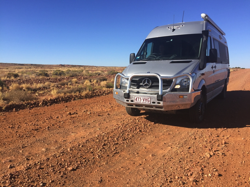
And the 4 erstwhile explorers are ready to tackle the wilds!
Another top day. Leaving Maree on the Oodnadatta Track was pretty exciting – our first foray into the real Outback of Australia. The track follows the old Ghan railway line all the way to Oodnadatta. Our first ‘point of interest’ was the Multonia Sculpture Park at Alberrie. These sculptures are all made from junk and spread randomly over a 5 acre paddock beside the road. Some were quite good, others … well they are made of junk.
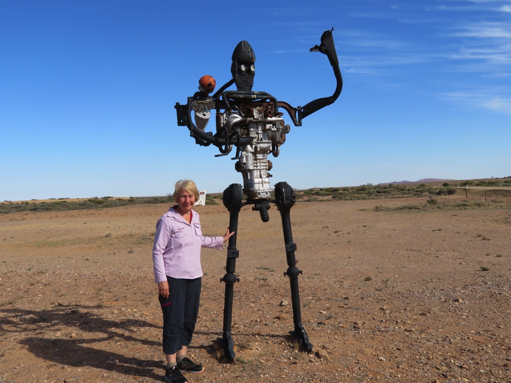
Man with child (and Denise). How do I know it’s a man?
Lake Eyre, Australia’s largest lake and the lowest point in Australia at 10 metres below sea level soon appeared to the east. Due to recent rains there’s water in it, an uncommon phenomenon. Lake Eyre is where the land speed record was set by Donald Campbell in his car the Bluebird in the 1960’s. When it’s dry it’s a smooth, fast salt lake.
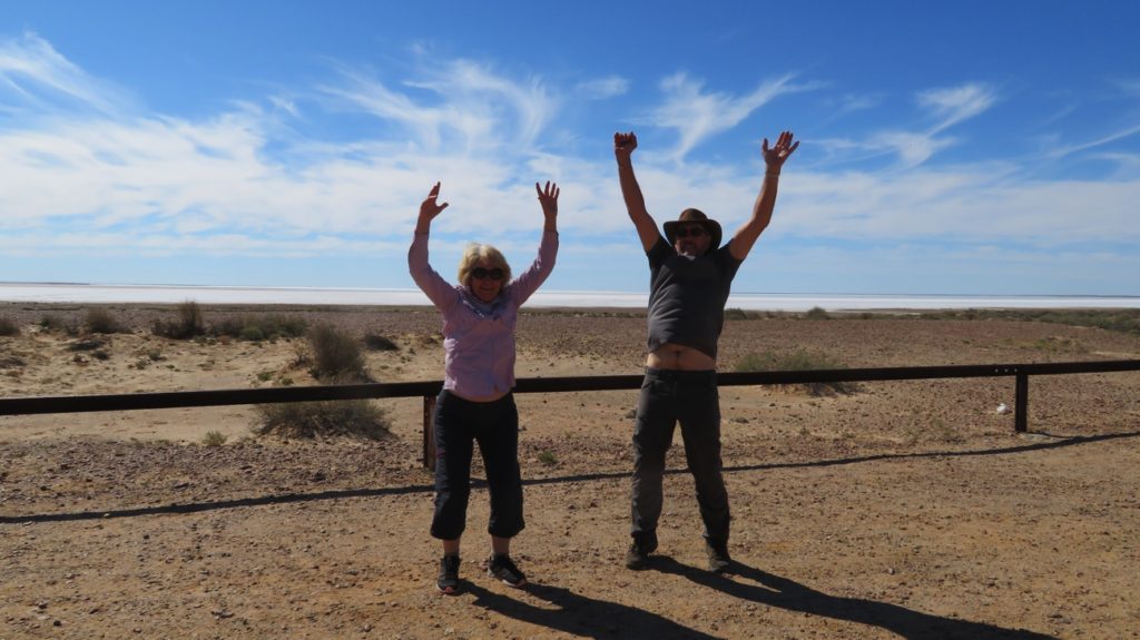
Yay! We’re at the lowest point in Australia – Lake Eyre, 10 metres below sea level.
A very strange sight a few kilometres further on was a large flock of seagulls – do you know how far we are from the sea!! There’s water in the Stuart River (maybe half a metre deep at the deepest) and thousands of little fish are trying to swim upstream and providing a banquet for the gulls.
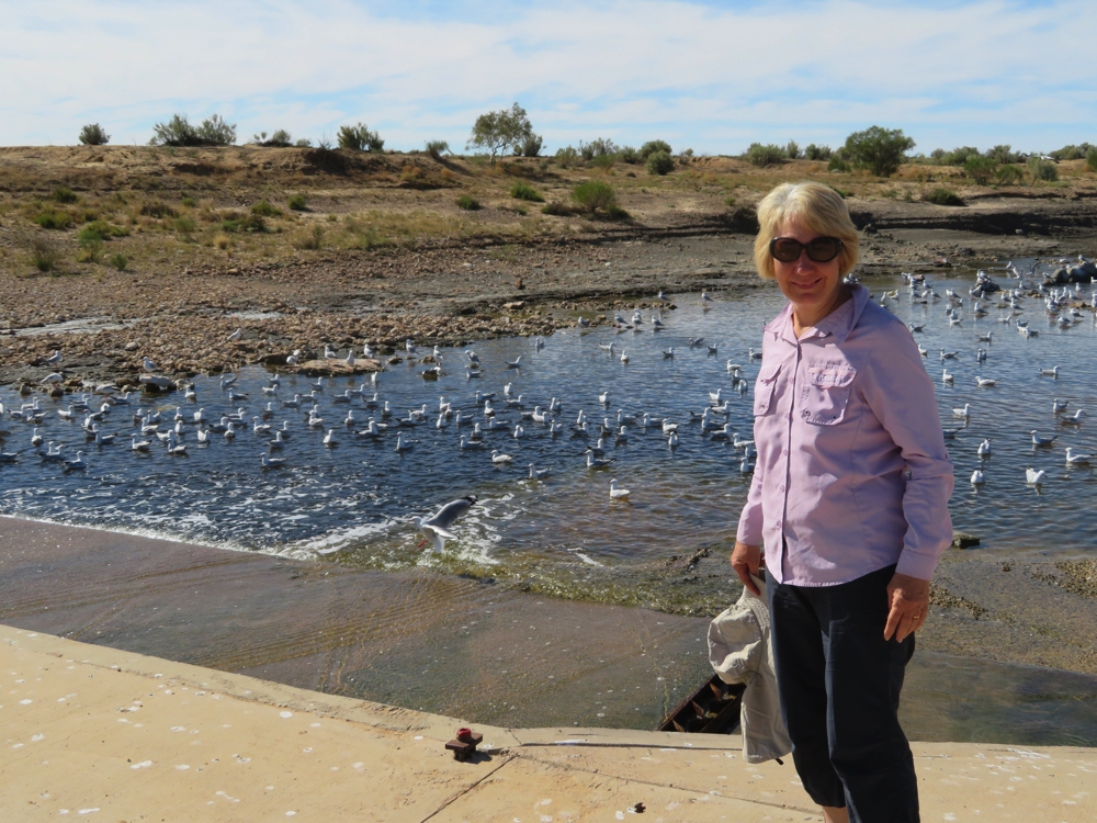
The seagulls are all there for the fish. The fish are jumping up onto the wet cement and trying to cross the culvert under the road.
We passed the ruins of several sidings and fettlers’ cottages before arriving at Curdimurka, another railway siding now in ruins. Here the original tracks still remain, the station building itself is still there, though birds have taken up residence in it and the big cast iron water tanks also remain.
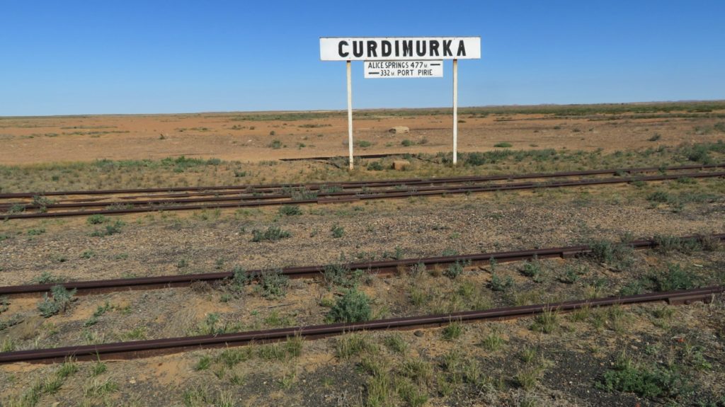
Curdimurka – wide gauge line closest, narrow gauge on the other side.
Moving on we came to Mound Springs. These are two springs fed by the Great Artesian Basin. They’re both on the top of small hills, or mounds, presumably formed by the springs bringing up sediment and depositing it at the edges. The first of these is ‘the Bubbler’ which does just that – bubbles languidly appear and rise to the surface, disturbing the muddy bottom as they do. The aboriginal mythology of this is that a snake has been caught and it’s the writhings of it that are seen in the pool. It doesn’t take too much imagination to be able to see that. This pool overflows into a lush, green area. The second pond is called Blanche Cup and is a pretty, reflective pool.
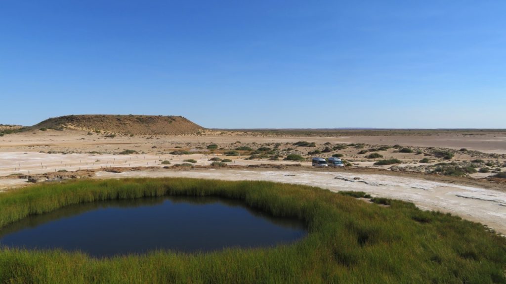
Mound Springs. This one is Blanche Cup. Pretty, still, reflective.
Our campsite tonight is at Coward Springs ($25/night) – a real oasis in the desert, complete with date palms and a thermal pool. The pool is only about 6ft square but very refreshing. The camping sites are all tree lined and have fire pits. A great spot.
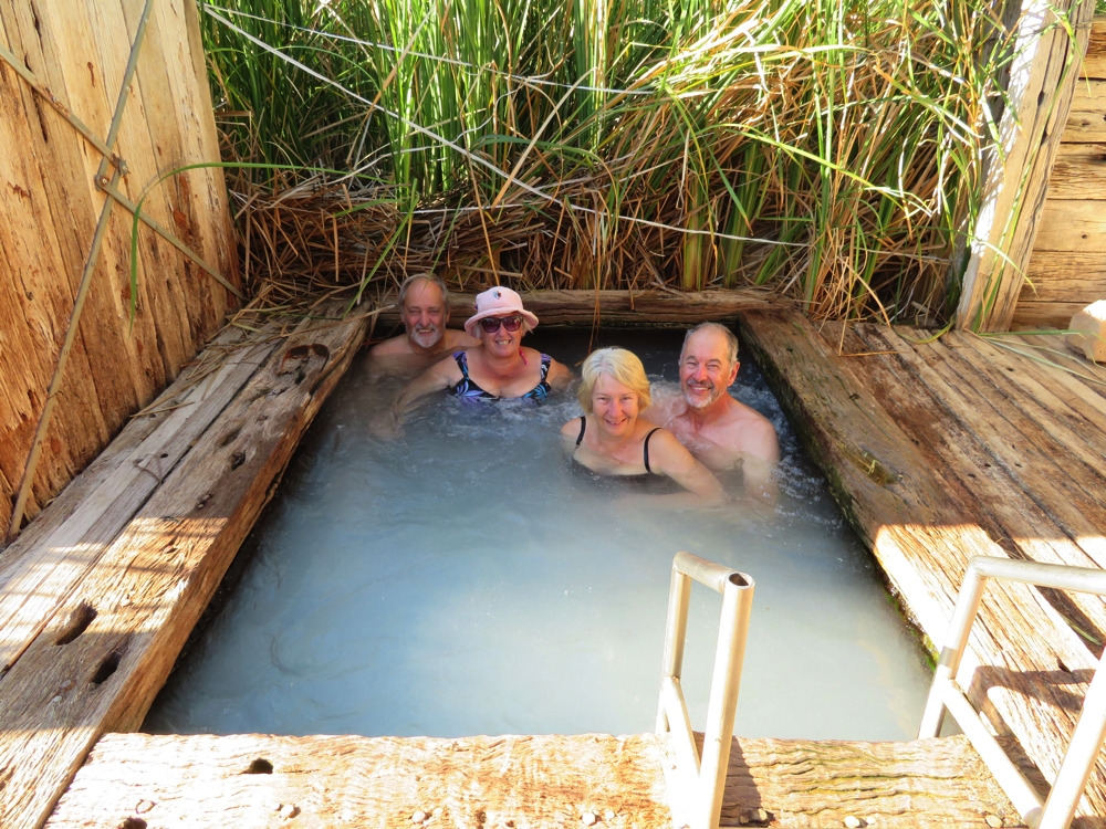
Not a big thermal pool … but nonetheless a very pleasant dip after a dusty drive.
Sunday 7th
Before leaving we took a look through the museum which is housed in the restored engine drivers home. Fabulous museum telling the history of the region from the very beginning.

The museum at Coward Springs is now housed in the restored Engine Driver’s residence. It’s an excellent museum, worthy of a couple of hours of time.
We stopped to look at the old rail bridge crossing Edwards Creek, then again further up the road at Warrina. Warrina is where the Elders Scientific Expedition alighted the train in 1891 before their 12 month, 6800 km journey exploring parts of Australia not previously seen by Europeans.
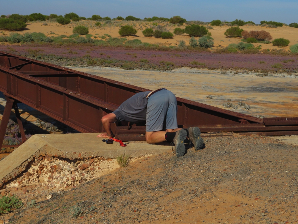
There’s a geocache under here somewhere – so he reckons. Edwards Creek rail crossing.
However, William Creek, next place up the road, actually has a permanent population, of 4, though during the tourist season (beginning now) it swells to 12. There’s a pub that provides alcohol, meals, coffee, accommodation and fuel, and the Wrights Air Charter office and aerodrome. After refuelling ($2/L), we headed off on a two-hour scenic flight over Lake Eyre and the Painted Hills ($420pp). Nick, our pilot, gave us good commentary on the trip, pointing out and explaining all the features as went. Apart from the area around William Creek and Lake Eyre we were over Anna Creek Station the rest of the time. Anna Creek Station is the largest cattle property in the world, though right now it has no cattle. It was one of the Kidman properties. Kidman owned connecting properties from northern Australia to the south, however they’ve all just recently been sold. Anna Creek was bought by the Williams family (couldn’t be sold to Gina Reinhardt apparently because of its proximity to Woomera, secret military stuff). The Williams family wanted it destocked before taking possession – a mammoth task for the outgoing Station manager.
The Painted Hills were beautiful, their story best told in photos, as is Lake Eyre’s. There’s a little water in Lake Eyre, but it’s from recent rainfall, not from water coming in from the rivers, and as such will soon dry up and there were no birds to be seen. We all enjoyed the flight and recommend it.
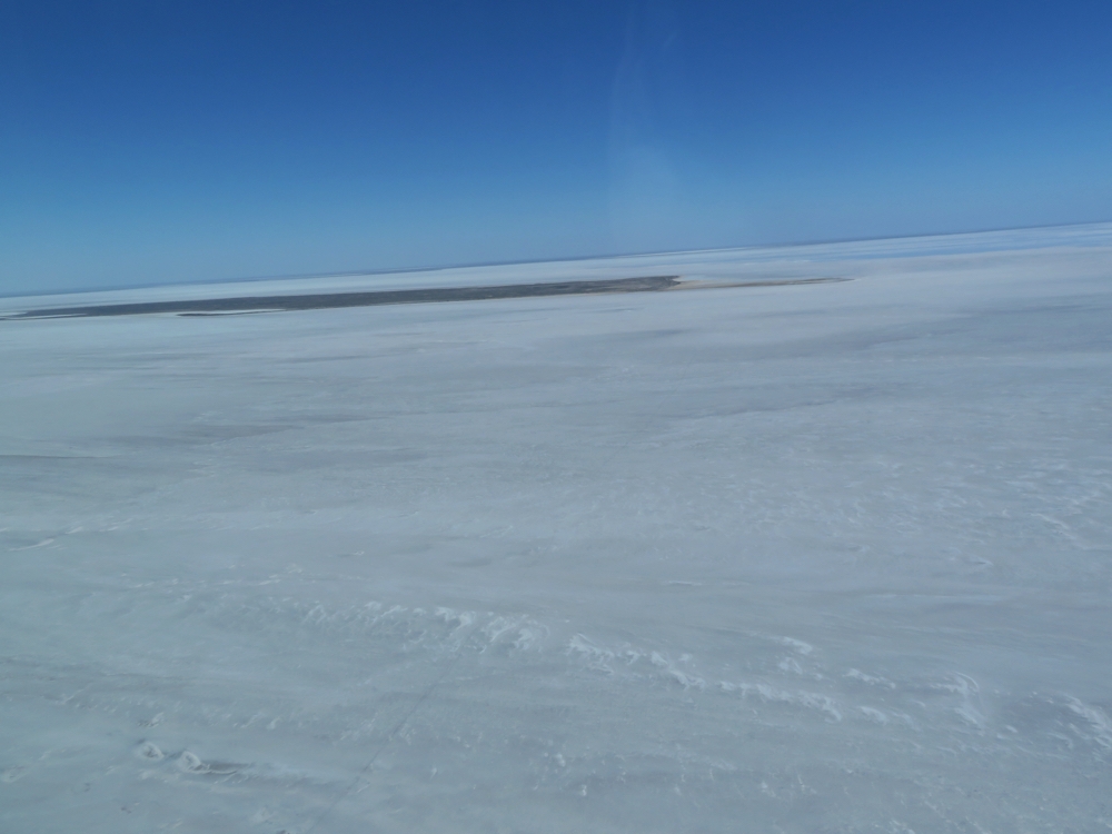
One of the islands on which the pelicans breed when there’s water in Lake Eyre.
CLICK HERE to see the photographs of the Painted Hills and Lake Eyre from our flight.
On return we continued up the road to Algebuckina Railbridge which is/was the longest bridge in South Australia. It spans the Neales River which has water in it, and lots of bird life. Camping here beside greenery and water, under this amazing structure was a real treat.
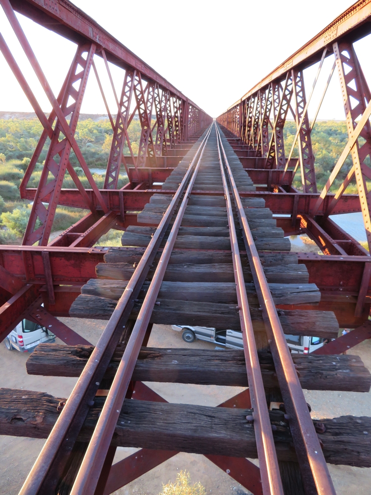
The Algebuckina rail bridge is the longest bridge in South Australia.
Monday 8th
Only 50km further on we arrived in Oodnadatta.
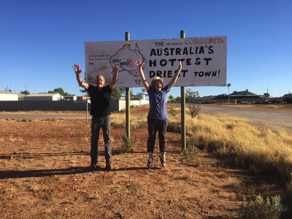
And yet ANOTHER point of geographical, or climatic, significance in Australia. Oodnadatta is the hottest and driest town in Australia.
A quick drive around the two town streets revealed a couple of parks, a free camp, a museum at the old Railway Station, a closed pub and, most famous of all, the Pink Roadhouse.
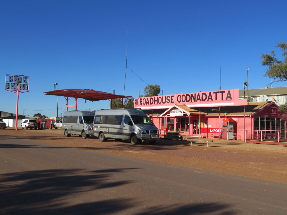
The Trakka Jabirus at the Pink Roadhouse Oodnadatta.
The Pink Roadhouse is everything – general store, fuel, car repairs, cafe, bar, souvenir shop, tourist information, caravan park and landline telephone (only Optus here!). Of particular note is their Oodnaburger – Ken and Steve both ordered one and thoroughly enjoyed it!
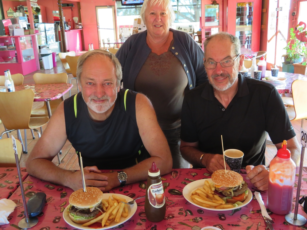
The report came in that the Oodnaburgers were excellent! Ken, Wendy and Steve.
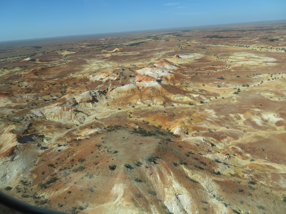
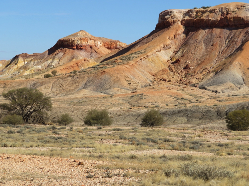
The Painted Desert is a 90km side trip from here on Archaringa Station. The road out was pretty good, until the last 15 km where the corrugations rattled our teeth and some sections of soft sand (over corrugations!) needed 4WD. But when we got there it was worth it. Though much smaller in area, they’re the same strikingly beautiful hills as we saw from the air at the Painted Hills yesterday, but here we were up close to them.
We drove further on to the station homestead where you can camp, but we decided we’d head back to Oodnadatta – let’s do all those corrugations again! The countryside is flat gibber plains (covered in small rocks) to the horizon with low-growing saltbush and, in the dry water-courses, stunted shrubs, Occasional flat topped low hills added variety. My description makes it’s sound boring, but it is quite beautiful – you have to be here to appreciate it.
Back in Oodnadatta we settled in to the free camp, which has a brand new picnic shelter and table, with an electric BBQ – so new they haven’t connected the electricity yet!
CLICK here to see our photos of the Oodnadatta Track.
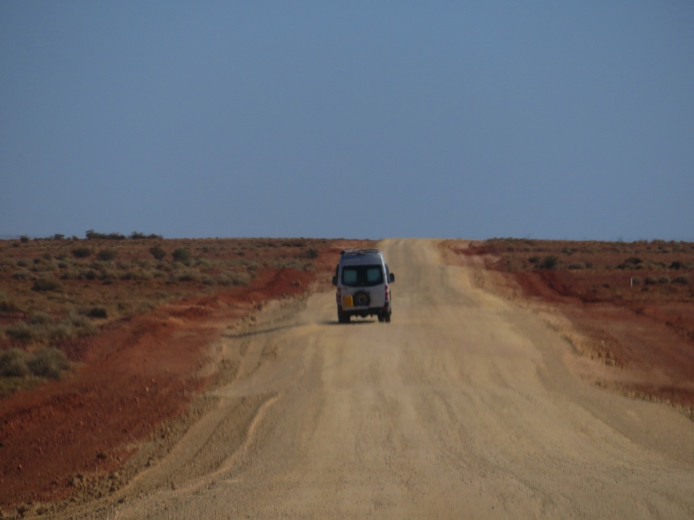
Many people asked us about the the track conditions. Here are a few pics.
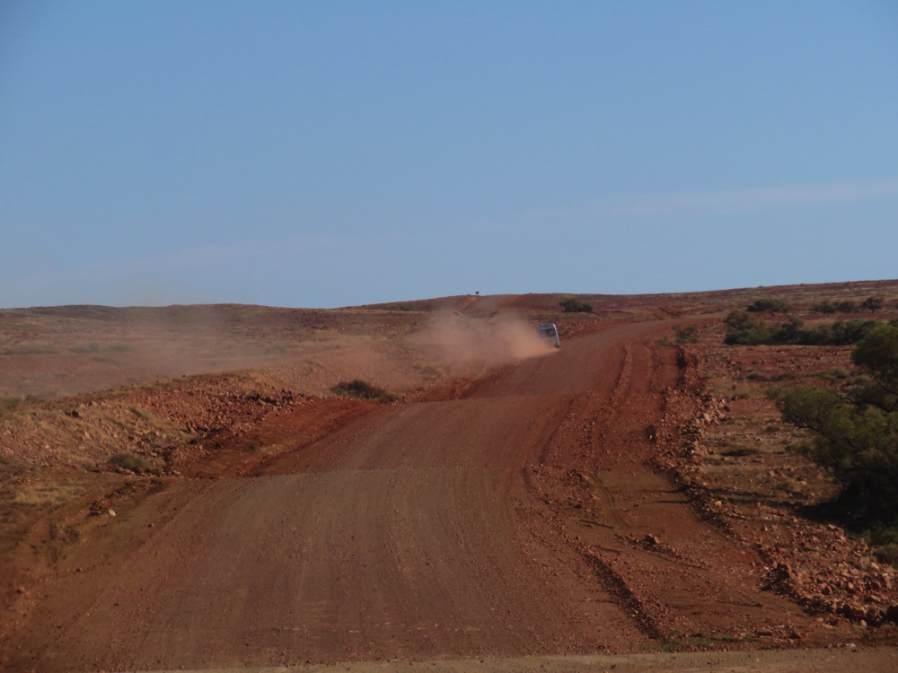
Pretty good here. The grader has been through.
Hard to see corrugations, but they are there.
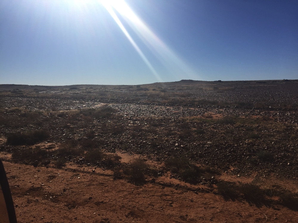
Gibber plain through which the road is built.
Choose your path and hope those gibbers under your tyres aren’t too sharp.