Hike Maria Island, Schouten Island, Freycinet Peninsula

14th -17th April

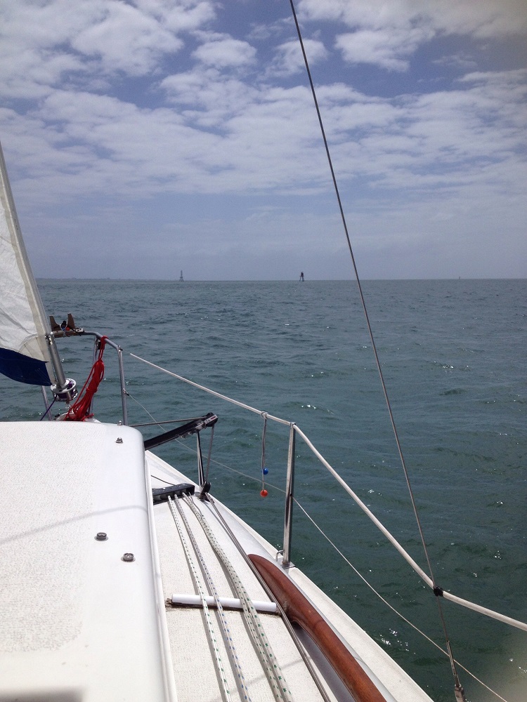
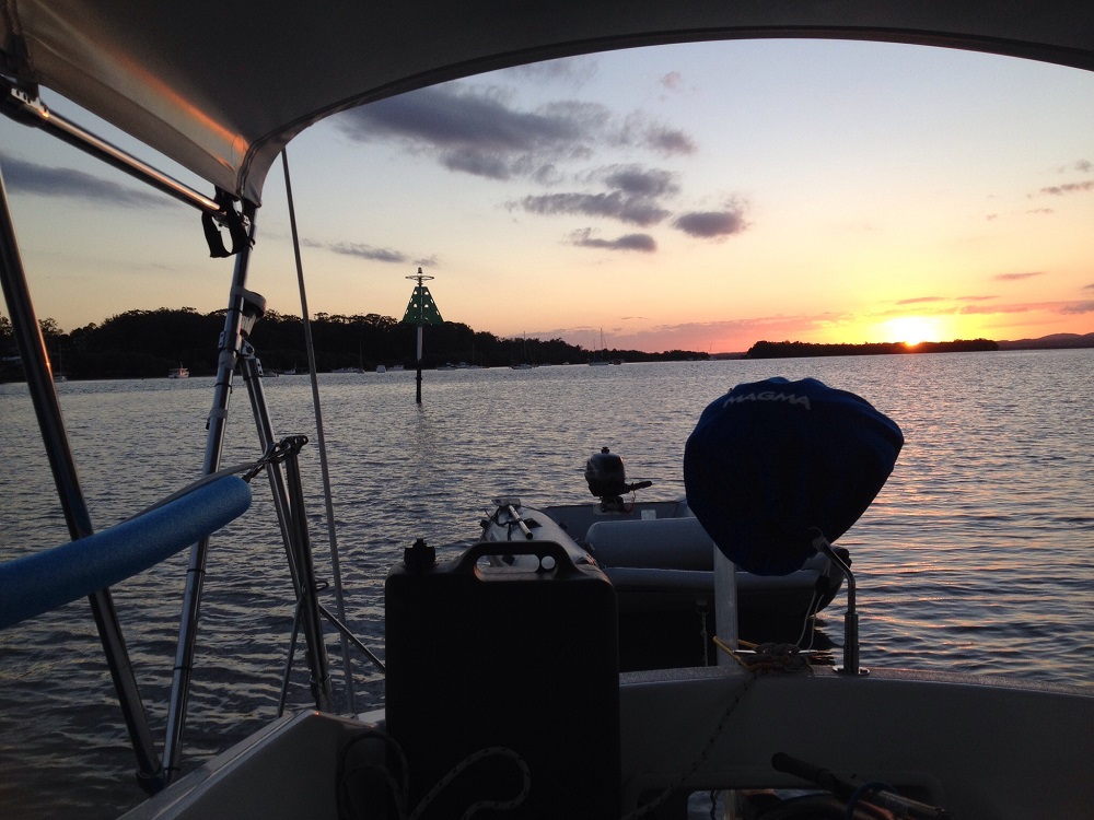
The much anticipated day of our third Tasmanian multi-day hike, the second with the Tasmanian Walking Company, dawned bright and clear with gentle winds – an important consideration! In Hobart we met our guide Bill and the other three couples we’d be walking and cohabiting with for the next 4 days. This hike, however has a major difference – we’ll be sailing between trailheads. A bus took us to Orford on the east coast where Lady Eugenie was anchored offshore.

The Lady Eugenie, a magnificent 75ft ketch-rigged yacht.

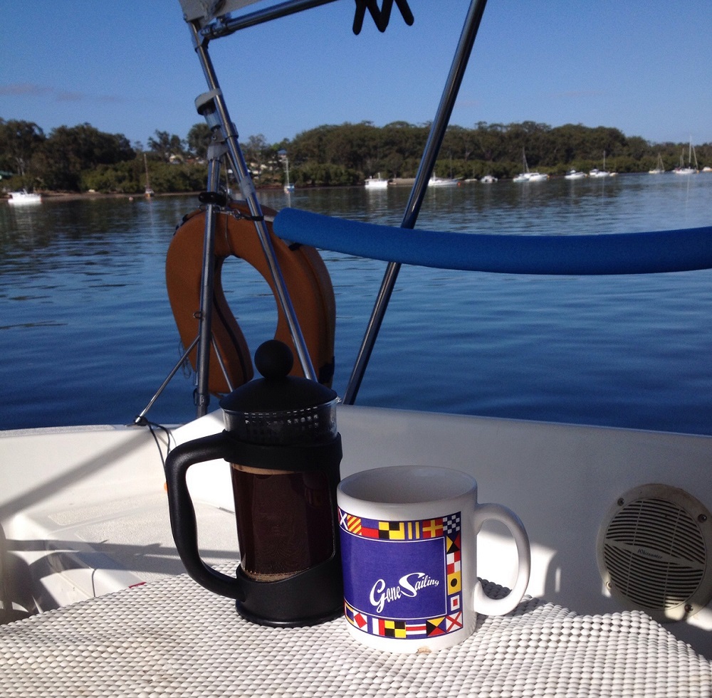
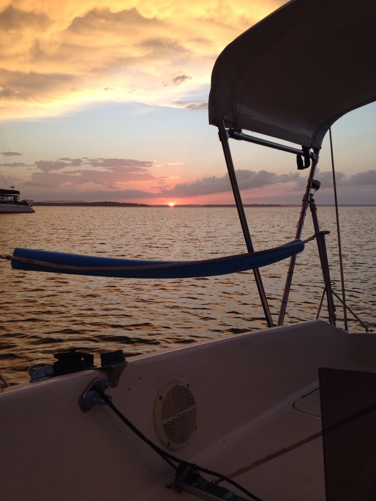
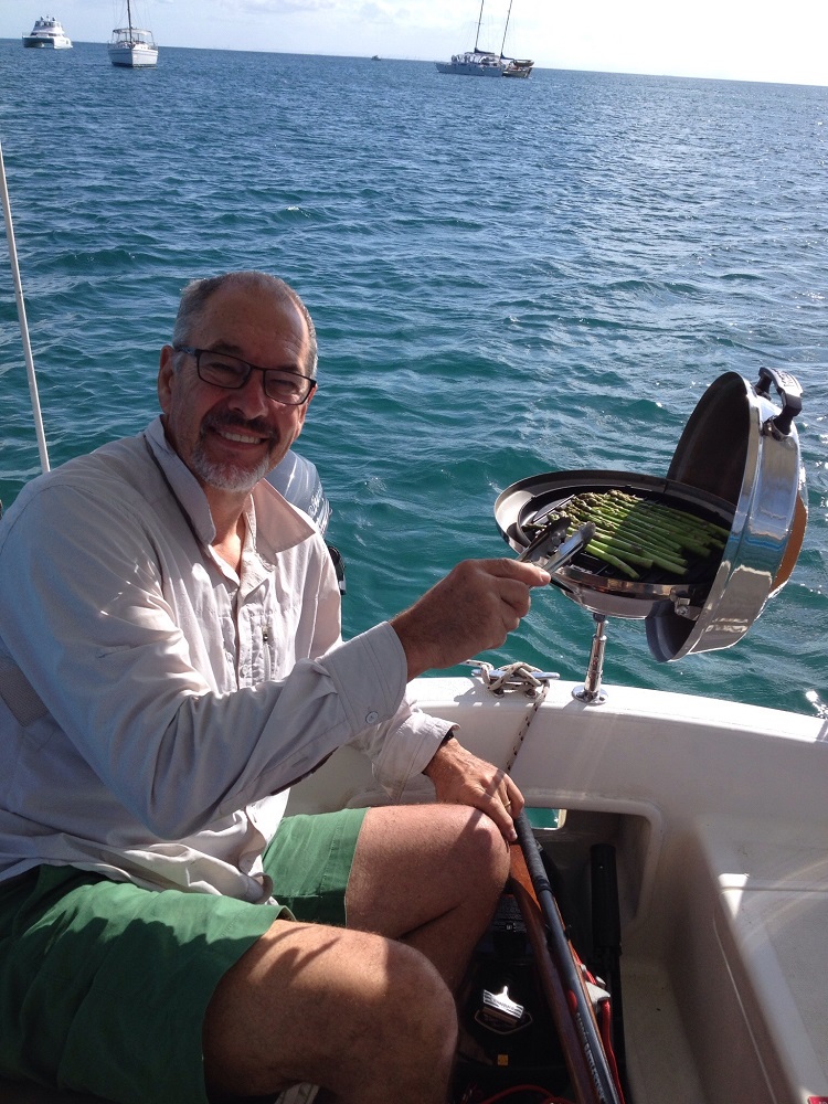
Lady Eugenie is beautiful – all polished and moulded timber and stainless steel. Each couple has their own cabin and ensuite. There’s heaps of room in the lounge below deck, which didn’t get much use due to the weather being so perfect, and the cockpit above where many deep, and not so deep discussions were had while we enjoyed our meals, a few wines and the incredible panorama. Hugo is the Skipper and Sam is first mate.

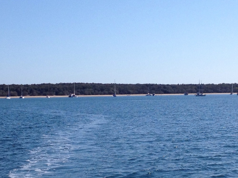
A short sail today across to Maria Island where the Lady Eugenie anchored off Hopground Beach. Hugo took us ashore in the dinghy, ready to start hiking. Here we joined the Frenches Farm Coastal Trail exploring the Painted Cliffs.

The vivid colours of the Painted Cliffs were formed when iron-enriched ground water soaked through the already formed sandstone layers – the iron interacting with the minerals in the sandstone forming swirls and waves and colours that range from rusty reds to oranges and even purples. It’s very beautiful, the cliffs extending for quite a distance.

Maria Island, like much of Tasmania, has convict labour to thank for the buildings on the island. Maria Island was declared a National Park in 1971. In recent years disease-free Tasmanian devils have been released on the island for the protection of the species.

Read about the history of Maria Island

Lunch today was at the Oast House. It’s one of the oldest oast houses in the country. In its heyday it was producing 3 tonnes of hops. Before you start imagining us at a lovely restaurant with a rustic menu I’ll mention that the Oast House is a ruin and our lunch was a pre-prepared salad we each carried in our backpacks.

It was built on two levels. The ventilation bricks can still be seen separating the two levels.

Darlington became the centre of activity during convict and early colonial days. Due to my sore knee I spent some time here exploring the old buildings and reading their history while the group continued their hike along the coast to the fossil cliffs.

I enjoyed the wildlife!
A Cape Barron Goose
‘Turbo chook’ is the affectionate name given to the Tasmanian Native Hen. However, they have no relationship to domestic chickens but belong to a group of waterfowl known as rails. Tasmanian Native Hens get their nickname from being a very fast runner, reaching speeds of 50 kph.

Dinner tonight in the cockpit, as it was every meal. Tonight we drifted to sleep gently rocked in our cosy bunks after a big day.

Mon 15th April

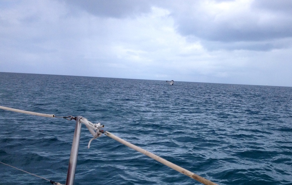
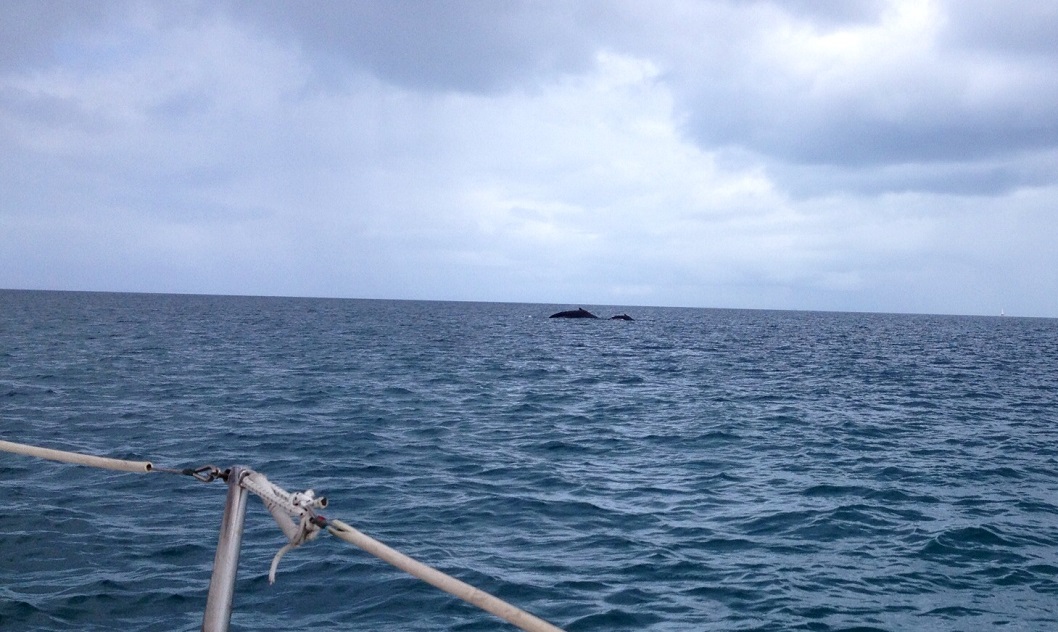
What a magic morning! After a lovely breakfast together sitting in the cockpit we had a magnificent sail for about 4 hours to get to Schouten Island. Rounding Maria Island the fossil cliffs plunging into the ocean were stunning. 

I’d like to think the Skipper found my assistance invaluable.
A little later we passed nearby to Iles de Phoques. A large colony of New Zealand fur seals call this tiny rocky island home.

Surprisingly there were seals high up on the rocky hill. These seals, unlike many other seal species, have jointed hips they can swivel which allows them to climb. It’s a noisy colony and the call of a seal is not melodious. 

Definitely the best seat on the boat.
A pod of dolphins joined us. Magic!
Anchored off Moreys Beach on the northern side of Schouten Is. Lunch before starting the hike. Cathy, Sam (first mate and chef), Steve and Dee.

Once onshore on Schouten Island we checked out a few historical huts before beginning the hike.

The hike up Bear Hill starts at the end of Moreys Beach.
Bear Hill is so named due to a rock formation that looks remarkably like a bear climbing the hill.

I elected not to do this climb feeling my knee was not quite up to this kind of a hike. The others reported the views from the top were wonderful, but questioned whether the difficult, rocky climb was really worth it – I was pleased I didn’t do it! 

Yay! A successful, if very strenuous climb of Bear Hill. Bill, Steve in front, Kate, Dee, Cathy and Carl with Rick at the back.
Back onboard Lady Eugenie Dee and I jumped in off the yacht for a swim.

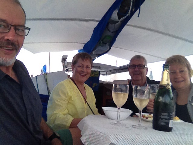
The cold water really takes your breath away, but so refreshing. A warm shower later and afternoon tea turned out to be champagne and fresh oysters. I was in heaven! 

Tuesday 16th April

Todays sail took us to Bryans Beach at the southern tip of Freycinet Peninsula. The southern section of this spectacular peninsula is only accessible to hikers and boaties.

Arriving at Bryans Beach. Anticipating the hike to come.
Bryans Beach with Lady Eugenie disappearing in the background. She’ll meet us again at Wineglass Bay.

Today will be our longest hike – 15.5km from Bryans Beach across the headland to Cooks Beach, over another headland to hike the full length of Hazards Beach before crossing the Peninsula on the Isthmus Track to the northern end of Wineglass Bay where we’ll hike the length of it to meet Lady Eugenie at the southern end.

Cooks Cottage

This cottage, which is on the southern end of Cooks Beach was built by graziers in 1859. It was in serious disrepair before being restored in 2007 by volunteers using many of the original bricks. Today it is only to be used as an emergency shelter.

Bill boiling the water for our morning tea. The water tank is greatly appreciated by multi-day hikers.
Morning tea (coffee, tea, hot chocolate and a bikkie) at Cooks Cottage. Carl, Dee, Michael (walking away), Cathy, Steve, Rick, Kate and Bill.
The path down to Cooks Beach
Banksia flowering.
Lunch on the rocks! We’ve walked the length of Cooks Beach, crossed over another headland and arrived at Hazards Beach.
Looking back down Hazards Beach – still more than half of it to go.

At the end of this beach we crossed over to the eastern side. Up until now the hike has been quite beautiful with the Hazards Range overlooking our every step, the bushland, some flowers, the birdlife and the crystal clear blue of the ocean lapping white beaches. Though it wasn’t long, the next section crossing the Peninsula was unattractive with dried up marshes and scant bushland.

Wow what a joy to come out at Wineglass Bay. So beautiful.

The beach hiking here though was really difficult, being high tide we were forced to hike in soft sand. Some found it a lot easier to take the boots off and walk on the wave line or even in the water.

Bill at Wineglass Bay
Lady Eugenie in Wineglass Bay with the pink granite peaks of the Hazards Range watching over her.

Another refreshing swim off the yacht and a glass of wine before dinner ended another magical day of hiking.

Wed 17th April

The Lady Eugenie remained anchored in the protected southern part of Wineglass Bay overnight. This morning it was just a tender transfer back onto the beach for today’s hike.

A beautiful time of day to start our hike on Wineglass Bay

We farewelled Hugo and Sam, then headed off to hike the length of the beach before we joined the track. 

There’s 1000 stairs to climb to reach the Wineglass Bay Lookout. That’s not to be sneezed at! The views of this perfect bay were stunning – the tight-curve of the white sand beach forming a compact bay with deep blue ocean and a cloudless sky – perfection. The surrounding forested and bare pink granite mountains contrasted so starkly. It was a very powerful land- and sea-scape.

The crew at the Wineglass Bay Lookout

You can use your imagination as to why it’s called Wineglass Bay, but you’d probably be wrong. This was a whaling area and whales were dragged into this bay before being slaughtered. The waters of this magnificent bay ran red with their blood, making it look like a glass of red wine.

At the Wineglass Bay Lookout with the beautiful pink granite rocks around us.

Down the other side and we’re, sadly, back to civilisation with so many tourists and cars. We paused for a rest and enjoyed watching the tourists setting off to the Lookout. One man was overheard reassuring his reluctant wife that it was “only 3km” – he didn’t realise that was 1.5km of climbing and 1.5km of descent to get back. 

This map shows the two hikes we did on the Freycinet Peninsula. Find Cooks Beach on the top right, then follow the path away to the unnamed beach, that’s Bryans Beach where we started yesterday. From Cooks Beach follow it to Hazards Beach then to the Isthmus Track then down to the far end of Wineglass Bay (where the tent symbol is). Today we hiked back along Wineglass Bay to the Wineglass Bay Track (and the 1000steps) to the Lookout then down the other side to where it says “You are here”. We then followed the yellow dotted trail hiking to Honeymoon Bay (off the map).

The hike to Honeymoon Bay was easy with the trail more-or-less following alongside the road. Despite most of it being through forest the rocky ranges of Mt Amos and Mt Dove towered above us. Honeymoon Bay was a delight – small, no one here and lovely warm granite rocks to sit on to eat our lunch while we watched several of our party swimming. 

And so ended our wonderful sail/hike with these people who will remain friends.

After about an hour of delightful relaxation here the bus arrived to take us back to Hobart – but not before a lovely cheese platter and wine tasting at Darlington Vineyard just outside Orford. For those worried about my knee it was fine for the last two hikes and has continued to improve ever since.

We met up with Kate and Ric, and Dee and Carl at the Blue Eye restaurant at Salamanca Place where we enjoyed a seafood dinner before farewelling them and heading back to our cosy motorhome for a restful sleep in our own bed. A great time of sailing and hiking. 

Days 9 and 10: Manly marina and home

The weather deteriorated throughout the day, getting really bad this afternoon and evening. We went for a very long walk 10+K along the foreshore to make up for our lack of exercise over the last week and spent the rest of the day tinkering with the boat.

2nd October
Well it sure did come in last night. The southeasterly change hit and was blowing over 40 knots which is classified as gale force. We were happily and safely snuggled up in the marina without a care. Phew!

Anyway it more or less blew itself out last night and by this morning the forecast was down to 10-15 knots and moving around to the east, on it’s way to northerlies again! We’d planned an after lunch departure to catch a north-flowing tide which would have meant some night sailing which would have been lovely. But in view of losing the southerly winds we left Manly marina for Scarborough marina just after breakfast.

coffee pots POB

The Coffee Pots – channel markers into Port of Brisbane

It’s a 22 nautical mile sail (pretty long) and we got in to Scarborough at 3pm. One of the higher stress times is crossing the entrance channel to Port of Brisbane. You have to tune in to their VHF channel and monitor it, timing your crossing to not disrupt a ship. Actually a small yacht like ours wouldn’t disrupt them, but we’d probably have ended up on the 6 o’clock news! Anyway as it turns out our timing was good and we slipped easily in between them without a worry.

We’re now moored at Scarborough marina at the end of our first long-ish period of cruising. 10 days of predominantly wonderful sailing and good times. We learnt many lessons and gained bucket loads of confidence. We’re now looking forward to long periods around other cruising grounds – maybe next year!

Soon after I send this we’ll walk over to Morgans Seafood where we’re booked in for their seafood smorgasbord. What better way to end the trip. We’ll sleep aboard on the marina tonight, pull Top Shelf out tomorrow and derig her before towing her home.

To see all the photos from our Moreton Bay sailing adventure CLICK HERE.

Day 8: Horseshoe Bay to Manly Marina

Well the weather forecast is getting steadily worse. Despite waking to an absolutely glorious morning in Horseshoe Bay and really longing to spend a day swimming in its lovely clear waters, walking (maybe even going for a run) on it’s lovely beach we really have to head to an anchorage where we’ll be protected from pretty bad south easterly winds – and the best place to be when there’s a bad blow is a marina.
So 8am saw us hoisting sails and heading north. Lovely sailing again. Saw a dugong! We were safely tied up on Manly marina just after lunch time. Our friends Vicki and John have their boat moored here, so we gave them a call and invited them over to Top Shelf for sundowners. A lovely evening was had while we watched the wind get stronger.

sundowners

Sundowners!

Day 7: Russell Is to Horseshoe Bay

coffee Russell Is

Morning coffee – idyllic

The night was just as pleasant as anticipated. Woke to a totally calm anchorage and enjoyed breakfast and coffee in the cockpit.
The forecast over the next few days is getting gradually worse (sad smiley). Today the winds will be pretty good until after lunch when they’ll start getting stronger and come from the north. Tomorrow and Wednesday they’ll be much stronger northerlies and Wednesday night they turn to strong to gale force from the south east. We’re now wanting to head north to finish our trip – so don’t want northerlies!

Anyway tomorrow is another day and today we motored around Karragarra and Macleay Islands before sailing back to Horseshoe Bay on Peel Island. The channels around these southern bay islands are very narrow and relatively shallow. You couldn’t sail them unless you had a gentle wind from directly behind and the motor running. Macleay Island, like Russell is fairly extensively inhabited – lots of large expensive homes overlooking the Bay – just above the midgie, oh I mean mangrove line! Nup, not for me.
Once we cleared the narrow channels and headed north along the western coast of Macleay we put the sails up and had a truly delightful sail all the way to Peel. Times like those are what keep you wanting to sail.

Another interesting factoid about Peel Is. Apparently in the ’60s the Island was sold to Keith Williams. He is the developer who put the resort on Hamilton Is. He wanted to build the resort here on Peel, but the council turned down his application to have exclusive use of Horseshoe Bay for his resort – so it never happened. Interesting ‘sliding doors’ situation wondering what the other Moreton Bay islands and Cleveland would be like now had it been approved.

(PS: Happy birthday Deb.)

horseshoe bay

Horseshoe Bay on Peel Island

Day 6: Blaksleys to Russell Is

The gods smiled on us at last and made all the other storms that were around last night go around us. Not complaining! Surprisingly we both slept very well and woke up to a lovely morning.

We left Blaksleys after breakfast heading to Russell Is where we could do some re-provisioning and wander around civilisation of sorts again for a while. Winds were from the south-south-east and high tide at 12.20. Most of our route was directly south, so we did a bit of tacking, but with pleasant winds and a flooding tide it was another good sail.

At this southern end of Moreton Bay there are lots of islands and even more sand banks with narrow passages between them. Ideal conditions for a trailer sailer because if you run aground you just wind up the keel. And no, we didn’t run aground!

After anchoring -very carefully- we went ashore.
A permanent population of around 2500 live on Russell, so it has a reasonable little shopping area with an IGA. It’s serviced by a regular passenger ferry, about half-hourly, and a barge which transports cars and their passengers. There’s a small primary school, but the children go to Victoria Point on the mainland for high school.

Steve noticed that a woman on the trailer sailer forum we follow lives on the Island and invited fellow trailer sailors to drop in to see her. We rang and spent a pleasant couple of hours with her and her daughter. She’s an artist and has a pretty amazing collection of, well, everything really. Her daughter is in year 11 and is being home-schooled. She told me she’s been sailing Moreton Bay for years and learnt to sail here. She assured me there are two types of Moreton Bay sailors – those who unintentionally spend a night on a sandbank and those who lie and say they haven’t. LOT’S of sandbanks!

We picked up a few more groceries, some water and sat at the cafe for a while before heading back to the boat. Little Takka, our Takacat tender, has been fabulous. Lots of fun zipping around in it.
Sundowners with some bubbles (mineral water!) and hors d’oeuvres was a fine ending to a lovely day – calm waters and the sun setting over the adjacent island off our stern – perfect. A very calm night anticipated.

sunset_karagarra_channel

Day 5: Blaksleys

Lovely day today. Steve did some fishing before breakfast and caught 3 bream which was pretty exciting, except they were under-size.  He gave up after that, obviously we were anchored over a fish kindergarten. Decided not to move on today after our stressful episode last night. Watched our position closely through both high and low tides. No dragging.

bom warning

The pointer indicates where we’re anchored!

About 3.30pm a ‘dangerous thunderstorm’ hit (as described by the Bureau of Meteorology). We were prepared and had a contingency if we were to drag and dammit if we didn’t – directly towards a power boat that had just anchored before the storm hit. Steve jumped onto the outboard and we motored to support the anchor and stop going back any further. Scary! Particularly as it was hailing and Steve had to sit out there in it. No doubt we would have hit the other boat if he hadn’t.

hail storm

Note the hail, and poor Steve!

Fortunately it was a fast moving storm and all over in about 15 minutes. We then retrieved our anchor to discover it had been fouled with some scrap rubber stuff which prevented one of the flukes from digging in. Reset anchor.
On the up side a very large cat that was anchored down from us also dragged his anchor and moved right over where we would have been if we hadn’t also dragged. A guardian angel?
More storms forecast so we’ve now put out a second anchor. Another unsettled night I fear.

after storm

A couple of hours later!

Day 4: Horseshoe Bay to Blaksleys

The wind was forecast to return to the south east, so Horseshoe Bay was no longer suitable. We left early for Blaksleys Anchorage on North Stradbroke Is. It was only 5+nm and took us 2 hours in light fluky winds. There’s a small beach here – 20 minutes walk from one end to the other, and there are lots of families camping. They come over on run-abouts, set up camp and use the boat for fishing, and also dragging screaming children behind them in inflatable tubes. Not the most peaceful place. But hey, I hope my grandchildren get to experience similar fun and freedom as they’re growing up.
We christened the yabby pump at low tide, gathering enough yabbies for fish bait. Mmmm I could already taste the fresh fish we’d have for tea. But … neither of us could be bothered fishing that evening!
We’d just finished dinner and were inside obliviously reading or talking when the skipper from the boat down from us hailed us. We were dragging our anchor and were awfully close to him.
It was weird – wind against tide with wind winning. We were bow to the south, anchor line under the boat and behind us. So in the dark we retrieved it and reset it, 3 times before we hoped it had set. Up and down all night checking to see it was OK.

Day 3: The Sandhills to Horseshoe Bay

Despite my complaints about the weather forecast it is something we read and memorise religiously all the time while sailing – that, and the state of the tide. The forecast comes out twice a day (ridiculously inadequate frequency!) around 4 morning and night. The forecast for today is north-westerlies 10-15 knots and high tide at 9.40am (the tide floods to the south). Anywhere on the west coast of Moreton is a lousy anchorage in a westerly, so last night we made the decision to move to a better anchorage this morning. Horseshoe Bay on Peel Island gives good protection in westerlies and that lay south of us – northerlies and a flooding tide sound good when you want to head south, but it was a long trip, 16nm and we’d probably be fighting the tide after it turned for the last half of the trip. We planned to get up, have brekkie and get away about 7.30am. After the long trip over on Tuesday I was dreading it.
The north-westerly came in an hour or so before dawn. We were both woken with the boat rolling very uncomfortably – no more sleep for us. No brekkie either as I couldn’t keep the kettle on the stove it was rolling so much. As soon as it was daylight we left – at 5.45am.

whale fluke

Whale fluke

two whales

Mother whale and her calf.

As it turned out it was a magnificent sail. The highlight was seeing two whales, but also saw turtles and dolphins. It was so smooth sailing I even managed to cook us an omelet each for breakfast as we went. We were safely anchored off Horseshoe Bay at 10.30 – less than 5 hours -> that’s how long a 16nm sail should take!


Peel Is used to be a quarantine station and a leper colony and is now a protected conservation area. Boaties are only allowed to land at Horseshoe and Platypus Beaches, and there’s camping just inside the foredunes … but no wandering around beyond there! That’s fine – the beach was lovely and long and we went for a great walk the length of it and inside looking at the camping sites (no campers).
That evening we christened the BBQ. Started with asparagus dijonaise, followed by feta stuffed chicken wrapped in prosciutto. Delicious!

christening the BBQ

Yum! Looking forward to dinner.


Day 2: Tangalooma to The Sandhills

Being school holidays Tangalooma is buzzing with people. We’re coming back in a couple of weeks as guests at the resort with the crew from work so decided to move on down Moreton Is to The Sandhills. There’s the Big Sandhill and the Small Sandhill. These are sand blows that are quite massive, the Small Sandhill going 2km from west coast to east coast.
It was a short sail, 8.7nm and took us 2 hours. The sailing was delightful, fast and smooth. Just what we needed after yesterday. The anchorage was calm.
Once again though we didn’t leave the boat – did chores on the boat and rested and read books. Had a quick swim off the boat and rinsed off with the solar shower in the cockpit.

small sandhills

Small sandhills.

Day 1: Scarborough to Tangalooma

Decided to launch as soon as we could then have breakfast on the way. Our destination – the Wrecks at Tangalooma on the western coast of Moreton Island. Tangalooma is a resort, and a very pleasant one at that. Beautiful long white sand beaches and snorkelling around the wrecks, the bar, etc. The Wrecks are old ships that were scuttled to form a reef for fish, a dive location and protection for boats from westerly winds. The main shipping channel out of Port of Brisbane passes within a nautical mile of the anchorage – all ships leaving the port must head north along this channel as far as Caloundra before heading wherever they’re going. These ships create a rolly swell as they pass which is quite unpleasant, hence anchoring between the wrecks and the beach is the place to be. It can get very crowded – not good when boats are swinging in all directions as tide and wind change.

Anyway after a problem-free launch (only forgot to put the wind direction indicator on the top of the mast) we were away at 9.30am with a forecast of south-easterlies at 10 – 15 knots – perfect for a close-hauled reach to our due-east destination. Well … forecasts seem to be a bit like crystal ball gazing. We rounded the clear water beacon and headed east, and that was directly into the wind! And nasty 1 – 1.5 meter seas to go with it. To cut a long story short our estimated 4 hour sail of 15nm turned into 7 hours and 26 nm later by the time we tacked and fought the swell. The last two hours we relented and motored. We finally anchored, absolutely knackered at 4.30pm. Good start to the diet – couldn’t even boil the kettle it was so rough. I did manage to make us a salad about lunch time, and felt a trifle sea sick working down in the galley in those conditions.
No going ashore, no runs on the beach, no snorkelling the Wrecks – too exhausted. Just rested onboard.