1st – 5th July 2017
Saturday 1st
Just a transfer – back to Exmouth to restock everything and catch up on the world – how did we ever manage before the Internet? Then an uneventful drive south to Lyndon River free camp for the night. WA has positioned these free camps fairly regularly along the highways – big open areas to park, toilets, picnic tables, a dump point, bins and even wifi sometimes. They are excellent for an overnight stop on the way to somewhere. – well done WA.
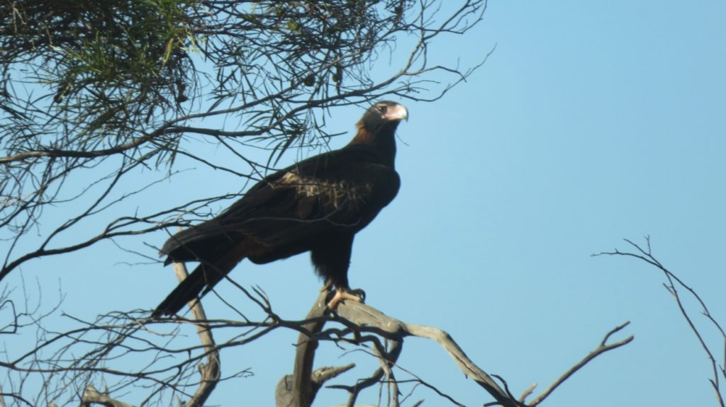
Eagle – We saw dozens of these majestic birds all through the inland, cleaning up road kill.
Sunday 2nd
A long drive today, continuing down the coast road to Carnarvon before heading east to Gascoyne Junction. The school holidays have begun – all good grey nomads know to either stay put during holiday times, or stay away from the coast. We chose to head inland. But first, lunch in Carnarvon. It was funny to be driving through mallee, acacia and even salt bush again then very suddenly find ourselves amongst market gardens, banana plantations and mango orchards as we approached Carnarvon.
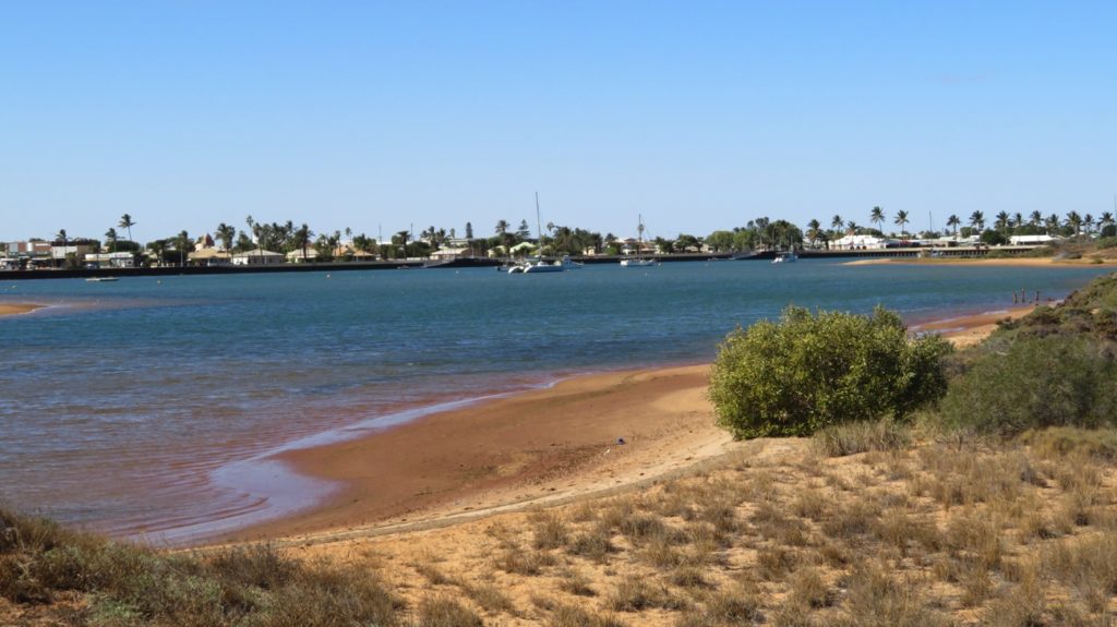
Carnarvon foreshore.
After our lunch and a walk along the foreshore and over the old tramway bridge we headed out to Gascoyne Junction. Our campsite is simply listed as Picnic Area in WikiCamps and has some pretty weird comments. Being the one who chose this as our destination I was a bit nervous about it, needlessly! It’s a lovely spot on the edge of the Gascoyne River, which here is a wide, deep pool with black swans and other waterbirds gracing its waters – it doesn’t actually flow unless there’s been a significant rain event.
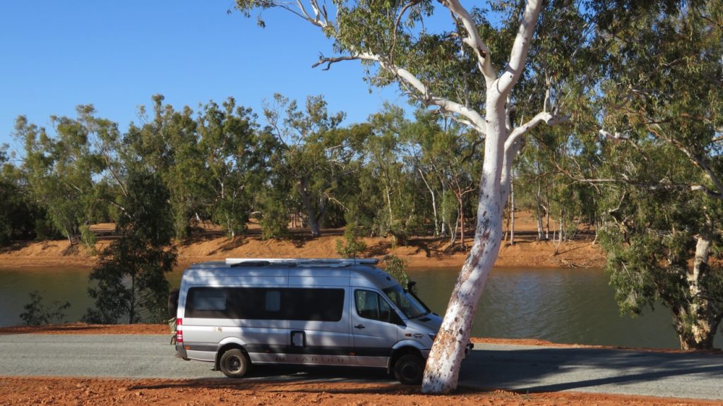
Another lovely, quiet campsite beside the Gascoyne River outside Gascoyne Junction.
Monday 3rd
Leaving Gascoyne Junction we headed north to Kennedy Range National Park. Interesting drive along a very good, unsealed road following the dry Lyons River with the usual mallee, acacias and spinifex growing on the plains, flat as far as the eye could see. Until, suddenly a perfectly flat-topped Range appeared on the horizon. Kennedy Range, or Mundatharrda as it’s been known to the indigenous people for centuries, is a 75km x 25km mesa that rises about 100m above the plains and is formed of sandstone and shale laid down when the area was under the ocean.
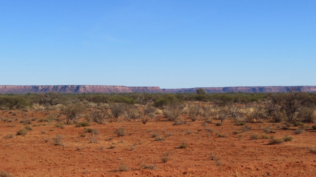
The mesa of Kennedy Range.
The weathered southern and eastern sides have spectacular cliffs and gorges eroded by the rivulets that would join the Lyons River, should it rain!
This road is a part of the Woolwagon Way (one of the tourist routes promoted by WA tourism). We came upon the cobblestone road which was built by pick and shovel in the 1920s so that the new form of transport for the wool, the truck, wouldn’t get bogged so easily. What a mammoth task!
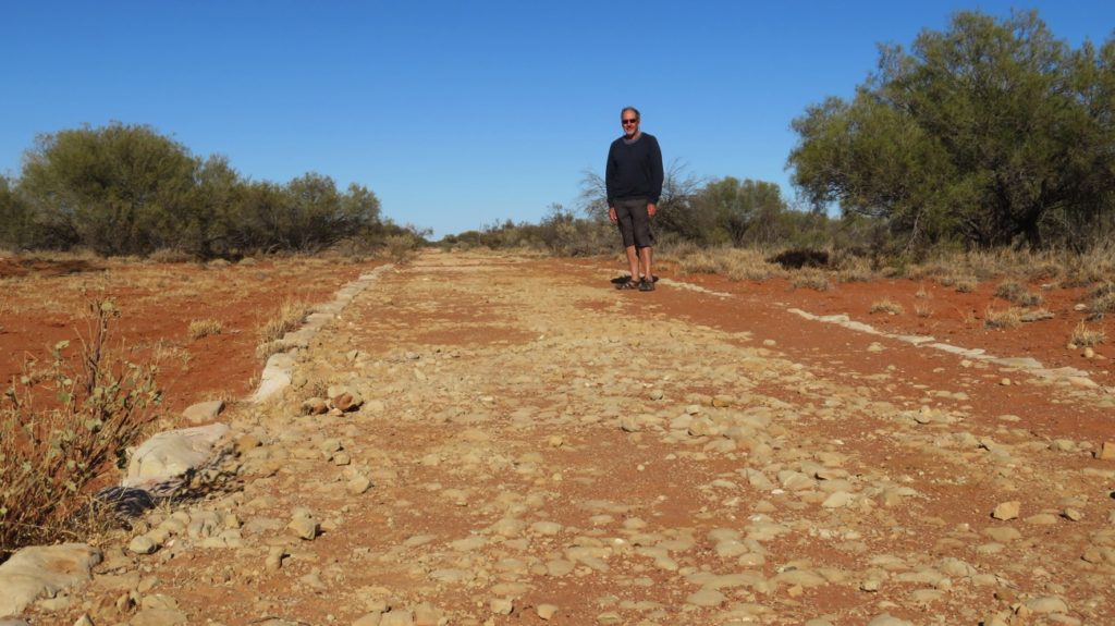
Cobblestone Road.
A rather nice feature the WA National Parks has is volunteer camp hosts at their campsites. The hosts greet new arrivals, give basic information about the national park, suggest the activities available, take the camping fees ($11/night here) when not prebooked online and facilitate the sundowners. All the hosts we’ve met have been very pleasant. Most are retirees who stay, free of charge, in their own van or motorhome for about 4 weeks before the next volunteers take over.
After settling in, ie having lunch, getting dinner into the Dreampot and doing the washing, we headed off to do the Escarpment Trail, a 4km Class 3 walk that involved lots of scrambling over rocks as we climbed up the length of a Gorge to reach the top of the mesa. A difficult climb. However the rewards were there with lovely views to the horizon over the plains, while closer in we could see down into the gorges and way down to the camping ground.
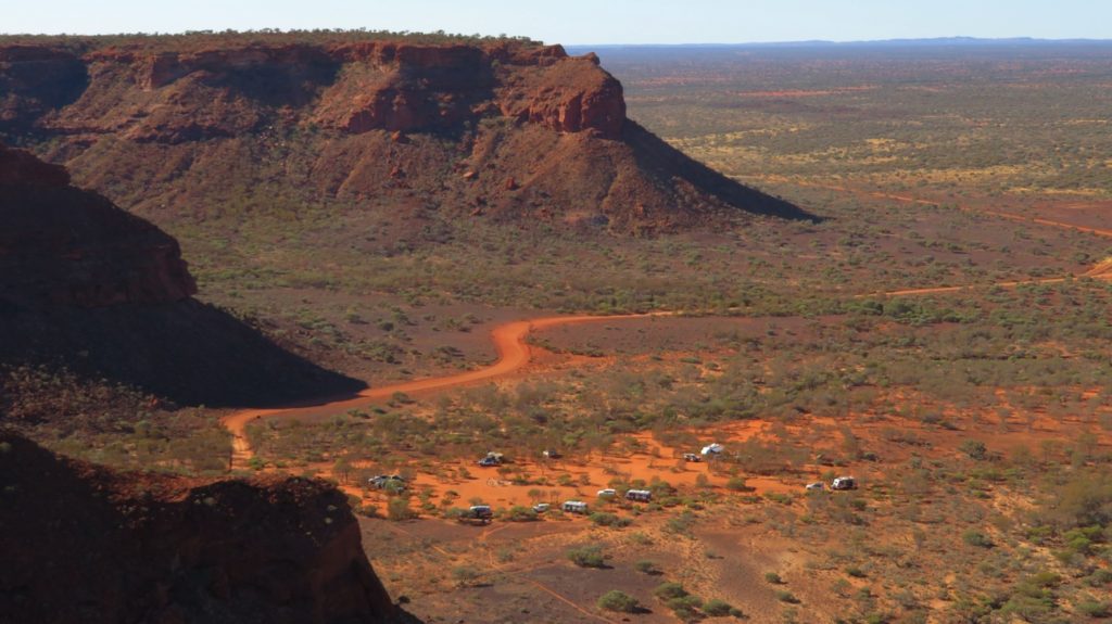
Our camping area at Kennedy Range National Park
The rocks were very interesting here – so many different colours. The shale layer was shaped so oddly in places it looked like it was formed by volcanic activity into lava tubes – but no mention of volcanic formation in the literature, so probably not. As the light changed it went from jet black to indigo blue and dark purple.
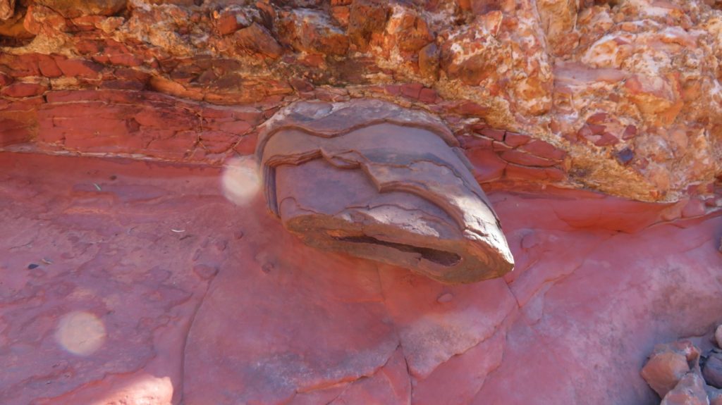
More of these very peculiar rocks that could be lava, if we didn’t know better.
Sundowners was around a large communal fire pit chatting to the other campers. It’s enjoyable to talk to someone other than each other, and you get great tips on other places to stay.
Tuesday 4th
The walks to Honeycomb Gorge and Sunrise View were on the agenda today, about 10 to 12 km. Honeycomb Gorge was a surprise. I’d never seen landforms like it before – caused by weathering of the sandstone.
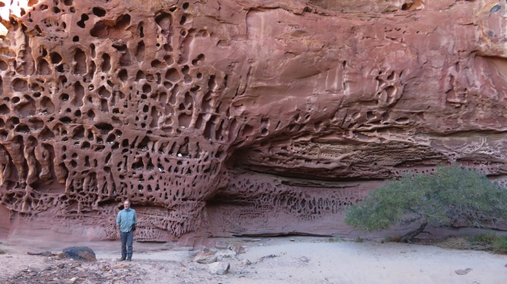
Amazing! What a stunning landform. Honeycomb Gorge
Sunrise View, not surprisingly on the eastern side of the Range, had views over the plains. The walks were from the campground and followed the base of the Range amongst the huge boulders that had tumbled down from above – fortunately none loose today.
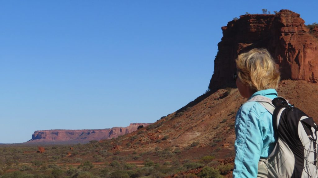
From Sunrise Lookout
Another pleasant sundowners around the communal fire pit with the other campers.
Wednesday 5th
Still two more walks to do here – one into Temple Gorge, the other into Draper Gorge. Both walks were quite challenging the further we walked into the gorges as we scrambled over and climbed up boulders and along ledges. Both had permanent pools at their head, at the base of what would be waterfalls in the wet season.
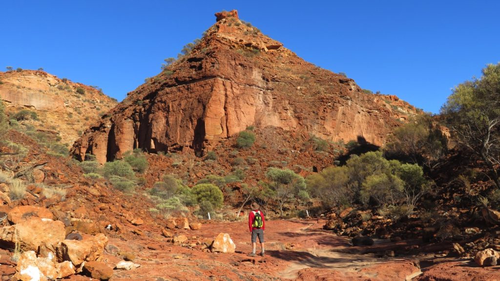
The ‘temple’ at Temple Gorge.
Back at Priscilla we farewelled the Kennedy Range National Park and moved back to our free camp at Gascoyne Junction, which now has No Camping signs around it. We camped further in along the dirt road beside the river, out of sight. Gascoyne Junction is a tiny place with few visible people, even the fuel station is automatic. They do however have a very expensive caravan park, $40 for a powered site, hence our choice to stay where we did.
To see more of our photos from this part of our adventure CLICK HERE