
12th – 14th March 2017
Sunday 12th
Fuelled, watered, showered (at Info Centre), fruit and veggies replaced, got the good guff from the Info Centre before we headed off to Mungo National Park. We’d heard varying stories about the condition of the road, from it being so bad tyres were shredded to ‘it’s OK, just a bit corrugated’. As it turns out it was surprisingly good – unsealed, a few areas of corrugations, a few areas of washouts, but on the whole not too bad. A 2.5 hour trip.
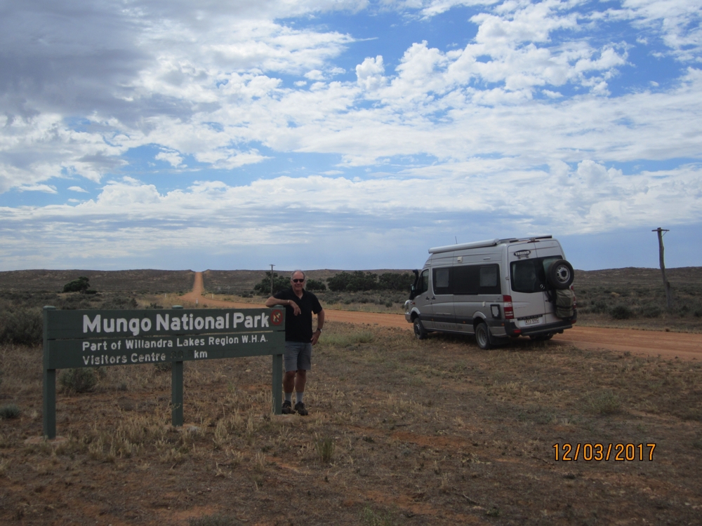
Nearly there. Just up and over those salt bush covered sand dunes.
Mungo National Park is World Heritage listed for both its geological significance and its cultural significance. It first came to national and international attention in 1968 when the remains of Mungo Lady were found. A few years later Mungo Man was revealed. It’s been agreed that these two people lived 42,000 years ago, the oldest bodies found in Australia and anywhere outside Africa. Apart from many ancient artefacts, archaeologists also uncovered footprints of a group of people, including children, in ancient mudflats.
The remains of Mungo Lady and Mungo Man were found in weathering ‘lunettes’ on the banks of Lake Mungo. Lunettes are formed only in specific and rare geological conditions, hence another reason why Mungo is such an important location. Lake Mungo and the other lakes in the Willandra Lakes area have been dry now for several thousand years.
White settlers came to the area in the mid 1800”s farming sheep on the saltbush that covers the ancient lake beds. Their arrival decimated the indigenous culture and people. National Parks has taken over the care of the particularly sensitive areas and indigenous rangers from the 3 tribes that lived in the region are the custodians.
The Discovery Centre at the entrance to the park tells the geological, aboriginal and pastoral histories.
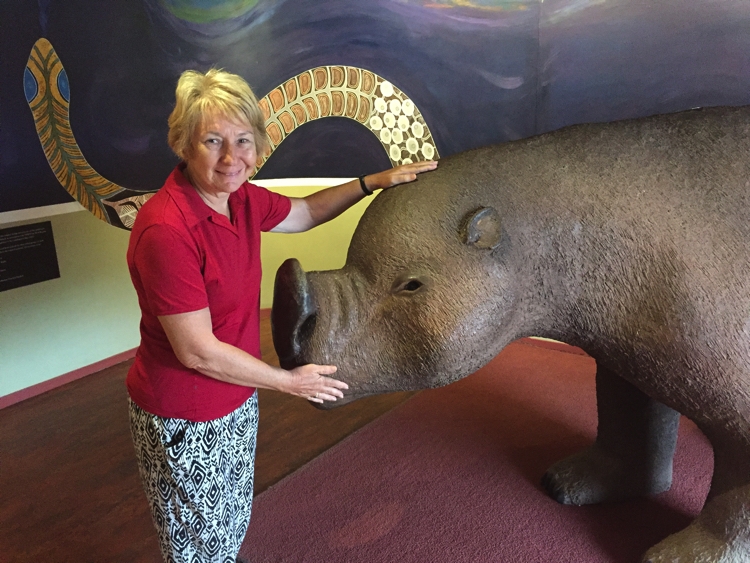
Megafauna – a wombat, apparently! Not so cuddly and cute back then.
After getting ourselves well-informed we did the 7+km walk called the Pastoral Loop which took us from Mungo Station (at the Discovery Centre) along the lake to the old Zanci Station shearing sheds and what remains of the homestead, then back to Mungo Station shearing sheds. We enjoyed the walk through Mallee and saltbush and found the information at the shearing sheds really interesting.
Not much remains of Zanci Homestead.
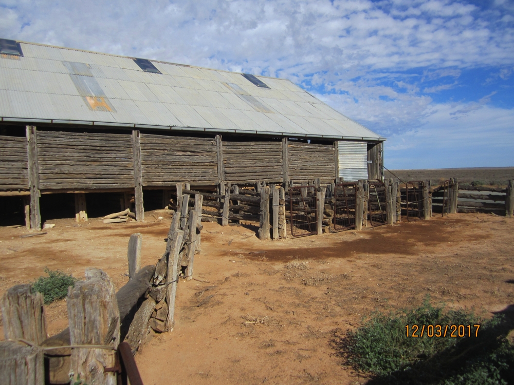
Mungo Station shearing sheds. Note the ‘dropped log’ construction of the walls. When the shed was first built shearing was done with hand clippers and there were many shearers, as times changed and steam-engine powered clippers became available the number of shearers was reduced to 5. Hence only the last 5 bays have the corrals for the shorn sheep.
We camped at Main Camp with about half a dozen other vehicles – good camp, large sites with tables.
Monday 13th
It rained a bit overnight and in this country it doesn’t take much to close roads. Fortunately the park roads are still open because we’re doing a tour with the Ranger to the Walls of China – the lunettes on the eastern side of the lake. ($35pp). We drive to the lookout, but with the Ranger we’re able to go onto the lunettes to see the layers formed over the last 50,000 years or so and see the fossils at various layers.
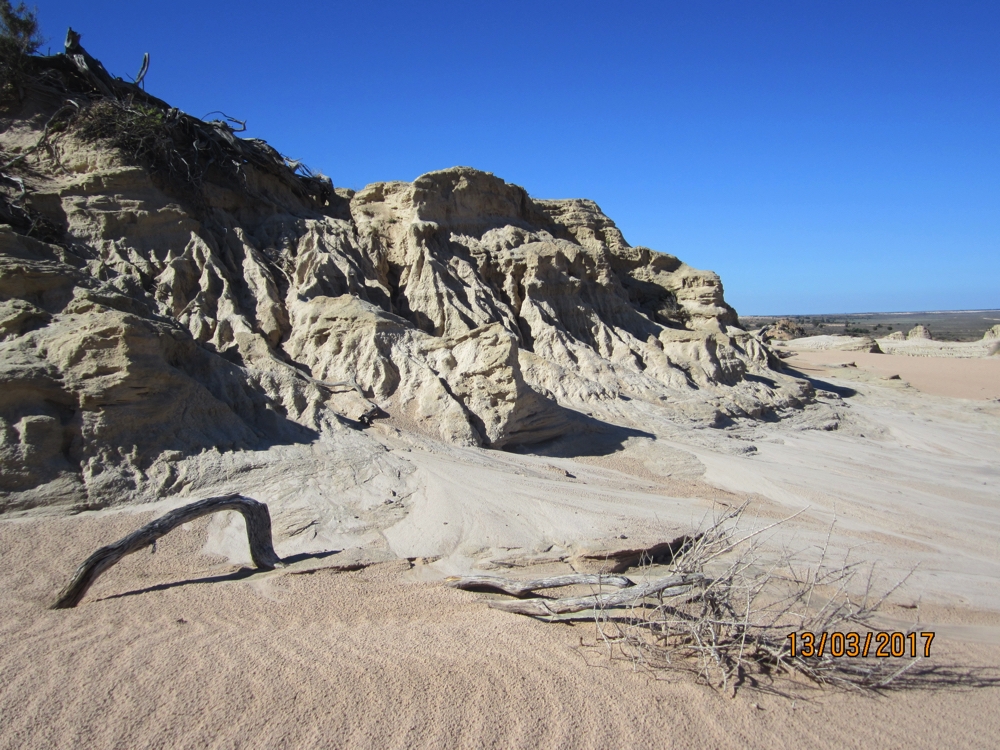
Walls of China. Even the sand in the foreground tries to make you believe you’re on the foreshore.
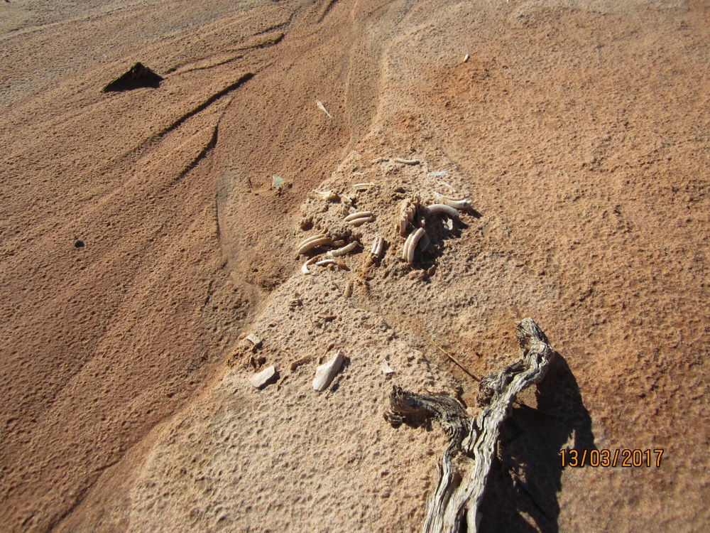
The bones of a wombat that died many thousands of years ago. As the Walls weather more of these fossils are being exposed.
He’s also able to tell us about aboriginal ways and practices. A tour well worth doing.
Following this we continue on the 70 km loop around the Park pausing at various points of interest where there are lookouts or short walks before stopping about half way around at Belah Campsite where we stay for the night. The National Parks have produced a leaflet with these points of interest explained. It’s a full moon tonight which would have been spectacular over the lake, however where we are is in the middle of a grove of trees. One other camper here.
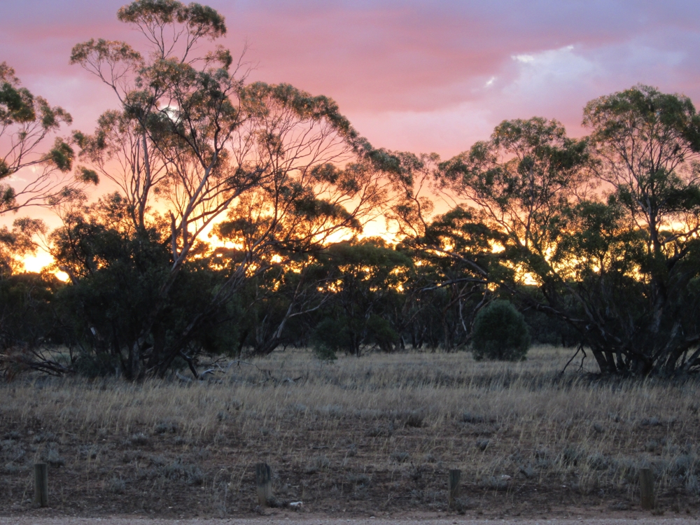
Sunset from Belah Campsite.
Tuesday 14th
We continued the loop with more sights on the way. Saw quite a few emus and several kangaroos. Birds are plentiful here with flocks of galahs, pink cockatoos and many small birds, particularly around the naturally occurring soaks.
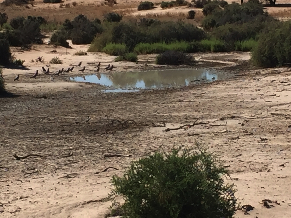
Pink Galahs having a drink at one of the naturally occurring soaks. It rained a little last night so more water there than usual.
Back at the Discovery Centre we have a hot shower (unexpected luxury in a place with so little water), and speak to the Ranger about the best road out. Arumpo Rd, to Mildura, is badly corrugated as a result of trucks going to a mine somewhere along it. We head off west via the Top Hut Road, which for the first 30 km of the 55 km unsealed section is very good – sand over hard clay. The last 25 km though – corrugations! We survived with no casualties.
Onwards to Wentworth. Here the Darling River, which gets its water from all the south western Queensland rivers joins the Murray. The confluence (where they meet) is quite striking as the Darling waters are a milky greenish colour and the Murray’s are brown. They don’t seem to mix too much until they reach a weir just downstream.
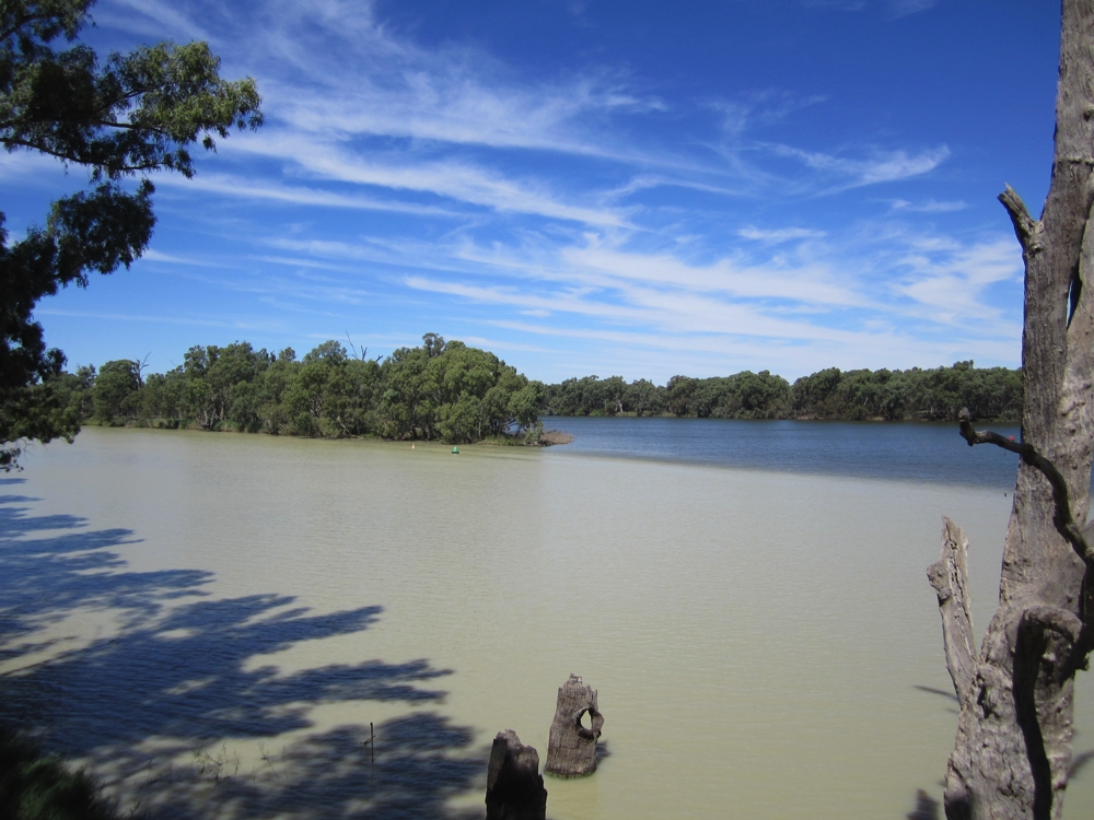
The confluence of the Darling River, closest and the Murray River in the background.
It wasn’t far from here where we spent the night back beside the Murray surrounded by enormous old River Redgums- what a contrast to the arid landscapes of the last two nights.
To see more of our Mungo NP photos CLICK HERE.