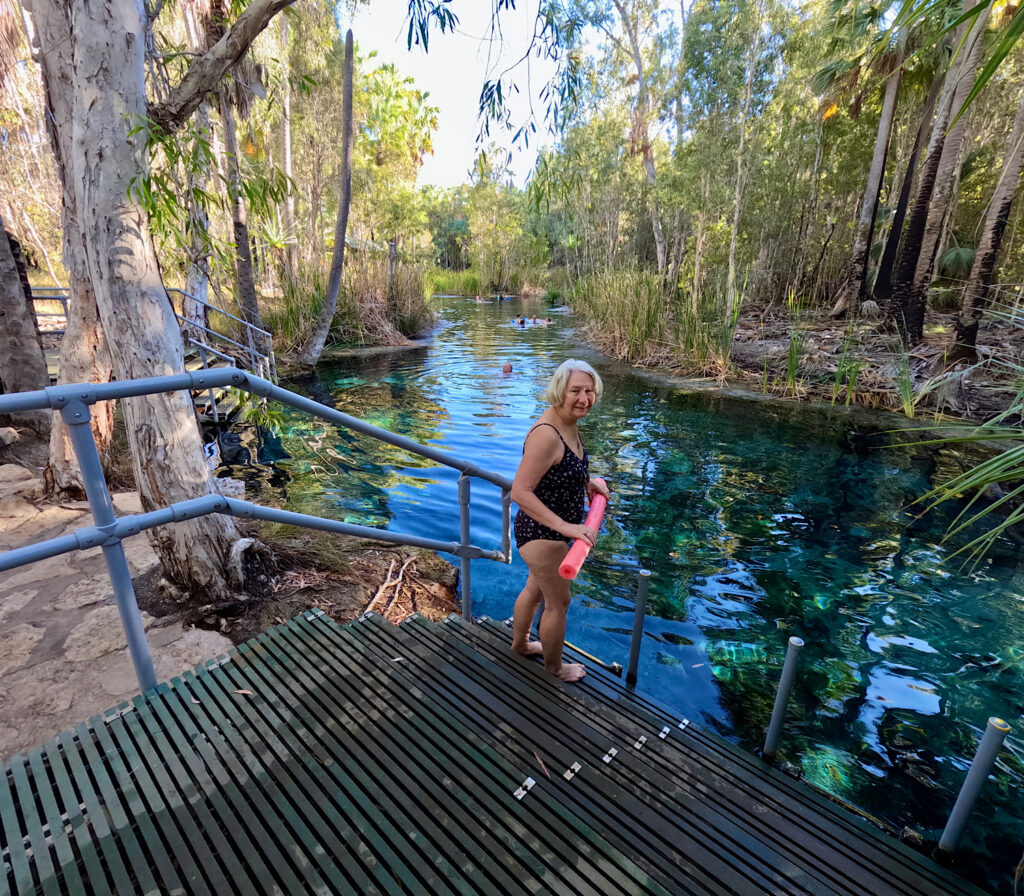
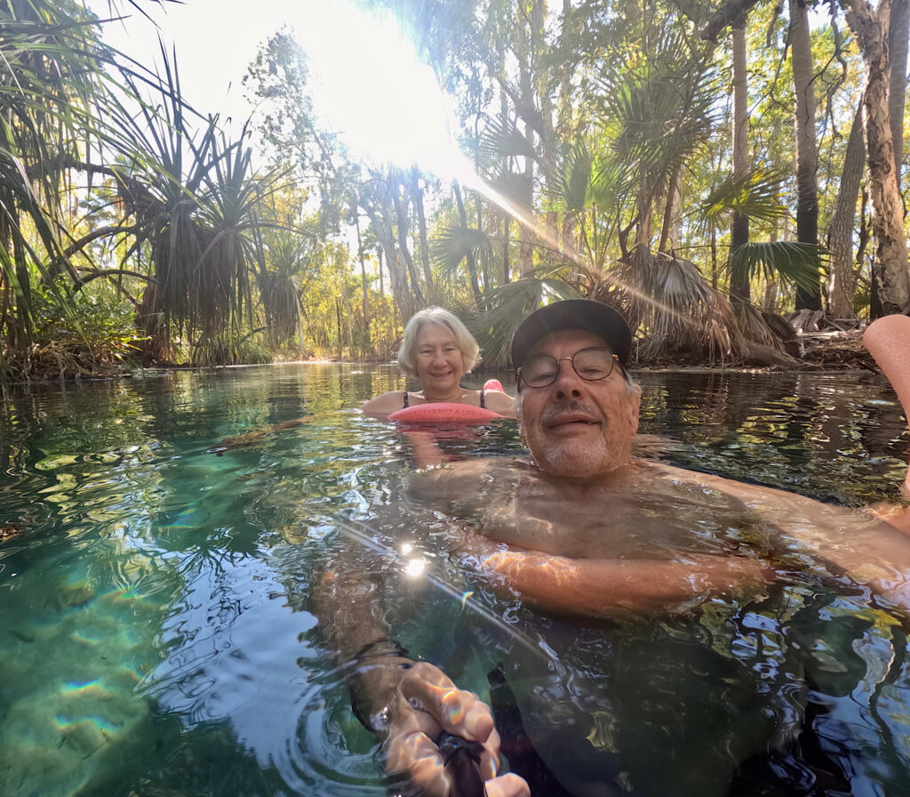
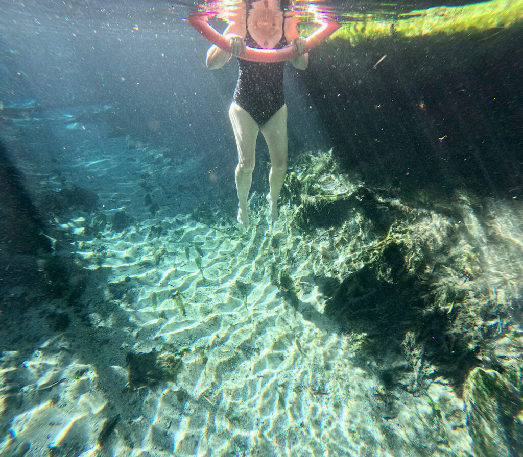
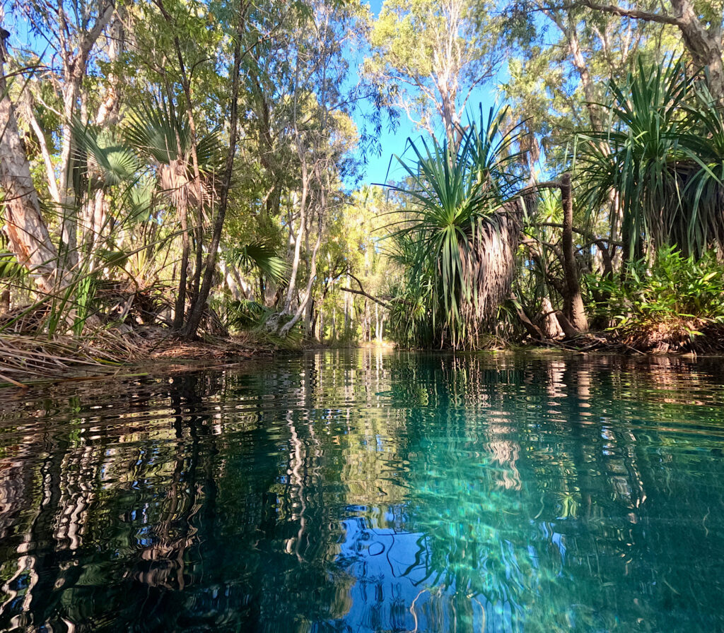
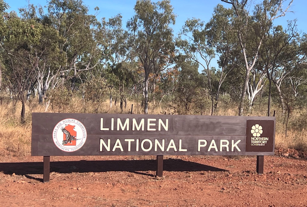
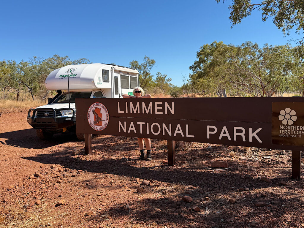
Limmen National Park sits on the western edge of the Gulf of Carpentaria, and the road to get there takes you deep into remote country. Just south of Mataranka, we swung east onto the Roper Highway, but not before making a mandatory stop at one of my all-time favourite places – Bitter Springs, which is in Elsey National Park.
Fed by a thermal spring pumping out a staggering 30.5 million litres a day, it’s going to be the perfect place to slow down before we tackle the long, dusty, bumpy road ahead.
Other than excellent infrastructure to get into and out of the spring it is entirely as nature makes it.The flow from the spring is sufficient to float you the 250m from one end to the other with no effort.The water is crystal clear and a constant 32°C year round.The relaxation felt floating in the warm water past the pandanus and eucalypts is cathartic. I’m sure you can see why I’d never drive past this place without stopping.
Wednesday
We’ve travelled around 300km since the last opportunity to refuel (at $1.75/litre), and we’ve got long-range fuel tanks, so theoretically we still have sufficient fuel to get us through Limmen NP, including its side trips, and back to civilisation. But … out here it’s not worth the worry, so we topped-up at the Roper Bar Store. This store serves a small remote community.
Peace of mind comes at a price.
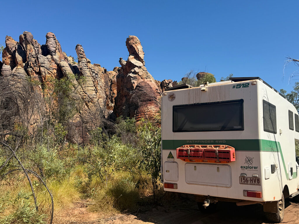
Corrugations, many bulldust holes and some rocky stretches with lots and lots of red dirt will be our constant companion now for the next 5 days.
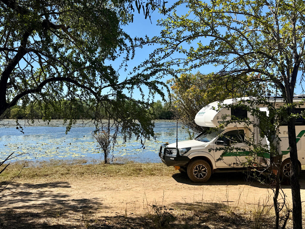
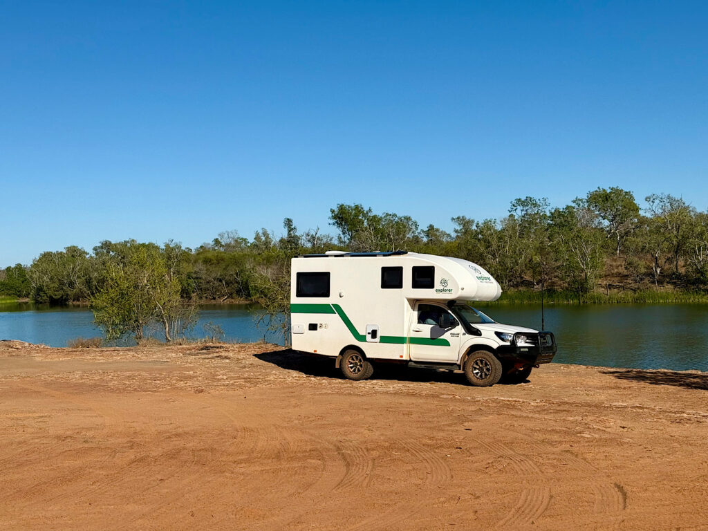
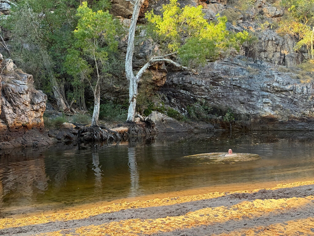
We’re so excited to finally be here. Expectations are high.Lomareium Lagoon lunch stop. We passed several lagoons alongside the road. This lilly-covered one is the prettiest. Apparently the estuarine crocodiles think so too!Towns River. The water is about 2 metres down a rocky ledge – enough to make it difficult for a crocodile to climb up. Lovely camping here, but nevertheless I didn’t venture out after dark when I couldn’t see my surrounds clearly.
Thursday
After a reasonably long but uneventful drive (just adding a water crossing or two to the previous descriptors of the road) we arrived at the Nathan River Ranger Station. No one in attendance but lots of excellent posters on the walls discussing the indigenous and early settler history, the flora, fauna and of course the spectacular geological formations we’re here to see. Also we needed to get the combination for the locked gate into the Western Lost City for tomorrow.
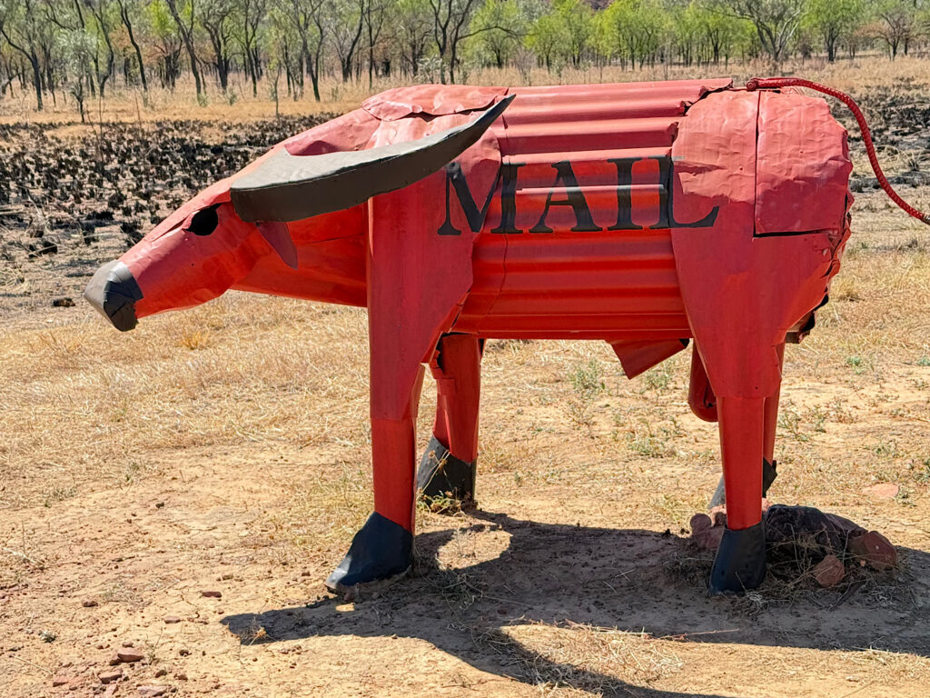
Beside the Ranger Station is an airstrip. Amongst essential services like being a landing strip for the Royal Flying Doctor, the Station gets its mail delivered, and this is their mail box.Butterfly Falls campsite was a little further down the road. After getting settled in we wandered down to the Falls for a lovely refreshing swim in the clear waters after our dusty drive today. A restful evening ensued.
Friday
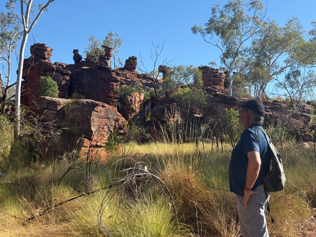
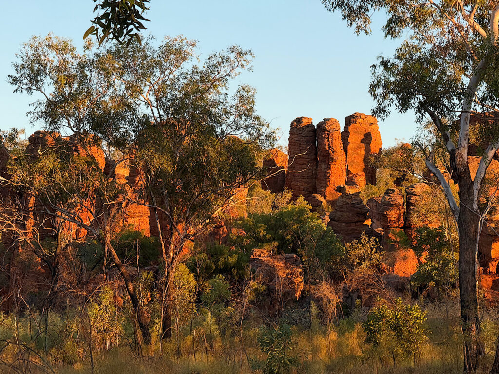
Because of the area’s remoteness, the rough gravel roads—often in poor condition, especially after the wet season—and the need for a tough, high-clearance four-wheel-drive vehicle, few tourists ever visit the Lost Cities in Limmen National Park. In fact, I met very few people who even knew they existed. We feel genuinely privileged to be here.
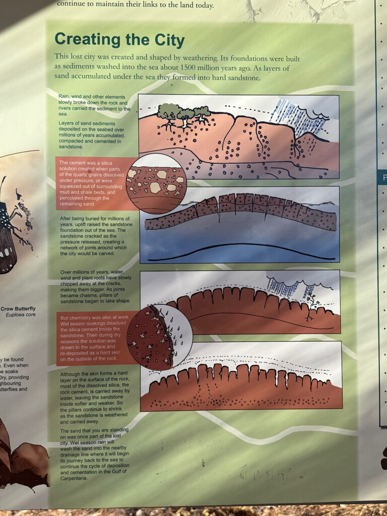
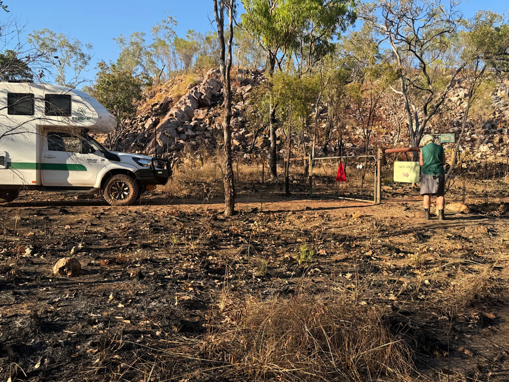
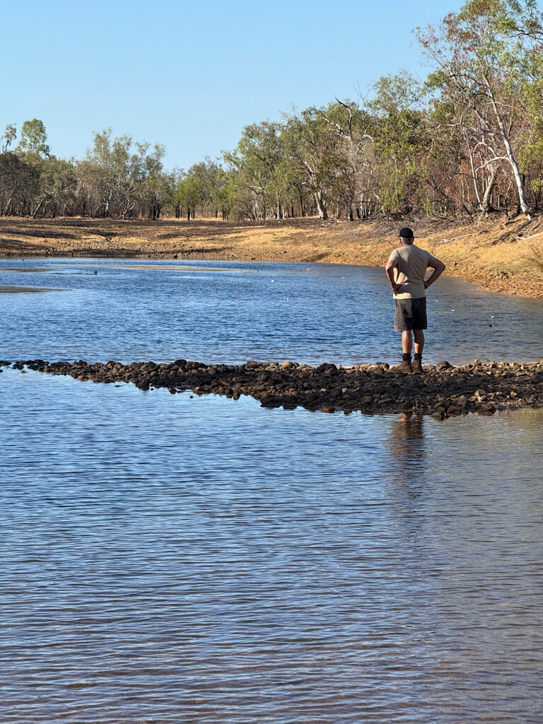
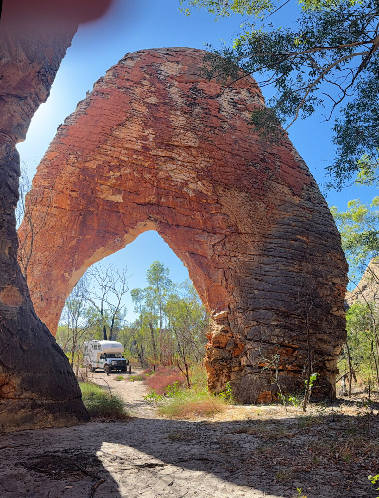
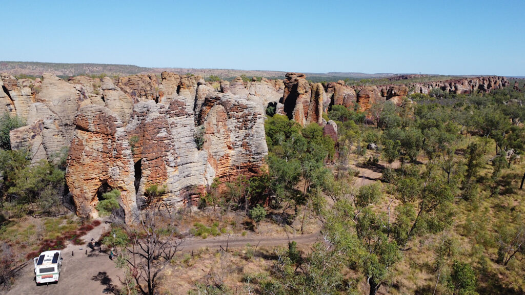
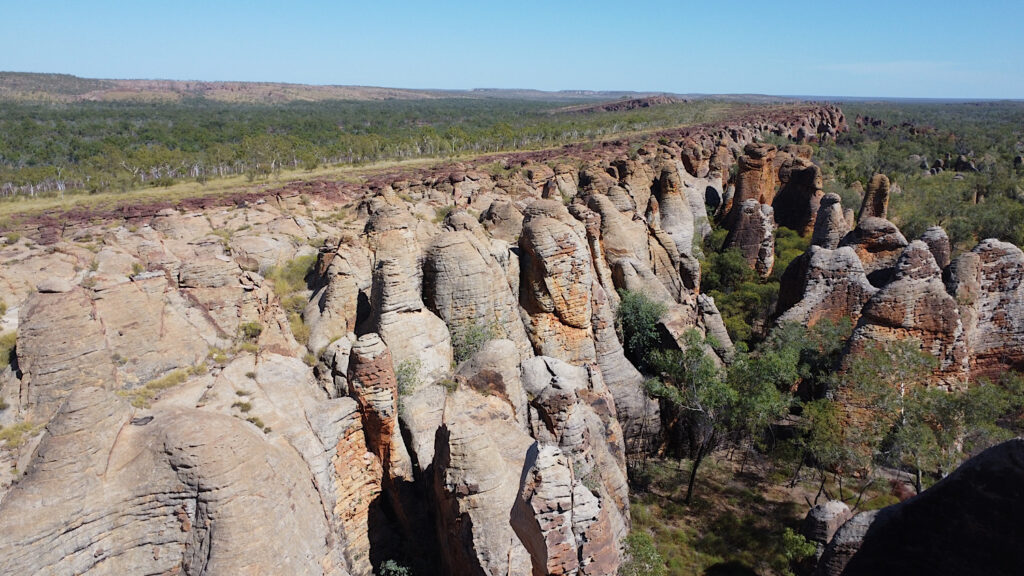
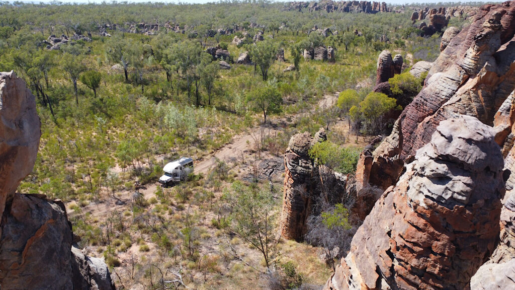
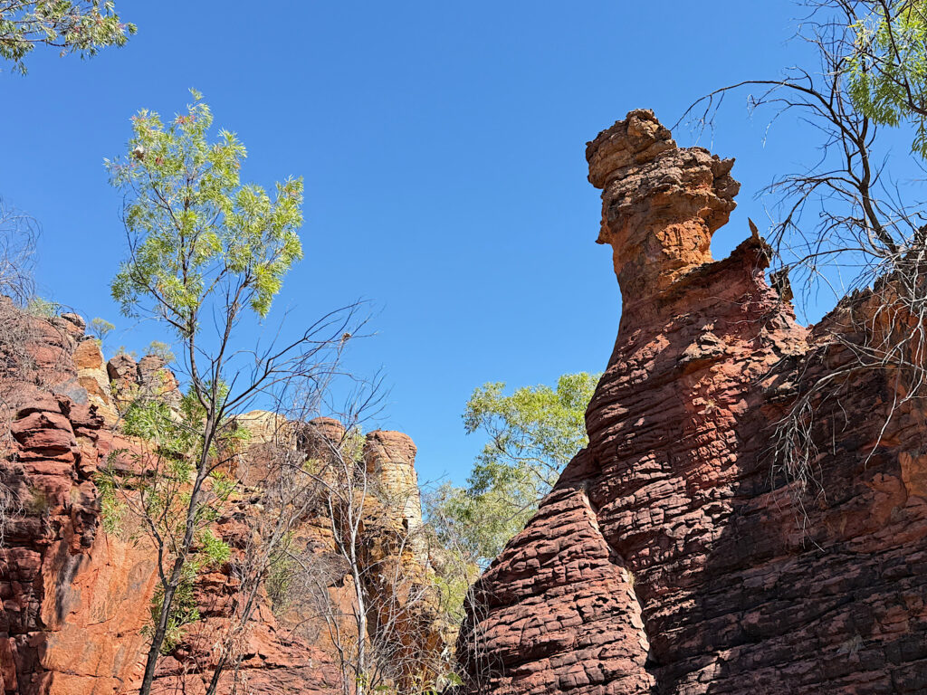
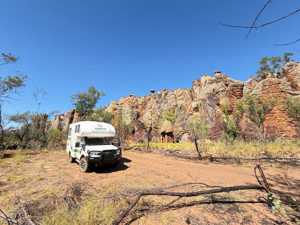
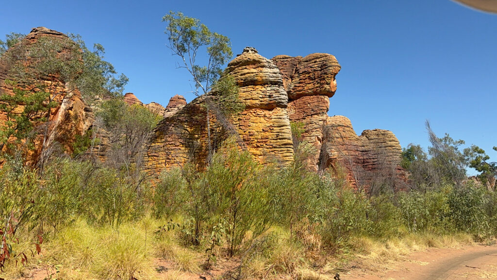
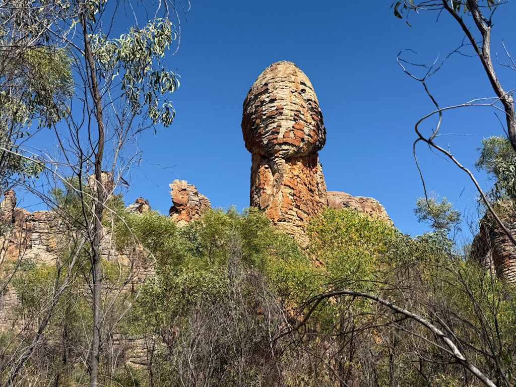
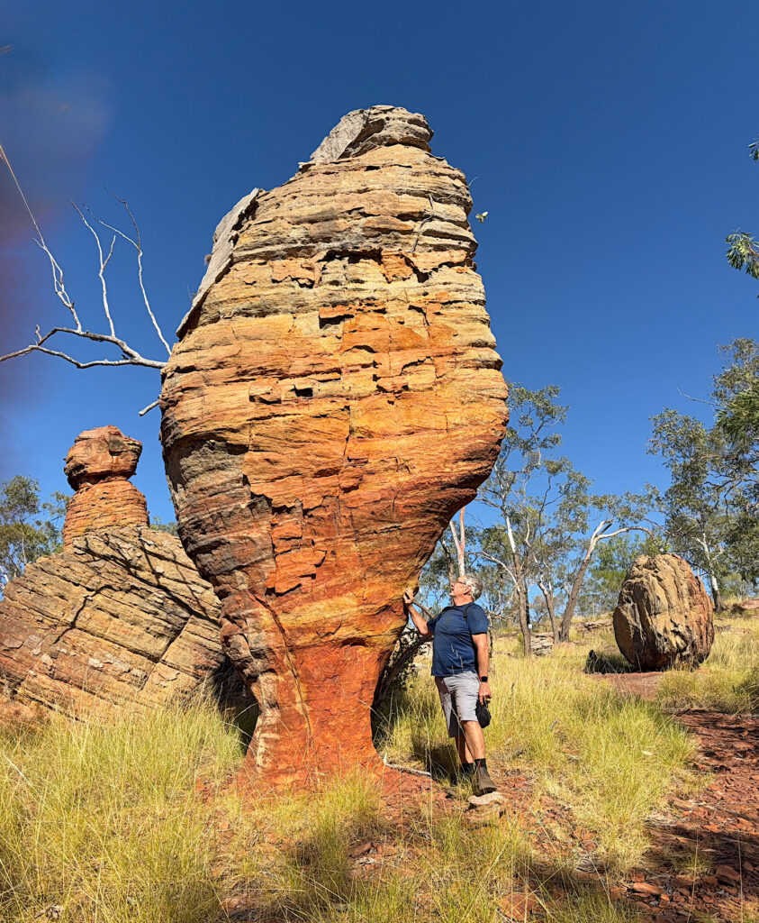
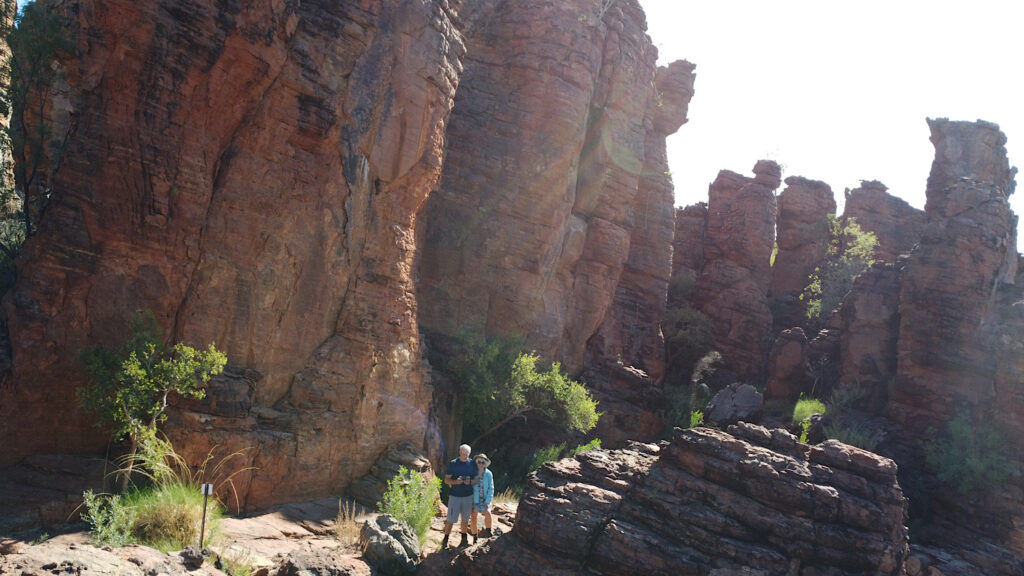
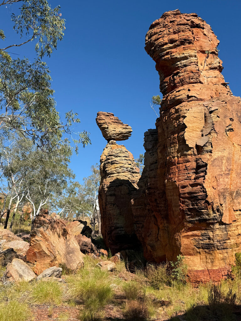
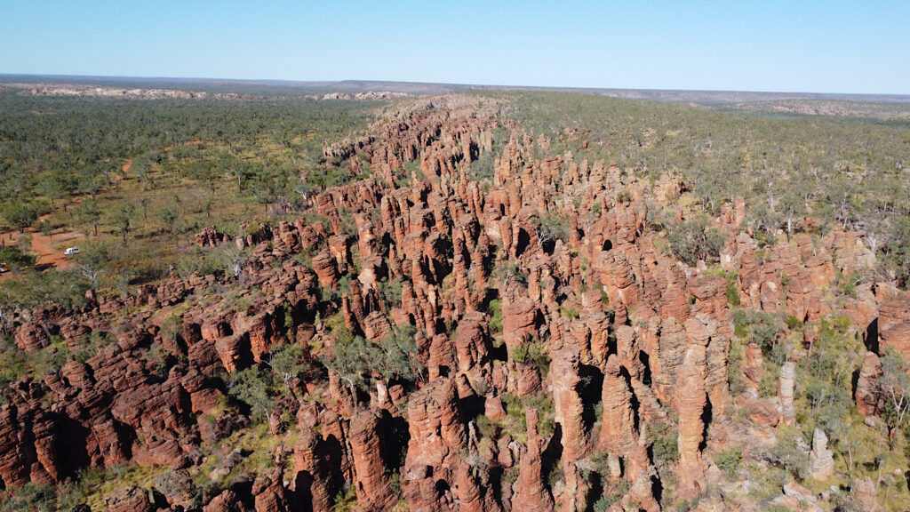
This explains better than I could how the land formations came about.To enter the Western Lost City we unlocked the gate and signed in. It’s a 30km drive into the City – it took us about an hour and a half, including a couple of stops on the way. Most of the track, which was just two wheel tracks, was OK, but there were some rough, rocky patches and washouts to negotiate and a couple of challenging water crossings.At the Ranger Station we picked up a self-guided information sheet to the drive. This lake always has water and is a popular bird watching spot. There are buffaloes in the park too that come to drink here.As the formations came into view we were stunned. I’d seen photos of what to expect, but none did them justice. It was quite spectacular.The extent of the formations, as well as the limits in width were interesting. The arch from the photo above.Why only here? Why so narrow a band? Questions, questions!The road took us alongside the formations for about a kilometre.Interesting.How do those smaller rocks on top get weathered like that? When will they fall?They look so old – and they are.This formation reminded me of the mushroom I found on the Gibb River Rd – the Shaggy Mane Mushroom or Podaxis pistillaris – just a bit bigger.Is that the Empress overlooking all who come here?
Saturday
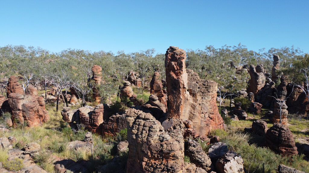
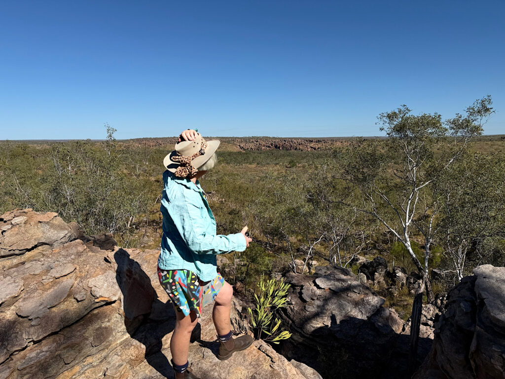
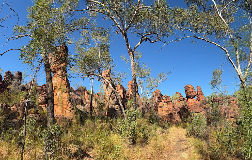
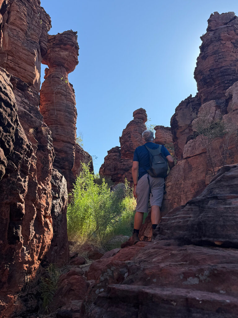
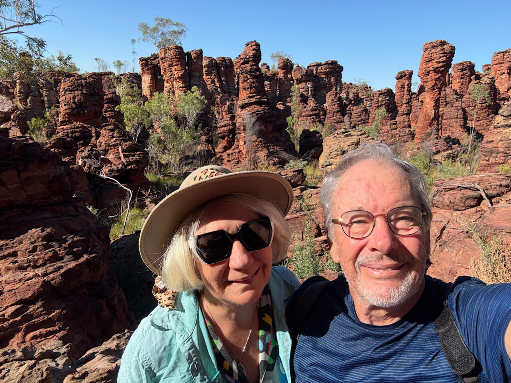
We set out early for the Southern Lost City to commence the 2.5 km walk winding through its otherworldly rock formations before it got too hot. We knew we’d linger often, and we did —capturing the intricate shapes and soaking in the ancient, sculptural landscape, preserving it for our memories. I hope you, too, enjoy some of the photos we took.
Sunday
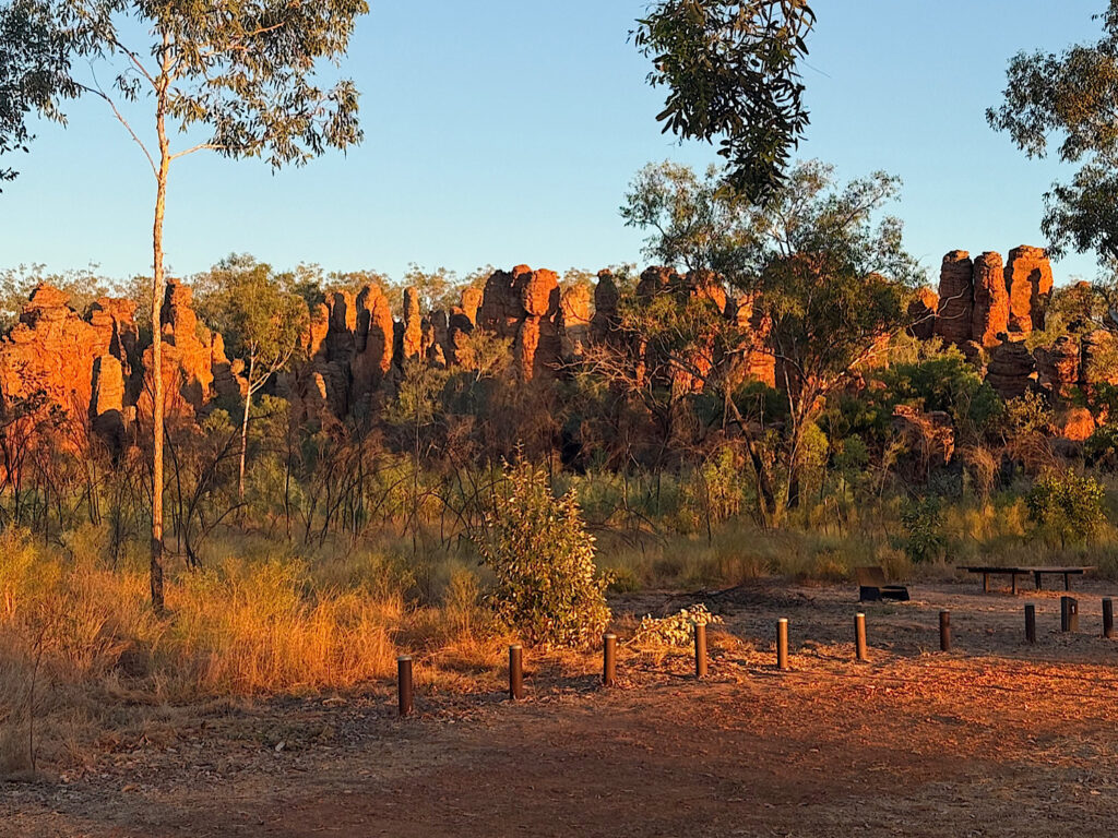
Sadly we leave Limmen National Park today. But not before a photograph of sunrise on the Southern Lost City.
Goodbye Limmen. That was truly an outstanding experience. What an amazing country we live in!