Cliff Head, Pinnacles and Yanchep

9th – 12th July 2017

Sunday 9th

We continued south to Mingenew, a great place for wildflowers, so we’re told (too early yet), then headed west to the coast. We had lunch today at a lovely little cafe on the beach at Dongara. After being away from civilisation for so long it made a very pleasant treat for us.

The river at Dongara.

Tonight we’re staying at another of WA’s wonderful free camps at Cliff Head South. We’re right on the beach, camped amongst the trees, and as the afternoon progressed the campers rolled in, as you can imagine. This spot is just outside Beekeepers Conservation Reserve, and there were a lot of bees around.

Our campsite at Cliff Head south. Short walk through to the beach

We enjoyed a walk along the beach and sundowners watching the sun set.

Monday – Wednesday 10th – 12th

On our way south we stopped off at The Pinnacles, a section of Nambung National Park.

The raw material for the limestone of the Pinnacles came from seashells in an earlier era that was rich in marine life. These shells were broken down into lime-rich sands that were blown inland to form high mobile dunes. However, the manner in which such raw materials formed the Pinnacles is the subject of debate. One theory states that they were formed through the preservation of tree casts, while another suggests that plants played an active role in the creation of the Pinnacles, based on the mechanism that formed smaller “root casts” where large amounts of calcium (derived from marine shells) moves with water into the roots. This calcium accumulates at high concentrations around the roots and over time is converted into a calcrete. When the roots die, the space occupied by the root is subsequently also filled with a carbonate material and so the ‘calcified’ root system remains.

The Pinnacles

However they were formed they make for a very interesting landscape. It was quite busy there today – could be just school holiday traffic, but our memory of visiting here 35+ years ago is that we were the only ones there at the time.for many hours. Today there’s a large information centre, shop, and talks given by the rangers.

Yanchep National Park is not far from Perth and a good spot for us to take a break while waiting for Laura and Olivia to arrive in Perth. The camping ground is on what used to be an oval – the National Parks are planting it up with native vegetation and making it quite a beautiful camping area, and still only $11.60 per night. Within the grounds there’re more parks, walking tracks, a lovely tavern, cafe, and information centre. We watched the final State of Origin football match at the Tavern and enjoyed a pub meal there.

Click here for a few more photos from these few days.


Coalseam National Park

6th – 8th July, 2017

Thursday 6th

We’re heading south now on the unsealed Carnarvon-Mullewa Road with purpose – to meet up with our daughter and granddaughter in Perth next week.

The countryside through which we travelled. This photo is taken right beside Bilung Pool.

The few cattle we saw on this arid-looking country looked in surprisingly good condition. Few cars passed us and we went through no towns before stopping for the day at Bilung Pool, with only two other campers. This lovely permanent waterhole is quite a surprise appearing from nowhere in this featureless country, surrounded by large old River Redgums. It’s about 10 metres below the surrounding plain with striking cliffs down which waterfalls would cascade after rain. A beautiful, quiet free camp.

Bilung Pool. Can you see our motorhome in the distance on the edge of the cliff? Magic overnight stop.

Friday 7th

Our travels today were very pleasant. The countryside changed little from yesterday, the unsealed road was very recently graded (ie we passed the graders working on it) and there were a couple of interesting places for us to stop. This road is a part of the tourist drive ‘The Woolwagon Way’, along which the first sheep were brought by drovers and subsequently the wool bales were taken south to the markets. Bores were dug every 15 – 20 km to provide water for the sheep and cattle on their journey. We stopped at one of these bores which is still fully functional.

The drinking troughs that can be filled with water from the well.

Further on was the story of the grids. We’ve crossed dozens and dozens of cattle grids so far, each interrupting a fence line, the fences in various states of repair these days, some good, others broken and useless. Back in the days before grids the farmers had gates at each of these places which a traveller on the road would have to stop to open, drive through, then stop again to close. There were more than 100 gates. Imagine how annoying that would be. However one rather large German man who travelled the roads frequently carrying wool and supplies would drive his truck straight through them smashing the gates and allowing the sheep and cattle to escape or intermingle with their neighbours. He was apparently too big and strong for any of the pastoralists to fight so they took to designing gates that would pierce his radiator if he ran into them. He eventually hired an offsider who would jump out at each gate to open it for him, close it after he went through, then he’d have to run to catch the truck as the German wouldn’t stop to wait for him. Rumour has it that it was because of this man that cattle grids were eventually installed along this road – we’ve got a lot to thank him for!

Brunch was at a roadside lookout – any hill higher than about 10 metres out here gives 360 degree views! Some very industrious people have enjoyed creating a bit of rock art for our pleasure.

Stone art – interesting.

The Murchison Roadhouse is quite an oasis on this trip. The Shire offices are here, a lovely grassy playground, a grassed caravan park, a red dirt sports arena and the Roadhouse. We refuelled (cheapest fuel we’ve seen in a long time) bought an ice cream and had a break – free wifi so checked our social pages! A museum with items supplied by the surrounding properties was well worth a look-around. Nina, a friend of Ric and Gill’s who we met in Brisbane last January walked up and said hello – what a surprise.

A surprise meeting with Nina, at Murchison Roadhouse.

The place was very busy as a polo cross competition was starting the next day on the sports arena and semitrailer-sized horse floats were pouring in.

After this lovely break we moved on down the now-sealed road to Ballinyoo Bridge free camp on the banks of the beautiful Murchison River. Another idyllic campsite, on our own!

The Murchison River beside our campsite.

Saturday 8th

Chilly again this morning – 1 degree!

Back onto unsealed roads we headed to Mullewa. Suddenly agriculture started to appear – wheat fields with new growth and a canola field covered in bright yellow flowers. It’s all or nothing out here!

Mullewa is a small, pleasant town – no grocery store we could see, and no shops open. We lunched here and Steve prepared the roast for tea and put it into the Dreampot.

Coal seam Conservation Park, our destination today, is a small park through which the Irwin River runs – when it rains. There’s a trickle in it now. However in years gone by it must have been spectacular as it has carved a deep valley for itself with high cliffs on one side, where a coal seam has been exposed. They began mining it in the 1920s, WAs first coal mine, however there not being a lot of it and it being poor grade, mining soon stopped. A walk into the dry riverbed to view the cliff face with its layers, one being coal, was interesting,  before we drove to the lookout at the top of the cliff and on to the campground.

At the lookout at Coalseam Conservation Park

The camping area is well laid-out, spacious, flat compacted deco sites with natural vegetation between each site, and Eco-toilets. It’s $11/n but no one here to collect it and no where to leave the money.

Click here for more photos.

To Kennedy Range NP

1st – 5th July 2017

Saturday 1st

Just a transfer – back to Exmouth to restock everything and catch up on the world – how did we ever manage before the Internet? Then an uneventful drive south to Lyndon River free camp for the night. WA has positioned these free camps fairly regularly along the highways – big open areas to park, toilets, picnic tables, a dump point, bins and even wifi sometimes. They are excellent for an overnight stop on the way to somewhere. – well done WA.

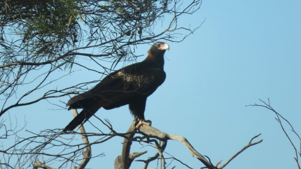
Eagle – We saw dozens of these majestic birds all through the inland, cleaning up road kill.

Sunday 2nd

A long drive today, continuing down the coast road to Carnarvon before heading east to Gascoyne Junction. The school holidays have begun – all good grey nomads know to either stay put during holiday times, or stay away from the coast. We chose to head inland. But first, lunch in Carnarvon. It was funny to be driving through mallee, acacia and even salt bush again then very suddenly find ourselves amongst market gardens, banana plantations and mango orchards as we approached Carnarvon.

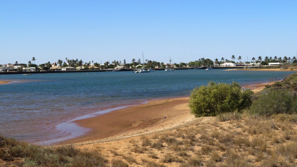
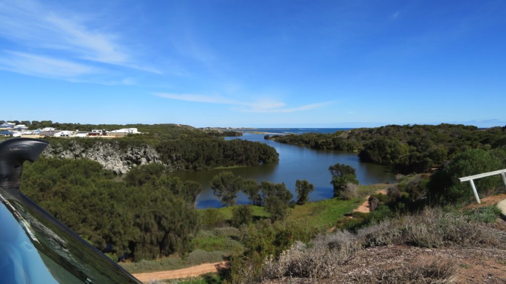
Carnarvon foreshore.

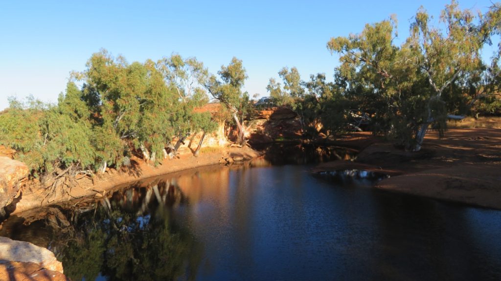
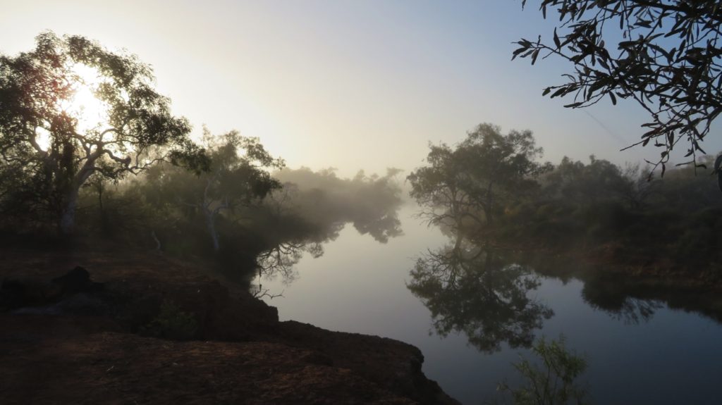
After our lunch and a walk along the foreshore and over the old tramway bridge we headed out to Gascoyne Junction. Our campsite is simply listed as Picnic Area in WikiCamps and has some pretty weird comments. Being the one who chose this as our destination I was a bit nervous about it, needlessly! It’s a lovely spot on the edge of the Gascoyne River, which here is a wide, deep pool with black swans and other waterbirds gracing its waters – it doesn’t actually flow unless there’s been a significant rain event.

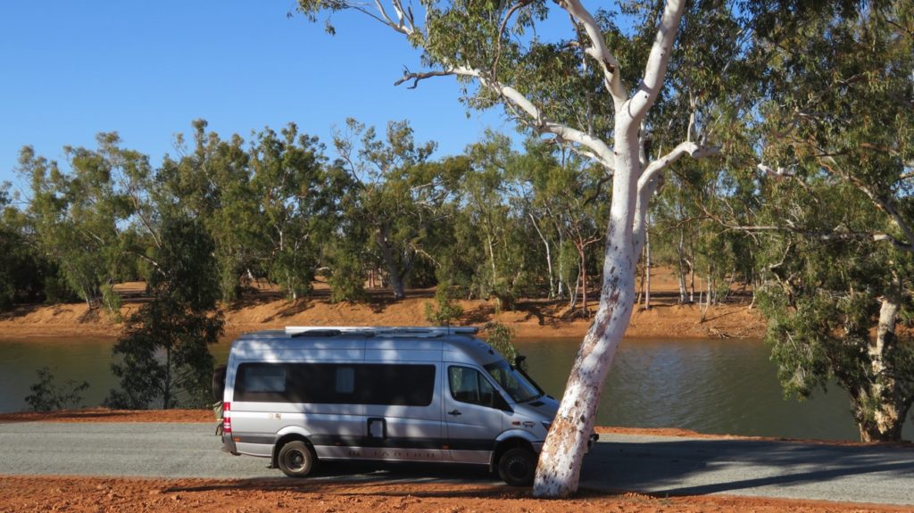
Another lovely, quiet campsite beside the Gascoyne River outside Gascoyne Junction.

Monday 3rd

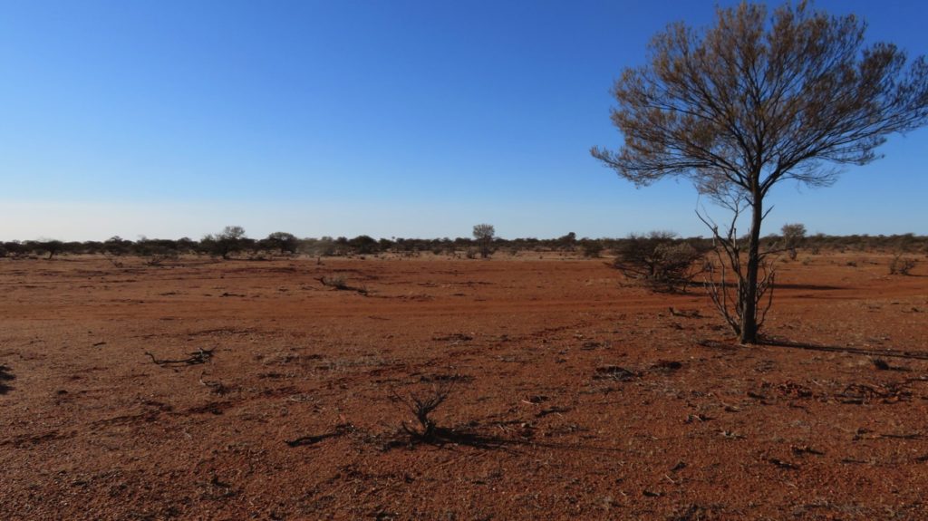
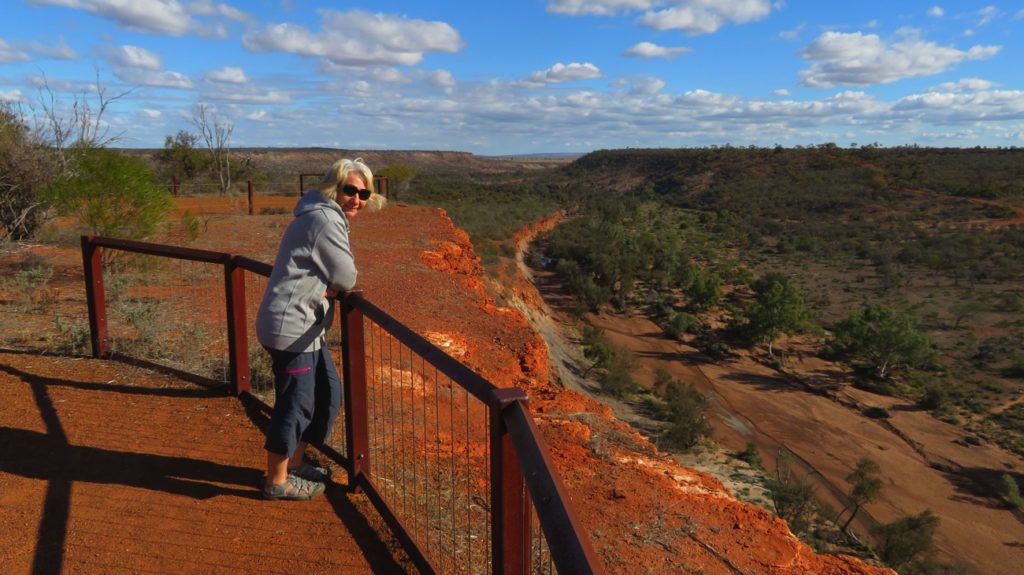
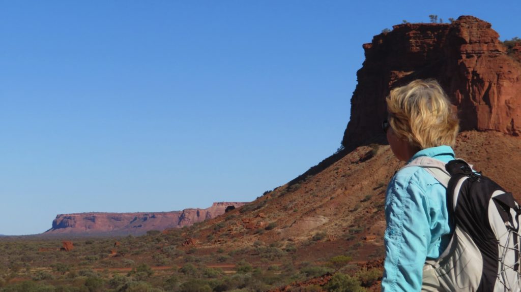
Leaving Gascoyne Junction we headed north to Kennedy Range National Park. Interesting drive along a very good, unsealed road following the dry Lyons River with the usual mallee, acacias and spinifex growing on the plains, flat as far as the eye could see. Until, suddenly a perfectly flat-topped Range appeared on the horizon. Kennedy Range, or Mundatharrda as it’s been known to the indigenous people for centuries, is a 75km x 25km mesa that rises about 100m above the plains and is formed of sandstone and shale laid down when the area was under the ocean.

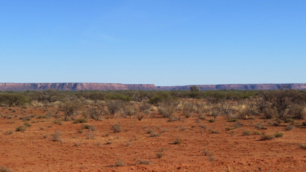
The mesa of Kennedy Range.

The weathered southern and eastern sides have spectacular cliffs and gorges eroded by the rivulets that would join the Lyons River, should it rain!

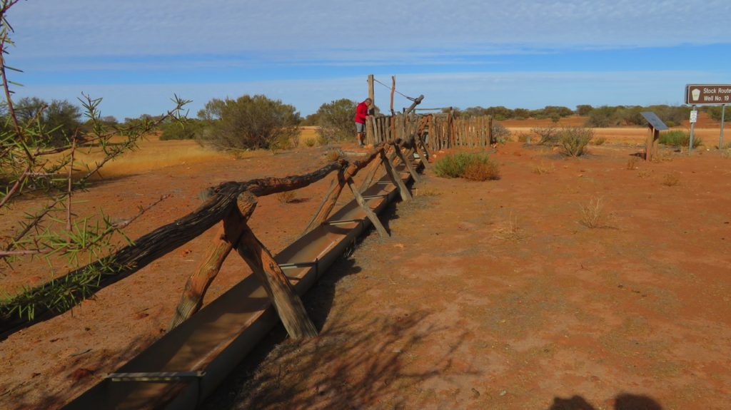
This road is a part of the Woolwagon Way (one of the tourist routes promoted by WA tourism). We came upon the cobblestone road which was built by pick and shovel in the 1920s so that the new form of transport for the wool, the truck, wouldn’t get bogged so easily. What a mammoth task!
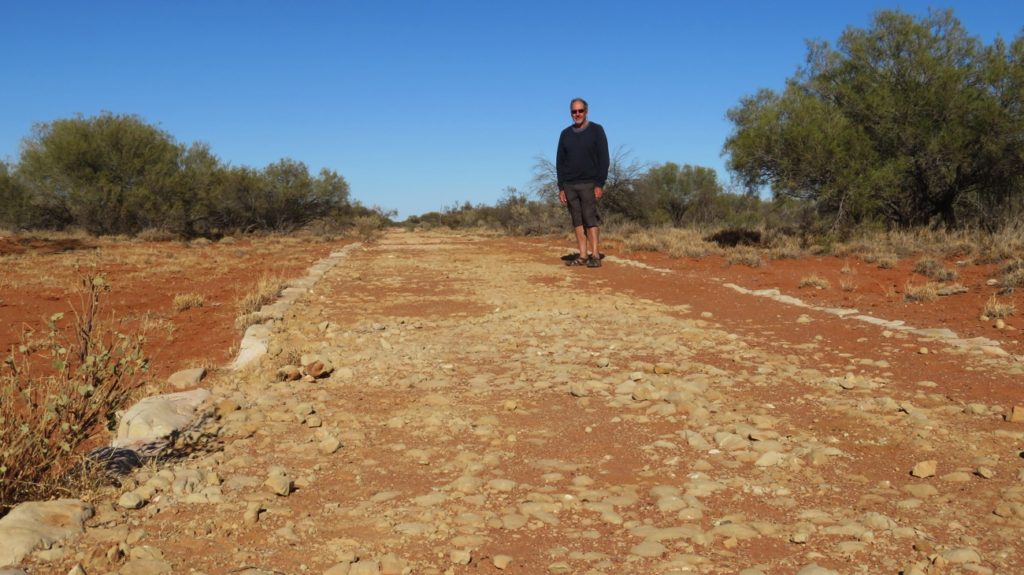
Cobblestone Road.

A rather nice feature the WA National Parks has is volunteer camp hosts at their campsites. The hosts greet new arrivals, give basic information about the national park, suggest the activities available, take the camping fees ($11/night here) when not prebooked online and facilitate the sundowners. All the hosts we’ve met have been very pleasant. Most are retirees who stay, free of charge, in their own van or motorhome for about 4 weeks before the next volunteers take over.

After settling in, ie having lunch, getting dinner into the Dreampot and doing the washing, we headed off to do the Escarpment Trail, a 4km Class 3 walk that involved lots of scrambling over rocks as we climbed up the length of a Gorge to reach the top of the mesa. A difficult climb. However the rewards were there with lovely views to the horizon over the plains, while closer in we could see down into the gorges and way down to the camping ground.

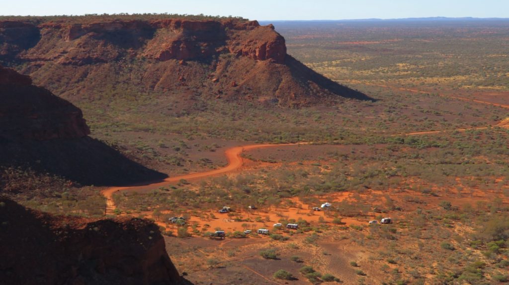
Our camping area at Kennedy Range National Park

The rocks were very interesting here – so many different colours. The shale layer was shaped so oddly in places it looked like it was formed by volcanic activity into lava tubes – but no mention of volcanic formation in the literature, so probably not. As the light changed it went from jet black to indigo blue and dark purple.

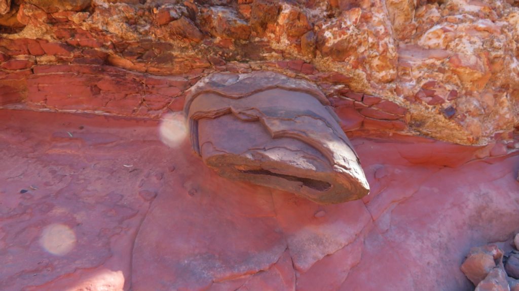
More of these very peculiar rocks that could be lava, if we didn’t know better.

Sundowners was around a large communal fire pit chatting to the other campers. It’s enjoyable to talk to someone other than each other, and you get great tips on other places to stay.

Tuesday 4th

The walks to Honeycomb Gorge and Sunrise View were on the agenda today, about 10 to 12 km. Honeycomb Gorge was a surprise. I’d never seen landforms like it before – caused by weathering of the sandstone.

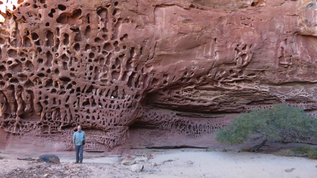
Amazing! What a stunning landform. Honeycomb Gorge

Sunrise View, not surprisingly on the eastern side of the Range, had views over the plains. The walks were from the campground and followed the base of the Range amongst the huge boulders that had tumbled down from above – fortunately none loose today.

From Sunrise Lookout

Another pleasant sundowners around the communal fire pit with the other campers.

Wednesday 5th

Still two more walks to do here – one into Temple Gorge, the other into Draper Gorge. Both walks were quite challenging the further we walked into the gorges as we scrambled over and climbed up boulders and along ledges. Both had permanent pools at their head, at the base of what would be waterfalls in the wet season.

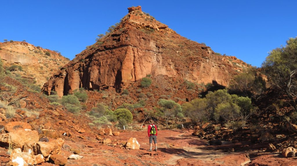
The ‘temple’ at Temple Gorge.

Back at Priscilla we farewelled the Kennedy Range National Park and moved back to our free camp at Gascoyne Junction, which now has No Camping signs around it. We camped further in along the dirt road beside the river, out of sight. Gascoyne Junction is a tiny place with few visible people, even the fuel station is automatic. They do however have a very expensive caravan park, $40 for a powered site, hence our choice to stay where we did.

To see more of our photos from this part of our adventure CLICK HERE