Monday 4th March – Thursday 7th March 2024
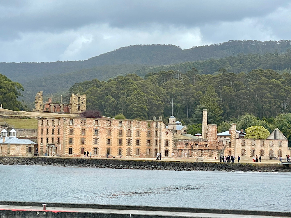
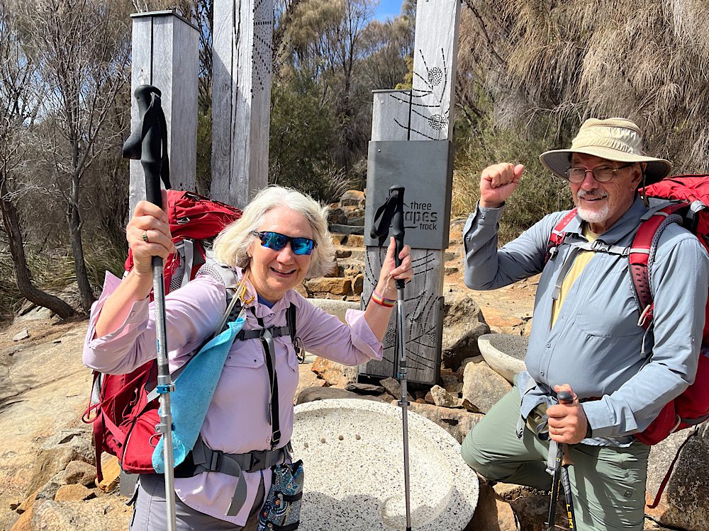
This multi-million dollar track on Tasmania’s south east coastline is one of the best walks you’ll ever do. Over four days we followed the amazing Three Capes Track for 48km around the Tasman Peninsula. It’s rated an easy to moderate trail, but considering the pack weight of any multi-day hike and the amount of ascending and descending to be done each day (after the first), a good degree of fitness (or youth!) is required. The trail starts and ends at the Port Arthur Historic Site, a two-year pass to the site is included in your track fee.
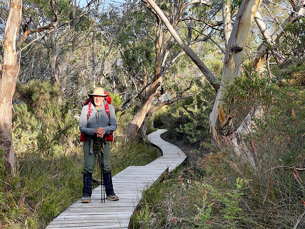
We booked to do it as a self-guided hike staying in the public huts – it’s a very popular walk with only 48 hikers permitted to leave each day. We both carried packs weighing around 13 – 14kg, which thankfully didn’t have to include tents or sleeping mats. All our own food, plates and cutlery, sleeping bags, pillows and clothing to deal with cold and wet conditions made up the weight.
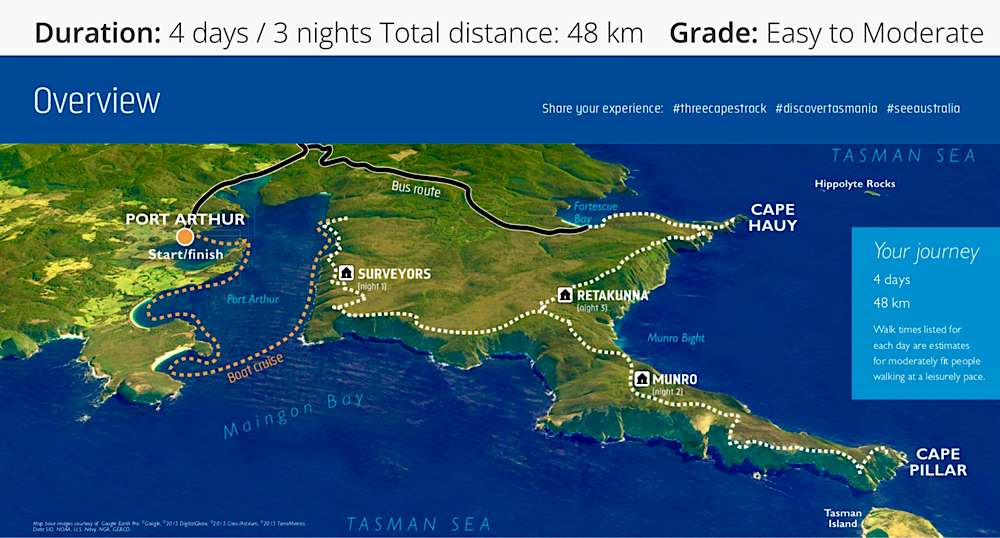
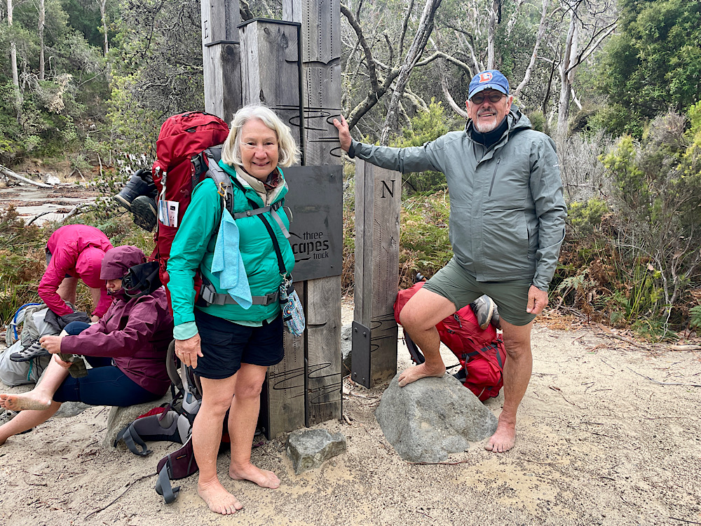
Day 1: Port Arthur – Denman Cove (boat) – Surveyors Hut (~4km walk)
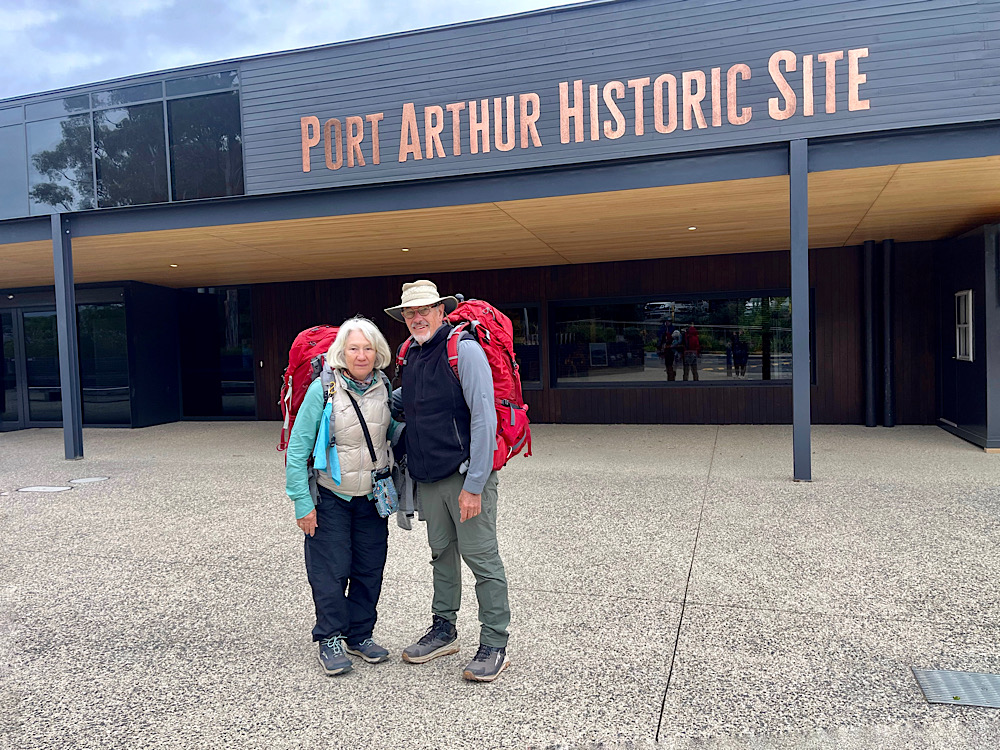
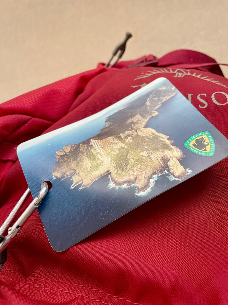
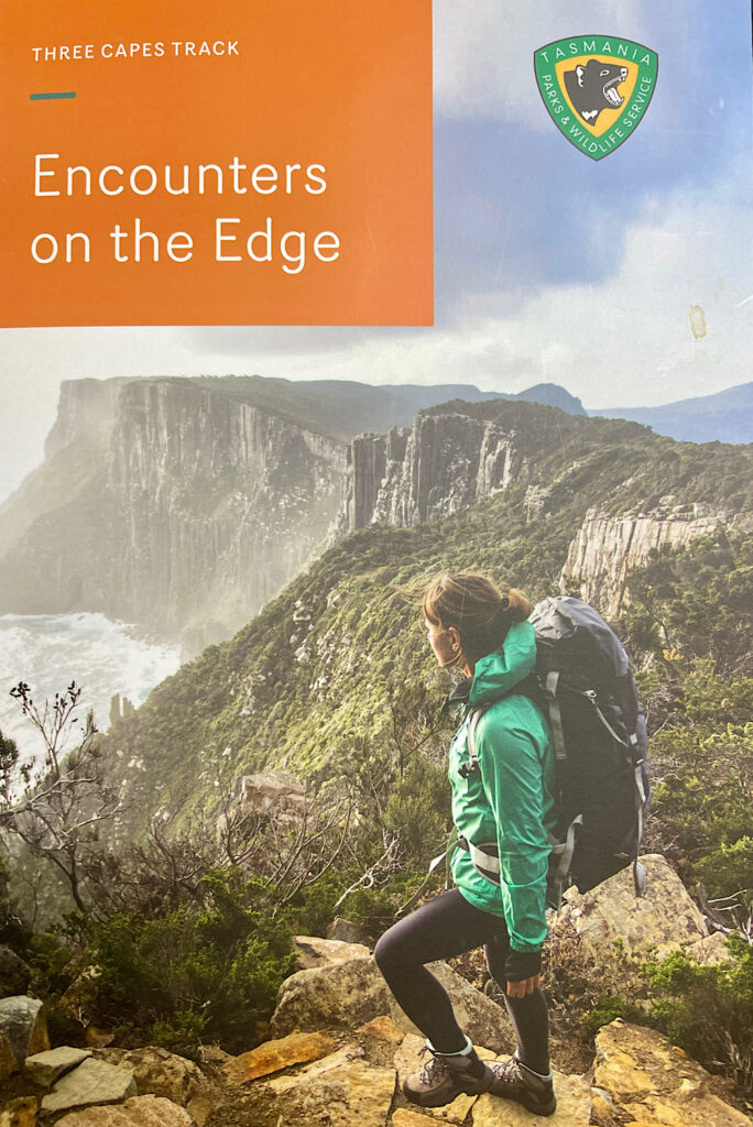
We’re booked on the 11.30am boat and arrived in plenty of time to drop off our packs and park Harvey in the long-term parking bay in the sun to keep the batteries charged and the fridge cold. Registering for the hike we were given our access cards and an excellent book called Encounters on the Edge filled with cultural, geographic and just plain fun facts – like how to recognise whose poo belongs to who.
The book, and the Park Rangers at each hut, encourage us to walk slowly and mindfully. To further support this the huts and beds are pre-assigned for the whole walk – no dashing in to get the best bed.
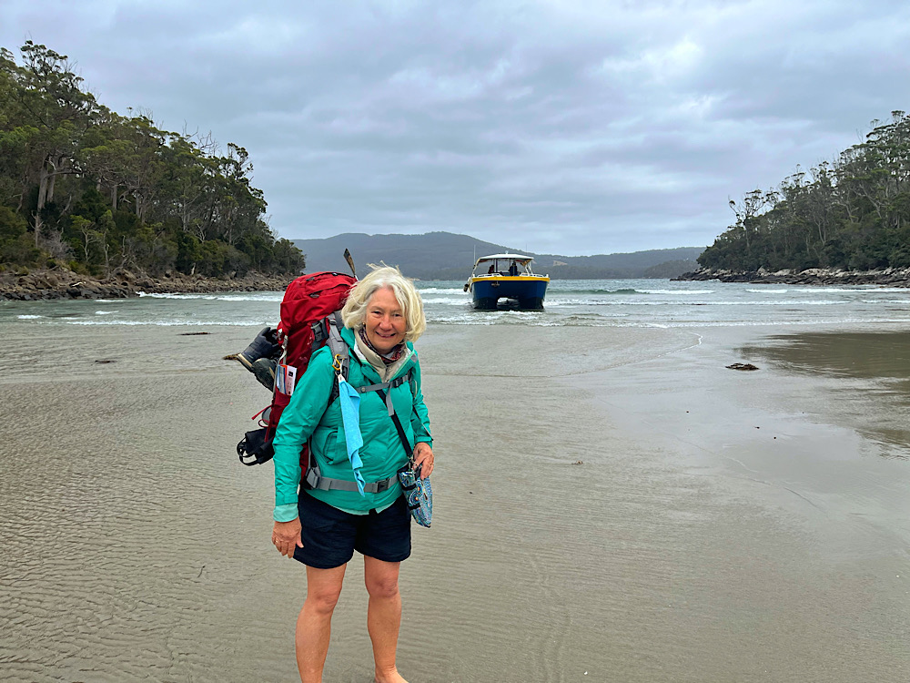
You’ll notice in the map above that it all starts with a cruise from Port Arthur to Denmans Cove. Our cruise was cut short due to rough seas and strong winds. At Denmans Cove the boat isn’t able to get into the shore so we zipped off the bottoms of our pants, wore our boots dangling around our necks and hoped like crazy we wouldn’t fall in with full packs as we negotiated the knee deep water and wave surges.
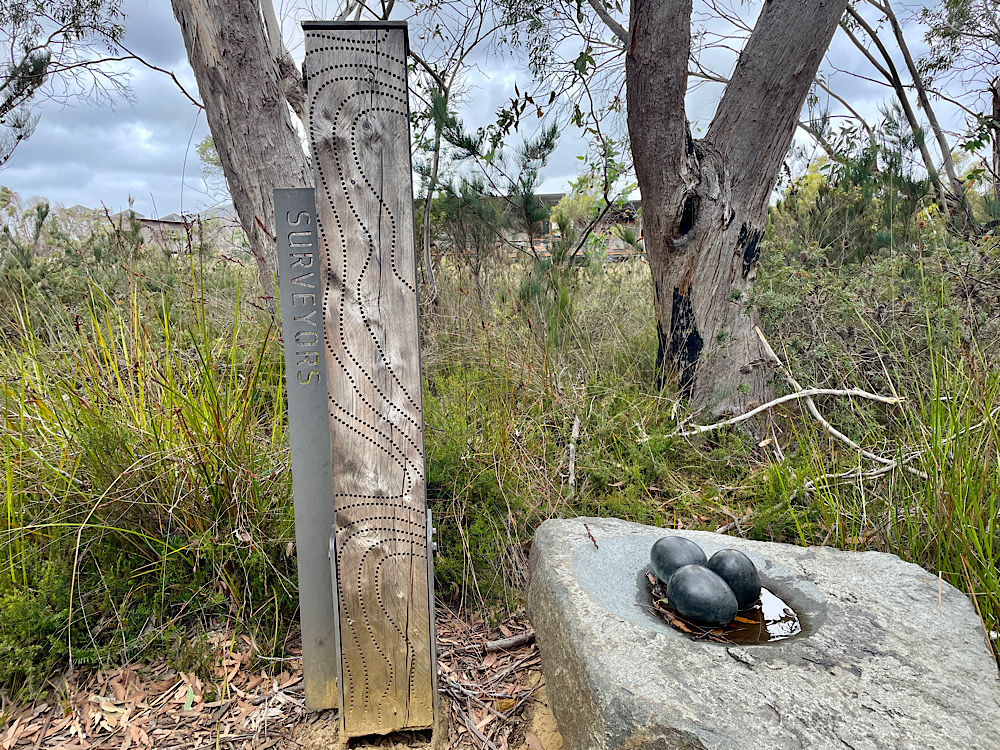
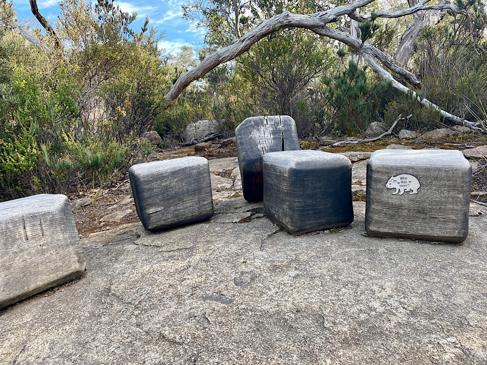
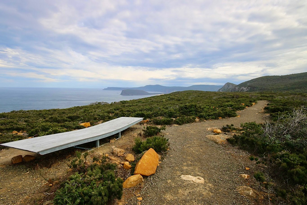
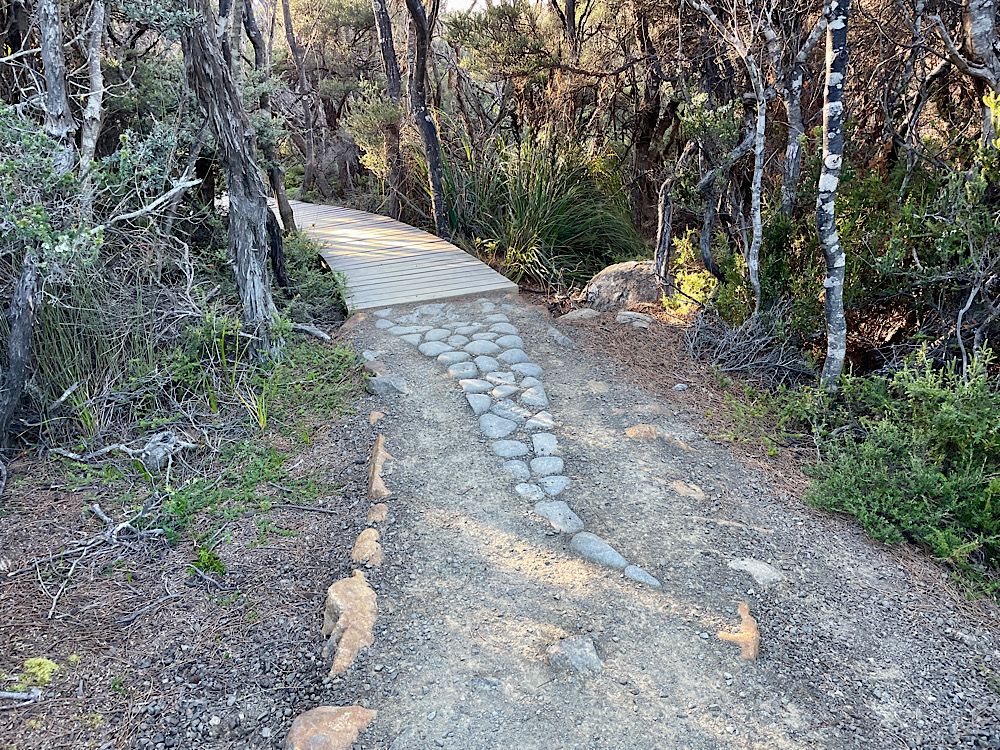
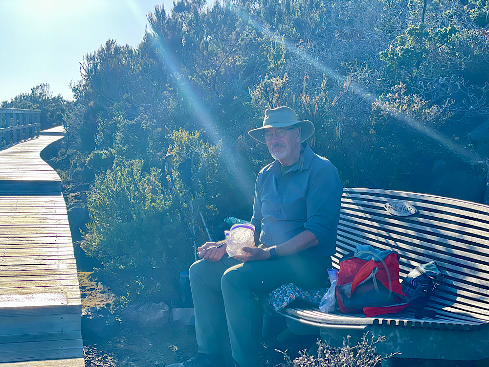
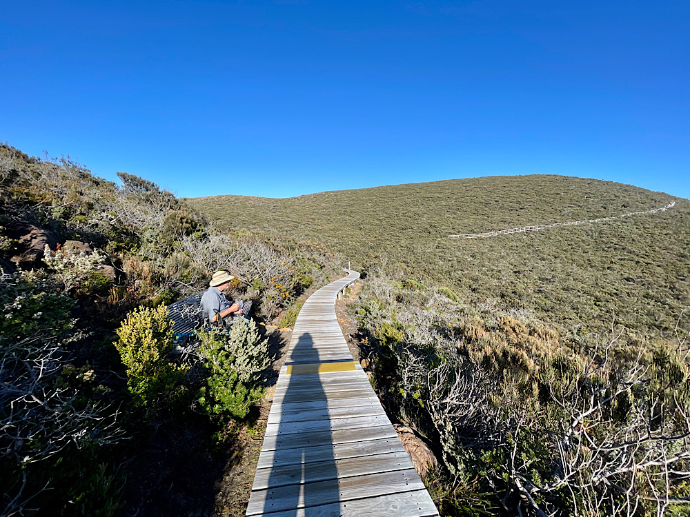
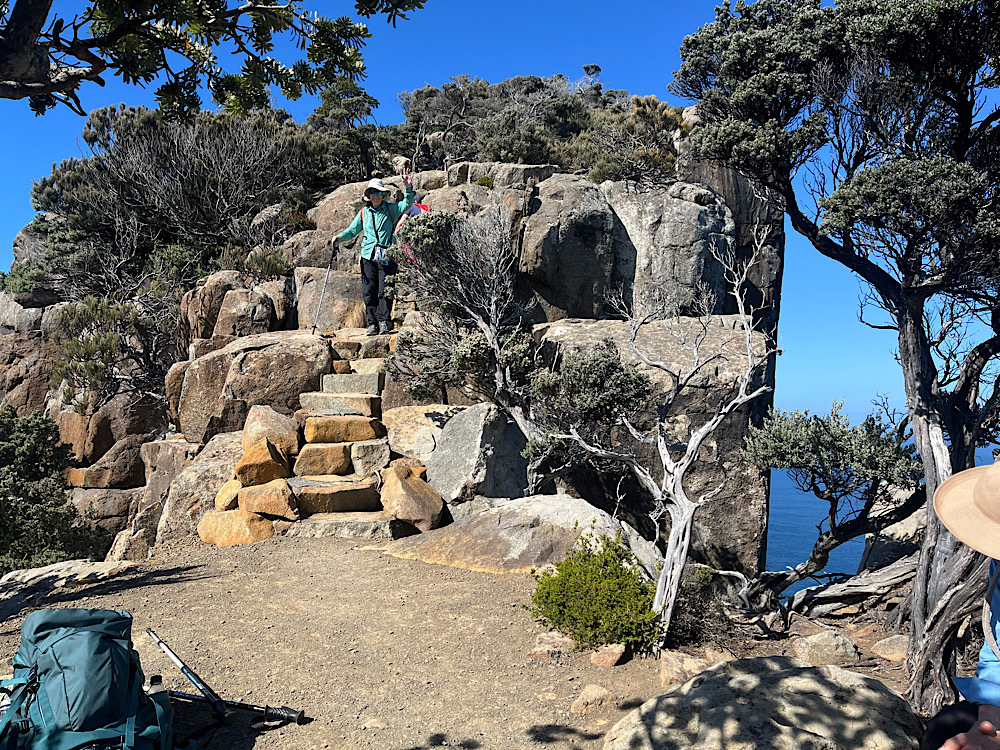
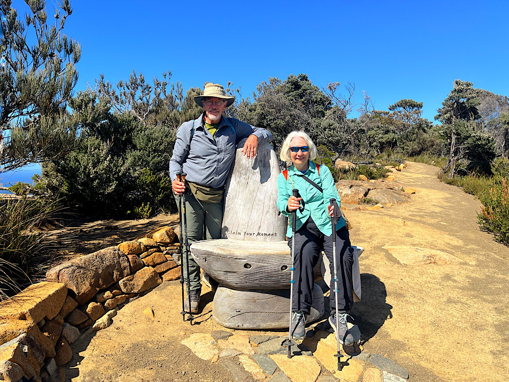
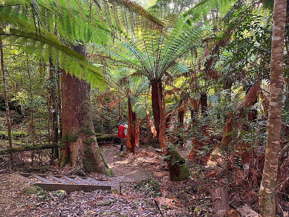
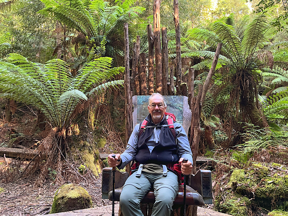
Today’s walk is short – 4 km along a well-defined natural path. With half the day still in front of us we took in the sights and sounds as we wandered, resetting ourselves to once more enjoy the pleasure of just walking through a beautiful landscape. Along the way are story seats designed by UTAS furniture design students. Each of these seats is linked to a story in the Encounters on the Edge book. These were a highlight of the walk which everyone enjoyed.
Initially we walked through coastal heath and eucalypt forest until reaching Surveyors Cove. This little cobblestone beach was a great place to pause, rest, eat our lunch and continue that recalibrating that is so hard to do in a busy world.
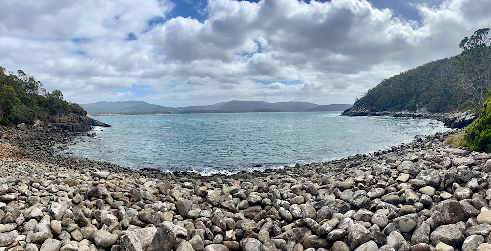
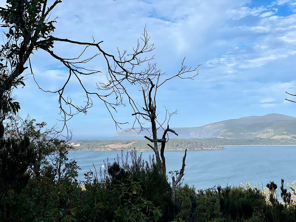
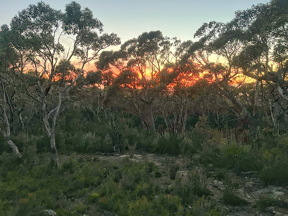
From here it was a surprisingly steep little climb up to our hut for the night. Surveyors Hut is situated in the middle of a buttongrass plain and has amazing views over the ocean to Cape Raoul and the setting sun.
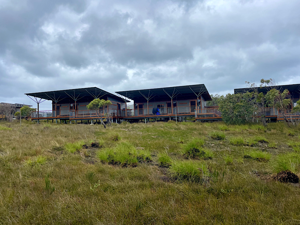
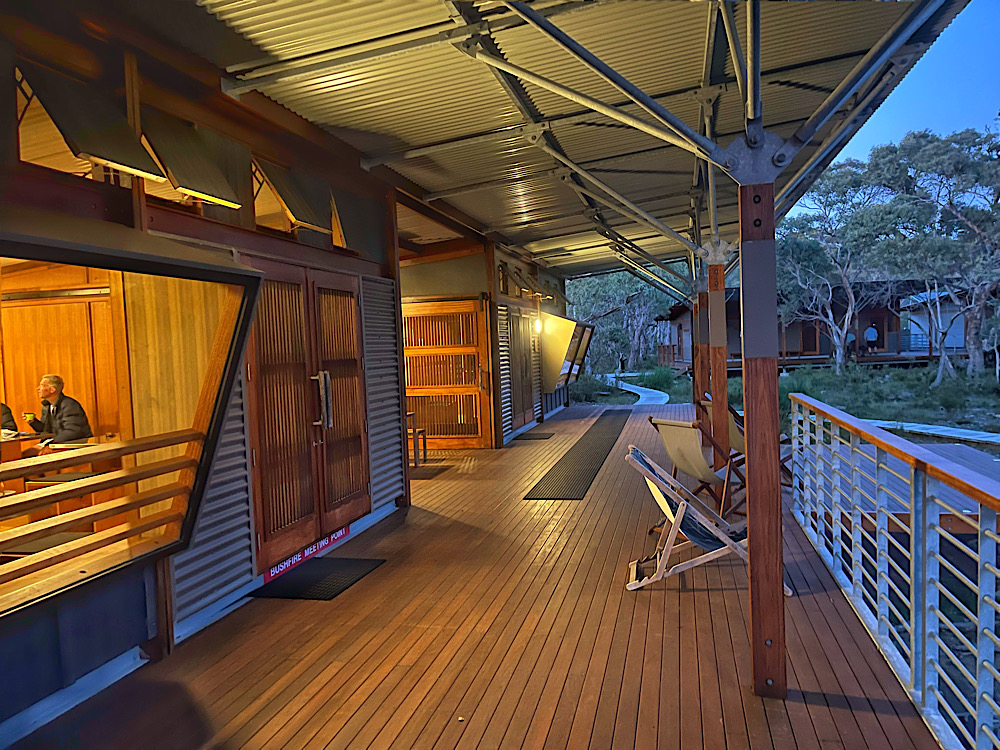
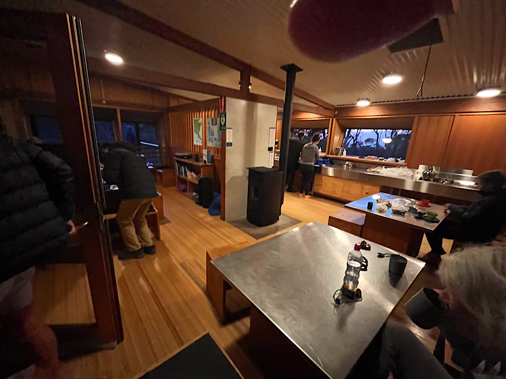
The huts are all environmentally designed. Two large kitchens with gas stoves, pots, pans, cooking utensils (but not cutlery), power points and USB charging stations, a pellet heater and a comfortable community sitting area created a warm and friendly atmosphere at each of the huts. Big covered and open decks surrounded the huts and all were linked by covered walkways. We were assigned a room with two double bunks which we shared with a couple from North Queensland. The beds have a triple layer memory foam mattress. With our sleeping bags and blow-up pillows we were both very comfortable. The ablutions block was about 50 metres away – no showers, just composting toilets and sinks on the deck. Lighting is only in the common rooms – a head torch to use in our own rooms and walking around after dark was essential.
Surveyors Hut was unique in that it had several big BBQs which we’d been told about and came prepared with sausages and my spicy bean chilli for a hearty meal tonight.
Each evening the resident Park Ranger shares information about the hut and tells us what to expect for the next day’s walk. They also spent some time talking about the history, geology and fauna and flora of the track. Excellent talks we looked forward to.
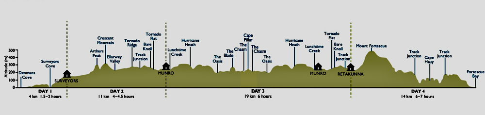
Day 2: Surveyors Hut to Munro Hut (11km)
Being the first time we’ve done this kind of walk, ie staying in shared huts, I slept badly, woke early and, due to no lighting in the huts, went over to the kitchen/common room. Another newbie to the experience was there and we got the pellet heater cranking, but neither of us had tea bags or coffee with us. Lesson learnt!
As everyone started waking and Steve was up we gathered our food bag and enjoyed our overnight oats and a coffee as we chatted with others. Backpacks repacked, boots back on we left the hut about 8.30am.
The first of many Story Seats for today “From Punishment to Playground” wasn’t far down the track and afforded views across to Point Puer and Port Arthur. Point Puer was the children’s prison where our guidebook tells us ‘despicable acts’ took place. Today it’s a golf course.
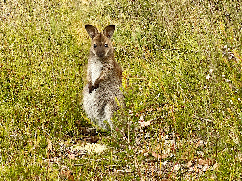
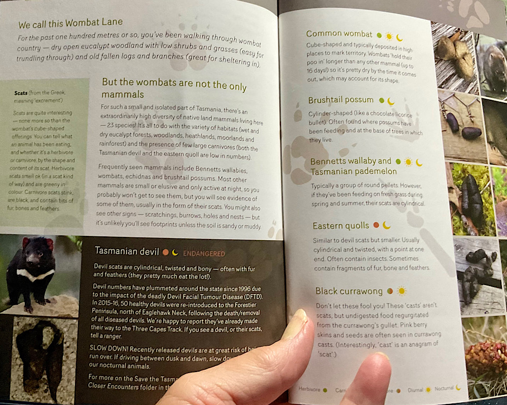
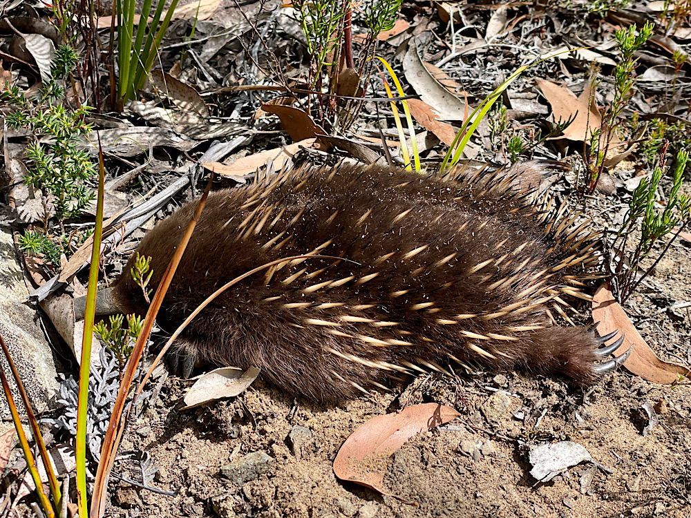
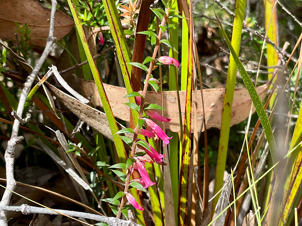
Moving along, the dry eucalypt woodland with low shrubs and grasses is wombat territory. The Story Seat here is quite fun – it looks like wombat poo. The guide book describes the scat of animals we may see as we walk, Tasmanian devils, brush tail possums, wallabies and pademelons, quolls and currawongs.
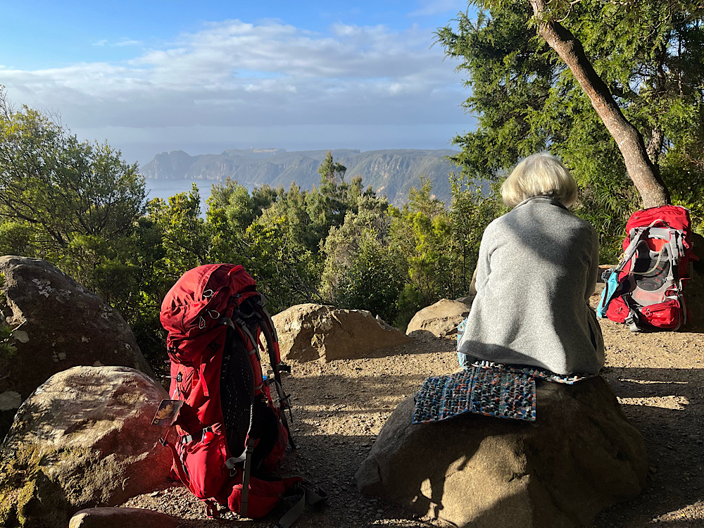
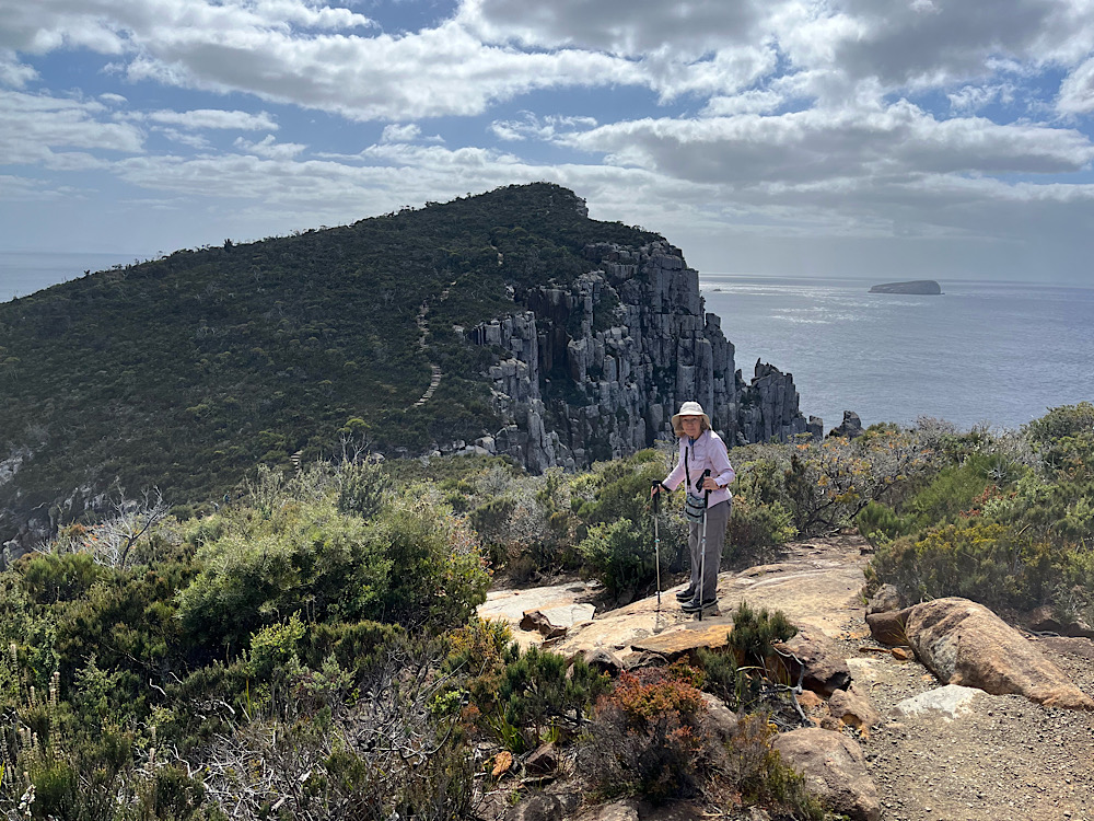
The sharp climb up Arthur’s Peak followed – some switch-backs, some steps, some just straight up. Once at the top though the views were worth every step.
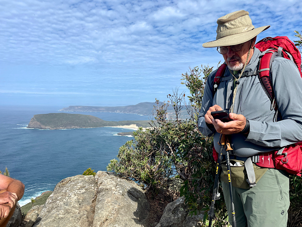
With no reason to rush we relaxed here watching the seabirds searching for their lunch and appreciating the calm ocean after the last couple of days of wild weather.
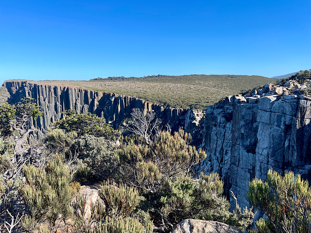
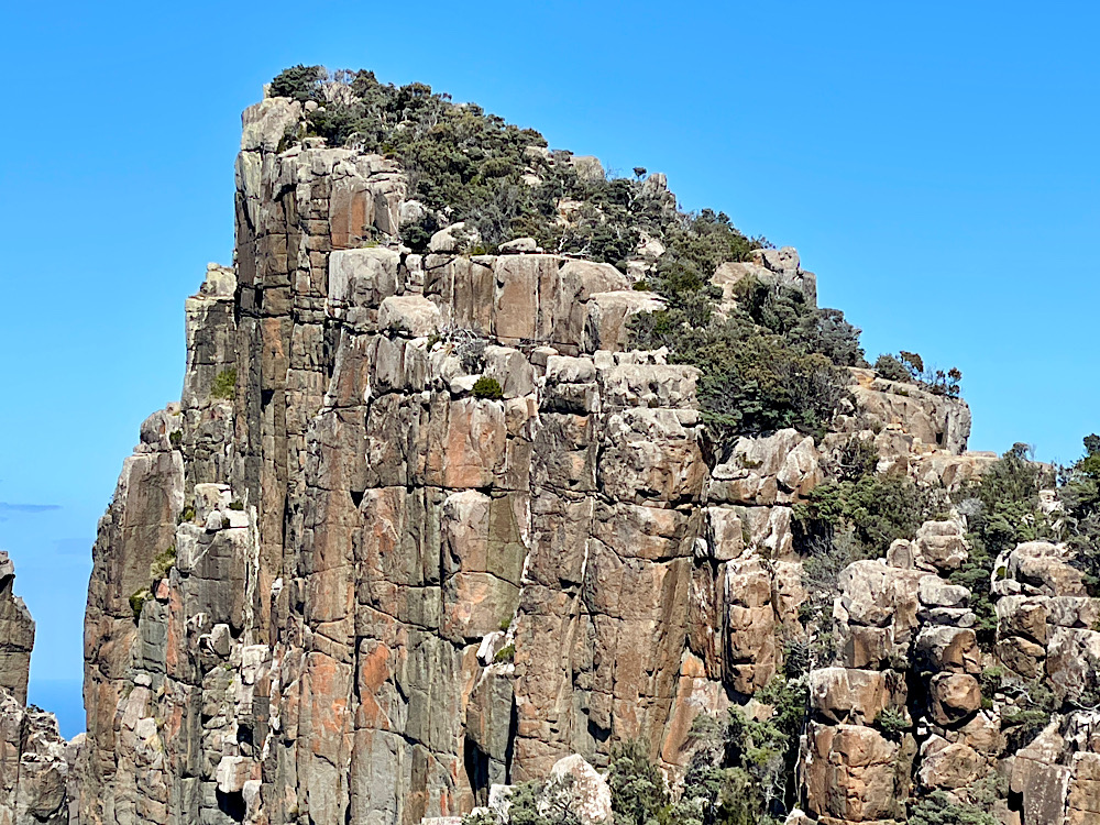
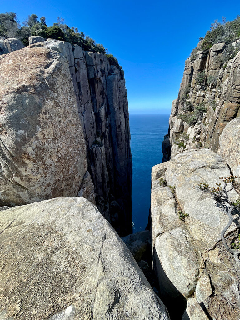
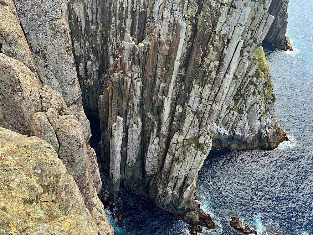
Despite our next climb up Crescent Mountain being even higher than Arthur’s Peak it was a gentler climb interspersed with points of interest, such as Jurassic Crack. All the rock we see on the track, and covering 1/3 of Tasmania is a Jurassic age igneous rock called dolerite. Dolerite is a very strong rock but cracks in huge columns. See the rock in the photos above and particularly the ones to come.
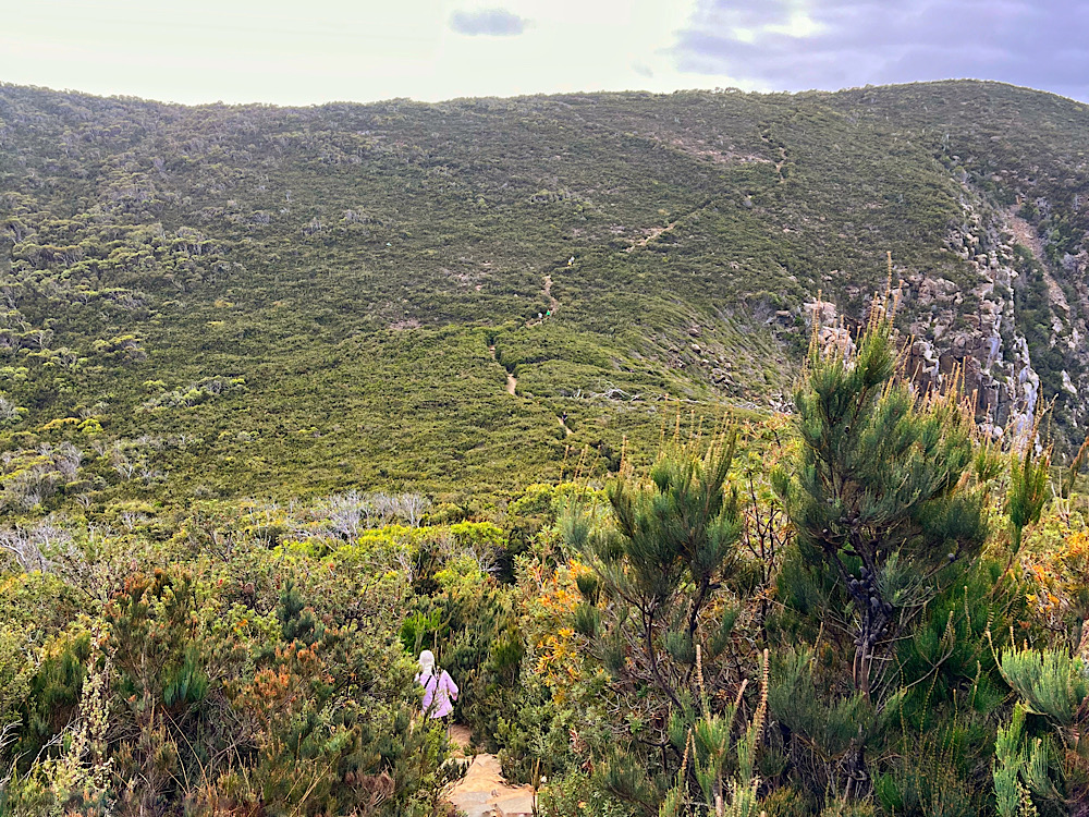
Emerging from the forest onto a ridge of very evenly low shrubs we see why it’s known as Tornado Ridge. The first European bushwalkers here described it as if a tornado had ripped through levelling the forest. Nothing as dramatic as that, but it is as a consequence of the wind. Ellarwey Valley is also named by these bushwalkers, though the name comes from them saying “where the ‘ell are we”. True story.
At a crossroad we turned south for the hour-walk through thick forest once more to Munro Hut. This has to be the best hut on the hike. For a start there are showers – open air, in a 2/3 corrugated water tank. First get a bucket of hot water, fill the shower bucket with it and hoist into the air. It may be primitive but it felt like pure luxury.
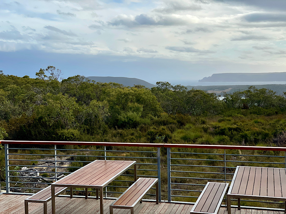
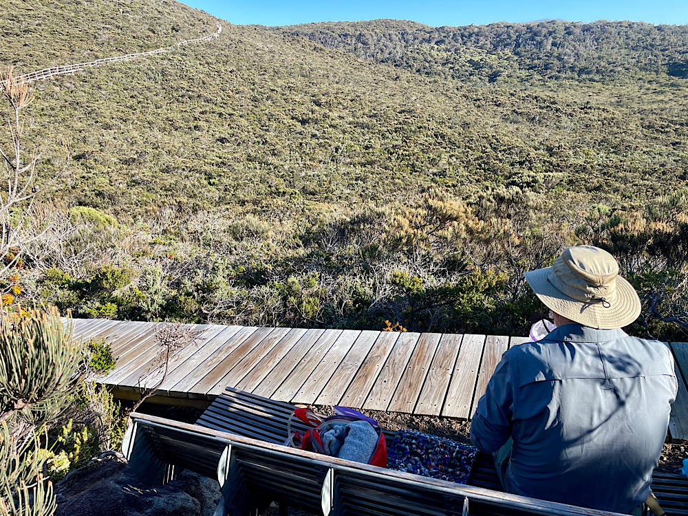
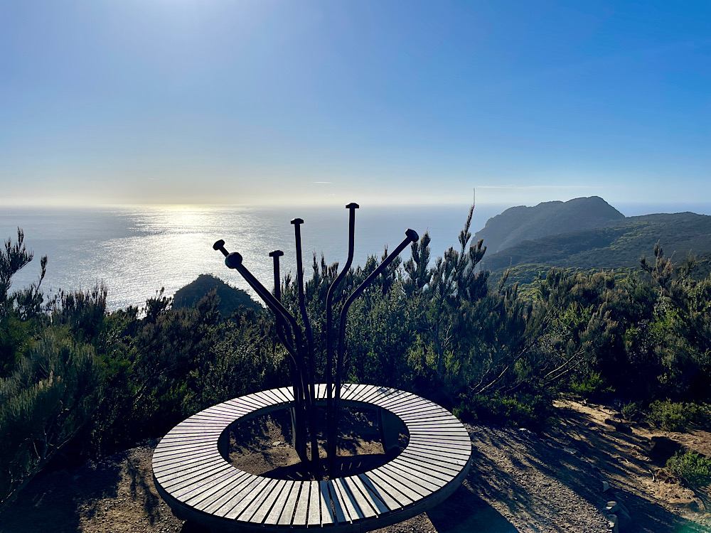
Next was the viewing deck, with binoculars, cantilevered over the forest for views along the coast to Cape Hauy. Of no less stunning a location is the helipad.
The downside – the toilet block is 200 – 300 meters away from the huts on a good path through the forest. Not designed well for the quick dash at 2am!
We’re getting to know many of our fellow hikers as we share story seats, kitchens and even food – freeze-dried ice cream isn’t that great! Tonight we were challenged to a game of Oh Hell (a 500 spin-off) with several other hikers. Lots of raucous fun and cries of ‘oh hell’!
Day 3: Munro Hut to Cape Pillar to Retakunna Hut (19km)
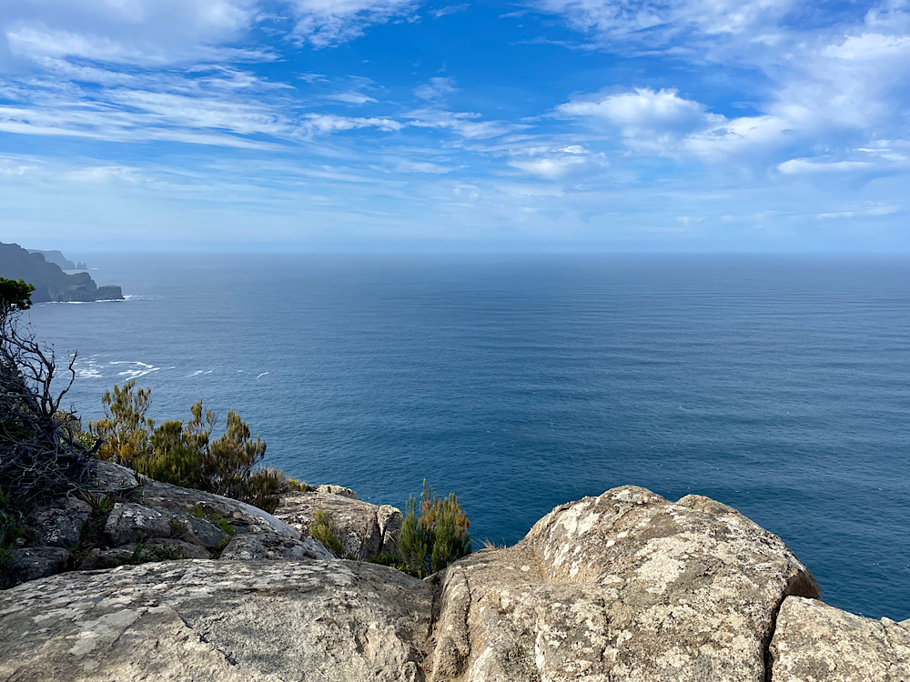
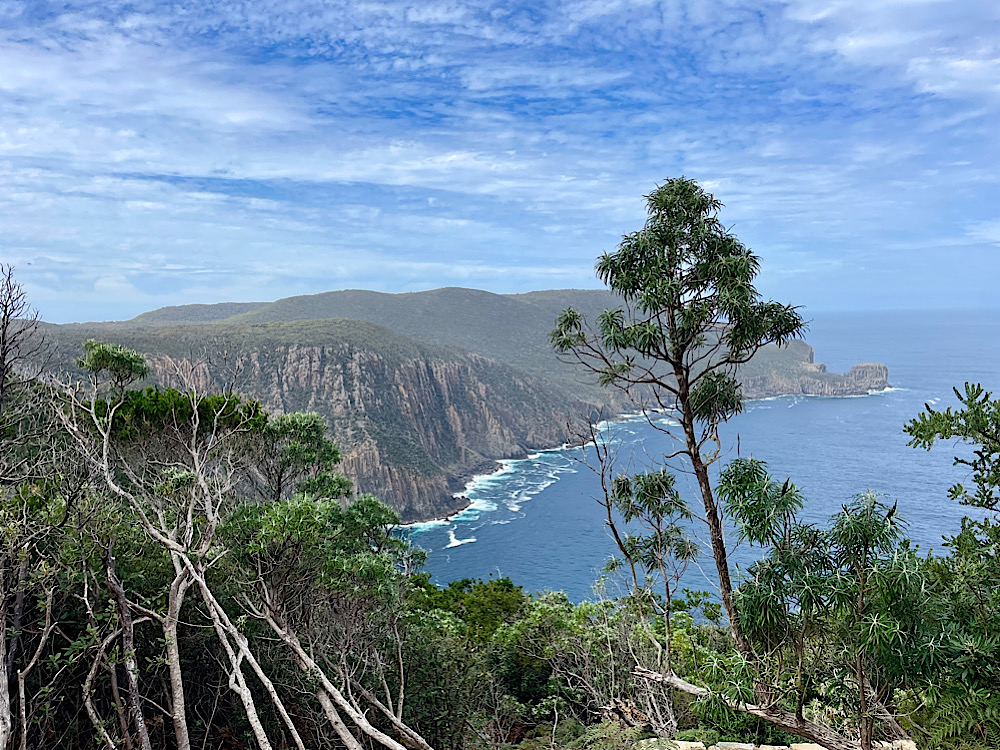
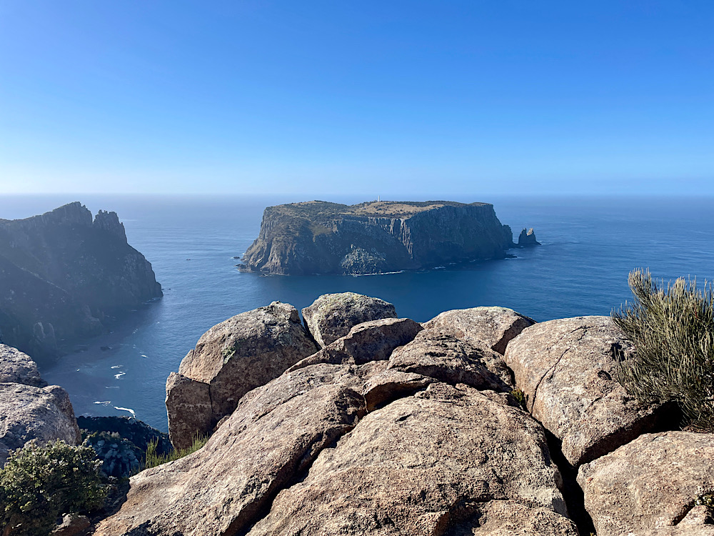
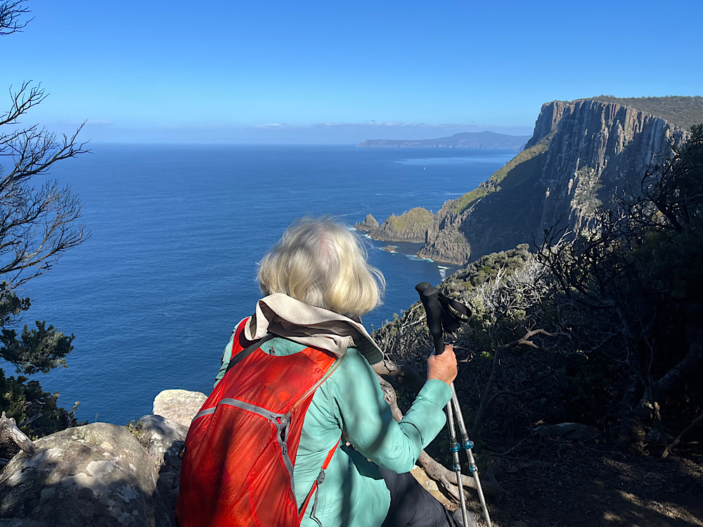
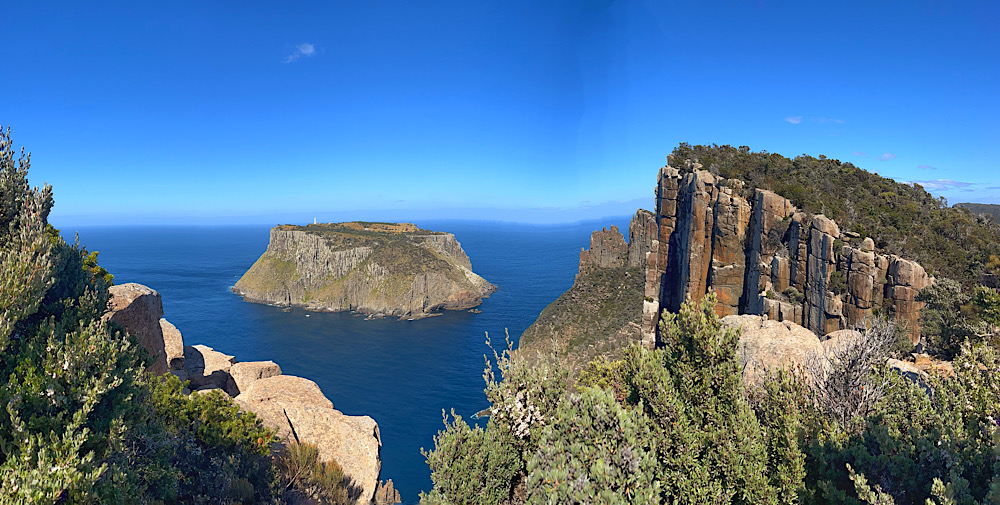
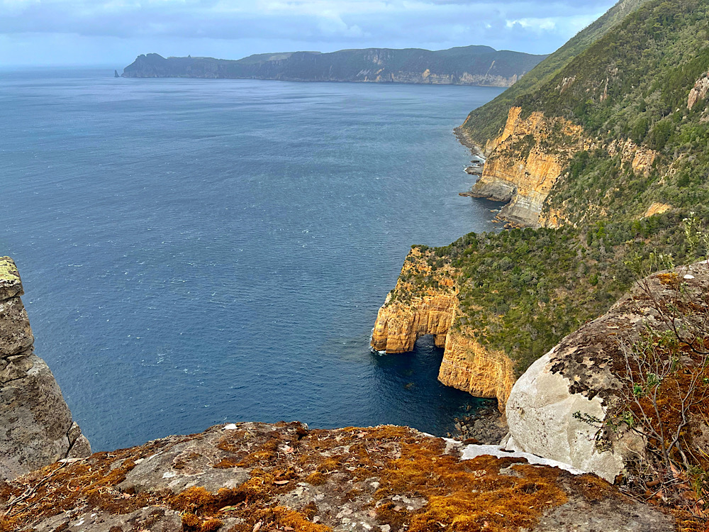
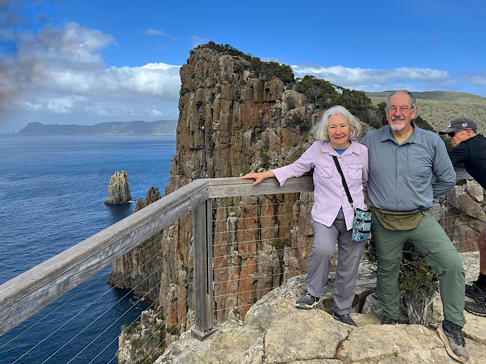
The longest day today as we leave through the silver gums to see Cape Pillar, the highest sea cliffs in the Southern Hemisphere.
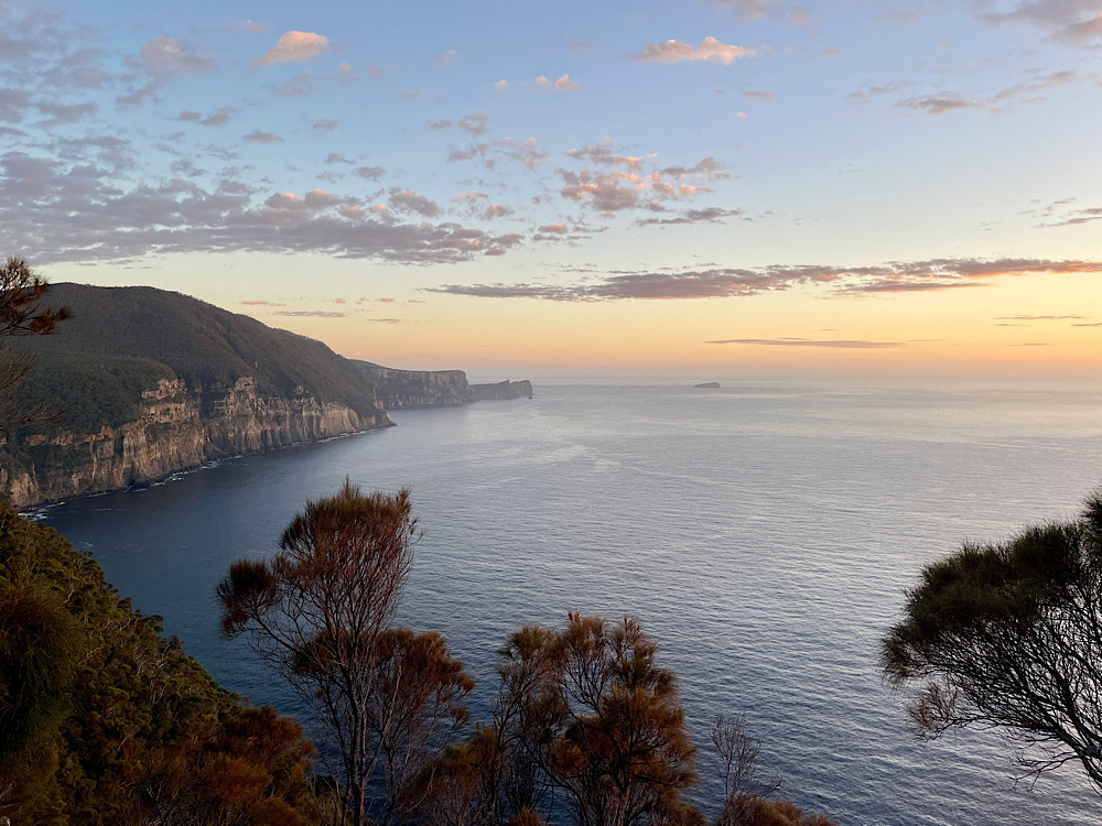
We were both awake before dawn, packed up quietly and after a delicious hot coffee headed off, but not before a sunrise photo from the viewing deck.
As it’s out and back to Cape Pillar we left our big packs in a storage shed, taking only day packs with water, food, first aid and wet weather gear (you never know in Tassie). Today’s track is either gravel or boardwalk and easy walking despite starting with a couple of ascents. After about an hour and a half of walking we came across carefully placed stones representing the tail of a snake which led onto a boardwalk. This is one of the art installations made in conjunction with the local indigenous people. It represents the rainbow serpent. 2.8km later, when the boardwalk ends, is the snake’s head.
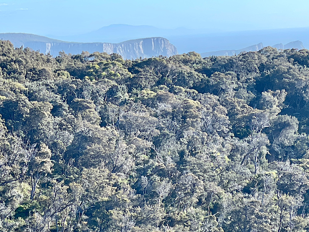
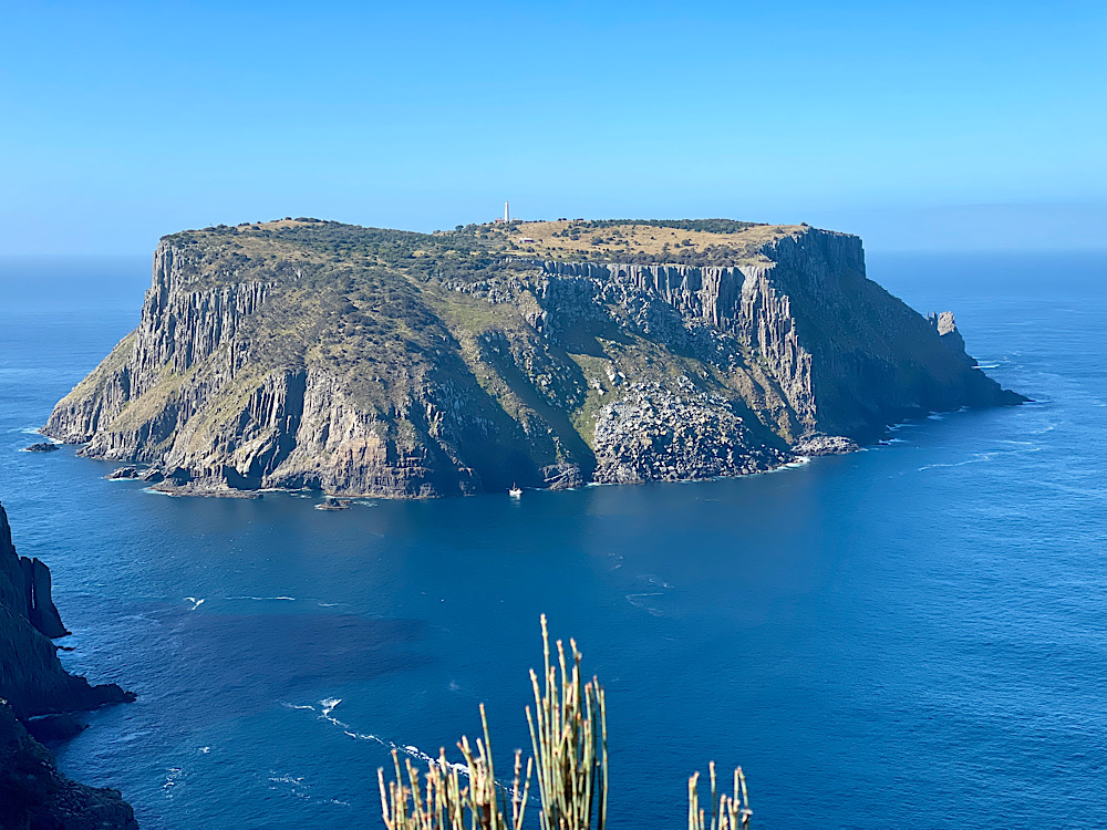
We’re nearly at Cape Pillar now. Tasman Island with its lighthouse and fascinating stories from the days of lighthouse keepers is coming into view as are the incredible dolerite cliffs.
After awhile of resting and taking in the extraordinary views we retraced our footsteps to Munro Hut, repacked our big backpacks and walked the hour or so further on to Retakunna Hut. Another beautifully designed hut, similar to the others, nestled at the base of Mt Fortescue amongst eucalypts and moorlands with wallabies grazing.
Another pleasant evening chatting, stretching on the yoga mats, then dinner, another hotly contested game of cards and off to bed to sleep soundly.
Day 4: Retakunna to Cape Hauy to Fortescue Bay (14km)
Today isn’t the longest day, but it is the toughest. Today we climb a mountain, wander through a rainforest, be stunned by the views and the number of steps to be negotiated to see them, before finishing at a pristine beach to complete this wonderful experience.
Last night the Ranger warned us we’d be climbing 482m to summit Mount Fortescue first thing this morning. Surprisingly the climb up Mt Fortescue is one of the highlights of the trip. This coastal temperate rainforest has beautiful tall stringy barks with their dark green leaves, fallen logs and rocks covered in lichens and mosses, tree ferns that tower over your head and the earthy aroma of damp humus-rich soil. It’s also very peaceful – darker, quieter and cooler. The perfect place to meditate on the Story Seats.
With the highlight of Cape Hauy committed to memory we headed back up and down those steps! The final ascent to the corner to pick up our backpacks was brutal! Worse still was putting our heavy backpacks back on – it’s been a tough day and we still have an hour to walk to Fortescue Beach and the end of the trail.
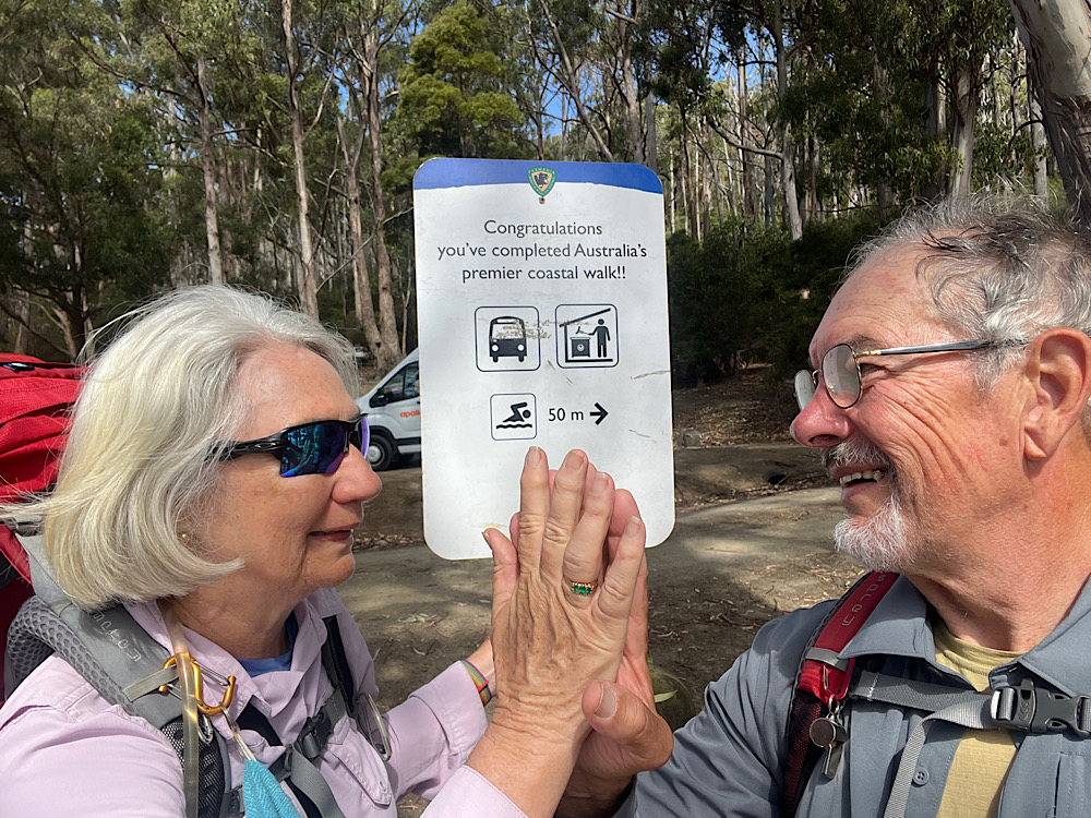
The beach and waters of Fortescue Bay are pristine and very inviting, but no swimming this time. We chilled and chatted and reminisced on one of the great walks with our fellow walkers as they wandered in. Granted it’s among the more expensive hikes, but the design and maintenance of the track, the fabulous Story Seats, the hut amenities, the attention of the Rangers and the sheer beauty of this trail makes it worth every cent.
It’s so good I may even do it again one day.