9th – 13th May 2017
Tuesday 9th
18km north of Oodnadatta we turned off towards Hamilton Station and Dalhousie Springs.
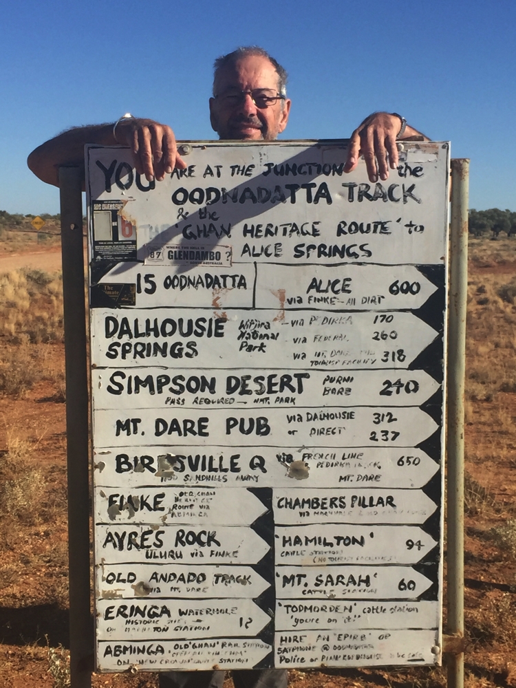
This is where we leave the Oodnadatta Track as we head to Dalhousie Springs.
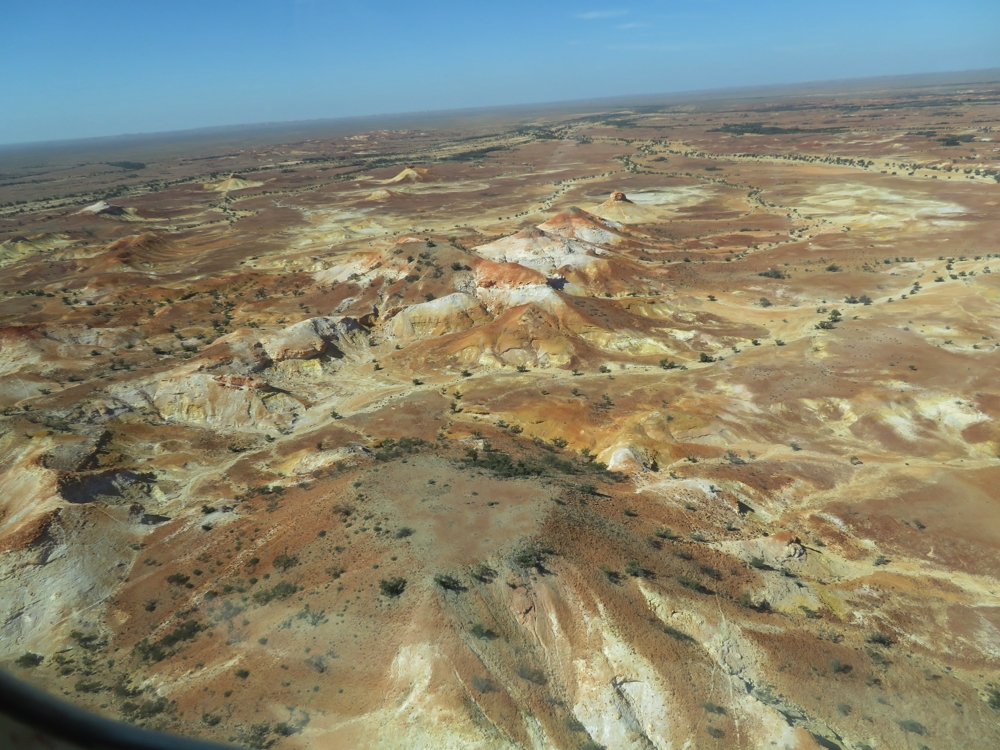
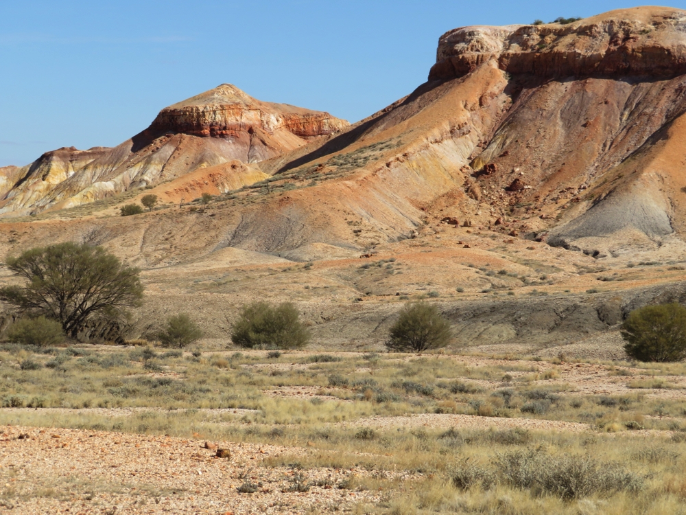
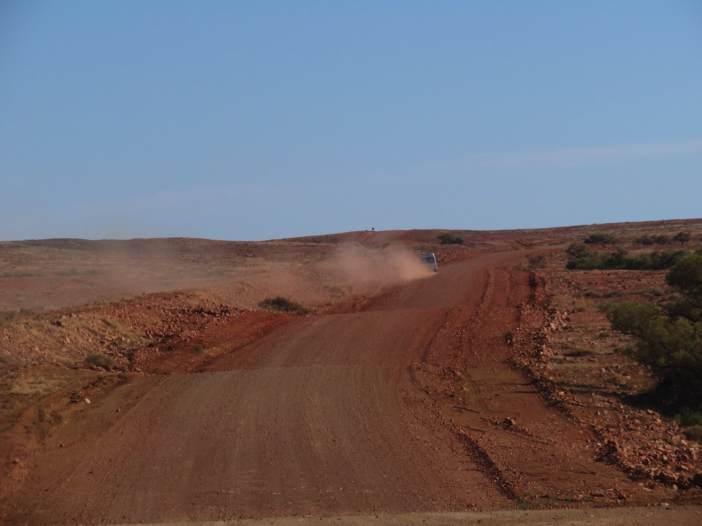
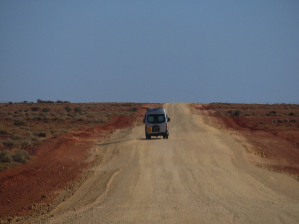
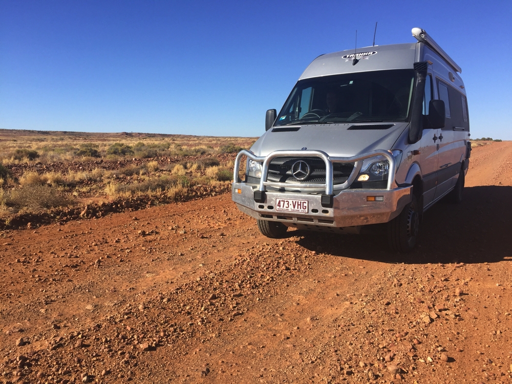
Yesterday I glibly described what a gibber plain is … today we learned a lot more about them, a LOT more! Corrugations reigned supreme until about half way to Hamilton where we met the graders – wow! It felt like a freeway from there until Hamilton and the Dalhousie turnoff where we left the Oodnadatta Track – this is now the Old Ghan Heritage Track. I can assure you there’s not been a grader down this road for quite some time! If it was not rocky gibber plain to drive on it was up and down over red sand dunes with soft sandy patches. We were 2.5 hours on the 75km track from the Hamilton turnoff, much of it travelling at around 20km/hr. It sure made the drive interesting.
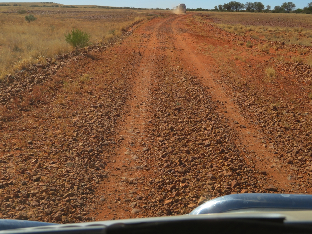
Those gibbers! It was always a worry that one of them would pierce a tyre.
Hamilton Station homestead is at the turnoff and we saw some of their Hereford cattle along the roadside, all looking particularly healthy and chubby despite it being hard to see what they were eating – it looked like dry, spindly grasses to me, but obviously OK for them.
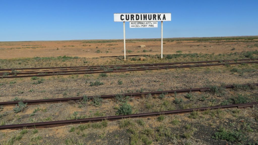
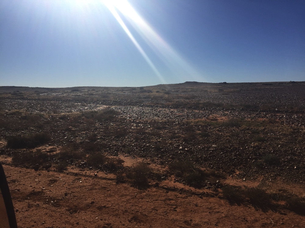
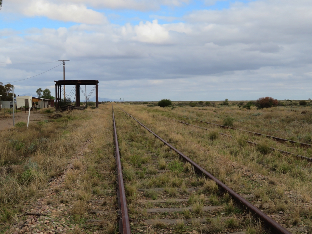
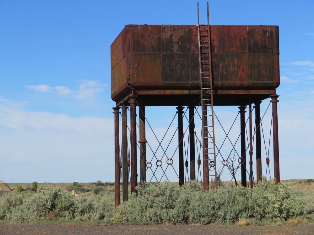
We stopped at Pedirka Siding ruins where the fettlers who looked after the Ghan railway line were housed in the middle of absolutely nowhere on a gibber plain – goodness knows how they survived it! Kudos to them!
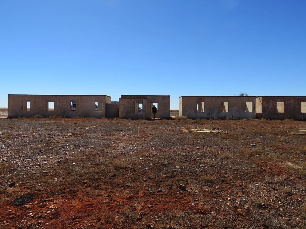
Single men’s quarters at Pedirka railway siding. These were the fettlers who maintained the line.
A real challenge occurred soon after that at the Stephenson Creek crossing, a dry watercourse of about 100 metres of soft, deep sand. Both Jabirus crossed it without a worry, drivers and passengers holding their breath, particularly as there was evidence of where others hadn’t been so blessed (or skilled!).
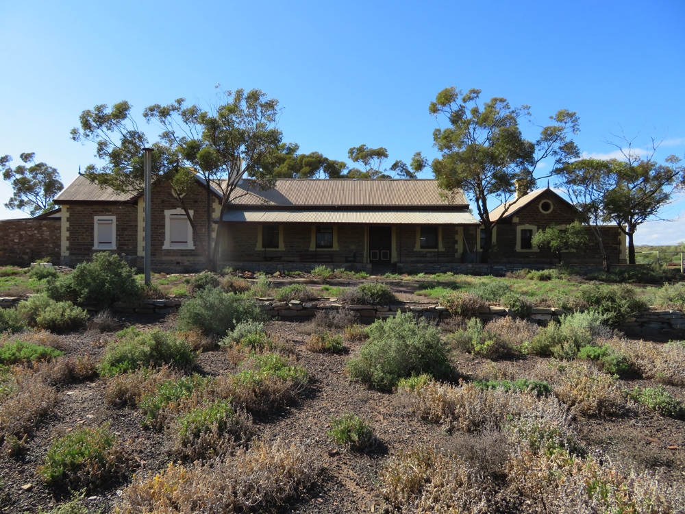
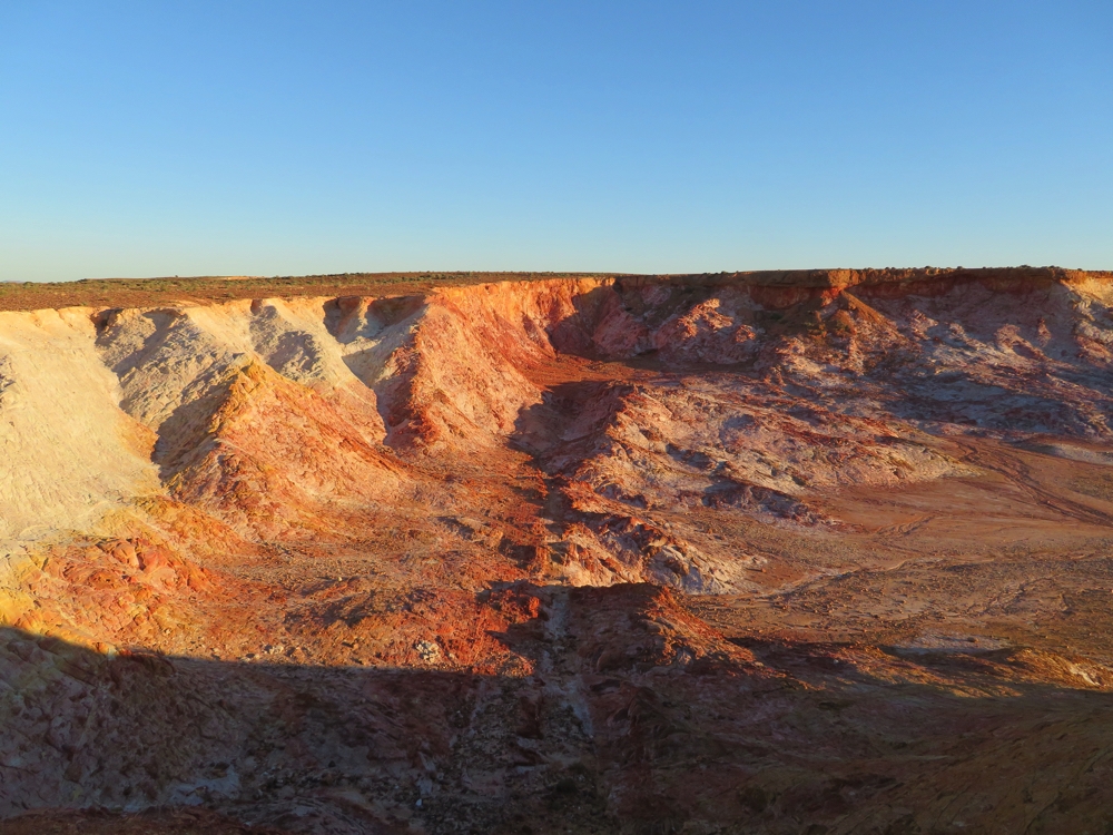
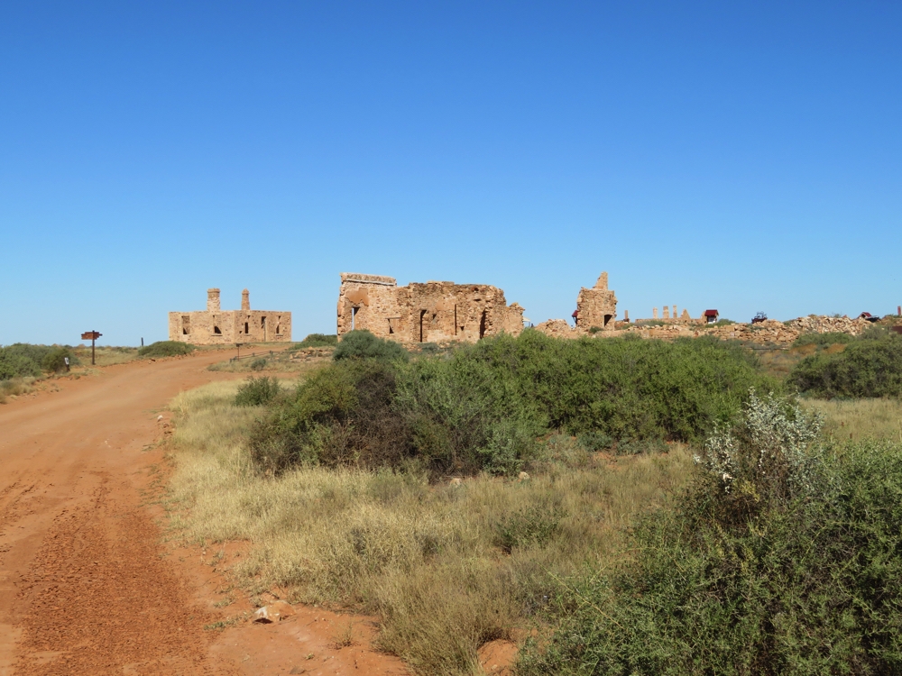
The road took us on into Witjira National Park and to Dalhousie Station ruins which were abandoned in the 1920’s. Dalhousie Station was a cattle station and was located here because of the many springs in the area providing a very necessary water source, average rainfall being only 150 mm per year, with an evaporation rate of 4000 mm per year! This was the most northerly station in South Australia. There are several ruined buildings and the old stock yards remaining. The mound springs are here too but have been overgrown. It is quite picturesque with the date palms in the background. Easy to say as I return to my air conditioned vehicle.
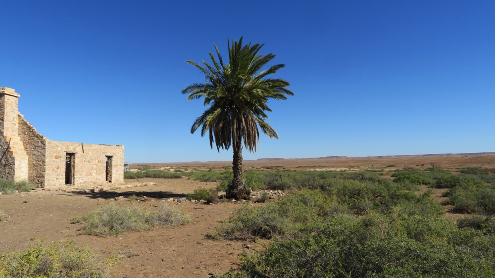
Dalhousie Homestead ruins.
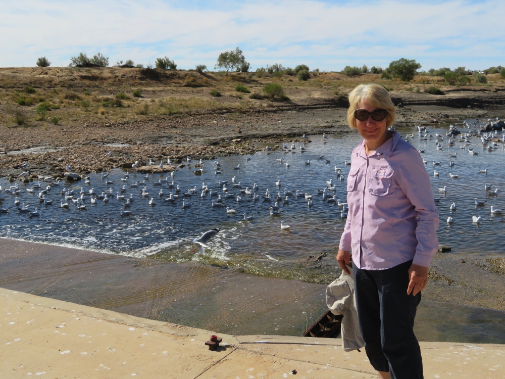
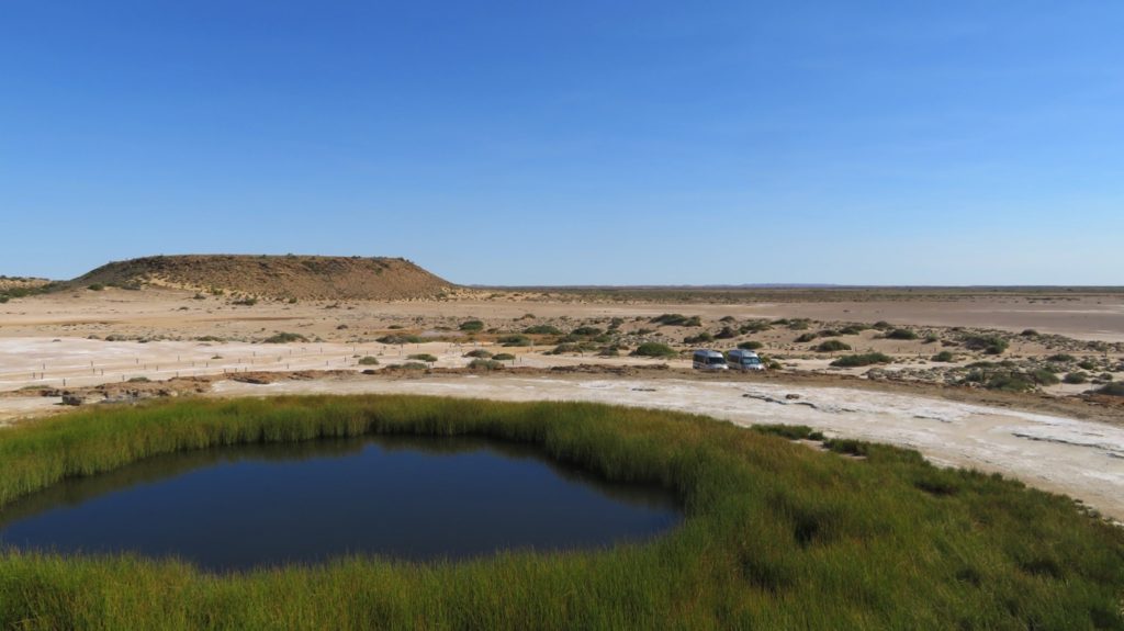
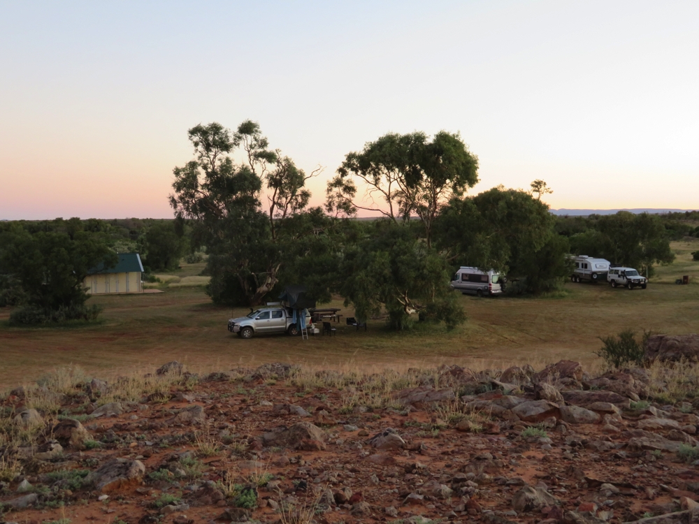
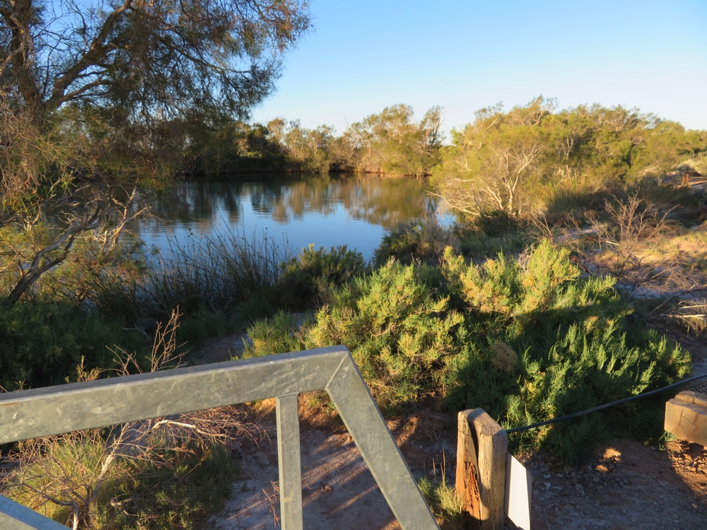
Not far from the homestead is the main spring where we camped for the evening. The campsite is large, treed, with good cold showers and toilets. There were half a dozen other campers here going in various directions – the Simpson Desert Track ends here.
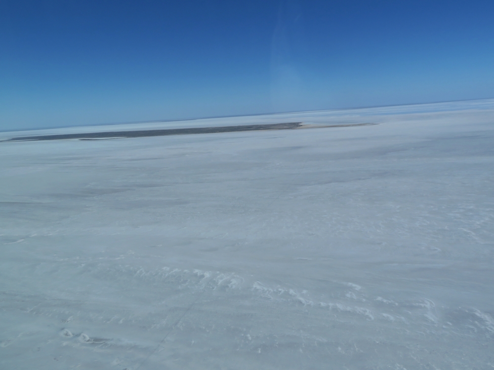
The main spring here is pretty amazing – about 150 metres long, 50m wide, very deep, tree – and grass-lined and a constant 37C. Fantastic! We all enjoyed a long soak in the spring before spending a delightful evening under the stars solving the problems of the world.
Dalhousie Springs.
Wednesday 10th
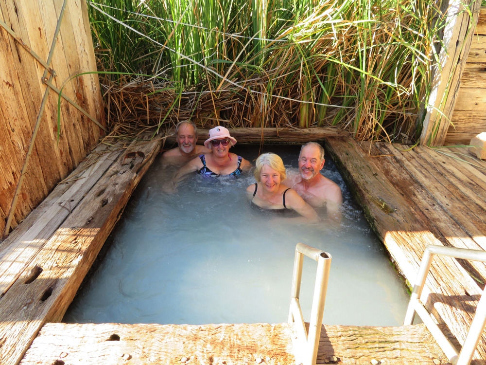
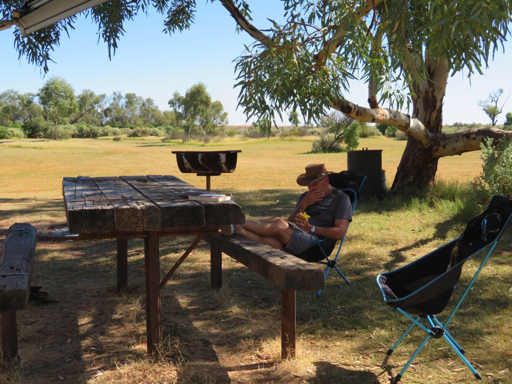
Why rush away from a lovely spot like this? The morning was spent cleaning up the vehicles, tightening loose screws, washing clothes and going for another swim.
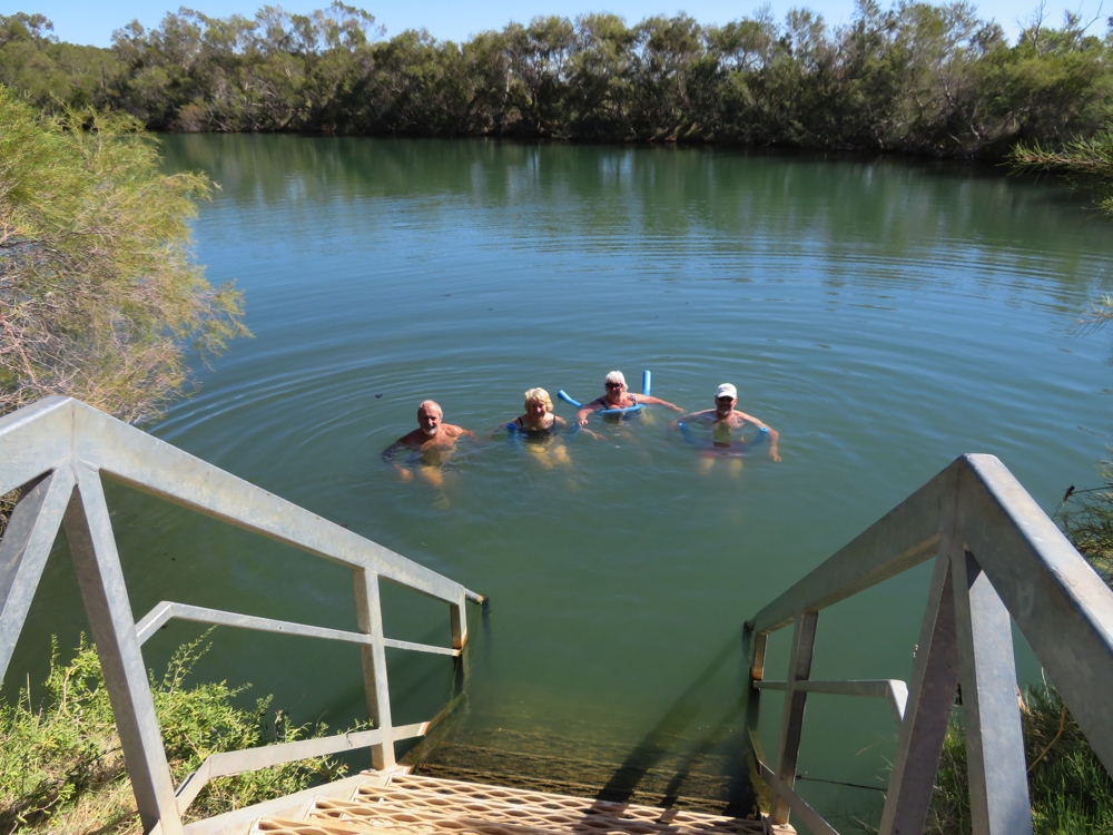
An early morning dip before leaving this delightful spring. Dalhousie Springs.
After lunch we moved off to 3 o’clock campsite, 12 very rocky, washed out, slow kilometres down the track. This endlessly large camping area, with us as the only campers, is on gibber plain in the bend of a dry watercourse, with a covered picnic table and a large tank of potable water. A couple of days of having plenty of water has been a treat.
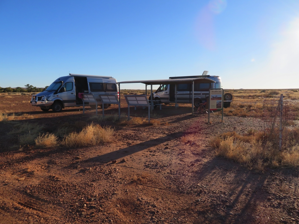
Our campsite at 3 o’clock -(the name of the campsite, not the time!).
It’s a full moon tonight, the light on the shiny gibbers and the stark beauty of this lonely campsite is stunning. A dingo visited us here; we’ve been surprised by the lack of wildlife seen out here – no camels even.
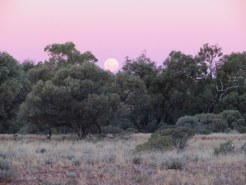
Moonrise over 3 o’clock Creek.
The weather since we left Maree has been brilliant – cloudless blue skies, daytime temps around 20C, nighttime dropping to 3 – 7C.
Thursday 11th
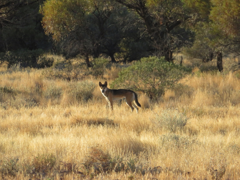
An early morning visitor at 3 o’clock campsite. A healthy looking dingo.
Today we rattled over corrugations, fish-tailed through sand and rock-hopped into MtDare. Though for a brief few kilometres we praised the god of the grader drivers. We went the long way via Bloods Bore, due to tales of bent axles and numerous punctures on the short cut. The countryside continues to be quite beautiful.
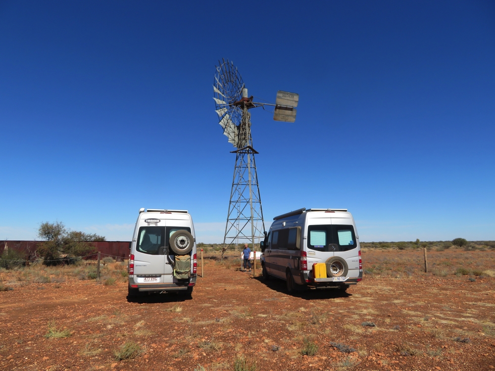
Bloods bore windmill and pump. Stopped here for a cuppa and break after a rough drive.
Mt Dare consists of just a pub with a population of the publican and his wife and two backpackers. When the season gets busier next month it increases by two more backpackers and a mechanic! Mt Dare is the most central pub in Australia,
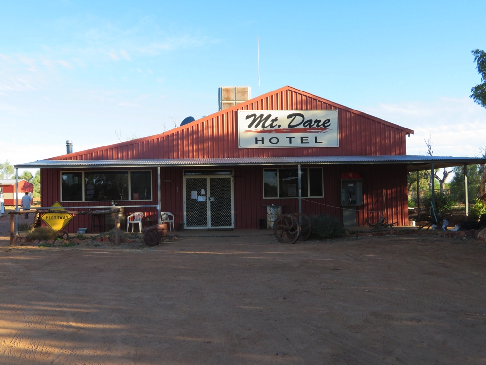
The hotel at Mt Dare. Campsite is out the back. Fuel to the right – that’s it! Nothing else at Mt Dare.
The campground here ($20/vehicle) has hot showers and flushing loos – will the luxuries never cease!
Friday 12th
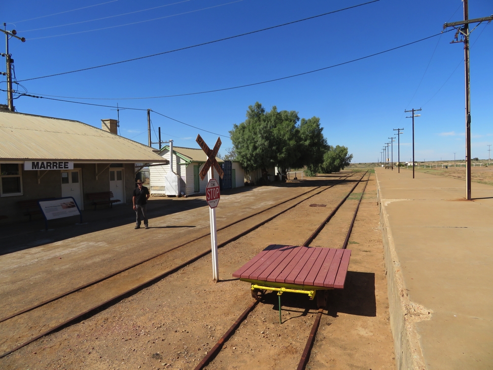
It’s an exciting day today – our final destination will be somewhere very special. But first Aputula, or Finke. We’re back to the Ghan towns, and, while Finke had already been a small town serving the pastoralists the Ghan gave it a big boost for a time. In the 1980s when the Ghan line here closed the town was handed over to the local aboriginal groups to manage and their name for it is Apatula. After a long, slow shake, rattle and roll over rocks and corrugations Apatula appeared.
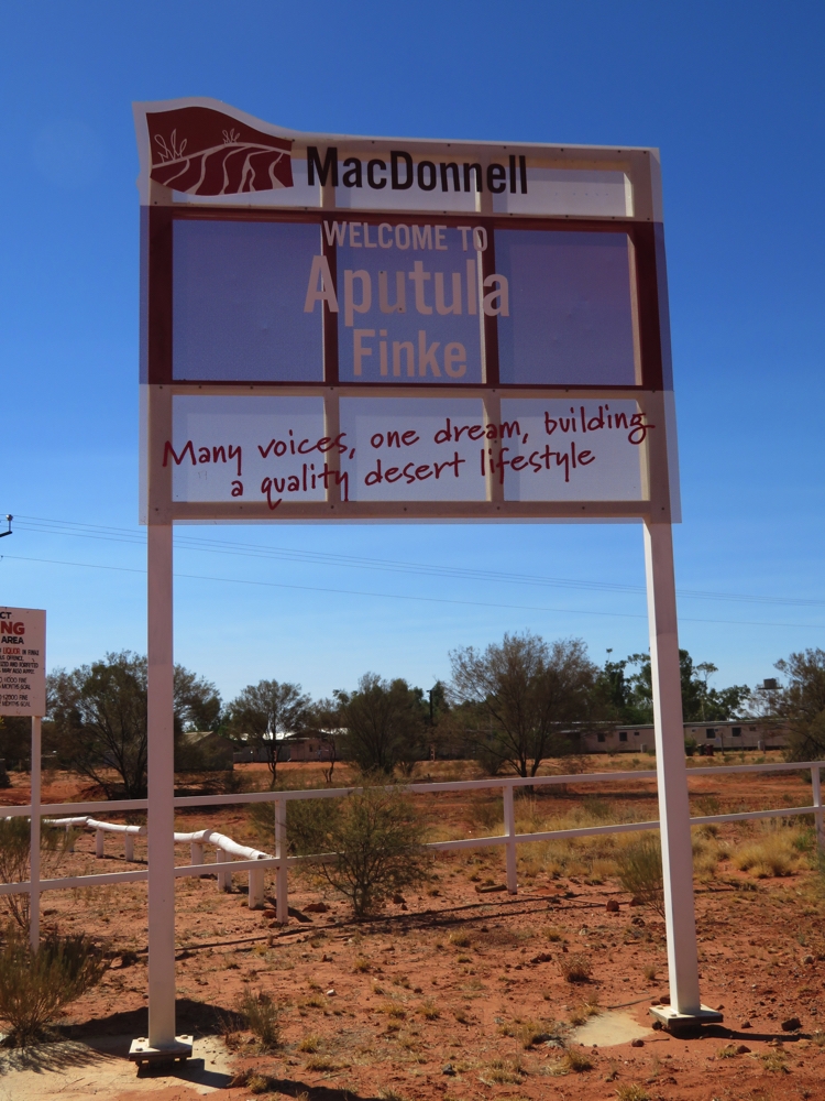
Welcome to Apatula Finke
We headed straight for the general store with thoughts of an ice cream, only to find it closed – its 1.30pm. The young white couple who are managing it and assisting the locals with governance issues saw us and opened up for us, bless them! An interesting chat with them, an ice cream each and a pair of aboriginal art decorated earrings and a Ghan spike later we moved on.
How can you say you’ve been to Central Australia unless you’ve been to the Geographical Centre of Australia? The planimetric centre of gravity of mainland Australia is at a point some 40km outside Apatula, and 14km in off the road.
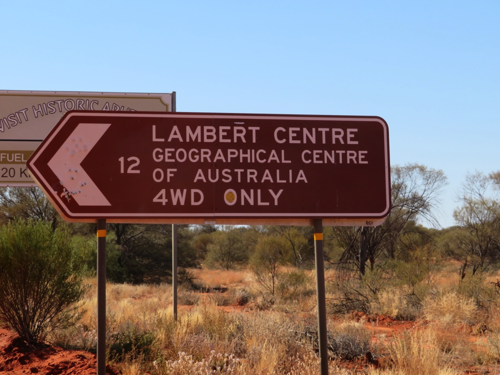
That’s our destination – oh that it were that simple!
The track in isn’t maintained and has become a maze of y-junctions as deep clay washouts or long soft sand patches are bypassed. The problem is that you don’t know which turn is the one that takes you away from the obstacles. All the tracks wound narrowly around and past mulga trees which threatened to graffiti the vehicles as we passed. The washouts and many stretches of sand were negotiated well though two long, very soft, very deep sand patches going around a corner tested both drivers and vehicles – all emerging victorious.
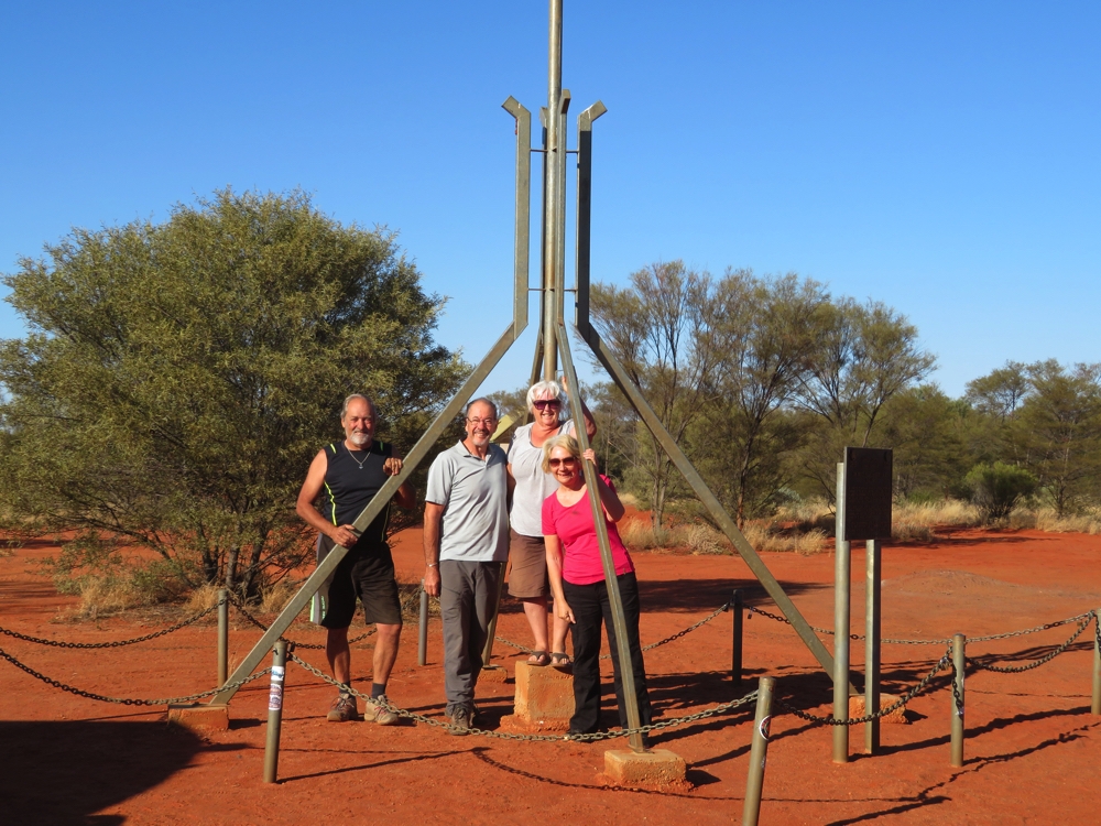
We’re all here – in the middle of Australia.
At last we arrived at the very centre of Australia – it was a pretty special moment.
There’s only one other camper here, well away from us. The stars were magnificent until the nearly-full moon rose lighting the mulga trees in its soft light. The silence was all pervasive.
Saturday 13th
Neither Steve nor Ken was too keen to go through the sand patch again, so as we left they walked each track option to see which was best. We didn’t escape the sand traps or the washouts, but we did manage to bypass the worst places.
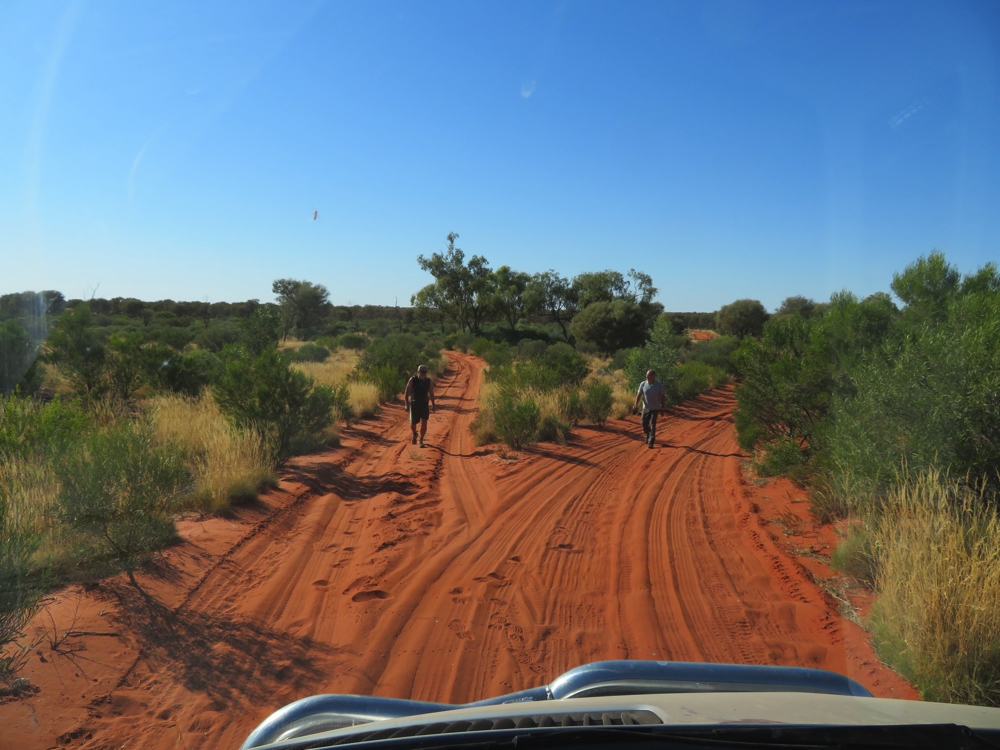
The prudent traveller walks the paths before choosing which direction to take. The road to Lamberts Centre of Australia.
It’s back to civilisation today – we joined the blacktop and dozens of caravaners at Kulgera (people shock!) where a beer was enjoyed by all, then moved on to Erldunda caravan park ($32/n) where we’re camped on lovely green grass, albeit with neighbours all around us – that’s the price we pay.
Our first internet/phone cover since Parachilna two weeks ago.
To see the photos from this part of our trip CLICK HERE.